Tramping in the Robinson Valley
Over the weekend I ticked off another of my planned trips for this summer by walking into the
Mid Robinson Hut in the Robinson River Valley, Victoria Forest Park. My original plan had been to walk to Top Robinson Hut which is another 4 hours up valley but more on that later...
 |
| Mid Robinson Hut, Victoria Forest Park |
 |
| Robinson River Valley, Victoria Forest Park |
A cautionary note concerning the Robinson Valley
If you are interested in tramping this track there are three things you need to consider first;
- Palmer Road: This is the name of the 20 km gravel access road you need to follow to get to the track head. It can be problematic as there are nine fords to be crossed between the Lake Christabel track and the road end. Most are fine but three are not - they would be impassible with even the slightest amount of rain to 2 W/D and 4 W/D vehicles. There were several notes in the hut book about the fords being impassible, one talking about "....a shocking torrent of angry brown spray...".
 |
| Palmer Road: One of nine fords on the access road to the Robinson Valley |
- Robinson River Track (?): Some parts of it are good but they are in the minority, it isn't really a track, it is more like a route. There are fallen trees, track washouts, overgrown track, river crossings, slippery conditions and rock scrambling as a part of it. I lost the track 12 times heading upriver, twice on the return trip: the track marking is shocking in places. Also there are two points where you will need to enter the river to get around obstacles, not possible in moderate to heavy rain.
 |
| Palmer Road from the car park at Newcombes Farm |
- Track times: The DOC site states this is a three hour trip, it is not! It took me 5 hours including a 30 minute lunch break. times in the hut book ranged from 4 to 6 hours, bear this in mind.
Don't get me wrong it is a beautiful valley, with an awesome hut but it is not a track for a novice, the potential for drama is high. Anyway.....
Day One: Newcombes Farm to Mid Robinson Hut
I have long coveted tramping in this Valley, this is the last of four attempts to get here. The problem is that access road...it is atrocious. If there is any rain falling then you cannot even get to the start of the track.
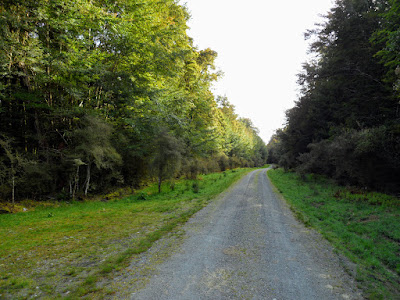
The track starts at the end of Palmer Road which is 10 km's west of Springs Junction on the road to Reefton. Stated track time on the sign below is four hours, take this with a grain of salt...
 |
| Robinson River Track sign |
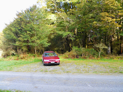
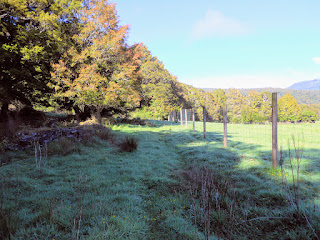
There is plenty of space to park at the track head, it is next to the gate for Newcombes Farm which is the private farm at the end of the Valley. There seems to have been some kind of beef between DOC and the farmer, so the track to the Robinson Valley skirts the outside of the farm property for about 1.5-2 km's. This adds about 45 minutes to the overall time it takes to arrive at the hut.
 |
| Parking area at start of Robinson River Track |
I note that there used to be a hut in the forest directly behind my car but it burnt down some time in the early 1990's.
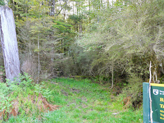
The track goes around the outside of Newcombes Farm along the bush edge....
 |
| Start of the Robinson River Track |
 |
| Robinson River Track: bit muddy at the start |
 |
| Looking fresh...at the start of the Robinson River Track |
 |
| Robinson River Track: climbing to start of track along deer fence |
 |
| The deer fence around Newcombes Farm, on the Robinson River Track |
You eventually reach a point where you can see out over the farm itself, the track closely follows the fence line from here till you start to descend to the Robinson River. It is nice looking country in this area, but certainly very remote.
 |
| DOC sign on the Robinson River Track...in other words...bugger off! |
 |
| View of Newcombe Farm from the Robinson River Track |
I spotted a number of Weka along this section of the track, two adults and one chick; they are often mistaken by tourists for kiwi but really they look like a cross between a duck and a big fat chicken.
 |
| Weka one..... |
 |
| ...and Weka two! |
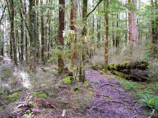
Eventually you pass the fence and join up with the old track that leads down to the Robinson River, it is quite swampy through this area, especially in the bush.
 |
| Track along deer fence, Robinson River Track |
 |
| On the Robinson River Track, a bush interlude... |
 |
| Descending to the Robinson River |
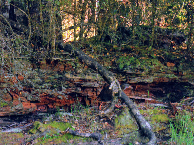
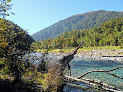
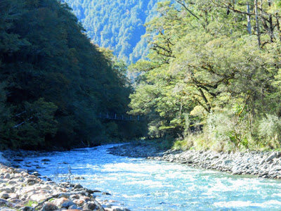
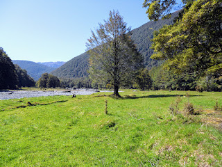
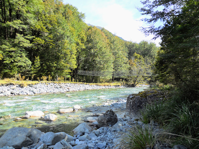
Here is the first view of the Robinson Valley it alternates between dense bush and large river flats. The track follows along close to the river for the rest of the trip up to Mid Robinson Hut, it is never more than 100 meters away.
 |
| In the Robinson River Valley |
The section of track from the point shown above to the first swing bridge is the worst, it has been heavily affected by flood and storm damage. Large sections of the track just do not exist...covered in fallen trees or washed away by the river, the two photos below give you a bit of an idea...
 |
| Robinson Valley looking East |
 |
| Robinson River Track, there is a track under that.... |
There are two swing bridges to cross on this track, you strike the first after about 1-1.5 hours. The final approach to this bridge is very tricky- you drop down to the riverbed and then climb up a series of roots to get to it. This is one of the points that would be impassible if it was raining.
 |
| First swing bridge on the Robinson River Track |
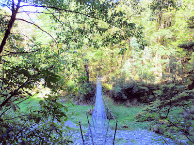 |
| First swing bridge, 1.5 hours in, Robinson River Track |
I stopped for a 10 minute break just past the bridge, it really is very beautiful and remote feeling, few people venture up this valley.
 |
| Robinson River Track: rest spot upstream from bridge |
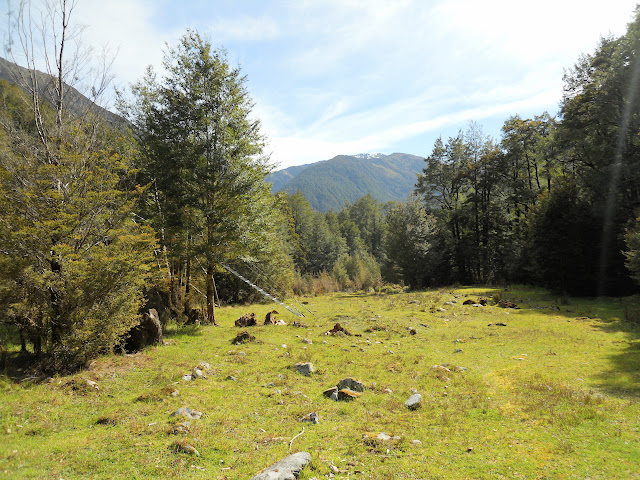
After another 30 minutes you reach Lynches Flat, the area was obviously used for stock at some point as it has a good covering of grass and old cow sign everywhere. The flats stretch for about a kilometre alternating between river flat and forest margin as you go.
 |
| Start of Lynches flat, Robinson Valley |
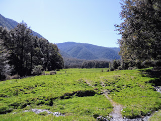 |
| Robinson River Track: end of Lynches Flat |
The next 2-3 km's are the worst marked sections of this track - the markers are widely spaced and badly placed making it next to impossible to travel at any speed. You are constantly climbing up and down - first by the river- then up the side of the hills. Frustrating....yes it was!
I took few photos through here because I was too busy negotiating my way through the mess. At one point you climb about 60 meters up from the river to get around a gorge - this was hand over hand stuff as you climb and descend a series of steep root steps.
Character building as they used to say...
 |
| Robinson River Track...where is that track...? |
 |
| Robinson River Track: the track sidling above a gorge |
 |
| Flood damage on the track mid Robinson Valley |
Eventually you drop back down to the riverside, the travel for the next 2 km's to the hut is quick and smooth. I knew I was approaching the hut because the track marking got a lot better- someone obviously based themselves at the hut and cleared the track in the immediate area.
 |
| Interesting pole beech re growth on the Robinson River Track |
Here is the second required river wade - you have to enter the river and make your own way from here to the bush past the shingle bank. At the moment the water is knee deep, it just would not be feasible to cross here if it was raining and the river was higher.
Make sure you find the track on the far side as there is a gorge just past here that stops you travelling in the river. Personal experience....
 |
| Robinson River Track: compulsory river wade |
 |
| Entry point into river on the Robinson River Track |
 |
| Side stream on the Robinson River Track |
The second bridge and the hut are about three hours on from the first swing bridge, the area surrounding the hut is very picturesque.
 |
| Nearly at Mid Robinson Hut |
 |
| Robinson River Track: Is that a ladder to salvation I see... |
Mid Robinson is a classic ex NZFS 6 bunker built in the late 60's for the deer culler's. It is nicely sited on a sunny man made clearing and is in excellent condition. These are my favourite kind of DOC huts - utilitarian, almost Spartan but comfortable, this beast would be 50 years old and she still looks good.
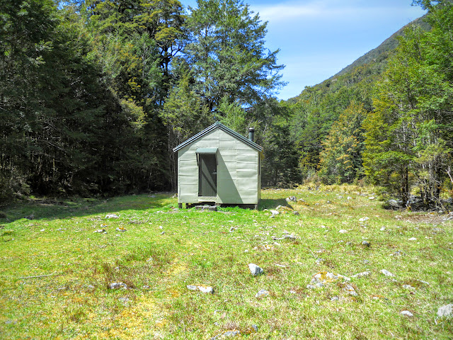 |
| Mid Robinson Hut, built 1967 |
I had planned to stop for lunch and continue up to Top Robinson hut but given it had taken me 5 hours to get here and it was 5 more hours to that hut I decided to stay where I was for the evening.
 |
| Hut interior- Mid Robinson Hut |
 |
| Fire and bench area Mid Robinson Hut |
I ate my lunch (salami, cheese and crackers) and re hydrated with a couple of brews and about 2 litres of water. Nothing like that first brew after walking for 4-5 hours- it really hits the spot!
 |
| A brew on the go! |
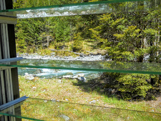 |
| Robinson River from the Mid Robinson Hut window |
Your water source is the nearby river, it would probably be fine to drink straight from the river as there are no people or animals up stream to pollute it. Icy cold as well!
 |
| Robinson Hut: view down river to swing bridge |
 |
| View up Robinson River from the hut flat |
 |
| Mid Robinson Hut from river level |
 |
| Clearing surrounding Mid Robinson Hut |
Not many people get to this hut- the hut book was from 1995, I was one of only seven people to pass this way since May. The last entry was from early September 2015, or over 8 weeks ago! It mostly hosts hunters and those doing the Lake Christabel-Robinson Valley circuit.
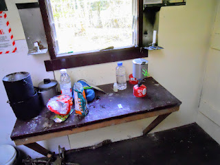 |
| Cooking bench in the Mid Robinson Hut |
These two photos give you a good idea of the interior of a six bunker- they are 'cosy' inside with a full complement of six bodies.
 |
| Mid Robinson Hut: Jon and good view of hut size |
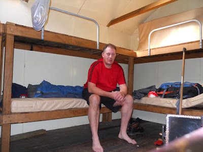 |
| Jon "at home" in the Mid Robinson Hut |
I did my camp chores- cut some wood, tidied up the hut, swept the floor, readied the fire, got some water- I have a routine when I get to a hut so that I am ready for the night when it comes.Then I lay on the bunk and read huntin' n' fishin' magazines until dinner time.
Reading material in a hut gives a good indication of the users, At Mid Robinson you get:
Hunting and Fishing magazines
NZ Wilderness- tramping focus
Forest and Bird Journal
Readers Digest from the 1990's
Christian materials
All are interesting in their own way especially if it is something you wouldn't usually read.
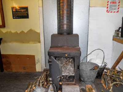 |
| Firebox loaded and ready for action at Mid Robinson Hut |
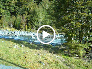 |
| Video of the river from the hut window |
I have discovered that New World Supermarkets in Christchurch are selling Back Country Cuisine meals for $10.50. This is extremely cheap for a 2 person serve so have been buying a few. The New World at South City has the widest range, they sell 14 of a possible 24 different meal types. I had Chicken and Tomato Alfredo with some added salt, olives, dried onions and sun dried tomatoes.
Very tasty...I recommend you try this variety.
 |
| BCC freeze dried meal with olives/tomatoes added |
 |
| Tucking into my Tomato Chicken Alfredo in Mid Robinson Hut |
I basically flaked out after that, too warm for the fire so I wrapped up in my pit and slept for nine hours. It is surprising how well I sleep in huts, much better than at home.
Its that wholesome exercise and good country air what does it....
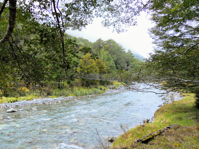 |
| The second swing bridge near Mid Robinson Hut |
Day Two: Mid Robinson Hut to the road end
After an uneventful night I set off for the road end at around 06.30am, I was slightly concerned about rain during the day but it was unfounded. It was dry, in fact it was warm and muggy by 0830 in the morning. The surrounding peaks were covered in clag, probably not a good day for crossing the saddle at the head of the valley as the clag had not cleared when I got to the car at 11.30.
 |
| Last view of Mid Robinson Hut...adieu! |
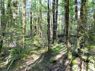
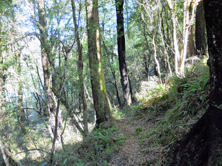
I found travelling downriver much easier than the previous day, the track marking was much clearer and I knew where I was going for a change. It is probable that this track was marked from the head of the valley, certainly the placement and distance between the markers made more sense. You should really be able to see the next marker within 20-100 meters in a straight line of sight if it is done correctly.
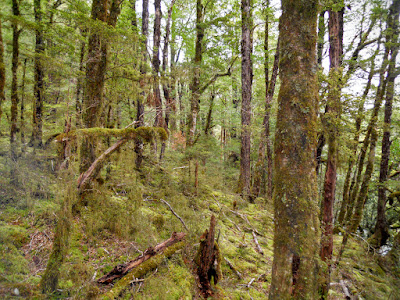 |
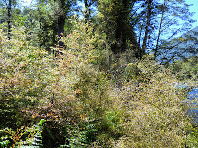
| Typical West Coast bush in the Robinson Valley |
I stopped and thought about the force of water needed to pile up flood debris in the fashion shown below. You must get some serious amounts of water coming down this valley when it rains in the headwaters. Its difficult to see but some of those logs are 3-5 feet in diameter- so heavy!
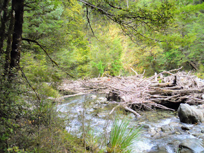 |
| Flood debris in Robinson Riverbed |
Just a note, there is a point next to the flood debris above where you have to climb a three metre bank to climb around a gorge. I slipped on the bank and banged up my arms on the roots and rock, be careful as it is very slippery.
 |
| View towards head of Robinson River Valley |
I got back to the car at 11.30 so taking into account the two 20 minute breaks I had, it was about a 4 hour trip. So much easier when you have an idea where you are going and the track marking is better. I enjoyed the trip but it was certainly hard work, probably more than is necessary.
 |
| Approaching the lower swing bridge over the Robinson River |
If road access wasn't such a problem I would be tempted to re cut this track: go up for 3 days, fly camp and slowly cut and mark the track as I went. I'm sure it would be appreciated by those following along behind you. Honestly, a bit of cutting back, some debris clearing and marking would make a world of difference to how difficult it is to walk the track.
Access:
From Springs Junction turn left onto SH7 to Reefton, turn off 3 km's
later onto Palmer Road the track start is 20 km's along at the Newcombes Farm car park. The track starts on the left hand
side of the road.
Track Times:
From Newcombes Farm road end it is 4-5 hours to Mid Robinson Hut. Upper Robinson Hut is a further 5-6 hours up river.
Hut Details: Mid Robinson Hut: standard, 6 bunks, wood burner, water from stream, toilet
Miscellaneous: Palmer Road has nine required fords, three of which are impassible to all traffic in moderate rain. Long, rough track to hut, two stream crossings these will flood in heavy rain. Track condition is poor in sections.


