Walking the Monument Track...more tramping fun on Banks Peninsula
I thought I would get out for a tramp over the ANZAC weekend, so after a bit of thought decided to walk up
Monument Track. This track on the far side of Lyttleton Harbour follows a paper road from Purau Saddle to the summit of Mt Herbert. I have previously walked the track but it is a nice walk so warranted another visit
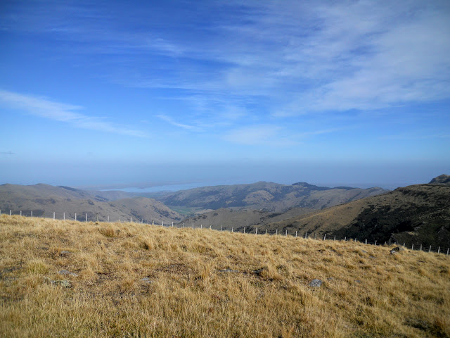
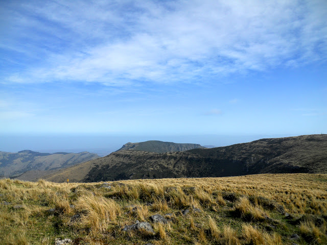
 |
| Lyttleton Harbour from the Pt 913 repeater Station |
When I was thinking about trip ideas I realised that I have been to the top
of Mt Herbert six times but had never climbed Pt. 913 just east of it. Pt. 913 is only 6 meters lower than Mt Herbert making it the second highest point on Banks Peninsula....that became my destination for the day.
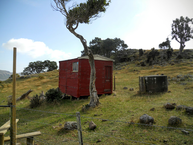
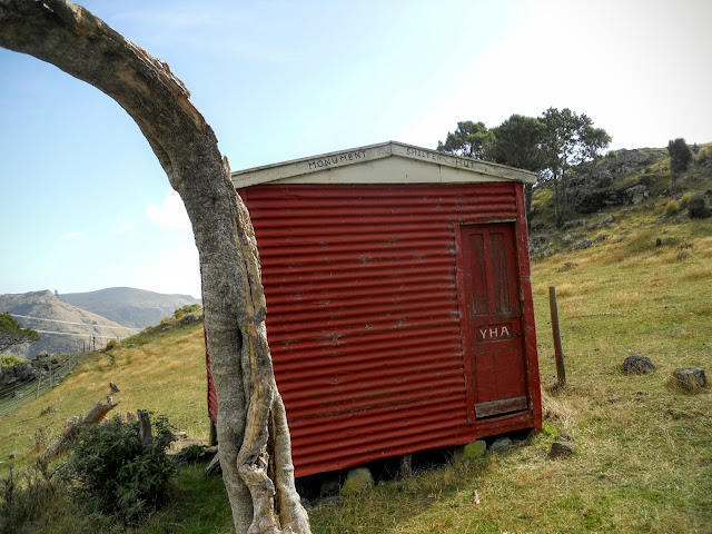
At the start of the track you pass the historic Monument Hut (1957) it is a couple of hundred meters to the South West of Purau Saddle.
 |
| Entrance to historic Monument Hut (1957) |
Please note that the course of the Summit Walkway has been altered since the topo map below was published. The Summit Walkway now runs to the SW of point 913 (marked in red), the old route joining with Monument Track is now a secondary feeder track and not the main route.
It is shorter but much steeper following this course.
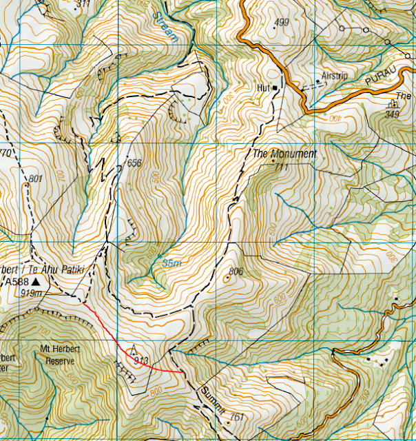 |
| Map: Monument Track, Purau Saddle to Pt. 913/Mt Herbert |
Monument Track: Purau Saddle to Mt Herbert
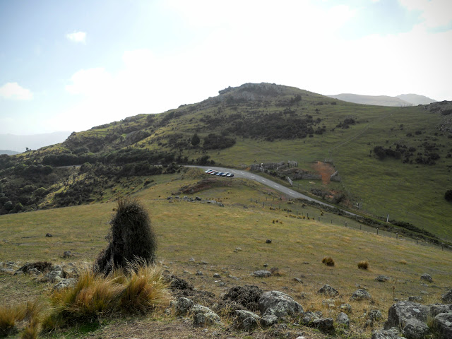
The track starts over a stile next to the parking area on Purau Saddle, it is not marked (there are no DOC information panels) so you just have to trust that there is a track. It's marked with DOC style poles about every 20 meters for its entire length so you are not going to get lost...
 |
| The start of the Monument Track on Purau Saddle |
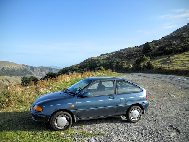 |
| The Purau Saddle car park, Monument Track |
The track heads up over a small slope before joining the main track near Monument Hut. Both the track and the hut are named after the rock feature in the photo below, the Monument or Te Pōhue.
I have been forwarded some information (see comments below) about the name/meaning of
the Monument to the local Iwi. Thanks Janey!
 |
| Monument Track: the track marker poles heading South West |
 |
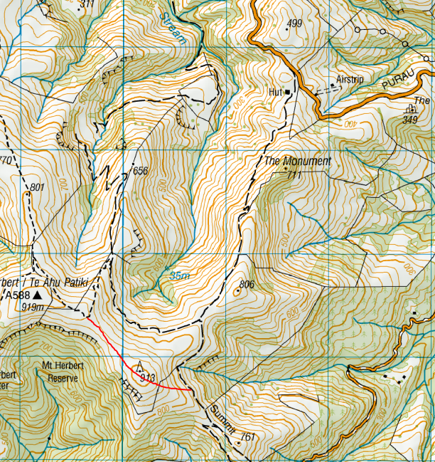
| The Monument, the track sidles this side of the peak |
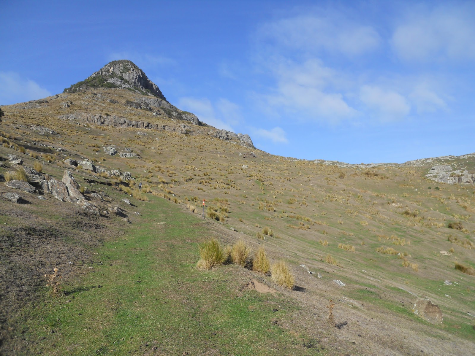
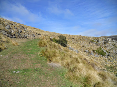
The trail follows old farming tracks for much of its length, this would make it easy to follow, even if it didn't have a blindingly obvious DOC track pole every 20 meters!
NB: The track may be easy to follow but it is STEEP, at least for the first hour or so...
 |
| Monument Track: starting the step climb to the Summit Walkway |
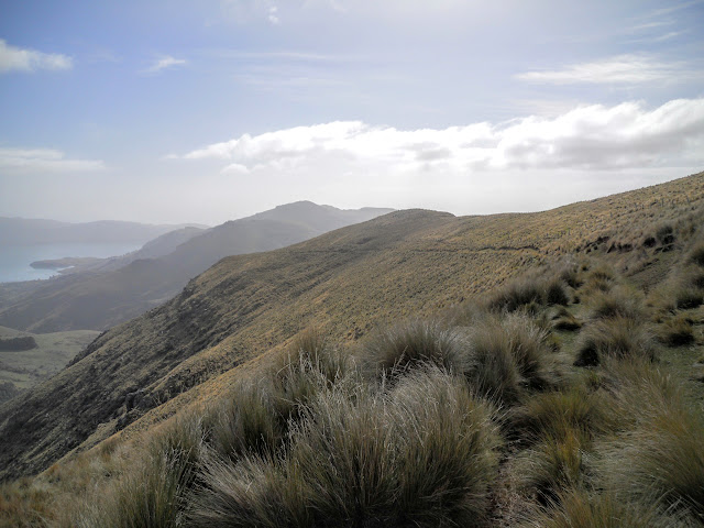
There are some awesome views almost right away as Purau Saddle sits at 450 metres ASL so you have good views of Lyttleton, the Port Hills and Pegasus Bay for most of the trip.
 |
| Looking back towards the Purau Saddle from the Monument Track |
 |
| Monument Track: a multitude of farm tracks up here... |
About halfway to the ridge top you strike a series of switchbacks in the track, above these the track levels out considerably making for much easier & quicker travel.
 |
| Starting up the switchback on Monument Track |
 |
| Purau Bay and Lyttleton from near the Monument, Banks Peninsula |
 |
| Purau and the Port Hills from Monument Track |
 |
| Topping the switchback section on the Monument Track |
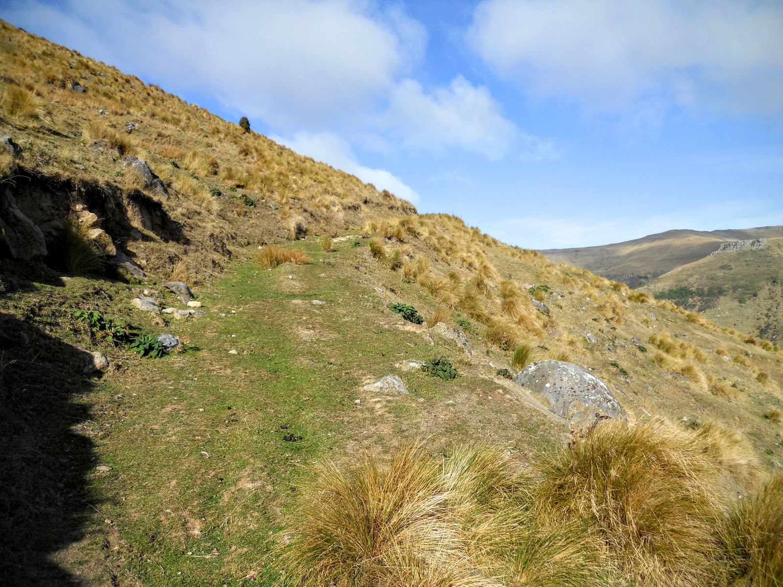
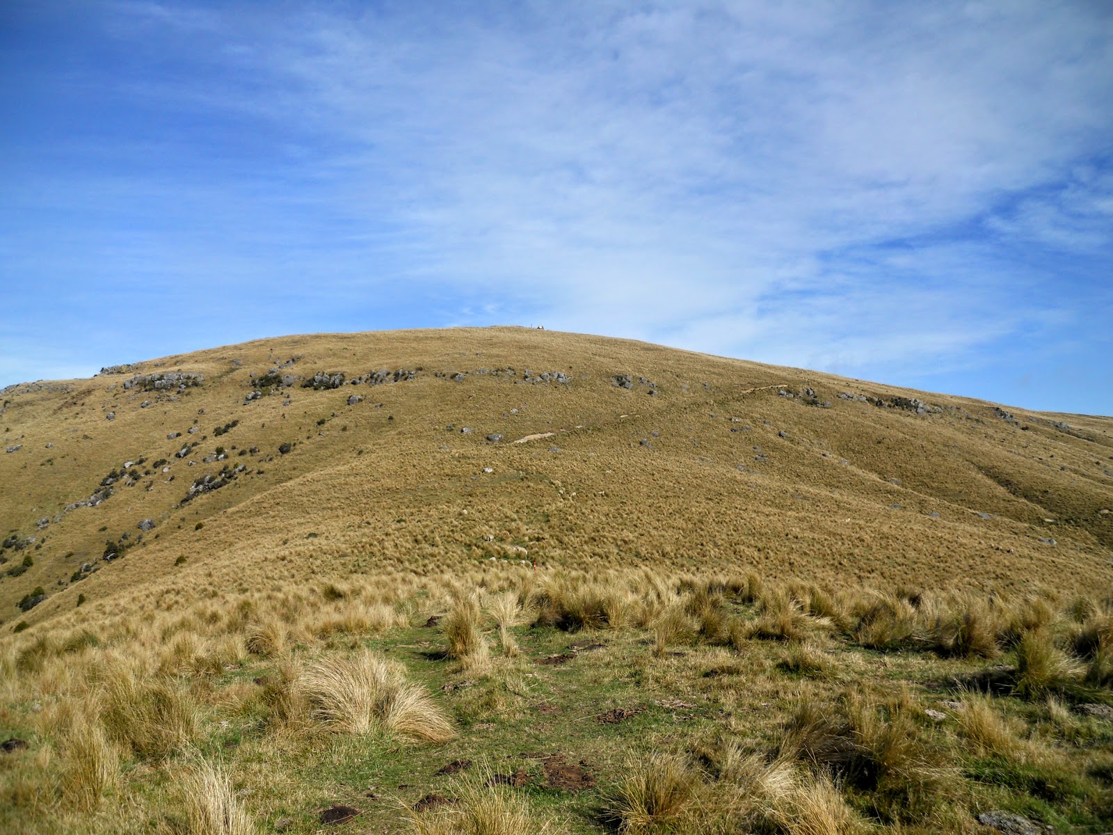
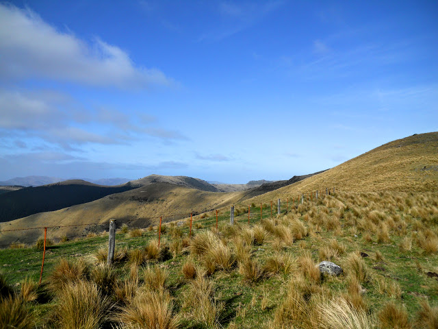
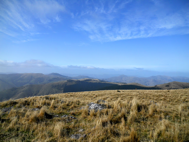
The next section (about a kilometre) is a fairly gentle stroll ascending and descending a series of small hills and ridges.
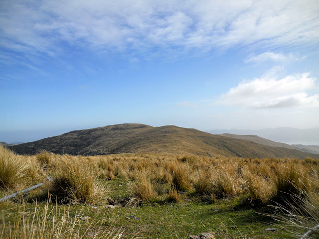
 |
| Pt. 913 to left and Mt Herbert to right... |
Pt. 806 is to your left as you climb this section of the track.
 |
| View of Pt. 913 from the Monument Track under Pt 806 |
 |
| View back along Monument Track |
 |
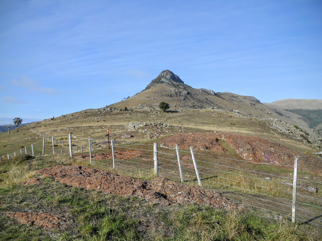
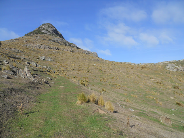
| Pt 913 the destination for today, Monument Track, Banks Peninsula |
On the saddle between pt. 806 and 913 you can see the old route of the Summit Walkway heading south along a fence. This is now a connector track as the new route climbs the SW side of pt. 913. The walkway passes close to the summit of 913 and then descends & crosses the saddle between pt 913 and the SE side of Mt Herbert.
I have noted this on the topographic map at the begining of this post...
 |
| The side track to the Summit Walkway.... |
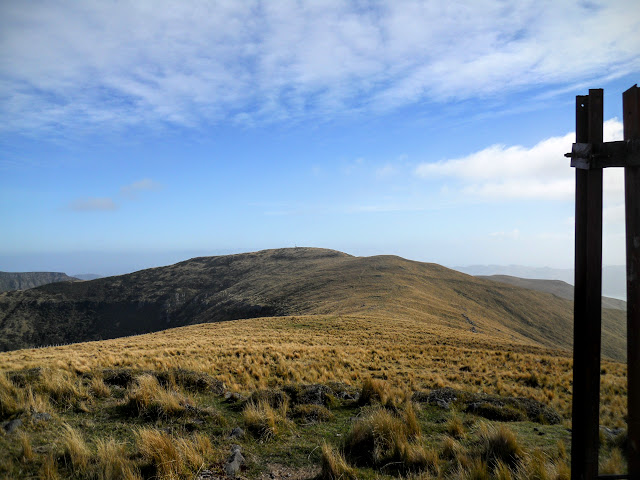
The last part of Monument Track is a short uphill section sidling around to another saddle between pt. 913 and Mt Herbert. You could just walk straight up the side of 913 but I wanted to see where the track went so I stayed on it.
 |
| Monument Track heading off to right, note the bluffs on Pt. 913 |
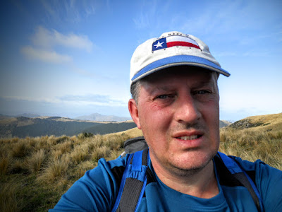 |
| Jon at the saddle between Mt Herbert and Pt. 913 |
The track eventually arrives at the saddle between Pt. 913 and Mt Herbert, you turn left and follow Te Ara Pataka , AKA the Summit Walkway for a couple of hundred meters to the summit of Pt. 913.
 |
| Mt Herbert to West from the saddle |
 |
| Birdlings Flat from near Pt. 913 |
You can just make out Mt Herbert Shelter in the middle of the photo below, it is the green roof just above the bush-line, with Mt Bradley directly behind it.
 |
| Mt Herbert shelter and Mt Bradley in the distance |
As I said the last stretch of the climb is following the Summit Walkway for a couple of hundred meters. When I came through here in
early April, it was so cloudy that I didn't even see that this was a high point let alone spot the repeater station. The summit is about 10 meters uphill from the walkway at its closest point.....
It was QUITE windy/foggy/wet/ bloody miserable on the day!
 |
| Climbing the Summit Walkway to the repeater station on Pt. 913 |
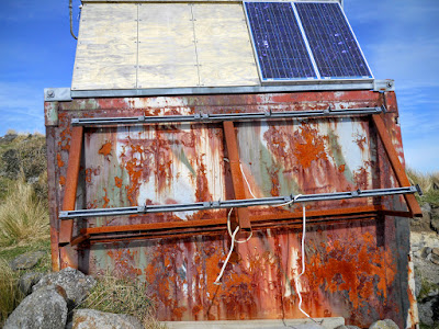 |
| Radio repeater station on Pt. 913 |
 |
| View to South towards Birdlings Flat from atop Pt. 913 |
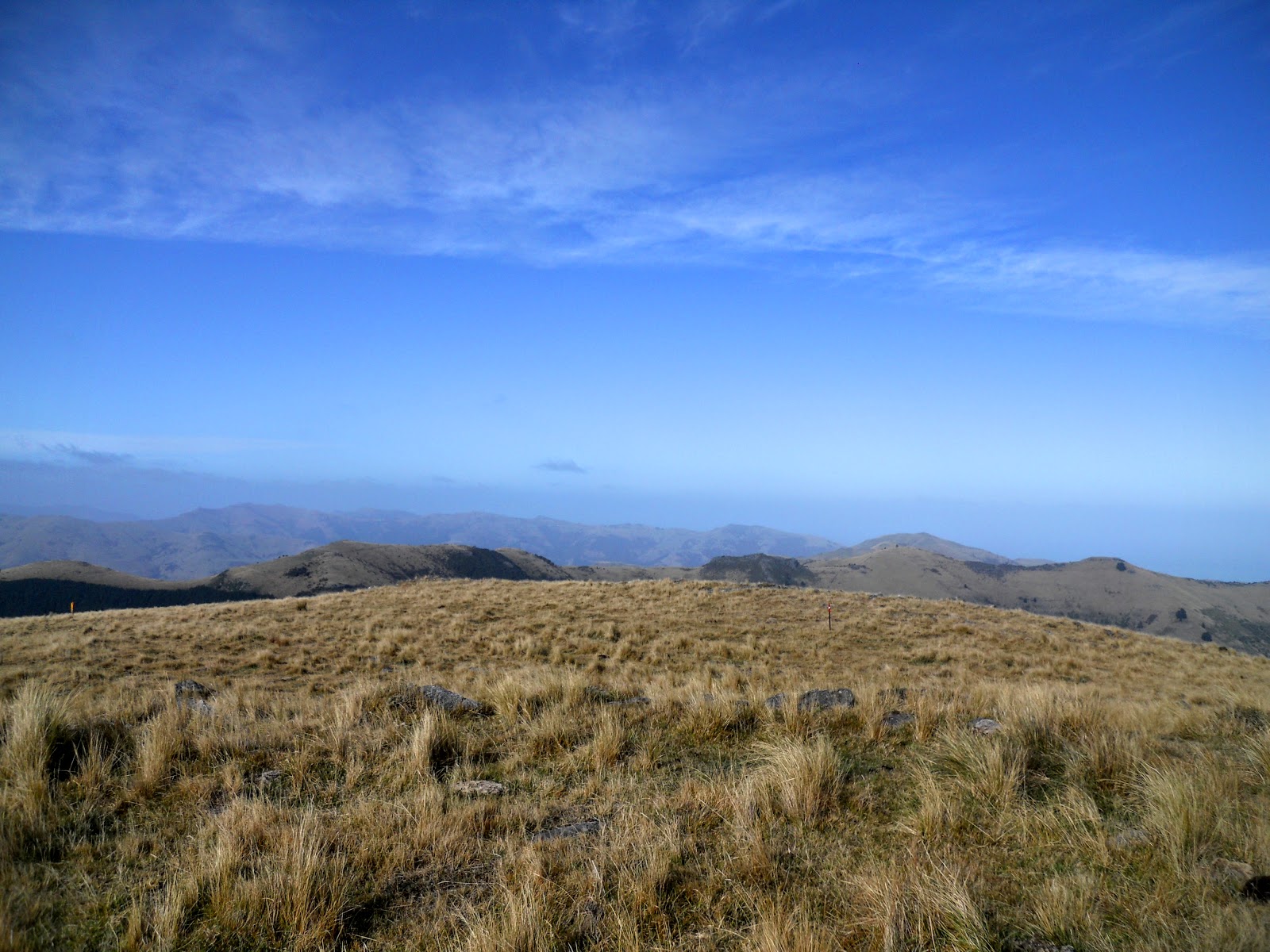
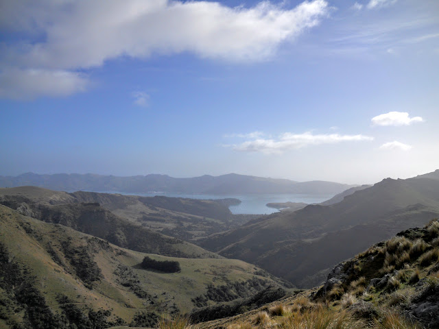
From the top of 913 you have clear views of the rest of the Summit Walkway heading towards Port Levy Saddle and points beyond.
The track follows the top of the ridges heading out to the left in the photo below...
 |
| View to SE along Te Ara Pataka from Pt. 913 |
 |
| Lyttleton and Port Levy from Pt. 913, Banks Peninsula |
Pt 913 is a high outlier peak to Mt Herbert (919 meters). At 913 meters above sea level it is only 6 meters lower than Mt Herbert, making it the second highest point on Banks Peninsula.
Surprisingly it has never been named!
As you can see in the photo below we are more or less on the same contour line as Mt Herbert out to the North West. Awesome views of Canterbury from up here even with the high cloud that obscured the distant Southern Alps.
 |
| Mt Herbert from atop Pt. 913 |
 |
| View to SW towards Mt Bradley from pt. 913 |
There is an emergency services repeater station located just off the summit, it is fully automated so does not have any road access. I would imagine that maintenance is done using a helicopter to transport gear and personal as required.
 |
| Jon on Pt. 913, Banks Peninsula |
The distance from Pt. 913 to Mt Herbert would be about 1-1.2 kilometres or about 20-30 minutes walking distance.While I was on 913 having lunch a person walked down off Mt Herbert and passed heading in the direction of Port Levy, it took her 20 minutes to get to me.
 |
| Mt Herbert from lunch spot next to Pt. 913 repeater station |
 |
| Close-up of Mt Herbert, people near the trig point on the extreme left.... |
I spent about 20 minutes on or around the repeater station and then set off back to the car park as it was getting cold and windy on the summit.
A note of caution: if you decide to walk down the NE face of Pt. 913 to meet up with the Monument Track look out for the small bluffs about 40-50 meters downhill. They are only 3-5 meters high but that would be plenty of height to seriously mess you up if you fell off them.
 |
| View to East: Pt. 806, the Monument and Port Levy from Pt. 913 |
Pt. 806 is the rising ground heading off to the right in the middle distance of the photo below.
 |
| Monument Track from Pt. 913 |
The return trip was much quicker; as is to be expected when you are walking down hill. Monument Track is the shortest route to gain the summit of Mt Herbert (not really the easiest though...) which would account for the 14 people I passed who were walking uphill.
 |
| Pt. 913 to left, Mt Herbert to right |
 |
| Wind blowing the tussock on the Monument Track |
 |
| Closing in on a misty Monument |
From a point on the track just past the Monument you are able to see down onto Monument Hut and the Purau Saddle car park which was now full of cars.
I saw a small group of rock climbers at work on one of the cliffs near the Monument, this area would be a climbers heaven with cliffs, bluffs, boulders and the Monument itself to explore.
 |
| View down to Purau Saddle from the Monument Track |
 |
| Monument Hut in lee of slope from Monument Track |
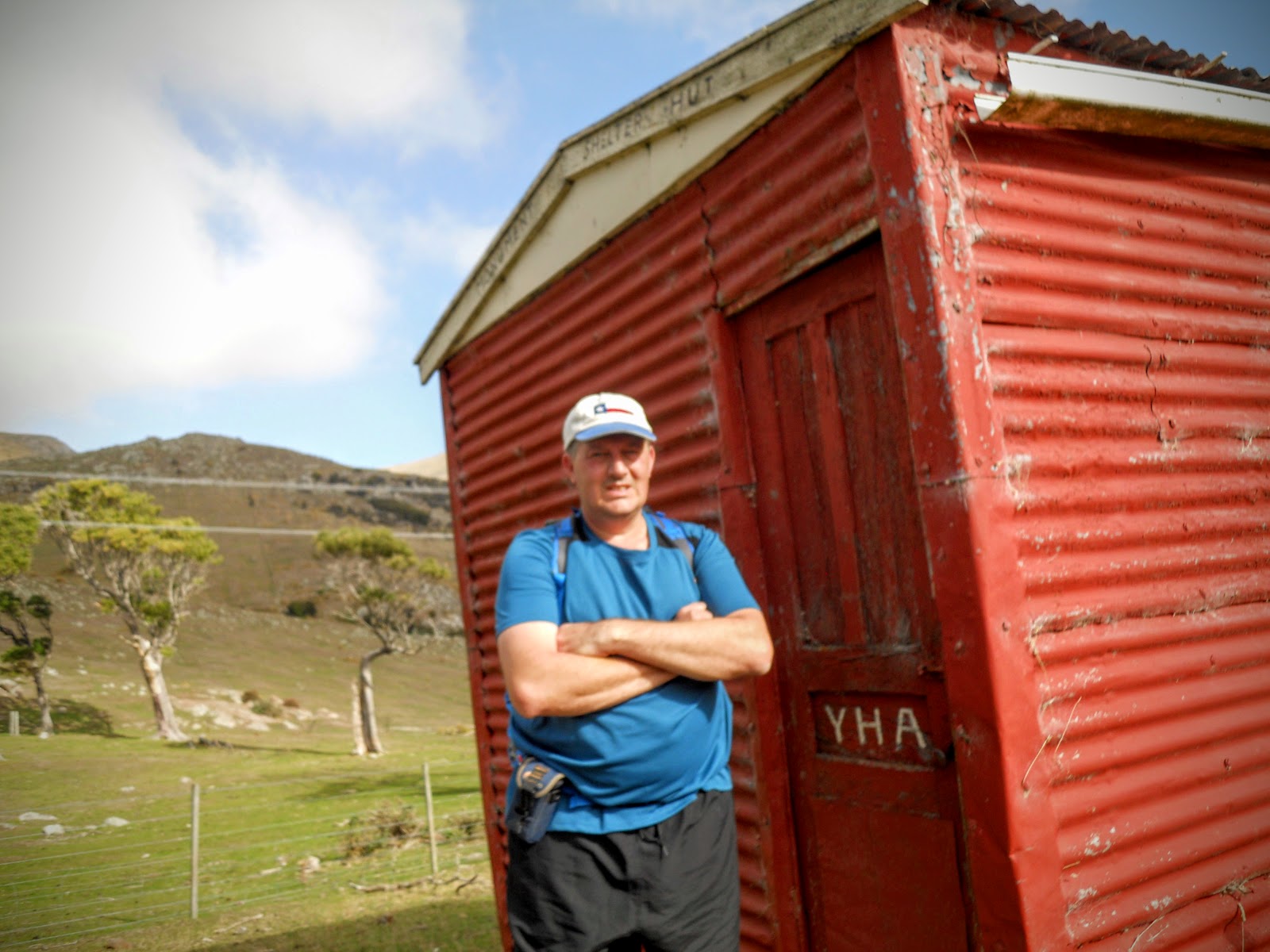
I stopped by Monument Hut on the return journey to have a look at this historic hut. Monument Hut was built in the 50's as one of a series of YHA huts located on Banks Peninsula. There were also huts built near Port Levy Saddle and Montgomery Bush, both now long gone. They were built to stimulate outdoor recreation in the area by using the public transport system at a time when only the wealthy had cars.
I imagine the hut didn't see much use, by the time it was completed Banks Peninsula was not the focus of local tramping clubs any more. With the advent of the overnight train, Arthur's Pass became the Mecca of Canterbury climbers and trampers in the 60-70's.
It is a pity really as it took another 49 years before a new public hut (Rod Donald) was commissioned on Banks Peninsula.
 |
| Historic Monument Hut (1957) |
 |
| Closer view of Monument Hut |
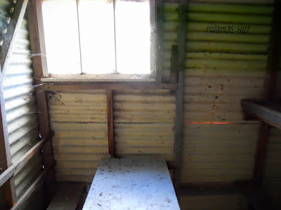
The hut officially holds 4 (on damn uncomfortable looking straw and scrim bunks), but I'm sure you would have been able to squeeze four more on the floor under the bunks. They must have been short in those days because the bunks are about 5'6" long.
It is still largely as built as it hasn't seen the wear and tear of a well used hut.
 |
| Monument Hut interior: straw/scrim bunks |
The hut is Spartan; corrugated iron cladding, no insulation, no heating and tiny: less than 4 meters by 2 meters. You can still stay in the hut even now but it would be a cold and grimy experience.
No potable water source in the immediate area.
 |
| Monument Hut: Spartan interior fit out |
 |
| View of Monument Hut and the Monument in the background |
 |
| Jon outside Monument Hut |
It is about 300 meters from Monument Hut to the car park, you climb up and over an intervening hill and then descend down to the track end.
 |
| Over the hills to Purau Saddle car park... |
I probably had the best of the day on my tramp as it grew progressively cooler and cloudier as the day wore on. When I got back to my car around 1 pm the cloud had started to mask pt 806.
It took me about 2 hours to reach the summit of 913 and about 1.5 hours to get back to the car, add an extra 30-40 minutes to reach the summit of Mt Herbert. That's 4-5 hours of tramping for the full distance.
 |
| Cloud closing in on Pt.806 |
 |
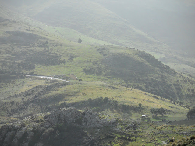
| Purau Bay from the road to Diamond Harbour |
Another nice day tramp completed I headed off home via Diamond Harbour and Dyers Pass.
As I have said previously, there is plenty of good tramping on Banks Peninsula, while its not Southern Alps style country it certainly has its own rich rewards. For one the amazing views you get from up here even in less than stellar weather. Another is its close proximity to Christchurch.
Consider a visit some time!
Access:The track starts at Purau Saddle about 20 minutes drive past Diamond Harbour, it climbs past the Monument to join Te Ara Pataka/ Summit Walkway.
Track Times:2 hours to Pt. 913, another 30 minutes to reach Mt Herbert, 1.5 hrs return to the Purau Saddle car park.
Hut details: Monument Hut: basic, 4 bunks, no water, no toilet, no heating.
Miscellaneous:The car park at Purau Saddle occasionally falls victim to vandals, do not park your car here overnight.