On the Abel Tasman Coastal Track, continued...
On Day one and two of this trip, Karen and I travelled along the Abel Tasman Coastal Track from Totaranui to Bark Bay Hut. The next two days saw us travelling to Anchorage Bay and then to Marahau at the end of the Abel Tasman Coastal Track.
 |
| Abel Tasman Coastal Track: Bark Bay Hut on the morning of day three |
So here is part two of this adventure, on the Coastal Track to Anchorage Bay and then by water taxi to Marahau.
Day 3: Bark Bay Hut to Anchorage Hut
Everyone was up and getting ready for action quite early on day three of tour trip. By the time Karen and I started preparing breakfast Annette (the kiwi women walking the track solo) was packing up to leave. Two of the young Americans had managed to get the fire going again so it warm for a change as we ate our breakfast.
 |
| Getting our breakfast going at Bark Bay Hut, Abel Tasman Coastal Track |
 |
| The dinning tables in Bark Bay Hut |
For breakfast on day three we had an odd mix; a Backcountry Cuisine apple pie, toaster pastries and some salami. It sounds strange but the mix gives you all of the calories and essential elements you need to sustain yourself for a long day.
The apple pie was actually very nice...it was freeze dried apples, a spicy sauce and raisins with biscuits you crushed up to make a crust...yummy!
 |
| Backcountry Apple Pie for Breakfast on the third morning |
We packed up our gear and were out the door by 9 pm...we were hoping to take advantage of the tidal crossing of Torrent Bay in the afternoon. We took our time as we didn't need to be there until after 2 pm as you can only cross two hours either side of low tide.
The Kiwi sea kayaker who stayed in the hut was just leaving as we go ready to set off so we watched him paddle across the estuary and head out to sea.
 |
| A Weka investigating our gear, Bark Bay Hut veranda, Abel Tasman Coast Walk |
 |
| Map: Abel Tasman Coastal Track, Bark Bay to Falls River |
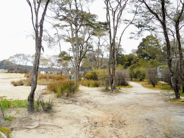
As we set out for Torrent Bay the tide was coming in and filling the estuary at Bark Bay...it took about 20 minutes for it to fill the estuary once the ocean had breached the sand bar at the entrance to the bay.
 |
| Bark Bay tidal estuary: the tide starting to come in... |
 |
| ...and the tide levels just 15 minutes later at Bark Bay Hut... |
 |
| Abel Tasman Coastal Track: last view of Bark Bay Hut |
Day three was a short tramp of about 2-3 hours and required us to cross two ridges: the first was to the Falls River bridge, the second was between the Falls River and Torrent Bay settlement.
 |
| Rejoining the Abel Tasman Coastal Track at Bark Bay Hut |
 |
| The tidal estuary at Bark Bay from the Abel Tasman Coastal Track |
 |
| Last view from the beach at Bark Bay, Abel Tasman Coastal Track: |
It was a good day for tramping...warm but overcast so there was no blinding sun to contend with. The start of the day was a slow sidle around to the Falls River bridge stopping en-route at a centennial lookout built for the 200th anniversary of Abel Tasman visiting this coastline.
 |
| Abel Tasman Coastal Track: starting the climb out of Bark Bay |
 |
| Last view of Bark Bay beach and the camp site, Abel Tasman Coastal Track |
 |
| South Head Peninsula from the Abel Tasman Coastal Track |
 |
| Centennial carving at the small bay just before South Head, Abel Tasman Coastal Track |
After South Head it was a slow climb up over the headland before dropping down to Falls River bridge. There is very nice forest along this section of the track...some beautiful mature Totora and Rimu Trees.
 |
| Abel Tasman Coastal Track: one of the bridges we crossed between Bark Bay and Torrent Bay |
 |
| On the track to Falls River Bridge, Abel Tasman Coastal Track |
 |
| Sandfly Bay, on the way down to the Falls River suspension bridge |
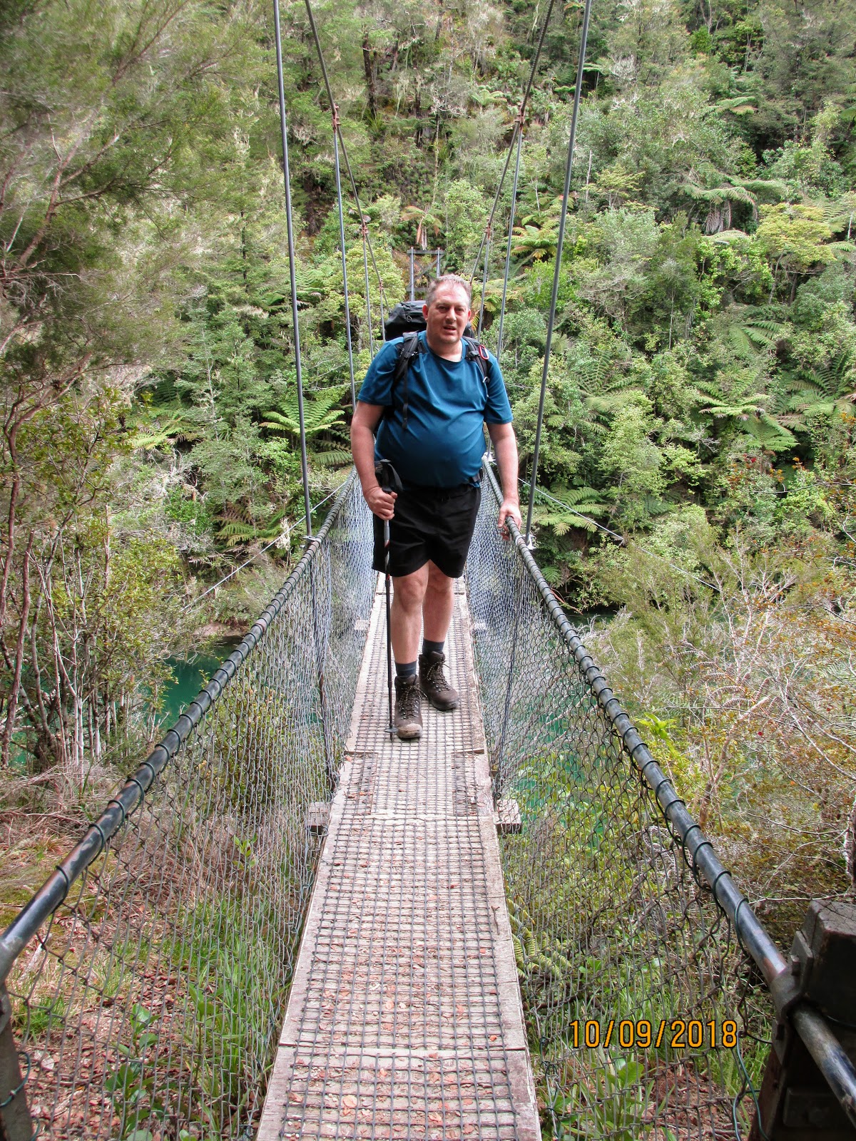
It took us about an hour to get to Falls River bridge, this is another of the suspension bridges along this track, this one crosses the Falls River. The Falls River starts way up in the hills over looking the coastline and is the largest river along this track.
Up until about 3-4 years ago you had to travel well up river to cross at a ford but the bridge has done away with all of this.
 |
| Falls River Bridge, Abel Tasman Coastal Track: |
 |
| Karen crossing over Falls River Bridge, Abel Tasman Coastal Track |
Its quite a long bridge, 100 meters at least and suspended high up over the river.
 |
| Detail of the bridge construction at Falls River, Abel Tasman Coast Track |
 |
| Looking up the Falls River from the bridge, Abel Tasman Coast Track |
Sandfly Bay is at the mouth of the Falls River, yes there is a campsite located near there but it is only accessible from the sea.
 |
| Looking down the Falls River from the bridge, Abel Tasman Coast Track |
 |
| Jon on the Falls River bridge, Abel Tasman Coast Track |
Once past the Falls River you climb to a high point looking out over Frenchman's Bay, then it is a very gentle sidle for the next hour before dropping down to the village at Torrent Bay.
 |
| Map: Abel Tasman Coastal Track: Falls River to Anchorage |
Project Janzoon has been hard at work along this part of the coastline...they maintain a number of trapping lines as well as undertaking replanting work and releasing native birds into the surrounding bush. We heard a lot of native bird song along this part of the Coastal Track.
 |
| Abel Tasman Coast Track: a Project Janzoon information board |
At one point you can see down into Frenchman's Bay which is one of a number of bays which can only be reached by sea kayak. There is a large and imposing holiday home located here with its own beautiful sandy beach.
 |
| Abel Tasman Coast Track: looking down onto Frenchman's Bay |
You strike Halfway Pool just past Frenchman's Bay...it isn't the half way point to Torrent Bay but in fact half way to Anchorage (if you are following the high tide track around Torrent Bay). It is a very modest stream but I imagine it fills up quickly when it starts to rain.
One of the features of a Great Walk is that they bridge all significant rivers & streams...there are 32 bridges on this track ranging from 2 meters to over 100 meters in length.
 |
| Halfway Pool: Abel Tasman Coast Track |
You could probably take water from this stream if required provided you filtered or treated it, we did not need to as we both had ample for the whole day.
 |
| Bush clogged stream at Halfway Pool, Abel Tasman Coast Track |
 |
| The DOC sign at Halfway Pool, Abel Tasman Coast Track |
 |
| Walking away from Halfway Pool on the Abel Tasman Coast Track |
Once you reach the high point between the Falls River and Torrent Bay it is all downhill to the coast as you gradually make your way to the holiday settlement at Torrent Bay.
 |
| Abel Tasman Coast Track: the high point between Falls River and Torrent Bay |
 |
| The bridge over Kilby Stream, Abel Tasman Coastal Track |
 |
| Rimu Tree grove, near Torrent Bay, Abel Tasman Coastal Track |
Torrent Bay Village is a collection of private lodges and holiday homes
situated within the boundary of the national park. Because the houses
had free hold titles when the park was set up in the 40's the owners are
allowed to build, extend and modify the land they own.
 |
| Looking down on Torrent Bay from the Abel Tasman Coast Track |
Torrent Bay can only be accessed by boat or on foot as there is no road access to the settlement even though there are a couple of car sized dirt tracks there.
 |
| The bridge at the entrance to Torrent Bay Settlement |
The landowners are VERY protective of their land rights so you must stay on the marked track while transiting through the settlement. I believe that the land can only be brought by and owned by Kiwis...this is to stop ownership leaving New Zealand.
 |
| Track markers in Torrent Bay Village |
 |
| Some of the holiday homes at Torrent Bay |
You can see the Anchorage and Pitt Head clearly from the beach at Torrent Bay, they are less than two km's away at this point. If you arrive at high tide it is nearly two more hours walking to get to the DOC hut or camp site around the long and dusty high water track.
 |
| Pitt Head and Anchorage Beach in the far distance from Torrent Bay |
 |
| Looking along the beach at Torrent Bay, Abel Tasman Coast Track |
 |
| The DOC track sign at Torrent Bay Beach |
Some of the houses at Torrent Bay are quite nice but none of them look like they belong to the mega rich. If this was any other place but New Zealand there would be multiple million dollar houses all along this beach.
 |
| One of the newer and nicest houses at Torrent Bay |
 |
| Following the dirt road through the Torrent Bay Village |
There was a builder working on one of the lodges near here sing at the top of his voice "...WHOAA OW OH...OH OH OH...WHY DOES LOVE... DO THIS TO ME....OH OH OH... WO OH WOO...WHY DOES LOVE DO THIS TO ME...".
Now I, like most Kiwis, enjoy a bit of the Exponents, but we could clearly hear this dude singing when we were at the lookout over Torrent Bay over two kilometres away!!!!!!
Loud bastid!
 |
| Heading up Manuka Street, Torrent Bay to the camp site |
 |
| What passes for a street sign in Torrent Bay Village, Abel Tasman Coast Track |
Karen and I stopped in the Torrent Bay camp-site to wait for the tide to fully recede. We arrived around 12.30 so we had to wait for about and hour and a half before it was low enough for us to cross.
 |
| Abel Tasman Coast Track: view from Torrent Bay camp-site...tide going out! |
The Torrent Bay camp site is the most basic along this coastline...it consists of 10 scratch camp sites, a set of toilets and a water point set amongst regenerating scrub and Manuka trees.
It was cool though as we just parked ourselves on one of the picnic tables and had lunch and a brew.
 |
| Map: the tidal crossing of Torrent Bay, Abel Tasman Coastal Track |
The crossing is about one kilometre long with handy orange markers to show you where the usual route lay. It basically goes from sand bar to sand bar from one side of the estuary to the other.
We started out behind a group of semi naked German day trampers (they striped down to their underwear to cross) but passed them within a couple of minutes as we both had beach shoes to wear and they were barefooted.
 |
| Walking across the tidal crossing at Torrent Bay, Abel Tasman Coast Walk |
 |
| Abel Tasman Coast Walk, the track to Anchorage crosses over the low saddle |
 |
| Abel Tasman Coastal Track: looking back towards Torrent Bay Village |
Notice how far behind us the German trampers fell as they slowly negotiated the rocks and sharp shells all over the mud flats.
 |
| Abel Tasman Coastal Track, crossing Torrent Bay estuary at low tide |
Once on the Anchorage side there is a small climb over a low saddle to reach the beach at Anchorage Bay. It is about 40 metres to the top and the same down the other side.
 |
| The track between Torrent Bay tidal estuary and Anchorage Beach |
 |
| On the track between Torrent Bay and Anchorage Beach, Abel Tasman Coastal Track |
 |
| On the track between Torrent Bay and Anchorage Beach |
The camp-site and DOC hut are located at the far end of Anchorage Bay close to Pitt Head, the beach is nice, much finer sand than that you find further north so I could see it would be an enviable location to sunbathe and swim over the warmer summer months.
 |
| Walking along Anchorage Beach to Anchorage Hut |
 |
| Looking out onto the Anchorage from Anchorage Beach, Abel Tasman Coastal Track |
 |
| Abel Tasman Coastal Track: the track to Anchorage Hut |
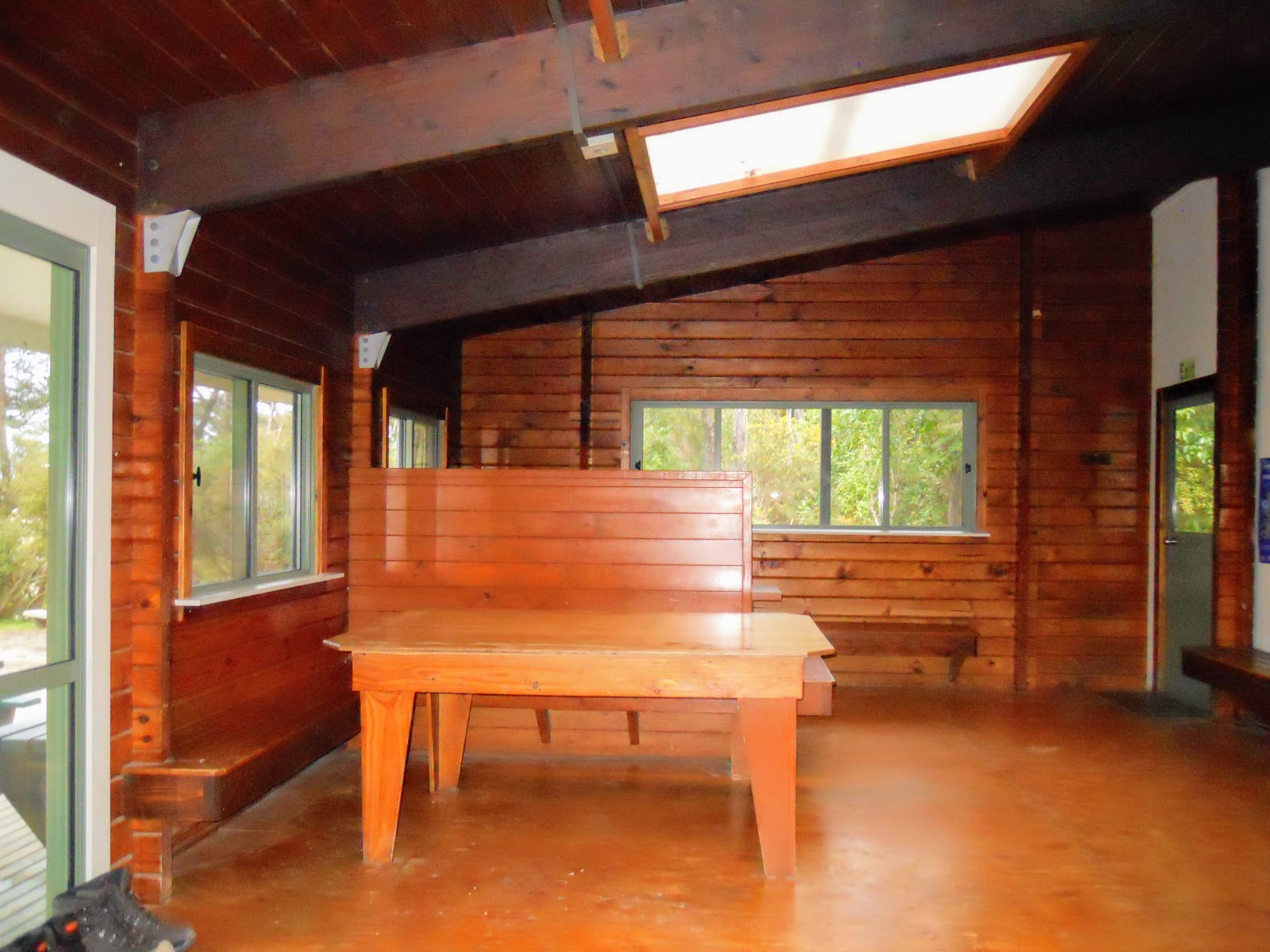
Anchorage Hut is huge and very nicely appointed, it has a large spacious living area and four 8 bunk cells for the people staying in the hut. There are large semi covered deck areas and several picnic tables located here...even at full capacity it would not seem all that crowded.
 |
| Anchorage Hut, Abel Tasman Coastal Track |
 |
| Anchorage Hut: the 8 bunk 'cells' or bunk-rooms |
The bunk-room cells are unheated but this is actually a bonus in my opinion as I always tend to get too hot in a classic DOC hut with a blazing wood burner going all night long in the middle of the room.
 |
| Interior of one of the eight bunk 'cells' at Anchorage Hut |
 |
| Interior of our eight bunk 'cell' at Anchorage Hut |
There are a set of toilets at the far end of the veranda as wel as a sink with filtered water so you can wash your self and clean your teeth.
 |
| Anchorage Hut bunk-rooms, we were in the first room |
The living/dining area is big...you could easily get 40 people in here at one time and still have space to spare. I think they made it so large as this is the busiest hut along the coast with day trampers, overnighters and multi day trampers all using the hut.
 |
| Getting a brew going in the dining area of Anchorage Hut |
 |
| Anchorage Hut: the nice view out of the dinning room window |
 |
| The Anchorage as view from near Anchorage Hut, Abel Tasman NP |
The whole setting of the hut is magnificent but I still prefer Bark Bay Hut as I feel it has more of a classic Kiwi tramping air about it. Anchorage Hut will eventually take on that air but as it is only a couple of years old it still seems too new.
We had a chat when we arrived with Annette the other Kiwi tramper and an older couple from the Philippines. The couple were waiting for their water taxi to arrive to take them back to Marahau. They were very friendly and chatty I recommended they go to Havelock as the guy wanted some fresh mussels. We also told them about Kaikoura as they were heading that way the next day.
 |
| Some of the resident Pukeko hanging around Anchorage Hut |
After a brew and a clean up Karen and I debated going out to Pitt Head for a small excursion but in the end we just went for a walk around the camp site and along the beach in the setting sun.
 |
| The undecipherable waste water system at Anchorage, Abel Tasman NP |
There was a school group from Wellington staying in the camp-site but they had set off for Pitt Head so we didn't really see much of them apart from the odd student who came up to use the nicer flushing toilets at the hut site.
 |
| The Anchorage camp site, Abel Tasman NP |
 |
| Un-tended fire burning at the Anchorage camp-site...bad Juju! |
 |
| Anchorage camp-site cooking shelter, Abel Tasman National Park |
 |
| The track to Pitt Head, Anchorage, Abel Tasman NP |
 |
| Heading to the beach at Anchorage from the camp-site |
It was nice and sunny so it was very pleasant walking up the deserted beach....
 |
| Anchorage Beach, early afternoon with the Evans Ridge in the background |
 |
| Tidal pool at the end of Anchorage Beach, Abel Tasman NP |
 |
| Pitt Head, Anchorage, Abel Tasman NP |
The storms back in March also damaged the bridge at the start of the section of track from Anchorage to Marahau. This stream is now impossible to cross for two hours either side of high tide so if you arrive at the wrong time you are going to be sitting on the beach looking at the hut another 100 meters up the beach
 |
| The blown out bridge on the track to Marahau, Abel Tasman NP |
Luckily you can still get onto the track to Marahau from the camp site and hut as the Department of Conservation have cut a new track along the edge of the bush/beach line.
 |
| Close up of Anchorage Beach bridge, Abel Tasman NP |
The DOC hut wardens quarters at Anchorage look very nice, they have a roving warden system in the park in the off season and a dedicated warden at each of the huts over the busy summer period.
 |
| The hut wardens quarters at Anchorage, Abel Tasman NP |
This beach is super busy at Christmas, the hut warden told me the last time I was here that they had 150 boats anchored here and about 1200 people using the beach on New Years Eve 2016.
 |
| The Anchorage, from the beach, Abel Tasman NP |
 |
| The low saddle between Torrent Bay and Anchorage, from Anchorage Beach |
There is only one other structure at the Anchorage; this is a private lodge located on Pitt Head just past the DOC camp site. The lodge also has its very own private beach, again this is a hold over from the time pre 1942 when private individuals were allowed to own land in the park.
 |
| Map: Pitt Head and the Anchorage area, Abel Tasman National Park |
 |
| The private lodge at Anchorage Bay, Abel Tasman NP |
 |
| Private beach next to Anchorage Beach, Abel Tasman NP |
We had a very pleasant night at Anchorage hut...it was about half full with about 17-18 people staying over night. Karen and I had a bunk room totally to ourselves which was a change as the last time I was here it was a full house.
For dinner that night we had freeze dried meals....I had an Outdoor Gourmet Venison Casarecce while Karen had good old Back-country Roast Lamb and Vege's. Surprisingly her meal was nicer than mine on this occasion.
I found and chopped up another of those heart Rimu trees for the fire...it had huge, thick veins of resin running through it so the wood burner was going like a blast furnace for most of the evening.
Day 4: Anchorage and a water taxi to Marahau
Originally we had planed to walk the final day out to Marahau but as it was just me and Karen we decided to catch the watertaxi from Anchorage so we could get home a little earlier.
We had a very leisurely morning eating all of our left over rations, reading and generally relaxing.
 |
| Maori Carving at Anchorage Hut site |
I went around and took a series of photos of Anchorage Hut to give you an idea of how nice this hut actually is..if it had a warm shower I could easily live here for an extended period of time.
 |
| View of Anchorage Hut sign, Abel Tasman NP |
 |
| View of Anchorage Hut, the dining/living area, Abel Tasman NP |
 |
| Anchorage camp-site facilities, near Anchorage Hut, Abel Tasman NP |
 |
| View of Anchorage Hut, Abel Tasman NP |
 |
| View of Anchorage Hut, Abel Tasman NP: the bunk-rooms |
 |
| The outdoor seating area, Anchorage Hut, Abel Tasman NP |
The hut has some thoughtful features: filtered water, flush toilets, gear cubicles in the bunk-rooms, solar lights and a USB connectible charging station. They even have an Ipad inside the living area with relevant information: weather reports, history of the area, tide charts and the main DOC website.
 |
| View of Anchorage Hut, Abel Tasman NP |
 |
| Interior of dining area, Anchorage Hut, Abel Tasman NP |
 |
| Interior of dining area, Anchorage Hut, Abel Tasman NP |
Our water taxi arrived at 11.30 so we went down to the beach at 11 and sat in the sun on a log to wait for them. We had managed to book the watertaxi by using our phones when we were on the high point overlooking Frenchman's Bay the previous day.
It costs $32 NZD to catch the taxi back to Marahau- so we booked and paid for it on-line using our debit cards.
 |
| The Marahau Aquataxi arriving at Anchorage Bay, Abel Tasman Coastal Track |
 |
| The Department of Conservation boat at the Anchorage |
 |
| Abel Tasman Coastal Track: the beach near Anchorage Hut |
Staff from the Department of Conservation were at Anchorage as they were doing some work in the camp-site, they have their own boats up here as this is the easiest method of travel from place to place along the coastline.
 |
| One of the Department of Conservation boats at the Anchorage, Abel Tasman NP |
 |
| On the watertaxi leaving Anchorage Beach, Abel Tasman Coast Walk |
 |
| First view of Marahau from the Abel Tasman water taxi |
 |
| A yacht lying off Marahau Beach |
 |
| Close up of the yacht lying off Marahau Beach |
The
Marahau Aquataxi whipped us back to Marahau within 30 minutes, saving us about four hours of walking. We plan to come up here some time in early 2019 and walk the remainder of the track from Anchorage to Marahau. This is once we have done a bit of fitness work to make it a bit more enjoyable.
The trip home: Kaiteriteri-Murchison-Lewis Pass-Christchurch
Karen had never been to Kaiteriteri before so we went up over the Marahau-Kaiteriteri Road to have a look at the beach. I must come back up here over the summer one year so I can spend some time sitting and swimming at this very nice location.
 |
| Kaiteriteri Beach looking towards the Marlborough Sounds |
 |
| Looking along Kaiteriteri Beach from near the camp ground |
 |
| Little Kaiteriteri headland from the beach at Kaiteriteri |
We drove back over Lewis Pass so that we could complete the Upper South Island loop, we stopped in Murchison for some fuel and an ice cream from the café on the main drag. It is much quieter in Murchison since SH1 through Kaikoura has been repaired.
 |
| Murchison: looking north from the main street |
 |
| Murchison: looking south down the main drag |
We went for a walk down to the domain at the northern end of the town to have a look at the WW1 memorial to the glorious fallen of the area. It is in the classic "resting soldier" format favored by many small towns for their war memorial after the Great War.
 |
| Murchison: the WW1 and WW2 memorial statute |
I was pointing out to Karen the massive damage to the surrounding hillside from the 7.3-7.8
Murchison earthquake back in the 1920's. I did Geography at school so it is easy to pick the areas where slippage has denuded hillsides of their top soil.
Over 20 people died in this area, most of them were buried by massive landslides cascading off the surrounding peaks. The two photos below are of the same general area at the entrance to the Matakitaki Valley.
 |
| Murchison: huge scar where a hillside slipped into the Matakitaki Valley |
Another feature caused by the same earthquake are the Maruia Falls about 15 kilometers up the road from Murchison. There is a Fault running right under the location of the current falls. The bed of the river rose five meters in the earthquake causing a series of waterfalls to develop. Water erosion over the last 80 years have deepened the falls to the current 20 meter size.
 |
| Maruia Falls, near Murchison, Tasman District |
 |
| Maruia Falls, near Murchison, Tasman District as seen from river level |
 |
| Close up of the Maruia Falls, near Murchison, Tasman District |
The other place we stopped was at the tarn at Lewis Pass, again Karen had never been through here before so she was keen to have a look. It was calm so we managed to capture a reflected view of the Freyburg Range in the water of the tarn.
 |
| The car park next to the Lewis Pass Tarn...the St James Walkway starts here... |
 |
| The Freyburg and Spencer Ranges reflected in the tarn at Lewis Pass |
 |
| The Gloriana Range as seen from the Lewis Pass Tarn |
 |
| The Lewis Pass tarn with the Opera Range in the background |
I hope to get back up to the Abel Tasman annually for an early Spring tramp, it is the perfect time for Kiwis to visit. Annette the solo kiwi tramper has walked the Coastal Track nine times over the past 5 years.
There is still plenty of territory for me to cover and camping and hut based trips still to do in the park.
Access: Water taxi from Kaiteriteri or Marahau, the trip takes up to one hour from Marahau or walk in from the Marahau road end
Track Times: 12.5km's or 3.5-4 hours Bark Bay to Anchorage, 13 km's or 4-5 hours Anchorage to Marahau
Hut Details: Bark Bay Hut: Great Walk, 34 bunks, wood burner, filtered water tank, wood
shed, flush toilets; Anchorage Hut: Great Walk, 34 bunks, wood burner, filtered water
tank, wood shed, flush toilets
Miscellaneous:
On DOC Great Walk booking system, must be booked for overnight visit.
Hut warden in residence from 1st October to 30th April each year. Tidal
crossing at Torrent Bay or use the longer high tide track.
Summary of the Trip
I love Abel Tasman National Park...if I ever move to Nelson this park would be my Port Hills...I would be up here all the time walking the tracks and enjoying the beaches.
 |
| Abel Tasman Coastal Track: a small cove just past Bark Bay |
It was nice to tramp with someone...I don't mind going out by myself, I feel capable and competent to do so but it sure is nice to share it with someone. Karen was wonderful company and we both had a lot of fun regardless of the lack of tramping fitness we both had. I look forward to sharing more adventures with her.
 |
| Wot u lookin at buddy...!!! |
The trip was great...nice sunny weather, no rain and bugger all people makes for a good tramp. I strongly urge any New Zealanders who have yet to visit Abel Tasman to do so. September and October are good times of the year to visit as the weather is OK and you don't have to deal with the hordes of people (or sandflies) you get at Christmas.
The only downside is you cannot swim as it is just too damn cold.
 |
| Coastal Forest above Torrent Bay, Abel Tasman Coastal Track |
I intend to come up and tramp the whole of the Inland Track some time over this season, not sure of the dates just yet but it could be sometime in December or perhaps late February. I was stymied last time by a recurrence of an Achilles injury but this has healed up now so it should be all guns blazing to walk the track from Marahau to Totaranui over three days.
Karen and I also talked about coming back to do the walk out to Marahau, we could do it super lightweight if it was only an overnighter.
 |
| Looking down on Awaroa Inlet from near Awapoto Hut, Abel Tasman NP |
As well as wanting to revisit the area I totally gotta go bag them huts along the Inland Track!


No comments:
Post a Comment