Back in the Canterbury foothills again...
I went for a day walk up Mt Grey a couple of weekends ago and it was really great to be back tramping in the Canterbury Foothills. The Foothills are a series of low hill ranges which stretch from Mt Oxford to Mt Cass near the coast by Waipara. Individual peaks on the ranges are as high as 1300 meters and they are inter-spaced with forest plantations or native bush.
 |
| Mt Grey as seen from Cramptons Bush Road... |
There is a whole series of excellent tracks/river valleys/huts right along the area between the two peaks...the Wharfedale Track, Ryde Falls, Mt Richardson, Lees Valley (multiple destinations), Mt Thomas, Okuku River and Mt Grey.
 |
| Looking down into the Lees Valley from the summit of Mt Richardson |
The track I followed started at Lake Janet at the start of the Mt Grey Lookout Track and climbs up the south-eastern face of Mt Grey through mixed exotic and native bush and sub alpine tussock fields. That is one of the interesting features of this track the varied types of vegetation and the quite abrupt difference between the zones.
 |
| The murky Lake Janet at the start of the Mt Grey Lookout Track |
Your first point of interest is the lookout view from a fire watch tower at the 800 meter mark with excellent views of Ashley Forest and the Canterbury Plains. From here it is another couple of kilometer's to the actual summit of Mt Grey with awesome 360 views of most of Canterbury, Waipara and the southern part of the Hurunui District.
 |
| View from Mt Grey of Ashley Forest, Canterbury Plains and Port Hills |
 |
| Jon at the Mt Grey fire lookout, Mt Cass, Amberly and the coast in the distance.... |
Mt Grey is actually another massif like Mt Herbert...a long ridge with a series of high points leading to the north west at more or less the same elevation. Once you get to the transmission tower at Pt 929 you can basically walk for several kilometer's within a hundred meter altitude difference. I had lunch up on the summit and enjoyed the views out towards Waipara...
 |
| The top of Mt Grey is a long ridge heading to the north-west..... |
 |
| The summit of Mt Grey looking south-west towards Mt Thomas, Mt Richardson |
 |
| Jon on the summit of Mt Grey, North Canterbury |
There are several tracks leading off the summit of Mt Grey but I walked back down the access road to a point near the fire watch tower. This is the easiest way of descending from the summit ridge...it is a relatively easy walk back down to the car-park at Lake Janet.
 |
| The Mt Grey access road goes from the forest right up to the TV transmission tower |
 |
| In the exotic forest on the flank of Mt Grey |
There are some great day walks on the Canterbury Foothills and this is one of the best and well worth the effort for the excellent views of Canterbury from the top. This track is justly popular and I must have passed at least 25 people on the day I was there.
So...lets have a more in depth look at what this track has to offer...
Climbing to the Mt Grey fire lookout:
Mt Grey is approximately 70 km's north of Christchurch and can be accessed from Amberley a small rural town on the outskirts of the city. I have included a detailed set of instructions for getting to Mt Grey at the bottom of this post as it is a bit confusing finding your way onto the forestry access road.
 |
| Turn left at the Amberley Hotel and head inland onto Douglas Road |
The track starts at Lake Janet which is located right next to Cromptons Bush Road...this is a gravel and dirt forestry road but it is very well maintained so it can be used by 2 and 4 wheel drive vehicles. Lake Janet is not signposted at all but there will usually be a couple of cars parked on the side of the road as this track is very popular...take a map!!!
 |
| The start of the Mt Grey Lookout Track at Lake Janet |
 |
| The only track sign on the Mt Grey Lookout Track, Mt Grey, Ashley Forest |
The track starts climbing almost immediately...to start with you are in mature exotic forest but further up the track you will strike both native and sub alpine vegetation. The forest on this side of the mountain belongs to Rayonier Forestry and they and DOC are fighting about who the land belongs to. Officially it is DOC land but it was over-planted with pine trees in the past so ownership is complicated...
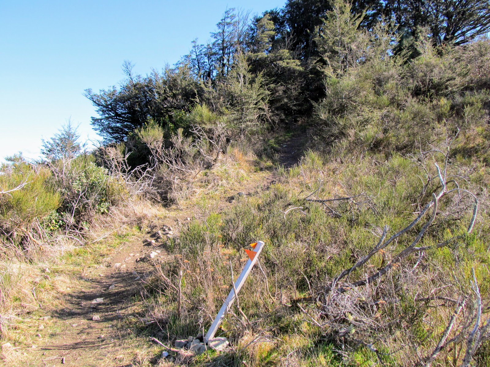
There is next to no track marking on the Mt Grey Lookout Track as Rayonier would prefer if the track did not exist. I think DOC are taking a softly softly approach so as to not antagonize them. The point is moot anyway as the track is very clear and hard to lose as it is well used by many people.
 |
| Map: Track network on Mautakere/Mt Grey |
 |
| Start of the climb on the Mt Grey Lookout Track, Mt Grey, Ashley Forest |
It is lovely and shady in the exotic forest but be prepared for sun and extreme weather as once you leave the plantation you are on tussock covered hillside exposed to all Mother Nature can chuck at you. Carry a sun hat and warm clothing as it is often windy on the summit.
 |
| ....the Mt Grey Lookout Track is initially quite steep... |
 |
| Map: Maukatere/ Mt Grey track network |
The track levels out a bit after 20 minutes and becomes a series of switchback track sections right up to the fire lookout tower on the 800 meter line.
 |
| The Mt Grey Lookout Track evens out to a steady climb in its mid reaches... |
Occasionally there are windows in the forestry canopy which give you views of the surrounding area. The views of Canterbury get better the higher you climb up the side of Mt Grey and are quite spectacular from up on the summit.
 |
| Looking out to Ashley forest and Canterbury from Mt Grey Lookout Track, Mt Grey |
You pass through a couple of areas of native bush on the bottom section of this track and in particular a whole grove of native Kotukutuku or Fuschia Trees. I did my usual and gathered a couple of hands full of the paper like bark as it makes a superb tinder for fire starting. I always have a small bag of it stashed in my pack in case I need some...
 |
| Area of native bush along the Mt Grey Lookout Track, Mt Grey |
 |
| A native Fuschia tree along the Mt Grey Lookout Track, Mt Grey |
 |
| ...there was a whole Kotukutuku or Tree Fuschia grove nearby.... |
About 30 minutes into the walk you will hit a track junction....one track continues up to the fire watch tower. The second leaves the exotic forest and sidles around the side of the mountain towards Red Beech ridge. This track is the old Bypass Track...long defunct but still used by a great many trampers. The Bypass Track links with the Mt Grey Track and then to the top of Mt Grey so it is possible to walk a circuit if you use it. .
I have walked the Bypass Track back in 2017 with a local tramping club who I meet on the summit of Mt Grey. We walked down the Mt Grey Track and then back across the Bypass Track. While remnants of the track remain I cannot recommend it to you as it is indistinct in places and I do not want you to get lost trying to follow it.
 |
| The Mt Grey Lookout Track-Bypass Track junction, Mt Grey |
 |
| The Bypass Track sidles around this slope on Mt Grey |
From the Bypass Track junction it is a series of ever ascending switch backs which snake back and forth across the south-eastern face of Mt Grey. Eventually they will deposit you at the clearing that the Ashley Forest watch tower sits on.
 |
| Mt Grey Lookout Track, Mt Grey |
 |
| Leaving the exotic forest along the Mt Grey Lookout Track, Mt Grey |
 |
| Pegasus Bay and Ashley Forest from the Mt Grey Lookout Track, Mt Grey |
The quality of this track is deteriorating as it is no longer maintained by DOC...several tramping clubs have taken over work on the track to maintain access to the DOC land on the top of Mt Grey massif. It is overgrown, muddy and slipping in places but still usable.....
 |
| You follow switchback track to the fire tower on Mt Grey |
 |
| Ashley Forest and South Canterbury from the Mt Grey Lookout Track, Mt Grey |
Once you leave the exotic forest you are in an zone of low scrub and ferns with the occasional patch of native trees to break the monotony. I noticed there were native trees growing among this junk so eventually this should regenerate into native beech forest.
 |
| Mt Grey Lookout Track, Mt Grey....open cut over on the way to the tower... |
 |
| View of Mt Richardson and Mt Thomas from the Mt Grey Lookout Track, Mt Grey |
The whole south-east face on Mt Grey is in shadow for all of the year so it can be a bit chilly walking along this section of the track. There was still frost on some of the plants along the track even though it was quite a mild temperature. It is also very windy so you might need to add a warm layer....
 |
| Regenerating native bush on Mt Grey Lookout Track, Mt Grey |
 |
| The distant Port Hills from the Mt Grey Lookout Track, Mt Grey |
 |
| The south face of Mt Grey is in permanent shadow.... |
You get glimpses of the fire watch tower as you get further up the track...it is one of those classic structures you see on the American and Canadian TV programs with a tower topped by a glassed in viewing area. I have never seen these anywhere else in New Zealand so they may be unique to this forest.
 |
| Ashley Forest/Mt Grey fire watch tower... |
 |
| The first sun I struck on the Mt Grey Lookout Track, Mt Grey |
 |
| Approaching the Mt Grey rangers tower... |
I takes about 45 minutes to walk from Lake Janet to the lookout...if you are short for time this is a perfectly good spot to turn around as there are awesome views of Canterbury to be had even from this point on the mountain. You are just a tad over 800 meters asl here and there is nothing higher than this to impede your view.
 |
| The fire watch tower on the Mt Grey Lookout Track, Mt Grey |
You can see the full sweep of Pegasus Bay as well as the Port Hills and most of Canterbury clearly from the viewing area around the watch tower. To the east there is Amberley and Mt Cass an outlier of the Canterbury Foothills. South-east is Canterbury, Christchurch and the Port Hills and south you can see as far as the Timaru Peninsula.
 |
| View towards Mt Cass, Amberley and the coast from Mt Grey |
 |
| Looking south-east along the Canterbury Foothills from the Mt Grey Lookout |
 |
| Ashley Forest covers a lot of land near Mt Grey |
It is another hour to the summit of Mt Grey from here so I stopped for a ten minute break, had a drink and a snack and talked to a couple of people who were also enjoying the view from around the lookout.
 |
| Standing at the Mt Grey fire tower with Canterbury in the background |
After a short break it was time to go and I quickly packed up my gear and tried to decide which way to go to get up to the summit of Mt Grey.
Mt Grey fire lookout to the summit:
From the fire lookout there are two potential ways to get to the top of the mountain. The first and easiest is to just walk down the watch tower access track to Mt Grey Access Road, turn left and follow it all the way to the transmission tower at Pt. 929. The second is to keep to the track and follow the sidle track around the front or eastern side of Mt Grey to a place close to Pt. 929.
I decided to stay on the track...
 |
| Heading up to the summit of Mt Grey from the fire lookout |
 |
| The first section after the Mt Grey fire lookout tower is steep.. |
 |
| View of the fire lookout tower from the Mt Grey access road... |
After a thirty odd meters the track will spill you out onto Mt Grey Access Road...directly opposite is the track entrance to the Mt Grey sidle track (not the actual name as it has no name...that's my name...). From here is is about another 40 minutes walking to get to a point close to the transmission tower on Pt. 929.
 |
| Routes to the Mt Grey Summit...Option 1: follow the access road.... |
 |
| ...Option 2: follow the Mt Grey sidle track along the eastern flank... |
The track is a mixture of open areas and beech forest remnants...the open areas are exposed to the elements so this is a good place to don your sun hat. The hillsides are covered in gorse, broom and tussock as this area has previously had exotic forest on it and is slowly regenerating.
 |
| The sidle track on the east side of Mautakere/Mt Grey.... |
 |
| The Mt Grey sidle track is rough, muddy and overgrown... |
The vegetation changes to sub alpine grasses and plants when you get to the 900 asl line on the mountain. There were some Celmisia or Mountain Daisy, flax and Spaniard and turpentine scrub along the side of the track but mostly it is various types of tussock.
 |
| Sub alpine Celmisia flowers on the Mt Grey Sidle track |
 |
| View back along the Mt Grey sidle track...Mt Grey, North Canterbury |
The front slope of Mt Grey is covered in Beech forest which I would imagine is now protected as you are not allowed to cut native trees for timber anymore. The shade and cover from the cold wind offered by the trees was well appreciated...
 |
| The Mt Grey sidle track passes through areas of Beech forest... |
 |
| The transmission tower on Pt. 929, Mt Grey, North Canterbury |
There are awesome views of North Canterbury, Pegasus Bay and Waipara from the sidle track...in the far distance you could see the start of the Hundalee Range on the way to Kaikoura, the Port Hills and the Amuri, Glen Wye and Hanmer Ranges inland.
 |
| View out to Mt Cass from the Mt Grey Sidle track |
You can follow the sidle track right up to the top of Pt.929 but as this was not where I wanted to go I cut off the track and climbed directly up the hillside when I was level with the transmission tower. I climbed up the slope for about 30 meters and found myself right next to the flat area where the Mt Grey access road ends.
 |
| Closing in on the transmission tower on Mt Grey, North Canterbury |
 |
| ....I just went up the side of Pt. 929 from the Mt Grey Sidle track |
 |
| Closer view of the transmission tower on Pt. 929, Mt Grey, North Canterbury |
The transmission tower on Pt 929 is easily seen from Amberley and is a welcome sight for Cantabrians heading back to Christchurch from the north. There is a control room at the base of the tower and some ancillary buildings but the site is unmanned. There are repeaters on the tower for radio, television and emergency service radio links.
This is a good spot to stop for a break as the buildings provide some shelter from the howling gales you usually get up here...you can hunker down and have a comfortable break.
 |
| Mt Grey, North Canterbury: control room for the Mt Grey transmission tower |
 |
| The track to Mt Grey goes past the transmission tower... |
Pt. 929 is one of the outlier high points of the Mt Grey ridge and sits right next to the transmission tower. There are excellent views from here and it is worth walking the extra 20 paces to view them on your way to the main summit of Mt Grey.
 |
| View towards Waipara & Weka Pass from Pt. 929 on Mt Grey, North Canterbury |
From Pt. 929 you drop down to a saddle in between it and the main Mt Grey summit before climbing a couple of hundred meters up the ridge to get to Mt Grey proper...
 |
| View of the saddle & summit of Mt Grey from Pt, 929.... |
 |
| Climbing up to the Mt Grey trig on the way from Pt. 929 |
 |
| ...you can just see the Mt Grey trig on the summit of the ridge..... |
 |
| On the summit of Mt Grey (934 a.s.l), North Canterbury |
The top of Mt Grey sits at 934 meters asl and has views of most of Canterbury....I arrived there after slightly more than 2 hours of walking or roughly around noon. I was the only person on the summit when I arrived and I took in the splendors to be seen in all directions.
On the summit of Maukatere/Mt Grey:
Mt Grey is a long and fairly flat ridge line heading out to the north west...it would be 1-2 kilometres from the trig on the highest point to where it stats to drop off in the headwaters of the Waipara River. It is horribly exposed to the elements and a strong and very cold wind meant I had to don my jacket and pull up my hood to stay warm.
 |
| Looking south from the summit of Mt Grey |
 |
| Standing next to the Mt Grey Trig |
There is a DOC track sign on the summit, a trig point, cairn and a memorial cross for Ray Cassidy who went missing in the forest around here in 1997. He was walking with a tramping group on the Red Beech Track when he disappeared off the track. A massive multi day SAR effort was undertaken but no trace of Ray has ever been found. It goes to show that even in relatively benign forest like this it is possible to become hopelessly lost.
 |
| Memorial cross for Ray Cassidy...lost in Ashley Forest since 1996... |
There is a fine view back along the ridge to Pt. 929 and the transmission tower with stunning views of Canterbury as a back drop. You can see why they placed a re-transmission tower on this peak as it has a line of sight to just about everywhere in Canterbury.
 |
| View back to Pt. 929 and the transmission tower, Mt Grey, North Canterbury |
 |
| View down to the Waipara Valley from Mt Grey... |
 |
| View west from the Mt Grey summit...distant Puketeraki Range |
 |
| That is Mt Richardson in the middle distance...Mt Grey, North Canterbury |
I had a good look at the trig point on the top of the mountain....it has a small panel with information about the altitude, latitude and longitude etc. and another which explains what a trig point is for. This is possibly necessary to stop idiots from vandalising the site.
BTW: the fine for removing or damaging a trig point is up to $40 000 or three years in jail...so don't bugger around with them!!!
 |
| Detail of the trig atop Mt Grey, North Canterbury |
It was far to cold and windy to have lunch on the top of the summit so I walked off the front edge and hunkered down in a hollow on the east face to get out of the wind. It was an excellent spot as the sun was blazing and I could sit there in my jacket and warm up a bit.
I had a chicken wrap, chips and a chocolate bar for lunch while I watched the traffic driving along SH1 north to Kaikoura and points beyond. While I was sitting there four further people reached the top of Mt Grey and headed off in various directions to finish their tramp.
 |
| My lunch on Mt Grey...chicken wraps and salted chips...yum!!! |
 |
| Coupland Bakery wraps are delicious..... |
 |
| My lunchtime view on Mt Grey, North Canterbury |
 |
| It was windy and sunny so hat and jacket required... |
I sat on the top of Mt Grey for about 25 minutes just enjoying life before packing up my gear and setting off back down the way I had come.
Heading back to the Lake Janet car-park:
The first part of the trip back to Lake Janet was the same as the way out....down the side of Mt Grey and then back up to Pt. 929 and the transmission tower. I kept my jacket on for a while as it had got progressively windier and colder as I was having lunch and it was just too cold to go without.
 |
| On Mt Grey, North Canterbury looking west to the Puketeraki Range |
 |
| Pt.929 from the summit of Mt Grey, North Canterbury |
 |
| Climbing up Pt. 929 at Mt Grey, North Canterbury |
There are a lot of sub alpine plants on Mt Grey including Spaniard or 'bastard grass' as it is known here in New Zealand. I passed a specimen as I was climbing up Pt. 929...it is a type of tough and very sharp flax with leaves so pointed they can stab through canvas gaiters and even boots. You find Spaniard above 900 meters a.s.l and I regularly strike it on the Port Hills, Banks Peninsula and up in the mountains.
 |
| A Spaniard on the flank of Pt.929, Mt Grey, North Canterbury |
Incidentally...the inner roots of the Spaniard plant are edible..you trim off the tough outer leaves (carefully as it it is bloody sharp...) and roast or eat the root raw. I have not tried it myself but I have been told it tastes a bit like a cross between an onion and parsnip. Please don't try this yourself unless you are in a survival situation as it is a protected plant.
 |
| The transmission tower on the top of Pt.929, Mt Grey, North Canterbury |
 |
| Mt Grey Track runs down the second ridge...Mt Grey, North Canterbury |
 |
| Detail of the Mt Grey transmission tower |
The Mt Grey Access Road runs from the area around the transmission tower all the way down to Cromptons Bush Road close to Lake Janet. This was the way I walked back down the mountain as it is the quickest waay...the road is gravel but in excellent condition. It took me about 30 minutes to make it back down to the fire watch tower following the road.
 |
| Mt Grey road runs back down to the Ranger fire tower... |
 |
| Mt Grey, North Canterbury: Mt Grey Road heading down.... |
 |
| The Mt Grey Road is a nice flat 4 W/D track.... |
 |
| The Port Hills are just visible from the Mt Grey Road |
 |
| View out to Amberley Beach from the Mt Grey Road... |
You turn off the road and onto the track at the same place you crossed on the way up to the summit...watch closely for it as it is not sign posted in any way and is a bit indistinct. I stopped at the fire watch tower for a drink and to take my jacket off now that I was out of the worst of the wind.
 |
| Back at the Ashley Forest fire watch tower, Mt Grey |
 |
| The track to Mt Grey Road from the watch tower... |
 |
| View of Mt Richardson from near the fire watch tower... |
You head back down the switch back track sections making for the visible bush line about 100 meters below the watch tower. You are heading for the line of trees you can see in the photo below.....
 |
| Back on the Mt Grey Lookout Track, Ashley Forest |
 |
| The Mt Grey Lookout track re-enters the forest along this edge.... |
Eventually you will find yourself back in the forest and from here is it about 30 minutes to Lake Janet down at the start of the track. It was good to be fully out of the wind after two hours as the thick forest blocks all of the cold blasts of wind coming from the snow covered Puketeraki Range.
I passed a couple halfway through the forest section...the chap recognized me from this site (..hi there...I hope your trip went well..) and we had a bit of a chat about track conditions and the Bypass track which they were going to follow to the summit. This occasionally happens and it is good to know people are visiting my blog for information and inspiration. That is why it is here...
 |
| Back in exotic forest on the Mt Grey Lookout Track |
 |
| One of the few track markers on the Mt Grey Lokout Track |
 |
| The turn off to the track around Lake Janet |
When I got to the bottom of the track I went and had a look at Lake Janet...its not much of a lake really. It is probably about 300 meters around the outside of the lake and the water is dank, dark and covered with pine tree pollen at this time of the year. It is an artificial lake dug for firefighting to be used as a source of ready water for fire tankers and helicopters etc.
In the south of the United States this kind of lake would be called a 'holla' which is short for hollow. I could just about imagine a couple of Tennessee mountain men sitting here over a corn mash still....it has that kind of feel to it.
 |
| Lake Janet at Mt Grey is dark and dank..... |
 |
| Lake Janet is surrounded by exotic and native forest |
There are a couple of nicely sited picnic tables here if you wanted to have a break before the drive home of if you wanted to come for a family picnic. No camping is allowed here though as this is forestry land and not DOC land.
 |
| Picnic areas at Lake Janet, Ashley Forest |
The cars had thinned out quite a lot in the car-park by the time I got back to my car but there were still about 10 of them even though it was getting on for 3 pm...There are spaces for about 8-10 cars alongside the road but there is also a flat overflow area across the road that could hold about 20 more.
 |
| The Lake Janet car park on Mt Grey, Ashley Forest, North Canterbury |
This was my third time to the summit of Mt Grey...I really like this track as it is a good work out without taking a huge amount of time to complete. You certainly get some stunning views of North Canterbury and the Waipara area from the summit. This is just one of three ways to get to the summit so there is plenty of good tramping to be had in this neck of the woods.
If you have driven past Mt Grey on the way out of Christchurch and wondered what it was like up there then I suggest you get your gears and start walking. It is well worth the effort.
Update January 2022:
Here is some additional information I received from a fellow tramper since this trip..have a read before heading to Mt Grey:
Hi Jon you dont know me but I was at the trig on Maukatere 10am today.
Just writing to say, although I'm familiar w Mt Grey tracks, last night I read your blog about being led to the Bypass track. Many times I've tried to find it from both ends. Today I met Mark a local kaitiaki up there. He said he was on that track recently. With your red lines on your blog map and being a Papo orienteer I'm happily reporting I did it both ways. A real treat. Admittedly almost an hour each way as the western gut into the kowai stream was slidy on my own.
Incidentally the lake janet area is logged out, it's just slash with a grader-formed track to the remaining pines.
Toilet is on its side. Larger parking area formed. Mark said the ford to the campsite was washed away in the May blood moon floods thus no vehicle access that far.
 |
| Lake Janet area back in 2016.... |
Thanks for the additional information Melanie....


No comments:
Post a Comment