I'm baaacckkkk....in Abel Tasman National Park!
Ahhh...a new tramping season opens with a return to the Abel Tasman National Park.
This is my third trip to the park in two years, previously I have walked the
Coastal Great Walk and ventured onto the far end of the Inland Track to
Awapoto Hut.
 |
| Panorama of the beach at Totaranui, Abel Tasman National Park |
This trip I had my partner Karen with me...my daughter and her "friend" were also due to come along but they had their school formal the same day. No doubt we will get up here some time but I'm looking at a tramp of the St James Walkway in November as an alternate.
 |
| Upper Boyle River Valley, St James Walkway, February 2016 |
We stayed in Motueka this time as there are more facilities located there, I will probably do this from now on as it only added an extra 10 minutes to the trip to Marahau in the morning. We had diner at a new Thai restaurant called
Lanna Thai, it was really good, go try it out if you are in Motueka...
 |
| Inside Lanna Thai Restaurant, Motueka |
We were booked on the first water taxi to Totaranui in the morning so we arrived a bit early so we could collect the tickets.It was an absolute cracker of a day, warm and sunny...perfect weather for a tramp in the Abel Tasman.
 |
| The view of Golden Bay from the Marahau promenade walkway |
 |
| Me and the Silver Surfer parked at Marahau Aqua Taxis |
The water taxi picks you up from the large parking space behind the main office, they transport you and your gear to the water while you are in the boat.
On the water taxi to Totaranui
As usual I used the water taxi service from Marahau so we could walk back to our car at the end of the tramp. The boat was almost full, there were only two Kiwis the rest were all Bri-wis (British Kiwis) or tourists.
We headed up the coast with a few stops along the way to drop people off and shift some bags from one beach to another.
 |
| Split Apple Rock near Marahau Inlet |
 |
| A New Zealand Fur Seal pup sunning itself on a rock on Adele Island |
 |
| An interesting sea arch half way between Bark Bay and Awaroa Inlet |
Because we picked up a couple of people from Kaiteriteri we were a bit late, we arrived at Totaranui around 1130 but this didn't matter as it fit with the tide patterns for the crossing of Awaroa Inlet.
Day One: Totaranui to Awaroa Hut: 8 km's and 2-3 hours
Day one was the walk from Totaranui to Awaroa Hut, we were moving slowly as neither of our fitness levels were optimum. I have had a couple of niggling health issues over the last six months so I haven't been able to keep up my fitness walking.
Hopefully with the better weather I can get out and do some serious walking as I am scheduled to walk the Milford Track in December.
McKinnon Pass with no fitness....no thankee!
 |
| Abel Tasman Coastal Track: the beach at Totaranui |
 |
| Our Marahau water-taxi at Totaranui Beach |
 |
| Totaranui Beach looking west along the beach, Wainui is that direction |
Yes...the sand really is that colour on Totaranui Beach...my third landing here now...
 |
| The beach ramp at Totaranui Beach |
|
 |
| First Weka of the trip, Totaranui Campgrounds |
 |
| Heading east in Totaranui camp-grounds to the start of the Abel Tasman Coastal Track |
We headed off along the track almost straight away, I was keen on having lunch at Goat Bay picnic area and getting as far along the track as possible so we were in a good position to get to the hut at low tide.
The Abel Tasman Coastal Track is all about tidal crossings...mandatory at Awaroa Inlet and Onetahuiti Beach, preferable at Bark Bay and Torrent Bay.
 |
| Abel Tasman Coastal Track:Karen at the start of her very first kiwi tramp |
 |
| Abel Tasman Coastal Track:only 6.7 km's today... |
 |
| Mature Manuka trees along the Abel Tasman Coastal Track |
 |
| Karen on the Abel Tasman Coastal Track |
We were both fine heading along the flat sections but had a bit of trouble with the hill climbs on the first two days. I had actually been planning for a couple of conditioning day/over night tramps before this trip but I keep injuring myself. I'm getting old...
 |
| Map:Abel Tasman Coastal Track: Totaranui to Awaroa |
Seriously underestimated the difficulty of the track for a first tramp...Karen said some of the medium on this easy to medium track is REALLY medium! She is right.
Luckily Karen tells me she enjoyed herself and is ready and willing for some more tramping punishment...its nice having a supportive partner with an interest in going tramping and spending time with me.
 |
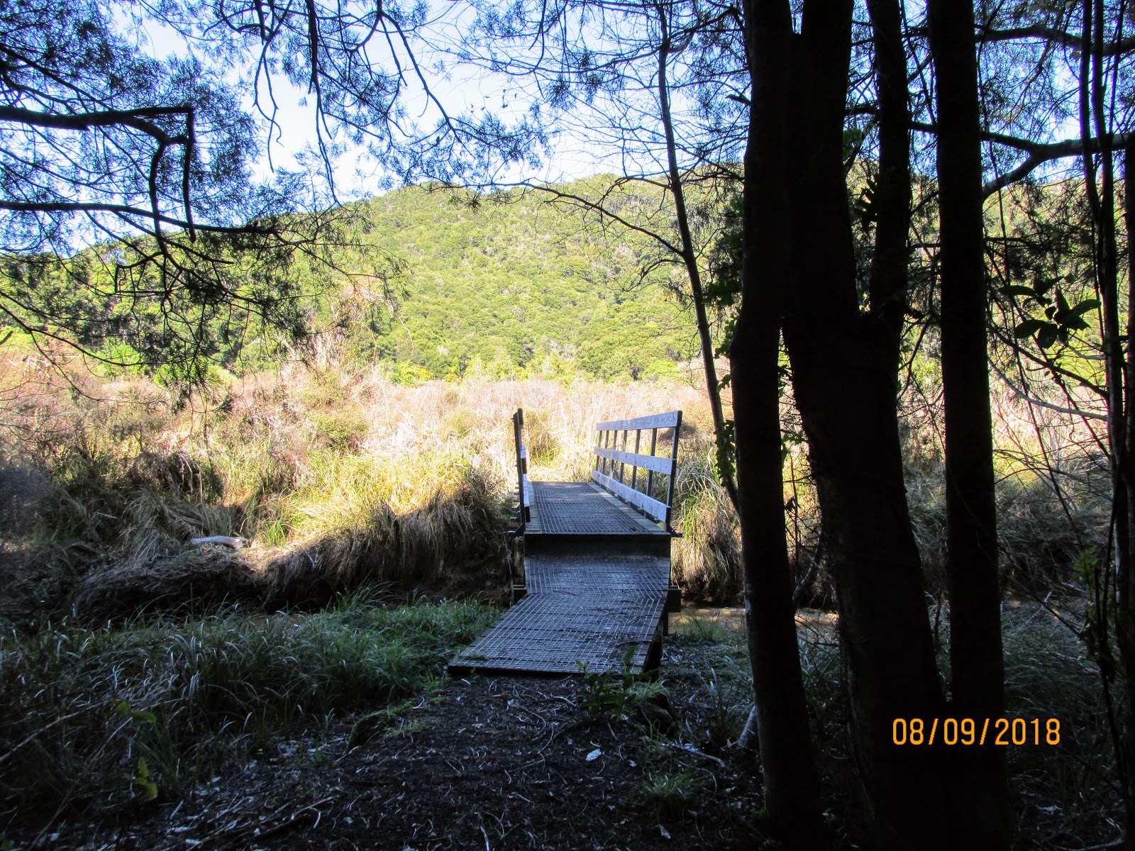
| Abel Tasman Coastal Track:Karen's very first DOC bridge...many more to follow |
 |
| View back to Totaranui Beach from near Skinners Point |
 |
| Abel Tasman Coastal Track:heading down to Goat Bay |
We stopped on Goat Bay picnic site for a half hour lunch, it was wonderful sitting in the sun and enjoying the view of the beach and coast. There are a lot more people up this end of the track this year...we passed or saw at least 12 people over the day...
 |
| Abel Tasman Coastal Track: first beach section, Goat Bay |
 |
| Jon on the beach at Goat Bay, Abel Tasman Coastal Track |
There has been a lot of damage to the shoreline in the park from ex tropical cyclones earlier this year. It does not bode well for the future with climate change and rising sea levels. I know sections of the track from Totaranui to Whariwharangi Hut are still closed 9 months after the storms...
 |
| Goat Bay Picnic Area, Abel Tasman Coastal Track |
 |
| View from our lunch site at Goat Bay, Abel Tasman Coastal Track |
 |
| Skinners Point from Goat Bay on the Abel Tasman Coastal Track |
 |
| Walking along the beach at Goat Bay, Abel Tasman Coastal Track |
After lunch we headed off to finish the last hour and a half of the walk for today...
 |
| Climbing over a headland to reach Waiharakeke Bay |
Here is more storm damage to the track near Waiharakeke Bay, in 2017 the track was just inside the tree line but now it is completely gone and you have to walk along the beach. There is a stream crossing here that might be a problem at high tide as it has blown out like the one at Onetahuiti Beach.
 |
| Waiharakeke Bay, Abel Tasman Coastal Track...the track is now gone! |
 |
| Storm surge damage to the Abel Tasman Coastal Track at Waiharakeke Bay |
We went past the camp ground at Waiharakeke Bay and headed inland to cross over the low saddle to the tidal crossing at Awaroa Inlet. There is water and a toilet at the camp ground if you need it.
 |
| Turn off to the Waiharakeke Bay camp-grounds |
 |
| Kahikatea swamp at Waiharakeke Bay |
 |
| Abel Tasman Coastal Track: Waiharakeke Stream |
We zipped up and over the low saddle to Awaroa Inlet...we had timed it just right as the tide was fully out and there was no two hour wait like the last time I was up here in 2017. I took a lot of photos of the crossing as last time I was too occupied watching my feet to take any.
 |
| Abel Tasman Coastal Track: on the track between Waiharakeke and Awaroa Inlet |
There was just the one ankle deep channel to cross about 2/3's of the way across the Inlet...
 |
| Abel Tasman Coastal Track: tidal crossing at Awaroa Inlet |
 |
| Abel Tasman Coastal Track: tidal crossing at Awaroa Inlet |
 |
| Abel Tasman Coastal Track: tidal crossing at Awaroa Inlet...Tonga Saddle in the far distance |
 |
| Looking back to the start of the tidal crossing at Awaroa Inlet |
 |
| The Abel Tasman Inland Track runs along those distant ridges |
The hut sits on the far side of the crossing taunting you...it looks close but it takes a good 20 minutes to walk all the way across the inlet from one side to the other. Bring some sandals, Croc's or water shoes as the sand and shells are really sharp!
 |
| Awaroa Hut from halfway across Awaroa Inlet |
 |
| Abel Tasman Coastal Track: tidal crossing at Awaroa Inlet, central shell bank |
A trio of young guys had obviously mistimed the tides as we could see them hauling their boat across the sandbars...I imagine they had to wait for a while as there is a BIG sandbar at the mouth of the Inlet which would have stopped them getting out to sea until after 6pm when the tide was due to turn.
 |
| Beached motor boat in the central channel of the tidal crossing at Awaroa Inlet |
 |
| Abel Tasman Coastal Track: tidal crossing at Awaroa Inlet...ankle deep central channel |
 |
| Karen in her handsome beach sandals....still a long way to the hut! |
We finally arrived at Awaroa after 3 hours, I had planned the trip to take advantage of the tidal crossings each day so we were almost dry when we arrived at the hut. There were already a few people in residence, we had a clean-up and made a brew. This is the fourth time I have been to this hut now, it is in a very attractive spot.
 |
| Awaroa Hut, Abel Tasman Coastal Track |
It is a classic Lockwood hut, mostly wooden with that beautiful caramel colour to the wood from all the varnish used on it. These are my favourite type of DOC huts...
 |
| Interior of the Awaroa Hut, Abel Tasman Coastal Track |
 |
| The other end of Awaroa Hut, Abel Tasman Coastal Track |
Because there were two of us I went old styles and used my veteran Kovea back packer stove (from 1992) and large stainless steel pot. Hopefully we will be doing a few more trips together so this will be the cook gear we will carry most of the time.
 |
| Brewing up inside Awaroa Hut, using my Kovea stove and larger pot on this trip... |
 |
| View of Awaroa Inlet from inside Awaroa Hut...tide coming in! |
I went and started chopping up some firewood and got some helpful assistance from a German guy and a Canadian who also wanted to have a go. We needed it as it was quite cold once the sun went down in the afternoon, this is normal at this time of year: warm sunny days, cold nights
 |
| Jon chopping some firewood at Awaroa Hut |
We had a quiet night in Awaroa Hut, there were about 10-12 of us in the hut, a mix of nationalities from New Zealand, USA, England, Spain, German, Denmark, France and Canada. Most of the people were heading to Totaranui but four of us were heading towards Bark Bay the next day.
 |
| Awaroa Inlet afternoon of day one...incoming tide |
Day Two: Awaroa Hut to Bark Bay Hut: 14 km's and 4 hours
Day two was the section from Awaroa to Bark Bay, were were taking our time so we didn't actually leave the hut until 9 am which is unheard of when Jon tramps on his own. Normally I am up and gone at sparrows fart (or 8 am at the latest..).
 |
| A nice view of Awaroa Hut, Abel Tasman Coast Walk |
The tide was just starting to recede as we left the hut, we couldn't cross the tidal stream crossing at Onetahuiti Beach until 11 am so that worked out really well. The first part of the track was a short walk around the Inlet, then the long slow climb to Tonga Saddle started.
 |
| Abel Tasman Coast Walk: goodbye to Awaroa Inlet |
 |
| The sandbar at Awaroa Inlet fully submerged |
There is a decent looking camp-site at Awaroa, about 100 meters from the hut. It doesn't have a cook shelter but there is a set of toilets, some picnic tables and filtered water on offer. The land looked dry and well sloped so they would be nice dry camp sites.
 |
| Awaroa Campsite...100 metres from the hut |
 |
| Last view of Awaroa Hut, Abel Tasman Coast Walk |
Once past the Awaroa camp-site you begin to ascend up to Tonga Saddle, the track very gradually gains altitude and then sidles along at the 100 meter (a.s.l) line. It is a long way from Awaroa to Tonga Saddle, at least 6.5 kms of the total 8.5kms to Onetahuiti Beach.
 |
| Map: Abel Tasman Coastal Track: Awaroa to Bark Bay |
 |
| View of the Awaroa sandbar from high on the Abel Tasman Coast Walk |
 |
| This is beach at Awaroa the New Zealand public brought in 2016 |
 |
| Abel Tasman Coast Walk: looking down on the airfield at Awaroa |
I found out from a local tramper that this track is informally called the 'Skyline Route' because it seems like you are walking along the skyline. It was constructed in 2017 as there are high tide access problems across the private land at Awaroa Settlement.
 |
| Abel Tasman Coast Walk: first bridge crossing of the day at Venture Stream |
 |
| Abel Tasman Coast Walk: first bridge crossing past Awaroa |
 |
| At Venture Stream.....yes!!!!! |
You get some great views of the area as you walk along he trip...make sure you have a hat as this section is very exposed to the early morning sun. We could see the various water taxis cruising up and down the coast from up there.
 |
| Abel Tasman Coast Walk: looking down on the airfield at Awaroa |
 |
| Awaroa settlement, Awaroa Inlet, and the northern end of Abel Tasman NP |
 |
| Awaroa Lodge from high on the Abel Tasman Coast Walk |
 |
| Abel Tasman Coast Track: on the climb to Tonga Saddle |
Once you reach Tonga Saddle you have finished one of the two climbs for the day, there isn't much at the saddle itself but 100 meters down the other side are a couple of seats with views of Onetahuiti Beach.
 |
| Tonga Saddle on the Abel Tasman Coast Track: |
 |
| First view of Onetahuiti Bay, Abel Tasman Coast Track |
 |
| Kahikatea Swamp at Onetahuiti Bay, Abel Tasman Coast Track: |
If the tide is out you can cross Richardson Stream at the bottom of the hill and walk along the beach. Personally, I prefer the board-walk track to Richardson Stream bridge as it is much easier walking than on the acutely sloped beach sand.
 |
| Richardson Stream at Onetahuiti Beach |
The swamp behind Onetahuiti Beach is a
Project Janzoon site, it is a replanted Kahikatea Forest. In 100 or so years there will be a forest of 30+ meter high Kahikatea trees in this area...pity I wont be here to see it!
 |
| Following the board-walk at Onetahuiti Beach |
 |
| Nice tannin stained water at Richardson Stream, Onetahuiti Beach |
 |
| The main bridge over Richardson Stream, Abel Tasman Coast Walk |
The bridge over Richardson Stream is nicely placed and designed to access the beach. Its a pity it is now in the wrong location as the stream has blown out closer to the cooking shelter at the other end of Onetahuiti Beach.
 |
| Abel Tasman Coast Walk: detail of the bridge over Richardson Stream |
 |
| Paddle inspired carving on Richardson Stream bridge |
 |
| Richardson Stream from the bridge, Abel Tasman Coast Walk |
 |
| The bridge over Richardson Stream. Abel Tasman Coast Walk |
 |
| Walking along Onetahuiti Beach to the camp shelter |
 |
| Tonga Island, Onetahuiti Bay, Abel Tasman Coast Track |
There were a pair of Variable Oystercatchers resident on Onetahuiti Beach, our presence did not disturb their slumber...
 |
| A pair of Variable Oystercatchers on Onetahuiti Beach |
 |
| A pair of Variable Oystercatchers on Onetahuiti Beach |
 |
| Bird tracks at Onetahuiti Beach |
There is a tidal crossing on Onetahuiti Beach about 200 meters shy of the camp-site cooking shelter. Richardson Stream has cut a new channel through the sand bar so you can only cross for four hours either side of low tide. When the tide is full the water coursing through the channel is waist deep and very dangerous.
Do not try to cross at high tide!!!
 |
| View back along Onetahuiti Beach...this is the blown out stream |
 |
| Onetahuiti Beach shelter just visible at the end of the beach |
We stopped at the shelter at Onetahuiti Beach for a half hour lunch, the camp site looks different than the last time I was up here. The whole camp-site is now covered in sand, I don't know if this is deliberate or a result of the big storm earlier this year. It looks to me as if DOC are building the area up so it can handle storms better.
The sand might have been thrown over the area by tidal surge as other similar camp-sites at Tonga Bay and Bark Bay were one meter underwater at the height of the storm.
 |
| Abel Tasman Coast Track: the Onetahuiti Beach camp shelter |
 |
| Sand added/deposited on the camp-ground at Onetahuiti Beach |
 |
| Has sand been added to the camp-ground at Onetahuiti Beach? |
 |
| ...Onetahuiti Beach cooking shelter in 2017, and... |
 |
| ...Onetahuiti Beach cooking shelter in 2018 |
 |
| Inside of the Onetahuiti Beach cooking shelter |
 |
| View from the Onetahuiti Beach cooking shelter |
 |
| Our lunch preparations at Onetahuiti Beach cooking shelter |
 |
| Cheese, salami and crackers were on the menu |
 |
| More bird prints at Onetahuiti Beach cooking shelter |
After lunch we set out on the final two hours to Bark Bay Hut; you sidle around to Tonga Quarry and then climb over another headland to get to Bark Bay. The first section to Tonga Quarry was a nice easy track so no big problem.
 |
| Two of the few orange markers I saw on the Abel Tasman Coastal Walk |
 |
| Abel Tasman Coastal Walk: more than half way to Bark Bay |
 |
| Last view of Onetahuiti Beach from the Abel Tasman Coastal Walk |
 |
| Heading to Tonga Quarry on the Abel Tasman Coastal Walk |
The Tonga Bay camp site has been decommissioned since the big storm earlier this year, rising sea levels will eventually take all of these camp-sites as they are all only a few meters above sea level and get flooded in the bigger storms.
 |
| Abel Tasman Coastal Walk: track junction at Tonga Quarry camp site |
Tonga Quarry still has a toilet but the water supply that used to be here is now gone. You can check out the ruins of an old jetty building used back in the early 1900's when limestone was quarried from the area for buildings in Nelson and Wellington.
 |
| The ruins of the stone works at Tonga Quarry, Abel Tasman Coastal Track |
 |
| The resident Weka at Tonga Quarry..not so many tasty treats any more...sad face! |
The land used to extend another 3-4 meters out to sea...this is how much land was taken by just one ex tropical storm back in March.
 |
| Tonga Island sits right off the Tonga Quarry site |
 |
| Abel Tasman Coastal Track: ruins at Tonga Quarry...note the plaque |
 |
| The Stone Works plaque at Tonga Quarry |
It is a bit of a steep climb up and out of the Tonga Quarry site, this is the last significant hill you climb before you get to Bark Bay Hut. We passed a spot where there are obvious pick marks from some long ago track building.
 |
| Climbing up out of Tonga Quarry, Abel Tasman Coastal Walk |
 |
| Obvious pick marks on the Abel Tasman Coastal Walk above Tonga Quarry |
Then it is a long sidle over a kind of tableland for about two kilometres before you drop down to Bark Bay and the bridge over Waterfall Creek. In the photo below Tonga Quarry camp site is in the dip between the two hills...
 |
| The long sidle above Tonga Quarry, Abel Tasman Coastal Walk |
 |
| First view of Bark Bay from the Abel Tasman Coastal Walk |
Waterfall Creek bridge is the first swing bridge Karen has ever used...I told her this was a Rolls Royce not the more pedestrian Ford version you find off the Great Walks.
I cannot wait to see her on a three wire!
 |
| Waterfall Creek bridge, Abel Tasman Coastal Walk |
 |
| Detail of Waterfall Creek bridge, Abel Tasman Coastal Walk |
 |
| The waterfalls above Waterfall Creekr bridge... |
 |
| Bark Bay estuary from the Waterfall Creek bridge |
From Waterfal Creek it is a 700 meter walk around the estuary to the hut site at Bark Bay...this is all easy track as it is flat and well constructed. Keep your eyes open as the turn off to the hut is not sign posted very well.
 |
| Abel Tasman Coastal Walk: walking around the estuary at Bark Bay |
 |
| Last bush verge before Bark Bay Hut, Abel Tasman Coastal Walk |
We got to the hut at Bark Bay around 2 pm so it took us about 5 hours to cover the distance from Awaroa to Bark Bay. This is one of my favourite parts of this track as there is nice podocarp forest along both sides of the track for most of the day.
I love the cooking shelters up here, DOC should build more of them to encourage camping.
 |
| Bark Bay Hut: first view of the hut |
 |
| Bark Bay Hut: the toilet block and woodshed |
Bark Bay Hut is my favourite hut along this track, I feel it has more of a genuine kiwi air to it than the other two huts. I have talked to other Kiwis who have walked the track and they mostly agree with me.
Both Bark Bay and Anchorage Huts have solar powered LED lights in the living areas, they automatically come on at dusk.
 |
| Bark Bay Hut: Interior of the living area |
 |
| Bark Bay Hut: Interior of the living area |
 |
| Bark Bay Hut: interior view of a bunk-room |
 |
| Our pits set up in Bark Bay Hut, Abel Tasman Coastal Walk |
We shared the hut that night with a group of four Americans, another Kiwi woman and a guy who had come in from Kaiteriteri in a sea kayak. Two of the Americans were a couple and they were basically California gorgeous...he looked like GI Joe and she was tall, blonde and cheerleader looking.
They were all super friendly and very nice.
The local Ranger stopped by to check things out, he was the same dude as the last time I was up here, a nice bloke. He said he has been working in the park for 17 years now...what a location to call your workplace!
 |
| The area in front of Bark Bay Hut, the tide is fully out |
 |
| Abel Tasman Coastal Walk: Bark Bay Hut: the tidal estuary at the front door |
We had the wood burner going for most of the night as it was a bit cold, the log burners sure make these back-country huts a lot more liveable.
 |
| Bark Bay Hut: the wood-burner going later in the evening |
DOC are moving the Bark Bay camp-site in 2019...at the moment it is on a sandbar in front of the estuary, it is probably moving to a site closer to the hut. Back in March the camp-site was inundated to a depth of one meter by a big storm surge. This will probably happen more frequently along this coastline in the years to come....good olde climate change at work!
 |
| Bark Bay Hut:a good view of the beach facing side of the hut |
Come back and see what we were doing on day three and four of our tramp...
Access: Water taxi from Kaiteriteri or Marahau, the trip takes one hour from Marahau
Track Times: 7.2 km's or 2.5 hours Totaranui to Awaroa Hut, 12.5 km's or 4.5 hours Awaroa to Bark Bay
Hut Details:
Awaroa Hut: serviced, 26 bunks, wood burner, filtered water tank, wood
shed, flush toilets; Bark Bay Hut: 34 bunks, wood burner, filtered water
tank, wood shed, flush toilets
Miscellaneous:
On DOC Great Walk booking system, must be booked for overnight visit.
Hut warden in residence from 1st October to 30th April each year. Tidal
crossing at Awaroa Inlet and Onetahuti Bay.