Gateway to Colonial Canterbury...the Bridle Path
Once
again the weather has played havoc with my tramping plans. I had organised to
go for a trip to the Arthur's Pass area, unfortunately yet another storm
made this impossible. As the weather on the Port Hills was good I
decided to do an extended walk closer to home. I walked up the Bridle path to
Summit Road and then along and down Mt Pleasant and
back to my car.
 |
| Lytellton as seen from the apex of the Bridle Path, Port Hills Canterbury |
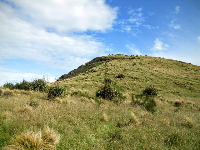
The Port Hills are the closest range to the city, they are covered
in tracks and routes for walking, cycling and tramping. The "Hills"
are visible from all parts of Christchurch and are one of the many reasons this
is such a great city to live in.
 |
| Map of Bridle path |
Here is my car at the car-park at the bottom of the path, the track climbs for 450 metres from this spot up to a road which runs along the crest of the Port Hills. It
would be about 2 kms from the car-park to the summit, following a track
which zig zags up the hill side. An alternate is too take the gondola to the
summit and then walk down the track, the gondola terminus is right next to this car-park.
 |
| The car park at the Heathcote Valley end of the Bridle Path |
The first section of the track is quite steep, gradually the gradient eases as you approach the top of the track. This is a popular walking and running route, as evidenced by the number of people I encountered as I walked the track.
 |
| Beginning of the Bridle Path in the Heathcote Valley |
The Bridle Path is the original route over the Port Hills, it was first used by the early settlers in the mid 1840's. It is quite steep and periodically needs to be repaired due to erosion and general wear.The track was built to transport the settlers and their chattels over the hills from Lyttleton, the closest port to Christchurch. It has been in constant use ever since.
 |
| Information panel detailing history of Bridle Path |
Since the earthquakes of 2010/2011 there are significant rockfall hazards on all tracks on the Port Hills. In fact a person was killed by falling rocks on this very track, this is the explanation for the below sign. There are several spots on this track where there are rock cliffs in close proximity to the track.
 |
| Rock fall warning on the Bridle Path |
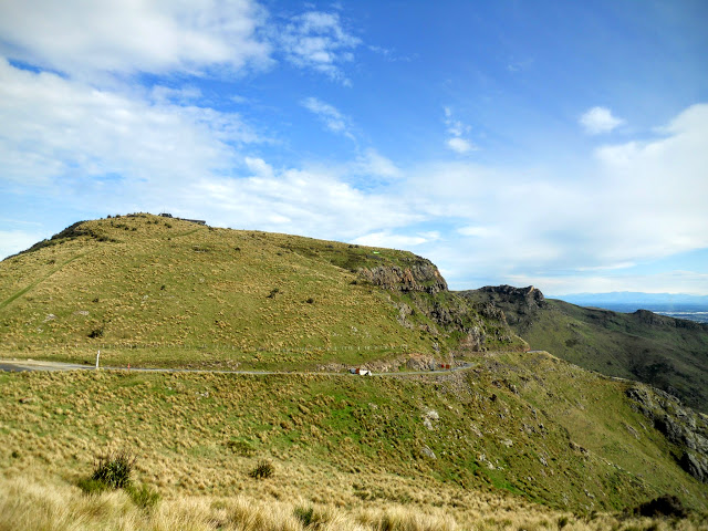
You can see portions of the Summit Road as you make your way uphill, this is the closed section of road which runs under the gondola cables. Although most of the road is open there are still sections closed by rockfall from the earthquake. You can see why a lot of debris rolled down here, the volcanic rock of the hills literally fell to pieces.
 |
View towards Mt Cavendish fromthe Bridle Path
|
The condition of the track is OK, it was a bit muddy from the recent rain but presented no problems.
 |
| Muddy Bridle Path Section |
There were a number of slips on the track, here a 50 metre section of bank has slid down onto the track.
 |
Bridle path heading for the tracks apex on Summit Road
|
It was a lovely day for a walk, slightly cloudy and not too hot, it makes a change from all of the rain.
 |
Heathcote Valley and Pegasus Bay from near Summit Road |
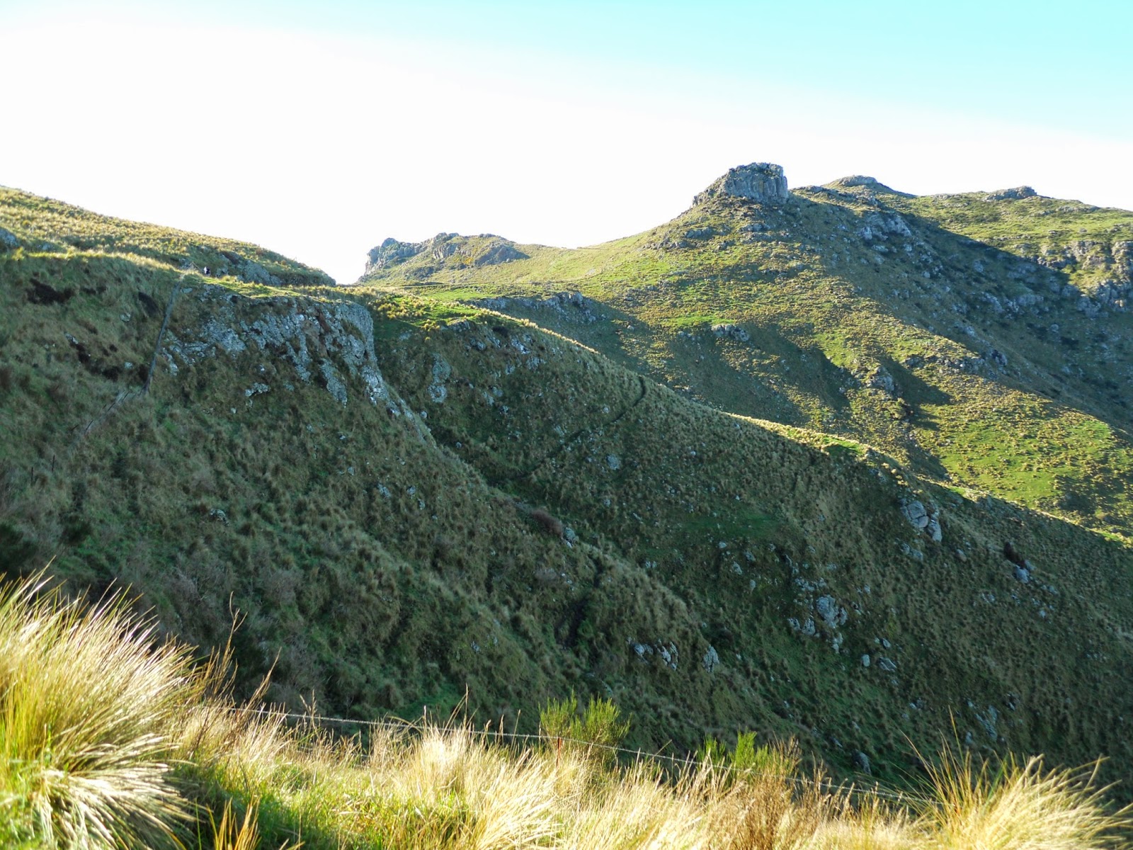
Slightly rougher section of the track, it is around this area that a person was struck by falling rock during the February 2011 earthquake. There are low cliffs about a 100 metres above this point, obviously some of the rock cascaded down onto the track. Tragic!
 |
| Bridle path, 3/4 way up |
An informative sign about 3/4 of the way to the top, it shows the track and a panoramic view of Heathcote valley.
 |
| Bridle Path information panel near the tracks apex |
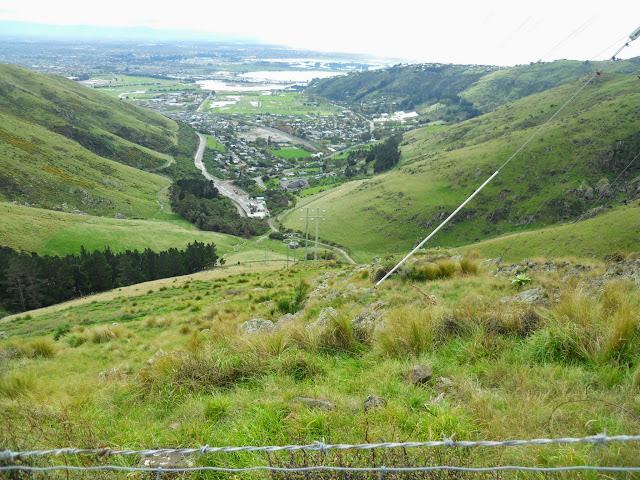
There is a great view from the top information board out over Heathcote valley, the view stretches all the way to the Kaikoura ranges and Southern Alps.
 |
| Pegasus Bay and Heathcote Valley from the Bridle Path |
The bottom terminus for the gondola is to the left centre of this photo. This is the view from the top of the track where it meets the Summit Road.
 |
| Christchurch gondola terminus at the Heathcote Valley end of the Bridle Path |
A view of Heathcote from the Summit road, there were 10-12 people milling about checking out the scenery.
 |
| Heathcote Valley, Christchurch |
From the rest area at the top of the track Lyttleton harbour lays spread out below you, the Bridle path continues down into the harbour making a traverse of the hills a possibility. A lot of school groups will walk over the track from the Lyttleton side to Heatcote valley, in fact I did a trip like this in High school. The trip would take about 2 hours in total.
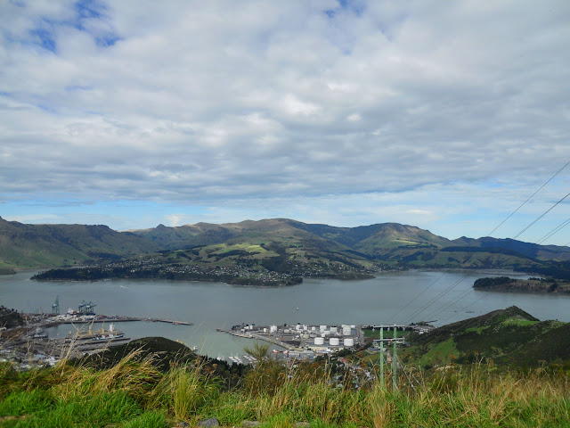 |
| Diamond harbour, Mt Herbert from the apex of the Bridle Path |
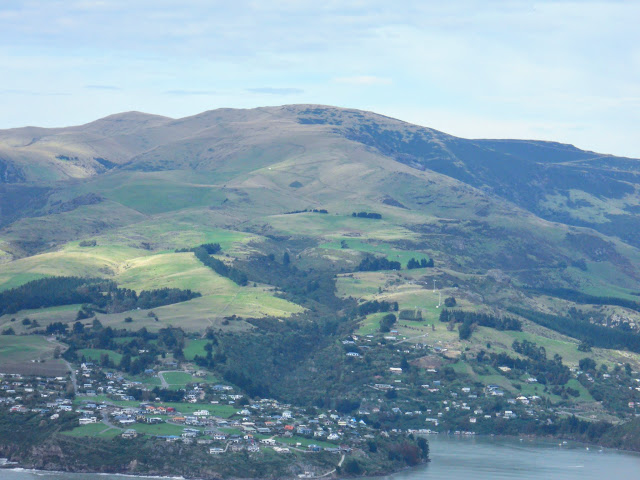
Here is a closer view of Diamond harbour and Mt Herbert, there is a track which runs right up the middle of this slope all the way to the Mt Herbert Summit.
 |
| Diamond harbour, Mt Herbert from the apex of the Bridle Path |
 |
| View of Lyttleton Harbour from the apex of the Bridle Path |
Looking to the south-east you can see Gebbies pass and the ocean near Birdlings flats.
 |
| Towards Gebbies Pass from the apex of the Bridle Path |
 |
| View due North from Summit Road |
The Summit track mostly runs parallel to the road, it is poled and runs along the crest, up to the gondola and then onwards along the ridges. Mt Cavendish is the location of the top terminus for the gondola, from there you can follow the tracks to east and west.
 |
| View towards Mt Cavendish |
Looking back from half way up the hill, you can see the road, shelter on the apex of the Bridle path and the track itself. The Summit walkway follows the road around to the right, eventually you will reach Cashmere and Victoria park.
 |
| To the East, summit road and Bridle path |
The gondola crosses the road in the centre of this photo, the road has been cleared but is still closed due to the danger of rockfall.
 |
| Gondola crossing Summit road |
 |
| Track to Mt Cavendish, part of the Christchurch 360 Trail |
I stopped for a rest at a nice seat near this track junction, you go up to the gondola and right to continue following the walkway.
 |
| Track junction, up to Gondola, right to Mt Pleasant |
 |
| Christchurch gondola top station from the Summit Walkway |
Here is a view to the east from the seat at the track junction, the hill in the distance is the crest of Mt Pleasant.
 |
| View to East towards Mt Cavendish from near the gondola |
Once you reach the low saddle between Mt Cavendish and Mt Pleasant you can follow a farm track or walk along the road. As it was quite muddy I decided to follow the road.
 |
| Mt Cavendish, North East side from saddle |
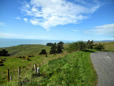
The road is very quiet as there is no through traffic, mostly MTB people and rock climbers coming to scale the cliffs near here.
 |
| Climbing summit road, Port Hills |
Below are a series of panoramic views of the surrounds from the same spot on the summit road:
 |
| View back towards gondola/ Mt Cavendish |
 |
| View towards South West over Canterbury Plains from near Mt Cavendish |
 |
| Glorious Canterbury, to the North West from near Mt Cavendish |
This is one of the sections of the summit road which has not (and probably never will be) reopened, as you can see a lot of rock fell down during the earthquakes, it is surprising that nobody was injured.
 |
| Summit Road: Rock fall as result of earthquakes |
 |
| View down Heathcote valley from near Mt Cavendish |
I stopped for lunch at a memorial seat near the road, it was really great sitting and contemplating the city while I enjoyed my tasty pate lunch. Take lots of water with you if you decide to walk along the Port Hills, as there are no supplies to hand.
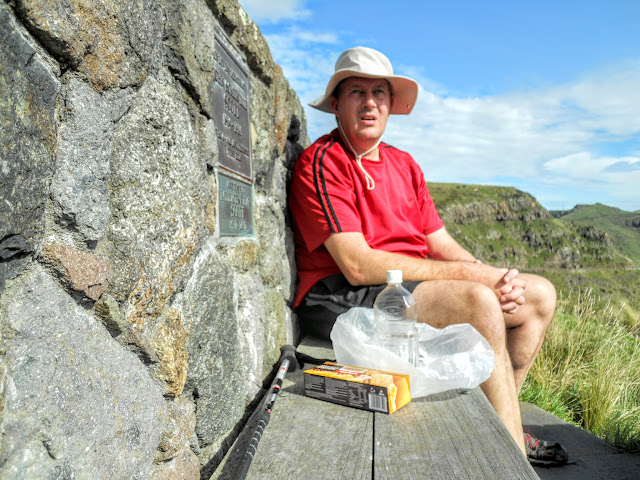 |
| Hey folks...Jon eats lunch on the Port Hills! |
 |
| Tasty pate /cracker lunch near Mt Cavendish |
 |
| Jon with the 1000 yard stare! |
There was a small group of rock climbers plying their trade near the seat, looks like some good climbing if that is your thing.
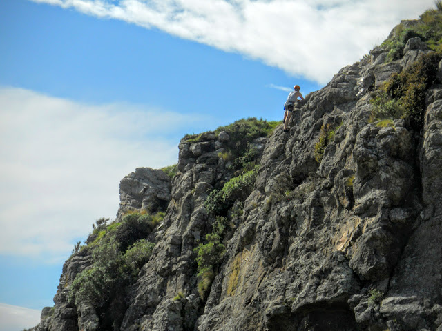 |
| Rock climbers near lunch spot at Mt Cavendish |
 |
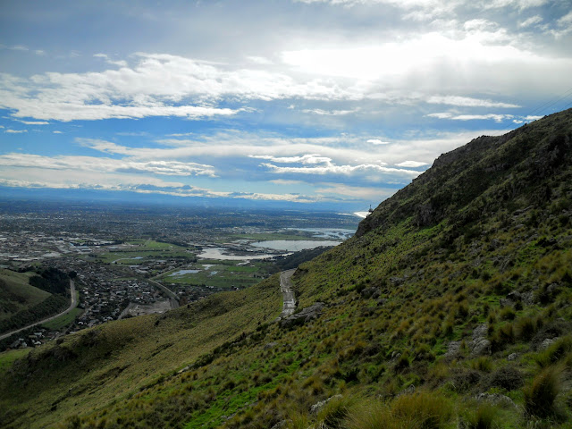
| Estuary, Mt Pleasant Spur from the Summit Road |
 |
| View out North towards Southern Alps from near Mt Cavendish |
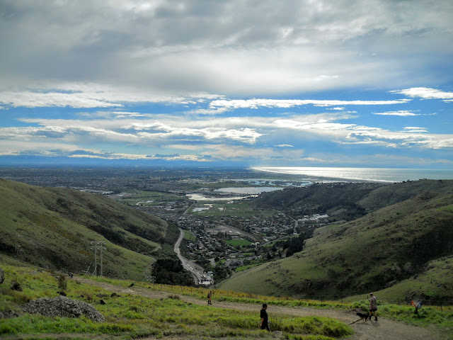
I started back along the road, after about a kilometre you reach the high point on the ridge and can get your first clear view out to the East. The spit of land in the centre of the photo is South Shore, with the long golden crescent of Pegasus Bay stretching away to the north.
I live in a beautiful and remarkable place.
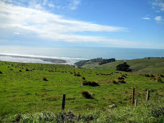 |
| View due East from Summit Road on from Mt Pleasant Spur |
 |
| View due East from Summit road, Godley Head area. |
 |
| Long view of Pegasus Bay from Mt Pleasant Spur |
I followed the road for about another kilometre, then headed down Mt Pleasant road. Eventually you reach the Heathcote valley, from Ferrymead you walk around the bottom of the hills back to the car-park, this is all on roads and footpaths.
 |
| View towards Estuary mouth from Mt Pleasant Spur |
It was a great excursion, although I didn't get to go where I had originally planned it was still a good walk (4.5 hours). I will be doing more trips on the Port Hills and Banks Peninsula as the weather tends to be better here when it is raining up in the mountains. There are lots of interesting and moderately challenging trips to be had, and they are really close to home. Bonus.