Showing posts with label Hanmer Springs. Show all posts

Wednesday 7 August 2019

Short Walk: Conical Hill, Hanmer Forest Park, July 2019

Some short walks around Hanmer Forest Park


Karen and I went up to Hanmer Springs last weekend for a four day holiday from Tuesday to Friday, while there we went for a couple of short walks in Hanmer Forest Park

Entrance to Hanmer Forest to the east of Hanmer Springs village on Jollies Pass Road

Hanmer Forest is awesome...there are a series of both walking and MTB tracks through the exotic forest to the east of the village and an area of exotic/native forest, sub alpine herb fields and alpine land to the north of the township. 

Map: Hanmer is the gateway to the St James and Molesworth Conservation Areas

I have walked and tramped extensively in the area as it is a popular holiday destination for residents of Christchurch. It is only 1.5 hours drive from the city so we tend to visit a couple of times a year to walk in the forest, on the mountains and soak in the famous thermal hot pools


Map: Hanmer Springs is also close to Lewis Pass, Nelson Lakes NP and Lake Sumner FP

This is the first trip of my 2019 tramping program I have a full list of tramps planned for this year. 


Heading up Conical Hill from Alpine Avenue


We walked up Conical Hill Track for the views of the village and the surrounds, you can see most of the Hanmer Basin from the top. Conical Hill is only 550 meters high but its location and the flatness of the surrounding land mean there are excellent views from the top.


Conical Hill, Hanmer Springs with Mt Isobel in the background

As you can see in the photo above we had a bit of snow on Wednesday morning so it was good we managed to walk up Conical Hill on the day we arrived.

Map: Hanmer Springs and surrounding area

We could still have walked up the Conical Hill Track but it would just have been a lot colder and possibly icy underfoot. 

Conical Hill track from Alpine Avenue

We were staying in a bach on Alpine Avenue which is halfway up Conical Hill. As the years have progressed the houses have climbed further and further up the hill. Unfortunately Conical Hill is not part of Hanmer Forest Park so it is fair game for development.


Sign on Alpine Avenue showing the track to Conical Hill


We had a walkway right next to the bach which led up to a side entrance to the Conical Hill Track off Acheron Heights Road. The main entrance to the track is on Conical Hill Road which runs right through the centre of the village.


Hanmer, Conical Hill Track: on the walkway to Acheron Heights

Once on Acheron Heights Road there is a connector track which joins the main track at the top of the first switchback section. The track to the top of the hill is not that arduous, it is about 1.5 kilometers spread over five 200 odd meter switch-back sections. 


Acheron Heights Road, entrance to the Conical Hill Track

Hanmer, Conical Hill Track: off Acheron Heights Road

Even from this low on the hills you have excellent views out over Hanmer Plains and Hanmer Forest. 


View of Hanmer forest from Acheron Heights Road

Looking down Acheron Heights Road to Hanmer Forest

Distant Mt Percival from Acheron Heights road

On the connector track you go past the water supply for the township a large concrete tank situated on the middle slopes of Conical Hill. The track to the top of the hill is actually an old forestry road which has been modified slightly so it is wide and fairly even the whole way to the top.


Hanmer, Conical Hill Track: passing the towns water supply tank

You walk in forest the whole length of the track, they are exotic pines with an understory of native bushes and shrubs. Matariki Forestry have stopped clearing forest debris from under the trees so eventually I imagine the understory will be very thick. 


A sign on the Conical Hill Track, Hanmer

Hanmer Plains & the Conical Hill Track: view to south east 

As you can see the switchback sections are on a nice gradient, wide and easy to climb. The track is one of the most popular short walks in the area as it is near the centre of the village and accessible by foot. We passed many people walking up and down the track as we made our way to the summit. 


Hanmer, Conical Hill Track: the first of five switchbacks


Conical Hill Track, Hanmer Forest:switch-back three

At every second switchback there are benches so you can stop for a rest if required, these have been donated by local charities and individuals. 


There are some seats along the Conical Hill Track, Hanmer Forest

The top of the Conical Hill Track will deposit you on an old forestry road with the last small section of track to the top of Conical Hill just to your left.

If you follow the forestry road west it will eventually deposit you down on Chattertons Road and going east it leads to the Woodland Walk at the bottom of the valley. 


Second to last section of the Conical Hill Track, Hanmer Fores

Approaching the top of Conical Hill Track, Hanmer Forest

Most of the land around Hanmer is owned by Matariki Forests which is a subsidiary of Nga Tahu (the local Maori Iwi). They are gradually cutting down the forest as the trees are mature so these hills will eventually be bare. The land from the crest of the Mt Isobel massif north to St Arnaud/SH6 belongs to DOC as part of the St James/Molesworth Conservation Area and Nelson Lakes National Park. 


Hopefully they will replant the cleared areas with native trees sometime in the future as Hanmer would not be the same without the forest covered hills. 


View of Mt Isobel and Jollies Pass area,  from Conical Hill, Hanmer Forest

View to the top of Conical Hill (550 a.s.l) from the forestry road

The track from the bottom to the shelter on top takes about 30 minutes maximum so it is an excellent constitutional walk of an evening. 


What is on the top of Conical Hill?

Conical Hill has a small picnic area to the north of the summit and a shelter on the crest of the hill. Both have excellent views of the surrounding Hanmer Basin. You can see right out to the distant Amuri Range and right up to the head of the valley near the Hope River and Lake Sumner Forest Park. 


Mt Isobel and the picnic area from the top of Conical Hill, Hanmer

Location dial on the summit of Conical Hill showing nearby peaks

The shelter is an open sided one with seats, interpretive panels and a wide overhanging roof so even if it is raining you can still sit here and look at the views. There were several people at the shelter when we arrived  just on dusk and we watched the sun setting behind the nearby Hanmer Range. 

Climbing the stairs of the observation point atop Conical Hill, Hanmer

The shelter is orientated with its sides facing to the directions of a compass: north-south-east-west. 


Conical Hill observation point, Hanmer Forest Park

There is a massive erratic rock sitting next to the shelter...God knows how it got here as the slopes of Mt Isobel are some distance away. The local plains are the result of river erosion not glacial action...I imagine that Conical Hill is a terminal morraine from some ancient glacier. 


Large erratic rock next to the Conical Hill observation point


Plaque on the massive erratic rock next to Conical Hill shelter

View east from the Conical Hill observation shelter

You can clearly see the S for south on the wall of the shelter in the photo below... vandals have been at work defacing the structure. It is inevitable that graffiti is present given how close to the village the shelter is...

I would think there would be an excelent view of the lights of Hanmer from up here of a evening....


View south from the Conical Hill observation point shelter

View west from the Conical Hill shelter, Hanmer Springs

Chattertons Road from the Conical Hill shelter

We sat in the sun at the shelter for about 15 minutes as we watched the sun set behind the mountains. It was warm but make sure you take a jacket or warm top with you as it is notoriously windy on the top of Conical Hill. 

Karen and I at the Conical Hill observation point shelter

Sun setting over the Hanmer Range from the Conical Hill observation point shelter

Once the sun went behind the hills we headed for home as there was a real chill in the air. It snowed later that night and we could see the incoming bad weather over the surrounding mountains at the Hope River end of the Hanmer Basin.

We were really lucky to grab the fine weather window before the storm blew in, it started raining a couple of hours after we got back to the bach. 


The Conical Hill observation shelter from the stairway, Hanmer Springs


Jon standing in front of the Conical Hill observation point shelter


Heading back down to Conical Hill Road

You follow the same track back down to the bottom of Conical Hill but there are also tracks to other points from near the shelter. There is a track to Chattertons Road out to the west and if you follow the old forestry road east it will deposit you on the Woodland Walk. 

Conical Hill, Hanmer: heading back down the Conical Hill track

Because the track is a series of switchbacks people have tried to save time by running down hill from section to section. Please do not follow suit as this will encourage erosion, damage the under story and it could be dangerous as the slope is steep. 

Please stay on the official track...


One of the un-official tracks on the Conical Hill Track


We passed a number of people heading for the top as we walked down the track, this track is wide enough and level enough to allow for a night time visit if that tickles your fancy.

I have walked up here at night in the past just make sure you take a torch or headlamp as it is quite dark under the trees. 


Further down the Conical Hill Track on the way back to the house

Nice wide and easy sections on the Conical Hill Track

About half way down the track there is a side track to Pawsons Road & the Woodland Walk. This takes about an hour to get down to the road and includes the walk back into Hanmer Village along Jollies Pass Road. 


The side track to the Woodland Walk, Conical Hill Track Hanmer

We didn't come in off the main entrance on Conical Hill Road but if I can find a photo I will post it so you can see what the entrance way looks like. It is really obvious....it is signposted and sits right at the top of Conical Hill Road. 


The Conical Hill Track heading out to Conical Hill Road

Conical Hill Track, unmarked turn off to Acheron Heights Road

As you can see the sun was just setting behind us lighting up the Amuri Range to the east and south with its last rays. The forest park extends right out to the horizon shown here to the east of Hanmer village. 


Sun setting over Hanmer forest from Acheron Heights Road, Hanmer

The path between Acheron Heights and Alpine Avenue, Hanmer

We got back to the bach after about an hour and a half of walking and observing the sights from the top of Conical Hill. 

Stay in a Hanmer Holiday Homes....

There are a number of holiday homes in the Hanmer area, most of them are scattered around the centre of the village but some of them are some distance along the side roads. You can book a bach or holiday home with beds for 1-13 people, the prices vary but a good average amount would be $130-$160 per night for a decent three bedroom house. 

There are two main holiday home providers: Hanmer Holiday Homes and Alpine Holiday Homes...have a look at their websites to see what houses they represent. 


The holiday home we stayed in at Hanmer Springs

The home Karen and I stayed in cost $145 per night, if you go mid week you can get a deal: three nights for the price of two. It was quite nice inside was furnished and had a full kitchen, log burner, heat pump, and all the other amenities you might need during your stay. This house is a Lockwood design so lots of varnished wood, high ceilings and creaking floorboards. 


Karen in the kitchen in our holiday home, Hanmer Springs

I chopped up a lot of wood as it was cold in Hanmer Springs


This is the third time we have stayed here...I like it because it is a bit quieter than houses closer to the thermal pools but is still close enough to walk to the village. The bach is half way up Conical Hill so it actually has a good view out onto Hanmer Plains. 


If you are ever up at Hanmer consider staying in a bach or holiday home rather than a motel/hotel. 


View of Hanmer under snow from our holiday home, Hanmer Springs

Conical Hill Track is a nice wee walk so make sure you visit the next time you are in Hanmer Springs.

Wednesday 7 May 2014

Mt Isobel: Hanmer Springs: 1 May 2014

Climbing Mt Isobel, Hanmer Springs


Recently I was in Hanmer Springs for a holiday during the school term break. Hanmer is great it has thermal hot pools and a multitude of tracks and walks for those who enjoy the outdoors. Because it is only 2 hours north of Christchurch it is easily accessible and a great spot for a holiday. 

Mt Isobel: Gearing up for the trip

I took the opportunity to climb the track up Mt Isobel, a 1300 metre peak which looks down over the township.


Map: Mt Isobel: up Mt Isobel Track, then down Clarence Valley Road

On the Mt Isobel Track


I started up the Mt Isobel Track, this is one of the three ways you can access the summit, the others are from the top of Jacks Pass, and a track from the Hydro-Jollies Pass road. I decided to do a circuit, up the track to the summit and then down Clarence Valley Road to the car park, about 10kms in total. 

Mt Isobel Track end on Clarence Valley Road

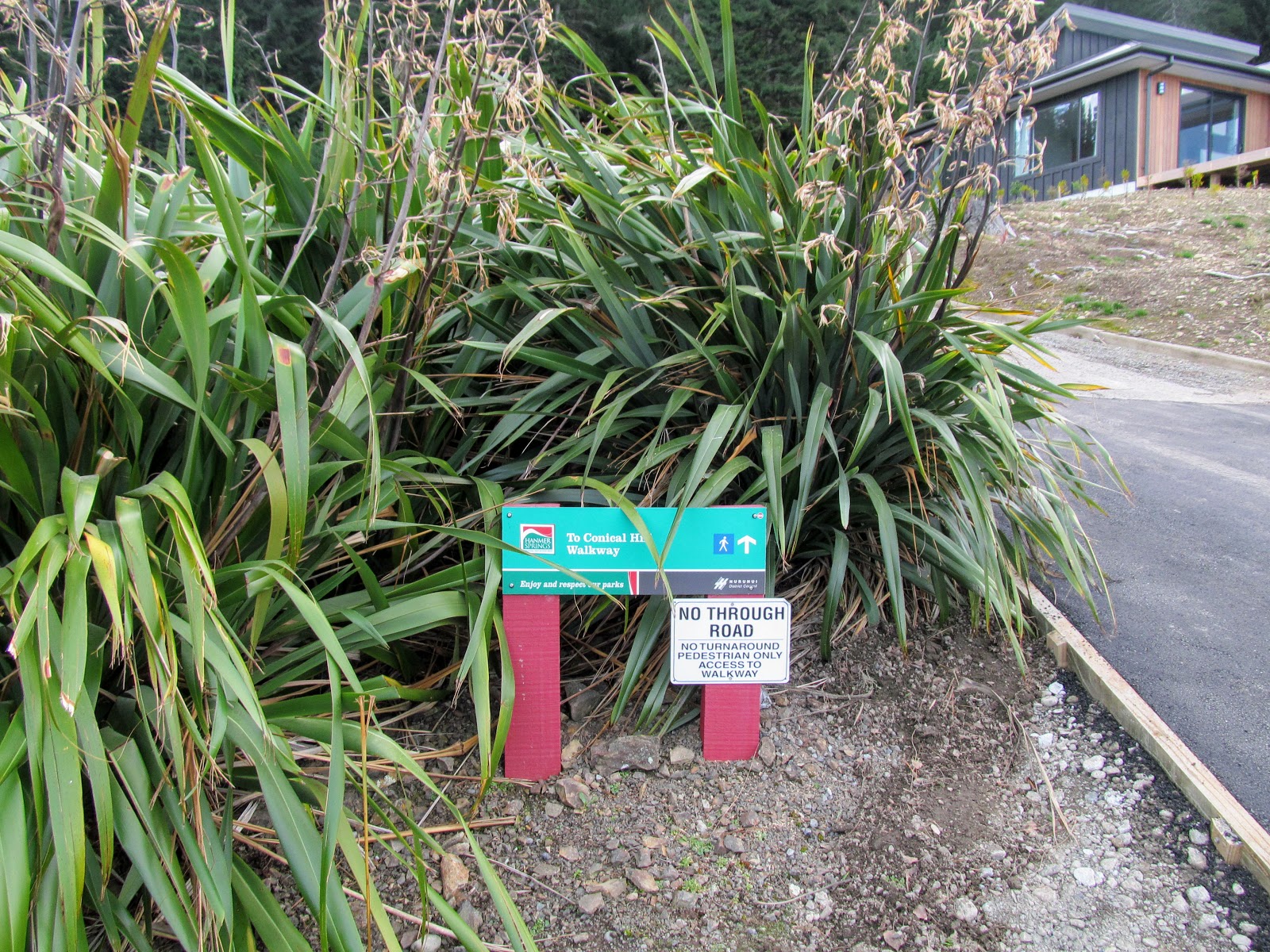
Here is the DOC sign at the beginning of the track, it is about 3 odd hours to the summit from this spot.


The start of the Mt Isobel Track

Above and below are views from the car park showing the track and parking area, plenty of space for several vehicles at this point.

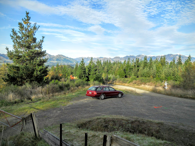
Carpark at start of Mt Isobel Track, Hanmer Forest Park


Mt Isobel Track climbing through broom

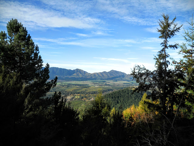
The track starts through scrub and then transitions into a mixed Spruce/Pine plantation, the trees here were planted in 1904 so are past there prime.

Mt Isobel Track: in the exotic forest

The plantation is very reminiscent of European or Canadian forests, open with plenty of light...there are a few board-walks to ease you over swampy areas.


Board-walk on the  Mt Isobel Track

The canopy gradually changes to your typical beech forest, the track was muddy but in excellent condition for most of the way to the ridge top.


Mt Isobel Track, climbing slowly through beech forest


View of the Hanmer area from Mt Isobel Track

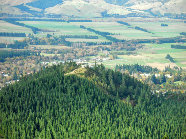
This is the view from my first rest point...because the car park is already 200+ metres higher than the valley the views are expansive. This is the area immediately around Hanmer Springs township, mixed forestry, township and farming.

Hanmer once again from the Mt Isobel Track


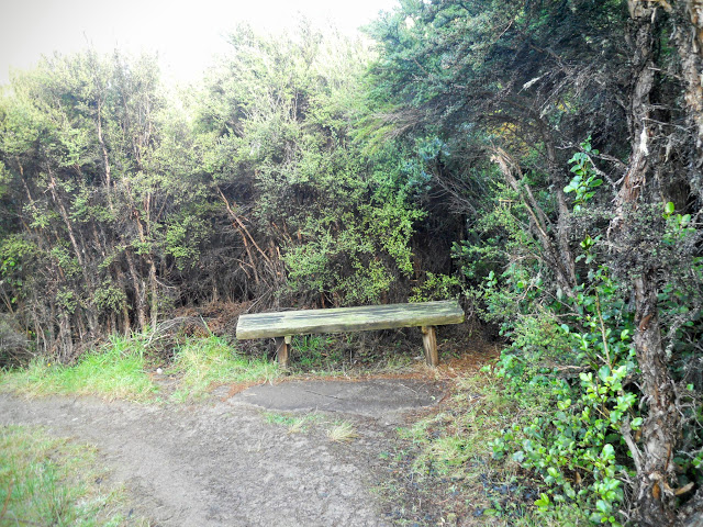
A rest spot on the Mt Isobel Track, Hanmer Springs

There are a series of rest stops on the lower slopes of the mountain with seats for people to rest on, they are spaced about every 200 metres or so. As you can see the undergrowth is quite thick along the sides of the track.


Mt Isobel Track: go left to reach Mt Isobel

After a kilometre there is a fork in the track...the main track continues to the right, the track to the left leads to a small viewpoint on a rocky outcrop. This provides a solitary view through the thick bush.


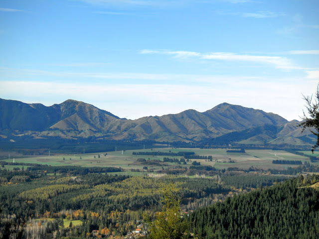
The Organ Range along SH7 from the Mt Isobel Track

Here is a view of Conical Hill from one of the outlooks... Conical Hill is right next to the town and a moderately easy walk of 30 minutes with a great view of the valley. It is one of the 'must do's' while you are staying in Hanmer.

Conical Hill from the Mt Isobel Track

The four photos below are a panning view of the Hanmer basin from about half way up the track.

Hanmer Plain: view towards Hope Valley to west

Hanmer Plain: Hanmer Township and the Amuri Range

Hanmer Plain: view east towards the coast and Amuri Range


We had a bit of snow early in the week (as you will see later), it fell to 1000 metres so all of the hills surrounding the town had a frosting of snow on their upper levels.


Snow on surrounding mountains from the Mt Isobel Track

As you ascend the canopy becomes almost alpine in nature, it reminds me of some of the alpine basins in the higher mountain regions of Arthur's and Lewis Pass.

Climbing the flank of Mt Isobel

Board-walks and single track on Mt Isobel Track


A classic (2014) selfie of Jon from the same location, selfies are the craze of the year!

Jon on the Mt Isobel Track, Hanmer Forest Park

The lay out and extent of Hanmer Forest Park is more apparent from high on Mt Isobel.

Hanmer Forest looking towards east from Mt Isobel

This is the last of the forest on the track, above this point is a classic alpine herb basin, this extends right to the crest of the ridge. The track to the right takes you back down the hill to the Waterfall track and a 41 metre waterfall. (This track is now permanently closed due to damage from the 2016 Waiau/Kaikoura Earthquake, 2019).

Mt Isobel - Waterfall Track Junction

Note the classic alpine vegetation, this would be at 900-1000 metres ASL. The track zig-zag's up the slope from this point until it reaches a track junction at the top of the ridge.

Moving into the sub alpine zone on Mt Isobel


Pt 1195 from the Mt Isobel Track

Summit of Mt Isobel from the track

There were still patches of snow this low down even after two fine and sunny days.

Mt Isobel: residual snow

Eventually you reach the top of the track; as you can see people will walk 4 km's up hill to put graffiti on something. Idiots! To the left is the track down to Jacks Pass, to the right Mt Isobel.


Mt Isobel: on the saddle next to Pt.1195

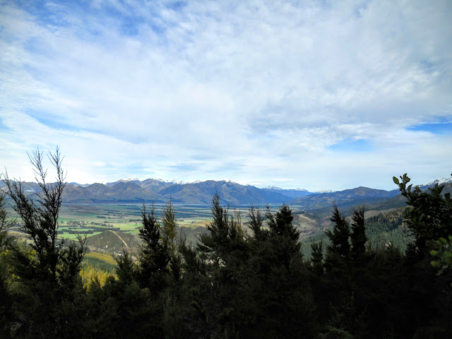
Below are some shots from the top of the track looking south to Hanmer and Kaikoura and North to the Clarence Valley.


Mt Isobel: to south, Hanmer plains, note township


Mt Isobel: to east, the coast is about 100kms away

Mt Isobel: to north, Clarence River Valley

" I turned around and headed back down.."

Ha ha ha.....climbers joke!!!


The trig station on the Mt Isobel summit is on the centre of the hill to the centre right below. I walked about a kilometre in this direction and then had to stop and come back. There was about 10-12 cm's of icy snow on top of snow grass and tussock. As it was so deep and I didn't have any crampons I decided it was not safe to continue.

 I have been to the summit back in the 90's as part of an Army exercise so I didn't feel the need to take chances. It would be about 1.5 km's from the track junction to the trig, about 30 minutes walking in good conditions.

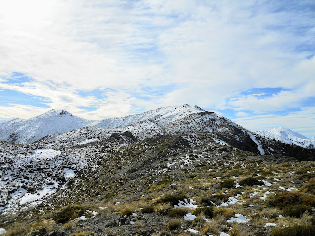
Looking towards Mt Isobel summit: too much snow!

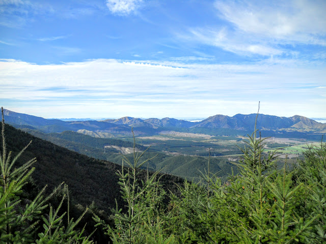
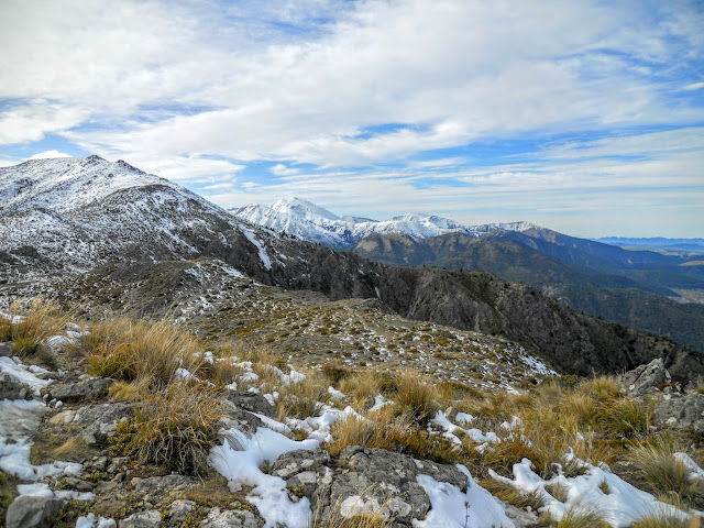
Here are some views of the Hanmer basin from around the highest point I reached on the track, there is little snow here but down on the track it was quite deep.


You can just see the east coast from Mt Isobel

Waiau River, Amuri and Organ Range from Mt Isobel

Hanmer township from Mt Isobel

Spencer Mountains from Mt Isobel

Mt Percival from the Mt Isobel summit track

As you start to descend the Jacks Pass track there is a short but very steep dirt/scree slope, take care here as I saw a chap ahead of me fall and slide down this slope. It was not a pretty sight.
Luckily he was wearing pants so no rock burn.

Rock slide on Clarence side of Mt Isobel

The track follows the crest of this ridge right down to the road, watch out in misty/windy conditions as there are several points where there are bluffs/ rock faces you could stumble over.


Following ridge down to Clarence Valley Road

Mt Isobel: Pt 1195, from closer to Clarence Valley Rd

Mt Isobel: Lots of snow on the St James Range

Here are a couple of shots of Spaniard bushes (aka: bayonet grass, speargrass, bastard bush etc. it has many names, none of them complimentary). You only get them in tussock sub alpine areas above 900 meters asl, they are bloody sharp so you don't want to fall onto one. There are many varieties the most common in the South Island is Golden Speargrass, Aciphylla Aurea.

I walked into one near Lewis Pass once...it actually stabbed me in the ankle through my leather boot and drew blood!


The barbs atop a Speargrass plant...damn sharp!!!

Golden Speargrass, Aciphylla Aurea

Two views from different points as I descended the track, the scree slope is in the centre-left in the first of the photos.

Mt Isobel: Pt 1195 from my lunch spot


Mt Isobel, about a kilometre from the road

I stopped near the point above and walked off the track to have some lunch, it was a great sunny place for a rest. Here is my lunch, crackers/tuna/raisins and water.....yum!

I usually have tuna or pate with crackers for my lunch, I've found some small cans of French pate that weigh less than 80gms, ideal for tramping.These are nice tuna slices in olive oil....bloody marvellous vittels!

Tuna and crackers for tramping lunch

Great view from my lunch stop!

Mt Isobel with view of St James Range at lunch

The track continues down the ridge line for another 500 metres and then turns to the left towards the road in the centre of the photo. The Rainbow Road (Clarence -Hydro Road) continues right through to St Arnaud in the Nelson Lakes area, the middle part is closed from May-September as they get some prodigious falls of snow in these back valleys over winter.


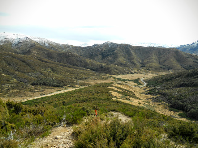
The Hanmer-Clarence Valley Road

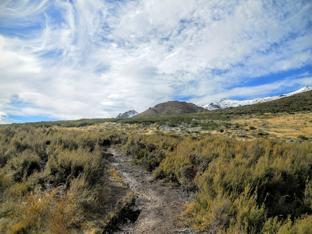
Here is the DOC sign at the Jacks Pass end of the track, this would be the closest access point to Mt Isobel but it would be a bit of a slog up the ridge line to the high point. Short and steep or long and steady, the choice is yours really.

Mt Isobel-Clarence Valley Rd track end

View back up the track from the road/track end.

View up the spur to Mt Isobel

There is a massive amount of parking space next to the track, a lot of people come up to this point and run/mountain bike down to the town. It is a straight road slog from this point onwards.

Car park at the Clarence Valley-Mt Isobel track end

The road descends from this point right down to Hanmer township itself, it would be 4-5 km's from this point to where I parked my car. The road is only closed at the bottom if the conditions are extremely bad up near Jacks Pass. Otherwise you are able to access this road through out the year.

Walking down the Clarence Valley Road to my car

This was a very pleasant wee tramp, the hardest bit is the slog up to the ridge top track, it is easy after that point. I have now walked all three access tracks to Mt Isobel, but would be keen to try a traverse from Jollies Pass to Jacks Pass the next time I am in Hanmer.

This trip took me about 5 hours total, by comparison they run a mountain running challenge along the same track I followed, the best time in 2013: 47 minutes!


Access: From Hanmer Springs head west out of town on Jacks Pass Road, turn on to Clarence Valley road just past the golf course. The tMt Isobel Track starts about 1.5 km's up this road on the right. 
Track Times: Mt Isobel track, 3 odd hours to summit of Mt Isobel, 1.5 hours return to track end on Jacks Pass, 45 minutes to bottom car park.
Miscellaneous: Some fall & rock fall danger. Please exercise caution if walking the track in winter as it is very exposed. Take appropriate gear as required as this is an alpine area.