Another trip to Godley Heads....
This last weekend I was scheduled to go for a tramp up Mt Herbert with my oldest daughter but due to the inclement weather it was scaled back to a shorter walk on the Port Hills.
 |
| Georgia crossing the fence at the Godley Head Loop Track |
We decided to go and walk around the defense works at Godley Heads, an excellent short walk in my opinion.
 |
| Godley Head Loop Track: map of the whole defense site and the buildings at the campsite |
I have previously been out to the defense works on Godley Heads many, many times the latest in late March, but this was the first time Georgia has ever visited the site.
Going clock wise this time....
When Karen and I visited recently we walked the Godley Heads Loop Track in an anti clockwise direction so this time for a change we walked clockwise. I think walking clockwise (...through the campgrounds first...) is a better way to travel, it was certainly easier.
 |
| Godley Head Loop Track: timings on this sign are for the trip to Taylor's Mistake from Godley Head |
It was a lot cloudier on the day Georgia and I visited but it was actually much warmer as there was zero wind to contend with.
 |
| The car park at the Godley Heads site....holds about 30 cars |
 |
| Toilet block at the Godley Heads Defense site car park |
There is a set of toilets at the car park, there is also a couple of picnic tables and a sheltered spot under some well placed pines if you wanted to sit down for a picnic.
 |
| Decent picnic spot next to the Godley Head car park |
From the car park we headed up the campsite access road, this will eventually deposit you down where the coastal gun battery was situated. The gate is locked at all times if you want to gain access to the camp site you need to book a campsite on line and they send you a code for the lock.
Georgia was keen to come stay up here as well though she said it would be cold...which it most certainly would...
 |
| The road leading to the Godley Heads campsite, the gate is locked.... |
People walking the tracks can just pop over the stile located next to the gated entrance to the DOC camp site. The track is well signposted and clearly marked so there is no risk of becoming lost.
 |
| Georgia crossing a stile on the Godley Head Loop Track |
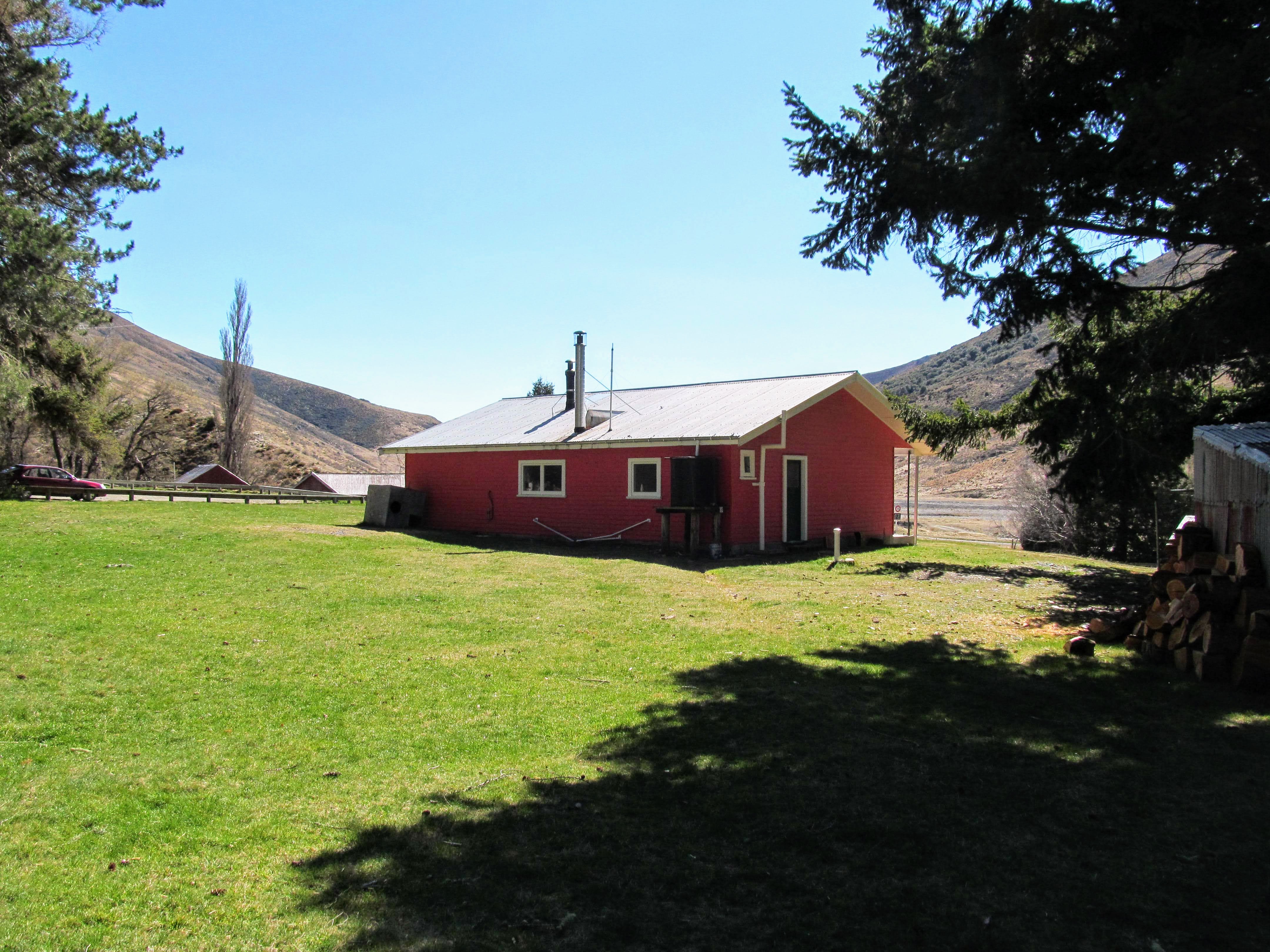
 |
| One of the restored buildings used by DOC at Godley Heads |
 |
| This map is right next to the Godley Heads camp site |
Point of interest, there is a turret off a M3A1 light tank sitting next to the workshop building at Godley Heads. It is missing all of the hatches and the main gun and has numerous 2 pdr shot holes through it but the shape is unmistakable.
The strange thing is New Zealand only used the M3 in North Africa and Europe not in New Zealand or the Pacific (...the New Zealand 3rd Division did some tough fighting in the Solomon Islands...). Gawd knows how it ended up at Godley Head.....very curious....
 |
| M3A1 light tank turret next to the old workshop building, Godley Heads |
I imagine it was used by the tankers for target practice in Tekapo or up at Waiouru....I read recently the trust also have a couple of heavy anti aircraft guns in one of the sheds, not on display yet but hopefully one day.
At the Godley Battery site
We went down and had a good look at the defense battery site including inside the gun bunkers....we found a short track that allowed us to circumvent the big fence around the site...enough said about that..
 |
| Gun emplacement E1, Godley Heads Defense Installation |
There is a massive amount of graffiti on the defense site buildings...it is really poor taste to desecrate these historic sites but unfortunately anything this close to a major city is bound to suffer a lot of damage from assorted idiots.
 |
| Gun emplacement E2, Godley Heads Defense Installation |
Georgia and I walked a short distance down the track to Taylor's Mistake so we could see the sea cliffs. I managed to get a couple of good shots of the Taylor Battery gun site. This was the first temporary gun site housing 60 pounder field howitzers in open emplacements but was quickly superseded by the main battery.
 |
| The Taylor Battery gun pads from near Godley Heads Battery |
You can see the trees around the main battery position at Godley Head in the background of this photo of Taylor Battery. Once the larger naval cannon were fitted to the Godley Battery this site was abandoned...it was only a temporary fix but it would have provided some protection to Lytelton.
 |
| Godley Heads: the 60 pdrs at the Taylor Battery circa 1940..... |
 |
| View from Godley Head towards Taylor Battery (middle ridge), Taylor's Mistake and Pegasus Bay |
We walked back over the ridge and had a look at the main defense installation, you can get a good look through the fence (it is fenced off as the site has suffered earthquake damage) but as promised I went over the fences and took a series of photos of the gun pits, bunkers and emplacements that made up the Godley Battery.
I do not recommend you do this but the choice is yours, just be careful as some of the ground around here is unstable.
 |
| Map and information panel near Godley Heads Battery, Godley Heads |
 |
| E1 gun emplacement from the battery access road, Godley Heads Battery |
 |
| Closer view of E1 emplacement, Godley Heads Battery |
 |
| Looking down into the magazine for E1 emplacement, Godley Heads Battery |
 |
| Looking down into the magazine for E1 emplacement, Godley Heads Battery |
If you would like to see what the tunnels and underground bunkers look like go to the
Coast Central Construction website. They are the firm contracted to restore this site prior to the Christchurch Earthquakes and they have a series of photos of the underground works.
 |
| Interior of the E1 emplacement Godley Heads Battery |
 |
| The gun pit which house the naval gun in the E1 emplacement at Godley Heads Battery |
 |
| View out to sea from inside E1 emplacement, Godley Heads Battery |
 |
| Looking back into E1 emplacement, Godley Heads Battery |
 |
| Gun crew bunker, next to E1 emplacement, Godley Heads Battery |
 |
| Inside the Gun crew bunker, next to E1 emplacement, Godley Heads Battery |
 |
| Ancillary building next to E1 emplacement, Godley Heads Battery |
 |
| Godley Heads Battery: the E1 emplacement from near the E2 gun pit |
 |
| Gun emplacement E2 at the Godley Heads Battery |
I'm not anti graffiti style art...some of it is very good but this historic place is not the right place to paint it. I don't like the graffiti painted here but at least the one below is topical...a Maori soldier in World War Two gear.
I think this one is nicely done....
 |
| Godley Heads Battery: a nice graffiti painted at the E2 emplacement |
 |
| The interior of E2 emplacement at the Godley Heads Battery |
 |
| Godley Heads Battery: a powder bag chute at the E2 emplacement |
The last of the gun emplacements at Godley Heads (E3) was open topped so it had the maximum arc of fire. If they had built overhead cover it would not have been able to swing to the north to cover the beaches of Pegasus Bay
The gun housed here was powerful enough to lob a shell as far north as the mouth of the Waimakiriri River/Woodend about 20-25 odd kilometers away.
 |
| Gun emplacement E3 at the Godley Heads Defence Installation |
The main entrance to the underground bunker system is located in between the E2 and E3 battery positions. It would be good if the bunkers were opened to the public but they were five stories underground so perhaps they may have been damaged by the 2010/2011 earthquakes.
 |
| Stairs to the main magazine, Godley Heads Defense Installation |
E3 had protective bunkers to its rear for the gun crew but I bet this was the gun they put all the people on the 'shithouse list' into as it was the most exposed to the elements. There are massive scuppers at the rear of the pit to clear all the rain that must have poured into the gun emplacement.
Hey...the military don't build features unless required....
 |
| Godley Heads Defense Installation: the open topped E3 gun pit |
 |
| Godley Heads Defense Installation: Gun E3 could shoot as far as the Waimakiriri River |
After we had a good look around the gun installations Georgia and I headed down to the Observation Post No. 2 further down the track.
Heading down to Observation Post No. 2
We jumped back onto the Godley Heads Loop Track and headed down hill towards the No. 2 Observation Post. It is a bit of a steep track with that really fine gravel DOC use so it is a bit slippery. It would be around 1 kilometer from the gun battery site to the observation bunker.
 |
| Walking away from Godley Battery, on the Godley Heads Loop Track |
 |
| Godley Heads Loop Track: the trees that surround the Godley Battery emplacements from down the track |
 |
| Looking out towards the entrance to Port Levy from the Godley Heads Loop Track |
We stopped and had a look at Observation Post No. 2...this cliff side post controlled the battery of searchlights located at water level at the base of the cliffs. It was also the communication nexus for the main battery and the various defense posts scattered around the area.
You used to be able to walk down to the search light battery but a huge chunk of the cliff fell on them and squashed them in the 2011 earthquake....
 |
| Sign for Battery Observation Post No. 2 on the Godley Heads Loop Track |
The people on top of this post are really stupid: there is a 100 meter drop immediately in front of the post. If they or the dogs fell off that roof they would die...no questions about it. In fact there is a DOC sign at the site which says "Do not sit on this roof. Fall Danger"
Do not do this yourself!!!
 |
| Godley Heads Loop Track: Observation Post No. 2 at Godley Heads |
 |
| Panel about the defunct light house that once resided near Godley Heads |
 |
| View from inside Observation Post No, 2 on the Godley Heads Loop Track |
 |
| Inside Observation Post No. 2, Godley Head Loop Track |
 |
| Panel describing the work undertaken at Observation Post No. 2, Godley Heads Loop Track |
We headed up the hill towards the power generation and battery fire control/plotting buildings closer to the car park. The track is uphill for all of the way back but the slope is a lot easier to climb than the one to the battery site as the gradient is gentle.
 |
| View of Lytelton Harbor and Purau Bay from the Godley Head Loop Track |
 |
| Godley Head Loop Track: view out to Lytelton Harbor mouth |
 |
| Georgia on the Godley Head Loop Track with Lytelton in background |
 |
| Clearer view of Lytelton Heads from the Godley Head Loop Track |
There are great views from Godley Head of the surrounding area and the still day meant we could see the details a lot clear than the last time I was here.
At the generator and plotting buildings
Mid way between the Observation Post and the car park are a series of command and control buildings for the defense installation. There is a workshop/power generator, a battery observation and a scale model shot plotting room.
All these buildings were an integrated part of the defense works and would have housed soldiers, WREN's/WAAC's and assorted naval personal over the course of the war.
 |
| Inside the generator room at the Godley Heads defense site |
As you can see the Armour on the windows and doors is about 5-8mm thick...not enough to deflect large naval rounds but good enough for shrapnel and bullets.
 |
| Thinly armored door on the generator room, Godley Heads defense site |
 |
| An interpretative panel inside the Godley Heads generator room, Godley Head Loop Track |
 |
| Godley Head Loop Track: the generator room |
The battery fire control room was where a group of military personal would have controlled the fire of the guns if anyone had tried to enter Lytelton Harbor. They were located around this side of the peninsula to protect them from any fire directed at the main gun sites atop the ridge line.
They must have had a top notch telephone network to link all of these posts as radio technology was a lot more primitive in those days..expensive, complex, hard to use and not very reliable.
 |
| Interpretive panel inside the battery plotting room at Godley Heads |
The miniature plotting room was for training the gunners and their officers, a large scale model of Lytelton Harbor and Godley Heads allowed the gunners a chance to practise their skills. Models of ships were moved across the plotting model and the fall of 'shot' was shown by small wooden pegs inserted into the plotting model from below.
This is still how they train naval gunners abet it is now computer simulated...
 |
| Godley Head Loop Track: inside the miniature range room, our earlier visit |
 |
| An explanation of how the battery plotting worked, Godley Heads defense site |
 |
| An explanation of how the battery plotting worked, Godley Heads defence site |
Its great that DOC and the Godley Head Heritage trust leave these buildings open as they have always been closed up to this point.
Walking back to the Godley Head car park
From the defense buildings it is a short 10 minute stroll to get back up to the Godley Head car park, it is uphill but a easy gradient. There were a lot of people out walking on this section of the track as it is the closest to the car park.
 |
| Looking at the range, plotting and generator rooms at the Godley Head site |
 |
| Godley Heads Loop Track, heading down towards the defense buildings |
If you walk the track in an anti clockwise direction there is a very good information panel just near the start of the track. Make sure you stop and have a look as it makes the history of the buildings and installations a lot easier to understand.
 |
| Godley Heads Loop Track: map of the whole defense installation at Godley Head |
 |
| Lots of people waking on the Godley Heads Loop Track |
The whole track is 5.5 km's long and takes between 45 minutes and 1 hour to complete.
 |
| Godley Head Loop Track....5.5km's from one end to the other |
 |
| Godley Head car park...a lot less cars as the afternoon progressed! |
Again, this is an awesome weekend short walk, bring the kids out for a look but take care on that road from Evans Pass and keep a tight hold of any children along the cliff sides.
Access: From Summer take the Evans Pass road, then turn left onto Summit Road heading out to Godley Heads. The road is narrow, winding with drop offs on the downhill side. Exercise caution as it can be busy and some of the other drivers are not very courteous.
Track Times: From the car-park it is 45 minutes to 1 hour to complete the Godley Heads Loop Track, all tracks are well marked and signposted.
Campsite Details: DOC ranger on site over summer, water tank, toilets
Miscellaneous: The campsite is on the DOC booking system, must be booked for overnight visit. Public toilets at the camp site and at the car-park.