A day trip to John Hayward Hut...
Over the weekend I went for a jaunt up the Kowai River to John Hayward Hut. This was my alternate-alternate plan as both of my overnight trips were subject to heavy rain warnings. I've been wanting to get up here for a while but always seem to have other trips to do.
 |
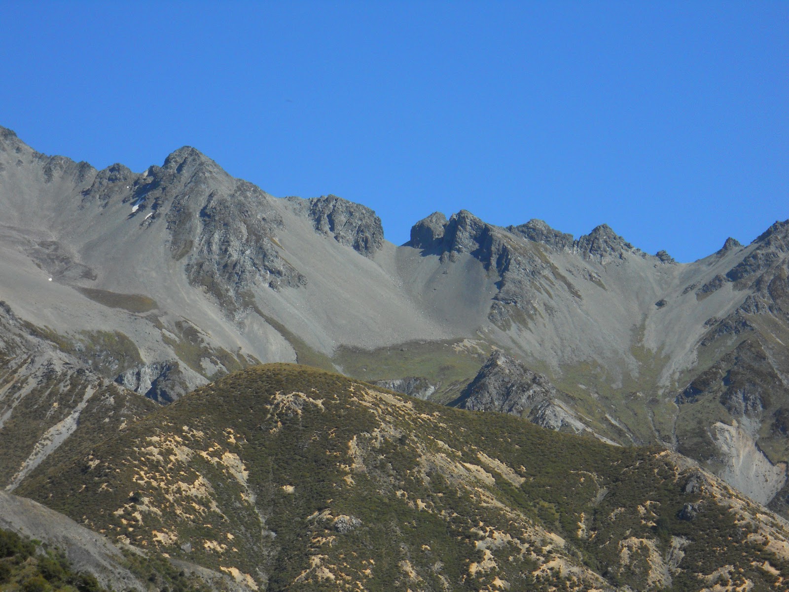
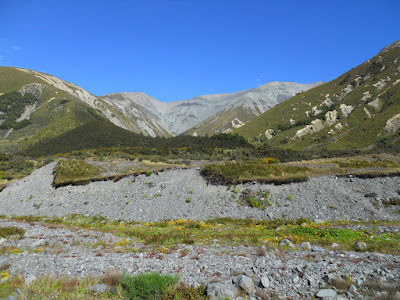
| Mt Torlesse at the head of the Kowhai River Valley |
Travelling up the Kowai River
The Kowai River Valley is the last side valley you pass on SH73 before starting the climb to Porters Pass. Access to Mt Torlesse/John Hayward Hut is across privately owned farmland belonging to Brooksdale Station. You should get permission from the owners before visiting this valley. No dogs, firearms or vehicles are permitted without consent.
 |
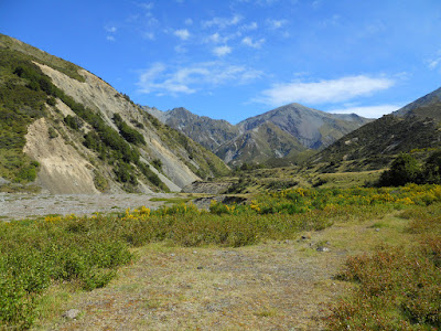
| Kowai River Valley, Korowai-Torlesse Tussocklands Park |
The trip starts from the farm gate opposite the historic road-man's hut on the last bend before the climb to Porters Pass. The car park is also a rest area so there is plenty of space here. Unfortunately it would not be a totally secure place to leave your car overnight, SH73 is notorious for break-ins and vandalism of parked vehicles.
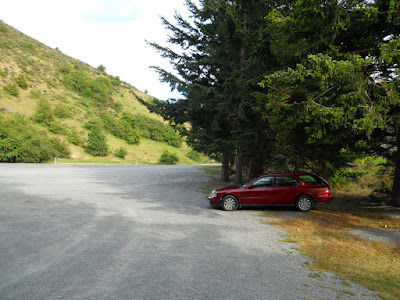 |
| Kowai River Valley: car park on SH 73 |
 |
| Porters Pass road-mans hut on highway 73 |
 |
| Start of the Kowai Valley Track next to rest area |
Once past the gate you almost immediately cross a small stream, it is shallow, it doesn't look like it would rise much with rain.
 |
| Kowai River Valley: awesome river crossing....! |
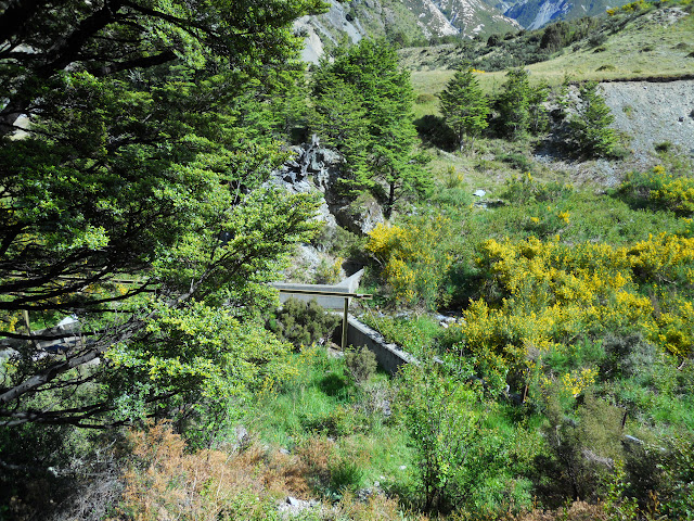
The first two kilometres of the route are on an old 4 W/D track belonging to Brooksdale Station. The upper reaches of the Kowai River Valley are part of
Korowai-Torless Tussocklands Park. Note that the base of Mt Torlesse is on private land and you should seek permission from Brooksdale Station before heading there.That said, I called the guy up and he said '...thanks for calling, lots of people don't call me but I'm happy for them to visit...".
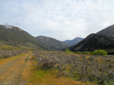 |
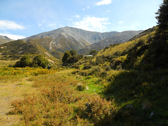
| View towards head of Kowai Valley |
I've been in this valley once before in 1989, back in my Army days. Four of us were part of a skill at arms/ long distance navigation team, we were the Signals team from Addington Barracks. We got pummelled by the Rangers and the 5 teams from 2/1 Infantry Battalion but whipped the Engineers, REME, Medical and Artillery teams.
The road to Porters Pass is really obvious once you start walking up the
valley, here you can see it zig-zagging up the side of the hill.
 |
| SH73 climbing to Porters Pass from the Kowai River Valley |
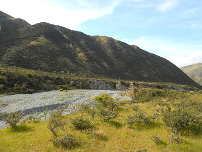 |
| Kowai River lower reaches from the 4 W/D track |
 |
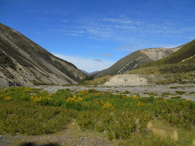
| Kowai River view North, Mt Torlesse in distance |
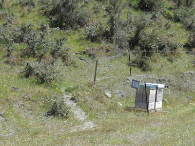
From the beehives you have two choices: the river route or the high track route. I followed the river route which basically means I walked up the river bed to the hut. Great on the day as the river was low, but impossible if there has been any rain. On my return I walked on the high route which follows an old 4 W/D track over the spur lines high above the river.
 |
| Kowai River Track goes to left of bee hives |
Going up the river took about an hour and a half from the car park: it is a mixture of boulders, scrubby intersecting spurs, gravel bashing and river crossings. I crossed the river 14 times on my way up valley: obviously a problem if the river is high.
 |
| Kowai river bed- view towards road |
 |
| Through the Kowai River gorge |
 |
| Mid point on way to John Hayward hut |
Once you get over the first couple of river bends the valley has a very remote, back country feel about it, there is little sign of humanity, save the old power lines visible on the northern slopes of the surrounding hills.
 |
| Back view of Foggy Peak from Kowai River Valley |
 |
| Kowai River- last corner before hut comes into view |
Eventually you round the last corner and John Hayward Memorial hut is clearly visible on the opposite river bank. It is an awesome spot for a hut as it gets full sun sitting high on a river terrace.
 |
| John Hayward Hut- first view from the river bed |
Other than being a enjoyable walk there are three reasons to visit this valley: John Hayward Hut, Mt Torlesse and a feature known as the "Gap". Most parties will stop by the hut before continuing further up valley to the surrounding attractions.
 |
| Looking North West to the "Gap" and Torlesse Range |
 |
| John Hayward and Mt Torlesse |
 |
| Ford point over Kowai River at John Hayward Hut |
John Hayward Hut: A research station...
John Hayward Hut was built in 1973 to house a long term Lincoln University hydrology study. There are several relics around the hut which show this history including an interesting set of sluices near the hut for testing water resistance etc. It would have been a relatively comfortable hut as it had heating, hot water (from a fire warmed wet-back), electricity, telephone and bunks for 4 people.
 |
| John Hayward Memorial Hut -1973 |
 |
| John Hayward Memorial Hut -interior showing bunks |
 |
| John Hayward Memorial Hut -interior domestic bliss |
The hut is jointly owned by DOC and Brooksdale Station and is looked after by some members of Permalot who clear the tracks and do minor repairs as needed. The hut is in good condition considering how close it is to the road. From the hut book it appears most visitors were mountain runners, rock climbers or trampers, with a few hunting parties added in.
 |
| Jon Moake in John Hayward Hut |
 |
| Old Lincoln University experimental hydrology water race |
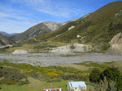
You can see why they used the area for hydrology studies, there are three watersheds to study as well as extensive areas of erosion along the valley sides. From the small knoll behind the hut it is possible to see right up to the headwaters as well as the area you have traversed on your way in.
 |
| View down Kowai Valley from above the hut |
 |
| John Hayward Hut on its terrace |
 |
| Torlesse Range from Kowai catchment |
 |
| View of Castle Hill and Torlesse Range from above the hut |
 |
| Headwaters of Kowai River, with the "Gap" at centre-left |
 |
| John Hayward Hut and wood shed |
 |
| Panoramic view of Kowai valley |
The "Gap" is a notch in the Torlesse Range out to the north west, as you can see it is an obvious feature and is often the destination for parties coming up the valley. From the top there are supposedly great views of the Broken River area, Cragieburn Range and outliers of the Southern Alps. Here is a trip report about the route from
Backcountry Bibles.
 |
| The famous "Gap" to the NW of John Hayward Hut |
The standard route to climb Mt Torlesse starts right next to the hut and follows a couple of spur lines to the top. It looks a relatively simple if arduous task to reach the summit.
 |
| Mt Torlesse from the knoll behind the John Hayward Hut |
 |
| John Hayward Hut memorial plaque |
 |
| Jon Moake sitting inside John Hayward |
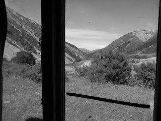 |
| View out window, John Hayward Hut |
 |
| John Hayward Hut in black and white |
I really wish this "wetback" water heating system still worked as it would provide hot water for the still existent shower and taps. I could see that it is being dismantled- the water pipes are disconnected and the old hot water tank no longer exists.
 |
| The John Hayward hut firebox with wetback |
 |
| Electrical fittings for now non existent power in John Hayward |
After eating my lunch I started back down the valley. I decided to follow the actual track out to the road head for a change of scenery. The track starts down near the confluence of Kowai River and the stream coming off the back of Foggy Peak. It is not obvious (no orange markers) so you need to hunt for it. Look for the intersection of the old power lines, and the river to find the track. It climbs high above the river along an old 4 W/D track.
 |
| Kowai Valley track, high above the river |
Permolat volunteers have recently re cut the track through the gorse and manuka scrub.
 |
| Kowai Valley track, recently cut back scrub |
 |
| View of the start of the Kowai River Gorge from high on a spur |
 |
| View back towards head of Kowai River |
Here are what some radial moraines (...go the 7th form geography...) rising high up the hill side next to the track, these extended for about 200-300 meters up the hillside. Big glacier!
As the glacier receded up this valley it would dump these debris on the side of the hills. These would be from the last mini glacial age about 7000 years ago.
 |
| Glacial moraines on the hillside- Kowai Valley |
Below is the high point of the track, there are great views both up and down the valley from here.
 |
| View down to SH73 and the trail head from high point on Kowai Valley Track |
At the track junction pictured below, left takes you down into the riverbed, right is the track which continues to sidle around the hillside.
 |
| Kowai Track junction- both lead to the road |
If you find yourself in the river on the way up valley and want to locate the 4 W/D track turn left at the rock below and join the track on the grassy river terrace visible beyond the gravel.
 |
| Kowai track- access point from the river |
 |
| Kowai track on river terrace behind beehives |
I stopped for a break in the shade of some trees near here. It was really hot...like 28-29 degrees celsius, so I was wanting a rest....
 |
| Shady rest spot overlooking Kowai River |
The official route goes left behind the beehives pictured in the photo below, it then sidles around some slips before starting to climb over the first and highest spur.
 |
| Kowai River Track- go left around the beehives |
 |
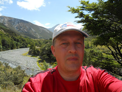
| Another Jon 'selfie' from near Kowai River |
Then it was just the slog along the farm track back to the start of the track on SH 73....
 |
| Kowai River Valley: SH73 & track head are near the distant pines |
A bit of advice: take a good sun hat with you if you go up this valley. You will be out in the full sun for the four hours you are walking as there is zero shade on either route.
Historic Porters Pass Roadman's Hut
Here are some shots of the interior of the historic Porters Pass roadman's hut, derelict and vandalised. It is a bit of a shame because the hut has been standing here since the 1910's at least, so it really is historic in nature. It is a perennial problem protecting these huts close to a road, even the John Hayward Hut six km's from the road was vandalised a month or so ago.
 |
| Interior of old Roadmans hut |
 |
| Interior of old Porters Pass roadmans hut |
Not the trip I had planned but again a very interesting journey none the less. I will return because an ascent of Mt Torlesse certainly looks do-able. I'm not sure I want to contemplate climbing to the "Gap" by myself, that might be pushing my luck a bit far....
Update 2017:
The hut has been significantly refurbished in 2016 by a volunteer group using money from the Outdoor Consortium Fund. There are now six bunks, new mattresses brought, the firebox has been replaced and a new water tank has been installed. It has also received a new coat of paint.
Access: The Kowai River Valley is the last valley before you start the climb to Porters Pass on SH73. It is not sign posted but starts from the gate and stream crossing visible from the car park.
Track details: 2 hours to Kowai Hut from SH73, the same return. Both the river route and track take about the same time.
Hut Details: Privately owned by Brooksdale Station: Basic, 6 bunks, rainwater tank, fire box, wood shed, toilet
Miscellaneous:River route would be impassable in rain. You need to cross the Kowai to get to the hut, may not be possible in very heavy rain