Boxing Day on the Lewis Pass Tops
Happy New Year, here's hoping that 2016 finds you all fine and well.
Tramping over the Christmas break
We mostly stayed around home over the holidays as we had family visiting from the United States. I managed to get out for a couple of walks but only one day tramp over the Christmas break, I went up to Lewis Pass on Boxing Day and walked up to the
Lewis Pass Tops.
 |
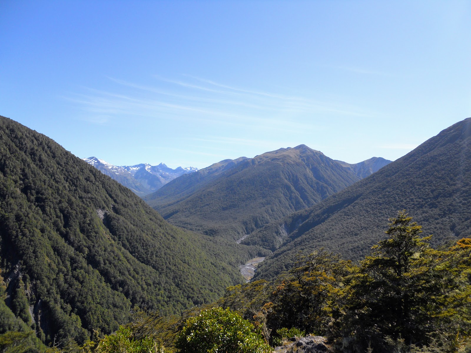
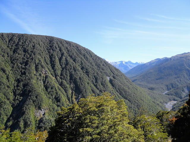
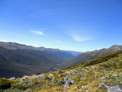
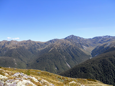
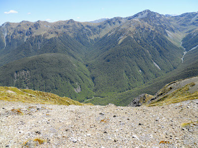
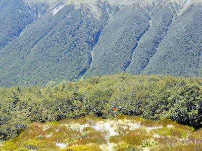
| Maruia River Valley from the Lewis Pass Tops |
I was still full of ham and good cheer so was moving slowly but it was an awesome trip regardless.
 |
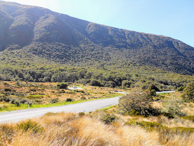
| Lewis Pass Tops route from Lewis Pass car park |
The Lewis Pass Tops route
The track from the Lewis Pass/St James car park to the Lewis Tops covers about 400 meters of ascent over a distance of about 5 kilometres and takes 2-3 hours. Initially the track is in beech forest but as it reaches the Alpine zone the bush gives way to tussock and snow grass slopes.
 |
Start of the Lewis Pass Tops Route
|
I parked the car in the main Lewis Pass car park, this is fine for a day tramp but is not a secure location overnight as it regularly has car break-ins and vandalism.
 |
| View back towards Lewis Pass-St James Car park |
 |
| Track sign for Lewis Tops Route |
 |
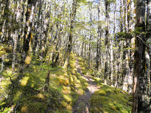
| Bush track to Lewis Pass tops |
There is another car-park with a link track accessing this route: it is about a kilometre west of Lewis Pass but is difficult to use as it it has a steep driveway coming off the highway. It would be a much safer spot to park your car overnight provided you are able to get up the slope. It is a large gravel flat area with a short drive leading to it, approach it from the West Coast side as it is easier to see oncoming traffic.
 |
| Track leading to other parking area, Lewis Tops route |
You break out of the bush for a short while after 20 minutes, there are views of the Cannibal Gorge area and the Freyburg Range on the other side of the Lewis Pass highway. Then it was back into thick bush for another half an hour.
 |
| First break in the canopy, Lewis Pass Tops route |
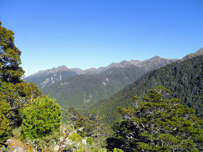 |
| Freyburg Range from Lewis Tops route |
 |
| View down to Cannibal gorge, from the Lewis Tops route |
 |
| Track sign and junction point, go left for Lewis Tops |
 |
| View towards the Lewis Tops |
 |
| View towards head of Maruia Valley, Cannibal Gorge bridge |
The track is steep, it follows a spur from the highway all the way to the tops so is a bit unrelenting. Be careful on the rocky sections as the rock is very crumbly as well as sharp edged.
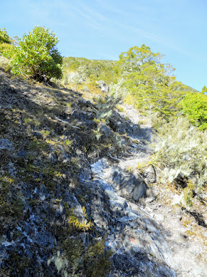 |
| Rocky track section, Lewis Tops route |
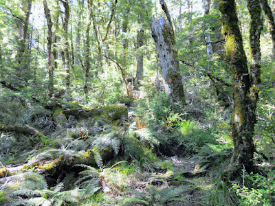 |
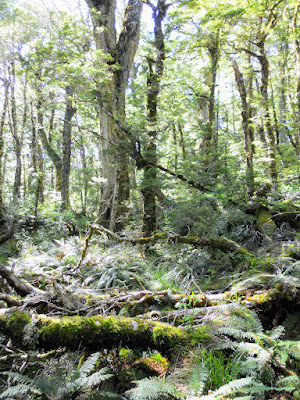
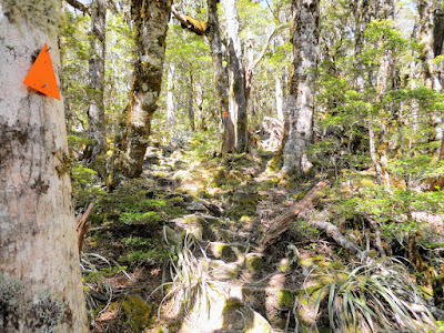
| Typical bush section, Lewis Tops route |
There are some good examples of Hall's Totara near the track, the biggest I saw would have been 3-4 meters in diameter at least.
 |
| Moderately large Totara tree on the Lewis Pass route |
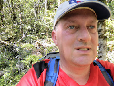 |
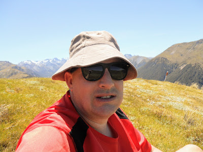
| Me on the Lewis Pass Tops track |
 |
| Start of Alpine transition, Lewis Tops Route |
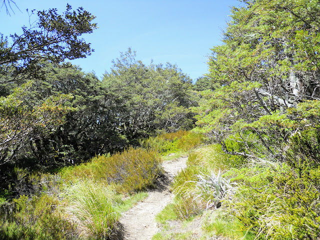 |
| Breaking out of the bush, Lewis Tops route |
You break out of the bush after an hour and start the climb up scrubby slopes to point 1568, the high point on the first section of the Tops route. It can be blazingly hot so make sure you have lots of water, sun screen and a good sun hat past this point.
 |
| Climbing up the spur to point 1568, Lewis Pass Tops Route |
NOTE: This is a marked route but can be hard to follow in thick cloud, fog or snow conditions. Make sure you take a compass bearing (or GPS way point) at the point where the track enters the bush. You may need it when you are returning from your tramp.
Also be aware that there are some big falls on both sides of the route, stay on the track!
 |
| Mt Travatore 1737m from the Lewis Tops Route |
 |
| The Spencer Mountains from Lewis Tops Route |
The views become more spectacular the higher you climb, you can see a long way even from this modest height. There are right and left marker poles about 50 meters off to the side of the poled route, this is the outer limit of the safety zone on this spur. The arrows on them point to the middle of the track.
 |
| Libretto range from the Lewis Tops |
 |
| Opera Range from the Lewis Tops route |
 |
| View North to Mt Freyburg 1817m from Lewis Tops |
 |
| Upper Maruia Valley and Spencer Mountain Range |
 |
| Jon Moake on the Lewis Pass Tops |
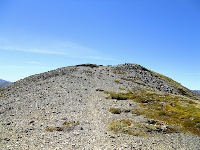
You gradually climb a series of false summits, your goal is an unnamed high point call 1568, the route goes over the top of this and continues on to the west for several kilometres.
 |
| Point 1568, Lewis Pass Tops |
 |
| Glacial erratic high on the Lewis Pass Tops |
 |
| Climbing to point 1568, Lewis Pass Tops |
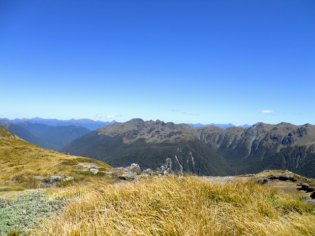
There are some awesome views from the flat area on top of point 1568, you can see as far as the Paparoa's to the West, and the high Spencer Mountains (Glorianna and the Fairie Queene) out to the east. It is also possible to see right down the Lewis Valley as far as Windy Point.
 |
| Lewis Pass Tops: view to East, headwaters of Maruia river, Lewis Pass SR |
 |
| Lewis Pass Tops Route: Mt Technical and the Apprentice, Lewis Pass SR |
 |
| Route heading West, Lewis Pass Tops |
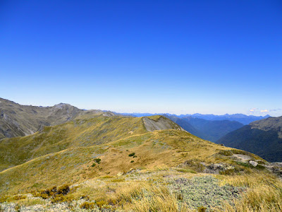 |
| View West towards point 1561, Lewis Pass Tops |
I stopped for a rest right on top of 1568, the views on offer sure make up for the effort expended to get to this spot!
 |
| Rest spot on point 1568, Lewis Pass Tops |
 |
| Mt Technical, from the Lewis Pass Tops |
 |
| View of Victoria Range around Springs Junction |
 |
| View West, with Victoria, Brunner and Paparoa ranges in distance |
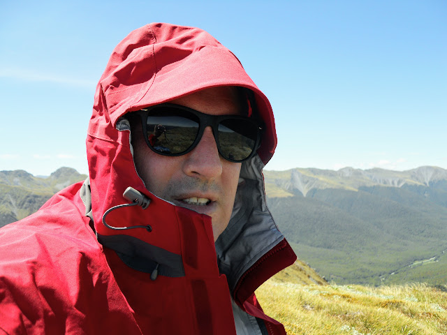 |
| Chill wind blowing high on the Lewis Pass Tops |
Lewis Tops: the Tarns
Once you reach the top of the spur there is virtually flat travel along the tops for several kilometres. There are a series of tarns along the route, offering excellent camping spots high above the surrounding valleys. I was surprised to see no one in residence as the weather was fine and warm for about 4 days around Christmas.
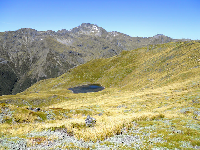 |
| The first no-name tarn, Lewis Pass tops |
I only tramped as far as the first tarn which is situated between point 1568 and 1561. I walked down to the tarn for a look and to refill of my water bottles because it looked so enticing. It would be an awesome spot for a camp and the water was icy cold even with the sunny weather.
 |
| Close up of the first tarn, Lewis Pass tops |
 |
| View of the ridge from the first tarn, Lewis Pass Tops |
If you go as far as point 1561 you will be able to see a group of about 5-7 tarns of various sizes on a saddle to the South West, this is the spot people usually stop if camping in the area.
 |
| View of point 1561 from West of point 1568, Lewis Pass Tops |
Once past point 1568 the travel is along a relatively flat track, you can basically walk as far as you like, if you continue past Mt Technical you eventually reach the Brass Monkey Biv and route's to Lake Christabel, Mt Boscawen and Rough Creek. It is possible to follow the tops from here all the way to the Hope River Valley about 20 km's to the South East, as they are all inter connected.
 |
| High alpine meadows on the Freyburg Range from the Lewis Tops Route |
 |
| Climbing back up to point 1568, Lewis Pass Tops |
I stopped for a late lunch just shy of the bush line as the wind had picked up and it was getting quite cold higher along the ridge. There are plenty of little nooks and crannies for you to tuck yourself into out of the wind along the track.
 |
| Lunch stop above bushline, Lewis Pass Tops |
 |
| Me eating lunch on the Lewis Pass Tops |
 |
| Entry point back into the bush on the Lewis Pass Tops |
It took me about 2.5 hours to walk back to the car park from the tops, the steepness of the track makes for slow descent rates. The only people I saw all day were two German hikers who passed me just after I entered the bush line. When talking to them I found they were on their way to camp at the tarns.
Another great tramping location for you to add to your lists, I will come back some time and camp by one of the tarns.
Access: The track starts directly opposite the Lewis Pass car park on SH 6, the Lewis Pass Highway.
Track details:1.5 hours to the beginning of the Tops, another 30 minutes to the point overlooking the first 'no name' tarn. Another hour to the next set of tarns.
Miscellaneous: High exposed alpine environment, dangerous in snow, rain or windy conditions. There are some big drop off s along here. Stay between the snow poles to left and right of main track.