Showing posts with label Lyttelton. Show all posts

Wednesday 10 April 2019

Christchurch 360 Trail: Godley Head Loop Track, 30th March 2019

Jon and Karen visit Godley Heads...


It was a relatively nice Sunday so I suggested to Karen that we visit the old defence battery at Godley Heads. I have been here many times over the years but this was the first time Karen had visited.

The defense works were built in haste in 1939 when New Zealand entered the Second World War and the threat of an attack on Lytelton Harbor from German commerce raiders was high. Initially there was a half battery of dug in WW1 era 60 pdr field howitzers these were later replaced with a dedicated coastal battery.

One of the initial 60pdr guns at Godley Heads, Godley Heads Heritage Trust website


As the war progressed a sophisticated set of landing defences, coastal defence batteries, observation posts, searchlights and control rooms was built to dominate the seas around Lytelton Harbor


View of Lytelton Harbour, Mechanics Bay from near the Godley Heads car park

To get to Godley Head, go through Sumner and climb up to Evans Pass then turn left and follow the Summit Road the five odd kilometers to the Godley Heads car-park. 

Layered volcanic soil layers at Mechanics Bay, Godley Heads, Port Hills


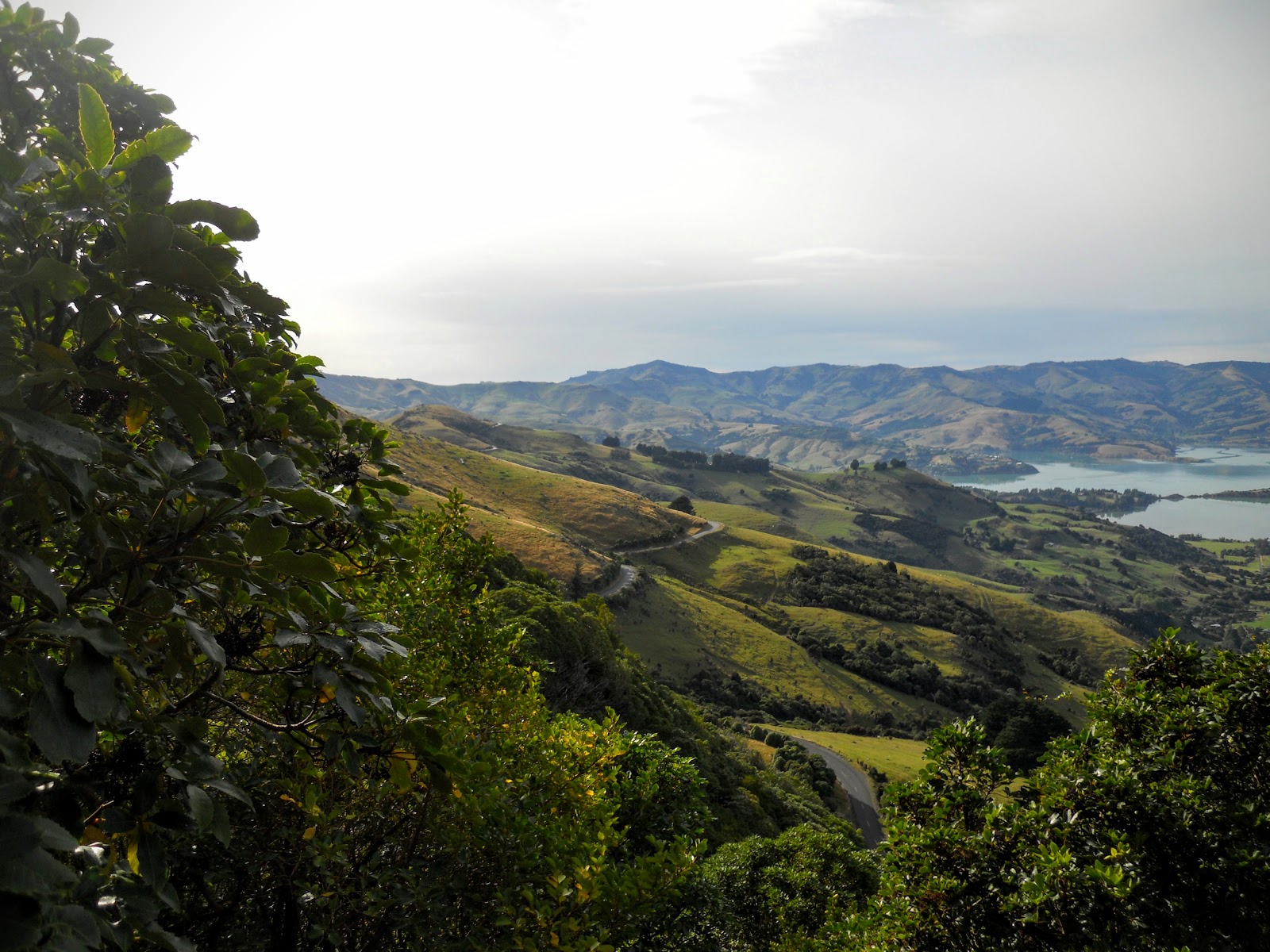
There is a sizable car park at the end of Godley Heads, the Summit Walkway (part of the Christchurch 360 track) starts from this point and goes out to the end of the peninsula and back towards Evans Pass. From near the car park you have excellent views of the surrounding area, down to Lytelton Heads and out to Banks Peninsula.


Looking out to the mouth of Lytelton Harbor, Port Levy beyond closest headland

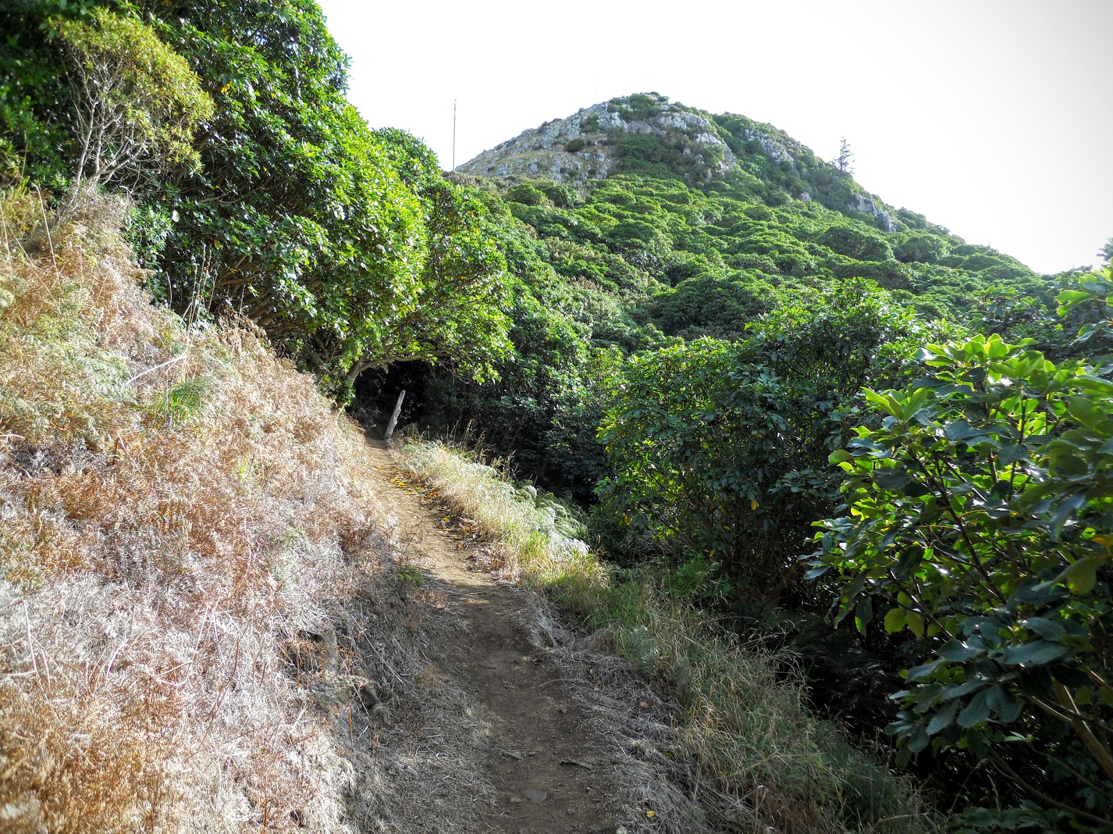
As you can see below there are a multitude of tracks up here all of them are well marked and signposted and the track surface is just about good enough for a wheelchair. 


Awaroa/Godley Heads, Banks Peninsula
We decided to do the Godley Heads Loop Track which takes you out past the old control buildings for the complex, past an observation bunker and then climbs to Godley Battery at the apex of the ridge. 

Godley Heads: looking towards the old control buildings
As you can see below the old defense buildings are slowly being restored and are now open to the public. The last time I was here it was totally locked up so that vandals could not damage these very historic building.

The buildings at the start of the track consist of a plotting room, a workshop and the power generation building.  The Battery HQ, barracks and other control bunkers were situated on the top of the ridge closer to Godley Battery. 


Godley Heads: the plotting room, workshop and power generator room

Inside the old plotting building, Godley Heads, Port Hills

All of the buildings have foot thick reinforced concrete walls and armored shutters and doors where fitted to limit blast damage and shell splinters if the site had ever been attacked.

Its worth noting that a German commerce raider Adjutant dropped 10 mines off Lytelton Harbor in early 1940 (they were never recovered!!!). It is also suspected that various German U-Boats & Japanese ocean going submarines visited the area during the war, so the threat to local shipping was real.


Godley Heads defense installation: the old power generator room
The walls and armored doors are bit pathetic to tell the truth...they would have been fine for machine gun bullets and light shrapnel but a big naval gun like a 5.9 inch/150mm (carried by commerce cruisers) would have blasted these buildings to rubble. German U-Boats carried a 3.4inch/88mm gun and some of the big Japanese subs had up to 8 inch guns all of which would have been effective against visible buildings.

I can only imagine what a really big gun like those on a battleship would do to the installation. 

BOOOOOOOOMMMMMMMMMM!!!!

Nothing left....


Armored door on the old power generation building, Godley Heads, Port Hills

Armored shutter on window, Godley Heads, Port Hills

Bit of an artistic shot by Karen of the Purau area as seen from one of the generator room windows.

Artistic shot from Karen through the window generator room, Godley Heads, Port Hills

As you can see by this map there were two main batteries, Godley and Taylor as well as a series of observation posts so corrections could be made to the fall of the shot. Taylor Battery was temporary and the guns were removed once the main battery at Godley Head became operational.

These were complimented by machine gun pill boxes, observation posts and searchlight batteries. At the peak of its use in 1943 there were over 500 Army, Navy and Home Guard troops occupying the site. 

DOC map of the various defense works on Godley Head, Port Hills

From the control buildings we took the obvious track down to battery observation bunker No.2 which has clear views out past the head of Lytelton Harbor and well out to sea. When you reach the bunker make sure you go inside as there are a number of informative panels explaining what the installation was used for. This bunker controlled the searchlight battery located at the base of the cliffs.


Concrete roof of Observation Bunker No. 2 on the Godley Heads Loop track

As you can see they used classic defense work engineering skills here: the steps down to the bunker are small, steep and tight and there is a L shape entrance to limit shrapnel damage from a near miss. Back in the 1940's the bunker was covered with soil and grass/plants were put on the top to camouflage it from above and out to sea.


Godley Heads, Port Hills...classic defense engineering: steep, small staircase


Inside Observation Bunker No. 2, Godley Heads, Port Hills
The views from the bunker are superb, from here the sentries would have been able to see any approach made to Lytelton as well as into Port Levy to the South East. Observation is unobstructed right out to the horizon....obviously useful if you are trying to sink approaching enemy vessels.

View out to sea from the Godley Head Observation Bunker No. 2

Godley Heads, Port Hills: a series of views from inside the observation bunker....north...

...due east from the Godley Heads, Port Hills observation bunker...

...south east looking towards Adderley Heads, the entrance to Port Levy from the bunker....

....view due south towards Mt Evans.....from Godley Heads

Godley Heads is the home for a number of flora and fauna species which do not occur anywhere else in New Zealand. There are also invasive species like gorse, broom and Cotyldon Orbiculuta or Pigs Ear which are the large succulents growing around the observation bunker.


Godley Heads, Port Hills: a freighter transiting towards Lytellton, 

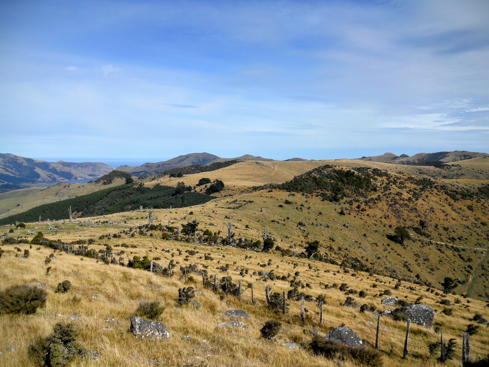
From the observation bunker the track climbs quite steeply to the Godley Battery compound at the apex of the ridge the defense installation sit on. This is the most difficult part of the track but even here the track is well constructed and relatively easy to climb.


On the Loop Track to the Godley Battery, Godley Heads, Port Hills

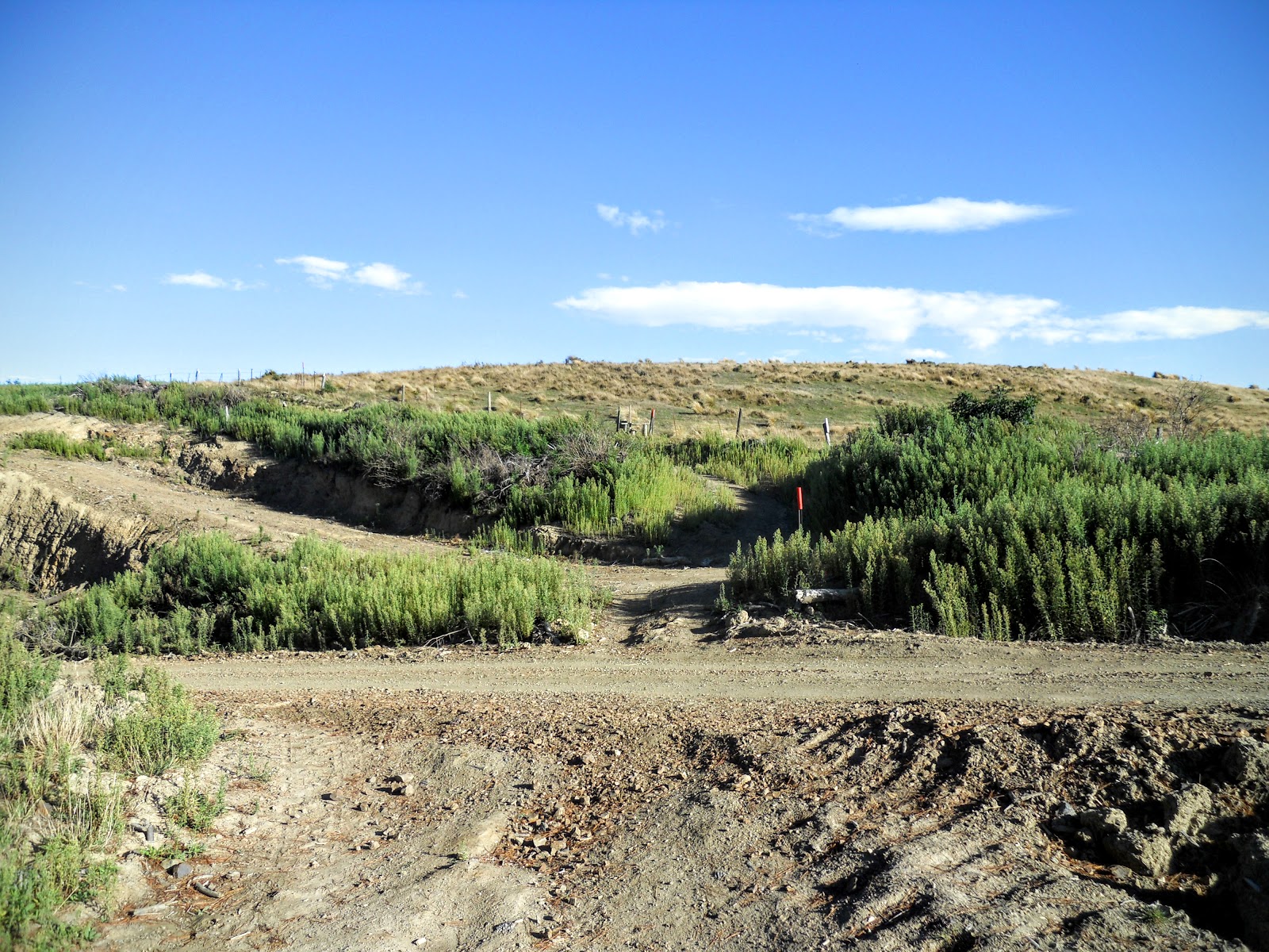
DOC and the Godley Heads Trust who look after the area have started a planting program on the slopes beside the track, they appear to be planting native trees possibly as a means to stabilize these cliffs after damage sustained in the 2010/2011 earthquakes.


Godley Heads, Port Hills: native planting along the Godley Heads Loop Track

There are some spectacular views of the cliffs and the ocean as you walk through this area but keep any children close to hand as there are some massive drop offs quite close to the track. 

The Godley Battery: Godley Heads, Port Hills

There are two gun battery sites, Godley and Taylor both situated on the edge of the cliffs at the extreme end of Godley Head.

Godley Battery is currently closed while preservation work is underway. I believe DOC may ultimately decide to permanently fence the site off as it is liable to fall off the side of the nearby cliff if here is ever another large earthquake.


DOC sign showing the location of the defense works circa 1940/50's


We did not visit Taylor Battery as it is about a kilometer downhill on the track to Taylors Mistake which is one of the bays in the area. I will visit the area at some time in the future and post some photos here. 

Even though the site is fenced off you can still get a good overview of how the site was set up by walking along the fence from the southern to the northern side of the peninsula. You can clearly see the site of the gun pits and supporting bunkers where the fall of shot from the guns was controlled. 

Foundations for old barracks at Godley Head Battery site

The barbed wire fence around the old Godley Battery Compound


Newly wired entrance gate to the Godley Battery, Godley Heads

There were three guns located at Godley Battery: two in Emplacement A and one in Emplacement B. All of these guns had a range of 22 miles so would have been able to lob a shell to the horizon and as far north as the mouth of the Waimakiriri River. The guns were British designed BL 6 inch coastal guns and the emplacements featured an armored shield on the guns and steel and concrete overhead protection.

The ammunition magazines are located near the guns in underground bunkers protected with thick concrete roofs with a deep layer of soil on top. 


Godley Heads, Port Hills: this is gun Emplacement A to right and a observation bunker

Gun Emplacement B at the Godley Battery, Godley Heads, Port Hills

View towards Taylors Mistake and Pegasus Bay from near the Godley Battery

The site was still active until the late 1950's as it was used for National Service training....the guns were last fired in 1957 and were removed shortly afterwards. It would have been amazing if they still existed but it seems likely they were cut up for scrape metal.

If they ever open the site to the public I will come up here and take some photos of the gun pits, magazines and observation posts.

The Godley Heads Campsite

From Godley Battery there is a short climb up a track to the Godley Heads campsite, this is a very basic DOC administered campsite located next to some of the historic buildings used as the Battery HQ back during the war.

Godley Heads DOC campsite, Godley Heads, Port Hills
As you can see the camp site is quite basic but it would be an excellent spot to camp some summer evening. You could set up camp and take a stroll down to the battery site to watch the moon/sun rise over the horizon.

I have been out here in the morning and it really is spectacular to see the sun rise up out of the ocean.

Godley Heads DOC campsite, Godley Heads, Port Hills

Godley Heads DOC campsite, Godley Heads, Port Hills

There are a set of toilets and several water points next to the campsite...it is normally dry up here so if you are coming to camp I would bring copious amounts of water with you in case the tank is dry. The charge for a camp site is only $15 per night with a two day maximum stay limit.

 You book a campsite through the DOC campsite booking page and they give you a code for the locked gate at the entrance. 

The toilet block and water point at Godley Heads campsite
Over the summer there is a volunteer ranger in attendance, they can stay in one of the old restored barrack huts which look exactly like the ones I remember from Helwan Camp up at the Army Training Area, Waiouru. 

Hopefully they are warmer and more comfortable than the lousy one I stayed in one winter while doing a three month field line laying course. It was memorable that's for sure.

Fun, fun, fun in negative -5 degree temperatures with the wind whistling off Ruapehu and the snow blowing under the door.

Outdoor toilets, hot box meals and one shower every 3-4 days...

We practiced laying field telephone lines right out into the training area..no supervision and made up solutions for getting over roads, rivers and the such. That was a lot of fun.

One of the guys drove over a concrete berm and ripped a front axle and the oil pan off a Landrover...so he got charged and had to pay $4500. 

Also one of the guys got done for impersonating a NCO when he tried to buy alcohol after hours at the Sergeants mess. The duty NCO recognized him the moment he walked in the door...

Good aspects... we did get away from all the B.S at the School of Signals no parades or inspections and we dressed like a bunch of pirates...I got around for most of the time in a blue boiler suit, old navy jersey and a German Army parka....we played a lot of cards and darts...went tramping some weekends, had a lot of barbecue's (venison, smoked eel, trout wrapped in foil...yumbo!!!) and drank a lot of booze when not working so not all bad...!!!

One of my friends and I both turned 21 while we were on the course so we had a joint kegger and a bbq...we all got gloriously drunk and took three days to recover

Yeah I enjoyed my time in the Army...but I digress.


Godley Heads, Port Hills: DOC rangers quarters, Godley Head campsite

You have to pre-book to stay in the camp grounds, but you could turn up, book online (cell coverage here) get the code for the gate and make yourself at home. No open fires are allowed here at any time of the year so you near to bring some sort of gas cooker with you if you intend cooking a meal.

Karen and I are both keen to give it a go but I think they close the camp grounds over winter (June-October???) so we need to get in fast if its going to be this year.


Access road and locked gate at the Godley Heads campsite, Godley Heads, Port Hills

I thoroughly recommend you go take a look at Godley Heads it is an awesome place to visit just be careful on the approach road as it is very narrow and busy in the weekends. Maybe take a tent or your motor-home and stay for a day or two...go watch the sun rise one morning.

Cheers!!!


Access: From Summer take the Evans Pass road, then turn left onto Summit Road heading out to Godley Heads. The road is narrow, winding with drop offs on the downhill side. Exercise caution as it can be busy and some of the other drivers are not very courteous. 
Track Times: From the car-park it is 45 minutes to 1 hour to complete the Godley Heads Loop Track, all tracks are well marked and signposted. 
Campsite Details:  DOC ranger on site over summer, water tank, toilets
Miscellaneous: The campsite is on DOC booking system, must be booked for overnight visit. Public toilets at the camp site and at the car-park.
Christchurch 360 Trail: Breeze Bay Track-Pilgrims Way Coastal Track - Taylors Mistake to Scarborough

Thursday 7 April 2016

Summit Walkway: Te Ara Pataka: 1-3 April

Walking the Summit Walkway from Hilltop to Gebbies Pass...


After visiting Rod Donald Hut back in November 2015 I hatched a plan to tramp the Summit Walkway (or Te Ara Pataka as it is otherwise known) early in 2016. I have been wanting to walk this track for a long time but this tramp previously entailed a 27 km, 8-10 hour walk between Hilltop Tavern and Packhorse Hut. 

This was not enticing!

With the new Rod Donald Hut you can break the trip down into 2 or 3 days with a stay at Rod Donald and an optional second night at Packhorse Hut.  This makes it a 5+7 hour trip over two days or a 5+5+2 hour trip over three days.

Pigeon Bay from the Summit Walkway/Te Ara Pataka

If you were fit as a mountain goat and a complete nut you could even tramp it over one day but you would be walking for 12-13 hours!

There is an article about the track in the January 2016 issue of Wilderness Magazine if you want more information.

Te Ara Pataka: Map of the track from DOC website


N.B: Both Rod Donald and Packhorse Huts are now on the DOC hut booking system and MUST be reserved if you want somewhere to sleep at night.

Day One: Friday, Hilltop Tavern to Rod Donald Hut

I used the Akaroa Shuttle to get to Hilltop Tavern overlooking Akaroa Harbour, this is the closest point public transport gets to the walkway. Then it was a five hour tramp up and along a series of ridges which stretch from Montgomery Bush to Waipuna Saddle 15.6 km's in the distance.


Hilltop Tavern, transport drop off point if walking Te Ara Pataka


The weather was perfect, cloudy with a gentle wind and mildly warm all day long...


Walking back up to the Summit Road from Hilltop Tavern

Te Ara Pataka track starts 300 meters this way...

Looking down to Akaroa Harbour from near Hilltop Tavern
The start of the track is about 300 meters along the Summit Road which links Hilltop with the outer Peninsula bays like Pigeon and Okain's. It is well marked so should be next to impossible to miss.

Map: Hilltop Tavern to Port Levy Saddle, Te Ara Pataka/Summit Walkway


Start of the Summit Walkway/Te Ara Pataka near Hilltop Tavern

DOC Summit Walkway sign, start of Te Ara Pataka
The track starts out gently climbing through native forest but soon becomes rougher as it climbs to the ridge line above. There are step places, some rock scrambles and mud but generally it is a benign track.

Easy uphill at the start of Te Ara Pataka
There is a spectacular Totara tree about 10 minutes up the track, it is a relic of the forests which cloaked these hills back in pre colonial times. These were either cut down for timber or burnt to clear the land in the mid to late 1800's.

Large Totara tree in Montgomery Bush, Te Ara Pataka

Jon walking through Montgomery Bush

Large Fuchsia tree in Montgomery Bush, Te Ara Pataka

Montgomery Bush: Rough and rocky track


Rougher track conditions on the Summit Walkway

Akaroa Township in the distance to left from Te Ara Pataka

Summit Road heading to Pigeon & Okains Bay

Unnamed Pt. 700 from the Summit Walkway
There are still a number of the old NZ Walkway Commission track markers along this track, they are the orange posts shown in the photo below...

NZ Walkway's track marker on Te Ara Pataka


Te Ara Pataka: nice rock steps near the top of the ridge

Just about to top the first ridge line on Te Ara Pataka
Eventually you top the ridge line and can see the terrain you will be walking over for the rest of the day. There are two significant climbs, over Mt Sinclair and Mt Fitzgerald but both are relatively easy. 

View East to Pt. 700, Summit Walkway/Te Ara Pataka

View of Akaroa Harbour from Te Ara Pataka

Te Ara Pataka: Birdlings Flat from thetop of the first ridgeline


Course of the Summit Walkway/Te Ara Pataka over the next 2 days...

Pigeon Bay from the ridge above Pt. 700, Te Ara Pataka
For the most part the ridge top trail is an old 4 W/D track that runs from near pt. 700 all the way to Waipuna Saddle, so the walking is easy for much of the day. 


Te Ara Pataka: heading North East towards Mt Sinclair

Te Ara Pataka: innovative use of a log as a fence strainer
Some long ago farmer got around this oddly placed stump by running the fence wire right through it, a lot of unnecessary effort but cool to look at....

The fence post from a stump, Te Ara Pataka

Te Ara Pataka: view back to Pt. 700 from near Mt Sinclair

Remains of burnt native trees alongside Te Ara Pataka

Te Ara Pataka: Little River and Lake Forsyth in the distance


Entering Mt Sinclair Reserve on the Te Ara Pataka track

View of Hilltop area from near Mt Sinclair, Te Ara Pataka
There is a lot of sub alpine flora on the higher points of the track including various types of Speargrass which you normally associate with the Southern Alps. Speargrass will generally grow in drier soils above 700 meters, it is almost a natural altimeter.

Speargrass alongside Te Ara Pataka
You can see the various Peninsula Bays from high on this track, including Pigeon Bay and Port Levy Bay.

Te Ara Pataka: view of Pigeon Bay from near Mt Sinclair

Summit Walkway follows these ridges to North and East

Classic sub alpine tops travel, Summit Walkway

First glimpse of Port Levy from Summit Walkway

Speargrass grove high on Mt Sinclair, Te Ara Pataka
I stopped at the saddle between Mt Sinclair and Mt Fitzgerald to have some lunch in a spot out of the prevailing NE wind. You are still about 2 hours away from Rod Donald Hut at this point.


Me having some lunch near Mt Sinclair
At the base of Mt Sinclair there are two routes to the top of the next hill (Mt Fitzgerald): the newer, official DOC track crosses a fence and climbs a spur, the alternate is an old farm track which sidles the side of the ridge. They both lead to the same spot which is a stile over a fence on the summit.

Only the old farm track is shown on the current topographic map of the area.


View back to Mt Sinclair from flank of Mt Fitzgerald

The old farm track sidling around Mt Fitzgerald

Port Levy Saddle in middle distance, Port Hills behind

Pegasus Bay from on Mt Fitzgerald
Mt Fitzgerald is a long wide ridge rather than a single peak, so it takes quite a while to actually reach the crest of the ridge line. 

Heading towards the fence stile, Mt Fitzgerald

View NW to point 717, from crest of Mt Fitzgerald

Corral high on the Summit Walkway, near Mt Fitzgerald
One of the notable features of this track are the graveyards of old bleached native tree trunks laying on the ground. Most of these were burnt in the 1890's to clear the land for farming and the charred trunks left as they fell. 

A real waste as some of the trunks are big so they are probably from +500 year old Totara, Matai and 
Beech trees.

Te Ara Pataka: last climb before Waipuna Saddle


Port Levy from the Summit Walkway

Te Ara Pataka: native forest graveyard

Waipuna Saddle, Te Ara Pataka
There is a clearly marked side track to Rod Donald Hut, it is about 10 minutes walk and 200 metres descent from the track marker on the saddle.

Turn off to Rod Donald Hut at Waipuna Saddle
I happened upon this spider as I was descending to Rod Donald Hut sunning itself on the track.  It was big, probably 4-5 cm long, that's about 2-3 inches for those of you in the US and Europe. Not likely to be poisonous but I bet it could give you a good old bite if it wanted to.


One hua of a big tussock spider...

I got to Rod Donald around 2.30pm and had the hut to myself for at least an hour, once again I thought what an awesome hut this is. I visited the hut back in 2015 and liked it immediately, it is a good example of the private/public facilities that farmers, community groups, charitable trusts and DOC have started to build together all over New Zealand.

This is probably the way forward for outdoor facilities as the government is constantly draining manpower and resources from the Department of Conservation (DOC). DOC just don't get enough to cover all of their expenses, much to the detriment of "clean green New Zealand" and our local environment. 


Rod Donald Hut (2015)

DOC notices...bunk room at Rod Donald Hut

View from my bunk, Rod Donald Hut

Dining area in Rod Donald Hut

Western Valley from Rod Donald Hut

The bunkroom at Rod Donald Hut, Banks Peninsula

We had a full hut that night: myself, a father and son, a German couple and four women from Christchurch were the residents for the night. The hut holds 9 people but there is still a lot of space even when you have this number inside as it is an old converted two story farm house.

Mt Herbert Massif from Rod Donald Hut

Rod Donald Hut and surrounds

The next day would see me travelling from Rod Donald to Packhorse hut via Mt Herbert a distance of about 12 km's or 5 hours walking.

Day Two: Saturday, Rod Donald Hut to Packhorse Hut

It was wet weather gear right from the hut door on the second day as a front had moved in overnight bringing intermittent rain and wind to the Peninsula. It was wet but warm with the temperature around 15 degrees. 

In all honesty the conditions were nominal for continuing the tramp. Because I have good wet weather gear and a GPS receiver I decided to try to make it to the Mt Herbert Shelter where I would reassess my options. I had bail out options at Kaituna Spur, Monument Track and the main track down to Diamond Harbour if required.


View of bad weather from Rod Donald veranda

Nearing the cloud layer on the climb out of Rod Donald Hut

Port Levy Saddle to Packhorse hut


It rained for the next 3-4 hours, I had to stow my camera in my pack as it is not waterproof, so there aren't a lot of photos of this section. Please refer to my Rod Donald day trip for photos of the track from Port Levy Saddle to the hut. Here is a link to Wozzawanderer's trip photos from Mt Herbert to the Port Levy Saddle.

Bear in mind, I couldn't see any of this as the cloud and rain were too thick...

 I managed to snap a photo at one of my infrequent rest stops in a finger of forest near Kaituna Spur Reserve. The other was taken in the lee of a massive rock about halfway between the Monument Track turn off and Mt Herbert.


Both times momentary lulls in the wind/rain allowed me to stop for 5 minutes otherwise it was tramp, tramp, tramp, tramp,  tramp....


Jon in full wet weather gears, near Kaituna Spur Reserve


For the most part the track between Port Levy Saddle and Mt Herbert is very easy to follow, it is a well marked old 4 W/D track. From the Monument Track turn off to Mt Herbert is a different story, not too many markers and a confusion of various farm tracks to accidentally follow.


My view for most of the day, sidling Mt Herbert

 I've walked this track before on a fine sunny day and it is steep but very easy to follow. On this day, with 3-5 meters of visibility, wind, horizontal rain and cloud I found it very difficult. 

Basically, I couldn't see a goddamn thing!

All I will say is thank god for GPS, because I got lost several times and had to haul mine out to find the track again. As an example, I lost the track and then found it using the GPS about 20 feet away in the cloud. The problem, I could not tell which way was up or down, I happened to hit one of the few flat spots on the whole track....

Luckily another tramping maniac like myself came along and I was able to confirm which way
 the Summit was.

Mt Herbert Shelter on a fine day

I went straight to the Mt Herbert Shelter as you would not have been able to see anything from the summit anyway. I had a long talk to the French guy in residence, he had spent a cold,  windy night in the shelter and we compared gear, track talk and the such.

After some hot soup, tea, crackers & pate I set off in the rain and cloud for Packhorse Hut using the track which runs along behind Mt Bradley.

On the track behind Mt Bradley

...more of the track behind Mt Bradley
It was cloudy behind Mt Bradley but much calmer as the prevailing NE wind was blocked by the mountain in the way. 

White out conditions in Kaituna Valley

Te Ara Pataka: one of the least maintained sections of track behind Mt Bradley

Te Ara Pataka: visibility of about 10 meters....


Starting to descend on the track behind Mt Bradley

The track condition around the back of Mt Bradley is not too bad and is obviously being upgraded by DOC as there is a lot of new cut back and track maintenance visible. Regardless, care is still needed as there are a couple of drop offs along here, especially treacherous in the rain and wind.

Gawd knows how, but someone has obviously ridden a MTB along here as there were tire marks clearly visible in a couple of spots.....

Bush remnant 20 minutes from Packhorse Hut

Kaituna is down there....somewhere...I think?


Groping my way through the fog behind Mt Bradley

Te Ara Pataka: final track heading to Packhorse Hut


Kaituna Pass and Packhorse Hut

Packhorse Hut from the flank of Mt Bradley

Track heading down to Kaituna Valley

View back towards Mt Bradley, Kaituna Spur area

If you walk the track over three days you have the option of spending a second night in Packhorse Hut, high above Lyttelton Harbor and the Kaituna Valley.

Packhorse Hut is 100 years old and sits in a very picturesque spot on a saddle next to Mt Bradley.

This was my 9th visit to this awesome hut and my 2nd overnight stay. 

Be aware, Packhorse is now on the DOC hut booking system- you need to pre-book a bunk if staying overnight.


Packhorse Hut from the end of the Te Ara Pataka track

Stormy weather over Gebbies Pass from Packhorse Hut

I had my wet weather pants on for most of the day, unfortunately I managed to catch them on a wire fence near Port Levy Saddle The wind basically destroyed them from that point on as the tear ripped open and acted like a sail catching the wind.

 This is what they looked like when I got to the hut....they are stuffed!


Wind damage to my over trousers

View towards Mt Bradley, Packhorse Hut

Storm over the Port Hills from Packhorse Hut

I left Rod Donald at around 8 am and finally arrived at Packhorse at 2.45 pm, with an 45 minute break at the Mt Herbert Shelter. That is roughly 6 hours which is an O.K time given the atrocious conditions I was tramping in.

First order of business was a brew of course, I had cold water and both hot soup and hot chocolate as I was parched from not drinking enough liquids over the course of the day.

Brewing up inside Packhorse Hut

The weather around Mt Bradley cleared a lot by the late afternoon which allowed me to take some photos of the surrounding area.

Slightly worse for wear Jon and Packhorse Hut


Mt Bradley, Clearing weather in the late afternoon

View out to Birdlings Flat from Packhorse Hut


Still cloudy over Kaituna Spur area, viewed from Kaituna Pass

Packhorse Hut has had a bit of a make over, this is a work in progress, as DOC fix up earthquake damage and do some well overdue maintenance of this historic hut. They have changed the internal set up with a bigger single bunk room, some repairs to the ceiling and a good coat of paint all over.

There is also a brand new and bigger rainwater tank.

A totally full wood shed...yaaaahhhh...fire time!

For a hut over 100 years old it is looking good.


New bunk room set up at Packhorse Hut
Me working on getting the fire going in Packhorse Hut

Packhorse Hut: brewing up and the hut interior


My dinner for the night, Packhorse Hut

I shared the hut overnight with 4 young guys who had walked up to the hut from Kaituna. I had checked on the Thursday before leaving town and was expecting a full (9 bunks) hut so some people had obviously flagged their trip. I was most thankful for the company especially as they shared some of their bacon and sausages with me.

They must have had 2 kilos of bacon, 30+ sausages and 2 dozen eggs all of which they hauled up from the car-park.

It took them about 2 hours to cook and eat it all.....

Thanks for the tasty tucker lads!

Dusk with Lytelton Harbour full of cloud from Kaituna Pass

Dusk over Mt Bradley from Kaituna Pass

The next day was going to be a short one with a journey of about 2 hours to cover the 6 km's from the hut to Gebbies Pass where I had arranged to be picked up.

Day Three: Sunday, Packhorse Hut to Gebbies Pass

Day three was a short 2 hour walk out to Gebbies Pass on a nice track down and through McQueens Forest. The weather was beautiful again, sunny and not too warm, it was a pleasant change from the previous day...

The views from Kaituna Pass are fantastic, you can see most of the Canterbury Plains and on very clear days you can actually see Mt Cook far off in the distance. The rose coloured light on this morning was particularly awesome as a backdrop.


Dawn over Gebbies Pass and Southern Alps from Packhorse Hut

Lyttelton Harbor covered in fog and the Port Hills

View out to Birdlings Flat and Kaituna Valley from near Packhorse Hut

Dawn over the Port Hills from near Packhorse Hut

Map: Packhorse Hut to Gebbies Pass, Banks Peninsula

I set off around 0730 just as the sun was coming up over Mt Bradley, the first section of the track sidles the ridge out to the South gradually losing altitude as you go. Although the track looks indistinct on the topographic map in fact it is obvious and well marked for its whole length.


The Te Ara Pataka track heading towards the Remarkable Dykes

Looking down on McQueens Forest and Gebbies Pass from Te Ara Pataka


Passing the Remarkable Dykes about to enter McQueen's Forest

The next section was a very pleasant track into and through McQueen's Forest, this covers about a 1/3 of the total distance out to Gebbies Pass. The McQueen family were one of the original settlers of this area and are well known for their forestry interests both around the turn of the century and right up to present times.

 The exotic plantation is in the process of being felled so there are a few areas where you are walking along logging roads so take care. 


Entering McQueen's Forest on the Summit Walkway

I saw a multitude of native wood pigeon or Keruru eating the berries on the shrubs shown below. I'm not quite sure what this plant is but it is a native commonly found in both native and exotic forest.


New Zealand pigeon. Feeding on tree lucerne. Maud Island, September 2008. Image © Peter Reese by Peter Reese


Te Ara Pataka: the shrubs some Keruru were roosting on

Close-up of the berries Keruru were eating, Te Ara Pataka


Track marker: Packhorse Track

Every so often you have to cross wide fire breaks in the forest but the track is so well marked it would be impossible to get lost here.


Packhorse Track crossing Mc Queens Forest fire-break

Looking back towards Mt Bradley and Kaituna Pass from McQueen's Forest

The track is on the leeward side of a spur for most of the way down so it is cool and shady.

On the shaded side of the ridge for most of the way, Packhorse Track


Interesting light effect on the trees, Packhorse Track

The only section of logging road you need to use is very short, probably less than 500 meters, there are standard DOC orange poles marking the route so you won't get lost. 


Te Ara Pataka: beginning of the short road walk....go left...

...past the cows...

...up the hill...

...across here!

Jon on the way to Gebbies Pass, Te Ara Pataka

Packhorse Hut is right in the middle of the V shape visible on the photo below...this is Kaituna Pass.


Mt Bradley and Kaituna Pass from McQueen's Forest

Te Ara Pataka: the last 2 kilometers to Gebbies Pass

View towards Lyttelton from near McQueen's Forest

The next to last section of the track is down into and through a exotic shelterbelt, this climbs to the last rise near the radio tower and is about 1.5-2 km's from the end of the track. 


Heading down to the shelter belt on Te Ara Pataka


Te Ara Pataka: nice track through the shelter belt

The end of the track is about 1 kilometer past the radio tower visible on the Gebbies Pass skyline, once you pass the tower it is a stroll down the gravel road to the parking area located there.

Radio tower near Gebbies Pass


The last 300 meters of the Te Ara Pataka

Te Ara Pataka: Christchurch City Council track marker

Te Ara Pataka: the gravel road leading to Gebbies Pass

Track next to McQueen's Forest Road leading to Gebbies Pass

Almost finished the Summit Walkway/Te Ara Pataka

Gebbies Pass Road descending to Lyttelton Harbor


End of the Packhorse Track at Gebbies Pass

DOC sign warning about need for hut booking on Te Ara Pataka

Start of the Summit Walkway at Gebbies Pass

The Gebbies Pass parking area was totally deserted when I arrived at 0930, but by the time Kathryn arrived to collect me it was full of cars. I watched a procession of walkers, runners and MTB'ers head up the gravel road which leads to the Packhorse Track.


Gebbies Pass car park at 0900

I really enjoy tramping on the Port Hills and Banks Peninsula, it is right on our doorstep and was traditionally the home of Canterbury trampers back before everyone had their own car. Even though the track is mostly across farmland the views you enjoy as you walk along more than make up for the ease of the track.

Gebbies Pass car park at 1030....

If you have never walked the Summit Walkway/Te Ara Pataka I urge you to get out there and give it a go, the track could easily be walked in 2 days if the weather is fine.  Or spoil yourself and do the walk over 3 days and stay in the two excellent huts en route. Alternately, if time is short why not do a "there and back trip" along one of the many sections.


Access: Track starts 100 meters along Okains Bay Road from Hilltop Tavern overlooking Akaroa Harbor. Montgomery Reserve entrance is on the left, very small parking area at entry point. 
Track Times: Main route: 4-5 hours Hilltop to Rod Donald Hut, 2.5 hours Rod Donald to Mt Herbert Shelter, 1.5-2 hours Mt Herbert to Packhorse Hut, 4 hours Packhorse to Gebbies Pass
Hut Details: Rod Donald Hut: serviced, 12 bunks, wood burner, water tank, wood shed, toilets: Mt Herbert Shelter: no bunks- day shelter only, water tank, toilet: Packhorse Hut: serviced, 12 bunks, wood burner, water tank, wood shed, toilets
Miscellaneous: All huts on DOC Hut booking system, must be booked for overnight visit