Mt Grey: A tale of three tramping plans.....
Plan 1:
So.... I had this plan to go up to Arthur's Pass NP over the weekend and tramp the Cass - Lagoon Saddle Track....now, lets just have a look at the weather...oh what...rain, high wind, snow, high avalanche risk.... Unghhh!
Plan 2:
So instead I had this plan to go tramp up the Nina Valley to revisit Nina Hut on the Sunday when the rain had passed, stay for the night and then walk out on Monday morning...I'll just have a look at my diary to see what I'm doing on Tuesday...what...I'm working on Sunday...Unghhhhhh!
Anyway, this plan was to go tramp one of the tracks to the summit of Mt Grey in North Canterbury and surprise it actually worked out this time!
This is my third visit to Mt Grey; the first was an army exercise in 1988 where we drove up to the summit to practice communication tasks, the second was an off track crossing from near the Grey River Campsite to Lees Valley via Mt Grey again with the army in 1989 or 1990.
That is a long time between visits....nearly 30 years!
Tramping in the Mt Grey conservation area
Mt Grey (933 meters) is a stand alone peak about 60 km's north of Christchurch near the small country town of Amberley. The mountain is clearly visible as you travel along SH1 to points north, south and west, it is the dominant feature on the landward side of Amberley.
 |
| Mt Grey track network |
Mt Grey is covered in exotic forest owned by Matariki Forestry but it also contains a significant conservation area of native bush and a nice track network on the south side of Mt Grey. The Lookout Track is on Matariki land on the SE side of the mountain.
 |
| Mt Grey Track network |
 |
| Map: Mt Grey showing the route I took on this trip.... |
The forest is usually open to allow tramping/hunting access although it will be closed if there is a high fire risk, it is windy or if there are logging operations under way. From Amberley, follow Douglas Road, then Crampon's Bush Road until the road reaches the Lake Janet picnic area (17 km from Amberley). Don't look for DOC signs, there aren't any, make sure you take a topo map of the area with you.
All of these forest roads are high standard gravel roads so you can reach them in an ordinary car.
Starting at Lake Janet
I
decided I would follow the track from Lake Janet to the summit of Mt
Grey, I would then return on the same track making for a 4 hour round
trip. More about that later.....
 |
| Lay by at Lake Janet...no damn signage! |
There is a lay by at the Lake Janet track entrance, it is big enough to hold 6-7 cars with plenty of parking on the opposite side of the logging road as an over spill area.
 |
| Looking towards the Port Hills from lay by |
 |
| Lay by at Lake Janet |
There is no signage here, I found out later that Matariki and DOC are having a tussle over access to the forest so DOC have removed all signs and are not maintaining the tracks anymore. Local tramping groups have taken over track maintenance to maintain some level of access.
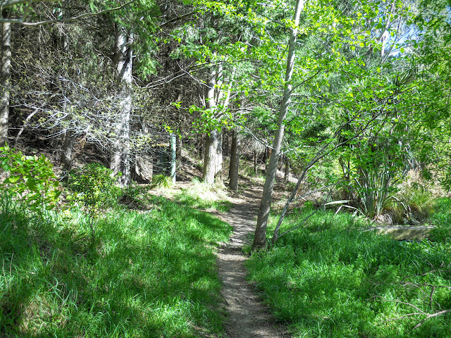 |
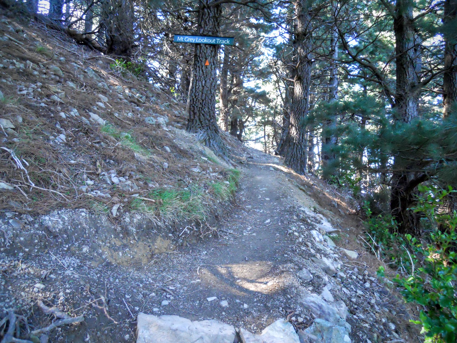
| Start of the Mt Grey Lookout track |
Lake Janet is what an American from the South would call a "holler" or "hollar" i.e "Hi ben livin bout a mile up tu holler hi got a place onu". It's a small depression where rain water has collected. There is a nice looking track which goes around it, posted time is 5 minutes.
 |
| Murky Lake Janet (Janet Holla') |
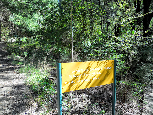
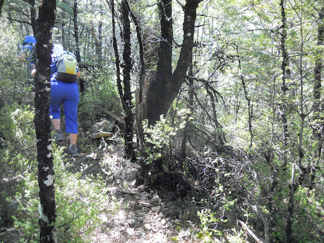
Below is the only track sign you will find at this end of the track, this does not matter as the track is obvious and in good condition. The first hour of the walk is a slow climb through exotic forest to a fire lookout overlooking the forest. The track is a series of switchbacks slowly climbing the flank of the mountain and shaded except for the last 500 meters which are in the open.
 |
| Mt Grey Track: The only track sign at this end of track... |
 |
| Climbing through the exotic forest, Mt Grey Track |
 |
| One of the switchbacks on the Mt Grey lookout track |
Below is the only sign that tells you that you are following the right track, it is about 30 minutes up the track just before you break out of the cover of the pine trees. There are still DOC track markers but they are few and far between.
 |
| Mt Grey Track: track signage and track marker, Mt Grey |
 |
| Switchback track climbing through the pine forest on the Mt Grey Track |
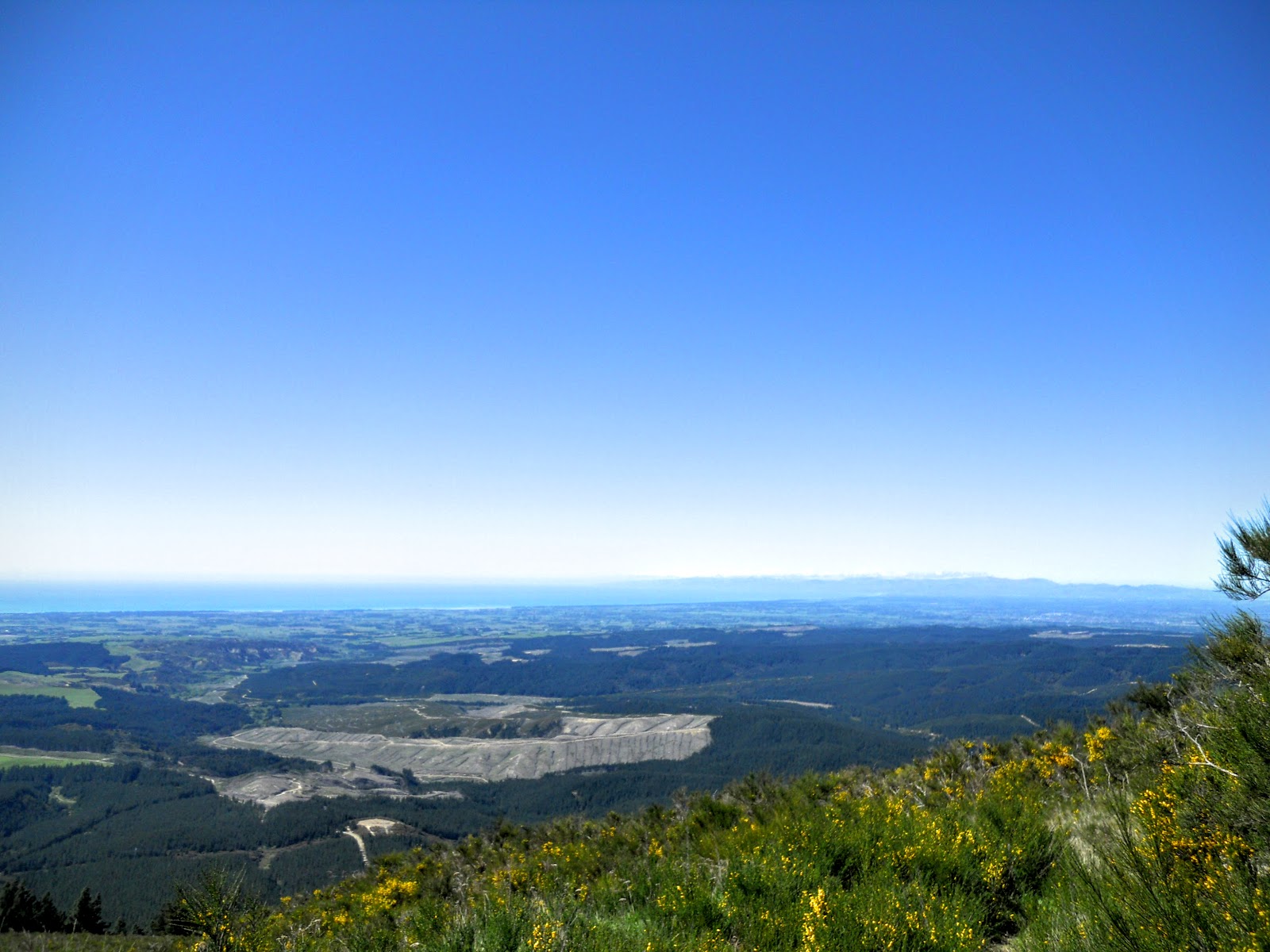
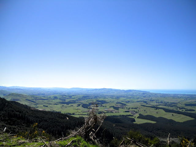
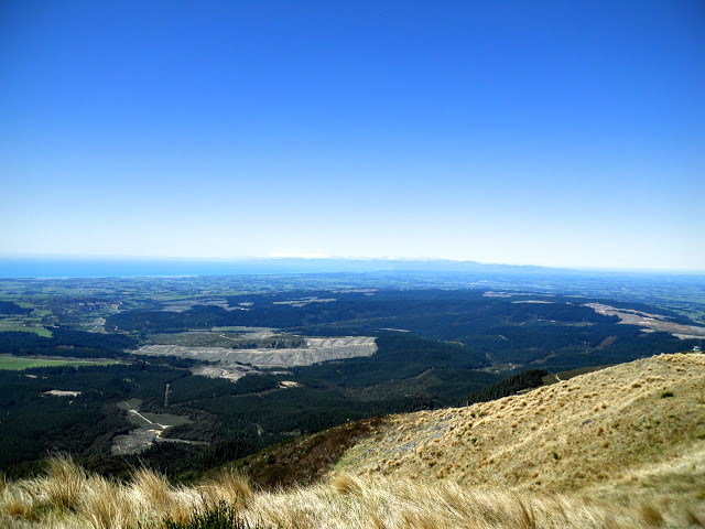
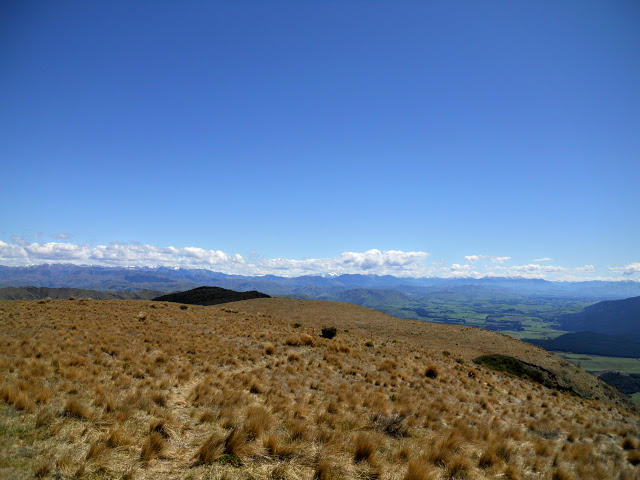
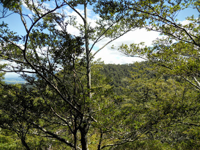
The views get progressively better as you climb; they encompass South Canterbury right out to the Kaikoura Peninsula from the trig point atop Mt Grey.
 |
| Mt Grey Track: view SW towards Oxford |
 |
| Approaching the fire lookout station on Mt Grey, Mt Grey Track |
 |
| Christchurch, Banks Peninsula in the far distance from Mt Grey |
After about an hour you crest a small spur and reach the fire lookout. A fire lookouts are not common in New Zealand, this is probably the only commercial forest in the country that has the right conditions to favour having one.
It is certainly a good vantage point, you can see 60% of the forest from this spot.
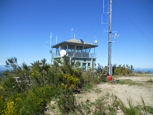 |
| Fire lookout station, Mt Grey |
 |
| View NE towards Motunau Bay, Amberley Beach from Mt Grey Track |
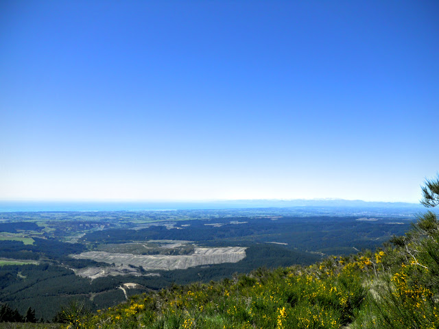 |
| Mt Grey Track: Pegasus Bay from high on Mt Grey |
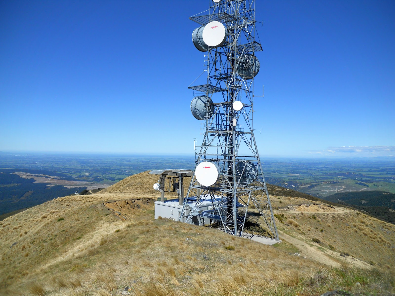
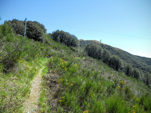
From this point you can either follow the 4 W/D track to the repeater station near the crest or take the more scenic sidle track which rolls along the NE face of Mt Grey.
I got talking to the trip leader of the Amberley Mountain Goats group who were resting by the fire lookout. He recognised me from this blog: this is the third time this has happened in the last 2 months so people are obviously getting some value from my ramblings.
He said that the sidle track was nice and it is..thanks for the info!
 |
| Steps leading to the start of the Mt Grey sidle track |
 |
| On the sidle track to the TV repeater station, Mt Grey Track |
 |
| Mt Grey Track: slightly further along the Mt Grey sidle track |
 |
| Jon on the Mt Grey sidle track |
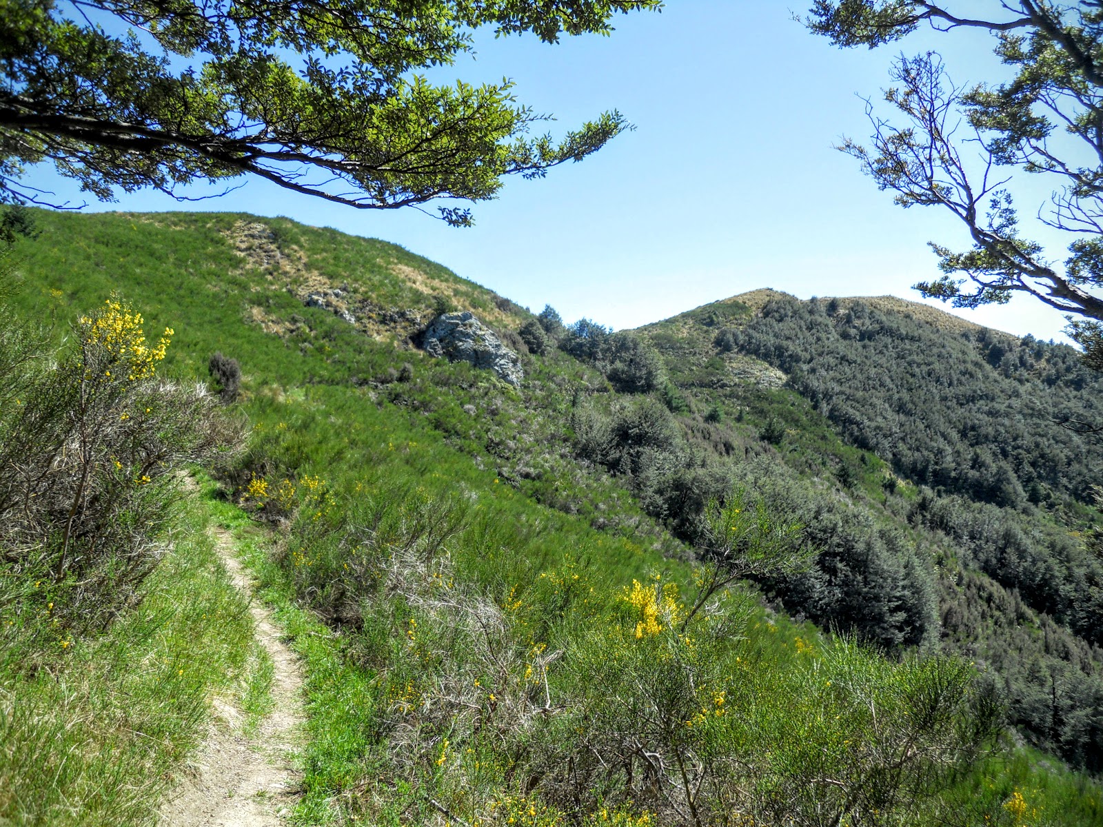
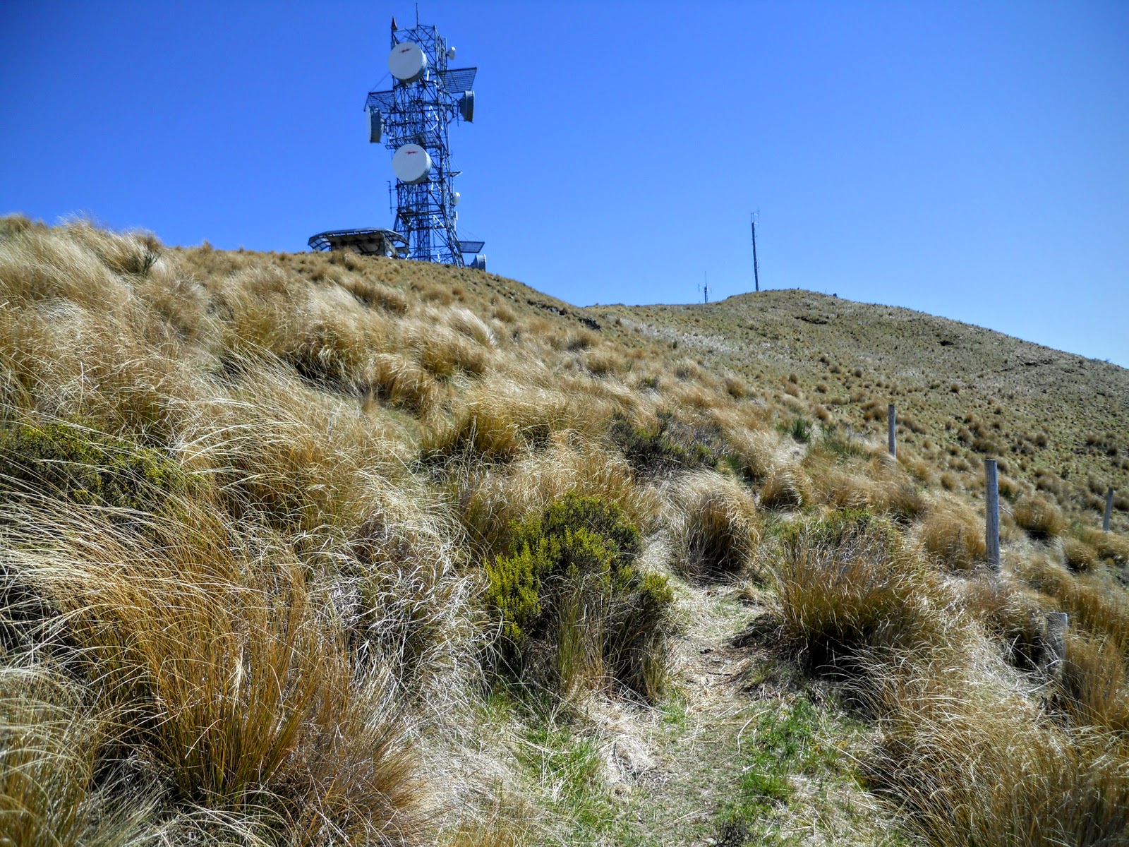
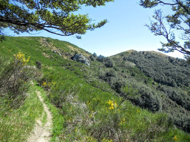
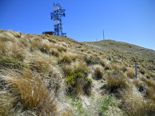
The Sidle track is very nice, it is a mixture of bush track and tussock basin with awesome views out to the North and East. From the fire lookout it is about 30 minutes of gradual climbing to reach the TV/radio repeater station on the secondary high point of the Mt Grey massif.
 |
| Mt Grey Track: on the sidle track: Bush |
 |
| Mt Grey Track: on the sidle track: Tussock |
 |
| Climbing the slope to gain the Mt Grey repeater station, Mt Grey Track |
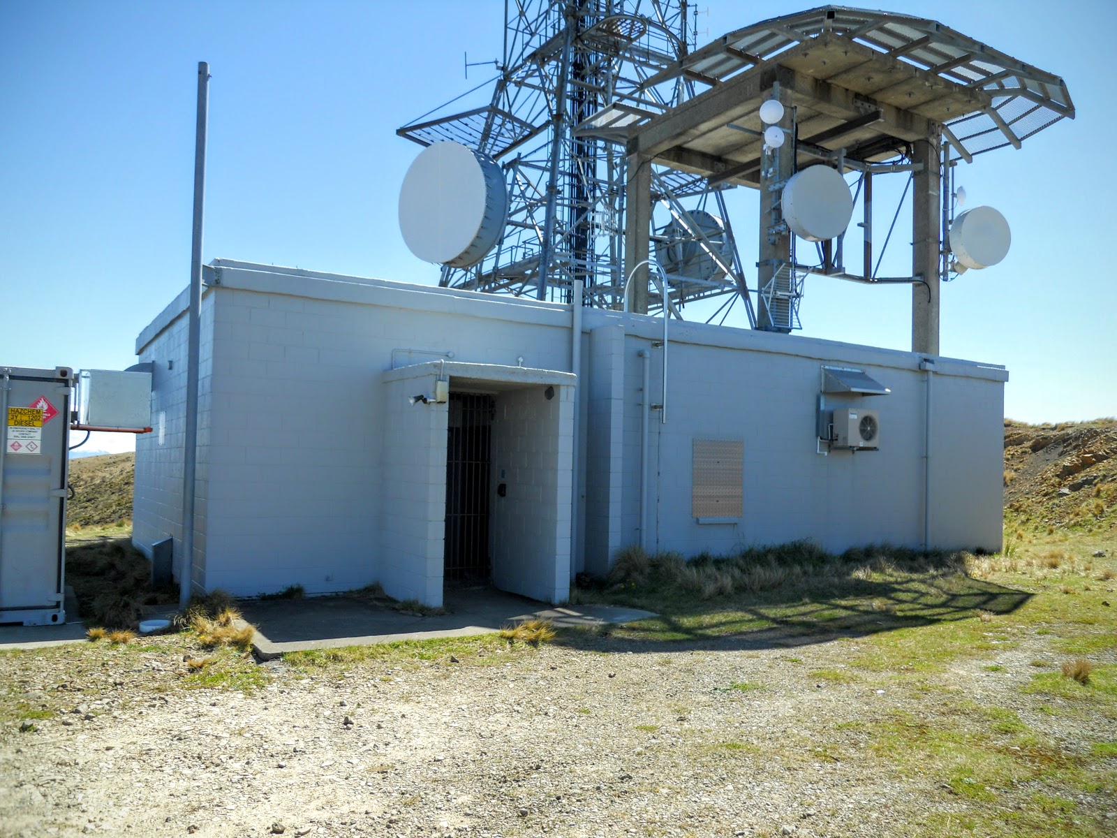
 |
| TV/radio repeater station on Mt Grey massif |
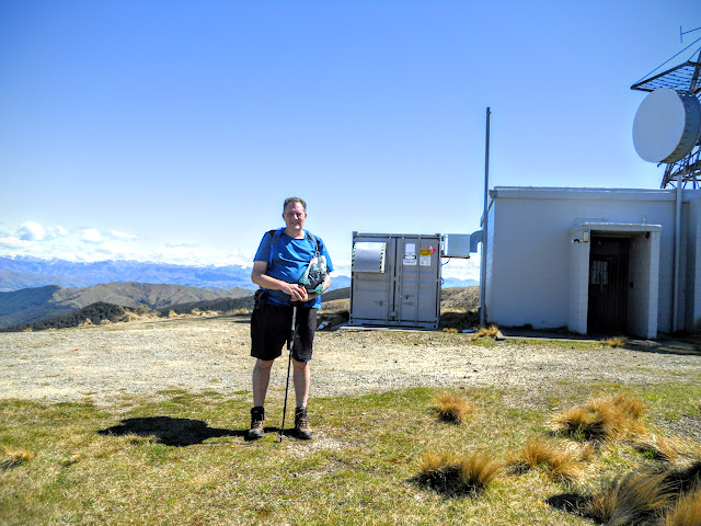 |
| Jon at the Mt Grey repeater station |
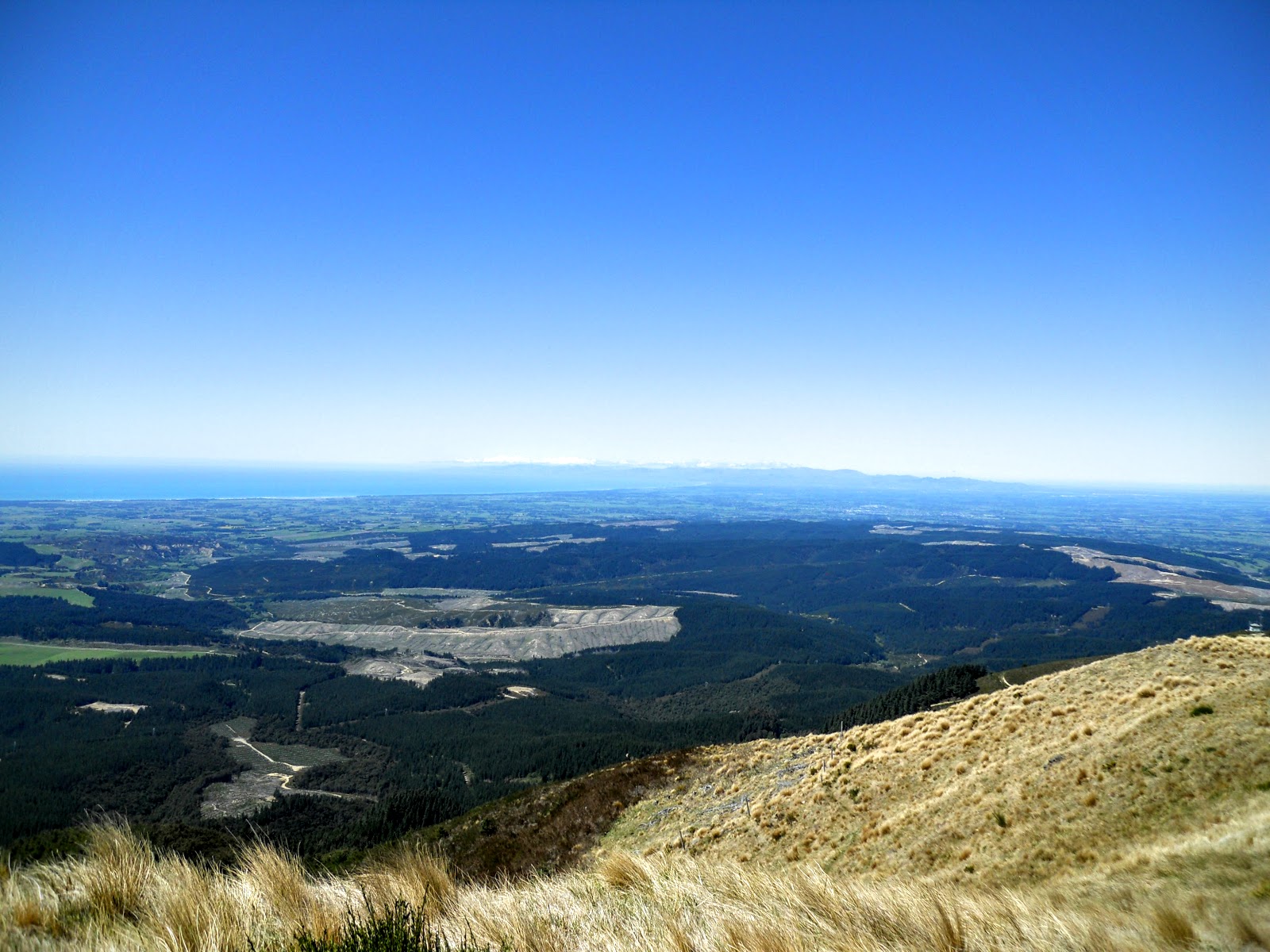
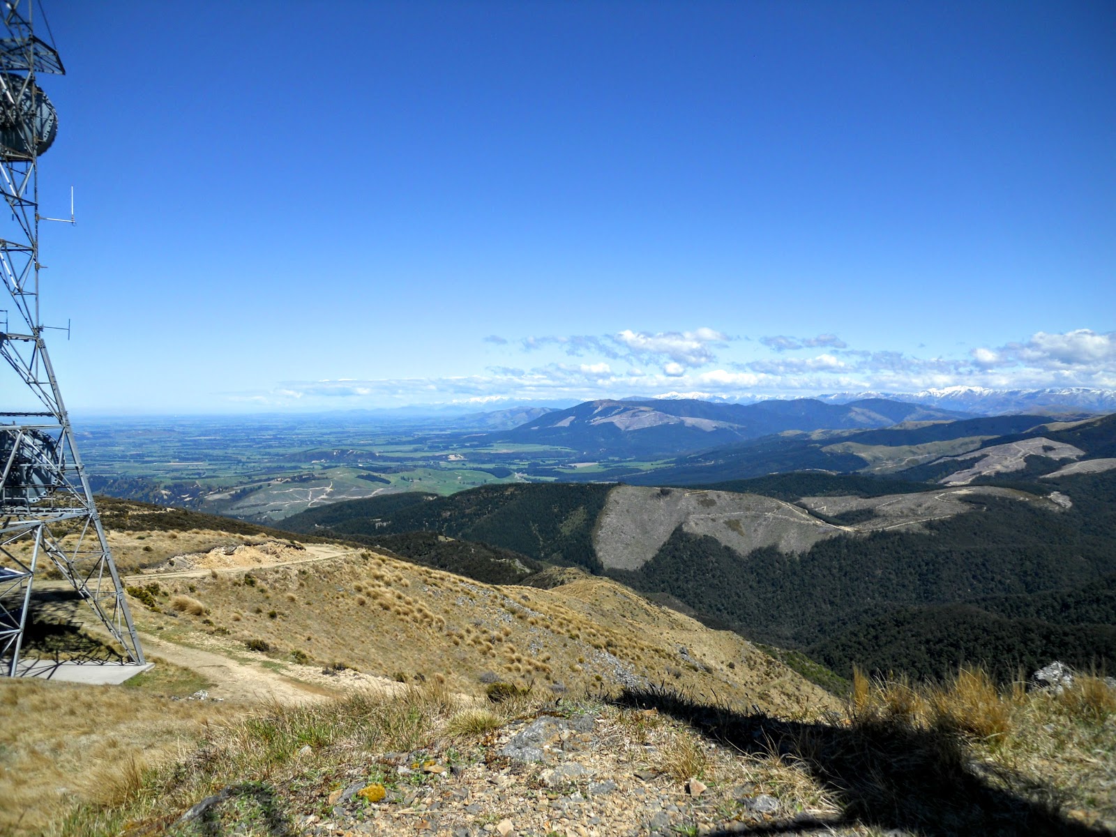
From the repeater station I moved north to pt. 929 about 100 meters along the ridge, there are fantastic views from this point of all of the Canterbury Plains and Hurunui District.
 |
| Mt Grey Massif: View north from pt. 929 |
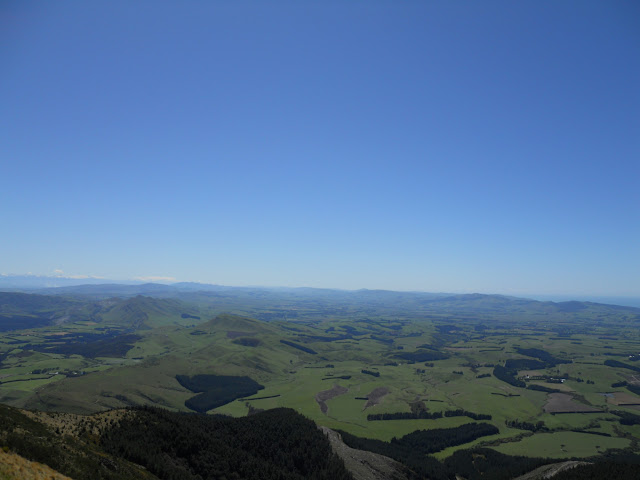 |
| Mt Grey Massif: View North from Pt. 929 |
 |
| Mt Grey Massif: Banks Peninsula from pt. 929 |
 |
| Mt Grey Massif: The repeater station from Pt. 929 |
 |
| Mt Grey Massif: View South towards Oxford etc from pt.929 |
 |
| Panoramic view from Pt. 929, Mt Grey Massif, North Canterbury |
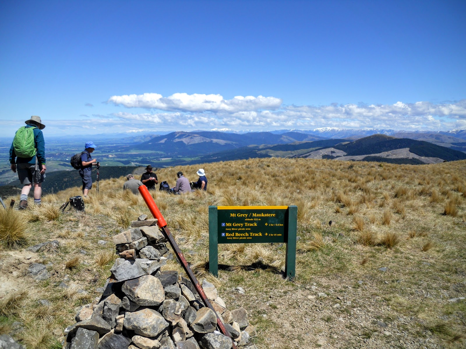
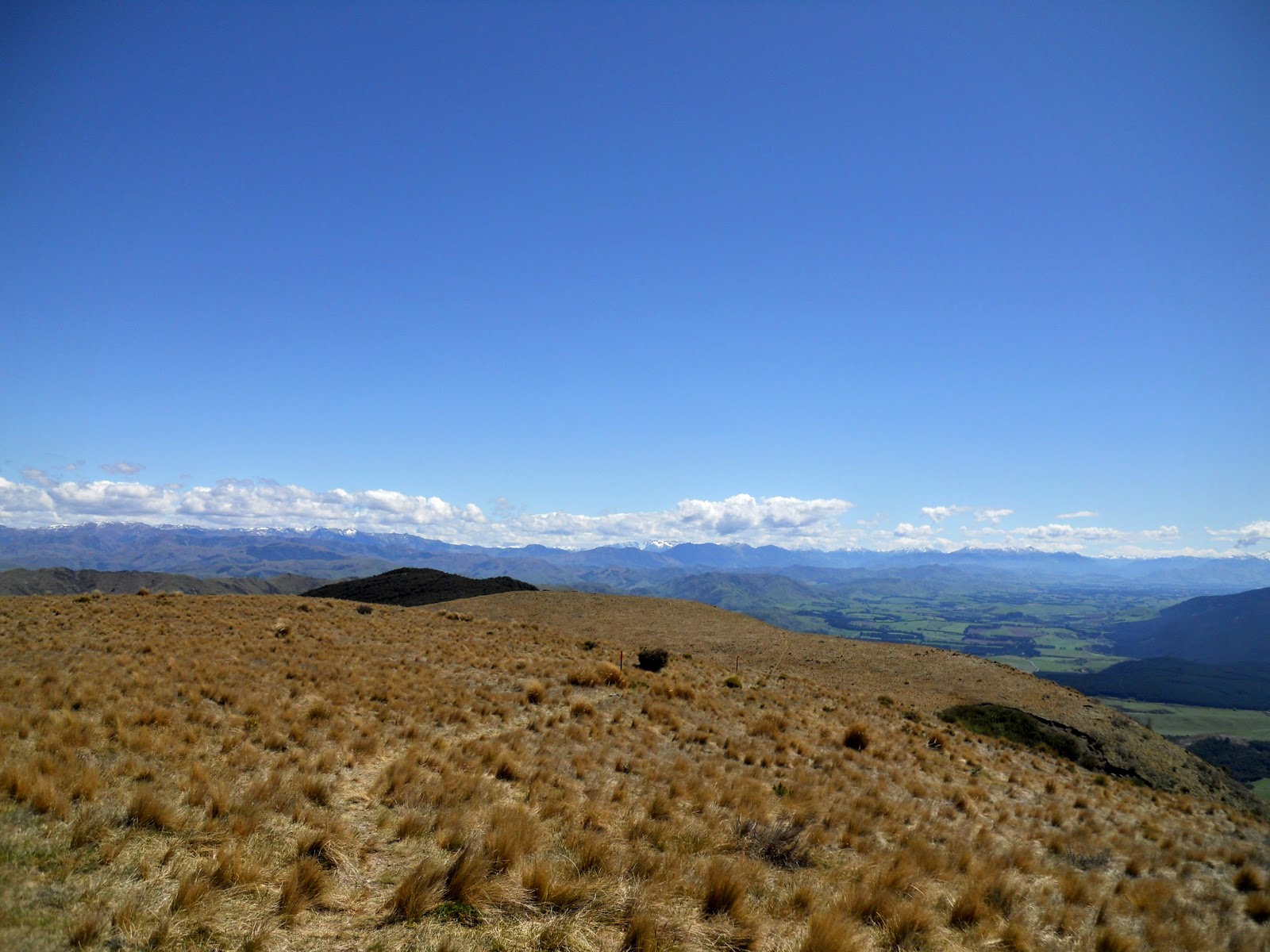
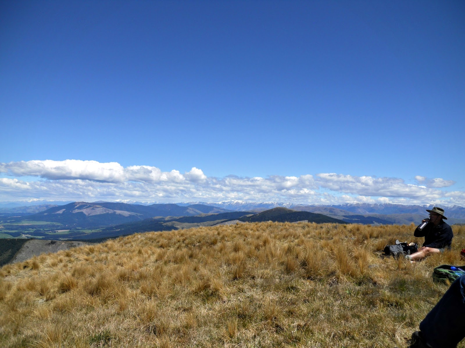
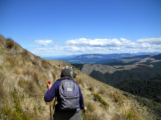
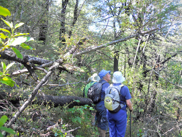
After a stop for a snack and a drink (both of water and scenery) I moved off to the north along the long slowly climbing ridge line that is Mt Grey. The actual crest of the mountain is about 15 minutes to the north and is marked by a large cairn and a trig point. As I climbed to the crest I was accompanied by the members of the tramping group who had caught up to me.
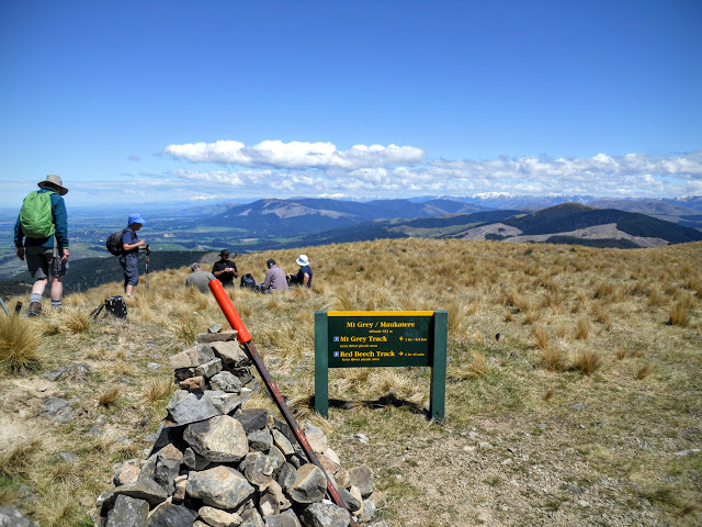 |
| On the summit of Mt Grey with Amberley Mountain Goat Group |
 |
| Red Beech track heading out to NW, Mt Grey Massif |
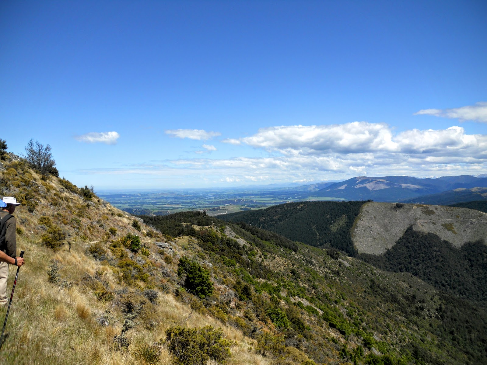
There are true 360 views from the top of Mt Grey, including a good view down into Lees Valley and the area to the north west of Amberley. This is a valley of gently rolling hills usually only visited by those who farm there.
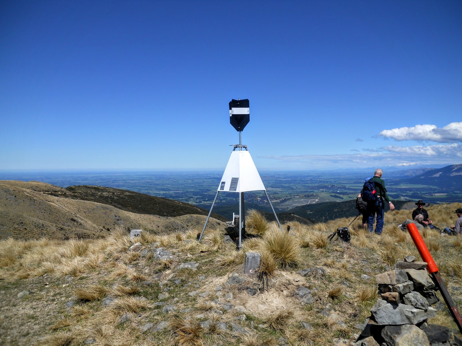
 |
| The trig point on Mt Grey |
 |
| View back down the whole Mt Grey Massif from the trig |
I was invited to sit and eat lunch with the Amberley tramping group which I did. We sat on the warm hillside for about 20 minutes eating and chatting to each other. They seem like a nice group of people, mostly locals and they looked fit as a fiddle.
This is what I envision for myself when i get older, a weekday tramping club going out for interesting day walks. I was offered the opportunity to walk back to the car park with them as part of their group, which I happily accepted.
 |
| Looking out towards Lees Valley from Mt Grey |
 |
| View north towards Hurunui area from Mt Grey |
Originally, I had planned to follow the same track back to the car park, but the Amberley group were going down the Mt Grey Track and using the now defunct Bypass track to get back to Lake Janet. I knew about the Bypass Track but had heard that it was difficult to find so had discounted it as an option.
This was a real treat to bush bash, something I don't get a lot of opportunity to do tramping solo.
Thanks for the offer by the way....
 |
| Descending on the nice Mt Grey Track |
 |
| Alpine vegetation along the Mt Grey Track |
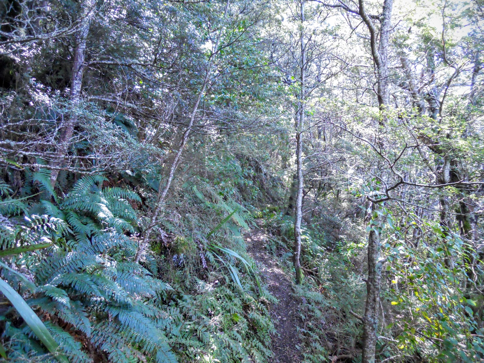
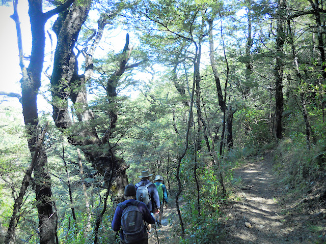
The Mt Grey Track is very nice, a mixture of open tussock basins and beech forest, especially good to be walking DOWN on it rather than up......
 |
| Entering the bush on the Mt Grey Track |
I forgot to take a photo of the Huntaway dog the Amberley group had with them, she was a real charmer and faithfully followed along at the back of the group like any good farm dog should.
 |
| Mt Grey Track: Clemensia Vines growing on track side beech tree |
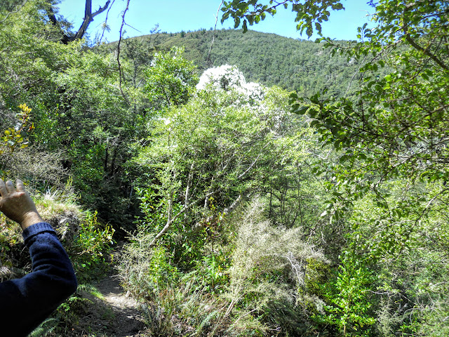
After travelling down the Mt Grey Track for 45 minutes you strike a small flat saddle, the turn off for the Bypass Track is in this area. It is not sign posted as it is no longer maintained or marked. If you didn't know it was an old track you would not see it because it is overgrown.
 |
| Map: Bypass Track from Mt Grey Track to Lookout Track, Mt Grey Massif |
I'm not going to be any more precise because, quite frankly, I don't want anyone using the track on my recommendation and getting lost. People get lost in this forest all the time, notably a local man Ray Cassidy who got separated from his tramping party on the Red Beech Track and has never been found.
 |
| Saddle at the start of the Bypass Track turnoff, Mt Grey |
 |
| Mt Grey: on the overgrown Bypass Track |
 |
| Regroup point on the Bypass Track, Mt Grey |
 |
| Ridge the main Mt Grey Track descends |
While the track is a bit rugged it is still easy to follow and is actually quite nice to walk on for most of the way. I believe that various tramping clubs in the North Canterbury area maintain the track at a basic level so they can do loops to and from Lake Janet. It is a real pity that DOC seem to be stepping back from the area as all of the tracks in this area are very nice.
 |
| One of the better points on the Bypass Track, Mt Grey |
 |
| Mt Grey Track follows this spur to Grey River Campsite |
You can just make out the course of the track on the hillside in the photo below, it is the line running from left to right over the top of the spur. Because the taller trees are removed it leaves a clear gap in the canopy which is visible to the trained eye.
 |
| The spur line the Bypass Track crosses, Mt Grey |
From the end of the Bypass Track it was downhill for 20 minutes along the Mt Grey lookout track back to the car park. Total time for this trip was 4.5-5 hours, 2 hours to reach the top of Mt Grey and about 2-3 hours back to the car park.
 |
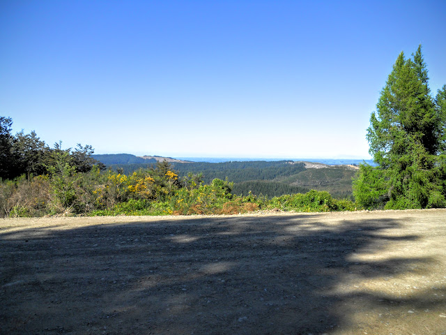
| Last view of Ashley Forest when descending the Mt Grey Lookout Track |
Another fine hill trip in the bag, so to speak, the views from the top of Mt Grey are the most spectacular from any of the Canterbury foothills in my opinion. You should head out to Amberley some day and take a tramp on one of the fine tracks in this forest.
Access: Maukatere/Mt Grey is approximately 72 km's north of Christchurch and can be accessed from Amberley township. From Amberley turn left onto Douglas Road and drive to the intersection with Crampton's Bush Road and follow this to the Lake Janet car-park on the left of the gravel logging road.
Track Times: Lake Janet Track; From the Lake Janet car-park to summit is 1.5-2 hours. It is quicker on the descent...1.5 from the summit of Mt Grey to the car-park. To use Mt Grey Track and Red Beech Track continue past Lake Janet for approximately 2 kilometers to the Mt Grey Campsite.
Miscellaneous:There is a toilet and some picnic tables at Lake Janet. The track is steep, muddy and rough underfoot in some sections. From the fire lookout to the summit is exposed to the weather so carry warm clothing and sun protection. There are alternate tracks up Mt Grey Track, Red Beech Ridge and the 4 W/D road to the summit for MTB riders. Crompton's Bush Road is a gravel forestry road so look for logging trucks and heavy machinery.