Climbing Mt Isobel, Hanmer Springs
Recently I was in Hanmer Springs for a holiday during the school term break. Hanmer is great it has thermal hot pools and a multitude of tracks and walks for those who enjoy the outdoors. Because it is only 2 hours north of Christchurch it is easily accessible and a great spot for a holiday.
 |
| Mt Isobel: Gearing up for the trip |
I took the opportunity to climb the track up Mt Isobel, a 1300 metre peak which looks down over the township.
 |
| Map: Mt Isobel: up Mt Isobel Track, then down Clarence Valley Road |
On the Mt Isobel Track
I started up the
Mt Isobel Track, this is one of the three ways you can access the summit, the others are from the top of Jacks Pass, and a track from the Hydro-Jollies Pass road. I decided to do a circuit, up the track to the summit and then down Clarence Valley Road to the car park, about 10kms in total.
 |
Mt Isobel Track end on Clarence Valley Road
|
Here is the DOC sign at the beginning of the track, it is about 3 odd hours to the summit from this spot.
 |
The start of the Mt Isobel Track
|
Above and below are views from the car park showing the track and parking area, plenty of space for several vehicles at this point.
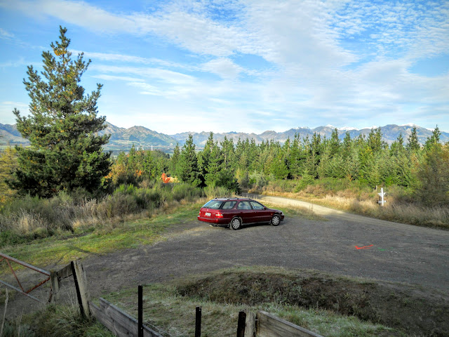 |
| Carpark at start of Mt Isobel Track, Hanmer Forest Park |
 |
| Mt Isobel Track climbing through broom |
The track starts through scrub and then transitions into a mixed Spruce/Pine plantation, the trees here were planted in 1904 so are past there prime.
 |
| Mt Isobel Track: in the exotic forest |
The plantation is very reminiscent of European or Canadian forests, open with plenty of light...there are a few board-walks to ease you over swampy areas.
 |
| Board-walk on the Mt Isobel Track |
The canopy gradually changes to your typical beech forest, the track was muddy but in excellent condition for most of the way to the ridge top.
 |
| Mt Isobel Track, climbing slowly through beech forest |
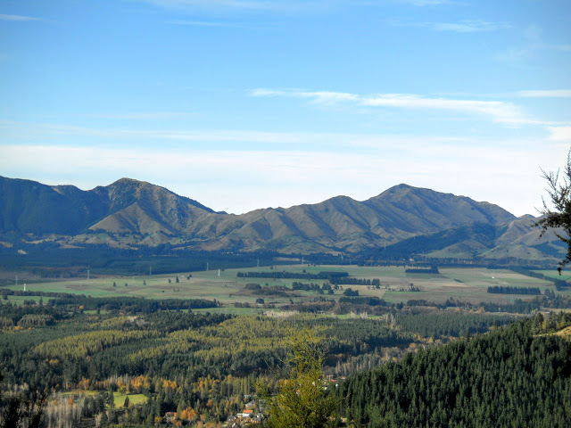 |
| View of the Hanmer area from Mt Isobel Track |
This is the view from my first rest point...because the car park is already 200+ metres higher than the valley the views are expansive. This is the area immediately around Hanmer Springs township, mixed forestry, township and farming.
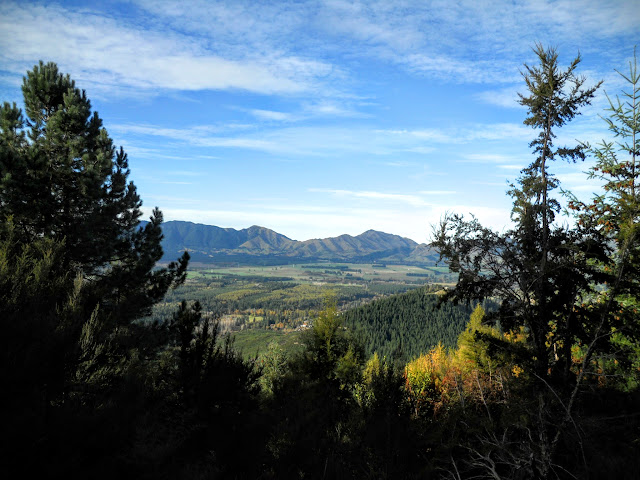 |
| Hanmer once again from the Mt Isobel Track |
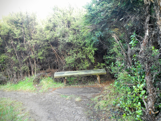 |
| A rest spot on the Mt Isobel Track, Hanmer Springs |
There are a series of rest stops on the lower slopes of the mountain with seats for people to rest on, they are spaced about every 200 metres or so. As you can see the undergrowth is quite thick along the sides of the track.
 |
| Mt Isobel Track: go left to reach Mt Isobel |
After a kilometre there is a fork in the track...the main track continues to the right, the track to the left leads to a small viewpoint on a rocky outcrop. This provides a solitary view through the thick bush.
 |
| The Organ Range along SH7 from the Mt Isobel Track |
Here is a view of Conical Hill from one of the outlooks... Conical Hill is right next to the town and a moderately easy walk of 30 minutes with a great view of the valley. It is one of the 'must do's' while you are staying in Hanmer.
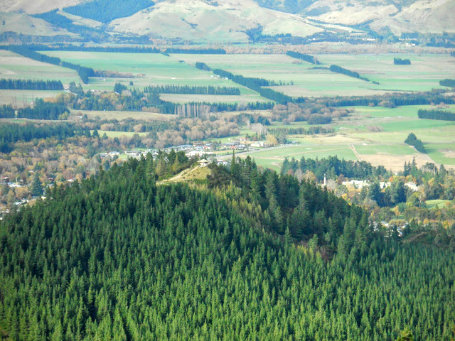 |
| Conical Hill from the Mt Isobel Track |
The four photos below are a panning view of the Hanmer basin from about half way up the track.
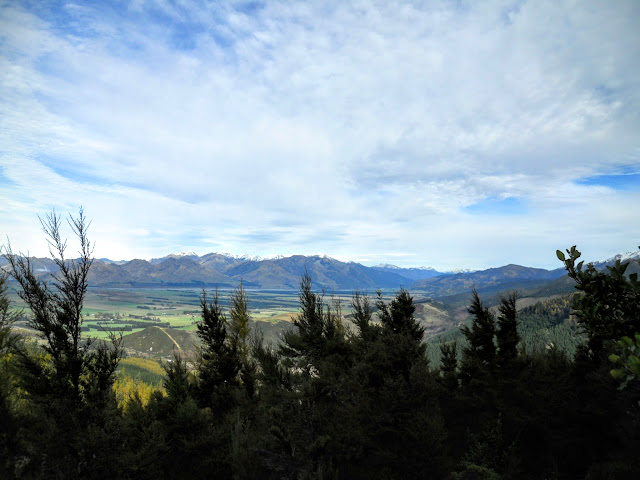 |
| Hanmer Plain: view towards Hope Valley to west |
 |
| Hanmer Plain: Hanmer Township and the Amuri Range |
 |
| Hanmer Plain: view east towards the coast and Amuri Range |
We had a bit of snow early in the week (as you will see later), it fell to 1000 metres so all of the hills surrounding the town had a frosting of snow on their upper levels.
 |
| Snow on surrounding mountains from the Mt Isobel Track |
As you ascend the canopy becomes almost alpine in nature, it reminds me of some of the alpine basins in the higher mountain regions of Arthur's and Lewis Pass.
 |
| Climbing the flank of Mt Isobel |
 |
| Board-walks and single track on Mt Isobel Track |
A classic (2014) selfie of Jon from the same location, selfies are the craze of the year!
 |
| Jon on the Mt Isobel Track, Hanmer Forest Park |
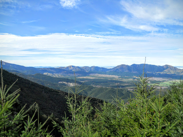 |
| Hanmer Forest looking towards east from Mt Isobel |
This is the last of the forest on the track, above this point is a classic alpine herb basin, this extends right to the crest of the ridge. The track to the right takes you back down the hill to the
Waterfall track and a 41 metre waterfall.
(This track is now permanently closed due to damage from the 2016 Waiau/Kaikoura Earthquake, 2019).
 |
| Mt Isobel - Waterfall Track Junction |
Note the classic alpine vegetation, this would be at 900-1000 metres ASL. The track zig-zag's up the slope from this point until it reaches a track junction at the top of the ridge.
 |
| Moving into the sub alpine zone on Mt Isobel |
 |
| Pt 1195 from the Mt Isobel Track |
 |
| Summit of Mt Isobel from the track |
There were still patches of snow this low down even after two fine and sunny days.
 |
| Mt Isobel: residual snow |
Eventually you reach the top of the track; as you can see people will walk 4 km's up hill to put graffiti on something. Idiots! To the left is the track down to Jacks Pass, to the right Mt Isobel.
 |
| Mt Isobel: on the saddle next to Pt.1195 |
Below are some shots from the top of the track looking south to Hanmer and Kaikoura and North to the Clarence Valley.
 |
| Mt Isobel: to south, Hanmer plains, note township |
 |
| Mt Isobel: to east, the coast is about 100kms away |
 |
| Mt Isobel: to north, Clarence River Valley |
" I turned around and headed back down.."
Ha ha ha.....climbers joke!!!
The trig station on the Mt Isobel summit is on the centre of the hill to the centre right below. I walked about a kilometre in this direction and then had to stop and come back. There was about 10-12 cm's of icy snow on top of snow grass and tussock. As it was so deep and I didn't have any crampons I decided it was not safe to continue.
I have been to the summit back in the 90's as part of an Army exercise so I didn't feel the need to take chances. It would be about 1.5 km's from the track junction to the trig, about 30 minutes walking in good conditions.
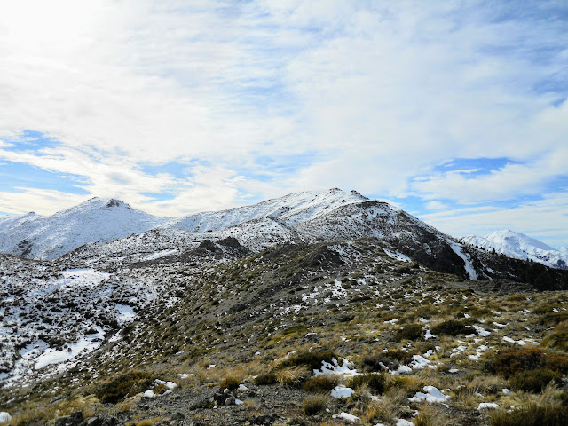 |
| Looking towards Mt Isobel summit: too much snow! |
Here are some views of the Hanmer basin from around the highest point I reached on the track, there is little snow here but down on the track it was quite deep.
 |
| You can just see the east coast from Mt Isobel |
 |
| Waiau River, Amuri and Organ Range from Mt Isobel |
 |
| Hanmer township from Mt Isobel |
 |
| Spencer Mountains from Mt Isobel |
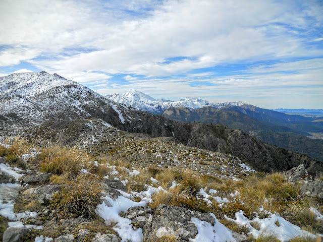 |
| Mt Percival from the Mt Isobel summit track |
As you start to descend the Jacks Pass track there is a short but very steep dirt/scree slope, take care here as I saw a chap ahead of me fall and slide down this slope. It was not a pretty sight.
Luckily he was wearing pants so no rock burn.
 |
| Rock slide on Clarence side of Mt Isobel |
The track follows the crest of this ridge right down to the road, watch out in misty/windy conditions as there are several points where there are bluffs/ rock faces you could stumble over.
 |
| Following ridge down to Clarence Valley Road |
 |
| Mt Isobel: Pt 1195, from closer to Clarence Valley Rd |
 |
| Mt Isobel: Lots of snow on the St James Range |
Here are a couple of shots of
Spaniard bushes (aka: bayonet grass, speargrass, bastard bush etc. it has many names, none of them complimentary). You only get them in tussock sub alpine areas above 900 meters asl, they are bloody sharp so you don't want to fall onto one. There are many varieties the most common in the South Island is Golden Speargrass,
Aciphylla Aurea.
I walked into one near Lewis Pass once...it actually stabbed me in the ankle through my leather boot and drew blood!
 |
| The barbs atop a Speargrass plant...damn sharp!!! |
 |
| Golden Speargrass, Aciphylla Aurea |
Two views from different points as I descended the track, the scree slope is in the centre-left in the first of the photos.
 |
| Mt Isobel: Pt 1195 from my lunch spot |
 |
| Mt Isobel, about a kilometre from the road |
I stopped near the point above and walked off the track to have some lunch, it was a great sunny place for a rest. Here is my lunch, crackers/tuna/raisins and water.....yum!
I usually have tuna or pate with crackers for my lunch, I've found some small cans of French pate that weigh less than 80gms, ideal for tramping.These are nice tuna slices in olive oil....bloody marvellous vittels!
 |
| Tuna and crackers for tramping lunch |
Great view from my lunch stop!
 |
| Mt Isobel with view of St James Range at lunch |
The track continues down the ridge line for another 500 metres and then turns to the left towards the road in the centre of the photo. The
Rainbow Road (Clarence -Hydro Road) continues right through to St Arnaud in the Nelson Lakes area, the middle part is closed from May-September as they get some prodigious falls of snow in these back valleys over winter.
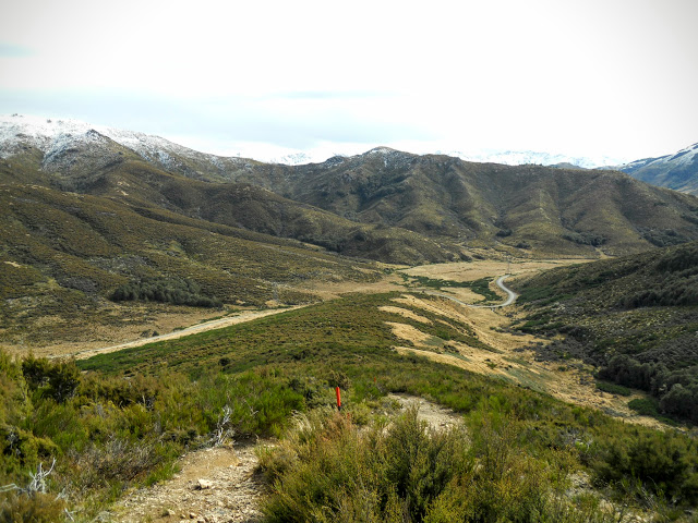 |
| The Hanmer-Clarence Valley Road |
Here is the DOC sign at the Jacks Pass end of the track, this would be the closest access point to Mt Isobel but it would be a bit of a slog up the ridge line to the high point. Short and steep or long and steady, the choice is yours really.
 |
| Mt Isobel-Clarence Valley Rd track end |
View back up the track from the road/track end.
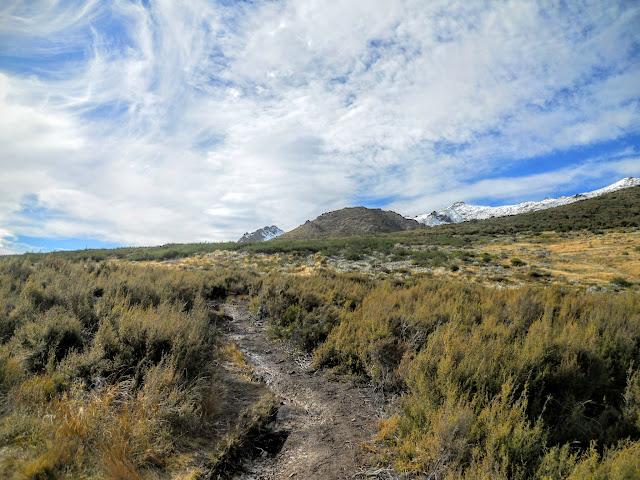 |
| View up the spur to Mt Isobel |
There is a massive amount of parking space next to the track, a lot of people come up to this point and run/mountain bike down to the town. It is a straight road slog from this point onwards.
 |
| Car park at the Clarence Valley-Mt Isobel track end |
The road descends from this point right down to Hanmer township itself, it would be 4-5 km's from this point to where I parked my car. The road is only closed at the bottom if the conditions are extremely bad up near Jacks Pass. Otherwise you are able to access this road through out the year.
 |
| Walking down the Clarence Valley Road to my car |
This was a very pleasant wee tramp, the hardest bit is the slog up to the ridge top track, it is easy after that point. I have now walked all three access tracks to Mt Isobel, but would be keen to try a traverse from Jollies Pass to Jacks Pass the next time I am in Hanmer.
This trip took me about 5 hours total, by comparison they run a mountain running challenge along the same track I followed, the best time in 2013: 47 minutes!
Access: From Hanmer Springs head west out of town on Jacks Pass Road, turn on to Clarence Valley road just past the golf course. The tMt Isobel Track starts about 1.5 km's up this road on the right.
Track Times: Mt Isobel track, 3 odd hours to summit of Mt Isobel, 1.5 hours return to track end on Jacks Pass, 45 minutes to bottom car park.
Miscellaneous: Some fall & rock fall danger. Please exercise caution if walking the track in winter as it is very exposed. Take appropriate gear as required as this is an alpine area.


