One of the main tourist highlights in Punakaiki are the famous Pancake Rocks on the coast at Dolomite Point. The Rocks look like...well a big stack of pancakes! They are ancient seabed which has been thrust up along the coast near here as the Australian Plate crashes into the Pacific Plate and forces up mountains, ridges and hills.
Karen and I arrived at Punakaiki around 3 pm after travelling over to the West Coast via Arthur's Pass & Greymouth. We decided to head down to the Pancake Rocks later in the afternoon as the sun was getting ready to set. It was uncertain weather over the next couple of days so we decided to jump in just in case it was miserable.
The Pancake Rocks Track is located on Dolomite Point opposite the DOC centre on SH 6 about a kilometer south of Punakaiki settlement. It is clearly marked and obvious as it starts right from the highway and there is a ton of parking here.
We saw very few people on this trip...partially as there are few tourists in New Zealand at the moment. The other reason was a closure of SH6 just north of Punakaiki which meant the settlement was cut off from Westport. There was a large slip which took several days to clear so there was hardly any through traffic the whole time we were at Punakaiki.
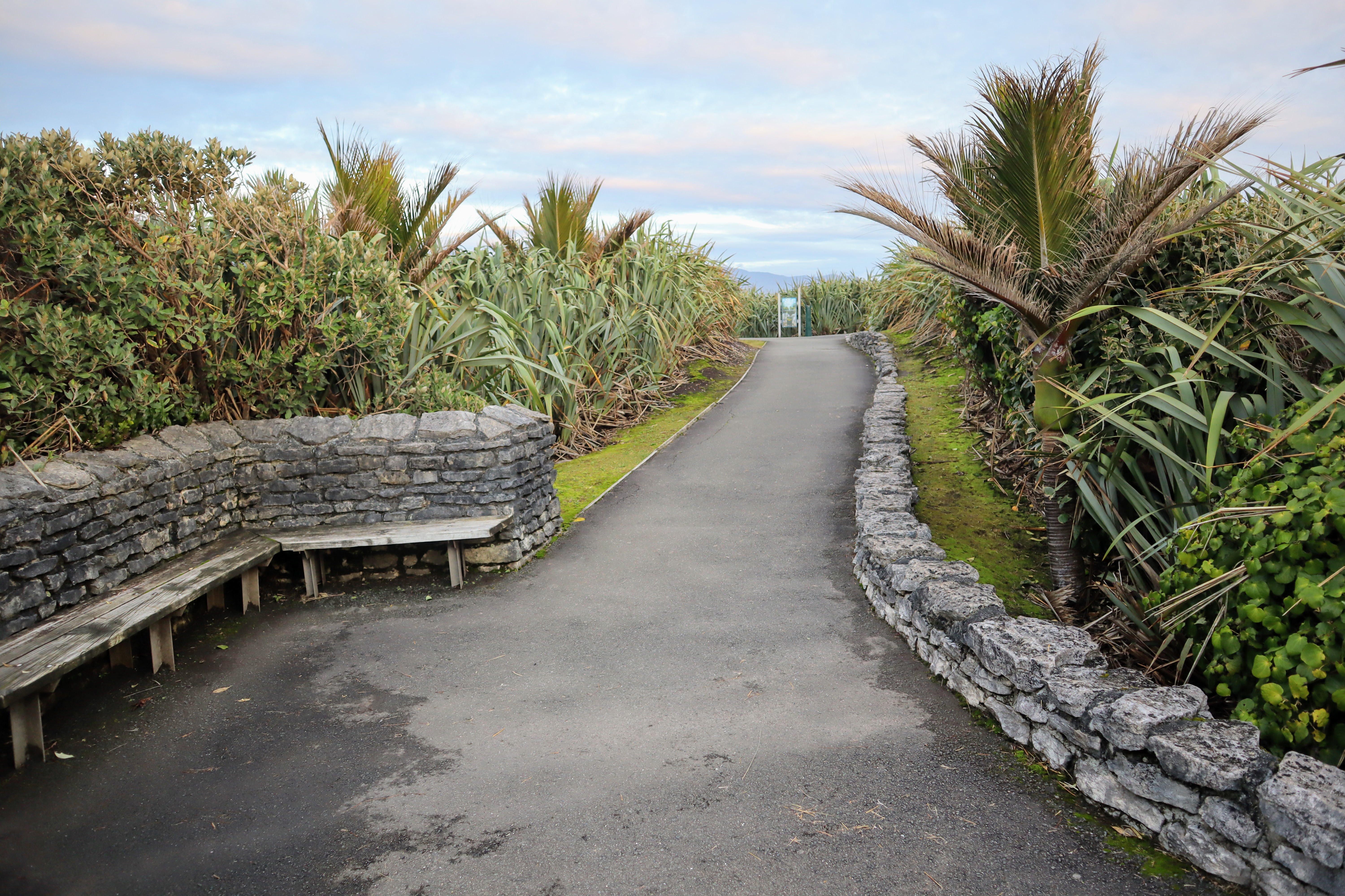
The track is hard seal along its length and easy to walk but be aware there are some stairs at the furthest point of the headland so it is not wheelchair friendly right along its path.
We got to the track as dusk was coming on around 4.30 p.m...because the sun is setting over the western horizon it was still relatively light. The setting sun cast a beautiful orange-gold light over everything but by the time we walked off the track about 40 minutes later it was really getting dark.
 |
| View south from the Pancake Rocks Track |
One of the features of the area are the Nikau Palm trees...yes they are an actual palm tree...only found on the upper West Coast of the South Island, Golden Bay and select places on Banks Peninsula. They really define the forests around Punakaiki as they are growing in profusion. There are whole groves of them at Truman's Track and up the Punakaiki & Pororari Rivers.
 |
| Kernel's on a Nikau Palm on the Pancake Rocks Track |
 |
| Nikau Palms jut out of the Harakeke |
There are actually some lights along this track so you can come down here in the dark if you want too. I would bring a torch as the parts of the track through the forest were really dark after the sun set. You should also bring warm clothing as the wind rips right over Dolomite Point so it can sometimes be very cold.
 |
| The rocks contain ancient layered sediments |
 |
| The narrow cove next to Putai blowhole in Punakaiki |
They need a hard track surface as so many people visit the location (over 250 000 in 2019) so a gravel track would soon degrade. They have done a lot of work since the mid 1990's...back then the track was a bit rough and ready but tourist numbers have surged in the intervening years so the track gets a lot of attention from DOC.
 |
| Information panels on the way to the Surge Pool, Pancake Rocks Track |
 |
| Life preserver at Pancake Rocks Track |
There is a large surge pool at the edge of Dolomite Point. The ocean has gradually undermined an area of soft rock making it collapse in on itself. Harder rock forms an archway over the ocean end of the pool with just enough space for the waves to come in and crash against the inner cliffs.
 |
| Surge Pool at Pancake Rocks Track |
 |
| Sun setting at Pancake Rocks Track |
 |
| Iceberg succulent next to the Pancake Rocks Track |
The strip of coastal forest between the headland and SH 6 is really dense and full of the typical species of trees and bushes you would find near the coast. I'm not sure if this is old growth or replanting...there are some really big Nikau Palms but everything else looks immature.
 |
| Pancake Rocks are backed by massive limestone cliffs |
The sea washes against and ultimately under-mines the coastal cliffs which collapse to form the coves and tidal surge pools on Dolomite Point. High pressure water also invades cracks in the rock and eventually erode large holes which become blowholes. As the waves crash into the bottom it forces jets of water spray out of them. The Chimney Pot is a good example of the blowholes you will see at the Pancake Rocks.
 |
| At the Chimney Pot blowhole...Pancake Rocks Track |
The character of the layering is really obvious in particular places and you can see how it is made up of layers of sediments laid down on some ancient seabed. Erosion gradually washes away at the rock from rainwater and the sea and breaks the solid mass of limestone down into rock spires, caves, arches and small coves.
 |
| Good example of rock layering at Pancake Rocks |
 |
| Mt Ryall (1220) is visible from Dolomite Point |
There are several blowholes at Dolomite Point but the only named ones are the Chimney Pot and Putai. The ocean was relatively calm the days we visited so they were not working but during a big storm they are absolutely spectacular.
 |
| Putai blowhole on the Pancake Rocks Track |
 |
| The rocks slowly break down at Pancake Rocks |
There are several seating areas along the track with a big seating area on the edge of Dolomite Point. This is right next to Putai and there are a number of informative panels here interpreting the features you can see.
 |
| Cliffs backing the Punakaiki coast from Dolomite Point |
 |
| Razorback Point marks the Punakaiki River mouth |
On clearer days it is possible to see right inland to the Paparoa Range rising about 5 kilometers inland. Some of the mountains run to 1300+ meters a.s.l and the highest visible mountain is Mt Ryall just to the south of Punakaiki.
If you are walking the Paparoa Great Walk the coast around Punakaiki is clearly visible. Even though it was cloudy and raining when I walked the track I did see fleeting glimpses of Dolomite Point from the Escarpment.
 |
| Transition from coast to mountain from Dolomite Point |
 |
| Ghostly figures of myself and Karen |
The Pancake Rocks are on the southern side of the reserve...they look out onto the Tasman Sea and south down the coast to the mouth of the Punakaiki River, southern Paparoa Range and all the way down the coast to the bottom of the South Island.
If you have a clear day you can clearly see Mt Aoraki/Cook, Mt Tasman and Mt Haast shining about +200 km's away. We managed to see them the next day when we visited in clear conditions.
 |
| Pancake Rocks aglow in the setting sun |
 |
| Information about the erosion cycle at Pancake Rocks |
The sun was beautiful setting over the western horizon...it cast a lovely golden glow to the horizon.
 |
| View out to the Tasman sea from Pancake Rocks |
 |
| Rocks slowly crumble off the front of Pancake Rocks |
To the north you can see several headlands which jut out into the Tasman Sea including Cape Foulwind 50 odd kilometers to the north. This is a remote rugged coastline...transport must have been atrocious before the road was built. The Inland Pack Track was one way to avoid the coast...it loops from near the Punakaiki River inland and comes out near the Fox River 30 kilometers to the north.
 |
| View north up the coast towards Westport |
 |
| Hugh cliffs tower over SH6 at Punakaiki |
There is a massive archway at the edge of Dolomite Point which separates the Surge Pool from the ocean. The track goes right over the top of this arch so you get views of the Pool from three sides.
 |
| On the archway at the Pancake Rocks |
 |
| Looking down to the Surge Pool, Pancake Rocks |
There are a number of rock spires surrounded by the sea just off Dolomite Point. They are the remnants of long gone cliffs and will eventually succumb to the wind, sea and wind and tumble into the water. All of this coastline is slowly eroding so sometime many millennia from now the sea will have worn all of the Pancake Rocks down.
 |
| The sun dips over the western horizon...Pancake Rocks |
 |
| Hardy vegetation clings to the Pancake Rocks |
The sun set over the western horizon as we were on the archway and once the golden light dimmed it start to get dark quite rapidly. We had beautiful sunsets every night we were in Punakaiki and Karen and I went down to the beach on Saturday and Sunday evening to see the sun set.
 |
| Rock spires just off Dolomite Point |
There is a awesome set of stairs out on the archway...they have been carved out of the rock. Layers of sediments have been artfully chiseled away for steps making for a great photo opportunity.
 |
| Karen uses the carved stairs at Pancake Rocks |
 |
| Steps carved out of the rock which surrounds them |
You can get a really good look at how this rock is layered...it is basically coarse sand compacted under the weight of the layers above it.
 |
| Rock spires to the north of Dolomite Point |
This whole area is ancient seabed which has been forced up by the collision of the Pacific and Australian Plates. Because it is mostly limestone it has been easily eroded by sea, rain and wind action into the huge bluffs, coves, rock formations, caves and deep incised river valleys that characterize the area now.
 |
| View towards Pororari River mouth from Dolomite Point |
There is a good information panel about 3/4 of the way around the track which explains how coastal uplift and river erosion has shaped this coastline.
 |
| Panel describing how the cliffs rose from the sea |
The rock slab suspended over the two chonks of rock below is the size of a Toyota Hiace van. The sheer scale of the terrain at Punakaiki sometimes over powers you and certainly makes you feel small.
 |
| ...the suspended boulder is the size of a mini van... |
The Pancakes Rock Track is a loop so once you go out to the edge of Dolomite Point it basically turns back inland to the start point off SH6.
 |
| Heading back towards the entrance at Pancake Rocks |
 |
| Nikau Palms are abundant at the Pancake Rocks |
The forest at the back of the Pancake Rocks is super dense and a perfect example of lowland and coastal forest. While the track through it is not long it is wonderful to see all of the various types of trees and bushes you get on the Coast especially those funky Nikau Palms. DOC have done a magnificent job of providing access while still preserving a natural looking forest here...well done
 |
| On the Pancake Rocks Track heading for the exit |
 |
| Lenticular clouds over the Paparoa Range |
The last couple of hundred meters are back through the Lowland forest backing the shoreline here. It was quite dark by the time we headed past here and a torch would have been useful...
 |
| Bridge over a ravine...Pancake Rocks Track |
 |
| Dense Lowland forest at edge of Pancake Rocks Reserve |
 |
| Back at the start of the Pancake Rocks Track |
The track will eventually deposit you back onto the Highway and from here you can head over the road to check out the DOC Visitor Centre or Punakaiki Crafts. The Pancake Rocks Cafe was closed due to the road closure but we visited it the next day for a coffee and cake slice.
 |
| Pancake Walks Track starts from SH6 |
 |
| Silhouette of Nikau Palms at Punakaiki |
It was getting really dark as we walked off the track...the minimal lights along the route had come on but you really need a torch when walking through the forest section as it is very dark there.
On the Sunday afternoon we went back down to Pancake Rocks to have a walk around them during the day. It is strikingly different visiting when the sun is shining and the sky is free of clouds.
 |
| Rock spires at Pancake Rocks on a sunny day |
You could see much further up and down the coastline...the snow covered tops of the Mt Cook-Mt Tasman area stand out shining to the far south. You can also see many of the other high mountains of the Southern Alps down around Fox Glacier.
 |
| ...we could see Aoraki/Mt Cook in the far distance |
 |
| Curious rock shapes at Dolomite Point |
The contrast between the different times of the day makes multiple visits worthwhile....on dusk you have the sun setting over the Tasman Sea which gives the coastline a lovely golden-orange hue. During the day you have better views along the Coast and it is easier to see fine detail in the rock formations.
 |
| Ancient sedimentary layers make up the Pancake Rocks |
Visiting during the day draws out the the deep blue color of the sea and its contrast with the verdant green of the forest which covers the coastal range of hills. You can certainly see the layering of the rocks much better...they are multi hued....tan, orange, grey, white and black.
 |
| Bay leading out to the Tasman Sea, Pancake Rocks |
It would have been a wonderful day to be up on the Paparoa Track on Sunday. The view from the Escarpment out to the sea would have been awesome!!!
 |
| Looking south over the Pancake Rocks |
I wouldn't want to fall into the Tidal Surge Pool...it looked like a agitated washing machine in there...sure to dead you in short order. The track is well fenced but I would still keep an eye on small children as there are places they can squeeze around fences.
 |
| Surge Pool on a calmer day...Pancake Rocks |
It was a much calmer day and while the ocean around here is never perfectly flat it was certainly noticeable. Punakaiki could be see shinning in the afternoon light off to the north of Dolomite Point...you could see the limestone cliffs, the village and the mouth of the Pororari River clearly.
 |
This cliff is retreating inland...Punakaiki | | The limestone bluffs are 100-400 meters high at Punakaiki |
|
 |
| ...the spectre of 'Evil Jon' approaches... |
Karen and I had a great weekend at Punakaiki...everything about the trip was good...great company, beautiful weather, nice accommodation, bugger all people about! If you have ever wanted to visit the West Coast and Punakaiki in particular...just do it...you will not regret a trip south.
Access: The start of the Pancake Rocks Track is directly opposite the Paparoa DOC office on SH 6 just before Punakaiki. It is well sign posted and obvious.
Track Times: From the start of the track it takes approximately 30-40 minutes (about 1 kilometer) to complete the circuit...the track can be walked in either direction.
Miscellaneous: There are several large car parks here as the site receives over 1 million visitors a year. DO NOT leave valuables in sight as this car-park is targeted by thieves. The track is sealed along its length but there is a section of steep stairs half way around. There are toilets, a café, gift shop and the local DOC office near the entrance to the track.
YouTube: Pancake Rocks Track