An overnight trip to Woolshed Creek Hut
I went for an overnight trip to Woolshed Creek a couple of weeks ago. Woolshed Creek is about 130 km's south west of Christchurch and inland from Ashburton and it takes about 1.5 hours to drive there. Once at Mt Somers you take the Ashburton Gorge Road towards Hakatere for 10 kilometers and then turn down Jig Road the sign posted turn off to Woolshed Creek.
 |
| Junction of Ashburton Lakes Road and Jig Road |
At the carpark there are some grass areas where you could have a picnic and regenerating beech forest to sit under and walk through. The river is about 10 meters away from where you park. There are toilets you can use and a water source although the water must be boiled or treated before use.
Note: the car-park is not a camp site so over night camping is not allowed although as it is DOC land you can camp 200 meters away from any track if you can find a suitable location.
 |
| At the start of the Miners Track to Woolshed Creek |
Woolshed Creek runs around the south west side of Mt Somers and the start of the track to the hut is through the Alford Forest.
 |
| View of Alford Forest from near Blackburn Mine |
You climb up past some old mine workings and descend down into the lovely basin the Woolshed Creek Hut sits in. Mt Somers is actually a part of the much larger Hakatere Conservation Park.
 |
| Woolshed Creek Hut rests in a lovely basin |
 |
| A view of the rear of Woolshed Creek Hut, Mt Somers |
 |
| Leaving Woolshed Creek Hut the next morning |
If you are looking for a new place to visit or searching for new tramping locations then put a trip to Woolshed Creek and the Mt Somers area at the top of your list.
Woolshed Creek Carpark to Woolshed Creek Hut: 5.1 km's or 2.5-3.5 hours
Woolshed Creek Hut is one of two huts on the popular Mt Somers Walkway inland from Ashburton. It is a really nice 2-3 day trip which involves quite a bit of altitude gain and loss through beech forest and sub alpine tussock land.
 |
| Toilet block at Woolshed Creek carpark |
 |
| Silver Surfer parked at the Woolshed Creek carpark |
You access the hut from the Woolshed Creek car-park off the Ashburton Gorge Road...this is the same road you use to get to the Heron/Hakatere basin. I was last up here a couple of weeks ago when I visited Manuka Hut and will be returning here often to enjoy the Hakatere Basin.
I jumped on the Miners Track which is a 3-3.5 hour trip to get to the hut among beech forest, tussock fields, sub alpine grassland and river edge track.
 |
| Map of the Mt Somers track network |
There is an absolute wealth of tramping to be done in the area from gentle strolls to hard core hill climbing. Here is a complete list of destinations from the Woolshed Creek car-park...all of these are walking times and are one way unless noted as a return trip.
On the southern bank you can access:
Miners Track to the start of the Blackburn Incline, 40 minutes returnMiners Track to the old Blackburn Mine site, 1-1.5 hoursMiners Track to Woolshed Creek Hut 3-4 hoursSidewinder Track Circuit to Blackburn Mine site, return to car-park 2.5-3 hours
On the northern bank, over the Woolshed Creek bridge you can access;
Rhyolite Track to Mt Somers Track, 1 hour
Rhyolite Track to Woolshed Creek Hut 3.5 hours
Rhyolite Track & Mt Somers Track to Mt Somers Summit 5 hours
Rhyolite Track & Mt Somers Track to Sharplin Falls car-park 6 hours
Rhyolite Track/Mt Somers/Pinnacles Track to Pinnacles Hut 9 hours
Woolshed Creek Nature Walk 1 hour return
 |
| DOC map of Mt Somers/Hakatere Conservation Park |
From the start of the track it is 3-3.5 hours to reach the hut...the time will really depend on your fitness as there are a number of quite steep hills to climb along the way. If you were super fit you could walk to the hut in 3 hours but not much quicker than that.
 |
| Start of Miners Track to Woolshed Creek |
Woolshed Creek and Pinnacles Hut are in the Mt Somers area and both on the hut booking system now so you can be assured of a bunk for the night. This means you do not have to scramble to arrive before the rest of the trampers heading for this location.
 |
| On the Miners Track, Woolshed Creek |
 |
| Both huts on the Mt Somers Circuit must be pre-booked |
 |
| The first kilometer is flat alongside Woolshed Creek |
The track is a mixture of bush track, hill climbs, tussock and sub alpine forest....you will encounter all of these terrain types while walking into the hut. To start with the track is a gentle meander through regenerating beech forest along the side of Woolshed Creek
 |
Map: Miners Track to Woolshed Creek Hut and back via the 4 W/D track
|
It was a warm sunny day so it was nice to have the beech forest as shade along the first section of the track. You can see and hear the creek right up to the start of the climb up the Blackburn Incline about 1.5 km's along the track.
 |
| Woolshed Creek from the Miners Track |
 |
| Woolshed Creek is a great destination for a day trip |
 |
| The Miners Track starts in Beech forest |
This area is riddled with relics of its past as a mining area....old mine shafts, rail lines, coal carts and piles of mine slag are everywhere. The area was once a source of coal and other minerals including gold and tungsten but in very small quantities. You pass many of these relics on your way to the hut the first one you strike is an old filled in mine shaft along Miners Track.
 |
| Old mine shaft along Miners Track, Alford Forest |
 |
| Nearly at the old incline railway terminus, Woolshed Creek |
Eventually you will arrive at the Blackburn Incline...this was a steep cable way for transporting coal from the Blackburn Mine site down to the railway that ran out along miners track. Not much of the incline remains....it was basically along the course of the current track.
 |
| Information panel for incline at Woolshed Creek |
At the base of the incline is a large coal cart, some rails and interpretive panels which explain the history of the local mines. It is worth your time to stop and have a look at the relics as this was a fascinating episode in the history of the area.
 |
| Coal cart at the bottom of the incline, Woolshed Creek |
 |
| The incline ran from the Blackburn Mine to the Woolshed Creek railway |
 |
| Detail of coal hopper, Blackburn Mine Incline |
 |
| Start of climb to Blackburn Mine, Miners Track |
Once past these mining relics the real work begins....you will be more or less climbing continuously for the next hour as you make your way up to near Pt. 934 the high point of the track. The track is generally good and consists of a series of switch backs slowly climbing up to the Blackburn Mine site the first point along the climb.
 |
| There are a series of switchbacks to Blackburn Mine |
The track is mostly gravel but there are some steps and areas of boardwalk as and when required.
 |
| Stairs along the Miners Track, Alford Forest |
About 30 minutes along the track you will come to a turn off for the Sidewinder Track. This is an alternate route to get to the Blackburn Mine but be aware there is a loss of altitude involved in using this track. You are far better to just stay on the main path.
 |
| DOC sign on Miners Track, Alford forest |
 |
| Sidewinder Track is an alternate route to Blackburn Mine |
 |
| Breaking out of the forest on the Blackburn Incline, Mt Somers |
Alford Forest is full of Black Beech trees (i.e. the ones that have Honeydew on their trunks) as well as a sprinkling of other species. As a result it is infested with German Wasps which are a real problem. They eat the Honeydew depriving native birds of the nectar and are a major health concern.
When walking through a Black Beech forest you have to watch what you touch and where you are walking. Every tree is potentially covered with these aggressive Wasps and walking off track is dangerous as you can easily step on a Wasp nest. If you disturb them the Wasps will sting you.
 |
| German Wasps on the trunk of a Black Beech |
You have limited view of the surrounding area until you get close to the mine site....from near here you can see down onto the car park and the first section of the track through Alford Forest. This area was volcanic in nature so there are shear rock faces, loose conglomerations of rock and rock outcrops in all directions.
 |
| Breaking out of the forest at Blackburn Mine |
 |
| View out to Canterbury Plains from the Miners Track, Mt Somers |
Eventually you arrive at the old Blackburn Mine site...this was the location of several mine shafts which operated on and off from the 1870's right up to the late 1960's.
 |
| First sight of the old Blackburn Mine |
They were never particularly profitable the most successful was shaft number 3 which was producing good quantities of coal until the seam ran out in 1969.
 |
| At the Blackburn Mine site at Mt Somers |
The area is covered with old slag heaps....the rock removed from the shaft while mining the coal. It is a hot and barren place much as it must have been when the mine was open. There are chunks of coal strewn right over the slag heaps with some quite sizable pieces to be seen.
 |
| Old mine spoil from the Blackburn Mine |
 |
| A hunk of coal laying next to Blackburn Mine |
The weather was improving as the day went on and it gradually turned into a lovely blue sky day.
 |
| Moorhouse and Peter Ranges beyond Woolshed Creek |
The area has a number of old mining relics scattered around and you can sit outside the portal of mine shaft no. 1 and have a rest. Blackburn Mine consisted of both shafts dug into the hillside and gullies where sluices were used to shift the soil.
 |
| Mining equipment at the old Blackburn Mine |
 |
| Old pulley system at Blackburn Mine site |
 |
| Coal wagon at Blackburn mine, Mt Somers |
There is a mine shaft set up at the site but I am not sure if it is an actually shaft or just a mock up to give you an idea of what they looked like. It is an interesting place to explore and there are a couple of seats inside the shaft where you can sit out of the sun or bad weather when you are passing by.
 |
| Blackburn Mine, Mt Somers |
 |
| Interior of the mine shaft at Blackburn Mine |
 |
| Blackburn Mine information panel |
 |
| Cart inside the Blackburn Mine shaft |
 |
| Blackburn Mine ran fo about 20 years |
I sat outside in the sun for about 10 minutes and had a couple of snacks and some water before packing up to continue on my way.
 |
| My treking poles outside the Blackburn Mine |
 |
| There are seats out of the weather at Blackburn Mine |
From the mine you head off across a plateau following the course of an old 4 W/D road. This flat open area gives you great views of the surrounding hills, Alford Forest and across to Mt Somers.
 |
| Blackburn Mine site....piles of mine spoil..... |
 |
| It is roughly three kilometers to Woolshed Creek Hut from the mine |
A small creek has cut down through the slag piles and formed interesting patterns in the till. It is almost a mini range of mountains with ridges, gullies and reentrants. Chunks of coal were visible right through the side of the till.
 |
| More slag piles from the Blackburn Mines, Mt Somers |
 |
| Water is slowly eroding the slag heaps at Blackburn Mine |
Past the mine you follow an old 4 W/D track for awhile.....it is all heading up hill thru beech forest and into the sub alpine region of tussock and other alpine plants. Make sure you have some sun block on and a wide brimmed hat as this is an exposed and windy section of the track where you are likely to get sun burnt if not careful.
 |
| Miners Track: track surfaces include 4 W/D road... |
 |
| View back to the Blackburn Mine site |
 |
| Miners Track:...beech forest track |
If you are following Miners Track then you are heading for Pt. 934 which is the high point of this track on a hill over looking the hut site. You get you first clear view of the hut after you have been walking for a couple of hours and past the plateau the mine sits on. The track climbs a series of ridges to gradually deposit you on the top so this is the steepest section of the track.
 |
| Breaking out into the tussock fields above Blackburn Mine |
 |
| Boardwalk along Miners Track at Mt Somers |
 |
| Open tops cover the second half of Miners Track |
I diverted from the main track at the fence line below...there is a side track here which goes up to an old 4 W/D track about 100 meters further up the hill. Following the old track is a much quicker and easier way to get to the hut and can be one or both legs of a trip into Woolshed Creek.
 |
| Junction of Miners Track and the Connector Track |
 |
| View to Pt. 855 on the Connector Track |
 |
| View back towards Rhyolite Ridge from the connector Track |
 |
| The Connector Track heads up to the old 4 W/D track |
You can make out the Miners Track winding around the mountain side...it goes up and over Pt. 934, along a short ridge top and then drops down into the basin the hut sits in. You can se how steep it is as it makes its way up along the spine of a spur.
 |
| Miners Track from the Connector Track, Mt Somers |
five minutes of walking will se you at the end of the connector track and standing on the old 4 W/D track. the hut warden told us about how it was bulldozed by the run holder back in the late 1950's to make access to the back of the station land easier.
 |
| Junction of Connector Track and 4 W/D Track |
 |
| 4 W/D track to Woolshed Creek Hut |
You get your first view into the Hakatere and Heron Basins from the 4 W/D track as you gradually clear the surrounding hills. You can see down into the eastern end of the Stour River and the Eastern side of the Mt Somers Range.
 |
| Looking out over the Hakatere Conservation Park from the track |
The 4 W/D track is steep in parts but for the most it is wide, flat and covered with fine gravel which makes it a much nicer walking surface. You can really make up some time walking along the track and it will shave a god 30 minutes off the time it takes you to walk to the hut.
 |
| The 4 W/D track is steep in places |
You ca see down into the Stour River Valley for most of the way along the track and I could se a 4 W/D vehicle way off across the plains. They were probably making for Manuka Hut which is up a valley on the western side of the Mt Somers Range.
 |
| Stour River Valley from the track to Woolshed Creek |
From the track junction it is about one kilometer to the apex of the 4 W/D track where you start descending down into the basin that Woolshed Creek sits in. This is the most exposed part of this whole tramp so be prepared for all weather conditions as it can be cold and windy and hot as hell walking along the track.
 |
| Flatter section of 4 W/D track to Woolshed Creek |
 |
| It's one kilometer from the Connector Track to the Apex |
 |
| Relatively easy walking into Woolshed Creek Hut |
 |
| Looking back along the 4 W/D Track, Woolshed Creek |
I eventually made it to the apex of the track where I sat down on the bank along the track and had a rest for about 10 minutes. I sta and watched al the lizards darting around amongst the rocks just off the track. There are a lot of them here which is why you aren't allowed to bring dogs into the hut. From the apex it is about 20-30 minutes down to the hut so it is still about a kilometer away.
 |
| Apex of the Woolshed Creek 4 W/D Track |
 |
| View east from the apex of the 4 W/D track |
You can see the route of Miners Track just up the hill from the apex...at this point it would be about 50 meters away. If you walked up Miners track and you have had enough just walk down to the 4 W/D track and use the easier walking surface.
 |
| Miners Track is about 50 meters uphill from the 4 W/D track |
 |
| Great view of Stour River and Hakatere Conservation Park |
Once you pass the track apex near Pt. 934 it is all downhill to the hut....it is a steeper section of the 4 W/D track so take your time. There are expansive views of the surrounding area from up here and it is worth sitting for awhile to take in all of the mountainous splendor which surrounds you.
 |
| First view down to Woolshed Creek head basin |
 |
| First view of Woolshed Creek Hut |
Your first view of Woolshed Creek Hut is from a point just past the apex as you make your way down to the hut. The hut is nestled at the lowest point in between two small ridges in the headwaters of Woolshed Creek.
You can clearly see the tracks leading to the hut (...like Rome all roads lead to the hut...) as well as the silvery ribbon of the creek passing the hut and meandering down to Woolshed Creek Gorge. It looks beautiful and enticing in equal measure....
 |
| Woolshed Creek Hut sits at the bottom of a basin |
 |
| View to Winterslow Range from the track |
 |
| Looking back up the 4 W/D track to the apex, Mt Somers |
 |
| Mt Somers Track heads off to Pinnacles Hut |
You can see Miners Track a bit clearer once you get some distance down the last hill. Miners Track is really rocky and slippery on this side of the hill and really slow to walk along. It would almost be better to go 'off piste' and just walk over the tussock on the side of the hill.
 |
| Miners Track coming down off Pt. 934, Mt Somers |
 |
| Start of the Woolshed Creek Gorge, Mt Somers |
I finally arrived at the hut after 3.5 hours which was good progress on such a warm day. It was scorching hot around the hut as it sits surrounded by small hills but the atmosphere is regulated to a degree by the river running right past the hut.
 |
| View of rear of Woolshed Creek Hut |
 |
| Composting toilets at Woolshed Creek Hut |
 |
| Two massive water tanks at Woolshed Creek Hut |
...it sure was nice to sit down under the shady veranda and have a rest after all that time out in the sun.....
 |
| Woolshed Creek Hut, Woolshed Creek, Hakatere Conservation Park |
The basin the hut sits in is really nice...it has its own micro climate and it is really nice to be able to walk out the front door and sit with your feet in the cool waters of the creek which passes by only 20 feet away.
 |
| Track to Emerald Pool and Woolshed Creek Falls |
Woolshed Creek Hut is relatively new....it was built in 2006 to replace an much older & smaller musterer's hut and is an excellent place to stay overnight. The hut has 24 bunks, tank water, a fireplace with wood supplied and a lovely generously sized veranda around much of the exterior.
 |
| Veranda around the front of Woolshed Creek Hut |
The hut is on the DOC hut booking system so you can pre-book a bunk and know you will have somewhere to sleep. There are two bunk rooms with sleeping benches for 10-14 in each room and it has one of the most generous cooking benches I have ever seen.
 |
| Woolshed Creek Hut: the interior of the cooking/living space |
There are two bunkrooms with 8 bunks in the smaller and 20 bunks in the bigger one. I was in the smaller room with a couple of other people and i took my usual position in the hut on the bottom platform and next to the window. I like to leave the window open at night so I don't get so hot and the ones on this hut have bug screens.
 |
Woolshed Creek Hut: my pit set up in the smaller of the two bunk-rooms |
 |
| Woolshed Creek Hut: second larger bunkroom |
It still looks fresh and new inside despite nearly 15 years of hard use as it is well maintained by DOC and the Trust who set up the track system at Mt Somers.
 |
| Woolshed Creek Hut: the woodburner, cooking bench |
 |
| Woolshed Creek Hut: the front of the living area |
Woolshed Hut is a bookable hut so you can be assured that you will have a bunk at night (provided you haver booked of course). It is god to know you will have somewhere to sleep and that you wont end up on the floor or atop one of the tables as happens with busy non bookable huts.
 |
| Woolshed Creek Hut: DOC information board |
I got a brew going to go with my lunch and went and had a look at the sinks which are outside on this particular hut.
 |
| Woolshed Creek Hut: my cook kit set up |
There are two good sized sinks and a smaller hand bowl out the back of the hut with cleaning products and water from tanks. There was a sign up above the sink warning about Giardia in the area so I made sure I treated my water and didn't use water from the taps for anything without boiling it first.
 |
| Woolshed Creek Hut: the back veranda |
 |
| Woolshed Creek Hut: the water taps are outside at the back of the hut... |
It has two of the newer self composting toilets which are quickly becoming the standard set up for DOC huts...the waste dries out and is removed by helicopter several times a year. It is a more environmentally sustainable way to deal with human waste than burying it and hoping it will not seep...but it is heinously expensive to build and remove waste from.
 |
Woolshed Creek Hut: the composting toilets at the hut site...
|
I spent most of the afternoon siting down by the creek, on the veranda or relaxing in the hut. The hut was about 1/3 full so we all managed to have a couple of mattresses each.
 |
| Steps down to Woolshed Creek at the hut |
 |
| Woolshed Creek, Mt Somers |
 |
| Woolshed Creek runs past the hut site |
Woolshed Creek would be an excellent spot for a camping trip and I have plans to come here for a camping trip some time.
 |
| Camping is allowed on the flats next to Woolshed Creek |
You can camp on both sides of the creek both above and below the hut the camp spots looked nice and flat and all still had a good cover of grass to cushion your sleep. It would be more than worth bringing a tent up here over the summer and spending a couple of days enjoying the local delights.
 |
| Long view of Woolshed Creek Hut |
Woolshed Creek hut has a DOC warden over the busy summer period...I believe her name was Pam and she was an older Kiwi. She was a full time DOC Ranger based in Geraldine and spent her time moving between Woolshed Creek and Pinnacles Huts.
It would be a rewarding job but also lonely....I imagine you would spend a lot of time on your own as outside the weekends the hut would be quiet. You would really need a hobby or interest to keep your mind occupied....painting would be good as there is plenty of subject matter in the local area.
The hut wardens have their own smaller quarters off the main hut with gas for cooking and heat and solar panels for lights.
 |
| Woolshed Creek Hut: note woodshed and picnic table |
 |
| On the way to the Emerald Pool in Morgan Stream |
There is quite a lot to do around the hut and I recommend you go for a walk up one of the nearby hills for a different view of the hut.
A visit to the Emerald Pool and Woolshed Creek Waterfall...
I got bored sitting around the hut so I went for a walk down the Bus Stop Track to have a look at the Emerald Pool and Woolshed Creek Falls. You walk along the side of Woolshed Creek following the obvious track on the true left of the creek.
 |
| Woolshed Creek Hut is surrounded by low hills |
This exposed hillside belies the volcanic nature of this area...it is a pile of ash with chunks of volcanic rock through it. Mt Somers was a volcanic cone millions of years ago and is a sister to the Akaroa and Lyttelton volcanoes.
 |
| Volcanic debris mixed with ash at Woolshed Creek |
There is a large swing-bridge on the Bus Stop Track which crosses the side stream from the Emerald Pool. This is an alternate track to the hut but as it entails a 1000 meter climb at the start I did not use it. Turn left at the bridge to get to the Emerald Pool and right to access the waterfall
 |
| Bus Stop Track swingbridge over Morgan Stream |
The bridge spans the gorge of Morgan Stream and has a lovely swimming hole right underneath that many of the hut visitors used later in the day. It is a great spot for a wash after the long dusty walk into the hut.
 |
| Emerald Pool is upstream from the swingbridge |
You can walk down to and go under the water fall at the top edge of Woolshed Creek Gorge. The creek falls over a small bluff here and cascades down into a fairly deep pool at its base. Nature's shower so to speak but I bet it is a freaking cold one.....
 |
| Woolshed Creek Falls, Mt Somers |
 |
| View of Woolshed Creek Falls from below |
 |
| ...their is a deep pool at the base of Woolshed Creek Falls... |
 |
| Woolshed Creek Falls from far bank |
The water from the falls continues down hill and passes over a series of cascades down into the gorge of Woolshed Creek. Be careful on the side of the river as there are fall dangers if you go over the cascade.
 |
| Cascade down into Woolshed Creek Gorge |
From the waterfall I walked back past the swingbridge and back to the hut for a brew and sit outside in the sun reading my Kindle.
 |
| You pass high above the Bus Stop Track swingbridge |
 |
| Walking back to the hut from the Woolshed Creek Falls |
 |
| The Woolshed Creek Hut is beautifully sited |
There were still some New Zealand Daisy's to be seen along the tracks...normally by this time they would have desiccated in the heat and wind and blown away. You find them in the sub alpine zone in places like Hakatere, Nelson Lakes, Arthurs Pass and down to Fiordland.
 |
| New Zealand Daisies grow through the Hakatere area |
I spent a lovely evening sitting, reading or talking to the other people who were staying the night in the hut. In particular I was having a good chat with a Kiwi couple from Wellington, an Austrian women and an Aussie guy who is retired and comes to New Zealand for a tramping trip each year.
 |
| Late afternoon at Woolshed Creek Hut |
 |
| ...it got chilly at Woolshed Creek once the sun set... |
 |
| ...Mt Somers Track to Pinnacles Hut... |
There were several couples and a small group staying and most of the other visitors were my age or older. The youngest was an Australian woman in her late 20's who was there with her dad and partner. It was a Sunday night so the hut was full of folk who didn't need to go to work the next day.
It was too hot for a fire which was a pity because DOC had a woodshed full of beautifully dry wood enough to warm the heart of any budding pyromaniac.....
 |
| Early evening at the side of Woolshed Creek |
I had my first Radix meal for diner that night...it was Lamb, Mint and Rosemary and it was decent eating. It was tasty, filling and packed with flavor. I have a stash of them going out of date in the next couple of months so you will see me eating them in posts.
 |
| Radix Lamb with Mint and Rosemary |
Everyone in the hut was in bed by 9.30 that evening including me which is super early. I think it denotes the advanced age of all present and the fact most of the people had walked in from Sharplin's Falls an 8 hour and 22 kilometer trip.
 |
| Looking towards Mt Somers from Woolshed Creek |
I really enjoyed Woolshed Creek Hut....it would be a fabulous first hut experience for kids and I thoroughly recommend you think about a visit sometime. I think I might come back in Winter this year when there is a bit of snow to make the trip more interesting.
Day two: Back to the Woolshed Creek carpark...
I decided the next morning that I would return along my route of the previous day. The four wheel drive track starts from next to the hut and while steep is a much easier surface to walk along.
 |
| Early morning on day two at Woolshed Creek |
Before I set out I made some breakfast...this time a Real Meals Creamed Rice and Apples. Those Real Meals are bloody good vittles and I often have the Creamed Rice for breakfast. Washed down with my standard 3 in 1 coffee of course....
 |
| Heating water for breakfast at Woolshed Creek Hut |
 |
| View of the woodshed from inside Woolshed Creek Hut |
 |
| First people set off to Pinnacles Hut on the Mt Somers Track |
The second day of the tramp was another blue sky day and I was up and away from the hut by 8.00am....it was already getting hot by then so I was out in the sun almost from the beginning. Make sure you bring some sun block on this tramp....or your gonna roast like the Sunday Chook!
 |
| The Woolshed Creek Hut 4 W/D track to the car-park.. |
 |
| Woolshed Creek Hut is in a really lovely location |
You quickly gain altitude by following the road...and gain an alternate view of the hut and its surrounds from an angle you may not have seen it from. I noticed another couple setting out on their walk back to the car-park along the Bus Stop Track...I would see them regularly from a distance over the rest of the morning.
 |
| My shadow on the dirt 4 W/D track, Mt Somers |
 |
| The Clent Range peaks over the top of the track |
There was sun on the track from near the first corner on the 4 W/D track and it gradually got warmer as the day progressed. It meant there were excellent views out and down over the Hakatere as I walked back to the car.
 |
| Looking west to Mt Somers Range from 4 W/D Track |
There was fresh snow on the distant mountains out near Mt Sunday...it had been quite cold overnight with some rain showers and it was obviously just cold enough in that location to turn to snow. I believe it is the Arrowsmith Range which sits to the south of the Upper Ashburton River.
 |
| Looking down into the Stour River Valley |
 |
| Snow on the distant Arrowsmith Range near the Upper Ashburton River |
 |
| Clent Range from the 4 W/D Track, Mt Somers |
The track has three switchbacks before you gain the high point which is at around 900 meters approximately inline with Pt.934 and Miners Track. It is steep but you just have to grunt it out taking one step after another till you get there.
 |
| View up to Pt. 934 near Woolshed Creek |
 |
| The track out of Woolshed Creek is steep |
There is one last and final view of Woolshed Creek as you top the rise and then the track heads along the 4 W/D track on its way to the connector track about 1 kilometer away.
 |
| Last view down towards Woolshed Creek |
I was walking by myself for most of the day as most of the hut residents were heading out to Pinnacles Hut and I was the fourth person out of the hut that day. I saw a couple of people heading into Woolshed Creek but none following me along the track I was on.
 |
| The snow is on the distant Arrowsmith Range, Hakatere Conservation Park |
 |
| Rest spot on the 4 W/D track near the apex |
 |
| Shadows on the Winterslow Range near Woolshed Creek |
There was a field of Golden Spaniard along the track close enough to see some detail. You would have seen me talking about Spaniard on the site before...it is a native type of spiky shrub with really sharp barbs which can easily puncture boots, gaiters and your skin. You normally get Spaniard from 900 meters a.s.l and this is the altitude you find it here.
 |
| Golden Spaniard just off the track, Mt Somers |
The four wheel drive track is steep but easy to walk along as it is relatively level and not covered with any rocks larger than a pebble.....
 |
| Heading down from the apex of the 4 W/D Track |
 |
| View down towards Pt.855, Alford Forest |
I left the hut just after 8 am and by 9 am I was in sight of the connector track down to Miners Track and the Blackburn Mine site.
 |
| On the 4 W/D Track near Pt. 934, Mt Somers |
 |
| You can see the 4 W/D track ahead of you |
Here is my last view of the Hakatere Conservation Park from the track...
 |
| Last view of the Stour River Valley, Hakatere |
 |
| Closer view out to Arrowsmith Range |
Once at the connector track junction you follow a side track back down to the Miners Track....the side track is clearly marked with orange trail markers on the 4 W/D track and it follows the line of an old fence back down to Miners Track.
 |
| Nearing the track junction to Miners Track, Mt Somers |
It is fairly difficult to miss the turn off as the track markers are super obvious as you can see in the photo below.
 |
| Connector Track down to Miners Track |
 |
| Walking along the Connector Track at Mt Somers |
These berries were growing along the connector track...I think they are Red Snowberries. They are very attractive as they are very delicate looking!
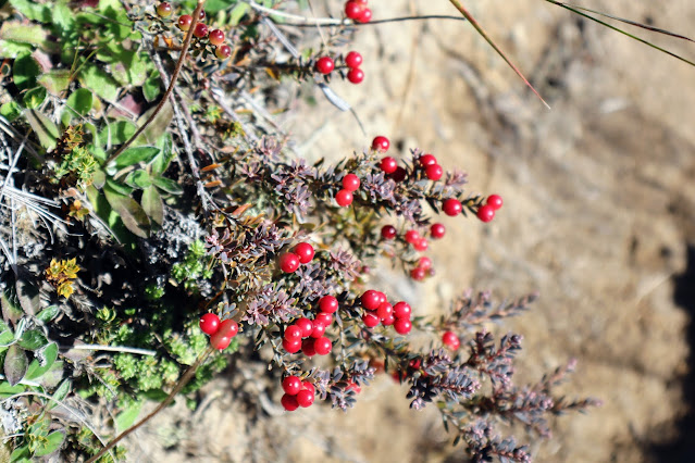 |
| Native Red Snowberries next to the track |
Soon I arrived at the end of the connector track and jumped back onto the main route along Miners Track. From here it is about one kilometer down to the Blackburn Mine.
 |
| Following the fence along the Connector Track |
 |
| Jon on the Connector Track, Mt Somers |
 |
| Junction of Connector and Miners Tracks, Mt Somers |
You walk the last kilometer to the Blackburn Mine on the track you followed on the way in....through the tussock, beech forest and down onto the plateau near the mine.
 |
| On Miners Track heading for Blackburn Mine |
 |
| Back at the edge of the Beech Forest, Miners Track |
You get a better perspective of the scale of the mining site from above..it covers about a forty hectares with old mine shafts, abandoned equipment and multiple slag heaps in view. Mining has altered the landscape around here in an obvious way and it is only slowly reverting to its original state...
 |
| Blackburn Mine site comes into view |
I had a 10 minute break near the mine site and debated the merits of following the Sidewinder Track down to the valley bottom. In the end I decided to stay on Miners Track as I knew from looking at the map that there was a significant hill to climb at the end of the Sidewinder while the Miners Track was tending to downhill all the way back to the car.
 |
| Jon at the Blackburn Mine, Alford Forest |
 |
| ...nuts for a morning snack at Blackburn Mine... |
 |
| Miners Track heading away from the Blackburn Mine |
 |
| Rhyolite Ridge from Blackburn Mine, Mt Somers |
 |
| Blackburn Mine portal, Mt Somers |
 |
| Various bits of mine equipment at the Blackburn Mine |
 |
| Slag piles around Blackburn Mine, Mt Somers |
 |
| Looking down towards Alford Forest from Blackburn Mine |
From the mine it is about 1-1.5 hours to the carpark depending on conditions and your fitness. In my case it took just over an hour to cover the roughly 1.5 kilometers to the trailhead.
 |
| On Miners Track again near the Blackburn Mine |
 |
| Alford Forest from Miners Track, Mt Somers |
 |
| Descending Miners Track into Alford Forest |
As I headed down off the plateau the old mine sits on I had one last look around as who knows if I will ever be back here again. I enjoy visiting this area but I have a lot of 'to do' tracks on my list and less and less time to complete them. I'm going to need to prioritize the ones that I most want to visit.
 |
| Last view of the Blackburn Mine site |
I saw a few people making their way to Woolshed Creek as I walked down the track...it was Monday so I was a bit surprised. They were mostly day walkers and mountain runners...this would be a good track for a run as you could probably make it to the hut and back in under four hours.
 |
| Beech forest along Miners Track, Alford Forest |
 |
| Nearly at the river flats on Miners Track |
I finally made it down to the flat track running along the side of Woolshed Creek and made excellent progress down the easy to walk track to the car-park. It only takes 20 minutes to walk from the bottom of the Blackburn Incline back to the car-park and picnic area.
 |
| At the bottom of the Blackburn Mine Incline |
 |
| Flat track and open forest next to Woolshed Creek |
 |
| Water seep along the Miners Track |
 |
| On Miners Track enroute to Woolshed Creek car park |
Woolshed Creek is clearly visible from the track and it is a nice accompaniment to your walk.
 |
| Woolshed Creek in Alford Forest |
 |
| Moss covered rock on the Miners Track, Alford Forest |
I arrived back at the Woolshed Creek car park in a little over 3 hours so using the 4 W/D track is well worth it as it will easily cut at least 30 minutes off your total tramping time.
 |
| Nearly at the trailhead for Miners Track |
 |
| End of Miners Track at Woolshed Creek car park |
I finally arrived back at the car park just after 11am...it was good to be back at the car but also a bit sad as it was the end of another excellent tramping trip. There was a big group of high school kids from Geraldine getting ready to head down one of the tracks.
 |
| School tramping group at Woolshed Creek car park |
Woolshed Creek runs alongside the car-park and is a fine destination in its own right with a clear creek with pools, rock scrambles and a sandy stream bed that is clean, safe and warm over the summer months.
 |
| Start of the South Face Track, Woolshed Creek car park |
You can cross over the Woolshed Creek bridge and enter a thick stand of native beech trees...there is a very nice short nature walk on that side of the bridge which runs alongside the creek for some distance.
 |
| Bridge over Woolshed Creek, Woolshed Creek car park |
The creek was low with most of the rocks visible from the bridge. After a good rain storm this creek can be a boiling mess of water from one bank to the other. Take care around the creek if it is running high as falling in is not to be contemplated.
 |
| Woolshed Creek upstream of bridge |
 |
| There are some nice swimming pools in Woolshed Creek |
 |
| Woolshed Creek downstream of the bridge |
This whole area is part of the Mt Somers/Hakatere Conservation Park and a really interesting destination to take the kids for an easy introduction to the type of terrain and forest you find along the edge of the Canterbury Foothills.
 |
| View back over bridge from across Woolshed Creek |
 |
| Walking back over the Woolshed Creek bridge |
This was a good tramp to a nice destination with an excellent hut to stay the night....although the track is steep and rough in places it is not beyond the skill range of a novice tramper. Using the Woolshed Creek 4 W/D track certainly saves time and in fact this is the route I would use if ever visiting the hut again.
 |
| ...a great place for a swim on a hot day... |
Being a bookable hut means you know you will have somewhere to stay and while the hut is busy it is large enough to handle the crowds well. I thoroughly recommend you go visit Woolshed Creek
Access: From Rakaia follow Thompsons Track to Tramway Road and Mt Somers village. Join Ashburton Gorge Road to the Jig Road turn off and follow the marked gravel road to the Woolshed Creek car park.
Track Times: Miners Track to Woolshed Creek Hut is 12 km's or 3-3.5 hours walking time. Alternate tracks via Rhyolite/Mt Somers Track (4-5 hours) or on the Woolshed Creek 4 W/D track (3-3.5 hours). Pinnacles Hut is 11 km's or 4 hours using the track on the northern flank of Mt Somers.
Hut Details: Woolshed Creek Hut; Serviced, 24 bunks, water tanks, toilets, wood burner. You can also camp near the hut. Pinnacles Hut: Serviced, 16 bunks, water tanks, toilets, wood burner...no camping near the hut. Both huts are on the DOC hut booking system.
Miscellaneous: The Miners Track is steep and rough in places but suitable for even novice trampers. Once past Woolshed Creek there is no potable water until you reach the hut. The terrain is wide open and exposed so take suitable equipment for cold/wet & hot/sunny weather.


