A visit to the Mt Somers region in mid Canterbury....
As a part of my ongoing exploration of the Hakatere Conservation Park in mid Canterbury Karen and I went for an over night tramp to Woolshed Creek Hut. Woolshed Creek Hut is one of two huts on the popular Mt Somers Walkway inland from Ashburton. It is a really nice 2-3 day trip which involves quite a bit of altitude gain and loss through beech forest and sub alpine tussock land.
 |
| Looking down on Woolshed Hut at Woolshed Creek |
We accessed the hut from the Woolshed Creek car-park off the Ashburton Gorge Road...this is the same road you use to get to the Heron/Hakatere basin. I was last up here a couple of weeks ago when I visited Lake Emma and will be spending more time in the area going into the future.
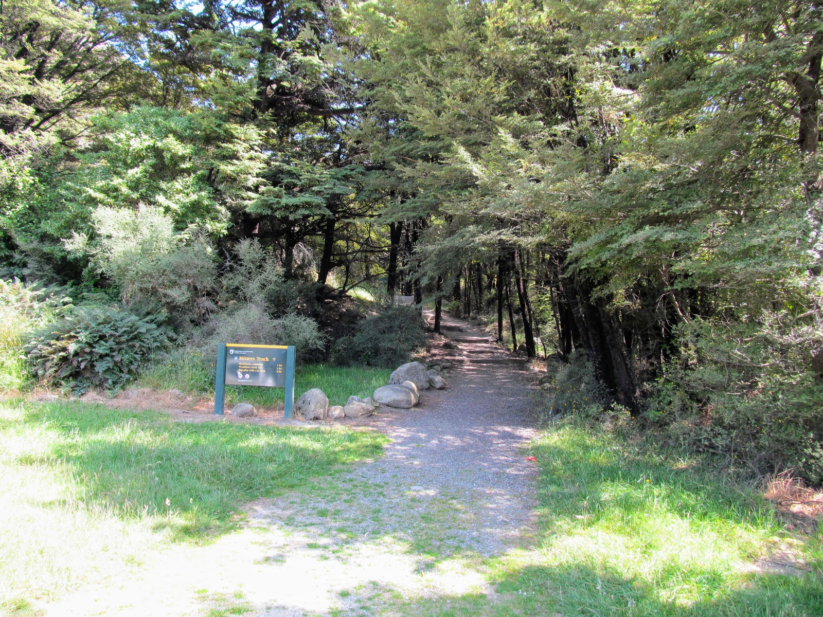
We jumped on the Miners Track a 3-3.5 hour trip to get to the hut among beech forest, tussock, sub alpine grassland and river edge track.
 |
| At the start of the Miners Track to Woolshed Hut |
Another attraction on the Miners Track is the old mining area around the Blackburn Mine...there is a boarded up mine shaft and lots of information boards and mining relics at the site.
 |
| View from inside the Blackburn Mine, Mt Somers |
 |
| Looking at the suspension bridge near Woolshed Creek Hut |
Woolshed Hut is awesome...built in 2006 it has 24 bunks, a great location and best of all an almost bathwater warm stream running right past the front door. It is an awesome hut for kids to visit and in fact most of the other visitors were families with quite young children.
 |
| Woolshed Creek Hut, Woolshed Creek, Hakatere Conservation Park |
So lets have a look at what you can expect if you want to visit Woolshed Creek Hut....
On Miners Track to Woolshed Creek
Karen came with me on this trip, we drove into the car park at Woolshed Creek on the SFriday morning. Woolshed Creek and Pinnacles Hut are in the Mt Somers area and both on the hut booking system now so you can be assured of a bunk for the night. This means you do not have to scramble to arrive before the rest of the trampers heading for this location.
 |
| ...last minute repacking at Woolshed Creek car-park |
 |
| Information kiosk at the Woolshed Creek car-park |
 |
| Woolshed Creek car-park, Mt Somers, Hakatere Conservation Park |
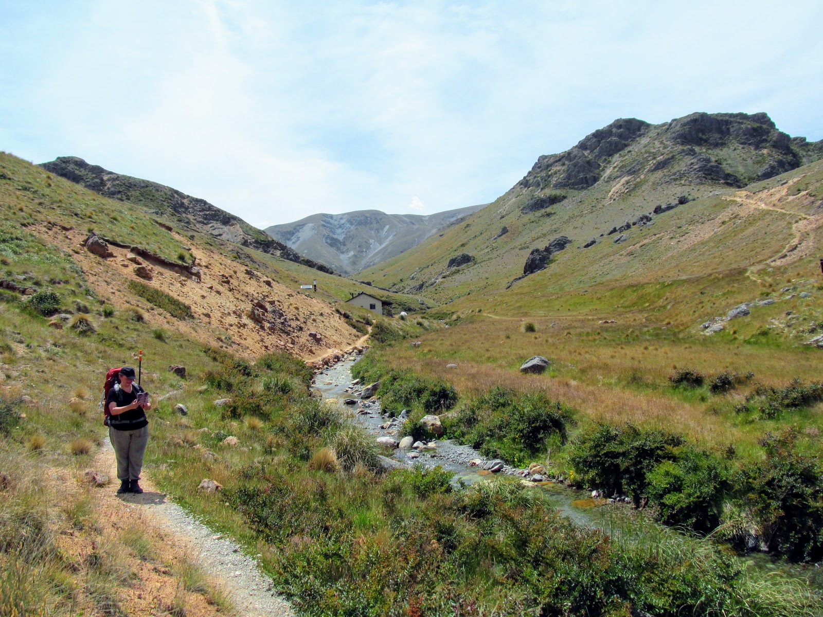
The track is a mixture of bush track, hill climbs, tussock and sub alpine forest....you will encounter all of these terrain types while walking into the hut. To start with the track is a gentle meander through regenerating beech forest along the side of Woolshed Creek.
 |
| Map: Miners Track to Woolshed Creek Hut and back via the 4 W/D track |
From the start of the track it is 3-3.5 hours to reach the hut...the time will really depend on your fitness as there are a number of quite steep hills to climb along the way. If you were super fit you could walk to the hut in 3 hours but not much quicker than that.
 |
| Start of Miners Track to the Woolshed Creek Hut |
 |
| ..online bookings required at Pinnacles and Woolshed Creek huts... |
 |
| Woolshed Creek alongside the Miners Track |
It was a warm sunny day so it was nice to have the beech forest as shade along the first section of the track. You can se and hear the creek right up to the start of the climb up the Blackburn Incline about 1.5 km's along the track.
 |
| Miners Track: at first it is nice beech forest..... |
This area is riddled with relics of its past as a mining area....old mine shafts, rail lines, coal carts and piles of mine slag are everywhere. The area was once a source of coal and other minerals including gold and tungsten but in very small quantities. You pass many of these relics on your way to the hut the first one you strike is an old filled in mine shaft along Miners Track.
 |
| Old mine shaft along the Miners Track, Mt Somers |
 |
| Nearly at the Blackburn Incline, Woolshed Creek |
Eventually you will arrive at the Blackburn Incline...this was a steep cable way railway for transporting coal from the Blackburn Mine site down to the railway that ran out along miners track. Not much of the incline remains....it was basically along the course of the current track.
At the base of the incline is a large coal cart, some rails and interpretive panels which explain the history of the local mines. It is worth your time to stop and have a look at the relics as this was a fascinating episode in the history of the area.
 |
| Information panels at the old Blackburn Incline, Woolshed Creek |
 |
| Information panels at the old Blackburn Incline, Woolshed Creek |
 |
| An old 4 ton coal wagon wrecked at the Blackburn Incline, Woolshed Creek |
Once past these mining relics the real work begins....you will be more or less climbing continuously for the next two hours as you make your way up to Pt. 934 the high point of the track. The track is generally good and consists of a series of switch backs slowly climbing up to the Blackburn Mine site the first point along the climb.
 |
| Sidestream along the Miners Track, Mt somers |
 |
| Karen climbs up the Blackburn Incline, Mt Somers |
 |
| Breaking out of the forest on the Blackburn Incline, Mt Somers |
 |
| Benched track that once housed the Blackburn Incline |
You have limited view of the surrounding area until you get close to the mine site....from near here you can see down onto the car park and the first section of the track. This area was volcanic in nature so there are shear rock faces, loose conglomerations of rock and rock outcrops in all directions.
 |
| View out to Canterbury Plains from the Miners Track, Mt Somers |
 |
| View of Mt Somers from the Miners Track |
 |
| Moorhouse and Peter Ranges beyond Woolshed Creek |
Eventually you arrive at the old Blackburn Mine site...this was the location of several mine shafts which operated on and off from the 1870's right up to the late 1960's. They were never particularly profitable the most successful was shaft number 3 which was producing good quantities of coal until the seam ran out in 1969.
The area has a number of old mining relics scattered around and you can sit inside the portal of mine shaft no. 1 and have a rest out of the sun. The area is covered with old slag heaps....the rock removed from the shaft while mining the coal. It is a hot and barren place much as it must have been when the mine was open.
 |
| The old Blackburn Mine site, on Miners Track, Mt Somers |
 |
| Boarded up Blackburn Mine, Mt Somers |
 |
| Mining equipment around the old Blackburn Mine, Mt Somers |
 |
| Blackburn Mine site....piles of mine spoil..... |
 |
| More slag piles from the Blackburn Mines, Mt Somers |
Past the mine you follow an old 4 W/D track for awhile.....it is all heading up hill thru beech forest and into the sub alpine region of tussock and other alpine plants. Make sure you have some sun block on and a wide brimmed hat as this is an exposed and windy section of the track where you are likely to get sun burnt if not careful.
 |
| Miners Track: track surfaces include 4 W/D road... |
 |
| Miners Track:....on the gravel track.... |
 |
| Miners Track:...beech forest track... |
 |
| Miners Track:...and boardwalk through tussock fields.... |
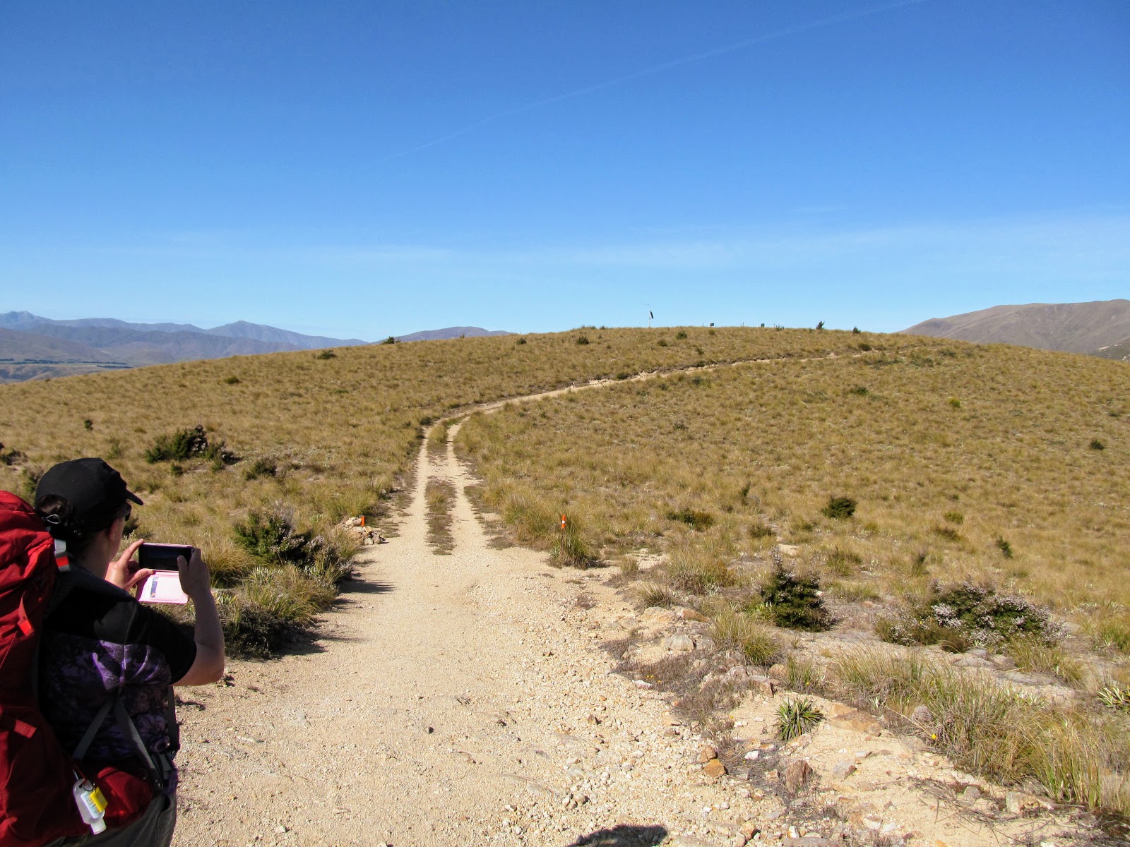
You are heading for Pt. 934 which is the high point of this track on a hill over looking the hut site. You get you first clear view of the hut after you have been walking for a couple of hours and just past the plateau the mine sits on. The track climbs a series of ridges to gradually deposit you on the top so this is the steepest section of the track.
You need to take a bit of care through here as the trail is really rocky and the area is covered with Spaniard Plants. You would have seen me talking about Spaniard on the site before it is a native type of spiky scrub with really sharp barbs which can easily puncture gaiters and your skin. You normally get Spaniard around 900 meters asl and this is the altitude you find it here.
 |
| Pt 934...the apex of the Miners Track to Woolshed Creek |
 |
| Karen on the Miners Track near Pt 855..... |
 |
| Miners Track: sidling past Pt. 855...... |
 |
| Spaniards growing in the rock garden near Pt. 855, Miners Track |
The largest concentration of Spaniard was in a gully just before Pt.934...it was classic terrain for them...a rocky, tussock basin facing towards the sun. You have to be careful walking through here as some of the plants are next to or right on the track.
 |
| Close up study of Spaniard near Pt. 855, Miners Track |
 |
| Miners Track: Pt. 855 with the Southern Alps in the far distance |
You get your first view into the Hakatere and Heron Basins from the slopes of Pt. 934 as you gradually clear the surrounding hills. There is a tricky section of track climbing along the spine of a ridge and then the last much easier track to get to the cairn on the top of the high point.
 |
| Miners Track: on the final steep ridgeline climbing to Pt. 934 |
 |
| Karen climbing the final slope before Pt. 934, Miners Track |
 |
| Miners Track: Pt. 934 is just in front of Karen....the high point on this tramp!!! |
 |
| Woolshed Creek, the Blackburn Mine and the land crossed by the Miners Track |
 |
| The rock cairn on Pt. 934, Miners Track |
 |
| View into the Hakatere Valley from near Pt. 934, Miners Track |
Once you reach Pt. 934 it is all downhill to the hut....first by sidling along the ridge heading out to the north-west and then down quite a steep and rough track leading down to the bottom of the Woolshed Creek headwaters. There are expansive views of the surrounding area from up here and it is worth taking time to sit for a while and take in all of the splendor which surrounds you.
 |
| Descending down to the Woolshed Hut site from Pt 934.... |
 |
| The 4 W/D track to Woolshed Creek Hut... |
 |
| A lone beech tree on the ridge past Pt. 934, Miners Track |
 |
| Miners Track: the start of the descent down to the hut site... |
Your first view of Woolshed Creek Hut is from the edge of the surrounding hills as you make your way down to the hut. It sits down at the lowest point in between two small ridges nestled in the headwaters of the river.
You can clearly see the tracks leading to the hut (...like Rome all roads lead to the hut...) as well as the silvery ribbon of the creek passing the hut and meandering down to Woolshed Creek Gorge. It looks beautiful and enticing in equal measure....
 |
| Woolshed Creek Hut from the ridge above the hut |
 |
| Rough terrain on the Western side of Mt Somers |
 |
| Miners Track: Woolshed Creek Gorge is in the rough terrain near the center |
There is a large swing-bridge near the hut on the Mt Somers Track which also passes close to the hut...this is the alternate track to the hut but as it entails a 1200 meter climb at the start we decided not to use it.
The bridge spans the gorge of Woolshed Creek and has a lovely swimming hole right underneath that many of the hut visitors used later in the day. You can also walk down to and go under the water fall at the edge of the gorge. Nature's shower so to speak but I bet it is a freaking cold one.....
 |
| The high suspension bridge on the Mt Somers Track near Woolshed Creek |
The track down to the hut is fairly awful....so it took us nearly 30 minutes to cover the last kilometer of the track to the hut. Once down at river level it follows the course of Woolshed Creek past a 10 meter waterfall and right up to the front veranda of the hut.
 |
| Woolshed Creek Hut from the Miners Track |
 |
| Karen negotiates a stile at Woolshed Creek |
 |
| Only 200 meters till we reach Woolshed Creek Hut |
We finally arrived at the hut after 3.5 hours which was good progress for Karen and I given our age and general state of fitness. It was scorching hot around the hut as it sits surrounded by small hills but the atmosphere is regulated by the river running right past the hut.
 |
| Woolshed Creek Hut, Woolshed Creek, Hakatere Conservation Park |
It sure was nice to sit down under the veranda and have a rest after all that time out in the sun.....
Overnight at Woolshed Creek Hut
Woolshed Creek Hut is relatively new....it was built in 2006 to replace an much older & smaller musterer's hut and is an excellent place to stay overnight. The hut has 24 bunks, tank water, a fireplace with wood supplied and a lovely generously sized veranda around much of the exterior.
 |
| Woolshed Creek Hut, Woolshed Creek, Hakatere Conservation Park |
The hut is on the DOC hut booking system so you can pre-book a bunk and know you will have somewhere to sleep. There are two bunk rooms with sleeping benches for 12 in each room and it has one of the most generous cooking benches I have ever seen. It still looks fresh and new inside despite nearly 15 years of hard use as it is well maintained by DOC and the Trust who set up the track system.
 |
| Woolshed Creek Hut: the interior of the cooking/living space |
 |
| Woolshed Creek Hut: the interior of the cooking/living space |
 |
| Woolshed Creek Hut: information boards in the hut space |
 |
| Woolshed Creek Hut: our pits set up in the smaller of the two bunk-rooms |
 |
| Woolshed Creek Hut: the water taps are outside at the back of the hut... |
It has two of the newer self composting toilets which is quickly becoming the standard set up for DOC huts...the waste dries out and is removed by helicopter several times a year. It is a more environmentally sustainable way to deal with human waste than burying it and hoping it will not seep...but it is heinously expensive.
 |
| Woolshed Creek Hut: the composting toilets at the hut site... |
The basin the hut sits in is really nice...it has its own micro climate and it is really nice to be able to walk out the front door and sit with your feet in the cool waters of the creek which passes by only 20 feet away.
 |
| Looking back up to the hill near Pt. 934, Woolshed Creek Hut |
 |
| Various people around Woolshed Creek itself... |
 |
| Woolshed Creek Hut: the main entrance |
 |
| Woolshed Creek Hut: the well designed veranda... |
Karen and I spent most of the afternoon siting down by the creek, on the veranda or relaxing in the hut. The hut was nearly full and there were also about 15 tents on the surrounding camping areas. Woolshed Creek would be an excellent spot for a camping trip and most of the younger folk had chosen this option.
 |
| Jon is sitting in the bed of Woolshed Creek.... |
 |
| More Trampers arrive at the Woolshed Creek Hut site |
You can camp on both sides of the creek both above and below the hut the camp spots looked nice and flat and all still had a good cover of grass to cushion your sleep. It would be more than worth bringing a tent up here over the summer and spending a couple of days enjoying the local delights.
 |
| A tent city starts to grow at Woolshed Creek Hut site |
Woolshed Creek hut has a DOC warden over the busy summer period...I missed her name but our warden was a bright cheerful Australian woman. She was a full time DOC Ranger based in Geraldine and spent her time moving between Woolshed Creek and Pinnacles Huts.
It would be a rewarding job but also lonely....I imagine you would spend a lot of time on your own as outside the weekends the hut would be quiet. You would really need a hobby or interest to keep your mind occupied....painting would be good as there is plenty of subject matter in the local area.
The hut wardens have their own smaller quarters off the main hut with gas for cooking and heat and solar panels for lights.
 |
| Cooking dinner inside Woolshed Creek Hut |
 |
| Mac n' Cheese was on the menu at Woolshed Creek Hut |
 |
| Trampers prepare dinner at Woolshed Creek Hut |
We spent a nice evening sitting and reading or talking to the other people who were staying the night in the hut. There were several large groups as well as a couple of families staying but generally the atmosphere was good. It was too hot for a fire which was a pity because they had a woodshed full of beautifully dry wood enough to warm the heart of any budding pyromaniac.....
 |
| The sun sets over the septic tanks at Woolshed Creek Hut..... |
 |
| Woolshed Creek Hut from the hill behind the hut |
 |
| Woolshed Creek Hut site...another tent city grows on the opposite bank... |
One of the families had brought some of those huge American style Marshmallows and all the kids enjoyed themselves roasting them over a small stick fire their parents made for them outside the hut. I'm sure that will be a treasured memory that will stick with them through their lives and hopefully encourage them to tramp as they get older....
 |
| Woolshed Creek Hut site...a family roasting marshmallows.... |
I really enjoyed Woolshed Creek Hut....it would be a fabulous first hut experience for kids and I thoroughly recommend you think about a visit sometime.
Back to Woolshed Creek car-park on the four wheel drive track....
After the rigors of the first day we decided to take things a little bit easier on the way back to the car and followed the Woolshed Creek 4 W/D track back out to the car-park. The four wheel drive track starts from next to the hut and while steep is a much easier surface to walk along.
 |
| Woolshed Creek Hut: getting ready to start walking... |
 |
| ...action man Jon starts the days journey from Woolshed Creek Hut |
The second day of the tramp was another blue sky day and we were up and away from the hut by 8.30am....it was already hot by then so we were out in the sun from the beginning. Make sure you bring some sun block on this tramp....
 |
| The Woolshed Creek Hut 4 W/D track to the car-park.. |
You quickly gain altitude by following the road...and gain an alternate view of the hut and its surrounds from an angle you may not have seen it from. I noticed another couple setting out on their walk back to the car-park...we would see them regularly over the rest of the morning.
 |
| Woolshed Creek Hut is in a really lovely location...couple heading for car-park |
 |
| Climbing the 4 W/D track from Woolshed Creek Hut |
 |
| At the top of the first slope on the Woolshed Creek 4 W/D track |
 |
| View down into the Upper Ashburton Lakes area from the Woolshed Creek 4 W/D track |
Once past the first switch back you have some excellent views of the Upper Ashburton Gorge area, Stour River Valley and out into the Hakatere. The track has three switchbacks before you gain the high point which is at around 900 meters approximately inline with Pt.934 on Miners Track.
 |
| Climbing up to near Pt. 934 on the Woolshed Creek 4 W/D track |
 |
| A hardy succulent on the Woolshed Creek 4 W/D track |
There is one last and final view of Woolshed Creek as you top the rise and then the track heads down gradually to end up near Pt. 934 and a small pinnacle of volcanic rock halfway to the Blackburn Mine site.
 |
| The final view of Woolshed Creek for this trip... |
The four wheel drive track is steep but easy to walk along as it is level and not covered with any rock larger than a pebble.....
 |
| At the crest of the Woolshed Creek 4 W/D track |
 |
| Woolshed Creek 4 W/D track heads towards the car-park |
 |
| Much easier going on the Woolshed Creek 4 W/D track |
 |
| Looking down on the Stour River from the Woolshed Creek 4 W/D track |
 |
| Heavy erosion on the Woolshed Creek 4 W/D track |
From there you follow a side track back down to the Miners Track....the side track is clearly marked with orange trail markers on the 4 W/D track and it follows the line of an old fence back down to Miners Track.
It is fairly difficult to miss as the track markers are super obvious as you can see in the photo below...
 |
| Woolshed Creek 4 W/D track...the side track to the Blackburn Mine...orange markers!!! |
 |
| On the Blackburn Mine side track to Miners Track |
 |
| On the Blackburn Mine side track to Miners Track...Mt Somers in the background |
You can just make out the Mt Somers Track around the mountain side...it goes to the Rhyolite Track and continues around the mountain to Ackland Shelter, Mt Somers Summit, Staveley Falls and Pinnacles Hut.
 |
| Mt Somers with Rhyolite Ridge heading to the right... |
 |
| Approaching Miners Track along the Blackburn Mine side track |
 |
| Karen is back on the Miners Track to Blackburn Mine Site |
You walk the last 1 km to the Blackburn Mine on the track you followed on the way in....through the tussock, beech forest and down onto the plateau near the mine.
 |
| Boardwalk and soggy tussock on the Miners Track |
 |
| Skirting the beech forest on the Miners Track, Mt Somers |
 |
| Setting off after a short break along the Miners Track, Mt Somers |
You get a better perspective of the scale of the mining site from above..it covers about a forty hectares with old mine shafts, abandoned equipment and multiple slag heaps in view. Mining has altered the landscape around here in an obvious way and it is only slowly reverting to its original state...
 |
| Good view of the Blackburn Mine Site from Miners Track |
 |
| Old Blackburn Mine Site, Miners Track, Mt Somers |
We had a 20 minute break near the mine site for lunch and debated the merits of following the Sidewinder Track down to the valley bottom. In the end we decided to stay on Miners Track as I knew from looking at the map that there was a significant hill to climb at the end of the Sidewinder while the Miners Track was tending to downhill all the way back to the car.
 |
| About to start down the Blackburn Incline from the Blackburn Mine site |
 |
| Heading down the Blackburn Incline on Miners Track |
 |
| Miners Track along the Blackburn Incline, Mt Somers |
We saw a lot of people making their way to Woolshed Creek as we walked down the track...it was Saturday so a lot of people would have been going in for the weekend. We also saw a number of day walkers and mountain runners..this would be a good track for a run as you could probably make it to the hut and back in under four hours.....
 |
| In the beech forest along Miners Track, Mt Somers |
 |
| Miners Track: we got passed by a few mountain runners.... |
We finally got down to the flat track running along the side of Woolshed Creek and made excellent progress down the easy to walk track to the car-park. It only takes 20 minutes to walk from the bottom of the Blackburn Incline back to the car-park and picnic area.
 |
| At the bottom of the Blackburn Incline and 20 minutes to go.. |
 |
| Miners Track near the Blackburn Incline |
 |
| Lovely flowers growing along the Miners Track, Mt Somers |
We arrived back at the Woolshed Creek car park in a little over 3 hours so using the 4 W/D track is well worth it as it easily cut at least 30 minutes off our total tramping time.
 |
| Approaching the end of Miners Track at the Woolshed Creek car park |
 |
| Last bridge before the Woolshed Creek car park |
We finally arrived back at the car park just after noon...it was good to be back at the car but also a bit sad as it was the end of another excellent tramping trip.
 |
| Karen arrives at the Woolshed Creek car park.... |
 |
| We both arrive at the Woolshed Creek car park, Mt Somers |
This was a good tramp to a nice destination with an excellent hut to stay the night....although the track is steep and rough in places it is not beyond the skill range of a novice tramper. Using the Woolshed Creek 4 W/D track certainly saves time and in fact this is the route I would use if ever visiting the hut again.
Being a bookable hut means you know you will have somewhere to stay and while the hut is busy it is large enough to handle the crowds well. I thoroughly recommend you go visit Woolshed Creek
Access: From Rakaia follow Thompsons Track to Tramway Road and Mt Somers village. Join Ashburton Gorge Road to the Jig Road turn off and follow the marked gravel road to the Woolshed Creek car park.
Track Times: Miners Track to Woolshed Creek Hut is 12 km's or 3-3.5 hours walking time. Alternate tracks via Rhyolite/Mt Somers Track (4-5 hours) or on the Woolshed Creek 4 W/D track (3-3.5 hours). Pinnacles Hut is 11 km's or 4 hours using the track on the northern flank of Mt Somers.
Hut Details: Woolshed Creek Hut; Serviced, 24 bunks, water tanks, toilets, wood burner..you can also camp near the hut. Pinnacles Hut: Serviced, 16 bunks, water tanks, toilets, wood burner...no camping near the hut. Both huts are on the DOC hut booking system
Miscellaneous: The Miners Track is steep and rough in places but suitable for even novice trampers. Once past Woolshed Creek there is no potable water until you reach the hut. The terrain is wide open and exposed so take suitable equipment for cold/wet & hot/sunny weather.


No comments:
Post a Comment