A return to Mt Herbert...
I did my annual pilgrimage to the summit of Mt Herbert on Banks Peninsula over the weekend. I try to get up to the top at least once a year...this is my second visit in 2020. This may not be my last visit this year as I would like to do a walk from Purau Saddle to Diamond Harbor sometime over the summer.
 |
| The Monument as seen from the Purau Saddle car-park |
 |
| Mt Herbert can be accessed from the Purau-Port Levy Saddle |
I walked up the Monument Track from Purau Saddle to the top of the mountain...this is the shortest route to Mt Herbert but certainly not the easiest as it is steep for the first hour. On the way I passed by the historic Monument Hut built for the YHA in the early 1950's but hardly ever used as people gravitated away from Banks Peninsula to the Southern Alps.
 |
| Monument Hut, Monument Track, Banks Peninsula |
 |
| Interior of the rustic Monument Hut...kapok bunks and bare corrugated iron! |
I could not have asked for a more perfect day for a climb to Mt Herbert...it was cool but crystal clear with sunny skies, little cloud and views from Kaikoura all the way south to Dunedin. It was probably the best visibility I have ever encountered as the clear winter air makes for clear views right to the horizon.
 |
| On the Monument Track, Banks Peninsula heading for Mt Herbert |
I passed a few people over the day but was surprised to almost have the summit to myself while I was there. With the perfect conditions I expected a horde of people to be out and about. The only other person I talked to on Mt Herbert was an older chap who had set up his amateur RT radio and was talking to some people in the UK. I sat in the sun and just enjoyed the stunning view.
 |
| Jon Moake on the summit of Mt Herbert, Banks Peninsula |
 |
| View of Canterbury from the top of Mt Herbert, Banks Peninsula |
On the way back down to Purau Saddle I did the small side trip to Little Mt Herbert which is 500 meters to the south east of the main summit and the second highest point on Banks Peninsula at 913 asl. This is the fourth time I have visited Little Mt Herbert and it is a stunning destination in its own right. It has excellent views of the outer part of Banks Peninsula, Kaitorete Spit and South Canterbury.
 |
| On the summit of Little Mt Herbert, Banks Peninsula |
 |
| Sitting outside the radio shelter on Little Mt Herbert |
The Monument Track is generally easy travel except for some steep sections, a little mud and sheets of ice across the track after a cold night. Take care if you are visiting the track as it was quite slippery in places...I would wear good outdoor shoes or boots and not the running shoes I saw a lot of people wearing.
 |
| Still ice on the Monument Track, Banks Peninsula in the afternoon |
I love Mt Herbert and intend to keep visiting each year for as long as my legs will carry me to the top. Hopefully that will be some time from now...
 |
| Heading back to the Purau Saddle car-park |
This is an excellent track and if you are reasonably fit it is perhaps the best introductory route to the summit of Mt Herbert. I will not lie and say it is easy as it is not due to the steepness but it would be next to impossible to get lost from the start of the track to Little Mt Herbert as it is well sign posted and well marked.
 |
| Plenty of track markers on the Monument Track |
In bad weather the section from Little Mt Herbert to Mt Herbert can be tricky as there are a multitude of ground paths to confuse you. Best not to be up there in a storm.
 |
| The view from Mt Herbert during a storm...bugger all!!!! |
Right...lets see what the track put on for us on the day....
On Monument Track:
Monument Track starts at the car-park at Purau Saddle between Port Levy and Purau on Banks Peninsula. Yo get to Purau over Dyers Pass or Gebbies Pass and head around the southern side of Lytellton Harbor. From the car park to the summit of Mt Herbert is approximately 6 kilometres or 1.5-2 hours depending on fitness levels.
 |
| Start of the Monument Track, Banks Peninsula at Purau Saddle |
There is space for about 10-12 cars on Purau Saddle...it is fine to leave your car here while on a day walk but I would not leave it here overnight as the area is prone to vandalism and car thefts. Make sure you car is securely locked.
 |
| The Silver Surfer parked at the Purau Saddle car park |
The Monument Track starts right over the fence from the car park and is across farmland for the first hour. It is a combination of a route across sheep paddocks, old farm tracks and purpose build walking track. The local farmers raise cattle and sheep so this track is usually closed for lambing season from the start of August till the end of October.
 |
| Map: Monument Track & Mt Herbert |
 |
| Monument Track, Banks Peninsula: sign at the start of the track |
 |
| Snow poles along the route of Monument Track |
The first hour of the track is steep...up and over small knolls and along an old farm track for about 2 kilometres to the saddle between Pt. 806 and Little Mt Herbert.
 |
| Climbing over the first hill...Monument Track |
 |
| View down to Port Levy from the Monument Track |
 |
| Looking back to the Purau Saddle car park form Monument Track |
The Monument gives the track its name...it is a pinnacle about 700 meters along the track...it is a well used climbing area by Canterbury rock climbers. It doesn't get as much use after the earthquakes as the rock is a bit unstable but people do still climb here. Keep an eye out for falling rocks when passing under the Monument as they do occasionally roll down over the track.
 |
| The Monument Track crosses farmland... |
I stopped by Monument Hut on the way to have a look at this historic hut. Monument Hut was built in the 1950's as one of a series of YHA huts located on Banks Peninsula. There were also huts built near Port Levy Saddle and Montgomery Bush, both now long gone. They were built to stimulate outdoor recreation in the area by using the public transport system at a time when only the wealthy had cars.
Note: Rita Angus (a famous Kiwi artist) painted this scene of the area with the cabbage tree, Monument Hut and the Monument in the background. I think she was inspired by that funky looking tree...it has a great shape and lustre. It is in an art gallery in Dunedin I believe...
 |
| Monument Hut nestled under the Monument, Banks Peninsula |
Monument Hut didn't see much use, by the time it was completed Banks Peninsula was not the focus of local tramping clubs any more. With the advent of the cheap overnight train, Arthur's Pass became the Mecca for Canterbury climbers and trampers in the 1960's-1980's.
It is a pity really as there is a ton of excellent tramping to be had on the Port Hills and Banks Peninsula. I am a real advocate for spending some of your precious tramping time here...it is worth it. It took another 49 years before a new public hut (Rod Donald) was commissioned on Banks Peninsula.
 |
| The YHA Monument Hut, Monument Track, Banks Peninsula |
 |
| Monument Track: the hut name on the Lenten... |
 |
| Monument Track: Monument Hut door... |
The hut officially holds 4 (on damn uncomfortable looking kapok and scrim bunks), but I'm sure you would have been able to squeeze four more on the floor under the bunks. They must have been short in those days because the bunks are about 5'6" long.
It is still largely as built as it hasn't seen the wear and tear of a well used hut.
 |
| Spartan lodgings at the Monument Hut |
 |
| There is a table and benches in Monument Hut, Banks Peninsula |
The hut is Spartan; corrugated iron cladding, no insulation, no heating and tiny: less than 4 meters by 2 meters. You can still stay in the hut even now but it would be a cold and grimy experience.
No toilet and no potable water source in the immediate area.
 |
| A study of the outside of Monument Hut |
If you are having a look at Monument Hut make sure you keep away from this bush outside...this is Onga-onga. Onga-onga is a type of native nettle with a neuro-toxin in its spines that cause excruciating pain if you get stung and can lead to paralysis, breathing difficulties and even death if you are stung too many times. It is prolific all over the Banks Peninsula area.
Steer well clear of Ongaonga at all times...
 |
| Large patch of Ongaonga growing beside Monument Hut |
Monument Track is actually an old farm track that goes from near Monument Hut right up to the saddle between Pt. 806 and Little Mt Herbert. The gradient is OK for the most part but there are a number of steeper sections near the start and at a series of switchbacks about 20 minutes past Monument Hut.
 |
| On the Monument Track to Mt Herbert, Banks Peninsula |
 |
| View of the Port Hills from the start of Monument Track |
 |
| Mt Evans and Monument Hut from the Monument Track |
The Monument dominates the skyline for the first hour of the track as it sits right beside the track. The crag is popular with climbers as it has a couple of technically difficult bluffs although it does not get as much use since the earthquakes as it is a bit unstable.
 |
| Approaching the Monument on the Monument Track |
 |
| Lytellton from the Monument Track, Banks Peninsula |
If you look out to the north east you get progressively better views of Mt Evans (703) which is the mountain on the other side of the Purau-Port Levy road. People do climb up to the top although they are doing so without permission as it is all on a working sheep farm. I bet there is an excellent view of Port Levy from the top....
 |
| Another view of Mt Evans, Banks Peninsula |
You slowly climb up Monument Track along the old farm track...I could see another tramper in the distance also heading up the track, I passed him about 20 minutes later just after the switchback section of this track. He was heading for Port Levy Saddle along the
Te Ara Pataka Track.
 |
| Monument Track is an old farm track... |
 |
| Ice covers the Monument Track, Banks Peninsula |
The switchback section is the steepest of this track...it is a series of track sections which fold back on themselves so you can quickly gain altitude. There are five switchbacks of various lengths the last one is one long section about a kilometer in length.
 |
| Monument Track: a steady uphill climb for 1.5 hours.... |
 |
| Farm track leading up to Mt Herbert from Purau |
 |
| Switchback section of Monument Track, Banks Peninsula |
 |
| The views get better as you climb higher on the Monument Track |
 |
| Last switchback on the Monument Track, Banks Peninsula |
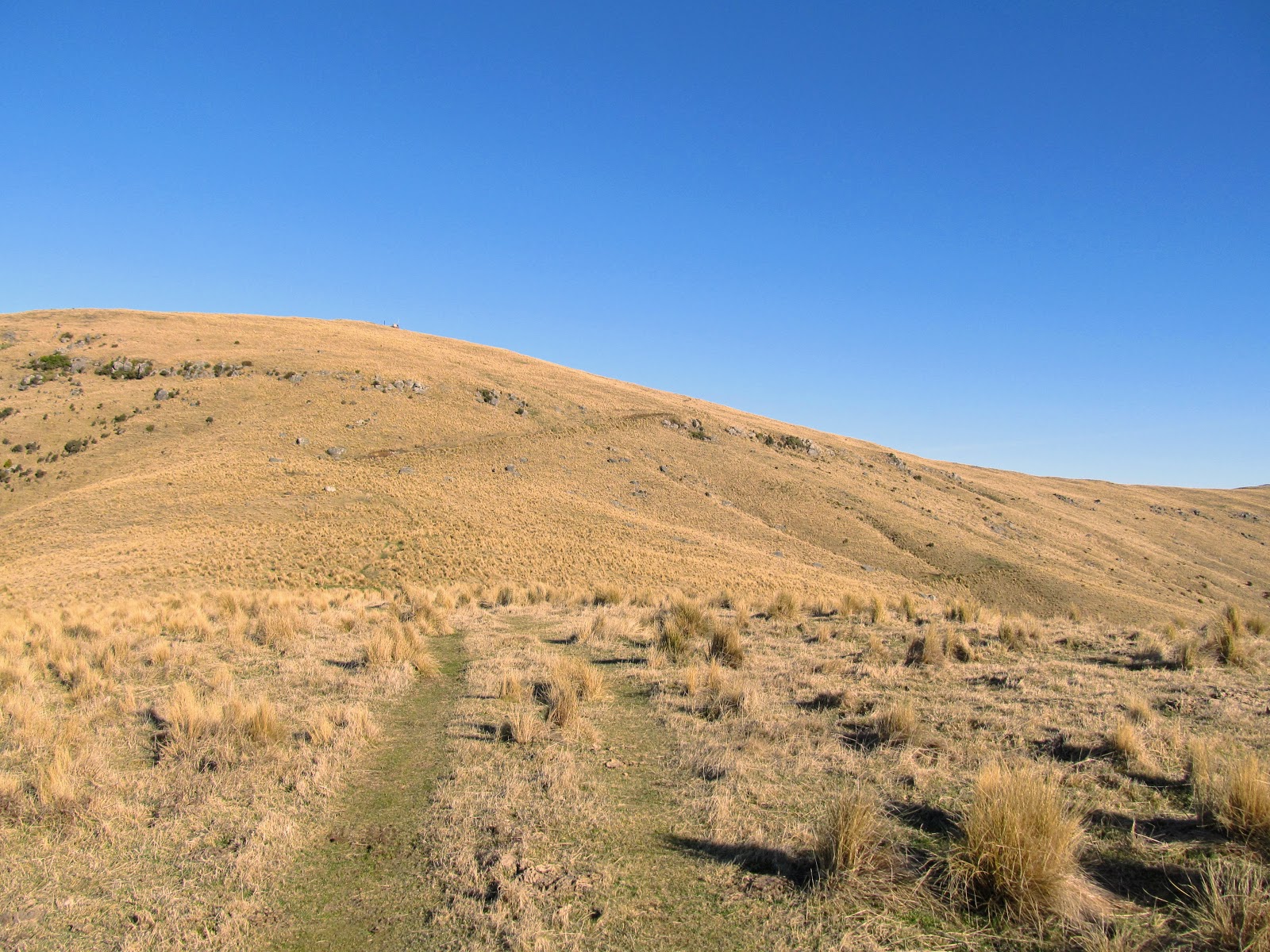
Once past the switchback sections the track evens out for some distance as it slowly climbs up to the saddle between Pt. 806 and Mt Herbert. You start to get better views of the Canterbury from here as you can now see over the Port Hills to the distant Canterbury Plains and Pegasus Bay.
 |
| Monument Track: there is another tramper just ahead.... |
 |
| The Monument Track levels out above the switchbacks |
I liked the look of this old fence post with a couple of short lengths of rusty barbed wire attached...
 |
| Interesting fence post along the Monument Track |
You can see the small saddle between Pt. 806 and Little Mt Herbert in the photo below. It is still another kilometer away but it takes only 15 minutes to get there are the track less steep. You can see the whole Mt Herbert massif better from here including an area of regenerating bush in a gully on the north east side of the mountain. I could hear a waterfall running somewhere in the bush although I could not see it at all...
 |
| View of the saddle between Little Mt Herbert and Pt. 806 |
 |
| Regenerating native bush, northern-eastern edge of Mt Herbert |
 |
| Monument Track: passing Pt.806...heading for Little Mt Herbert |
 |
| A stile along the Monument Track, Banks Peninsula |
 |
| Little Mt Herbert from near Pt. 806, Monument Track |
After an hour and a half you will find yourself on the saddle between Pt. 806 and Little Mt Herbert. There is a track junction here with the Monument Track (south) to Te Ara Pataka at Pt. 761, Summit Link Track to Mt Herbert and the Monument Track.
You follow the Summit Link Track up the side of Little Mt Herbert to the junction with Te Ara Pataka and then head off to the summit along that track. It is all uphill of course but the gradient is more gentle than the lower part of the Monument Track.
 |
| View south along the route of Te Ara Pataka to Pt. 761 |
 |
| Monument Track: 30 minutes to Te Ara Pataka Track |
You can see the radio antenna array on the top of both Mt Herbert and Little Mt Herbert from the Summit Link Track. The radios are used by the emergency services and provide coverage for the whole of the Canterbury Plains as Mt Herbert has line of sight to most places in Canterbury.
 |
| You can just see the radio antennas on Little Mt Herbert |
 |
| View of Pegasus Bay and Mt Evans from Summit Link Track |
I stopped for my first break of the day just off the Summit Link Track about half way to the junction with Te Ara Pataka. There were some boulders here which protected me from the bitterly cold wind that was blowing while also being in the sun. I had a snack and a drink and then got on my way for the last push to the summit of Mt Herbert.
 |
| View south to Pt. 761 from the Summit Link Track, Mt Herbert |
 |
| Lots of ice along the Summit Link Track, Little Mt Herbert |
As you get further up the Summit Link Track it looks like you could cut off the track and just sidle around to the track to Mt Herbert. Do not do this as there are a series of bluffs that are not visible from the track and block your way forward.
 |
| View of Mt Herbert from the northern side of Little Mt Herbert |
 |
| Radio antennas on Little Mt Herbert |
 |
| Saddle between Little Mt Herbert and Mt Herbert |
I got my first view of the area around Kaitorete Spit and Lake Ellesmere from the saddle between Little Mt Herbert and Mt Herbert. The visibility was excellent and you could see all the way south down the coast to Dunedin.
 |
| View south to Kaitorete Spit, Birdlings Flats and Lake Ellesmere |
 |
| View to Mt Herbert from the saddle with Little Mt Herbert |
From the junction of the Summit Link Track and Te Ara Pataka it is 25 minutes to the summit of Mt Herbert. To start with you descend down to the saddle between Mt Herbert and Little Mt Herbert and then climb up and over two knolls to get to the main summit.
The track is easy to follow on a clear day but if there is any cloud, mist or fog it can be a nightmare to navigate due to the profusion of tracks which exist. Although it was sunny the slight wind was icy cold so I had to stop to put my jacket on to keep me warm.
 |
| At the low point of the Mt Herbert-Little Mt Herbert Saddle |
 |
| An old Walkways Commission route marker, Mt Herbert |
 |
| Starting the climb to Mt Herbert on Te Ara Pataka |
 |
| Better view of Kaitorete Spit from Te Ara Pataka |
I was just about to the top of Mt Herbert when a helicopter flew around the side of the mountain and then landed on the southern end of the plateau on top of Mt Herbert. I thought it was a SAR pick up so I hurried along the last couple of hundred meters of track in case they needed help moving someone.
 |
| A helicopter circled Mt Herbert...... |
 |
| ....and illegally landed on the summit of Mt Herbert |
It was just a tourist flight with a pilot and a couple of Asian tourists who got out and started taking photos of Canterbury. I'm fairly certain this was an illegal landing as my understanding is only the emergency services are allowed to land on Mt Herbert. When the pilot saw me come over the crest of Mt Herbert and take a photo of them he hustled the passengers into the helicopter and buggered off.
 |
| On Te Ara Pataka for the last 300 meters to the Mt Herbert summit |
 |
| Only 50 meters to the summit of Mt Herbert... |
Anyway I got to the top of Mt Herbert after two hours and 15 minutes of walking from Purau Saddle.
On the summit of Mt Herbert:
The top of Mt Herbert is a long flat plateau approximately 300 meters long by 50 meters wide...it is really flat and I would estimate the height only varies by maybe 2-3 meters right across the crest. Mt Herbert is 919 meters asl which makes it the highest point on Banks Peninsula.
 |
| On the summit of Mt Herbert looking south along Canterbury |
You cannot take a 360 panoramic picture from the summit as the top of Mt Herbert is too flat. Instead you pick a central spot and walk back and forth for a couple of meters until you can see over the edge of the plateau.
 |
| Jon standing on the summit of Mt Herbert (919) a.s.l |
Here is a series of photos of the view in all four directions from near the summit marker....
 |
| Mt Herbert Summit: view north to Pegasus Bay |
 |
| Mt Herbert Summit:the helicopter which landed on Mt Herbert |
 |
| Mt Herbert Summit: out to sea beyond Birdlings Flats |
 |
| Mt Herbert Summit: view to Little Mt Herbert |
 |
| Mt Herbert Summit:east out to the ocean |
The actual high point is marked by a rock cairn and a geodesic marker put there by the New Zealand Geological Service. This is right next to the summit sign on the northern side of the plateau. There is a radio repeater station on the top of Mt Herbert..it is an unmanned station and automatically relays all of the emergency service radio calls around the region.
 |
| Mt Herbert Summit:the sign at the top of the mountain |
 |
| Mt Herbert Summit: radio repeater station on the summit |
There were stunning views of Canterbury on the day...usually there is a bit of cloud around but there was absolutely no cloud at all over the plains.
 |
| Mt Herbert Summit: Lytellton, Port Hills and distant Kaikoura Range |
 |
| Mt Herbert Summit: view across to Mt Bradley massif, Port Hills |
 |
| Mt Herbert Summit: clear view of Quail Island and the Port Hills above Christchurch |
 |
| Mt Herbert Summit: standing by one of the radio antennas |
I sat down and had a 20 minute break next to the radio repeater station as it forms a good wind block. I had no lunch just a selection of snacks which I had chucked into my bag the previous night. It was excellent sitting in the sun and looking at the splendid view in front of me.
 |
| My Vaude 45l day-pack at the Mt Herbert radio shelter |
 |
| My selection of lunch goodies......snacking on Mt Herbert!!! |
 |
| That is one damn fine lunchtime view.....Pegasus Bay from Mt Herbert |
I could make out an oil tanker coming into Lytellton Harbor as it slowly made its way past Godley Head and into the port. You can see the distant Seaward Kaikoura Range in the photo below...
 |
| A oil tanker coming into Lytellton Harbor from Mt Herbert Summit |
There used to be a trig point on the top of Mt Herbert but it was destroyed in a storm a couple of years ago. When it gets stormy up here it can be extreme...there is nothing around the mountain to stop the wind. The fastest wind speed every recorded up here was 203 kph in a massive storm in the early 2010's. That is hurricane force....
 |
| The trig station on the Mt Herbert Summit |
 |
| Mt Herbert Summit: it is a long flat plateau.... |
As I mentioned earlier there was a chap sitting on the top of Mt Herbert with an R/T radio talking to people in the UK. I was in the Corps of Signals when I was in the Army so I had a good discussion with him about radios, radio theory and communication exercises I took part in.
With an HF radio it is easy enough to talk to people right around the world provided you have the right antennas. He had a nifty looking Chinese radio with a long wire antenna he propped up with his trekking poles. Crude but obviously effective if it reaches to England...
 |
| Heading back along Te Ara Pataka to Little Mt Herbert |
After half an hour on the top of Mt Herbert I set off back to the car park down at Purau Saddle.
To Purau Saddle via Little Mt Herbert:
The return to Monument Track was a reverse of my trip to Mt Herbert...back down Te Ara Pataka, down Summit Link Track and down Monument Track. In a lot of ways the trip back down the hill is worse than the trip up as it puts enormous strain on the thighs which you usually don't feel until the next day.
 |
| Ice on a pond along Te Ara Pataka , Mt Herbert |
It certainly takes less effort to walk downhill...you just go into a neutral gear and hump, hump hump till you get to where you want to be. The track was a bit slippery so I had to take extra care on the descent as I did not fancy a SAR rescue because I slipped and broke my leg.
 |
| Another Walkways route marker on Mt Herbert, Te Ara Pataka |
When you get to the saddle between Mt Herbert and Little Mt Herbert you have an excellent view of the Monument Track heading down the distant hills.
 |
| Route of the Summit Link and Monument Tracks from Mt Herbert |
I decided to bag Little Mt Herbert as well as it is only another 200 odd meters of walking to reach the summit of that mountain.The track is steep but not as half as bad as the lower sections of the Monument Track.
 |
| Te Ara Pataka: climbing from the saddle to Little Mt Herbert |
 |
| Te Ara Pataka: you could see as far south as Dunedin |
 |
| Te Ara Pataka: at the junction to the track to Little Mt Herbert |
 |
| The summit of Little Mt Herbert from Te Ara Pataka |
Little Mt Herbert is an outlier peak of the whole Mt Herbert massif and at 913 asl it is only six meters lower than the main summit. This makes it the second highest peak on Banks Peninsula and a worthy destination in its own right.
There are excellent views from the top of Little Mt Herbert as the crest is a lot smaller than its larger neighbor. There are especially good views out over the rest of the Te Ara Pataka Route as far back as Hilltop. Here are a series of photos showing the views from the top of the peak...
 |
| Summit of Little Mt Herbert: north to Pegasus Bay |
 |
| Summit of Little Mt Herbert: east to Port Levy and the ocean |
 |
| Summit of Little Mt Herbert:along the route of Te Ara Pataka |
 |
| Summit of Little Mt Herbert:south to Kaitorete Spit and Lake Ellesmere |
There is another radio shelter on Little Mt Herbert servicing the outer bays of Banks Peninsula so I sat down in the very sheltered spot in front of it and admired the view for awhile.
 |
| There is another radio shelter on Little Mt Herbert... |
 |
| Jon outside the shelter on Little Mt Herbert |
Don't be tempted to walk down the eastern side of Little Mt Herbert to the Summit Link Track as there are bluffs down from the top which will impede your way forward. I walked back down to the junction of Te Ara Pataka and the Summit Link Track and headed back the way I originally came.
 |
| The junction of Te Ara Pataka and the Summit Link Track |
 |
| On Summit Link Track: heading down to Pt. 806 |
 |
| Mt Evans from the Summit Link Track, Banks Peninsula |
 |
| Pt. 806 and the Monument from the Summit Link Track |
 |
| Sunny Purau and Pegasus Bay from the Summit Link Track |
I rejoined the Monument Track at the saddle between Pt.806 and Little Mt Herbert and continued on my descent. I passed half a dozen people along the way which is unusual as it was getting on for 1 pm a bit late to my mind to be setting out for the summit.
 |
| Back on the Monument Track near Pt. 806, Banks Peninsula |
 |
| Monument Track: heading past Pt. 806... |
 |
| Purau and Lytellton from near Pt. 806, Monument Track |
I had another break just before starting the switchback sections of the track...here is a shot from near my rest spot of the Monument and a distant Mt Evans.
 |
| Start of the switchbacks on the Monument Track |
The Monument (711) dominates the track for most of the last two kilometres as it looms above you as you make your way down the hills. It used to be a well used haunt for the rock climbing community but doesn't see as much interest since the earthquakes. There wasn't anyone there on this trip but on my previous tramp I saw half a dozen people on the crags.
 |
| The Monument (711) from the Monument Track... |
 |
| Last of the switchbacks on Monument Track, Banks Peninsula |
The track was still frozen in a couple of places as there are places which get little or no sun during the day. You have to take care as some of these areas are big sheets of ice and mud...slippery as hell and easy to lose your footing on.
 |
| Monument Track was still icy at 2 pm.... |
 |
| View down to Monument Hut from near the Monument |
Then it was down and past Monument Hut and the short climb over the last small hill to the Purau Saddle car-park...
 |
| The door of the historic YHA Monument Hut, Banks Peninsula |
 |
| Port Levy from the Monument Track, Banks Peninsula |
 |
| Cresting the last hill on the Monument Track |
There were twice as many cars at the Purau Saddle car-park when I got back there. Most of the occupants would have been walking up Monument Track but others might have been exploring Mt Evans or checking out the Monument and I just didn't see them.
 |
| Purau Saddle car-park from the Monument Track |
I got back to the car at around 2.30 pm so it had taken me roughly 5.5 hours to walk to Mt Herbert, have a break and then walk back down to the car via Little Mt Herbert. That is what I call an excellent day of tramping...
 |
| Last view of Mt Herbert from the car-park at Purau Saddle |
Well...what a simply awesome day it was and perfect conditions for reaching the top of Mt Herbert. I have been to the summit of Mt Herbert nine times now and I think this was the finest view I have had out of all of my visits. A sunny day in the middle of winter is the ideal time to visit Mt Herbert as the clear air makes for great visibility.
It is a great wee walk so get out there and enjoy the views from the highest point on Banks Peninsula...
BTW: sorry for the purple bloom on some of these photos...I touched the front of my camera lens with my greasy finger. My bad...
Access:The track starts at Purau Saddle about 20 minutes drive past Diamond Harbor, it climbs past the Monument to join the Summit Link Track & Te Ara Pataka to the top of Mt Herbert.
Track Times:1.5 hours to Pt. 913 (Little Mt Herbert), another 30 minutes to reach Mt Herbert, 1.5 hrs return to the Purau Saddle car park.
Hut details: Monument Hut: (Historic) basic, 4 bunks, no water, no toilet, no heating.
Miscellaneous:The car park at Purau Saddle occasionally falls victim to vandals, do not park your car here overnight. Be wary of visiting in bad weather as it is extremely exposed to weather from all directions. It is very easy to get lost up here in mist or fog.