...on the Coastal Track....
The second morning of my walk was bright and sun shiny and I was looking forward to waking out to Marahau. It was due to be about four hour all up and I was travelling around 13 kilometers to the end of the track.
 |
| Anchorage Hut in the morning |
I quickly packed up and was on my way by 8 o'clock in the morning. I took some photos of Anchorage Hut as I was leaving.
 |
| Another view or Anchorage Hut |
 |
| The dinning area at Anchorage |
 |
| A sideview of Anchorage, Abel Tasman Coastal Track |
I was rearing to go but 8 o clock and I didn't see anybody on the track till I reach the main Torrent Bay track just before 9. It was nice spending the first hour on track with myself before I meet any people.
 |
| Leaving Anchorage Hut on Day 2 |
 |
| Anchorage Beech in the sun |
The track heads off the beach about 300 meters from the hut and at first you are on a track running along the back of the beach. This turns and starts heading uphill along the Anchorage Access Track and you will be walking uphill for the next hour to get to the main track.
 |
| Climbing up the Anchorage Access Track |
 |
| Anchorage Bay and Torrent Bay |
I takes about an hour to slog up to the main Abel Tasman Coastal Track and the best way to handle the climb is to just go slow and grind it out. It is steep to the lookout to Te Pukatea Bay but after that it levels out a lot...
 |
| At the top of the steep part, Abel Tasman Coastal Track |
I didn't a lot spend time looking at the scenery as I just wanted to get further up the ridge and into the cover of the bush. From the lookout to the junction with the Coastal Track you are in thick bush so most of the wind just shoots over your head.
 |
| Approaching the main track to Torrent Bay |
The last day was the longest distance at 13 km's but in a lot of ways the easiest to walk, once you get to the top of the first hill it is all downhill for the rest of the day.
 |
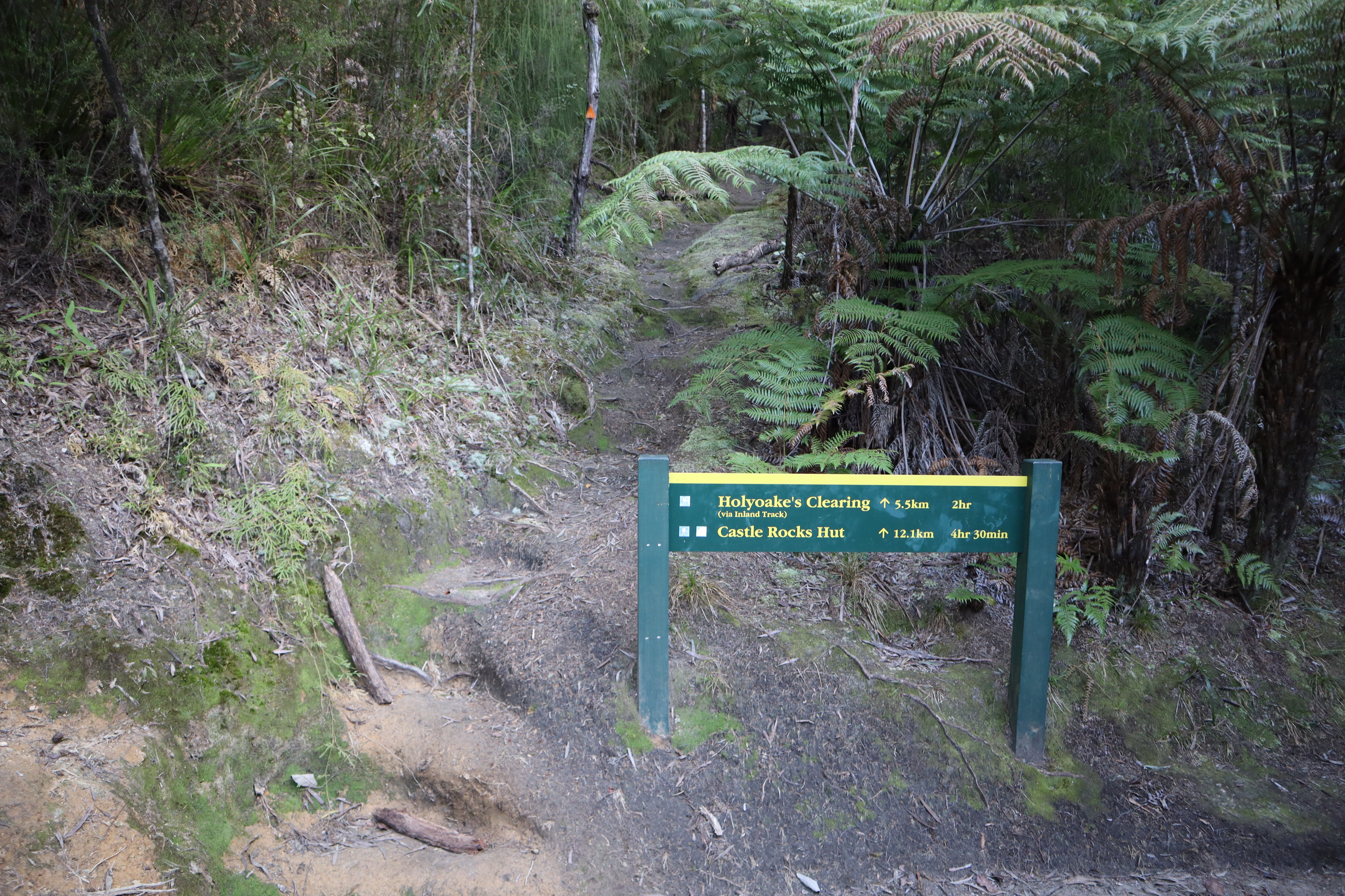
| Sign at the top of the Anchorage Access Track |
Here we see the Inland Track entrance...this is one of 5 entrances to this track. The track is very rough and is the poor cousin to the more sulubrius Great Walk Coastal Track along the coast. I have travelled on this track back in 2018 and it was a hard slog.
 |
| ...Rough track to the Inland Track... |
There was evidence of some track slippage on this section...I imagine if is from the large storms the hit this area back in February.
 |
| Fresh slip on the main track, Abel Tasman Coastal Track |
This bridge is the first of 31 I had to cross on the final day....not all of them are running streams. In fact I crossed a number that are just crossing gullies over the course of the day.
 |
| ...the first of 31 bridges for the day... |
I had my first break after about 1.5 hours walking...I was up on the main Torrent Bay track heading for Marahau. I didn't see any other trampers until I got past Apple Tree Bay as no fools were keen on walking into a backcountry hut that early.
 |
| ...8.8 kms left to walk on the track... |
 |
| Descending into the gloom of a forested area, Abel Tasman Coastal Track |
I stopped at the track junction for Observation Beach for a drink and snack break but didn't stop again until Yellow Point Track as it was was keen to get to the carpark. Normally I stop every 30 minutes for a couple of minutes and I was feeling a bit tired by the time I got down near Tinline campsite.
 |
| Stopping point at Observation Baty |
 |
| I'm walking through the deep bush, Able Tasman Coast Track |
Before I knew it Stillwell Bay came into view looking fine in the sun light. Stillwell is actually a private beach but the owners allow the public to come down and visit it. There is a very nice looking hut located there with a boat ramp and dock. Sea kayakers often stop here on their way along the coast and the last time I was here people were laying on the sandy beach...
 |
| First look at Stllwell Bay, Abel Tasman Coastal Track |
 |
The beach near Stilwell Bay camp-site
|
I stopped just past the turn off to Lesson Creek under some trees for a drink and a snack as I had been on the go for 2.5 hours by that stage. It is 7 kilometers or two hours walk from Stillwell Bay to the DOC carpark at Marahau...
 |
| Crossing over the Lesson Creek bridge |
I had a fine view of Fisherman's Island off the coast when I walked past it..it dominates the end of the track. It looked good sitting just off the coast...
 |
| Fisherman's Island, Able Tasman Coast Track |
 |
| Just past Apple Tree Bay, Able Tasman Coast Track |
Before I knew it I was walking past the turn off to Apple Tree Bay and the ocean side campsite. Apple Tree Bay is a nice looking campsite located on a spit of land with a small lagoon behind it. It has a number of large trees for shade, toilets and fresh water from nearby Simonet Creek.
 |
| Railings protect you from a fall...Apple Tree Bay |
Just along the track from Apple Tree Bay is Simonet Creek which is the other permanent water source along the track. There is access down to the river from the track. You can take water from the creek but do filter or treat it before use. I usually stop here for a break on my way to Marahau but it was just too wet so I carried on...
 |
| Simonet Creek, Able Tasman Coast Track |
There are still some areas of dense bush along this section even though it was the most heavily modified part of the coastline. They seem to mostly reside in the gullies, probably because it would have been difficult to extract timber from them.
 |
| ...Still areas of quite thick bush... |
You get your first views of the Marahau coastline as you approach Coquille Bay. From here you can see as far as Nelson, clearly visible over 50 kilometers away. You are roughly an hour from the end of the track at Marahau...just keep walking, just keep walking!
 |
| Coquille Beach, Able Tasman Coast Track |
 |
| The distant islands of the Marlborough Sounds |
 |
| Coquille Beach is tranquil in the sun |
I stopped at
Tinline camp-site to have a rest and to avail myself of the con-weniences....It looks like a nice camp-site, there would be plenty of room for a city of tents. This is the least developed of the camp-sites along the track: it has water and toilets but no camp cooking shelter.
 |
| Tinline Campsite.....no one is in residence |
 |
| Tinline Campsite. Able Tasman Coast Track |
Just past the camp site lies Tinline Stream, it is the last major river you cross on the track. You are 35 minutes from Marahau at this point..
 |
The bridge over Tinline Stream, Abel Tasman Coastal Walk
 | Walking along under the trees past Tinline Campsite
|
|
Almost at the end of the track: this is the causeway over Marahau Estuary. This is the last kilometre of the Abel Tasman Great Walk. On the Topo-map there is a notation about a low tide crossing here, disregard it...the causeway makes this an all tide track. You can cross the estuary at low tide but I don't know why you would want to...you would just get muddy.
 |
| Tidal flats at Marahau, Abel Tasman Coastal Track |
 |
| First view of the causeway at the Abel Tasman Coastal Track start |
There is a new carved Maori warrior at the start of the Abel Tasman Coastal Track...it has been installed sometime since October last year. There are now guardian figures at Wainui, Totaranui, Medlands Beach, Anchorage and Marahau. They could do with an interpretive panel explaining why they are there...
 |
| Maori carving standing guard over the Abel Tasman |
The last 600 meters of the track are across the Marahau Causeway and it has been substantially improved over the years as it kept being damaged in big storms. Heavy rain in the surrounding hills floods the Marahau River and the flow will easily top the bridges.
 |
| Mudflats at the causeway, Abel Tasman Coastal Track |
There is a portal at the official end of the Abel Tasman Coastal Track similar to the one at Wainui. There are carved portals on several of the Great Walks now including the Heaphy Track, Paparoa Track and Rakuira Track. This one is interesting in that it is facing the track end almost like it is welcoming you back into civilisation..
 |
| Carved entrance portal stands at Marahuau |
 |
| The start of the Abel Tasman Coast Track at Marahau |
Well there you go, finished at last....here is Jon in the information kiosk at the end of the track 3 days after starting out. There are a few interpretive panels and some information about the topography, history, flora & fauna of the park in the un-manned kiosk. There are also toilets and seats so it would be a useful place to wait for transport in inclement weather.
 |
| Mapboard in the kiosk at the track entrance |
Another 10 minutes saw me back at my car, still safely parked at the Aquataxi parking area. I arrived there at around 1 noon so that was 5 hours from Anchorage including two 20 minute breaks.
I made sure I did some extended stretching before heading off as I have been nearly crippled before by jumping straight in the car at the end of a tramp and driving for a couple of hours. Every time I stopped I spent 5 minutes stretching, it works a treat.
That was the end of my three day adventure in Abel Tasman National Park with a trio beautiful sunny days. I have now covered the full length of the Coastal Track on the blog There is great tramping in Abel Tasman and I think my trip for 2024 (if there is one..) will have to be a camping expedition staying at the beach side campsites.
I cannot wait...
Access: From Marahau walk north to Anchorage on the Abel Tasman Coastal Track. Alternatively take a watertaxi to Anchorage and walk back out to Marahau.
Track Times: 12.5 km's or 4 hours from Anchorage to Marahau on the Coastal Track.
Hut Details: Anchorage Hut: Great Walk, 34 bunks, wood burner, filtered water tank, wood shed, flush toilets; DOC campsites at Te Pukatea Bay, Watering Cove, Observation Beach, Akersten Bay, Apple Tree Bay, Coquille Beach and Tinline campsite
Miscellaneous: All huts on the Abel Tasman Coastal Walk are on the DOC Great Walk booking system and must be booked for overnight visit. Hut Warden in residence from late November to 30th April each year. Campsites are located at most bays and must also be booked year round.
You Tube link:


.jpg)