A short side trip to the Maruia Falls...
Hi folks...its been a while since I posted anything on the blog...near four weeks to be more exact. I have been stuck inside for much of that time due to a number of factors...bad weather, working a couple of weekends and getting stinking Covid.
 |
| Yerp...Jon got the Coves...!!! |
But...I'm back in business now and there will be a few posts coming soon about my recent trip to the Abel Tasman Coastal Track. I did my annual pilgrimage to the park last week and walked the track from Anchorage to Totaranui...the posts will follow soon.
 |
| Anchorage Beach in Abel Tasman NP |
On the way over Lewis Pass I stopped at a couple of places and did some short walks one of which was at the iconic Maruia Falls near Murchison.
At the Maruia Falls Scenic Reserve:
The Maruia Falls Scenic Reserve is on SH 65 about 20 kilometers from Murchison and is the location of the famous Maruia Falls. The Falls were a bi-product of the 1929 Murchison Earthquake (7.8 MW)...the river bed was uplifted by five meters and the water cascading over the falls continue to deepen them through erosion.
 |
| DOC sign on SH65 for Maruia Falls |
 |
| The area around the Falls is a Scenic Reserve |
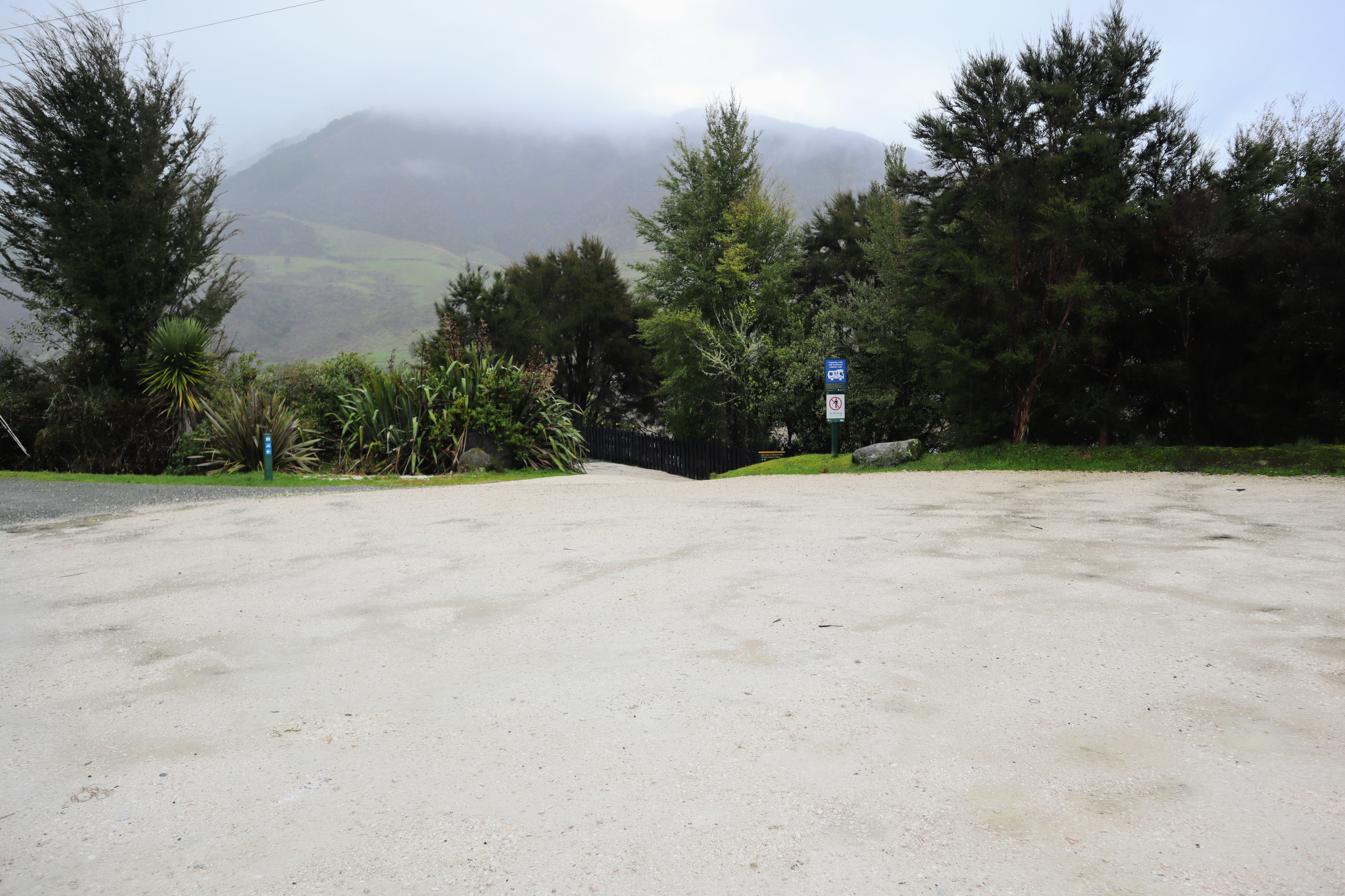
Prior to Covid the Maruia Falls were a very busy tourism spot but with the rainy weather and the fact it is winter few people were visiting. There was just one car at the carpark when I arrived and I saw one other person the whole time I was at the reserve. The carpark is huge and will easily hold about 30-40 cars at one time...
 |
| The carpark at Maruia Falls Scenic Reserve |
There is a good vantage point over the top of the Maruia Falls from the platform next to the carpark. The sound of the falls was deafening the moment I stepped out of the car so I knew the waterfall would be spectacular. It has been raining on and off here in the South Island for nearly a month so there is always plenty of water in the rivers...
 |
| Area at the top of the Maruia Falls |
There is a very confusing sign at the top of the Maruia Falls Track telling you to not go down to the falls. What they mean is do not go down to the edge of the top of the Falls as the area is unstable and it is extremely dangerous. You can follow the Maruia Falls Track down to the rivers edge at the base of the Maruia Falls.
 |
| ...from the top viewing platform as it is dangerous... |
There was a huge amount of water shooting over the Maruia Falls...the most I have seen the many times I have visited the site. The water was a total maelstrom and a fall into the water would mean certain death...
 |
| View from the top of the Maruia Falls |
 |
| The Maruia Falls were full due to heavy rain |
From the viewing platform you can see down to a flat area near the base of the Maruia Falls. Follow the track down the hill to access the side of the Maruia River where you can get a much better view of the power of the water...
 |
| Flat area at the base of Maruia Falls |
The Maruia Falls Track is about 300 meters long and descends down to the flats at the base of the Falls. The track is all weather and moderately steep but it is well maintained so most people will have no problem walking down it...
 |
| Heading down the short track to the base of Maruia Falls |
 |
| ...the track is about 300 meters to the Maruia Falls... |
 |
| Manuka forest along the Maruia Falls track |
There is a picnic table at the flat area where you can sit and have some lunch but be aware the Sandflies are murderous here in the summer...
 |
| ...there is a picnic area near the Maruia Falls... |
Follow the short track to the edge of the river and you can walk down onto the rocky edge of the Maruia River itself. For pity's sake stay away from the edge of the water though as this is an extremely dangerous place. There have been over a dozen fatalities here and even as recently as two weeks ago a couple of guys were killed when they went swimming here.
Jon says...stay out of the water unless you want to die!!!
 |
| Mist rising from the base of the Maruia Falls |
 |
| Warning sign at the Maruia Falls |
 |
| ...it is fatal to swim at the Maruia Falls... |
Here I am hamming it up near the bottom of the Maruia Falls...I was the only person there obviously!
 |
| Jon at the Maruia Falls in the Shenandoah Valley |
Here are some shots of the flow of water over the falls...the sound was amazing and there was a cloud of mist rising high over the falls from the force of the water. The Maruia Falls are currently about 10 meters high but they continue to carve away at the underlaying rock so they will continue to grow as time goes on.
Interestingly this piece of the Maruia River was flat until the Murchison Earthquake. The 7.8 quake caused a massive amount of damage in the Buller area and was felt as far north as Cape Reinga and all the way down in Invercargill. The area around Murchison was the worst affected with whole mountain sides collapsing leading to 17 deaths.
 |
| Maruia Falls, Shenandoah Valley, West Coast |
 |
| The Maruia River downstream from the Falls |
There is a vicious undertow at the base of the Falls and the dark swirling mass of water just looked dangerous.
 |
| Maruia Falls are about 10 meters high and 200 meters wide |
After about 10 minutes down by the river I started back up the track to the carpark. It is moderately steep climbing up the track but it is a very short track so it takes next to no time to head back up it.
 |
| Heading back up to the carpark at Maruia Falls |
The track is surrounded by a regenerating area of Podocarp forest and while the main tree species is Manuka I could also see young Rimu, Totara and Matai Trees growing there. I had a Fantail following me up the track and I also heard Tui and Bellbirds in the reserve...
 |
| Maruia Falls Track leading back to the carpark |
 |
| ...the Maruia Falls Track is an all weather track!.. |
 |
| Moderately steep climb back to the Maruia Falls carpark |
FYI: there is a DOC serviced vault toilet at the top of the Maruia Falls Track and it was both clean and tidy so it would fine to use for most of the time.
 |
| The toilet and viewing platform, Maruia Falls |
 |
| An empty Maruia Falls carpark |
So that is the Maruia Falls Reserve...stop by the next time you are in the area and have a look at this example of the power of nature. If you are following the Buller Gorge Road to Westport it is worth making the 20 kilometers side trip to the falls and it is on the direct route from Lewis Pass to Nelson.
I have more posts to follow including one about the Lake Rotoroa Nature Walk, Hope Saddle Lookout and the main event my annual trip to Abel Tasman NP.
See you soon!!!
Access: The Maruia Falls Scenic Reserve is located on SH 65about 20 kilometers from Murchison.
Track Times: Maruia Falls Track is about 300 meters long so about 5 minutes walk to the side of the Maruia River
Miscellaneous: There is a huge carpark at the reserve with a viewing platform, vault toilet and picnic table down next to the riverside. DO NOT SWIM IN THE MARUIA RIVER!!! Over a dozen people have died here...the currents and undertow make this a deadly spot. Stay out of the river at all costs!!!