Walking on a sunny winters day....
Note: this trip happened before the Covid lockdown so don't be hammering me for going outside of my area to exercise....
Sunday the 15th August was a beautiful sunny winter day here in Christchurch so I went out for a walk at one of my favorite walking tracks around Travis Wetland. The walk around the wetlands is very nice and at approximately 6 kilometers or 1-2 hours walking time is a great fitness walk.
 |
| View of Travis Wetlands from the Mairehau Road car park |
As usual I parked the Silver Surfer around near Burwood Hospital at the Mairehau Road carpark. This is just one of the ten different entry points into Travis Wetlands located around the perimeter of the reserve. From here you can walk either clockwise or counter clock wise around the outside of the reserve.
 |
| Silver surfer parked at the Mairehau road entrance... |
 |
| Me at the start of the walk around Travis Wetland |
Travis Wetlands is a wetland restoration project on the north east side of Christchurch where they are attempting to recreate the type of lowland swamps that existed before Europeans arrived in Canterbury. There used to be a vast Kahikatea swamp from the mouth of the Avon River right out to the mouth of the Waimakiriri but it was gradually drained for forestry, housing and farming.
 |
| At one of the entrances to Travis Wetlands.... |
I have been around the Travis Wetland Track a couple of times now so I wont go into too much detail but here is what the walk around the wetland looks like.
On the Travis Wetland Walk:
Travis Wetland Walk is a six kilometer 1-2 hour journey in the north east corner of Christchurch. There are 10 entrances to the reserve and it can be accessed off Queen Elizabeth II Drive, Mairehau Road, Frosts Road and from several other entrances around its perimeter. The main entrance is off Frosts Road and there are carparks, toilets and water sources here but I usually park along Mairehau Road opposite Burwood Hospital.
 |
| Photographic diagram showing Travis Wetland |
The track is very well maintained by a variety of groups including the Christchurch City Council, Environment Canterbury and Travis Wetland Trust. It is an excellent track...wide, well marked and covered with light gravel with some sections of boardwalk especially along the southern edge and some road side walking at the southern end.
 |
| At the Mairehau road entrance to Travis Wetlands |
 |
| Looking out over Travis Wetlands with the Port Hills in the distance |
The Travis Wetlands Trust have been working on replanting in this area for over 20 years now so many of the trees and bushes planted are now starting to get tall. They have recently started to install information panels next to some of these native plants with information about that particular tree or shrub. I have seen similar panels on other CCC tracks so I imagine they are being installed by the Council.
 |
| Newly installed plant information panals... |
 |
| Travis Wetlands: heading along the northern edge of the reserve |
I parked along Mairehau Road so to start with I was walking along the northern edge of the wetlands and heading in a clockwise direction around the outside of the reserve. The track is very easy to follow and well marked. Generally it was dry and well maintained but there are some muddy sections in the lower lying areas.
 |
On the eastern edge of Travis Wetlands
|
From Mairehau Road you walk along the eastern side of Travis Wetlands. This side of the reserve backs onto the suburb of Parklands and you can see over the back fences of the houses along the track. There is a corridor of trees you are walking under which line both sides of the track.
 |
These are information points for a audio file around the Travis Wetlands
|
There is a variety of terrain within the Travis Wetlands...the northern half of the reserve is mostly tussock, grassland and Raupo swamp. On the southern edge of the park there are more mature native trees and low laying wetlands. The center of the Wetland is mostly lakes, streams and canals which provide a home for a variety of bird species.
 |
Raupo swamp on the north-eastern edge of Travis Wetlands
|
 |
Information about Raupo, Travis Wetlands
|
Many different tree species have been planted in the wetlands such as Cabbage Tree, Totora, Kahikatea, Miro and Manuka. All of these species would have inhabited this area before it was cleared for farming in the 1880's.
 |
Travis Wetlands: there are trees both sides of the track
|
 |
Paradise Ducks on one of the old fields, Travis Wetlands
|
There are ten entrances to the Travis Wetlands with the main entrance on QEII Drive, Frosts Road and Mairehau Road. There are also a number of other smaller entrances from the suburbs of Parklands and Burwood such as the one in the photo below.
 |
One of the ten entrances to Travis Wetlands...from Parklands
|
 |
Travis Wetlands: heading to the main entrance on Frosts Road
|
 |
| View south across the Travis Wetlands from near Parklands |
Travis Wetlands was a working farm up until very recently so there is a lot of farm infrastructure still in place. The Wetlands Trust have turned the old farm house into a conference center and several of the old out buildings are used for gear storage, garages and as covered raising beds for new trees.
 |
| Old farm buildings owned by the Travis Wetlands Trust |
 |
| Young sun sensitive plants along the Travis Wetlands Walk |
 |
| This is the old farmhouse in Travis Wetlands...now a conference center |
A couple of purpose buildings have been constructed which serve as an Information Kiosk and bird watching hide. Both of these are close to the main entrance off Frosts Road as well as the only toilets in Travis Wetlands. The Information Kiosk has panels which describe the vision the Trust has for Travis Wetlands as well as brochures about the reserve and the Trust itself.
 |
| The Travis Wetlands Information Kiosk.. |
 |
| Looking out into Travis Wetlands from the Information Kiosk |
 |
| There are public toilets at the main Frosts Road entrance |
 |
| Travis Wetlands: the walk continues past the Information Kiosk |
The lakes in the center of the Wetlands are home for a variety of waterfowl, Ducks/Geese and wading birds. Species you will see here include various Ducks, Coots, Geese, Scaup, Pripets, Swans, Pukeko, Cranes and Herons.
 |
| One of the lakes in Travis Wetlands... |
 |
| A variety of Ducks, Geese and Swans live here... |
 |
| ...as well as a multitude of Pukeko... |
The Travis Wetland Walkway goes around the outside of the reserve but there is also a path across the middle of the wetlands as well. This means you can walk a figure 8 around the wetlands with two crossings of the central pathway.
This is what I was doing...
 |
| On the Travis Wetlands Walk heading across the center of the reserve |
 |
| There are many Cabbage Tree groves in Travis Wetlands |
 |
| There are several lakes on the south eastern boundary... |
I took the short side track to the bird watching hide in the center of the wetland. This is a covered structure with seats and viewing windows which look out over the largest of the lakes. There is space inside the hide for perhaps 6-8 people at any one time.
 |
| Travis Wetlands: turn off for the birdwatching blind |
 |
| Cabbage Trees and Kahikatea on the way to the bird hide... |
 |
| The Travis Wetlands bird hide... |
The hide also has information panels inside detailing the many species of bird you can see at Travis Wetlands. Some of these species live in the Wetlands right through the year but many of them are migratory and will usually only be here over the summer or during breeding season.
 |
| There are a number of information panels inside... |
 |
| Waterfowl found in Travis Wetlands |
 |
| Travis Wetlands: various wading birds live here as well... |
 |
| View south from the Travis Wetland bird hide... |
 |
| Travis Wetland: view from an observation port in the hide... |
 |
| Distant Mt Sugarloaf from Travis Wetlands |
There is a grove of native trees planted along the track to the bird hide which includes both Totora, Kahikatea and Miro Trees. All three of these species existed in this area in the past and form the main type of trees in the projected wetland forest that will eventually exist here.
 |
| A young Totara Tree near the bird blind |
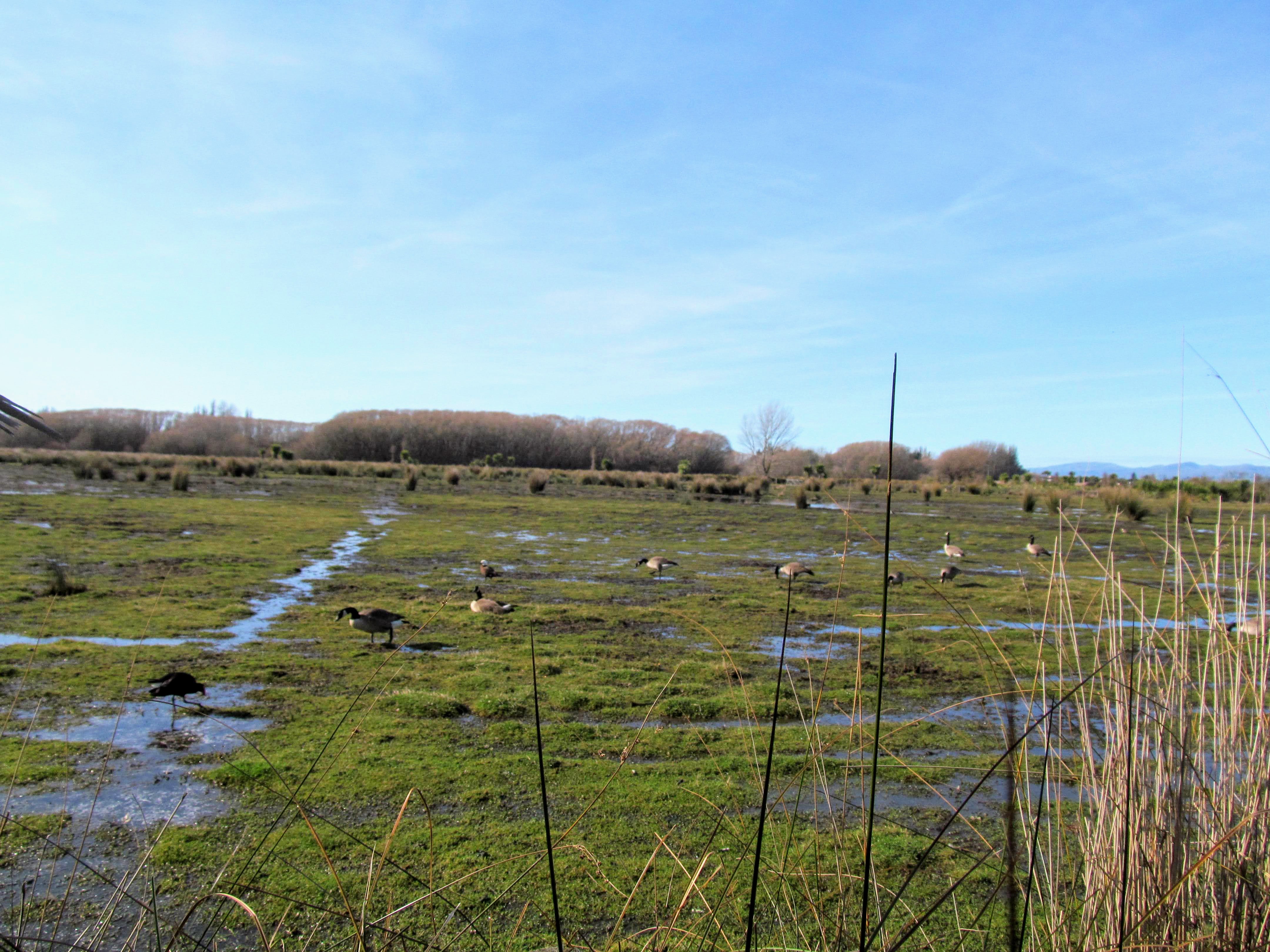
There are several smaller lakes along the south eastern side of the Wetlands in what were once farm paddocks. This area is much favored by Pukeko and Canadian Geese who both enjoy this type of grassy open area as habitat.
 |
| Travis Wetlands...there are more lakes in the south east corner... |
 |
| ...some of the larger Travis Wetland lakes have islands.... |
There is a nice seating area halfway across the center of the wetlands with views out to the north and some of the largest lakes. It is a very sunny and wind protected area which would be a great place to stop for a rest, drink or a snack.
 |
| Looking at some swans in Travis Wetlands |
 |
| Geese and Pukeko enjoying the sun... |
 |
| You can just see the Canterbury Foothills from Travis Wetlands |
 |
| Walking through the middle of Travis Wetlands |
The Port Hills are about ten kilometers away from Travis Wetland and when you get over to the more open southern side of the reserve you can see them clearly in the distance.
 |
| The middle of Travis Wetlands is a large marsh |
 |
| Typical plants found in the center of Travis Wetland |
 |
| Young saplings growing along the Travis Wetlands Walk |
 |
| Here I am in the middle of Travis Wetlands |
 |
| Canadian Geese also live in Travis Wetlands |
 |
| Recent rain has flooded parts of the Travis Wetlands |
There is a access fence and gateway on the southern end of the track across the wetlands to keep domestic dogs out of the wetlands. I think they had an idea to make the central portion of the wetlands into a predator proof reserve but it looks like they have made little progress. The fence is incomplete so it would offer only the smallest amount of protection to the birds that live here.
 |
| Approaching the southern edge of Travis Wetlands |
 |
| There is a gate to keep dogs out of the Travis Wetlands |
From here you can head right towards Mairehau Road or left towards QEII Drive. I headed out to QEII Road so I could walk right around the perimeter of the wetlands. It is about 400 meters from the junction to QEII Drive and the southern boundary of Travis Wetland.
 |
| We head left toward QEII drive....Travis Wetlands |
 |
| The Travis Wetland Walkway is part of the Christchurch 360 Trail |
 |
| On the southern edge of Travis Wetlands |
The houses are right up next to the boundary along the Burwood side of Travis Wetland. The wetland is mostly out of view for these homeowners due to the band of trees along the track BUT it would be nice having this lovely walk just over your back fence.
 |
| The house back onto the Travis Wetlands |
 |
| A domestic cat I saw stalking in Travis Wetlands |
 |
| Travis Wetlands: the southern side has the oldest planting... |
 |
| Extensive Flax groves along the south edge of Travis Wetlands |
The southern edge of the wetland is along QEII Drive and down to Travis Road intersection. This is the start of the road walking section of the track as you make your way down to Frosts Road on the South eastern corner of the reserve. You walk just next to the wetlands on a cycle path for about 400 meters.
 |
| Entrance to Travis Wetlands from QEII Drive... |
 |
| Travis Wetlands sign on QEII Drive |
 |
| Forest, tussock and lakes on the southern edge of the reserve |
 |
| Walking along the cycle way next to QEII Drive... |
 |
| Looking north over the Travis Wetlands |
Frosts Road runs between Travis Wetland and the old QEII Golf Course as it heads into the suburb of Parklands. You walk for around 300 meters to the main entrance to Travis Wetlands where you are able to reconnect to the walkway again.
 |
| You turn left down Frosts Road... |
 |
| There is a sidewalk alongside the old Council Golf Course |
 |
| Looking across Frosts Road to Travis Wetlands |
 |
| View along Frosts Road to the main Travis Wetland entrance |
I used to enjoy playing golf at the old QEII golf links but they were extensively damaged in the Christchurch Earthquakes and will not be re instated anytime soon. The old greens are sitting idle now except for some small areas being used by the Travis Wetland Trust and the CCC as a seedling bed for raising native trees.
I imagine the old Golf Links will one day become a part of Travis Wetlands as it already has several small lakes and is immediately adjacent to the existing reserve.
 |
| Looking into the old QEII golf course... |
 |
| Young native tree bed on the old golf course... |
 |
| Main entrance to Travis Wetland off Frosts Road |
The main entrance to Travis Wetlands is off Frosts Road and has a carpark, picnic tables, toilets and access to both the Conference Center and Walkway from near the end of the drive. This would probably be the best place to park if you are unfamiliar with the area.
 |
| Heading back into Travis Wetlands from Frosts Road |
 |
| There is limited parking along the access road... |
 |
| Jon at the Frosts Road entrance to Travis Wetlands |
Travis Wetland is officially open from 8am to 8pm but you can actually access the walkway at any time of the day so this is a fine place to visit over the longer summer evenings. During daylight savings it is often light here in Christchurch till after 10pm so you will often see people out exercising even this late in the day.
 |
| Travis Wetland is officially open from 8am to 8pm |
 |
| The pedestrian walkway off Frosts Road entrance... |
 |
| Carpark at the main entrance to Travis Wetlands |
 |
| Travis Wetland: the toilet and conference center |
 |
| There are maps and information at all entrances to Travis Wetland |
As I mentioned previously I was walking the track in a figure 8 direction so I headed back over the center of the Wetlands once again.
 |
| Heading back across the center of Travis Wetlands |
 |
| View south across Travis Wetlands from the bridge |
 |
| There are still loading platforms for stock in the wetlands |
We had a week of rain recently in Canterbury so the low lying areas of the wetlands were well inundated. Most of these areas were once farm paddocks and they often flood providing more habitat for birds like Pukeko, Canadian Geese and Swans.
 |
| The Port Hills are highly visible from in Travis Wetland |
 |
| Pukeko living in the wetlands go about their business |
 |
| Here I am walking across the middle of Travis Wetlands |
M |
| More Pukeko in the Travis Wetlands |
Travis Wetland has a number of small streams and canals some of which contain native fish. There are information panels on a couple of the small bridges over them which explain what species can be found here.
 |
| Several species of native fish live in Travis Wetlands |
Once over the center of the Wetlands I headed north along the far side of the Wetlands Walkway bordering the suburb of Burwood. It is about 1.5 kilometers from here back to the start of my walk along Mairehau Road. The track along here is lined on both sides by native trees which form a nice sun shaded corridor to walk along.
 |
| The start of the track along the south western edge of the wetlands |
 |
| To start with the Travis Wetland Walk runs along the fenceline... |
 |
| Looking north across the wetlands... |
There are several seats dotted around the Wetlands that you can sit at and enjoy the view of the scenery. Someone had been cutting back the trees along the track and had piled them up ready to be removed. There would be a lot of this sort of work to be done right through the year so the Trust volunteers would always have plenty to occupy them.
 |
| There are several bench seats around Travis Wetlands Walkway |
 |
| The Trust have been clearing bush along the tracks |
 |
| Cabbage Trees line the sides of the walkway... |
There is another entrance to Travis Wetland from a Council park off Clarevale Street in Burwood. There are playing fields here and a playground for children but no toilets or water source.
 |
| Looking out over the entrance to Travis Wetland on Clarevale Street |
 |
| ...the walkway was a bit muddy at the Clarevale Street entrance... |
Past the park you are back on the Travis Wetland Walkway on a long section of boardwalk. This will take you most of the way along the Burwood side of the Wetlands and eventually take you back to the carpark on Mairehau Road.
 |
| The north western edge of the track is on boardwalk |
 |
| There is a very nice restored swamp at the start of the boardwalk |
 |
| On the boardwalk along the north-west edge of Travis Wetlands |
 |
| There are areas of Cabbage Trees groves and Manuka.... |
 |
| These Willow Trees will eventually make way for natives... |
There is a viewing tower in the north western edge of the Wetlands next to the boardwalk. It has two elevated platforms with great views out over the northern end of the wetlands.
 |
| Approaching the viewing tower at Travis Wetlands |
 |
| Travis Wetland viewing tower near Clarevale Park |
From the top you can see right over to the eastern side of the reserve near the Frosts Road entrance. The northern end of Travis Wetlands is a large area of tussock, grassland with a line of trees along the outside of the reserve.
 |
| The stairs to the upper level, Travis Wetland viewing tower |
 |
| View to east from the viewing tower in Travis Wetlands |
 |
| There are still Willow Trees near the viewing tower |
From the top of the viewing tower you can see the distant Port Hills but much of the detail at the southern end of the Wetland is out of sight due to the trees.
 |
| Travis Wetlands: view back along the boardwalk... |
 |
| Travis Wetlands: view to the south east from viewing tower |
From the viewing tower it is back onto the boardwalk for the rest of the way back to the carpark.
 |
| Heading back towards the carpark on Mairehau Road, Travis Wetlands |
 |
| Boardwalk in the north west corner of Travis Wetlands |
 |
| Flaxes and tussock in the north west corner of Travis Wetlands |
Along the way you pass through an area of remnant Manuka bush which was a type of tree species that once existed in this area. The Travis Wetland Trust have also undertaken some planting of Manuka in the same area to regenerate this type of native forest inside the reserve.
 |
| Some of the remnant Manuka bush in Travis Wetlands |
 |
| ...and some newly planted Manuka trees... |
You continue past the Manuka along the boardwalk passing a nice setting area on the way. The suburb of Burwood can be seen along the edge of the wetland about 100 meters away.
 |
| Seating between the view tower and end of the walkway |
 |
| Burwood abuts Travis Wetlands on its northern edge |
 |
| View across Travis Wetlands from the north west corner |
The last section of the track is through native trees at the north west end of the Wetlands. They line both sides of the track with small gaps between the groves where you can see out and into the Wetlands.
 |
| Native trees in the north west edge of Travis Wetlands |
 |
| The old farm buildings are near the distant Willow Trees |
 |
| Pukeko near the north west end of the walk |
 |
| Travis Wetlands: the whole northern end is a vast swamp |
 |
| Another of the information points at Travis Wetlands |
 |
| ...continuing along to the end of the walkway... |
There is a great view point down at the northern edge of the Wetlands where you can look out across the swamps at this end of the reserve and you have a clear view of the Port Hills in the far distance.
 |
| View right across Travis Wetlands from the northern edge |
 |
| View along the northern end of Travis Wetlands |
The last section of the track is along the northern end of the wetlands in an area called the Anne Flannagan Dell. Anne Flannagan was one of the original stalwarts of the Travis Wetland Trust and it is really down to her that this area was acquired by the Council to be turned into a restored wetland reserve.
 |
| Heading into the Anne Flannagan Dell at Travis Wetlands |
 |
| Entrance to Travis Wetlands from Mairehau Road |
 |
| Seat at the start of the Anne Flannagan Dell |
Anne Flannagan Dell is an area of native tree planting and it also has a very nice seat where you can sit and contemplate the Wetlands.
 |
| Sign in Anne Flannagan Dell, Travis Wetlands |
 |
| Heading away from Anne Flannagan Dell... |
 |
| Looking along the southern edge of Travis Wetlands |
 |
| The last forested section of the Travis Wetlands Walk |
From Anne Flannagan Dell it is a short 200 meters walk back to the carpark on Mairehau Road where I had parked the car. That was the end of my walk around the wetlands...
 |
| Travis Wetlands: information panel at the carpark on Mariehau Road |
 |
| Travis Wetlands: back at the start of my walk |
There is a picnic table in a small grassy clearing next to the carpark and this makes a good place to end your walk. It would be nice to sit here with a coffee looking out over the Wetlands and watching the people pass by on their way along the track. There were quite a few Pukeko around this area as they like to live in areas of open grass or sparse open tussock.
 |
| Pukeko at the Mairehau Road entrance to Travis Wetlands |
 |
| Standing at the end of my walk around Travis Wetlands |
Travis Wetlands is a real asset for residents of Christchurch and deserves your attention. It is a lovely walk especially on a nice sunny day and I can thoroughly recommend it to you.
Access: Multiple access points to Travis Wetlands from Mairehau Road, Frosts Road, Travis Road and Clarevale Street. This trip started on Mairehau Road near Burwood Hospital, I then walked a figure of 8 circuit right around the wetlands.
Track Times: From the start of the track it takes approximately 1-1.5 hours to cover the six kilometer circuit around the Reserve
Miscellaneous: Toilets only near the Education Center in the middle of the Reserve...no potable water along this track section except near the toilets at the main Frosts Road entrance. Be careful around traffic as you cross several busy roads. The track is an all weather route.