...a West Coast Great Walk adventure.....
I went over to the West Coast to walk the
Paparoa Great Walk Track over Waitangi Weekend. This was my penultimate Great Walk...after this I just have the Kepler to walk in late March and they are all wrapped up. Ten Great Walks walked over many years and it just waits on the formation of any new Great Walks like the Humpridge Track before I can add to my bag...
 |
| View of Coal Creek from Tindale Ridge, Paparoa NP |
You can start the Paparoa Track from either the carpark at Smoke-ho above Blackball or from Punakaiki on the West Coast. I started from Smoke-ho BUT I actually drove over to Punakaiki and stayed at the
Punakaiki Beach Camp the night before I started the tramp. There is a shuttle service from the camp ground which will take you over to Blackball and the start of the track. That way your car will be waiting for you at the end of the track in Punakaiki.....
 |
| The main road through Punakaiki, West Coast |
I hired one of the cabins at the campground for before and after my tramp...it was reasonably priced at around $60 per night. I had a small kitchenette in the cabin but not a toilet or shower...you have to use the camp ground facilities but this is no problem.
 |
| My cabin at Punakaiki Holiday Park.... |
Because it was Waitangi Weekend it was super busy...I arrived later in the afternoon and spent a bit of time down looking at the Pancake Rocks and the shops a Dolomite Point. Later in the afternoon I went for a walk along the beach and it was marvelous...bright, warm sunny weather. In the evening I went to watch the sun go down over the western horizon and it was equally spectacular.
 |
| The distant Pancake Rocks from the beach at Punakaiki Holiday Park |
 |
| The weather at Punakaiki was lovely..... |
 |
| Gorgeous golden sunset at the beach at Punakaiki Holiday Park |
The start of the Paparoa Great Walk runs along the old
Croesus Track from Smoke-ho to Ces Clark Hut. This was once an old pack track and bush railway so the track is well established. It meanders for a good five hours through typical West Coast forest before breaking onto the tops and 16 bunk Ces Clarke Hut.
 |
| Paparoa GW Track: on the Croesus Track on day one... |
 |
| Blackball from the veranda at Ces Clarke Hut |
Day two of the track is a short three hours all of it on the open tops....in good weather you can see the coastline, the Southern Alps and as far south as Aoraki/Mt Cook. Or so I was told....I did not have good weather as it utterly pissed with rain for most of the day and blew like a bastid but more about that later...
 |
| On the Paparoa GW Track near Croesus Knob |
 |
| Rain, fog and strong wind at Moonlight Tops Hut |
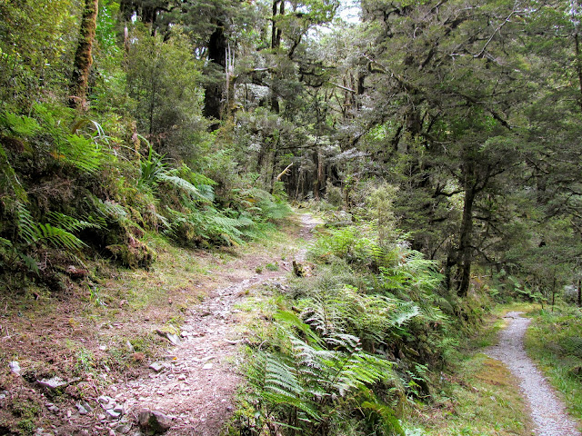
Day three is a mixture of forest walking and tops travel with a steep descent at the end down to Pororairi Hut on the Tindale Ridge. Even in the rainy and windy conditions I experienced it was still spectacular and its most interesting section. There is an expanse of Goblin Forest before the Escarpment and a whole forest of Dacrophyllum Trees for interest.
You end the day at Pororairi Hut with views down to the coast over 15 kilometers away....
 |
| At the start of the Escarpment on the Paparoa GW Track |
 |
| Rainy approach to Coal Creek on the Paparoa GW Track |
The last day of the track is a descent down off Tindale Ridge to the headwaters of the Pororairi River. This is through beautiful old growth Podocarp forest with some staggeringly huge examples of Kahikatea, Totora, Rata and Rimu.
It is absolutely humbling to be in the presence of these giants of the forest....it is some of the nicest rain forest I have ever encountered here in New Zealand.
 |
| Paparoa GW Track: heading down off Tindale Ridge on day four |
Another excellent section...the upper and mid reaches of the Pororairi River are magnificent and it is fantastic that they are now accessible along this new track. The middle section starts as wide and calm flowing before entering a narrow gorge then it reverts once again to calm water...
 |
| The calm mid reaches of the Pororairi River, Paparoa GW Track |
 |
| The gorge in the middle section of the Pororairi River |
 |
| Mid reaches of the Pororairi River, Paparoa GW Track |
The final stretch out through the Pororairi River Track was enhanced by the full river after all the rain the area received in the previous days. This section has the wow factor you would expect on a Great Walk as the Pororairi River is very photogenic.
 |
| Approaching the end of the Paparoa Great Walk Track at Punakaiki |
This is a awesome track and I can easily see it becoming one of the best loved Great Walks over time. It is beautiful, awe inspiring and remote feeling in turn and features a wide array of terrain. It can be a challenging track to walk or ride but I think the effort is worth it.....
Day 1: Croesus Track: Smoke-ho carpark to Ces Clarke Hut: 16 kms (5 hours)
My day started at the Punakaiki Holiday Park...I was catching an 8 am shuttle bus from the campground to the Smoke-ho carpark on the Blackball side of the Paparoa Range. It costs $80 for the ride and takes roughly an hour to drive to Greymouth before turning inland to the small town of Blackball. It is a lovely drive along a very scenic coastline.
 |
| Map: Paparoa/Pike 29 Track, Paparoa NP |
There were only three of us on board for the trip to the far end of the track and the driver said this was unusual as he nearly always has a full van. Make sure you pre book this ride if this is the way you want to get to the start of the track.
 |
| Punakaiki Great Walk Shuttle at Punakaiki Holiday Park |
You can drive your own car to the Smoke-ho carpark and have it relocated to Punakaiki for when you finish the track. This service is also run through Punakaiki Campground and costs around $120...and must be pre booked. I would think twice about driving myself to Smoke-ho...the road is being improved but it is still a long, winding, narrow gravel road prone to slips.
Your choice really...
 |
| Smoke-ho carpark high above Blackball |
The track starts right next to the Smoke-ho car park and there are toilets and a small covered shelter at this end of the track. Plenty of parking here for probably 40-50 vehicles at one time and it would be somewhat secure being so far from anywhere. There were probably 15 vehicles parked there the day I started the track.....
 |
| The start of the Paparoa GW Track at Smoke-ho car park |
 |
| The rest of the Paparoa GW Track is decidedly NOT like this...... |
DOC have installed a number of panels at the start of the track with information about the geology, flora/fauna and history of the area. The start of the track is actually in the Roaring Meg Ecological Area....Paparoa National Park only starts along the tops of the Paparoa Range.
 |
| Information panel at Smoke-ho carpark |
 |
| Track map and general information at Smoke-ho |
 |
| Historical panel at the Smoke-ho shelter |
I didn't muck about as I had a five hour tramp ahead of me so after quickly adjusting all my gears I started along the track. The track on the first day is broken down into 30-60 minutes sections...i.e. 30 minutes to the Smoke-ho Creek bridge, 30 minutes to the historic first hotel Site, 30 minutes to the second hotel site, one hour to the Garden Gully turn off etc. This makes it a bit easier to plan your breaks for the day...
 |
| Setting off from the Smoke-ho carpark |
The actual start of the Paparoa GW Track is marked by a gate with Maori motifs on it...there is an near identical version at the Punakaiki end of the track 55 km's away. Keep an eye out for the exposed bands of coal along the first 400 meters of the track...there is a one meter band of coal coming out of the sides of the tracks all along here....
 |
| Official start of the Paparoa GW Track at Smoke-ho |
The first 30 minutes is the walk down to Smoke-ho Creek about 1.5 kilometers distant. There is a large swing bridge over the creek and then you start the steady climb you have the pleasure to experience for the next four odd hours as you climb out of the creek bed and head along the track.
 |
| Heading down to Smoke-ho Creek, Paparoa GW Track |
 |
| Smoke-ho Creek and the swing bridge |
 |
| Paparoa GW Track: at Smoke-ho Creek bridge... |
 |
| Smoke-ho Creek Swing bridge, Paparoa GW Track |
This first day is along the old Croesus Track a mining track from the turn of the century. It was once a pack track and light bush railway so the course of the track is wide and on a fairly even gradient. Every so often you will see old railway sleepers and or rails stacked up next to the track. The track is fine for walking on but it must be one hell of a rough ride as the stones along the track are the size of your fist..rough going even with extra wide MTB tires.
 |
| Safety barrier near Smoke-ho Creek |
 |
| On the Croesus Track to the first hotel site |
There were once four taverns along this track...those miners were thirsty folk so they needed stops to whet the whistle as they headed into the mine workings at Garden Gully. Thirty minutes saw me at the site of the first of these just before Blackball Creek. All that remains today are some foundations and the clearing the tavern once stood in.
 |
| Paparoa GW Track: the First Hotel site 40 minutes in... |
 |
| Blackball Creek swing bridge, Paparoa GW Track |
Because this is a Great Walk DOC have built bridges great and small to cover all of the significant or dangerous rivers and creeks. You crossed over no less than 12 on the way up to Ces Clarke Hut....
 |
| Paparoa GW Track: new bridge over a side stream... |
 |
| Benched pack track near the Second Hotel site, Croesus Track |
 |
| Paparoa GW Track: the bush is thick and multi storied... |
I arrived at the second hotel site about an hour after setting out for the day...I stopped there for my first break as I was getting hot and hungry. It was a beautiful day...temperatures in the low 20's, cloudy but little wind. Good conditions for a long bush walk.
From the second hotel site you can just make out Ces Clarke Hut way up on the edge of the bushline on the Paparoa Range. This track is easy to walk with a slight uphill gradient but it is unrelenting so you will start to flag by the time you get to see Ces Clarke Hut up close.
The section from the hotel site to Garden Gully would probably be nice to ride along as it is well compacted with few loose rocks to negotiate.....
 |
| The second hotel site on the Croesus Track... |
 |
| View to the Paparoa Range from the Croesus Track... |
 |
| The Croesus Track is a steady climb to Garden Gully... |
The next section is an hour walk from the second hotel site to the turn off to Garden Gully. There are many old abandoned mines in this valley but Garden Gully was the largest with hotels, houses, stores, a large stamper battery and the mine itself. At one time there were several hundred people living and working in the area.
They did find gold up here but never enough to make it a going proposition...the mine closed in the early 1900's and the area became the haunt of fossickers who occasionally pull a little color from the rivers. There was a sawmill at Garden Gully up to the late 1960's but that too closed down as they exhausted the easily available timber resources...
 |
| Typical vegetation along the Paparoa GW Track |
 |
| Historic retaining wall along the Croesus Track |
I have been up this valley before way back in the 1980's when I came up here with a couple of my mates and one of their brothers who lived in Blackball. We followed the old Croesus Track up to Garden Gully and looked at the stamper battery and old dilapidated huts that were still there. It was an interesting trip but much more rugged than along the new Great Walk track.
I did the side trip to Garden Gully to bag the two huts which still stand there...it is worth doing as it only takes 20 minutes to walk to Garden Gully and then back again. If you want to visit the mine and stamper it is another 20 odd minutes but as I have already been there I didn't bother.
 |
| At the Croesus Track/Garden Gully Junction |
 |
| Garden Gully Track to left....Paparoa GW Track to right.... |
 |
| Descending the short distance to Garden Gully, Paparoa Great Walk |
Garden Gully Hut is a replica of a historic miners hut...the original was still there in the late 1980's but it collapsed and DOC built this one so you can see how the miners lived. There is also a small two person bivouac at Garden Gully used by DOC staff and trappers operating in the surrounding Roaring Meg Ecological Area. I'm not sure if it is available for use but there is plenty of tenting space if you want to come stay here.
 |
| Historic Garden Gully Hut, Roaring Meg Ecological Area |
I only stayed at Garden Gully for about ten minutes and then I climbed back up to the main Croesus Track and headed off towards Ces Clarke Hut. You are approximately two kilometers from Ces Clarke Hut from the junction to Garden Gully.
 |
| Back at the Paparoa GW Track junction |
The track gets a bit steeper after the Garden Gully turn off as you start the climb up the side of the Paparoa Range to the hut at 1100 meters. This was clearly once a bullock track or similar it is much wider and features a distinct bench on the uphill side. It reminds me of the bullock track on the last section of the Rakuira Track as you head from Sawdust Bay to Oban.
 |
| Past Garden Gully the Croesus Track gets steeper.... |
 |
| Paparoa GW Track: As a Great Walk all significant streams are bridged |
 |
| Some of the Croesus Track was blasted from rock... |
The Paparoa Great Walk Track features signs and marker posts set one kilometer from the huts so you know you are closing on the hut. Take the estimate of distance with a grain of salt. It was definitely more than one kilometer from the sign below to Ces Clarke Hut...more like 1.5 kilometers.
 |
| Paparoa GW Track: one kilometer to Ces Clark Hut.... |
 |
| The forest thins as we approach the bush-line, Paparoa GW Track |
 |
| Rata Tree grove along the Croesus Track.... |
You break out of the bush-line about 700 meters away from the hut...there are awesome views out to the plain around Blackball, along the Paparoa Range and down to the Roaring Meg River. The view was enhanced by the thousands of flowering Rata Trees in this valley...the whole canopy was shot through with splashes of red....
 |
| First open view of the surrounds...Croesus Track |
 |
| Paparoa GW Track: at the bush line close to Ces Clarke Hut |
 |
| View down to Roaring Meg River, Paparoa GW Track |
I got my first close up view of Ces Clarke Hut after walking for about five hours...you can see it clearly sitting on a small plateau on the eastern edge of the steep hillside leading up to Croesus Knob.....
 |
| First view of Ces Clarke Hut, Paparoa GW Track |
There are actually two huts located here...Ces Clarke is the newer and larger and the other is diminutive
Croesus Top Hut. Top Hut is a small hut built in the 1930's for mining activities and cannot be used as it is a historic place. It was refurbished by DOC in 1999 as it was on the point of collapse. Ces Clarke Hut is another 40 meters up the track...
 |
| Croesus Top Hut (1930's), Roaring Meg Ecological Area |
 |
| At the door to Croesus Top Hut.... |
 |
| 70 odd years of graffiti inside Croesus Top Hut |
The Paparoa Track is the first dedicated dual use Great Walk track...it is open to both walkers and riders right through the year. The success of the dual use QCT, Old Ghost Road and seasonal MTB access on the Heaphy Track have shown that this successful proposition. I would expect more dual use tracks going into the future.
 |
| The Paparoa GW Track is a dual use track |
I arrived at
Ces Clarke Hut just after 2pm so it had taken me slightly more than five hours to walk to the hut. There were a lot of people at the hut...MTB day riders, day walkers and a group of ten who were pushing on for Moonlight Tops Hut for the night.
 |
| View out to Blackball from the veranda at Ces Clarke Hut |
It is a nice bush walk from Smoke-ho carpark to the Ces Clarke Hut but boy was I glad when I finally got there and could have a good long sit down.....
At Ces Clarke Hut:
You can walk the Paparoa GW Track over three days, two nights but I decided to go for the slightly easier option of walking to Ces Clarke on the first day and then having a short three hour walk to Moonlight Tops Hut on day two. I think this was the right choice as walking from Smoke-ho to Moonlight Tops would be a 8-9 hour walk over 22 kilometers almost all of it uphill.
 |
| Rear of Ces Clarke Hut (1968), Roaring Meg Ecological Area |
The hut was built in the 1960's but has recently had a very thorough refurbishment including a new stainless steel bench, double glazing, insulation, a veranda and a paint both inside and out. It is an older hut but still very serviceable...right up my alley really.
 |
| A potted history of the Croesus and Monlight Tracks... |
 |
| Interior of Ces Clarke Hut, Paparoa NP |
The hut is one of those 'one big room' examples with both the living space and the bunks all clustered around the center of the building. There are 16 bunks over four platforms, it has cookers with gas provided and a new and very efficient wood burner. I took my usual location up against one of the walls..we had 13 people in the hut that night so it was nearly full.
 |
| Recently refurbished and painted Ces Clarke Hut |
 |
| I was pleased to get to Ces Clarke Hut.... |
The veranda at the front of the hut has a awesome view out towards Blackball and is a really nice addition to the hut. I never took a photo of it and cannot find any online so it must be quite new. It was breezy sitting on the plateau so we had no sandflies the whole time I was there which is near impossible with any West Coast tramp.
 |
| My pit set up for action at Ces Clarke Hut |
 |
| Ces Clarke Hut: first order was a brew..... |
As the day progressed the weather got worse...we had an extended forecast for rain and wind for the next two days followed by fine weather. By dinner time it was raining heavily and also very windy which made for some disconcerting discussions amongst the residents of the hut about what course of action to take.
I was fairly set in my course as my car was at Punakaiki but the largest group in the hut was ill equipped for tops travel in rain and had two pregnant women with them so they ultimately decided to pull pin and go back down to Smoke-ho. They were joined by another couple staying in the hut who also decided to head back to their car the next morning.
 |
| Distant Blackball from inside Ces Clarke Hut |
 |
| The Paparoa GW Track follows the tops from day two.... |
We all settled into the hut and enjoyed the warmth of the fire as it stormed and raged outside. I had quite a comfortable nights sleep considering all the noise and only woke up once at about 2 am during a particularly violent downpour.
Day 2: Ces Clarke Hut to Moonlight Tops Hut, 9 km's (3.5 hours):
We were all up bright and early the next morning to suss out what the weather had in store for us for the day. It was still raining on and off and the track further up the range kept appearing and disappearing into the mist. It really was not an optimal day to be out walking along the tops...
 |
| Starting on the section to Moonlight Tops Hut, Paparoa GW Track |
We had a final discussion at 8 am about everyone's plans for the day...Myself and two women tramping together had decided to continue on to the next hut despite the weather...all three of us had much better rain gear and our cars were at Punakaiki which kind of made it an easy decision.
If the weather had been worse at the hut we would all have gone back to Smoke-ho and tried to organize some kind of transport from there. I'm foolhardy at times but not totally stupid...myself, Amy and Kate set off along the track on the 3-3.5 hour trip to Moonlight Tops Hut. I was following them for quite a while but eventually lost sight of them in the intermittent mist.
 |
| View back down the Croesus Track as I set out for Moonlight Tops |
The wind was blowing quite strongly with gusts getting up to 50-60 kph and there was on and off rain showers for the first half of the trip. I didn't take a whole lot of photos along this section really only when I stopped as it was wet and my camera is not waterproof. The track is really nice and I imagine on a clear day the views are spectacular but I spent almost the whole day enveloped in cloud so I really saw bugger all...
 |
| On the Paparoa GW Track just past Croesus Knob.... |
All of day two is along the old Croesus -Moonlight Track which connected the Croesus and Moonlight Tracks together. It has had a little work done to it to get it to Great Walk standard but the route has existed for nearly 100 years now. You can drop down to the West Coast about three kilometers in where the Croesus Track heads past Mt Ryall and down to Barrytown on the coast.
 |
| On the Paparoa GW Track just past Croesus Knob |
I managed to get at least 1/3 of the way along that days track before the rain really set in and made it hard to take pictures etc.. I was wearing the full rota of rain gear...overtrousers, jacket, long sleeved merino top, woolly hat and outer mittens. I got a bit sweaty wearing my rain gear for a couple of hours but I didn't really get rain wet which is great as I had my doubts about my Stoney Creek Stowit jacket. It worked a treat but I do need to renew the DWR coating on it before the Kepler Track....
 |
| On the tops in deteriorating weather, Paparoa GW Track |
 |
| Paparoa GW Track: sidling along past Pt. 1216 in the rain |
It was raining steadily and windy as hell from Pt.1216 until I arrived at Moonlight Tops Hut...I was glad we had set out early as I had passed the worse sections of the track before the wind came in. From Pt. 1216 onwards there are larger areas of forest and you are protected from the wind by the bulk of the hill you are walking behind.
I managed to lose my pack rain-cover along here...it was tied down to my pack with cord but the wind was so strong it just whipped it right off. I felt a strong tug and turned around just in time to see it flying over the top of the mountain 200 odd meters above me. Luckily I use a heavy duty plastic liner bag inside my pack as I got goddam wet over the next two days..at least my gear stayed dry!!!
 |
| Awful conditions near Pt. 1147 on the Croesus Tops..... |
There are some really sketchy points along this section of the Paparoa Track...meter wide ridgelines with the wind howling across them. I got pushed around by the wind a couple of times but nothing worse than that. If it had been more than three hours to Moonlight Tops Hut I would probably have considered turning back.
This track section is true tops travel...little to no cover and the cover that exist is largely provided by the terrain and the odd patch of forest you traverse. I stopped twice to adjust my gear but I never really had a break during the walk...it was just too awful. I just wanted to get to the hut. If you are coming to walk/ride the Paparoa Track be prepared for all weather conditions.
 |
| A narrow section on the Croesus Tops, Paparoa GW Track |
You are about 1.5 kilometers away from the Moonlight Tops Hut when you pass through the area of Dacrophyllum forest in the photo below. It is all down hill from here as you sidle around the western side of Pt. 1104 and gradually drop down to the new hut. I sure was glad when I passed that 1 km to the hut sign...
 |
| Stunted forest near Moonlight Tops Hut |
It was very windy & misty for the last kilometer of the track...olde Huey was trying his best to make me as cold and wet as possible the total bastid.....! I ran into the outgoing Moonlight Tops DOC ranger on her way to Smoke-ho on her bike. She looked wet so I made sure to give her my best wishes for her trip out.
I finally came around that last corner and saw
Moonlight Tops Hut waiting for me...I might possibly have let out a little cheer and told Huey what he could do with his rain and wind. It was a awesome sight after all those hours of walking.
 |
| View from Moonlight Tops Hut veranda, Paparoa GW Track |
 |
| MTB bike racks at Moonlight Tops Hut, Paparoa NP |
 |
| The end of the track from Ces Clarke Hut at Moonlight Tops |
I managed to knock out the 10 kilometers to Moonlight Hut in just over three hours and I was really pleased to get there finally. Amy and Kate had arrived about thirty minutes before me and it was excellent to arrive to a blazing fire and a recently boiled hut jug...boy did I enjoy that first mug of tea!!!
 |
| Outside of Moonlight Tops Hut, Paparoa GW Track |
I was dripping with wet by the time I got to the hut and I had to squeegee all the water out of the door once I had got my wet outer gear off. There was a huge puddle on the floor but luckily all these new huts have a big mud room at the entrance with hooks and pegs for your wet gear. My pack was soaking but a couple of hours hanging near the fire quickly dried it out.
At Moonlight Tops Hut:
It was just the three of us at Moonlight Hut until very late in the day when a group of eight trampers arrived from Ces Clarke Hut. They were from Southland and we spent the next three days together at the huts and on the track. We were later joined by a father/daughter combo from Wellington just on dusk...this was our group for the rest of the track.
 |
| Moonlight Tops Hut (2018), Paparoa GW Track |
Moonlight Tops Hut is lovely...spacious, well thought out with a high level of amenity it was a real step up from the older Ces Clarke Hut. Both Moonlight Tops and Pororairi Huts are 20 bunkers and we had 13 people in both so we had a bit of spare space. I took my customary spot by a window as I like a bit of ventilation overnight.
Here is a video taken at Moonlight tops Hut that shows you what the rain and wind was like for the last two hours to the hut.....
Both Moonlight Tops and Pororairi Huts acted as accommodation for the contractors who built the track and there was a photo album in both huts showing details of the process. They also have copies of a book written by one of the guys who worked on the Paparoa Track and I managed to finish it between Ces Clarke and Moonlight Tops Huts. The book is The Last Front Line by Brendan O'Dwayer...the front line is the name for the leading edge of a track under construction.
 |
| Bunkroom at Moonlight Tops Hut, Paparoa GW Track |
 |
| The kitchen area at Moonlight Tops Hut, Paparoa NP |
 |
| A tasty brew was well received after a cold wet walk.... |
The hut normally has views down into the Canoe Creek River Valley and along the old Moonlight Track both of which were obscured by the cloud. The hut is double glazed and well insulated so it was lovely and warm inside. You have wood for the fire but the main fuel is coal which always burns with a longer and more intense heat.
It was very, very wet and very windy for the whole time I was at the hut which made going to the toilet a real pain. You literally had to put on all your wet weather gear to walk the 30 odd meters to the throne room.
 |
| Moonlight Tops Hut, Paparoa National Park |
We spent a great night in the hut getting to know each other and it was a good atmosphere as we all had stuff to contribute to the conversations. The German-Kiwi DOC hut warden we had was a real hoot...she had ridden in that day on her MTB and was really friendly, gregarious and full of good information about the local area. All of the DOC Rangers I meet were good on this track and there was a good mix of ages, sex and ethnicity amongst them.
 |
| A dark and wet veranda at Moonlight Tops Hut at 3pm!!! |
So that was the first two days of my Paparoa Great Walk tramp...despite the rain on the second day it was a great experience. Once you are at Moonlight Tops Hut you have completed the most technical parts of the track and the final two days were mostly in forest so not so exposed to the elements. Come back soon to see what happened on the rest of this marvelous track...
Access: The Paparoa Great Walk Track can be accessed from either Punakaiki or the Smoke-ho carpark above Blackball. There is a shuttle service from Punakaiki to Smoke-ho so you can leave your car at the Punakaiki end of the track. You can also access the Great Walk from the Moonlight Track (Andersons Flat) or Croesus Track (Barrytown).
Track Times: Croesus Track from the Smoke-ho carpark to Ces Clark Hut is 10.3 km's (4-5 hours). Ces Clarke to Moonlight Tops Hut is 9.7 km's 3-3.5 hours.
Hut Details: Garden Gully Bivouac (Historic), no over night stay, open fire, water from stream, toilet. Croesus Top Hut: Basic, no charge, 4 bunks, open fire, toilet at nearby Ces Clarke Hut. Ces Clark Hut: Serviced (bookable), 16 bunks, wood burner, water tank, wood shed, toilets. Moonlight Tops Hut: Great Walk, 20 bunks, wood burner, water tank, wood shed, toilets
Miscellaneous: Both Ces Clarke and Moonlight Tops are on the DOC Hut booking system, must be booked for overnight visit. This is a Great Walk so all overnight stays must be pre booked before starting the track. Hut Wardens at all of the Great Walk huts. The section from Ces Clarke to Moonlight Tops Huts is exposed tops travel. Do not try to walk the track in extreme weather (windy/cold/heavy rain).


