..a return to Arthur's Pass National Park...
The weather has been playing havoc with my tramping plan for most of October and November...so I have been making the most of every good day I strike. Recently there was a lovely sunny Saturday and Karen had the day off so we planned a trip up to Arthurs Pass for a walk. There are a great many excellent tracks in the park but the one we went to visit was the Arthurs Pass Walking Track.
 |
Start at the Punchbowl Falls carpark...view to the west
|
 |
Perfect conditions for a day walk in Arthurs Pass
|
I have walked this track a number of times but this was the first time Karen has visited it. The Arthurs Pass Walking track is about 6 km's return or 2-3 hours walking on a mostly easy well maintained track.
 |
Many cars at the start of the Punchbowl Falls Track
|
You start the track at the Punchbowl Falls carpark at the western end of Arthurs Pass Village and walk right up to the Dobson Memorial overlooking the Otira Valley. Several tracks start from here including the Punchbowl Falls Track, Arthurs Pass Historic Walk, Scotts Track and the tracks to both Mt Aicken and Mt Cassidy.
 |
DOC sign at the start of the trail network...
|
There are several spots on the way to the footbridge over the Bealey River where you have excellent views of the Devils Punchbowl Falls on the true left of Bealey River. Punchbowl Falls are 112 meters high...one of several waterfalls over 100 meters in the park.
 |
Punchbowl Falls in full roar after heavy rain.....
|
 |
No dogs are allowed on Arthurs Pass tracks
|
As you approach the footbridge over the Bealey river there is a window in the bush purpose built for excellent photos. The bridge heads over the Bealey River but just before it there is a side track which will take you up to SH73 and the start of Scotts Track to the summit of Avalanche Peak. There is no sign there which I found interesting as there was one there the last time I visited Punchbowl Falls.
 |
View of Punchbowl Falls from the bush window..
|
 |
Bealey River footbridge, Arthurs Pass NP
|
 |
Bealey River from the bridge, view downstream
|
 |
Jon Moake crossing the Bealey River footbridge
|
 |
Bealey River looking up stream...
|
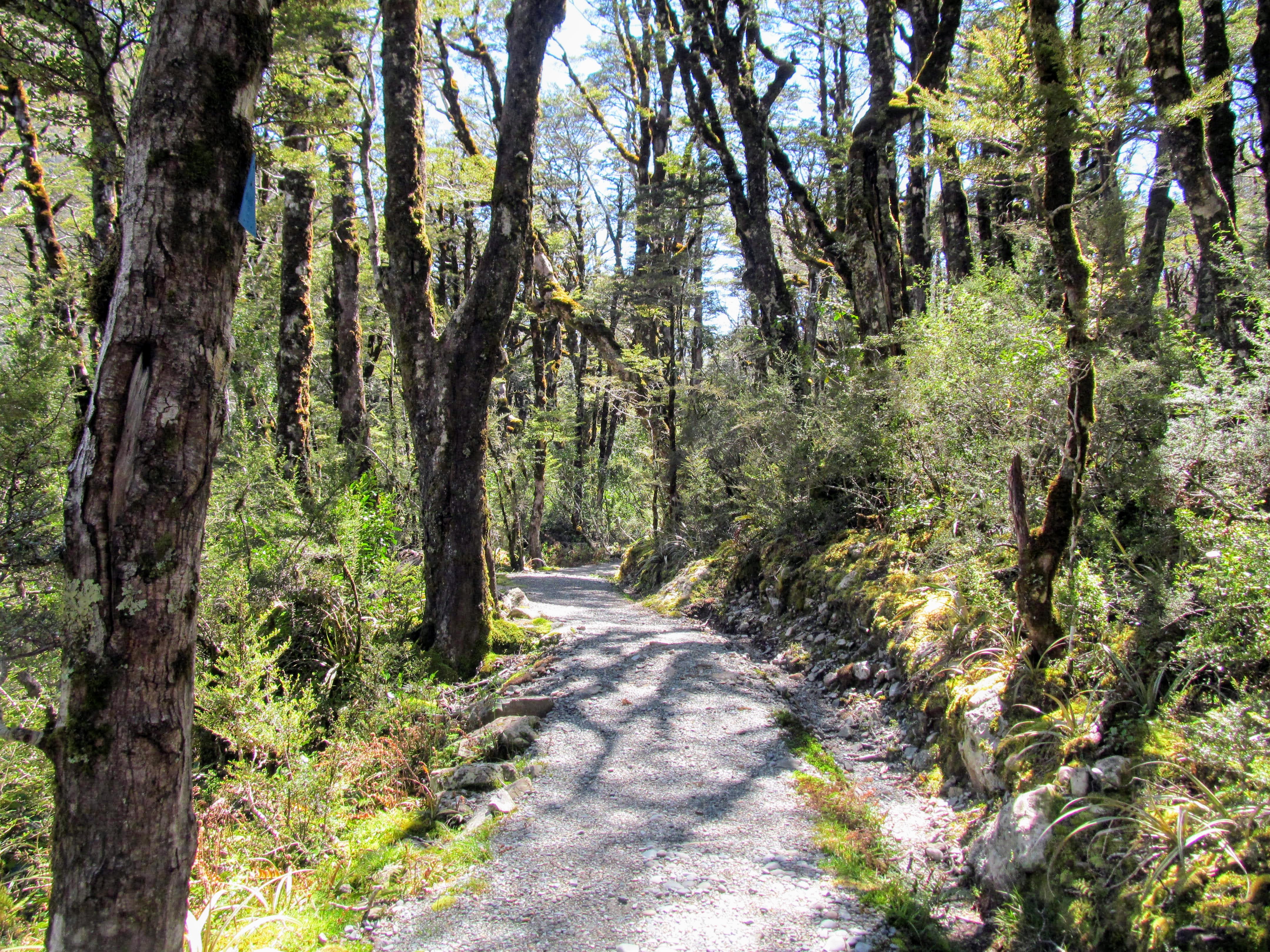
The Arthurs Pass Walking Track heads off to the left on the opposite side of the Bealey River and heads off along a flat Beech tree line corridor before starting the climb up this side of the valley. The track is wide and well maintained and the gradient is easy and consists of flat track and a number of sets of steps which helps you to rapidly gain altitude.
This is an all weather track as all streams and creeks are bridged and the canopy of trees protects you from the worst of any rain that is falling.
 |
| Arthurs Pass Walking Track: start of the track |
 |
| There are multiple bridges on the Arthurs Pass Walking Track |
 |
| Arthurs Pass Walking Track: steps at the start of the track |
 |
| You gain a bit of altitude at the start of Arthurs Pass Walking Track |
 |
| Nice benched section of Arthurs Pass Walking Track |
You steadily climb for 20 minutes before descending slightly to cross over a unnamed stream coming down off the side of Mt Cassidy. There is a wooden footbridge over this stream...you might wonder why when you see the flow. When it is raining up here this is a raging beast of a stream so they have built it well above the riverbed so you can easily cross the watercourse.
 |
| Arthurs Pass Walking Track: a bridge over a side stream |
 |
| Standard wooden bridge on the Arthurs Pass Walking Track |
 |
The stream is small now...but....in the rain!!!
|
There are also a number of bridges over dry gullies along the track these are more to even out the track than to protect you from flooded streams. There are occasional views of Mt Rolleston and the Bealey Valley as you walk the track...they are sitting off in the distance on the other side of the Bealey River.
 |
| More bridges over gullies on the Arthurs Pass Walking Track |
 |
| Distant view of Mt Rolleston from Arthurs Pass Walking Track |
 |
| Arthurs Pass Walking Track: another side stream crosses the track |
There is a viewing platform just before the descent down to Bridal Veil Creek with a picnic table you can utilise as a rest spot. You can see right up to the top of the Bealey Valley, towards Arthurs Pass and also out to the Bridal Veil Falls (108 meters).
Remember 108 meters is roughly 340 feet high so they are not insignificant. The existence of Arthurs Pass was partially about the waterfalls...people would come up to the village just to visit them.
 |
| Track junction to viewpoint on Arthurs Pass Walking Track |
 |
| Bridal Veil Falls (108 meters) from the Arthurs Pass Walking Track: |
 |
Looking west towards Arthurs Pass from the viewpoint
|
Just past the viewing area is a number of staircases which take you down the side of the hill to Bridal Veil Creek. There is a bridge here to take you over the creek surrounded by some bluffs which is why the track has to lose so much altitude. The forest around here is open with a lot of ferns, moss and lichen as the constant flow of water down the creek moderates the temperature and keeps everything nice and wet.
 |
| Descending down to Bridal Veil Stream, Arthurs Pass Walking Track |
 |
The bridge over Bridal Veil Stream...note the bluffs
|
There used to be a rough track up to the Bridal Veil Falls but DOC have removed the markers and the old track is all but invisible in this rapidly growing environment.
 |
View up Bridal Veil Stream, Arthurs Pass NP
|
Past Bridal Veil Creek you have to climb a number of steps to regain all the height you lost getting down to the bridge. There are a number of Neinei Trees along the side of the track these are otherwise known as Pineapple Trees or Dr Seuss Trees. Eventually you get to the top and the flat sidle track starts once again...
 |
Mountain Neinei next to the Arthurs Pass Walking Track
|
 |
| Arthurs Pass Walking Track: climbing the many steps after Bridal Veil Stream |
 |
Karen taking a photo of the steps...
|
 |
| Arthurs Pass Walking Track: at the top of the steps... |
 |
| Boardwalk and track on the way to Jacks Hut |
Approximately 10 minutes past the steps you pass under a transmission tower taking high tension power lines down valley. The power lines are the reason for the track...back in the late 1980's the power line company had a cleared corridor down the valley and people used it as a make shift track up to Jacks Hut. I remember walking up the old route some time in the late 1980's on a school Geology field trip to Arthurs Pass.
When they came to make a new millennium track in Arthurs Pass they simply built the track over the unofficial route that already existed. It is great to have a track from the Village to Arthurs Pass as people used to walk along the busy and dangerous highway to get back to the Village.
 |
Arthurs Pass Walking Track: passing under the transmission tower
|
 |
| Arthurs Pass Walking Track: View from under the transmission tower |
 |
Sidestream near the transmission tower
|
 |
"More bloody steps" on the way to Jacks Hut
|
 |
| Arthurs Pass Walking Track: entering the open near Jacks Hut |
After about 35 minutes of walking you find yourself in an open area of sub alpine bog with the track going over wooden boardwalk for a lot of the way. There are a variety of plants species that like wet soggy ground through here as well as a number of small side streams running across the track. There are great views of both sides of the valley including towards Mt Rolleston, Mt Cassidy, Mt Blimit and Rome and Goldney Ridges.
 |
| Sub alpine vegetation on the Arthurs Pass Walking Track |
 |
| Mt Cassidy from the Arthurs Pass Walking Track |
 |
| Avalanche Peak from the Arthurs Pass Walking Track |
You can see up valley towards Arthurs Pass although it is still out of sight tucked behind a fold in the ground.
 |
| Arthurs Pass Walking Track: the transmission lines along the Bealey Valley |
 |
| Boardwalk near Jacks Hut, Arthurs Pass Walking Track |
 |
| Mt Rolleston, Goldney Ridge from the Arthurs Pass Walking Track |
The final five minutes of the track to Jacks Hut are spent in the forest once again as you drop down to the small clearing the hut sits in.
 |
Bridge over a stream near Jacks Hut
|
 |
| Jon Moake on the Arthurs Pass Walking Track |
 |
| Arthurs Pass Walking Track: descending to Jacks Hut |
 |
First view of Jacks Hut and SH73
|
I have talked about Jacks Hut in previous posts but a potted history is that it was built in 1879 as a roadman's hut near Rough Creek and then subsequently moved to this location in the 1910's. The Butler family brought it in the 1920's as a holiday home and bach. It was used in the form full time and part time for the next 80 odd years.
The extended Butler family who owned the hut used it right up to the late 1990's when it was transferred to DOC Canterbury so it could be maintained as a historic landmark. It was extensively renovated in 2004 to return it to its original condition..i.e. as you see it now.
 |
Jacks Hut, Arthurs Pass NP (circa 1900)
|
There are a couple of excellent information panels inside the front room of the hut which gives you lots of information about the hut, surrounds and the people who lived here over the years. Another good source of information is the book Jacks Hut by Grace Adams (1968) the daughter of the bach owners.
 |
Information panel inside Jacks Hut
|
 |
Another information panel inside Jacks Hut
|
We have a copy of this book in my workplace Library and I know it is available in public libraries around New Zealand. I have my own copy of this book...I found an excellent second hand copy in a bookshop in Oamaru when Karen and I went there on holiday.
Adventure Books specialise in books about the New Zealand outdoors, Antarctica and adventure sports. It is well worth a visit if you are in Oamaru and sits down in the old historic part of the town by the Steam Punk Museum.
 |
Jacks Hut by Grace Adams (1968)
|
 |
Mt Rolleston (2275)from Jacks Hut
|
 |
| Arthurs Pass Walking Track continues on the other side of SH73 |
The Arthurs Pass Walking Track continues on the far side of SH 73 so we headed across the road and started walking up the last 1.5 kilometers of the track. Take care crossing the road here as there are blind corners in both directions and cars shoot along here at over 100kph.
 |
SH 73 at the Jacks Hut site, Arthurs Pass NP
|
Historic note...there is an old mile marker along the trees at the front of the carpark. There were once mile markers all the way from Springfield to Greymouth and you will still see them from time to time along the modern route of SH73.
 |
Mile marker at the Bealey Chasm carpark, Arthurs Pass NP
|
 |
| Arthurs Pass Walking Track: entrance opposite Jacks Hut |
 |
| More Beech Forest on the second part of Arthurs Pass Walking Track |
 |
| Bench seat above Bealey Chasm, Arthurs Pass Walking Track |
About 10 minutes down the track you will come to a track junction for the Bealey Chasm and Bealey Valley Walking Tracks. To stay on the Arthurs Pass Walking Track go right and keep walking.
 |
| Track Junction of Arthurs Pass Walking Track and Bealey Chasm Track |
 |
DOC sign for Bealey Valley Track etc.
|
 |
Goblin forest past the Bealey Chasm junction
|
There is an excellent view of Mt Rolleston and Goldney Ridge five minutes past the Bealey Chasm junction...it was looking stunning with a patina of snow and those bright blue skies behind it...just lovely!
 |
Full view of Mt Rolleston at head of Bealey Valley
|
 |
| Arthurs Pass Walking Track: open forest past Bealey Valley |
 |
| Every side stream is bridge on the Arthurs Pass Walking Track |
Twenty minutes on from Jacks Hut you will reach the edge of the beech forest and find yourself in sub alpine and alpine meadows. There is a bench right on the edge with fine views of the surrounding area so sit a spell and take it all in...
 |
| Edge of the forest near top of Arthurs Pass Walking Track |
 |
DOC information panel detailing glacial action
|
 |
Sub alpine and alpine meadows near Dobson Memorial
|
There is a really nice bridge crossing the Upper Twin Creek at the edge of the sub alpine zone.it is curved and also arched so it looks great when you get a little further up the track. Have a look over the uphill side of the bridge...there are some Greenstone boulders in the river the size of refrigerators.
The Maori Iwi in the South Island used to travel here and to the West Coast to find Pounamu which they traded with other tribes across Aotearoa. This area has one of the richest Greenstone deposits in New Zealand but removing even a pebble sized piece can see you fined $100 000 or sent to jail for up to ten years as it is on DOC land.
Leave it where it is folks...
 |
| Upper Twin Creek, Arthurs Pass Walking Track |
 |
Karen on the Upper Twin Creek bridge
|
 |
Alpine meadows around Upper Twin Creek Bridge
|
 |
Some of these boulders are hunks of Pounamu
|
 |
| Mt Blimit and Twin Creek from the Arthurs Pass Walking Track |
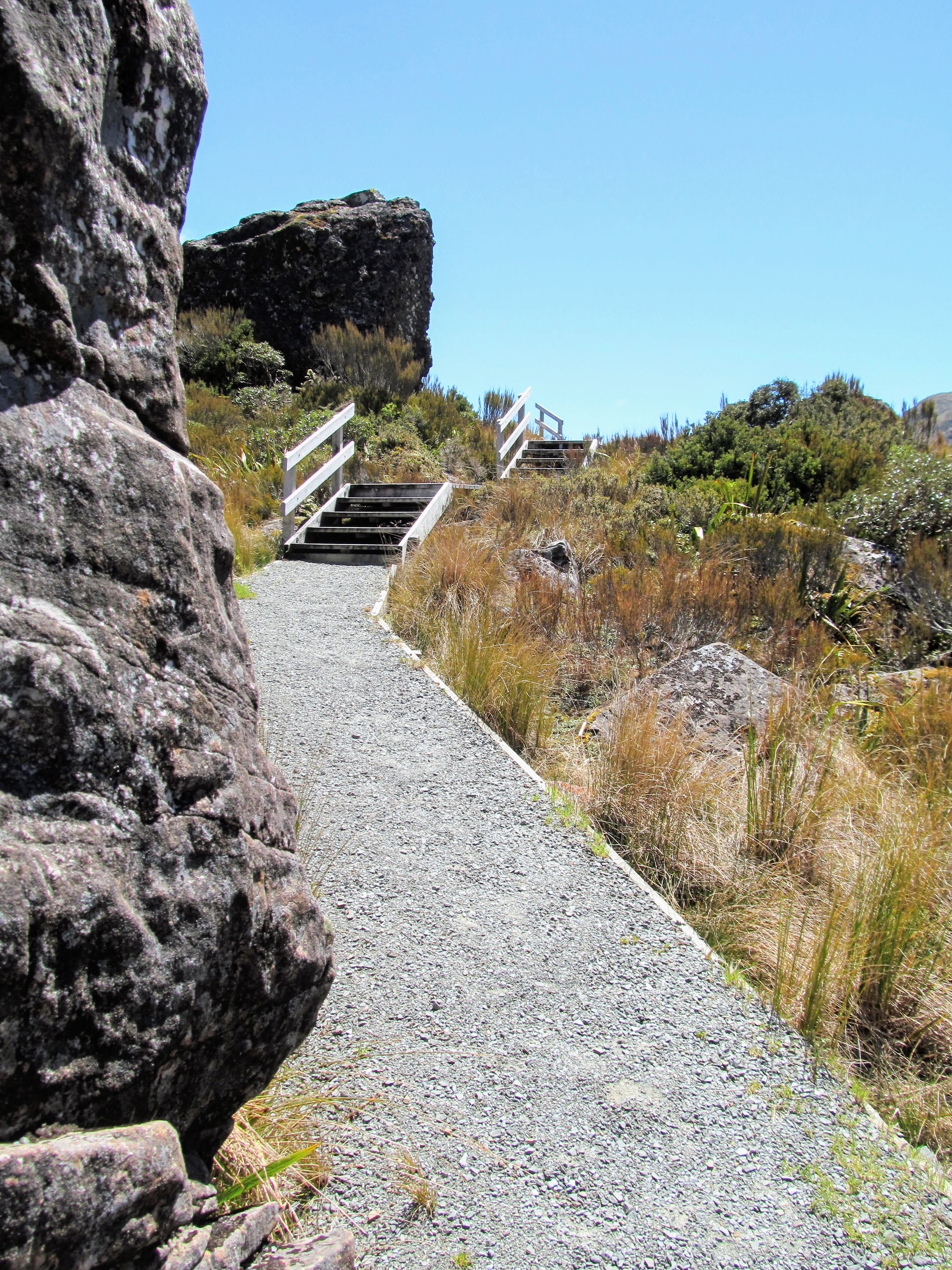
Past the Twin Creek bridge you gradually climb along the side of the valley and just off the road. The gradient is not too bad but gets steadily steeper as you go. The track is still to a good quality and there are stairs in the steepest places.
 |
| Heading for the tarns near the Dobson Memorial, Arthurs Pass Walking Track |
 |
| The upper part of Arthurs Pass Walking Track |
The Mt Cook Daisey's (actually Buttercups but misidentified by early botanists) were in bloom and there were clumps of them right along the track through here. If you visit at the beginning of December there will be fields of them on display as these are just the early risers....
 |
| Mt Cook Buttercups along the Arthurs Pass Walking Track |
 |
| Spaniard Plants along the Arthurs Pass Walking Track |
 |
| Pt. 1728 and Phipps Peak from the Arthurs Pass Walking Track |
 |
| More Mt Cook Buttercups along Arthurs Pass Walking Track |
 |
View back down the Bealey Valley from opposite Temple Basin Track
|
You can see Twin Creek Falls on the opposite side of SH73...this is 115 meters high and is the third highest waterfall in Arthurs Pass National Park. There is no track to the base but there really should be as they are a direct drop and are probably spectacular up close.
 |
Twin Creek Falls (115 meters) and Mt Blimit (1921)
|
 |
| Climbing over a moraine wall on the upper Arthurs Pass Walking Track |
 |
First view of Arthurs Pass and the Dobson Memorial
|
You will come to a series of glacial erratic's (huge boulders and chunks of rock) dropped as the massive glaciers in this valley melted after the last ice age. If you look off towards Arthurs Pass you can see the obelisk of the Dobson Memorial on the crest of the pass...this is the actual border between Canterbury and the West Coast.
 |
Arthurs Pass between Canterbury and Westland
|
 |
| Arthurs Pass Walking Track: large glacial erratic's |
 |
| Climbing up the Arthurs Pass Walking Track |
 |
DOC information panel about the alpine plants
|
 |
| Above the bush-line on the Arthurs Pass Walking Track |
Arthurs Pass is often used by low flying aircraft transiting between Canterbury and the West Coast. While we were there a SAR helicopter flew low over us heading for the Coast. We didn't see it come back so it must have been returning home and not picking up a casualty.
 |
A SAR helicopter transiting through Arthurs Pass
|
You climb up the side of the hills over the last 500 meters to the tarns at Arthurs Pass. You end up about 80 or so meters above the road before dropping back down to the nature walk at the end of the track. You can see the cars driving along SH 73 and as you reach the crest you can just see down into the Otira Gorge on the far side of the pass. You can also see up into Temple Basin between Mt Cassidy and Phipps Peak.
 |
SH73, Arthurs Pass, Dobson Memorial and Pt. 1728
|
 |
| Hills Peak from the Arthurs Pass Walking Track |
 |
The complex of tarns on Arthurs Pass
|
 |
Looking west past Arthurs Pass to Otira
We dropped down to the mostly dry tarns across a flat bog to the south west of the Dobson Memorial. There are a couple of bench seats here as well as some interpretative panels detailing the geology, terrain and flora of this area. If you wanted a better view of the Otira Gorge you can follow the Lake Misery Track 20 minutes to a rise which looks down to the Otira Viaduct.
Note that the Lake Misery Track is a standard backcountry track so it is rough, muddy and ill maintained compared to the Walking Track.
|
 |
Start of Lake Misery Track at Arthurs Pass
|
 |
You can down see into Westland from the end of Lake Misery Track
|
 |
| View down the Bealey Valley from Arthurs Pass Walking Track |
There is no easy way to get over to the Dobson Memorial as there is a stream and swamp between the track end and the obelisk. If you not afraid to go off trail there is a visible rock scramble which will take you to the other side of the road. Take care as the rocks are really loose and move around a bit which is why we didn't try it out.
 |
Dobson Memorial with Mt Blimit in the distance
|
 |
Close view of the Dobson Memorial, Arthurs Pass
|
Arthur Dudley Dobson was the first European to chart a course from Springfield to the Taramakau River. Of course Maori have used this route for hundreds of years but they preferred to go over Harpers Pass and down the Taramakau River as it was an easier journey. It is a lot flatter and lower over Harpers Pass and there was more food in the thick forest along the route.
 |
| Arthurs Pass Walking Track: information about the early explorers |
Dobson was looking for a quicker route to the West Coast to make the passage of gold miners and materials easier. It is a measure of how rough it is when you consider it took Dobson and his Maori guides nearly a week to get from here to the Taramakau only 25 kilometers to the West.
 |
Maori found Pounamu/Greenstone around here...
|
We spent about 10 minutes around the end of the track and then started back down the track as it was windy and a bit cold near the tarns. On the way back you have an excellent view of the track up to Temple Basin ski field. This is a hard day trip with a steep gravel road up to a couple of ski huts at the field.
From there you can summit Mt Cassidy and make your way back along the top of the ridges. Going past the ski field buildings is for experienced mountaineers only as there are some heinous sections of rotten rock to cross to head east along the tops.
 |
The track up to Temple Basin skifield...
|
 |
Temple Basin Track starts on SH73
|
 |
Temple Basin is at the head of Upper Twin Creek
|
We stopped at this nice seat on the way back to the village and ate our lunch sitting out of the cold wind blowing over the pass. There are a number of benches, seats and siting areas scattered along the track and we saw people at many of them as we walked. The rock behind this seat is another glacial erratic dropped by retreating glaciers some time in the past.
 |
| Nice sheltered seat on the Arthurs Pass Walking Track |
 |
| More Mt Cook Buttercups on the Arthurs Pass Walking Track |
There were half a dozen cars at the Temple Basin carpark...from there you can access both the Arthurs Pass Walking Track and the track up to the ski field. Karen and I spotted a number of people heading down the Temple Basin track as we were having lunch. They had obviously started early in the morning and were on the downward leg of their trip.
 |
SH73 heading towards Arthurs Pass township
|
 |
| Arthurs Pass Walking Track: heading back into the forest |
 |
Mt Rolleston from opposite Bealey Valley Track
|
 |
| Arthurs Pass Walking Track: nearly back at SH73 |
 |
| The Arthurs Pass Walking Track crosses SH73 |
We stopped at Jacks Hut to have a drink and take some photos before heading on our way back to the carpark. There were a few people in the Bealey Chasm Track carpark setting out for the Pass...or Bealey Chasm/Bealey Valley Track...
 |
Goldney Ridge from near Jacks Hut
|
 |
| Back on the lower part of Arthurs Pass Walking Track |
We made good progress on our way down the valley...it is much easier to walk this way as there is obviously a bit of a gradient to the track. It was super hot walking in the open...the sun was fully out so we stopped to put on sunscreen. When we got home we were both a bit burnt so take heed and cover up...you can get sunburn even when walking through fairly thick forest cover.
 |
| Heading back over the boardwalk, Arthurs Pass Walking Track |
 |
Arthurs Pass Walking Track: more sun in the afternoon...
|
We eventually made it back to the stairs down to Bridal Veil Creek and headed down to the creek. I spotted the only orange triangle I saw on this whole track on the way down. It was nice and cool walking in the thick shade of the ravine.
 |
At the start of the descent down to Bridal Veil Creek
|
 |
| Arthurs Pass Walking Track: the only orange triangle on the whole track... |
 |
Steps leading down to Bridal Veil Creek
|
 |
Bridal Veil Creek footbridge...
|
 |
Interesting play of light...Bridal Veil Creek bridge
|
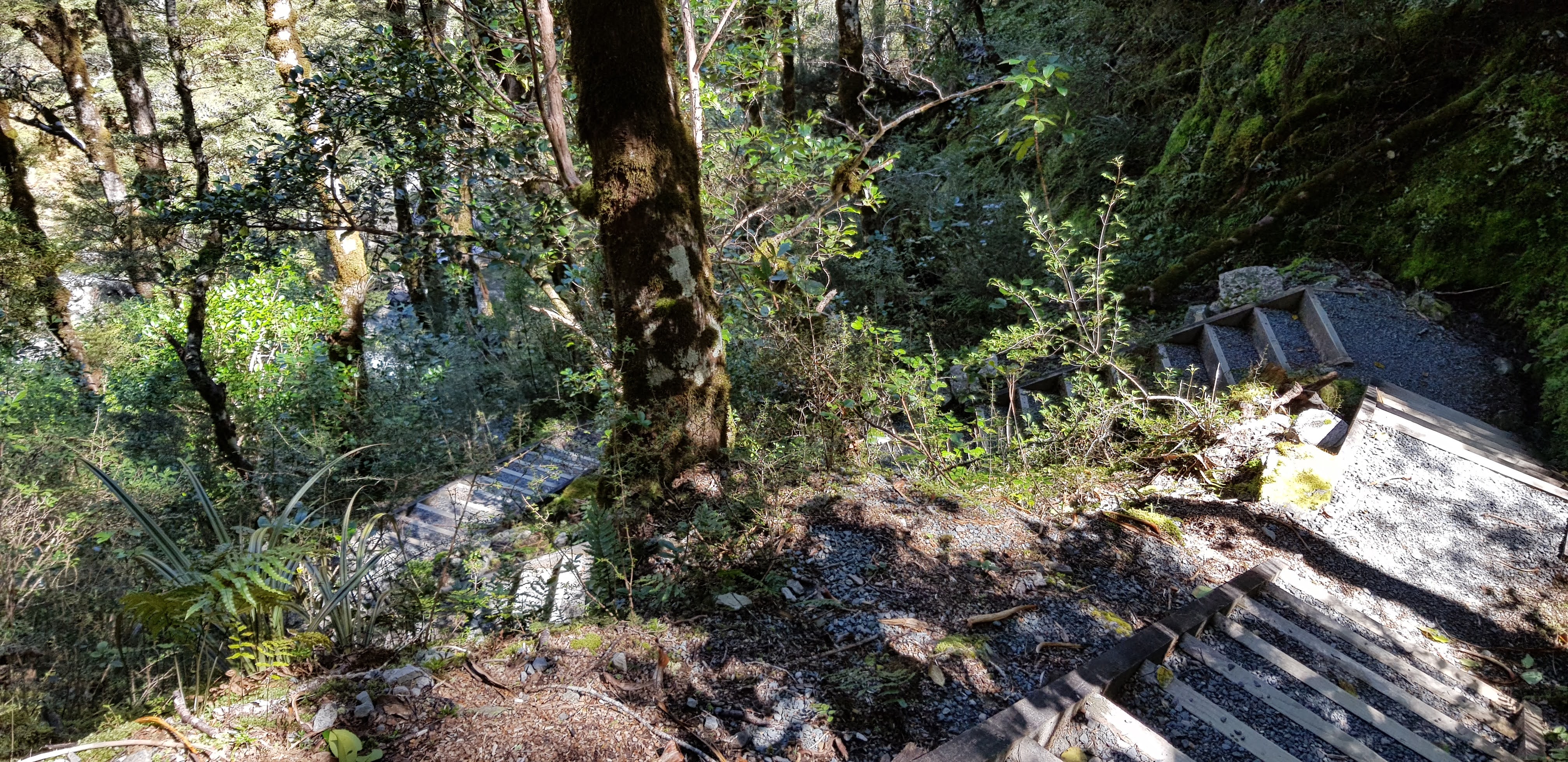
Then it was up the stairs to the lookout point above Bridal Veil Creek. Karen was not enjoying the stairs which are quite steep and there are a lot of them. Karen counted 122 steps on the way back up to the top of the ravine, she wanted me to make sure I mentioned that!
You would think steps or stairs would be nicer to walk on but actually they are a total pain in the behind...they make the track steeper and the size and length of them is not well suited to people with shorter legs. They do stop erosion though so they are a necessary evil if you will...
 |
Start of the steps on the climb out of Bridal Veil Creek
|
 |
There are 122 steps after Bridal Veil Creek
|
 |
| Arthurs Pass Walking Track: high point on the way back to the carpark |
We continued on our way back down the track passing several groups heading up the track...you could probably walk this track at night provided you had a decent head torch. I might do that sometime maybe when it is getting darker earlier in the night...
Night tramping is fun but it just doesn't make for a very good blog post because you cannot see anything. You have to keep your wits about you, have a good primary light source and a good secondary light source in case the first one stops working.
 |
| Another imposing footbridge on the Arthurs Pass Walking Track |
 |
| Interesting Moss growing along the Arthurs Pass Walking Track |
 |
| Last downhill section...Arthurs Pass Walking Track |
 |
| Back on the flats, Arthurs Pass Walking Track |
We soon found ourselves back down at the bridge over the Bealey River...I think we shaved about 15 minutes off the time it took us to get up to the top of the pass which I put down to walking downhill on the way back. It was nice to be back on the flat and only a couple of hundred meters away from the car.
 |
| Arthurs Pass Walking Track, back at the Bealey bridge |
 |
| Bealey River footbridge, Arthurs Pass Walking Track |
 |
There is an information panel next to Bealey footbridge
|
 |
Approach to Bealey River footbridge, Arthurs Pass NP
|
I think the distant view of Punchbowl Falls is one of the iconic images of the outdoors in New Zealand... definitely of Arthurs Pass National Park. It is really dramatic with the green of the Beech forest, the bluffs to each side, the white spume of the waterfall and the snow capped mountain tops behind.
 |
Punchbowl Falls from the Arthurs Pass Walking Track
|
 |
Closeup of Punchbowl Falls from near the Bealey footbridge
|
 |
Walking back to the Punchbowl Falls carpark
|
 |
Still a few cars in the Punchbowl Falls carpark
|
The Arthurs Pass Walking Tracks is one of the nicest day walks in the park and offers a relatively easy 2-3 hour option which takes in a variety of terrain and types of forest. This is probably best tramped if you are staying in Arthurs Pass Village overnight or are just here to day walk.
If you are on your way over Arthurs Pass you might be better to only walk to Jacks Hut (1.5 hours return) or try a shorter track like the Punchbowl Falls, Heritage Walk or Bealey Chasm Track. All of these tracks are under 2 hours return. The Cockayne Nature Walk past Otira is also an option at around 1 hour return.
Access: The track starts at the car park for the Punchbowl Falls, this is at the western end of Arthur's Pass township, look for the sign on the Bealey River side of SH73.
Track times: 1.5-2 hours to Dobson Memorial on Arthur's Pass, 3-4 hours for a return trip. It is 45 minutes to Jacks Hut from the start of the track if that suits your needs better.
Miscellaneous: All weather track, all streams bridged, some climbing/descent in the mid section of the track. Take water as all side streams along this track are contaminated. Watch for traffic on SH73 as you cross at Jacks Hut as this is a 100kph zone. You are exposed to the weather from just past the turn off to Bealey Chasm so bring a sunhat, sun screen and warm clothing.