At the southern most point on the South Island
Karen and I visited Slope Point while down in the Catlin's. Slope Point is just south of Curio Bay and can be accessed across some farmland on a track to spectacular cliff top views of the southern ocean. This is another of the 'must do' tourist spot if you are in the area.
 |
| Signs at the Slope Point Lookout, Southland |
 |
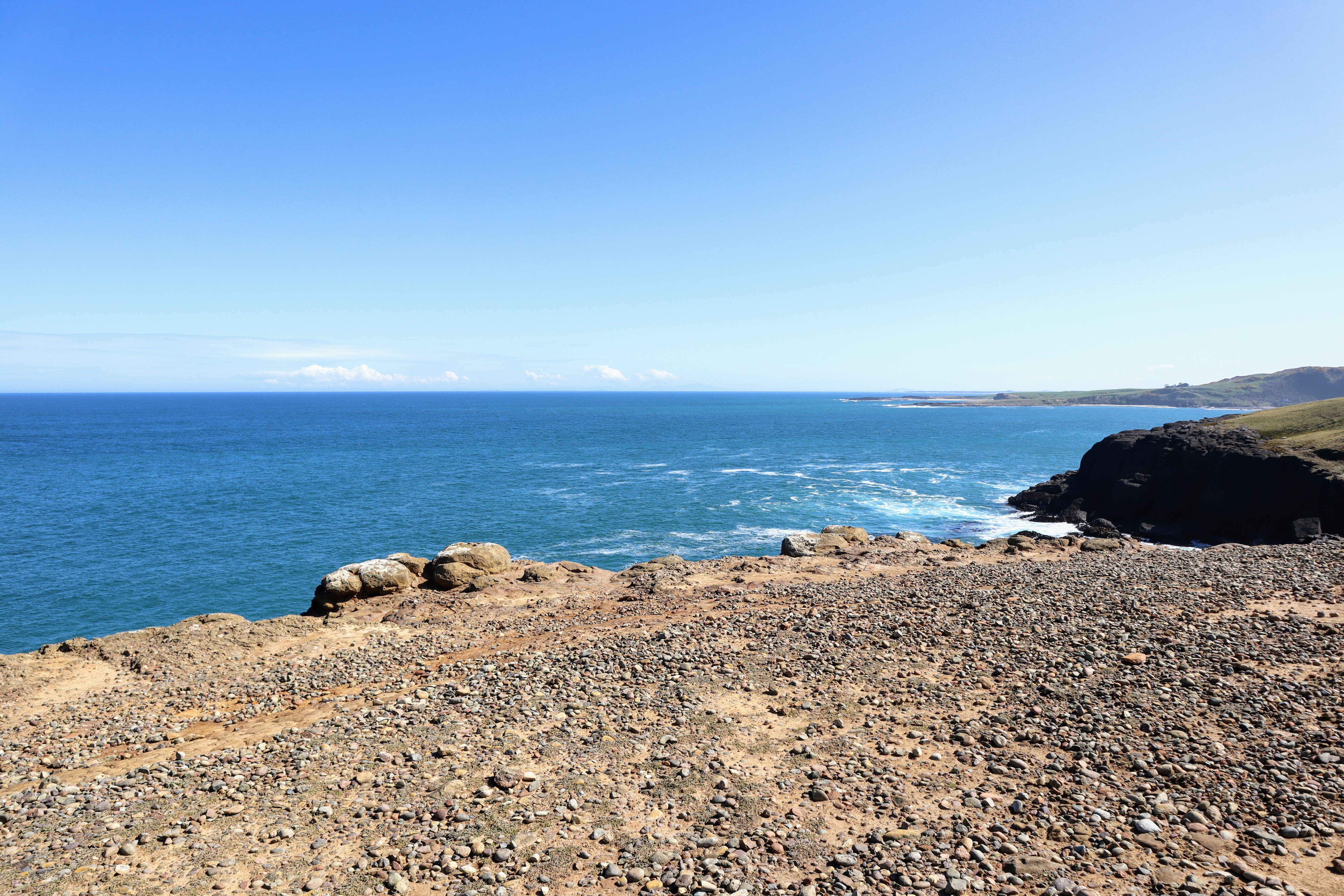
| You can see right along the coast from Slope Point |
It is quite an interesting area if not the normal bush walks I go on...so lets have a look at what you will find there.
Visiting Slope Point in the Catlin's:
We stopped at Slope Point on the way back from Waipapa Point which is another 30 odd minutes further south along the Southern Scenic Highway. There are a series of cliff top views from here but Slope Point is best known as the southern most point on the South Island.
 |
| Sealed carpark for the Slope Point Lookout |
 |
| Bruce the Britz van at Slope Point Lookout |
The track was open when we visited but you should check first as it crosses farmland and it is usually closed from August to late October for the lambing season. Lucky for us there were no sheep in these paddocks so we were able to use the track.
 |
| Start of the track to the Slope Point Lookout |
You walk over an obvious grass track from the carpark to almost down near the lookout. The land is even and slightly descending which means you will be walking uphill on the return journey.
 |
| Slope Point Lookout Track is mown grass |
There were a lot of people visiting Slope Point the day we were there...we passed at least ten other folk. Most were couples or families' but there were a couple of single people as well. This was actually one of the busier spots we visited down in the Catlin's.
 |
| Other visitors to the Slope Point Lookout Track |
 |
| Distant Maritime NZ radar reflector at Slope Point Lookout |
 |
| ...the Slope Point Lookout Track is across farmland... |
You have views along the coast from a number of spots on the track. The best are from down near the lookout but you can also get close to the cliffs half way along the track. If you have children with you keep a close eye on them as there are no barriers to stop them falling off the cliffs.
 |
| There are steep, dangerous cliffs along Slope Point Track |
 |
| Coastal view near Slope Point...Southland |
Slope Point itself is marked by a two meter high white radar reflector station just back from the edge of the cliffs. On a clear day it provides a point of navigation to aim for...
 |
| Slope Point Lookout is near the radar reflector |
 |
| Radar reflector at Slope Point Lookout |
The cliffs at Slope Point range from 20-60 meters high and provide excellent views both ways along the coast. The underlaying rock is mudstone from some ancient ocean bed with a thin layer of stones and topsoil. Heavy rain and strong winds have scoured these cliff tops giving them a worn look.
 |
| Slope Point Lookout...the view south |
 |
Heavy erosion around the Slope Point Lookout
|
 |
| The view north from Slope Point Lookout |
On a clear still day you can see out to Rakuira/Stewart Island from the lookout at Slope Point. You could just see the tops of the highest mountains and the towering thunderclouds building up over the distant islands.
I am super keen to get back to Rakuira as I would love to walk both the Southern Circuit and the North West Circuit on the main island.
|
Distant clouds over Rakuira/Stewart Island
|
The radar reflector is the property of Maritime NZ and provides a enhanced radar picture for any ships cruising along this coastline. There is also a light on the top to warn ships that they are close to a reef just to the front of the Lookout.
 |
| A Maritime New Zealand radar reflector: Slope Point Lookout |
 |
| ...the radar reflector warns ships of the reefs at Slope Point... |
 |
| Maritime NZ logo on the reflector, Slope Point |
The other point of interest here is an AA style road sign showing the distance to both Antarctica and the Equator.
 |
| View of the ocean from Slope Point Lookout |
Slope Point is roughly equidistant between the two with 5000 kilometers north and south of this point. It is also marked as the southern most spot on the mainland of New Zealand although Rakuira reaches several degrees further south.
 |
| Signs at the Slope Point Lookout |
 |
| Just about equidistant from Antarctica and the Equator |
Please exercise a bit of caution when you are on the cliff tops at Slope Point. This is not a sanitized tourist spot so there are no safety fences to stop you falling off the edge. It is roughly 60 meters to the rocks below so a fall from here could be and has been fatal.
In strong wind it would be very easy to get blown off the cliffs so I recommend you stay a couple of meters back from the edge.
 |
| Care is needed on the edge of the cliffs at Slope Point |
There are two reefs at Slope Point and they jut out from the coast for a couple of hundred meters. There is no safe way to climb down to them so you just have to admire them from afar.
People sometimes see Seals and Sea Lions here and there are frequent sightings of both Whales and Dolphins in the sea off the point. They round this point as they migrate from west to east coast...
 |
| The reef at Slope Point in the Catlin's |
We spent about 10 minutes down at Slope Point and after taking the obligatory photo in front of the sign we set off back up the track to the carpark and the campervan.
 |
| Jon at Slope Point Lookout in Southland |
 |
| The reflector at Slope Point Lookout |
|
| Distant clouds over Rakuira/Stewart Island |
It is uphill all the way back to the carpark but it is a very gentle climb gaining perhaps 60 meters over a kilometer of track. It is not a Great Walk but it is still a easy track to use as it is flat and soft grassland.
 |
| Climbing back up the track from Slope Point Lookout |
If you were visiting Slope Point in a storm or during thick fog this track could be dangerous as there is no barrier to stop you blundering off the cliffs. I would suggest you go elsewhere in those conditions but if you must visit keep the fence line in view from the carpark edge as it goes right down to near the radar reflector at Slope Point.
Do not go blindly walking into the abyss...or you might find an abyss!!!
 |
| It is a bleak and barren landscape at Slope Point Lookout |
 |
| Fence line along the Slope Point Lookout Track |
There is a line of trees planted near the start of the track with a definite lean to them caused by the strong southerly wind. Slope Point is one of the windiest spots in New Zealand and the wind is strong enough and persistent enough to permanently bend the trunks...
 |
| Twisted trees at Slope Point in Southland |
 |
| Back along the Slope Point Lookout Track |
 |
| Southerly winds have shaped these trees, Slope Point Track |
It takes about 15 minutes to walk back up to the carpark and the last section is the steepest even though it is very gentle. It is a very pleasant walk in reality and we saw a range of ages including people much older than us who seemed to find no difficulty so it is suitable for everyone.
 |
| Clear path down to the Slope Point Lookout |
 |
| Blacks Point is south of the Slope Point Lookout |
On a clear sunny day this is a most enjoyable stroll but please take warm gear and a decent rain jacket if you visit on a cold, wet or windy day. We had a lovely day on our visit but I still had my merino hat on as we walked back to the car as my face and ears were getting cold.
 |
| Slope Point...back at the carpark |
 |
| There was a steady stream of visitors to Slope Point |
I can thoroughly recommend the walk out to Slope Point...you will expend a modicum of energy getting there but it is well worth the effort. A really lovely and interesting spot to visit...
Access: Slope Point is 14km south of Curio Bay and can be accessed along the Haldane-Curio Bay Road. From the Haldane-Curio Bay Road take Slope Point Road to the large carpark signposted at the start of the track
Track Times: It is 1.2 kilometers to the cliffs at Slope Point from the carpark. It will take you 20-40 minutes return to visit the cliffs and walk back to the carpark.
Miscellaneous: Slope Point is the southern most spot on the South Island of New Zealand. The track crosses pasture to the edge of some high cliffs with excellent views along the coast. There is a shipping beacon here and signs showing the distance to Antarctica and the Equator. The track will be closed from August-late October for lambing season if Sheep are present.