Exploring the alpine world of Hakatere Conservation Park
I visited a new park over the weekend...
Hakatere Conservation Area inland from Ashburton in Mid Canterbury. The Hakatere is an extensive high alpine plateau...snow covered over much of winter and Spring but a mecca for trampers, Te Araroa trekkers and MTB riders in the summer.
 |
| Mt Guy and the distant Potts Range, Hakatere Conservation Area |
The land is generally flat rolling plain with some interesting hill climbs dotted around the edges...there are people up here at places like Lake Clearwater and Lake Heron and on the stations such as Hakatere and Potts. Further up the valley is Mt Sunday...the location of a climatic battle in the Lord of the Rings movies (Edoras)...so 95% of the traffic was heading there...
 |
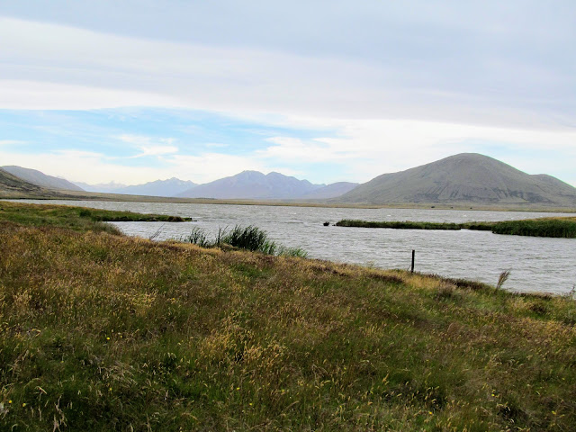
| On the excellent Hakatere Potts Road heading to the lake |
I was walking to
Lake Emma and the historic hut which sits at the south eastern end of the lake. It is an easy 2-3 hour return trip mostly easy walking on an old farm track that skirts the lake for most of its circumference.
The track can be walked, ridden or you can even drive to the historic hut if you have a good 4 W/Drive. I was passed by all three while walking the track...it is busy up here over the summer and I passed eight people on my walk...that's a lot for a remote spot.
 |
| Lake Emma Hut, Hakatere Conservation Area |
The Hakatere is an arid, dusty barren area....there is little native forest up here and the only trees you see are exotics planted by the station owners who used to own this land. It is a large open plain dominated by the wind and various grasses, tussock and the occasional stunted Matagouri bush.
 |
| View of Lake Emma from the southern shore, Hakatere Conservation Area |
There is an absolute tonne of good tramping up here so you are going to see many more posts from the area. But for now let us set off for our goal on this trip the historic Lake Emma Hut...
Heading to Lake Emma in the Hakatere
The Hakatere Conservation Area is about 150 km south of Christchurch in a wide open glacial valley behind Mt Somers. It takes about 1.5 hours to get there from Christchurch and is accessed by driving to Rakaia and following the road signs heading along Thompson Track to Mt Somers village. From Mt Somers get on the Ashburton Gorge road and head for Hakatere Station about 20 kms away.
 |
| The old Hakatere Station buildings at the end of Ashburton Gorge Road |
 |
| Turn off to Lake Emma from Hakatere - Potts Road |
Past Hakatere Station you are on gravel roads but they are really good gravel roads...extra wide with a nice flat surface and very easy to drive on. About five kilometers past Hakatere Station there is a road on the left leading to Lakes Roundabout and Lake Emma. If you have a good 4 W/D vehicle you can drive to the hut or stop towards the beginning of the track and walk.
 |
| Lake Emma Track to Lake Roundabout and Lake Emma |
 |
| Closeup of Lake Emma sign, Hakatere Conservation Area |
 |
| Map: Lake Emma in the Hakatere Conservation Area |
I drove about two kilometers up the road to a point where the track got rough and parked my car beside the track to continue on foot. It was about three to four kilometers to Lake Emma Hut...it is difficult to get lost as this track only leads to the hut on the far side of the lake.
 |
| Silver Surfer parked next to the Lake Emma Track |
 |
| Mt Harper Range and Lake Emma, Hakatere Conservation Area |
I started walking along the track down the eastern edge of the lake...right from the beginning you can just see Lake Emma Hut sitting on the other side of Lake Emma at the base of Mt Harper. The track is an old farm track and is very easy tramping as it is mostly flat and level with only a couple of slight rises along its length.
 |
| Hakatere Conservation Area: looking down the eastern side of Lake Emma |
I noticed that someone was camping on this eastern side of the lake...this is actually ok as this is all DOC land but you must take all waste with you when you are finished and there is a total fire ban up here from November to April as it is so arid. I passed the occupant of the camp further up the track as he was returning from Mt Harper.
 |
| Someone camping next to Lake Emma, Hakatere Conservation Area |
 |
| Lake Emma Hut is visible on the western side of Lake Emma |
It was a cloudy day and quite warm but really windy as a Nor'wester was slowly building over the mountains. It was so windy there were whitecaps on Lake Emma but the wind died down as the day went on so that it was calm by the time I was walking back to the car a couple of hours later.
Take sunglasses with you if you are up here on a windy day as it is super dusty and I kept getting dust in my eyes. Also make sure you have sun screen and a wide brimmed hat as the UV is savage up in these mountains.
 |
| Mt Possession at the end of the Lake Emma Track, Hakatere Conservation Area |
 |
| ...it was a bit choppy out on Lake Emma, Hakatere Conservation Area... |
It was easy going down the eastern side of the lake and I got to the lake outlet after about 20-25 minutes walking. Emma Stream is the outlet for this lake and you can either use the ford on the track or the handy plank crossing point to get over the stream...necessary as there was actually a bit of water coming out of the lake.
Mind that board...it is about five feet off the ground and 20 cm wide...not something you really want to fall off as you will injure yourself.
 |
| Hakatere Conservation Area: the ford over Emma Stream |
 |
| One plank bridge to get over Emma Stream, Hakatere Conservation Area |
 |
| Looking towards the Southern Alps from near Emma Stream |
Once over Emma Stream you have to walk along the southern end of the lake...either stay on the main track or take the slightly overgrown farm track closer to the edge of Lake Emma. It was REALLY windy at this end of the lake as two mountain ranges squeeze the wind through a narrow valley. I had to put my fleece on as I was starting to get cold from the wind.....breezy!!!
 |
| Mt Harper rises over the western side of Lake Emma |
 |
| Whitecaps on Lake Emma...plenty strong wind!!! |
 |
| Following an old farm track to Lake Emma Hut, Hakatere Conservation Area |
 |
| ...there was a Nor'wester building out to the west of Lake Emma... |
The one and only significant hill to climb is at the end of Lake Emma...it is only about 60 meters high but even that slight elevation gives you a much better view of this flat landscape. I could see the Southern Alps at the far western end of the plain and most of the surrounding hill ranges.
 |
| The only significant hill on the Lake Emma Track |
 |
| Another photo of a stormy Lake Emma, Hakatere Conservation Area |
 |
| Hakatere Conservation Area: on Lake Emma Track |
Past the hill it is about another kilometer to the hut...just keep following the track along the southern end of the lake and you will eventually arrive at the hut.
 |
| Rejoining the main track at Lake Emma, Hakatere Conservation Area |
 |
| The eastern shore of Lake Emma, Hakatere Conservation Area |
Mt Harper which is just behind the hut & is a awesome tramp in its own right...it is 1800 meters high so when you get to the top you have spectacular views of the whole of the Hakatere-Heron Basin.
 |
| Lake Emma Hut at base of Mt Harper....Hakatere Conservation Area |
 |
| ....lots of dusty farm tracks in the Hakatere Conservation Area.... |
 |
| Jon on the Lake Emma Track |
I got my first clear sight of the hut after walking for about an hour or so and gradually covered the remainder of the distance to the hut. It was much calmer on the southern of the lake as the bulk of Mt Harper was blocking most of the howling wind coming down the valley.
 |
| First clear view of Lake Emma Hut, Hakatere Conservation Area |
 |
| I arrive at my goal...Lake Emma Hut, Hakatere Conservation Area |
I got to the hut after about an hour and a half in time to see a couple of people heading off along the track which runs from the hut down the western edge of Lake Emma to the Hakatere Potts road about 10 kilometers up valley.
If you want to circuit the lake plan on taking up to five hours as the swamp at the extreme north western end of the lake means you have to walk a long way to get around it.
At Lake Emma Hut, Hakatere
Lake Emma Hut is an old musterers' building from the early 1900's which once belonged to Hakatere Station...during tenure review a decade or so ago the lake and hut became part of the DOC estate. It is maintained as a historic hut which means you are unable to stay here...it has no bunks, heating, toilet or potable water source!!!!
 |
| Lake Emma hut, Lake Emma Hakatere Conservation Area |
It is a classic mustering hut...corrugated iron roof and veranda, wooden walls with massive gaps...rugged and practical for a rugged & practical clientele. It is a bit dark inside but back when it was in use it would have been a haven from the harsh elements you get up here.
I could easily imagine the cook and musterer's sitting around the 'Corker Cooker' tucking into some freshly made damper & mutton stew washed down with billy. It would have been full of warmth, light and life then.
 |
| Lake Emma Hut: detail of the veranda and cladding |
 |
| Lake Emma Hut: view of the old bunk room....no sacking!!! |
 |
| The old 'Corker Cooker" in Lake Emma Hut, Hakatere Conservation Area |
 |
| Hakatere Conservation Area: Lake Emma Hut: detail of the interior... |
 |
| View of Lake Emma from in the hut... |
 |
| Hakatere Conservation Area: the old tackroom at Lake Emma Hut |
It is a great wee spot to get out of the wind on a day tramp...even if you only sit under the veranda like me to eat your lunch. I sat on a rock and tucked into my pate and crackers as the wind rattled and howled around the hut.
 |
| Potts Range from near Lake Emma Hut, Hakatere Conservation Area |
 |
| The Clent Hills from the Lake Emma Hut veranda, Hakatere Conservation Area |
 |
| Mt Possession from the Lake Emma Hut veranda, Hakatere Conservation Area |
 |
| Jon Moake at Lake Emma Hut, Hakatere Conservation Area |
It was quite nice sitting at the hut watching the wind blow the tussocks here and there but after 20 minutes I packed up my gear and set off back to the car. It was still windy but at least the wind was into my back so I wasn't constantly getting blinded by all the glacial dust flying through the air.
 |
| Lake Emma Track from near Lake Emma Hut |
 |
| Lake Emma Hut with Mt Harper to the rear |
I am sure I will come back here some day as it is a nice wee walk...something simple and easy to achieve. I might come back and have a go at climbing Mt Harper someday...scheming, scheming....
Tramping back from Lake Emma Hut
The way back is along the route you use to get to the hut...I got on the track and started walking back to the car. It was a more pleasant experience as the wind had died down a bit while I ate my lunch so it wasn't as cold as when I was walking in. You would have to take care coming up here in the winter...the wide open plain and altitude on a cold, wet & windy day could be deadly.
 |
| Lake Emma Hut with Mt Harper behind |
 |
| Distant Clent Hills from the Lake Emma Track, Hakatere Conservation Area |
 |
| The track around Lake Emma, Hakatere Conservation Area |
 |
| ...tramping along the Lake Emma Track, Hakatere Conservation Area... |
There are no naturally occurring forests in the Heron-Hakatere Basin..it is just too cold and windy over winter to allow it. There are a few small areas of native bush tucked into sunny protected gullies but no vast beech forest. This is typical of these high alpine basins...
The only trees you can see are hardy exotics planted by the stations...probably for shelter and a source of firewood. The largest plantation is at the base of Mt Possession near the track..they stand out like a sore thumb as it is so damn flat in the area...
 |
| Exotic forest in front of Mt Possession, Hakatere Conservation Area |
 |
| ...the only pine trees in the Hakatere Conservation Area...... |
You can see the Southern Alps at the end of the basin in the photo below...the Rangitata River lies at their base...there is still a little snow visible on their crests. The head of the Rangitata is where the glaciers of the Gardens of Eden and Allah sit...source of the water which feeds the massive rivers in the region.
 |
| View over the Hakatere Conservation Area to the Southern Alps from Lake Emma |
 |
| On the Lake Emma Track, Hakatere Conservation Area |
 |
| Eastern side of Lake Emma, Hakatere Conservation Area |
 |
| Lake Emma Track skirts Lake Emma, Hakatere Conservation Area |
This is a much better view of the narrow plank bridge you can use to cross Emma Stream...It is about 20 cm wide and 10 cm thick...not much to hold my hefty bulk. I would imagine the water level in the ford is usually lower but the wind and waves were sending a lot of water down Emma Stream so it was just too deep to use.
 |
| Board crossing Lake Emma Stream, Hakatere Conservation Area |
The Hakatere is glacial in nature and you can see reminders of this past all around you if you know what you are looking at. This big rock is a glacial erratic...a chunk of rock carried along by a glacier and dropped in its current location as the ice retreated. You could also see old moraine banks, Roche Moutins and ice cut rock everywhere you turned.
 |
| Hakatere Conservation Area: a glacial erratic next to Lake Emma |
There were several huge glaciers in this basin during the last ice age that reached out past Mt Somers.... the small glaciers still left are the merest remnant of the vast ice sheet that once existed here. It would have been a sight to behold that's for sure....
 |
| Distant Southern Alps from the Lake Emma Track, Hakatere Conservation Area |
 |
| Mt Harper Range from the eastern side of Lake Emma |
I made quick progress back along the eastern side of Lake Emma and was soon back by the campsite near my car. The couple camping there were sitting outside the tent and gave me a friendly wave as I passed on by. It would be a nice remote spot for a camp if you wanted to get away from all the people you normally encounter outdoors.
 |
| Lake Emma Track on the eastern side of Lake Emma |
 |
| Nearly at the campsite on the eastern side of Lake Emma, Hakatere Conservation Area |
I got back to the Silver Surfer after about three hours...I was pleased to see it but then it is so quiet here I never really had any fears it would get vandalised. I saw four vehicles and eight people the whole time I was walking and there were a lot of cars driving up the Hakatere Potts Road.
Watch that access road if you come up here...I just about got stuck as the dips in the road are deep...its not really the place for a road car but then it is what I own. I really will have to think about buy a 4 W/D vehicle when the Surfer needs replacing...it would make it a lot easier to access prime tramping spots like this without having to worry about bogging the car...
 |
| The Silver Surfer park next to the Lake Emma Track, Hakatere Conservation Area |
 |
| Lake Emma Road heading to Hakatere - Potts Road |
This was a nice day tramp walking around the bottom of Lake Emma and another hut to add to the hut bagging list. There is a tonne of excellent tramping to be had in the Hakatere Conservation Area so make sure to come back soon as I will be visiting the area again....
Happy tramping folks!!!
Access: From Rakaia follow Thompsons Track to Tramway Road and Mt Somers village. Join Ashburton Gorge Road to Hakatere Station and then Hakatere - Potts Road to the sign posted turn off to Lake Roundabout/Lake Emma
Track Times: Lake Emma Track to Lake Emma Hut 1-1.5 hours walking clockwise around the lake to Lake Emma Hut. It is approximately 6-7 kilometers or three hours return for the trip.
Hut Details: Lake Emma hut; Historic- no facilities...no over night stays allowed
Miscellaneous: The Lake Emma Track is a rough 4 W/D track...only go as far as you feel comfortable and then walk.There are no toilets and no potable water sources anywhere along this track. As this is DOC Land you are able to camp around the eastern edge of Lake Emma but bring your own water and carry out all waste including toilet.


