I did a cheeky late afternoon visit to the Hakatere Conservation Park on Saturday..I didn't leave Christchurch until nearly 2.30pm and actually got to the start of the Mt Sunday Track at 4 pm! This was my first tramp for a couple of weeks as sickness and bad weather keep interrupting my plans.
The track to the top of Mt Sunday is easy walking...initially across flat land and completed by a short climb up the eastern end of the mount. Some of this track crosses private land so it is important that you only follow the marked track so that access is maintained to Mt Sunday. Do not go haring off overland...high country station owners are notoriously irritated by people crossing their land without permission.
 |
| Start of the Mt Sunday Track, Hakatere Conservation Park |
 |
| Plenty of space for parking at the start of Mt Sunday Track |
There is space for around 20 cars at the carpark for the Mt Sunday Track...it is relatively secure as you are a gazillion miles from anywhere but I still wouldn't leave any valuables on display while walking the track.
On the Mt Sunday Track:
The Mt Sunday Track is just over 1.5 kilometers from the carpark to the summit of the mountain and takes 40-45 minutes walking time each way. For the most part it is a gentle stroll across some rocky and boggy flat ground with a climb of less than 100 meters in elevation at the end.
 |
| Map: Mt Sunday Track, Hakatere Conservation Park |
The track is easy but it is also rough...you are walking for more than half the distance in an old river bed and it is rocky and uneven ground.
 |
| The Mt Sunday Track crosses private land.... |
 |
| Mt Sunday Track starts on a gravel road... |
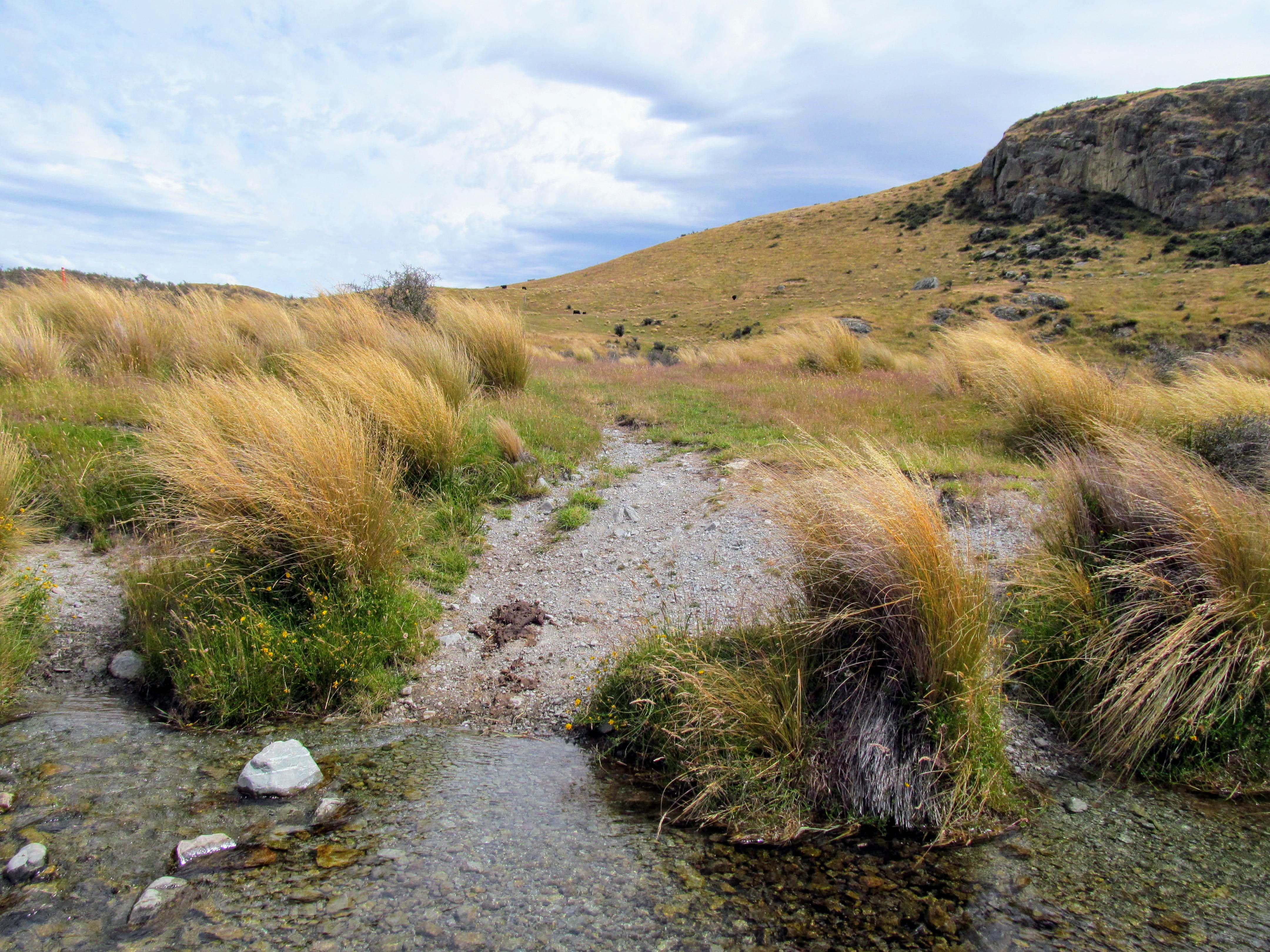
The track is well marked with snow poles with the usual orange sleeve on the top...there are no trees here to nail plastic markers too. It is super easy to follow as it weaves through the Matagouri and across areas of river shingle and grassland.
 |
| Snow poles mark the route of the Mt Sunday Track |
 |
| Black Mountain Range from the Mt Sunday Track |
It was looking stormy up valley from Mt Sunday with thick dark cloud and obvious rain squalls visible for all of the time I was walking the track. There was a good strong Nor' wester blowing as well so I hustled along the track to ensure I finished the track before it started raining. Although I did get hit with the odd bit of wind blown water it did not rain while I was there.
Thanks Huey for not chucking it down on me...
 |
| Threatening rain cloud at the head of the Rangitata River |
 |
| Jon sets off along the Mt Sunday Track |
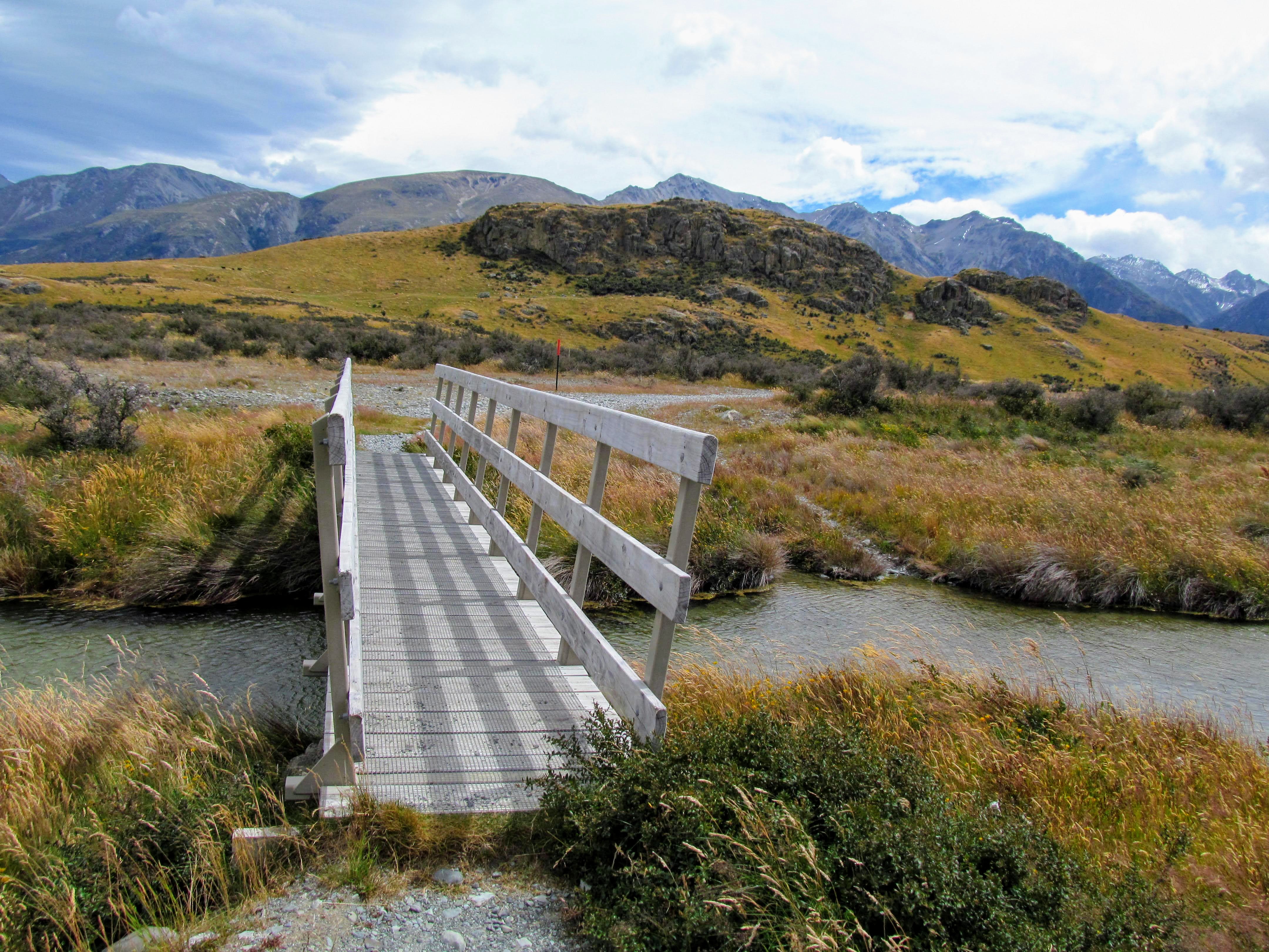
You follow the snow poles up valley for about half a kilometer before turning left and walking towards Mt Sunday out to the south west. There are a number of creeks and streams to cross along the track...this is old glacial till and it is undulating and filled with bogs and swampy areas. All of the major streams have bridges including a wooden footbridge and a proper swing bridge over the widest channel.
 |
| Mt Sunday Track: first of two bridges on the track... |
 |
| Mt Sunday from the first of the two bridges... |
 |
| Heading towards the Mt Sunday Track swing bridge... |
These headwater streams all fed into the Rangitata River so they are full of both native and exotic fish species. As well as various Galaxias/Kokopu species there are Trout and various types of Salmon. You can fish these streams but only in season and with the relevant fishing license. I would imagine there are also freshwater eels and koura here but I did not see any.
 |
| There are both native and exotic fish in these rivers... |
The swing bridge crosses what should certainly be a named river...it is about 15 meters wide, deep and swift but does not have a name. It is certainly bigger than some of the other named watercourses I have encountered so it is a bit strange. I suppose you would count it as a tributary stream of the Rangitata River.
 |
| It looks to be raining up the Havelock River.... |
 |
| The swing bridge on the Mt Sunday Track |
Mt Sunday (611 asl) is a small outlier mount separated from the surrounding mountain ranges...I would assume that it was harder than the surrounding area so it did not erode flat like its surrounding rock. It is about 100 meters higher than the plain it sits on and has some excellent views out to the Upper Rangitata River and up both the Havelock and Clyde Rivers. There are bluffs on the western flank that fall 40-60 meters from the crest and give it a rugged mountainous appearance....
 |
| Bluffs line the eastern flank of Mt Sunday, Hakatere Conservation Park |
 |
| Mt Sunday Track: there are smaller streams to cross... |
 |
| Mt Sunday Track: some of the stream crossings have foot bridges |
The track to the top of Mt Sunday goes from the eastern end of the ridge to the crest...keep on the old farm track and follow the snow poles up past the cattle. The track condition is decent and the gradient is not that step so it should only take 10 minutes to get from the base to the top of Mt Sunday.
 |
| Mt Sunday Track: starting the climb up Mt Sunday |
The views quickly improve as you climb and you can see down valley to Mt Potts Station and across the Rangitata to Mesopotamia Station. This valley is a couple of kilometers wide and consists of flat rolling grassland from the hills to the river. It is almost devoid of trees except near the station buildings which have exotic shelter belts to protect them from the fierce winds which often blow off the Southern Alps.
 |
| Harpers Knob from Mt Sunday, Hakatere Conservation Park |
 |
| The Potts Range from Mt Sunday...Mt Potts is 2184 asl |
The last 200 odd meters to the crest is along the spine of the ridge running in from the eastern side of Mt Sunday. This is the steepest part of the track but it is short so just pace yourself and take your time climbing. Stay away from the eastern edge of the ridge as there are a series of bluffs right along the track that you do not want to fall off.
 |
| Mt Sunday Track: on the ridgeline track to the summit |
 |
| Mt Sunday Track: the trig point on the summit... |
I eventually topped the ridge and found myself in a sheltered depression just down from the trig point which crowns Mt Sunday. This was a good place to get out of the howling wind and I had a drink before walking the last couple of meters to the summit.
On Mt Sunday.....
The wind was fair wiping over the top of Mt Sunday as I reached the crest...there is absolutely nothing here to stop the wind so it roars down the valley and up and over Mt Sunday before continuing on its way. There are magnificent views of the Upper Rangitata and Cloudy Peak Range from up here..it was especially dramatic with the misty rain clouds rolling over the distant hills.
 |
| View of the Upper Rangitata River from Mt Sunday |
 |
| View up the Clyde River Valley from Mt Sunday |
I hunkered down in the rock garden on the crest and enjoyed the various views on offer. The Hakatere is a bleak looking place but it is also beautiful as it looks totally wild with only minimal signs of human habitation to be seen. The high country stations up here are some of the most remote in New Zealand and it must be a harsh working environment for those who manage the farms in the area.
 |
| View to Bush Stream and Mesopotamia from Mt Sunday |
 |
| Black Mountain Range from Mt Sunday |
Mt Sunday runs out to the west along another ridgeline but as this is private land you should not venture too far along the tracks. We do not have roaming rights in New Zealand like they do in the UK...you need permission to use the tracks and cross farmland. We are really lucky to be able to visit these places and irritating the station owner is one way to lose walking access to choice spots such as this. Stay on the marked track please....
 |
| Rain cloud clears from the Havelock River Valley |
If you look out to the east you can see the Potts Range, the Hakatere-Potts Road and the course of the river that you crossed on your way to the mountain. Mt Potts is the highest peak at 2400 odd meters and there is a public easement track down by Erewhon Station if you want to bag the mountain.
 |
| View of the Hakatere-Potts Road and Mt Sunday Track |
 |
| Mt Potts dominates the Potts Range, Hakatere Conservation Park |
Mt Sunday was a place that was infrequently visited by walkers until quite recently..it was mostly Kiwis who knew about it...that was until the Lord of the Rings. Mt Sunday was the location of Edoras (capital of Rohan) in the LOTR movies and a small temporary village set was built on the crest of the mountain while filming was underway.
 |
| The LOTR Edoras set on the top of Mt Sunday... |
There was some talk of leaving the site set up as a tourist attraction but it was decided to remove all the workings after filming was completed. The harsh winters up here would have destroyed it within a couple of years. Today it is on the LOTR tourism fan route so most days over the summer the area would be swarming with fans of the films.
Covid has really knocked this type of scenic travel for six as our borders have been closed for more than a year now. It does mean we Kiwis get to explore our natural wonders without having to fight through a horde of tourists all trying to take the viral Instagram selfie....
 |
| The trig point on Mt Sunday, Hakatere Conservation Park |
 |
| Jon on Mt Sunday with the Rangitata River behind... |
I didn't spend long on the summit of Mt Sunday as I was getting hit by the occasional rain drop and I wanted to be gone before it let rip.....I spent about 10 minutes on the crest and then headed off the top via the eastern ridgeline I had climbed on my way in.
 |
| You could walk west off Mt Sunday.....but it is private land |
 |
| Mt Sunday trig with Harpers Knob in the distance |
 |
| Mt Potts Station is marked by the distant shelter belt... |
 |
| Mt Sunday: lots of good natural seats on the summit |
 |
| Jon on Mt Sunday with the Rangitata River and Black Mountain Range to rear |
Erewhon Station is about another two kilometers up the valley from Mt Sunday...it covers most of the land at the top of the Rangitata River. Erewhon is famous as it was land owned by an English gentleman Samuel Butler back in the 1860's who wrote a fictional account of life on the station.
He painted a rather rosy view of life on the station markedly different from the hard, dirty and lonely reality. It was widely popular in England of the time and resulted in a great many people heading to New Zealand to start anew.
 |
| Erewhon Station is marked by the distant shelter belt... |
 |
| There are a multitude of small kettle lakes around Mt Sunday |
Erewhon is still a running station and they primarily raise cattle, deer, high quality Merino sheep and large working horses like the Clydesdale. You can visit the farm on tours that include a look at the workings, horse treks and traditional morning tea...surely one of the most remote tourist attractions in the country.
Mt Sunday...heading for home....
I headed off as it looked like some rain cloud was heading for me down the valley and it was approaching 5pm by that stage. Heading back to the carpark is along the same track you followed to the summit and is perhaps 5-10 minutes faster as you are walking down hill for part of the way.
 |
| Mt Sunday Track: walking off the eastern ridge... |
 |
| So long to the summit of Mt Sunday.. |
I was quite taken by all the kettle lakes you can see on the plain surrounding Mt Sunday. They are glacial in nature...large chunks of ice from the glaciers that once filled the valley got covered by dense layers of glacial till. Long after the rest of the glacier is gone they melt and the till collapses into the resultant hole forming a small lake.
These kettles will infill with silt and become swamps, bogs and mires...a natural progression as old as time. Some of these kettle lakes are huge...the one to the south east of Mt Sunday is probably 300 meters across and is now filled with reeds, rushes and swamp grasses. Some time far in the future it will dry out and you will never know it existed at all.
 |
| Mt Sunday Track: a large kettle lake near the mountain |
While the track off the mountain is easy do take care as there are some bluffs along the eastern side of the hill...don't be tempted to try taking a short cut!!!
 |
| Heading down the eastern ridge of Mt Sunday |
There are cattle on the plains around Mt Sunday and for the most part they are harmless and will steer well clear of you. Do take care to stay away from cattle with young as they may charge you to protect them. This cow was giving me the evil eye as I walked past her so of course I asked her "...hey buddy...got some change..." She did not reply so obviously she must have left her purse at home that day...
 |
| Got some cash...black cow???? |
You get a good view of the eastern bluffs as you walk off Mt Sunday...they are not massive by any means but they do give the mount a more rugged appearance than would otherwise be the case. You certainly wouldn't want to fall off them...you might not die but you would be in hospital for quite some time...the bouncing would hurt a bit!!!
 |
| Looking along the eastern escarpment of Mt Sunday |
 |
| Mt Potts and the Pyramid from Mt Sunday |
 |
| Mt Sunday Track: the bluffs are 40-60 meters high... |
That vista looking towards the head of the Rangitata is very compelling...I have taken multiple photos as it draws your attention. It might not be quite so interesting if it was a calm, sunny and cloudless day but the moody, stormy air makes it much more interesting.
 |
| Cloudy Peak Range at the headwaters of the Rangitata River |
The trig point on Mt Sunday is atop the slight bump in the middle of the ridge...it gives you a sense of scale about how big this mount is. You can see why they would have thought it a great film location...you can just about imagine some eyrie like castle perched atop the mountain waiting to repel all attackers. It would certainly make a fine defensive position. With some mortars, half a dozen machine guns, lots of ammunition and a company of men you could hold off most of a Brigade from the top....
 |
| Excellent view of Mt Sunday from the track |
I stopped down by the swing bridge for a break and had a good look at the creek while I was there. It is really deep and moving a significant amount of water. I am surprised it has no name but then I suppose they just consider it a part of the Rangitata river.
You should take care if messing around near the river...I don't think it is suitable for swimming. Beside being polluted with cow manure it would quite easily carry you away down stream and it is perishing cold water.
 |
| Mt Sunday Track: nearing the swing bridge... |
 |
| Salmon and Trout make their home in these rivers... |
 |
| Deep and swift river along the Mt Sunday Track |
 |
| Cloudy Peak (2403) from the Mt Sunday Track |
I'm sure you could probably raft or kayak this river if you could be bothered lugging a boat this far inland...I think it would be worth the effort. The river joins up with the Potts River and then the Rangitata Rivers about six kilometers down the valley so you could get a decent run out of it.
 |
| The Mt Sunday Track swing bridge with Mt Potts to rear |
 |
| The no name creek is quite deep.....Mt Sunday Track |
 |
| Mt Sunday from the swing bridge.... |
 |
| Mt Sunday Track: Mt Sunday with the Black Mountain Range to rear |
Once over the rivers it is just that last kilometer or so across the old river bed shingles and through the Matagouri back to the car. This is the easy part of the track and you cover the distance swiftly.
 |
| Last view of Cloudy Peak Range, Mt Sunday Track |
 |
| The Mt Sunday Track heading for the carpark |
You can see Bush Stream and the Mesopotamia Station on the far side of the Rangitata River...this is one of the oldest high country stations in the country. It was originally owned by Samuel Butler (who owned all the land at the end of this valley including Erewhon Station) from 1860 to the late 1860's. It is a huge station at nearly 90 000 acres with a mix of freehold land (15 000 acres) and Crown lease land (65 000 acres)
Most of the land is due to undergo tenure review soon and it will probably form the basis of a new conservation park. There has been talk of a 'Eastern Rivers National Park' similar to the one proposed on the West Coast. The Hakatere area contains the headwaters of several large rivers...the Havelock, Clyde, Lawrence, Hakatere/Ashburton and Potts...they all feed into the larger Rangitata River.
 |
| Distant Mesopotamia Station and Bush Stream... |
The Te Araroa Trail goes right across the Hakatere Conservation Park...it comes in from the Rakaia River at Glenrock crosses several mountain ranges and then crosses the plains of the Hakatere from near Lake Heron to the Potts River.
The Rangitata is a hazard zone along the track...the TA trust does not recommend crossing the very dangerous Rangitata. Rather they advise you to travel right around the river and restart at Mesopotamia Station on the true right of the Rangitata. It is a long way between the Potts River and Mesopotamia...over 100 kilometers by road so every year foolhardy folks attempt to cross the river. Nobody has drowned yet but it is only a matter of time. Lets just say you wouldn't see me trying to cross the Rangitata under any circumstances.
 |
| Matagouri and grassland on the Mt Sunday Track |
 |
| Good view of the distant Black Mountain Range |
It is a bit quicker to walk back to the carpark as you are walking downhill for some of the way. I found myself back at the carpark about 35 minutes after setting off from Mt Sunday.
 |
| The Mt Sunday Track is well marked with snow poles... |
There are many things to do in the Hakatere Conservation Park so I will be spending time in the area going into the future. I have a couple of mountain climbs to do, Te Araroa Trail trekking and I am keen to do a camping trip to the Lake Camp campsite next to Lake Clearwater settlement. I would also like to investigate some of the big river valleys that feed the Rangitata.
 |
| On the gravel road at the beginning of Mt Sunday Track |
 |
| The Silver Surfer awaits at the Mt Sunday Track carpark |
The Hakatere is a bleak and starkly empty place but it has an ascetic appeal all of its own. I can see why people have built holiday homes at Lake Heron and Clearwater....the views would be spectacular right through the year No more houses will be built up here as all the freehold land available in the park for dwellings has now been built on. The rest of it is all DOC/Crown land...so this is how it is going to stay.
I hope to visit again soon...you should too!!!
Access: From Rakaia on SH1 follow Thompsons Track to Tramway Road and Mt Somers village. Join Ashburton Gorge Road to Hakatere Station and then follow Hakatere - Potts Road past Lake Clearwater Settlement and over the Potts River bridge to the sign posted turn off to Mt Sunday.
Track Times: Mt Sunday Track to the summit of Mt Sunday is 45 minutes walking. It is approximately 2 kilometers from the carpark to the top of Mt Sunday.
Miscellaneous: It is 45 km's along gravel roads from Hakatere Station to Mt Sunday...it is accessible by two wheel drive vehicles. Mt Sunday is near the headwaters of the Rangitata River not far from Erewhon Station (one of the most remote stations in New Zealand). This is in the shadow of the Southern Alps so it is a alpine area with the resultant changeable weather. There are two fords near Mt Potts Station that may be flooded in very heavy rain. Access over winter can also be blocked by heavy snow and ice. This is a remote area so make sure you have sufficient clothing, equipment and consumables to sustain your stay.