...Bark Bay to Anchorage...
I just completed my annual pilgrimage to the Abel Tasman National Park at the beginning of this month. Every year I head north just out of season to complete a section of the track. This year I walked the track from Bark Bay Hut to Marahau.
 |
| The roadstead at Abel Tasman park...Fisherman's Island |
 |
| Looking at the exposed ladder...the tide was going out |
I started the day in Marahau...I spent the night at the camp ground in Marahau and went down to the beach early the next morning to try and catch the sun. I took some photos of the waterfront and walked up and down.
 |
| ...the waterfront in Marahau... |
This time around I took a watertaxi to Bark Bay on the first day and continued from there along the coast to Anchorage. Then I walked the Anchorage to Marahau section of the track to finish it up...
 |
| Boats lined up waiting at Marahau |
So I took a water taxi to Bark Bay...I know its the cheats way but given how tired I felt walking from Anchorage to Marahau I suppose it was the best option...
 |
| Split Apple Rock, Abel Tasman Coast Track |
 |
| The coast around Marahau |
 |
The boat stops in Anchorage, Abel Tasman Coast Track
|
 |
| The boat stops at Adele Island to look at the seals |
The boat dropped me off at Bark Bay after an hour of travel along the coast. I quickly set off across the tidal flats for Bark Bay Hut which sits across the lagoon about 300 meters away.
 |
| Boat head out to sea after depositing me at Bark Bay |
Bark Bay Hut is my favorite hut on this track, the location is great and I always enjoy my stays here. It is the oldest hut on the track but in a lot of ways has the most character. These mid 1980-90's wooden Lockwood/Fraemohs huts are just full of charm...that deep orange color of the wood inside is very appealing.
 |
Bark Bay Hut, Abel Tasman Coast Track
|
After organising myself in the hut and chopping some firewood I sat down for a belated lunch of soup, crackers and cheese. I was the only person in the hut until a couple arrived around 1pm. More people continued to drip in from that time onwards.
 |
| Preparing firewood supplies at Bark Bay Hut |
I walked over too the beach about 2 pm to check out the tidal pool...the river has just about blocked the pool off now so it is a fairly dry lagoon. A sand bank is blocking the lagoon so it only fills right to the top is the sea is high.
 |
| The beach at Bark Bay |
 |
| Far end of the beach at Bark Bay |
I was up at dawn as I had considered heading down to the beach to see the sun rise. I went and took some photos and had a look at the receding tide in the estuary before heading back into the hut to warm up.
 |
| Sandspit at Bark Bay in the half light |
 |
| Photo of the beach at Bark Bay, Abel Tasman Coast Track |
 |
| Bark Bay tidal estuary |
I just stoked up the fire to get some warmth into the hut and set about having breakfast, packing up and getting on my way. We all headed out early as we just wanted to get the walking done. I had a Real Meal creamed rice for breakfast on the day and boy are they good...great for breakfast or dessert.
From the hut it is a 500 meter walk around the estuary to the Medlands Beach...this is all easy track as it is flat and well constructed. All up it took about 10 minuates of walking...
 |
| Bark Bay from just past Medlands Beach |
There has been a couple of slips on the first section heading away from Bark Bay. Every time it rains they get a deluge in Abel Tasman National Park and the track gets damaged. These would be from the significant rain they received back in Februray.
 |
| Damage to the track for February storms |
 |
| ...more of the damaging slips... |
Eventually you arrive at the side track to South Head where there is a lookout with views up and down the coast. I have been here a couple of times now so I decided to not go have a look at the view this time around.
 |
| Stopped at South Head, Abel Tasman Coast Track |
Sandfly Bay is the estuary at the mouth of the Falls River and there is a campsite located near there but it is only accessible from the sea or the main track at low tide. There is a side track down to Sandfly Bay Campsite a couple of hundred meters before the Falls River. It is only accessible at low tide and low river flow as the mouth of the Falls River enters the ocean there.
There are toilets and water here if you need them.
 |
| Sandfly Bay comes into sight |
 |
| Closer look at Sandfly Bay, Abel Tasman Coast Track |
The Falls River starts way up in the hills over looking the coastline and is the largest river along this track section. There is a track from near Bark Bay to the waterfalls in the river far up at its headwaters.
 |
| Mouth of Falls River tide half way out |
 |
| Upstream from the Falls River |
 |
| Falls River Bridge, Abel Tasman Coast Track |
The track climbs down quite steeply from the Falls River and this is one section of the track where heading east to west is much nicer then west to east. The gradient is easier heading towards Bark Bay as it is a real slog up this ridge coming away from the Falls River.
Take care on the track in wet conditions as that slick clay surface can be slippery as hell...
 |
| Climb up from the Falls River is steep |
 |
| Highpoint of track after Falls River |
There is a seat high above Frenchman's Bay where you can rest for a while and look out over the Tasman Bay to the mountains and islands of the Marlborough Sounds. There is cell phone reception from the seat so you can check the weather for the next couple of days, change hut/campsite bookings or order a watertaxi.
 |
| Frenchman's Bay is accessible by the sea |
You strike Halfway Pool just past Frenchman's Bay...it isn't the half way point from Bark Bay to Torrent Inlet but in fact half way between Anchorage and Bark Bay (if you are following the high tide track around Torrent Bay).
It is a very modest stream but I imagine it floods quickly when it starts to rain.
 |
| Bridge over Half Way Pool |
 |
| Halfway Pool is realatively shallow |
It was nice walking along on such a lovely sunny day...these have been rare this year as we have basically had rain every weekend for nearly three months now. The weather on all three of the days I spent in the park were good...
 |
| Point between Half way Pool and Torrent Bay |
 |
| ...highpoint of the track reached... |
The forest cover in Abel Tasman NP is of two types: original podocarp forest and regenerating forest dominated by Kanuka and Manuka. Kanuka/Manuka are re-generation trees...they are usually the first to return after land has ben modified in some way.
There used to be a lot of farms and other enterprises along this coast. They tended to cut down all the trees for building materials, fuel or just burnt it to clear the land. If you are walking through Manuka or Kanuka forest it was probably an old farm site at one time.
 |
| Map: Kilby Stream to Bark Bay |
 |
| High point between Halfway Point and Torrent Bay |
You walk through an area of wind fallen trees from a big storm about 10 years ago and then it is a gently descending sidle as you start off across an undulating plateau from here to the high point above the Falls River. It takes about 45 minutes to cross the plateau.
 |
| Area of downed forest above Torrent Bay |
Right before Torrent Bay comes the biggest descent of the day, its only to a height of about 160 meters. The track is fairly steep and care is needed when you are descending.
Luckily the pain is short lived...
 |
| Torrent Bay, Abel Tasman Coast Track |
The route between Torrent Bay and Bark Bay is the hardest of the whole track. Because of the nature of the track you climb two 150 meter hills over the day The first is between Bark Bay and the Falls River the second is between the Falls River and Torrent Bay. If you have to use the high tide track there is an additional 200 meter climb between the Torrent River and Anchorage.
 |
| Entry to Torrent Bay, Abel Tasman Coast Track |
The landowners at Torrent Bay are VERY protective of their land rights so you must stay on the marked track while transiting through the settlement. I believe that the land can only be brought by and owned by Kiwis...this is to stop ownership leaving New Zealand.
 |
| Mapboard in Torrent Bay near beach |
 |
| Torrent Bay looking to Anchorage |
 |
| Map: Anchorage to Falls River |
Torrent Bay Village is a collection of private lodges and holiday homes situated within the boundary of the national park. Because the houses had free hold titles when the park was set up in the 1940's the owners are allowed to sell, build, extend and modify the land they own.
 |
| End of the Torrent Bay beach |
 |
| The track heads inland from Torrent Bay |
From here you need to don your water shoes as it takes about 20 minutes to walk to the other side and the sandy mud is full of sharp shells. I had a pair of knock off Crocs for the tidal crossings and they worked a treat.
The crossing is about one kilometer long with handy orange markers to show you where the usual route lies. It basically goes from sand bar to sand bar from one side of the estuary to the other. You are heading towards a low saddle between Torrent Bay and Anchorage settlement where you can get back onto the Coastal Track.
 |
| Torrent Bay tidal crossing |
 |
| ...halfway across the Torrent Bay tidal crossing... |
You may have to cross some river channels on the way...just handle them like you would and other river crossing. You need to look for the shallowest point to cross. Generally the wider the crossing the more shallow the water. Watch the speed of the water as the flow will increase after heavy or prolonged rain.
 |
| View back across the Torrent Bay Crossing |
 |
| ...I'm heading for a point directly ahead... |
Once on the eastern side of the crossing look for one of the sets of steps which lead up off the beach and onto the track. You are heading for a low saddle at the western end of the beach and it is well sign posted with DOC signs and a huge orange track marker...
 |
| The orange track marker shows the path to the saddle |
At the head of Torrent Bay is a short side track to Cleopatra's Pool so if you have never visited its worth the trip as it is only 10 minutes return and it is quite scenic. You have to climb up to the main Coastal Track and follow it around to the Torrent River. In summer time this is a popular destination as you can
use the smooth rocks as a slide especially when the river is high.
 |
| Anchorage Beach, Abel Tasman Coast Track |
There were hardly any people at Anchorage which was very surprising as it was such a fantastic day. As the day progressed more and more day walkers arrived. Most of them were gone by 3 pm as multiple watertaxi's came to uplift people and take them back to Marahau and Kaiteriteri.
 |
Anchorage Bay sign near the hut
|
I headed up to the hut to get myself a bed...I was the first overnight visitor to arrive and had my pick of the bunkrooms. July-September is the ideal time to visit the Abel Tasman as visitor numbers are low but October is also very quiet.
I would plan to walk mid week if you can as that is when it will be the quietest. For most of the four days I spent in the park I was walking by myself about 95% of the time...
 |
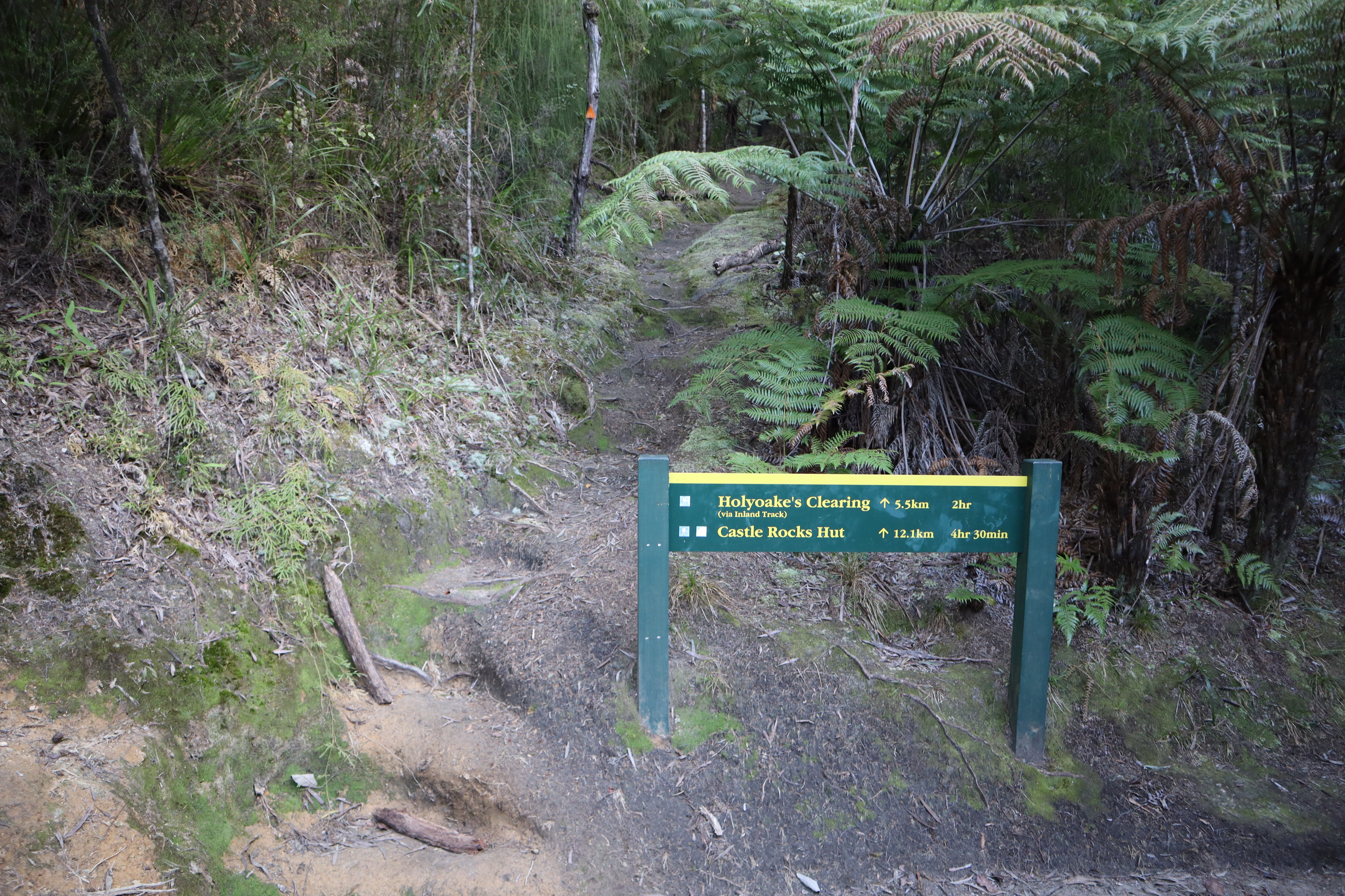
Sign you pass near the Anchorage Hut
|
I was back at the palatial Anchorage Hut for my sixth visit....it really is one of the best DOC huts I have visited while tramping. The previous hut was a copy of Bark Bay Hut that was showing its age and far less salubrious...this is an excellent replacement.
 |
| Anchorage Hut, Abel Tasman Coast Track |
 |
| Sitting on the Anchorage Beach later in the afternoon |
The hut has a number of 8 bunk 'cells' instead of the usual one big room (...to house them all...) so I chose the first cell from the living area. This was the second time I have stayed in that particular cell and I think it is ideally placed to access all the facilities at the hut.
 |
| One of the sleeping pods at Anchorage Hut |
I passed a decent night at Anchorage and it was warm and cozy in the hut that night. I was carrying freeze dry meals on this trip as I was trying to go as light as possible. They are ok for a couple of nights they just wouldn't be so great if you were walking for 10+ days.
They would wreck utter havoc on your innards...
Access: Water taxi from Kaiteriteri or Marahau, the trip takes up to one hour from Marahau. Walk in from Awaroa (4 hours) or Anchorage (3-4 hours)
Track Times: It is 12.5km's or 3.5-4 hours from Anchorage to Bark Bay, add an hour and an extra 4 kilometers if using the high water route. Roughly 13 km's from Bark Bay to Awaroa.
Hut Details: Bark Bay Hut: Great Walk, 34 bunks, wood burner, filtered water tank, wood shed, flush toilets; Anchorage Hut: Great Walk, 34 bunks, wood burner, filtered water tank, wood shed, flush toilets. Multiple campsites along this route at Anchorage, Torrent Bay, Sandfly Bay, Bark Bay.
Miscellaneous: On DOC Great Walk booking system, must be booked for overnight visit. Hut warden in residence from 1st October to 30th April each year. Tidal crossing at Torrent Bay or use the longer high tide track