...more fun in Abel Tasman National Park...
The second day of my recent trip to Abel Tasman NP had me walking from Whariwharangi Hut to Totaranui along the Abel Tasman Coastal Track. It is roughly ten kilometers between the two and is broken down into a roughly equal series of one hour trips between the various bays along the coast.
 |
| Whariwharangi Hut in Abel Tasman National Park |
 |
| Map: Wainui to Totaranui, Abel Tasman NP |
I was up and ready to go by 7.30 and it was another blue bell day with little to no cloud or wind and beautiful blue skies out to the horizon. I was keen to get going as I know from previous experience it gets hot walking along the coast as the forest is thin and you get a lot of sun streaming through it.
 |
| The campsite at Whariwharangi Bay....needs a mow!!! |
 |
| ...farewell Whariwharangi Hut..I hope to see you again!!! |
My first stop for the day was the beach as I had not gone for the short walk down to the shoreline the previous day. The track starts off by walking past the campsite at Whariwharangi...it was looking a bit unkempt as it has not seen much use over the last couple of months. It really needs a mow so it is not uneven to sleep on.
 |
| Abel Tasman Coastal Track starts at the campsite... |
 |
| Heading for Whariwharangi Beach, Abel Tasman Coastal Track |
Whariwharangi Beach is not a swimming beach as 95% of the time as it is directly exposed to any wind coming off the Tasman Sea and it usually has huge rolling surf which would make swimming here dangerous. On the day it was oily, flat and calm but I had places to be and that water is still damn cold...
 |
| Whariwharangi Beach is straight ahead... |
You can see from the end of Taupo Hill right around to the headland that marks Separation Point. Out to sea and in the far distance you could see the mountains of Kahurangi NP, Golden Bay and even the higher points along Farewell Spit.
 |
| Whariwharangi Beach...view towards Separation Point |
 |
| Taupo Hill and Farewell spit from Whariwharangi Beach |
Looking back up the valley from the track junction you can see the low saddle you cross over on the first day between Wainui and Whariwharangi. The line of the track can be seen curving around the hillside before disappearing over the top...
 |
| Looking back up the valley behind Whariwharangi Bay |
The main track follows along a line of old pine trees which back Whariwharangi Beach. Back in 1993 when I first visited this area the campsite was near these pines but they have become dangerous as they aged and it would be suicidal to camp there now as a branch is likely to 'squot you like a pumpkin' at any time.
 |
| Abel Tasman Coastal Track heads along the back of the beach |
 |
| Start of the climb to Mutton Cove, Abel Tasman Coastal Track |
At the far end of the bay the track climbs about 150 vertical meters up to a saddle between Whariwharangi Bay and Mutton Bay and this is where I was heading. It is a gradual climb so you just chuck yourself into low gear and grind up to the top.
 |
| Waking through Mahoe trees near Whariwharangi Bay |
 |
| There is a lookout with views of Whariwharangi Bay |
There is a lookout a couple of hundred meters up the track and you can see down to the beach and right along the shoreline to Taupo Hill. It was cool and shady as the sun had yet to crest the hills making it the best time of the day to be climbing out of the bay.
 |
| Looking out to the Tasman Sea near Whariwharangi Bay |
 |
| Mountains of Kahurangi NP from the Abel Tasman Coastal Track |
 |
| Taupo Hill and Whariwharangi Bay |
The track is an old 4 W/D road from when this was farmland and it slowly zig zags up the side of the hill. It is easy walking in the dry but if the ground is wet watch that clay soil as it is as slippery as oil...
 |
| On Abel Tasman Coastal Track heading for Mutton Bay |
Eventually I made it to the junction of the main track and the Separation Point Track where I stopped for the first time that day. If you have never visited Separation Point think about going out there but it takes about 1.5 hours and while the views along the coast are cool there are better vantage points along the coastline. If you do go that way you can rejoin the track at Mutton Cove so you do not need to retrace your steps.
 |
| At the apex between Mutton Bay and Whariwharangi Bay |
 |
| Separation Point Track near Pt. 167, Abel Tasman NP |
 |
| Jon is on his way to Mutton Bay... |
You still have a gentle climb for a couple of hundred meters past this point but it is much easier as the gradient has eased off. The track changes to the normal single track from here to near Totaranui and it is the usual wide, flat clay track benched from the side of the hillside.
 |
| Abel Tasman Coastal Track just past Pt 167... |
 |
| The track to Mutton Bay levels out... |
 |
| Wind throw from Manuka trees, Abel Tasman Coastal Track |
The whole coastline of the Golden Bay/Tasman area is prone to slips and I saw a number of them along the track over the three days. Heavy rain combined with steep terrain, thin vegetation and the soil itself mean the tracks need constant attention to stay open. DOC clear them as they can but they do not have staff to immediately respond to every problems so just use some common sense if you have to cross an active slip zone...
 |
| A recent slip on the Abel Tasman Coastal Track |
At one point there is a fantastic view down to Mutton Cove but you are actually heading for Anatakapau Bay a little further along the coast. All the bays up this end of the park have gorgeous sandy beaches and in the summer they are awesome swimming spots. Almost all of them have campsites so you can pick a bay and make yourself at home.
 |
| View down to Mutton Cove, Abel Tasman Coastal Track |
 |
| Most of the time you are under cover...Abel Tasman Coastal Track |
I eventually reached the high point between the two bays and started my descent down into Anatakapau Bay. It takes roughly one hour to travel between the bays so they make a natural point to stop and have a longer break at one of the campsites
 |
| View of Anatakapau Bay from the Abel Tasman Coastal Track |
 |
| On the switchbacks down to Anatakapau Bay |
All of them have toilets and water though it must be filtered or treated before use as it is coming out of the local streams. The last section of the track runs along the back of Antakapau Beach before popping out into the campsite.
 |
| First clear view of Anatakapau Bay, Abel Tasman NP |
It took me about one hour and five minutes to cover the distance from Whariwharangi Beach to Anatakapau Bay.
At Mutton Cove...???
The campsite is called the Mutton Cove campsite but it should really be called the Anatakapau Bay campsite as that is where you are. There is space here for 6-8 tents and there are picnic tables, firepits, water and toilets to use.
 |
| End of the track from Whariwharangi to Anatakapau Bay |
Shade is provided by a couple of big Pine trees although I know DOC are going to remove them and plant natives in their place. Don't camp right under the trees as they shed branches in high winds and you don't want to get squot.
 |
| Mutton Cove campsite, Abel Tasman NP |
 |
| There is a low tide track to Mutton Bay...behind the rocky headland!!! |
 |
| Plenty of camp spots at Anatakapau Bay |
I stopped for ten minutes and had a drink and a snack and used the toilet before packing my gear once again and heading on my way. The campsite was empty when I got there although I had passed a couple who were camping there the previous night just after I reached the high point to Whariwharangi Bay.
 |
| On Anatakapau Beach heading for Anapai, Abel Tasman NP |
 |
| Jon in the sun on Anatakapau Beach |
There is a low tide track along the beach and past the small rocky headland to Mutton Bay...there is no campsite there but it is a much smaller and secluded beach so would make a fine day trip if you wanted to visit.
 |
| Separation Point from Anatakapau Bay, Abel Tasman NP |
I enjoyed looking at all the foot prints both human and animal on the beach...there were bird foot prints everywhere and mine were the freshest man made prints to be seen. I really need some lighter boots for these Great Walks..the Lowas are great for backcountry tracks but these GW tracks are hard on the feet...
 |
| ..a variety of footprints at Anatakapau Beach..... |
The track to Anapai Bay starts a couple of hundred meters along the beach from the campsite and there is a large orange triangle to show you the entry point. A small boat was just coming into the bay as I left and when I got higher up the track on the next headland I could see a party getting out and heading up the beach. I also saw some of the people who were in the hut with me the previous night and they shadowed me until just before Totaranui.
 |
| Anatakapau Bay, Mutton Cove and Separation Point |
 |
| A small boat coming around Separation Point.. |
I really like Anatakapau Bay and I would love to organise a camping trip here some time in the future. That might be an idea for Abel Tasman 2022...a camping trip along the bays as I have not done this yet.
Mutton Cove to Anapai Bay:
It takes another 45 minutes to walk from Anatakapau Bay to Anapai Bay around a couple of headlands. To start with the climb up off the beach is steep but it gradually levels out once you have covered about 500 meters and is the same gradual climb you have experienced coming out of Whariwharangi Bay.
 |
| The Abel Tasman Coastal Track heads over this headland... |
 |
| On the way to Anapai Bay on the Abel Tasman Coastal Track |
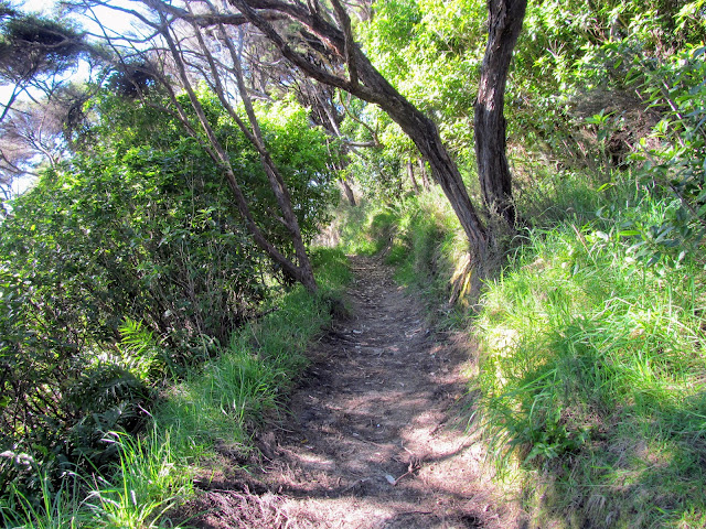
You are in coastal forest or Manuka groves for the majority of the next 45 minutes and this is a lovely shady section of the track. You cross a couple of side streams along the way but all of them have bridges so it would have to be truly heinous weather to halt your journey.
 |
| Bridge over Abel Tasman Coastal Track near Anatakapau Bay |
 |
| Last view of Anatakapau Bay, Abel Tasman NP |
You are walking around two headlands on your way to Anapai Bay so you have a number of places where you can see out to the sea and along the coastline. There was a cool breeze blowing which was welcome as it was in the low 20's and it was hot work walking up the hills in the sun.
 |
| On the Abel Tasman Coastal Track enroute to Anapai Bay |
 |
| ...nice shady track between Mutton Cove and Anapai Bay... |
There is a magnificent view back to Mutton Cove and Separation Point and it is perfectly framed by the Manuka trees to give a postcard like image....
 |
| Great view of Separation Point from the Abel Tasman Coastal Track |
 |
| Manuka trees between Anatakapau Bay and Anapai Bay |
 |
| ...the headlands are usually covered with thin forest... |
You pass a foot bridge over a small dry stream bed after 20 minutes and this is more or less the half way point between Anatakapau and Anapai Bay. There were no running streams anywhere along the track so make sure you fill up your water bottle at the campsites as you will find none enroute.
 |
| Crossing a stream half way to Anapai Bay |
The last headland between Anapai and Anatakapau has a bench seat with a nice view of the sea and down to Anapai Bay. I stopped here for a couple of minutes to have a drink and to film some vlog clips. The forest on these headlands is always thin with Manuka and Kanuka the most common trees. It would be a harsh environment for anything else....
 |
| Last headland between Anatakapau and Anapai Bay |
 |
| ...there is a nice seat looking down to Anapai Bay... |
 |
| Beach at Anapai Bay, Abel Tasman NP |
 |
| ...the view out to the Tasman Sea... |
From the headland you are gradually descending down into Anapai Bay through the valley at the back of the bay. The track follows the curves of the hills in long sweeping rolls and it is a wide & well maintained track section.
 |
| Track cutting heading down to Anapai Bay |
 |
| Nice bench track on the approach to anapai Bay |
There is a marvelous view of Anapai Bay from high on the ridge side and you could even just make out the high peaks of the North Island out across the sea. I could clearly see Mt Taranaki and the Tararua Ranges as well as the outer islands of the Marlborough Sounds.
 |
| Anapai Bay, Abel Tasman NP |
The track passes through a dense area of Podocarp forest with some big Totora and Rimu trees and along an elevated gravel track to the point where it exits onto Anapai Beach. There is a dense jungle like tangle of undergrowth along the track and with the vines hanging off the trees, ferns and palm like bushes it is a very attractive section of the track.
 |
| ...there is a shady area of Podocarp heading down to Anapai |
 |
| Benched track 100 meters from Anapai Bay |
 |
| First view of Anapai Bay through the bush |
It took me just shy of 45 minutes to walk from Anatakapau Bay to Anapai Bay and I was nearly past the two thirds distance of my journey. Anapai Bay is another gorgeous golden sand beach and the campsite is located just off the beach in a patch of protective Manuka trees.
 |
| Beach at Anapai Bay, Abel Tasman NP |
 |
| Anapai Bay campsite in the Manuka behind the beach |
There was a Dutch couple at the campsite that I exchanged pleasantries with and then I walked up the beach a hundred meters and dropped pack for a ten minute break. a drink and some snacks revived me for the last hour of the day...
 |
| The point at the northern end of Anapai Bay |
Anapai Bay is a popular day trip for people staying at Totaranui as it is only two hours return and the walk between the two points is relatively easy. This is another spot where I would love to camp but you would need to watch the Weka here as they are particularly adept at pinching your gear.
 |
| You come over the headland to the left to reach Anapai |
 |
| Pair of Variable Oyster Catchers, Anapai Beach |
I would imagine they get lots of practice as a lot of international visitors camp on the beach while they are in the Totaranui area. They don't generally realise what thieving bastards Wekas can be....leaving you stuff unattended almost encourages them to misbehave.
 |
| The southern end of Anapai Beach |
The track to Totaranui starts at the southern end of the beach and is marked by another big orange triangle on a pole. There is a tidal stream at this end of the beach so you might have problems crossing it at high tide as it runs right up to the side of the hill.
 |
| The start of the track to Totaranui from Anapai Bay |
It is roughly two kilometers to Totaranui from Anapai Bay and you climb up to a saddle at around 100 meters so this is the less strenuous of the sections you cover over the day. You are just one hour from the end of your walk...
 |
| ..it is one hour to Totaranui from Anapai Bay... |
 |
| The track to Totaranui climbs out of Anapai... |
 |
| More Mahoe trees climbing out of Anapai Bay |
You are climbing up along the side of a ravine with a no name stream at the bottom...it slowly gains altitude as you climb up towards the saddle. The track is damp and cool with the nearby stream and you are walking through a big area of Mahoe or Whitey Wood trees. There are some really big Manuka trees with trunks around a meter thick so they would have to be over 150 years old.
 |
| The track is a gradual climb to the last saddle before Totaranui |
 |
| Really old and big Manuka Tree |
I noticed a few Wasp bait stations along the track which I haven't seen up here before so they must have a problem with Wasps over the summer. I am surprised as they usually like Black Beech forest and there is hardly any Beech up this end of the park so I do not know what they are surviving on.
 |
| Wasp trap along the Abel Tasman Coastal Track |
 |
| In the saddle between Anapai and Totaranui |
I saw the first Nikau Palm of this trip in the ravine....there was a small patch of them around the halfway point over the saddle. Nikau grow from here right down to near Punakaiki on the West Coast but you don't see that many of them in Abel Tasman NP.
They really are a good looking tree....
 |
| My first Nikau Palm of this trip...... |
 |
| Crossing the stream on the saddle between Anapai and Totaranui |
From the stream crossing it was just 300 meters to the top of the saddle and the start of the final descent down to Totaranui. The people I shared the hut with the previous night passed me just along here and we kept leap frogging each other from here to the campsite.
 |
| ...start of the last hill for this day... |
 |
| Apex between Anapai Bay and Totaranui |
 |
| On the last descent down to the estuary behind Totaranui Beach |
They were a couple of sisters from Nelson and the elder had walked the Te Araroa the previous year so we chatted about that in the hut. As you do....
 |
| Junction of Abel Tasman Coastal Track and Headlands Track |
The descent down from the top of the saddle to flat ground is swift with a series of switchback tracks flowing back and forth across the Totaranui side of the hill. The track was clay and it is a bit slippery as it is often damp so take care on the descent.
 |
| View out to Skinners Point from above Totaranui |
 |
| Totaranui from the Abel Tasman Coastal Track |
There are views out to Totaranui Beach, the Estuary and further along the coast to at least Awaroa. The beaches are that golden sandy color and the ocean is a vivid contrast in an Azure blue color
 |
| You can see right around to Awaroa Head from the track... |
At the bottom of the hill there is a track junction...if you turn left you will find the low tide crossing to Totaranui, the end of the Headland Walk and the Pukatea Nature Walk. Only use the low tide crossing two hours either side of low tide as there is a deep channel along the bottom of the hills when the tide is in. Straight ahead is the high tide track to Totaranui...
 |
| Junction of the low water and high tide track to Totaranui |
 |
| Map: Totaranui area.... |
There is a map at the track junction showing you the layout of the various tracks in the area and giving information about the tidal crossing...
 |
| Map of the track network around Totaranui |
I just stayed on the high tide track as I did not know what the tidal stage was...it is about 1.5 kilometers from the track junction to the campsite so I was on the last 30 minutes of my walk. The track continues around the head of the Totaranui Estuary until it reaches some old farmland. From here you are following a gravel road all the way to the campsite...
 |
| Old farmland near Totaranui, Abel Tasman Coastal Track |
 |
| 4 W/D vehicle belonging to DOC.... |
The track to Gibbs Hill and the Inland Track branches off the main Coastal Track half way across these old farm paddocks. It would be 1.5-2 hours to the top of Gibbs Hill, 3 hours to Pigeon Saddle and 5 hours to Awapoto Hut on the Inland Track.
 |
| The Gibbs Hill/Inland Track heads off to the right... |
 |
| The last 1.5 km's to Totaranui is on the gravel road... |
I passed a number of people heading the other direction along here as they had obviously arrived on the 11 am watertaxi to Totaranui. Most looked like multiday trampers as they had bigger packs, tents etc. but some were obviously just going for a day walk.
 |
| Fast walking on the road to Totaranui campsite |
 |
| Totaranui Estuary, Abel Tasman NP |
You will eventually reach a gate across the gravel road...this is the official start/finish to the northern section of the Abel Tasman Coastal Track. There are track signs here as well as a small carpark for people walking the track. I would be more inclined to park down near the DOC office as there are more people down there and it might be a bit more secure.
 |
| Sign at the end of the northern section, Abel Tasman Coastal Track |
 |
| The road near Ngarata Farmstead, Totaranui |
I passed Ngatata Farmstead on my to the campsite....this is the historic home of the family who once owned all the flat land around Totaranui. This was a working farm from the late 1800's till the late 1950's after which most of the farmland was incorporated into the new National Park. The building is used as an outdoor education centre by school groups visiting the national park...
 |
| Ngarata Farmstead, Abel Tasman NP |
 |
| A potted history of the Ngarata Homestead... |
From the Ngatata Farmstead it is just 300 meters to the Totaranui campsite along the access road. It is a great end to a good days worth of tramping...nicely flat and easy travel!!!
 |
| On the road between Ngatata and Totaranui campsite |
 |
| The road to the right goes to Wainui over Pigeon Saddle |
You can see back to the ridge you have just crossed from the road to the campsite. The track crosses the lowest point of the ridge and descends down one of the spurs heading off the top of it. From the road you can see how low it actually is...most of it is between 100-120 meters a.s.l.
 |
| We crossed the lowest point between Anapai and Totaranui |
I arrived at the Totaranui campsite at just past 11.30 and was surprised to see how quiet it was...Totaranui was deserted. I was expecting a lot more people in the park as it was the school holidays but apart from the section from Anchorage to Marahau I saw very few people. I think it might have been due to the weather forecast for the next day as heavy sustained rain was coming.
 |
| DOC office at the Totaranui campsite |
 |
| Track information heading out of Totaranui |
 |
| A new map of the Totaranui Campsite, Abel Tasman NP |
I walked down to the beach to have a look at the sea...it was beautiful as always with that long curving golden sand beach and the calm water of the bay. Totaranui has always been one of my favorite spots around the country...
 |
| Looking towards Awaroa from Totaranui Beach |
 |
| The headland to the north of Totaranui Beach |
I was booked on the watertaxi to Anchorage at 3.15 pm so I had been anticipating a long afternoon at Totaranui. I had a special freeze dried meal for lunch as well as soup and a couple of snacks. Just after I sat down at one of the picnic tables I heard a boat heading into the beach so I went down to have a look. It was practically empty and there were only two people waiting to be collected.
 |
| ...Aquataxi coming into to land at Totaranui Beach |
I asked the skipper if I could catch his boat to Anchorage and he said yes. I literally spent less than five minutes at Totaranui before jetting off to Anchorage for the night. If I had been five minutes later I would have missed the opportunity to get to my destination early. That was some damn fine luck and meant I was at Anchorage by 1.20 pm and the first to arrive for that night...
 |
| ...on my way to Anchorage for the night... |
I love the northern end of Abel Tasman National Park and would love to spend more time up this end of the park. I fancy a stay at Mutton Cove or Anatakapau Bay campsites when it is warm so I could swim off the beach. That might be an idea for early next year or next summer but it really does appeal to me. Get up here if you have never visited this end of the park...the walking is relatively easy and the beaches are much quieter.
Access: From Wainui Bay and the northern start of the track or by watertaxi/road to Totaranui and then walking along the northern section of the Abel Tasman Coastal Walk..
Track Times: 10 km's or 3-3.5 hours from Whariwharangi Hut to Totaranui on the Coastal Track.
Hut Details: Whariwharangi Hut: Great Walk, 20 bunks, wood burner, filtered water tank, wood shed, flush toilets; DOC campsites at Whariwharangi Bay, Mutton Bay, Anapai Bay and Totaranui.
Miscellaneous: There is a relatively secure carpark at Wainui Bay. Whariwharangi Hut is on the DOC Great Walk booking system, must be booked for overnight visit. Hut Warden in residence from late November to 30th April each year. There is a large campground at Totaranui accessible from sea or via the Wainui-Totaranui road. It is very busy from Christmas to New Years and bookings are essential.
