Back on the Christchurch 360 Trail...
In early May I completed my penultimate section of the Christchurch 360 Trail by walking from Spencer Park to Brooklands on the Brooklands Lagoon Walk. The Christchurch 360 Trail is a long distance route which circuits Christchurch using existing tracks, newly constructed walkways, roads and river embankments. It is about 130 kilometers in total.
 |
| Brooklands Lagoon at the Spencer Park end |
I covered most of the route of the Christchurch 360 between 1993 and the late 1990's when I used to do a lot of road and cross country MTB riding around Christchurch. Other sections have been covered in the course of my fitness walking or when I was going for urban walks with friends and family.
At that time the current route did not exist as it was a lot of separate tracks. I started working towards completion of the route when the Trail was officially opened about 10 years ago.
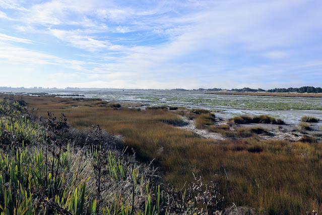
 |
| Christchurch 360: Spencer Park to Whites Crossing |
I have been working on this project for most of the last decade and have slowly been ticking off sections of the track with the goal of completing the entire circuit. I am almost there with the last section from Taylors Mistake to Scarbourgh to complete and it will be finished by the end of this year.
 |
| Looking out over Brooklands Lagoon near Brooklands |
The section along the Brooklands Lagoon is one of the nicer tracks I have walked along the Trail. It starts at Spencer Park and follows alongside Brooklands Lagoon out to the old suburb of Brooklands. The vista out over the lagoon is fantastic and the walking easy making this one of the more enjoyable parts of the greater trail.
 |
| Brooklands Lagoon at the end of the track... |
I have gone back over my previous posts and clearly marked them as Christchurch 360 sections so you can tell them apart. If I was starting this project anew I would probably devote a whole website to it as there are over 100 different tracks, walks and road sections in the Trail.
Spencer Park to Brooklands:
This section of the Christchurch 360 Trail runs from Spencer Park along the Brooklands Lagoon to the ravaged suburb of Brooklands. I say ravaged as Brooklands was basically dismantled by the Canterbury Earthquakes and all but about a dozen houses there were eventually demolished. The streets are still there just no houses or people...it is an eerie place to visit!!!
 |
| Start of the Brooklands Lagoon Walk at Spencer Park |
 |
| Christchurch 360 Trail sign at Spencer Park |
The track you are following is the Brooklands Lagoon Walk which starts from a Christchurch 360 sign near the Adrenaline Forest at Spencer Park. This section is +4 kilometers long (8-9 kilometers return) and is a mix of grass track, sandy walking, track matting, boardwalk and gravel path. It is about half of the greater Spencer Park to Whites Crossing section of the Trail.
 |
| Entrance to the Christchurch Adrenaline Forest |
Be aware that this track is very exposed to the elements so bring appropriate clothing and equipment with you. Plan for both hot sun and cold, wet and windy days. You need a good sun hat, a wind & water proof jacket, water and some food. I forgot my sun screen and I got a bit fried...lessons for your future visit people!!!
 |
| On the Brooklands Lagoon Walk at Spencer Park |
 |
| First Christchurch 360 marker...Brooklands Lagoon Walk |
 |
| Brooklands Lagoon from near Spencer Park |
The track is easy walking right along its length and is very well marked and signposted except out at Brooklands where you have to follow some of the roads. It would be good to see some of those Christchurch 360 trail markers on the lamp posts out there.
 |
| We follow the route of the Brooklands Lagoon Walk |
 |
| Brooklands Lagoon Walk: weed matting as track |
The Brooklands Lagoon Walk is a multi use track and you will see walkers, MTB riders, runners and people riding horses. Most of the Christchurch 360 is like that...you can cover the distance using many different means. I have either walked or ridden all my sections.  |
| ...the weed mat covers soft sand...Brooklands Lagoon Walk |
Once you are on the Brooklands Lagoon Walk the first point of interest is a bird hide about a kilometer along the track. It is atop a handy sandhill and has unobstructed views out over the southern end of the lagoon.
 |
| Bird hide on the Brooklands Lagoon Walk |
 |
| Interior of the bird hide...Brooklands Lagoon Walk |
 |
| Information about bird species in the bird hide |
 |
| Interior of bird hide...Brooklands Lagoon Walk |
The Lagoon is a permanent and migratory home for many different birds and I could see a number of Ducks, Gulls, Herons, Pukeko and Geese as I walked along the track. There would have been Weka here in Pre European times but they retreated over to the West Coast as the lowland forest was cleared and the land turned to agriculture.
 |
| Brooklands Lagoon...Spencer Park side from inside the hide |
 |
| ...lots of wetland birds at Brooklands Lagoon... |
 |
| View north towards Brooklands from the hide |
There are a number of spaced out seats, picnic tables and benches along this section of the Trail and they provide great spots to stop and rest. Most of them will have either a view of Brooklands Lagoon or out to the barrier spit between the lagoon and the ocean.
 |
| A seat along the Brooklands Lagoon Walk |
I made my way north along the track with a line of distant Pine trees at Brooklands as my goal. I saw a small number of fellow travelers but for the most part I had the track to myself.
 |
| Walking through wetland on the Brooklands Lagoon Walk |
 |
| Brooklands Lagoon Walk: boardwalk section... |
These horses looked at me with a great deal of suspicion...they probably see a lot of people over the course of any day and have rightly draw leery towards strangers. This looks to be a very horse friendly environment. I saw a group of people riding horses later in the day and there is a separate horse trekking track most of the way out to Brooklands.
 |
| Curious horses near the Brooklands Lagoon Walk |
 |
| Brooklands Lagoon Walk: rocky section of track... |
Here is a curious thing...a child's ride on toy just sitting in the middle of the track with no people around. It look's to have been there for a while as just about all the color has faded out leaving a washed out, bleached looking reminder of another visitor...
 |
| ...an abandoned child's toy on the Brooklands Lagoon Walk... |
Halfway to Brooklands near Barkers Brook is a set of sandhills with a picnic table on top. This would make an excellent place to stop for lunch as the elevation gives you great views both to the north and south across the Lagoon.
 |
| Brooklands Lagoon Walk...view back to Spencer Park |
 |
| There is a picnic table half way along the Brooklands Lagoon Walk |
 |
| Looking across the middle of Brooklands Lagoon |
Barkers Brook is a small stream flowing past the track from further inland and there is a marsh here and some more picnic tables to use. The Walkway skirts the edge of this area as it continues on its way out to nearby Brooklands.
 |
| Barkers Brook along the Brooklands Lagoon Walk |
 |
| Picnic area at Barkers Brook...Brooklands Lagoon Walk |
 |
| Barkers Brook on the Brooklands Lagoon Walk |
There is also a homemade lean-to here constructed from driftwood gathered I believe from the nearby lagoon. It is probably home base for a white-baiter, fisherman or someone who comes out here to gather shellfish from the Lagoon at low tide.
 |
| Driftwood shelter at Barkers Brook...Brooklands Lagoon Walk |
Right next to the lean to is a part of the old MTB track which existed here for many years. It was cut through the Raupo swamp and looks like a dirt pathway about 1.5 meters wide. You strike sections of it right along this walk but it has been superseded by the new route I was walking. You can still walk down the old track but it will be muddy and slippery when wet...
 |
| The old MTB track on the Brooklands Lagoon Walk |
You pass over a bridge separating a small estuary from Brooklands Lagoon and eventually reach the edge of the old suburb of Brooklands. The boundary of the old housing estate is obvious as it is marked by the roads which are the only part of the suburb that was not demolished.
Eventually the Government has plans to rehabilitate this land but I would be surprised if it ever happens. They should just turn it into a park like other earthquake damaged areas have been.
 |
| Tidal Estuary at Brooklands...Brooklands Lagoon Walk |
 |
| It was an outgoing tide in the Brooklands Lagoon |
 |
| Empty sections at earthquake damaged Brooklands |
You can end the section here if you like or continue walking as I did down to the Styx River and the start of the track through to Whites Crossing. From here you walk along the top of an embankment before joining a short length of the old Raupo track behind some of the few houses still in existence.
 |
| The Brooklands Lagoon Walk continues along the embankment |
 |
| At the end of the Brooklands Lagoon Walk |
 |
| ...you exit onto Charron Street at Brooklands... |
Following the track markers you exit out onto Charron Street and walk north for about 300 meters to the intersection with Chelmford Road. The few houses that still exist at Brooklands are hold overs from the once bustling suburb. They are now off grid except for power as the local council declined to maintain sewerage and water services once the majority of the houses were removed.
 |
| ...walk north along Charron Street for 300 meters... |
You turn right into Chelmford Road and walk down to the end of the road where there is a information panel and map. This area is known as Seaford Park and was an urban park back when there was a community at Brooklands. You will see some posts with the Christchurch 360 Trail markers on them so just follow the markers.
 |
| ...turn into Chelmford Street... |
 |
| ...and make for Seafield Park at the end of Chelmford Street... |
Seafield Park is the name for the area of land between the old suburb and Brooklands Lagoon and stretches right along the shore line to the mouth of the Styx River. I would imagine that all the land out here will eventually be incorporated into one big park as it is useless for anything else.
 |
| Information panel at Seafield Park, Broklands |
 |
| The extensive track network at Seafield Park |
You walk over a series of old grass covered sandhills before the track deposits you at the end of Harbour Drive. There is a view from here out to the end of the barrier spit and across to the mouth of Brooklands Lagoon.
 |
| On the track through the sandhills of Seafield Park |
 |
| More empty sections at the end of Seafield Park Track |
There is a Rahui or native ban on the collection of shellfish and fish from Brooklands Lagoon at the moment. After the Canterbury Earthquakes quite a lot of sewage, silt and dirty water was forced into the Lagoon so it is not safe to eat anything harvested from here. They also have occasional poisonous algal blooms...
 |
| There is a Rahui on Kai Moana from Brooklands Lagoon |
 |
| Looking out over the northern end of Brooklands Lagoon at Harbour Drive |
You will have to find your way around a fence line here to get atop the embankment running off to the north. The Trail runs along the top and it takes you right down to the mouth of the Styx River.
 |
| Last track section to the Styx River at Brooklands |
After about two hours of walking you will find yourself down at the mouth of the Styx River and the end of this section of the Trail. I was lucky to see a couple of Grey Herons close to the shore...they were wading and fishing in the shallow waters at the mouth of that river.
 |
| Grey Herons in the Styx River, Brooklands Lagoon |
 |
| The distant tree-line is the beach at the end of the Brooklands spit |
There is a gravel turning area at the on the embankment and this is the end of the track unless you are continuing to Whites Crossing. The Styx River is right next to the track end and this is where the Styx flows into Brooklands Lagoon and out to the sea. The Styx actually has its head near Christchurch Airport so it has followed a long and twisting path to get here.
 |
| Start of the section to Whites Crossing at Brooklands |
The mouth of the Styx River is close to the outlet of the Waimakiriri River and from the turning area you can see the end of the barrier spit and across to Kairaki-Pines Beach over on the true left of the river. You could see fishermen at the mouth of the Waimakiriri and a couple of guys were shooting around on some jet skis.
 |
| Distant Pines Beach from Brooklands |
From here you can continue on the Christchurch 360 Trail along the embankment to Stewarts Gully, Kainga and Whites Crossing near the newer Waimakiriri Bridge. I rode this section back in the 1990's when I lived out at Kaiapoi. Back then I rode from Brooklands right out to West Melton along the embankments.
 |
| The Styx River at Brooklands Lagoon |
 |
| Toilet block at the end of the Spencer Park-Brooklands section |
I stopped at the trail end only long enough to take some photos and film the trail end before turning about and following my route back towards Spencer Park.
 |
| Heading back to Spencer Track from the Styx River |
 |
| Brooklands Lagoon at the old suburb of Brooklands |
 |
| Spit between Brooklands Lagoon and Pegasus Bay |
You can walk straight back to Charron Street through the old suburb but I actually followed my outward route as I wanted to get some supplemental film clips from along the track.
 |
| Back onto the Brooklands Lagoon Walk at Charon Street |
 |
| Walking back towards the edge of Brooklands |
Back on the southern edge of Brooklands I stopped for a 10 minute break at a handy bench and had a snack and some water. I was eating a couple of Mr Kipling's lemon slices and let me tell you...they are damn fine eats!!!
 |
| Snack break...and a Mr Kipling's Lemon slice!!! |
 |
| Looking towards Spencer Park from near Brooklands |
On the return journey I took a short side track up to a vantage point overlooking the small estuary on the edge of Brooklands. There are some old sand dunes here with native trees planted on them and the seat has a great view over the surrounding area.
 |
| Nice viewing point...Brooklands Lagoon Walk |
 |
| The tide was out at Brooklands Lagoon |
I just meandered my way back to Spencer Park and as it was getting on for the late afternoon I saw hardly a soul. I was passed by one MTB rider near Brooklands and another walker back near the bird hide.
 |
| Heading towards Barkers Brook..Brooklands Lagoon Walk |
 |
| Port Hills from the Brooklands Lagoon Walk |
 |
| The distant Pine trees mark the edge of Spencer Park |
I noticed there was a trap line right along the route of the Brooklands Lagoon Walk. They looked like a local version of the venerable DOC 2000 trap and they were scattered right along the route. They will be after predators like Mice, Rats, Hedgehogs and possibly even Stouts that predate nesting wetland birds.
It is awesome to see all the trapping going on around the country...it is the only way to really dent predator numbers in the wild.
 |
| ...local take on the classic DOC 200 trap... |
 |
| ...the sun made an appearance ...Brooklands Lagoon Walk |
I saw a group of horse riders down by the bird hide...this would a really nice trail to ride along.
 |
| Horse trekkers on the Brooklands Lagoon Walk |
 |
| Brooklands Lagoon Walk...multiuse track!!! |
Brooklands Lagoon is shaped like a tear drop with the wider end at Spencer Park and the more narrow end going into the Waimakiriri River. At Spencer Park the lagoon would be at least one kilometer wide while at Brooklands it is only a couple of hundred meters.
 |
| Brooklands Lagoon is wider near Spencer Park |
 |
| Approaching the bird hide...Brooklands Lagoon Walk |
I stopped at the bench seat near the bird watching hide to have some lunch. I had a pair of wraps from Couplands a local bakery chain down here in Christchurch. They make for a tasty tramping lunch...they have a variety of meat filings, salad, cheese and sauces. I often buy them when I am going on a day tramp and if I pass a Couplands outlet.
 |
| I stopped for lunch at this seat...Brooklands Lagoon Walk |
 |
| ...mmmhhhh tasty filled wraps for lunch... |
 |
| Couplands filled wraps...good tramping eats!!! |
 |
| View from my lunch spot...Brooklands Lagoon Walk |
From the bird hide it is only 500 meters back to the end of the track and the start/finish of this section of the Christchurch 360 Trail.
 |
| Brooklands Lagoon Walk...the bird hide |
 |
| Christchurch 360 logo on a track marker pole |
I noted a number of areas where native planting has been undertaken...it would be awesome if this whole trail section was re-forested with the Kahikatea forest it was once covered in. This area would once have been an extensive lowland Kahikatea swamp but it was drained for farms in the late 19th century.
 |
| Area of new native planting on the Brooklands Lagoon Walk |
 |
| Spencer Park draws close...Brooklands Lagoon Walk |
Very soon I found myself back at the start of the trip and walking the last hundred meters back to the carpark. I was starting to get weary as i had been walking for nearly four hours by that point.
 |
| Back at the start of the Brooklands Lagoon Walk |
FYI: there is a nice bird watching tower down near the Adrenaline Forest carpark and it is worth going up to get a elevated view of this end of the Brooklands Lagoon.
 |
| Bird viewing tower...near the Adrenaline Forest at Spencer Park |
 |
| Many species of waterfowl live in Brooklands Lagoon |
 |
| Carpark for the Brooklands Lagoon Walk at Spencer Park |
This end of the Brooklands Lagoon is ringed by low Raupo reeds and you could see a variety of different birds wading about in the water and on the open mud flats.
 |
| View north from the bird watching tower at Spencer Park |
 |
| Looking towards the main beach access at Spencer Park |
 |
| Spencer Park Reserve is near the pines in the distance |
All in all this is one of the most enjoyable sections of the Christchurch 360 Trail I have walked and it would be a fine day walk in its own right. It took me about four hours to cover the distance and it is very easy walking right along the route.
 |
| At the carpark for the Christchurch Adrenaline Park |
I will have to organise a trip to walk the final 360 Trail section from Taylors Mistake to Scarborough. The main problem being transport as there is no public transport to Taylors Mistake and I don't fancy climbing up over that hill twice. I will get her done...I just don't know how or when at this stage.
Access: Drive to Spencer Park about 10 kilometers north of Christchurch. Start from the carpark at the Christchurch Adrenaline Park at Spencer Park. The trail section starts from a set of signs at the carpark and heads along the Brooklands Lagoon Track.
Track Times: It is approximately 8 kilometers return....1-1.5 hours to Brooklands, same return to Spencer Park
Miscellaneous: This whole section backs onto Brooklands Lagoon. It is exposed to sun and wind so be prepared. No potable water or toilets except at the track ends.
Christchurch 360 Trail: Waimariri Beach Section-Spencer Park to Brooklands Section-Brooklands to Whites Crossing Section


