Tramping the Hope-Kiwi Track, Lake Sumner Forest Park
Woo hoo.......!
My 2016/2017 summer tramping season gets off to a start with a trip up the Hope Valley to Hope Half Way Hut over the last weekend. I was looking for an easy but long day trip option to blast the cobwebs away. A trip 9-10 km's up the Hope Valley to the first hut sounded like just the ticket.
Walking to Hope Half Way Hut
I started out from the car park at windy Point on SH 7, this is the access point to Lake Sumner Forest Park from the Lewis Pass highway. Facilities at the car park are basic: a bus shelter (there is a limited bus service over Lewis Pass) and a toilet.
The sand flies are are terrible here, they were all over me within 10 seconds of getting out of the car!
 |
| The bus shelter at Windy Point, Lake Sunmer Forest Park |
 |
| Windy Point car park |
The start of the track is a 4 W/D access road to the Amuri Outdoor Education Centre, from there it is farm tracks and your typical DOC bush track.
 |
| Start of the Hope Valley Track, Windy Point |
 |
| Map: Hope Kiwi Track, Windy Point to Hope Halfway Hut |
Lake Sumner Forest Park starts on the far side of the stile shown in the photo below, it seems slightly mad when you consider that Lake Sumner itself is over 25 kms away!
 |
| Hope Kiwi Track: Lake Sumner FP starts here |
 |
| The gravel road to the Amuri OEC, Hope Kiwi Track |
 |
| Walking up the road to the Amuri OEC |
 |
| Amuri Outdoor Education Centre, Lake Sunmer FP |
At the car park for the Amuri OEC you head left and down to the swing bridge crossing the Boyle. It is an impressive swing bridge as it is both high above the river and long.
 |
| Hope Kiwi Track is to the left |
 |
| Harper Pass-Hope Valley information |
 |
| Hope Kiwi Track: swing bridge over the Boyle River |
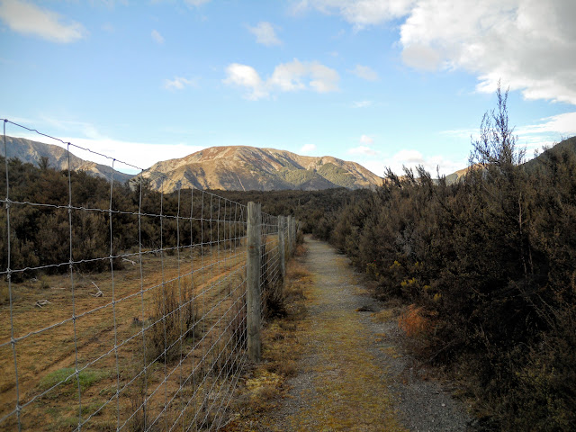
The first kilometre past the swing bridge is a gradual climb to the top of the eroded river terraces along the sides of Hope Valley, from there it is a gentle up and down trail all the way to Hope Half Way Hut, 9-10 km's distant.
 |
| Hatch in the deer fence on the Hope Kiwi Track |
Here is a curiosity: a hatch through a fence (a deer fence is about 7 foot high), a typical Kiwi solution to a basic problem.....how to cross the fence!
 |
| Hope Valley access straight ahead |
 |
| Climbing Hope Kiwi Track to top of terraces |
About half way to the top of the terrace there is a junction leading off to the Tui Track. The Tui Track joins the Boyle Valley Track and Windy Point via the Boyle and Doubtful River valleys. This is the recommended route for Te Araroa walkers provided they can cross the Boyle River (can be a problem after rain). This is also a way to access the Doubtful River Valley if the Boyle is too high to cross.
 |
| Hope-Tui track junction |
 |
| Climbing the old river terraces on the Hope Valley Track |
Once you reach the top of the terrace, it is about 30 minutes walk through Kanuka bush to get to the bush line and the track snaking up the Hope Valley.
 |
| Nice flat track heading to the Hope Valley |
 |
| Tarn on the river terrace, the Hope Valley Track |
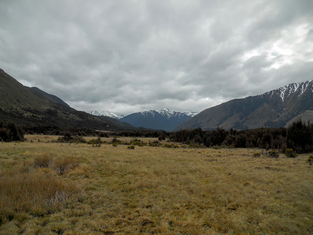
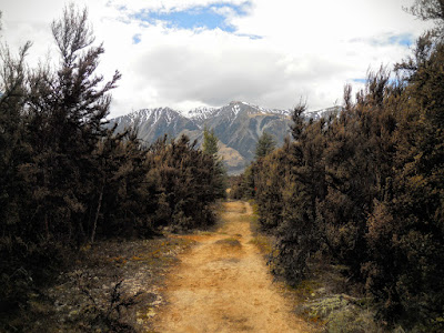
There is still a lot of snow on the mountains around Lewis Pass, this has been a late Spring year with significant snow falls as late as three weeks ago in the area. Normally all of the snow you can see below would be long gone by the beginning of October.
 |
| View North West towards Doubtful Valley from the Hope Kiwi Track |
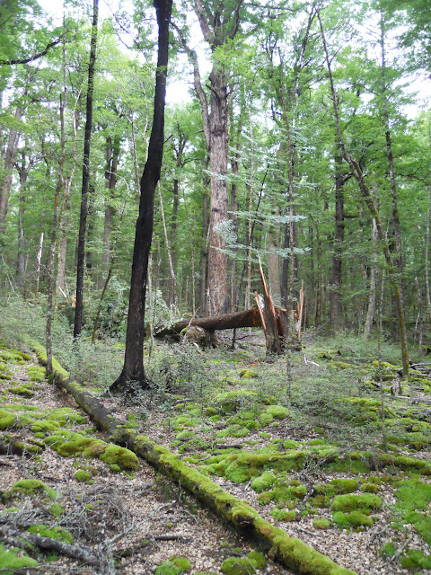
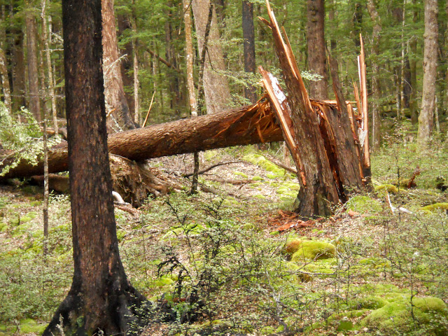
After 45 minutes you finally reach the start of the beech forest, you will be walking through mixed Red/Mountain Beech for the next couple of hours. There has been a bit of damage along the track, these beech trees are susceptible to both strong wind gusts and heavy snow falls. The track itself is nice: most flat, fairly obvious with a minimum of mud to cross.
 |
| Start of the beech forest, the Hope Valley Track |
 |
| Hope Valley Track: windfall over the track |
 |
| Nice even track surface, the Hope Valley Track |
 |
| Wind Damaged Red Beech tree, the Hope Valley Track |
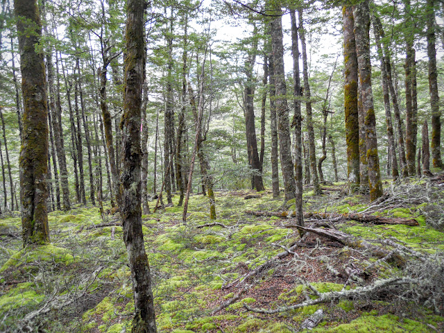 |
| More open red beech forest, Hope Kiwi Track |
 |
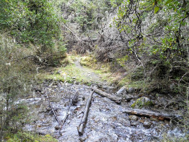
Hope Kiwi Track: First of the side streams to cross
|
At one point you pass a series of silt filled tarns, I imagine they are still quite swampy as no beech trees have colonised them yet. In a time of heavy rain I bet they fill with water, for a while at least!
 |
| Silt filled Tarn or mire, Hope Kiwi Track |
 |
| Another silt filled tarn, Hope Kiwi Track |
 |
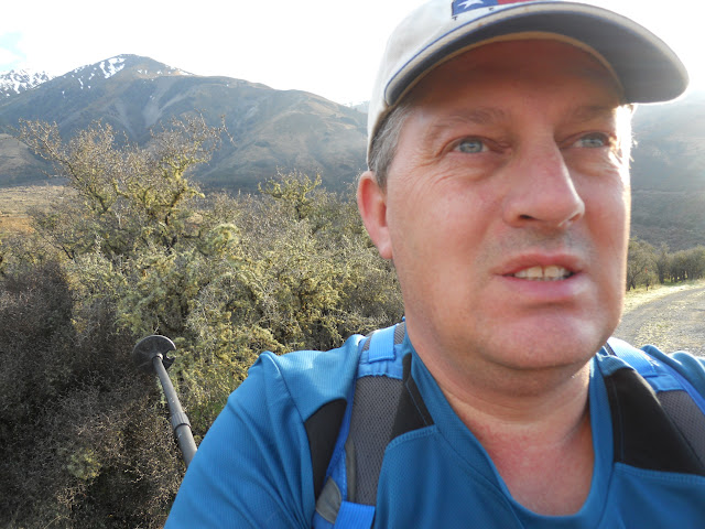
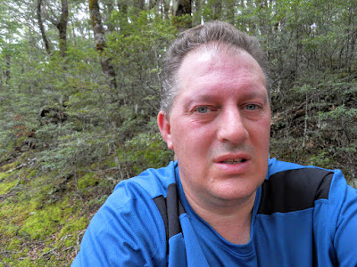
| Jon at first rest spot on the Hope Kiwi Track |
 |
| Small patches of Goblin forest on the Hope Kiwi Track |
 |
| First view of the Hope Valley |
There was a lot of animal sign in the Valley: both cattle, deer and pig. The photo below shows one of the classic furrows that wild pigs dig in flat grassy areas looking for roots etc to eat.
 |
| Hope Kiwi Track: wild pig sign on track side |
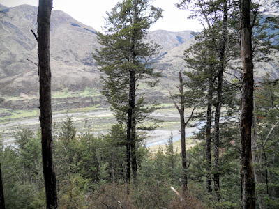
You finally get your first views of Hope Valley about 2 hours into the tramp, this side of the valley is Forest Park, the other is a high country cattle station. The mountains in the distance are outliers of the Glen Wye Range
 |
| View east Mid Hope Valley, from Hope-Kiwi Track |
 |
| View west Mid Hope Valley, from Hope-Kiwi Track |
 |
| Another side stream on the Hope Kiwi Track |
 |
| Mire or swamp next to Hope Kiwi Track |
 |
| Hope Kiwi Track: wind fallen trees just before Boundary Stream |
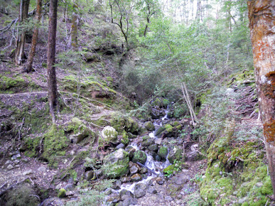
Boundary Stream is the most significant watercourse you cross on this track, it is fairly benign but I would watch this one if it was raining heavily, it is steep here so it will rise fast and hard. You have less than a kilometer to walk from here to get to the hut.
 |
| Boundary Stream, view North West to headwaters, Hope Kiwi Track |
 |
| Boundary Stream view East to Hope Valley |
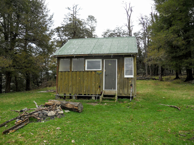
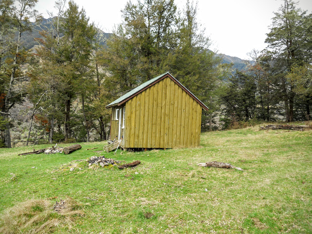
At Hope Half Way Hut
Finally after 2-3 hours you will arrive at Hope Half Way Hut. This hut is very basic as it is only actually supposed to be used as a day shelter. Regardless of that, it looks very comfortable with 6 bunks, a cooking bench, toilet and outside fireplace. No heating in the hut and the water comes from the Hope River about 100 meters away.
N.B: Boil, filter or treat all water from the Hope River and feeder streams in this valley as there are stock loose, the water is likely to be contaminated.
 |
| Hope Half Way Hut, Hope Valley |
 |
| Hope Half Way Hut, Hope Valley |
There were three people staying in the hut for the night, they had been hunting in the area for a couple of days and were leaving on Sunday morning. They said the hut was chilly at night but not cold, it looked like it would make for a fine nights quarters.
The photos of the interior below are from the
Tramping.Net website.....
 |
| Rather spartan interior of Hope Half Way Hut |
 |
| Benches and bunks, Hope Half Way Hut |
 |
| Hope Half Way Hut, Hope Valley |
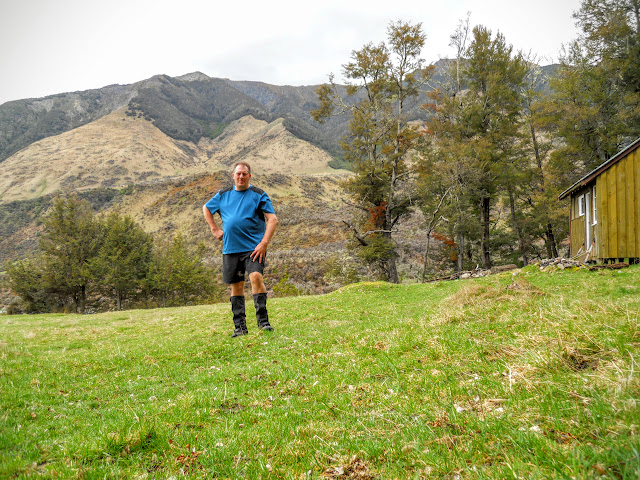 |
| Jon at Hope Half Way Hut, Hope Valley |
Heading back to Windy Point
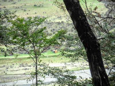
A curious sight: on the way back to Windy Point I noticed this hut on the far (true right) bank of the Hope River. It is strange as it does not show up on any Topo maps and is painted the classic DOC/NZFS blaze orange which leads me to believe it is a DOC hut.
The only hut on that side of the river is Museum Hut and that is historic (i.e.. old & wooden....), so I would appreciate any additional information.....
 |
| Hut on True right bank on Hope River |
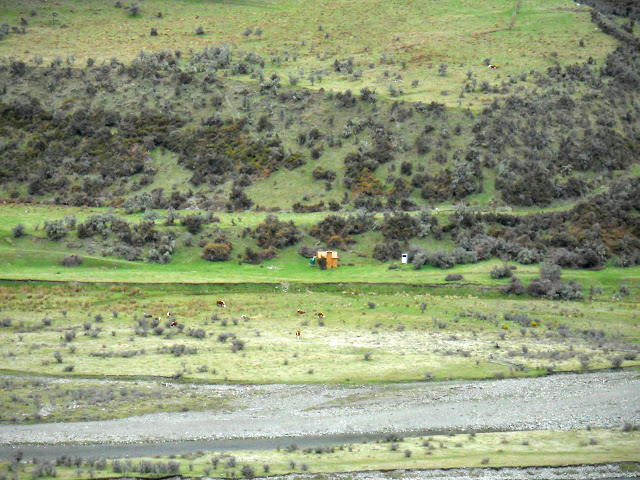 |
| Closer view of the hut on the Hope River from the Hope Kiwi Track |
 |
| Heading along the top of a spur line, Hope-Kiwi Track |
I was feeling the distance by the time I got close to the end of the tramp, I stopped for my final rest spot on a nice spur line about a kilometre from the bush edge. As you can see in the photos below the track was a bit muddy.
Lots of bird song in this forest, I guess the poisoning and trapping must be having some effect.
 |
| Muddy Boots, gaiters on the Hope Kiwi Track |
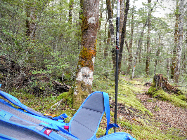 |
| Hope Kiwi Track: my Vaude Brenta pack and Leki trekking pole |
 |
| Last rest spot on the Hope-Kiwi Track |
 |
| Close-up of a wind damaged Red Beech tree next to the Hope Kiwi Track |
Some nutter has been riding a MTB over this track as I kept finding wheel tracks in areas of soft soil...
 |
| Jon on the Hope Kiwi Track looking at MTB tracks... |
It was a great sight to see the Kanuka brush once again as I knew it was only 2 kilometres to the car park from here. Just near here I passed an American couple heading into the Hope Valley to do some trout fishing.
The trout season has just started....these were 2 of 6 fishers I saw on the day.
 |
| The Track through the turpentine scrub, Hope Kiwi Track |
 |
| Hope Kiwi Track: clear weather on the descent to the Boyle Swing bridge |
Bit hairy crossing the bridge, the wind was blowing so it had a bit of a lean happening.
 |
| Nice view of the substantial Boyle Swing bridge on the Hope Kiwi Track |
 |
| Hope Kiwi Track: Kowai tree next to the Boyle River swing bridge |
A nice wee jaunt to get the limbs working, it was 7.5 hours walking there and back and about 18 kms of distance. I was lucky with the weather, it began to rain just as I turned onto SH7 to head home and continued all the way to the Hanmer turn-off.
I will be back through this area early in 2017 as I have the Harper Pass section of the Te Araroa Trail to walk sometime in February....
Access: Hope Halfway is on the Hope Kiwi Track, Lake Sumner Forest Park. Access from Windy Point on SH 7 just before the Engineers Camp.
Track Times: It is 3-3.5 hours from Windy Point to Hope Half Way Shelter, the return journey takes 2.5-3 hours. Total tramping time is 6-7 hours.
Hut Details: Hope Halfway Shelter (Basic/bivvies, 6 bunks, water from nearby stream, no heating)
Miscellaneous: Some un-bridged side streams, deer fence crossings


