Day-walking in Arthur's Pass, Part One...
Over the weekend I went up to Arthur's Pass and did a couple of day walks, I would have planned an overnight trip but an uncle was having a 90th birthday party on the Saturday night. The two tracks I walked were the Bealey Valley Track and the Devils Punchbowl Track.
 |
| At the Devils Punchbowl Falls later in the day |
I usually like to get up to Arthur's Pass around this time of the year to check out the snow conditions, tramping a lot of the tracks in the park depend on a lack of snow and it is hard to judge just from webcams and online information. I like to go up to the mountains and eyeball the situation in person.
 |
| Still plenty of snow on the mountains, Arthur's Pass National Park |
I think we are going to have a late snow melt this year, there is still a pile of snow on the surrounding mountains so I would imagine late December is when the last of it will disappear.
On the Bealey Valley Track, 1-1.5 hours return
I have started work on a new website:
Arthur's Pass Adventures so I needed some pictures to fill gaps in my photo collection. I had a list of locations I wanted to visit in Arthur's Pass so I started with the one furthest away and worked my way back towards Christchurch.
 |
| Map: Bealey Valley and Goldney Ridge |
 |
| SH73 at the Bealey Valley car-park...Arthur's Pass townships is 4 kms in that direction |
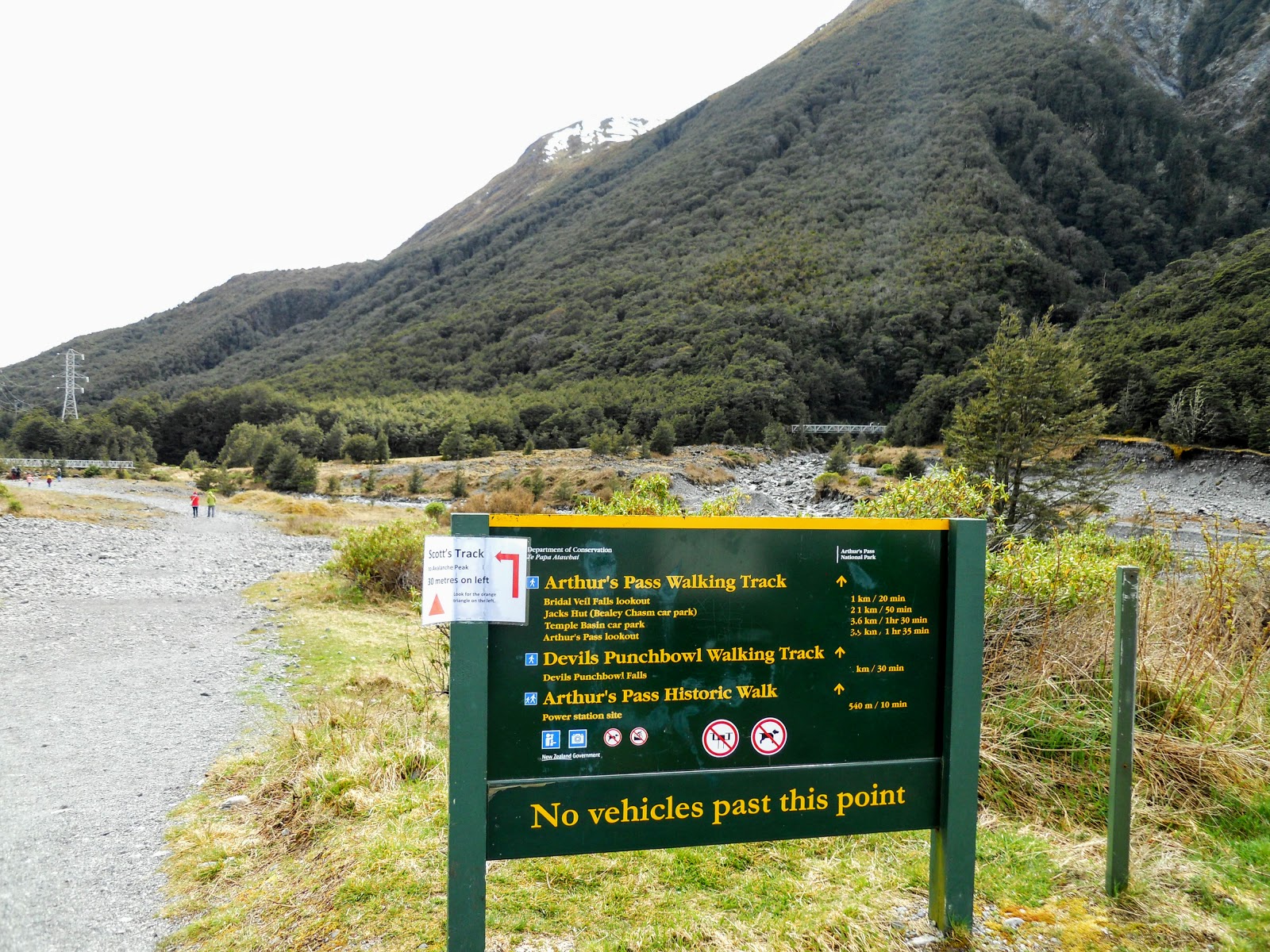
The Bealey Valley Track is approximately 4 kilometres west of the township, the entrance to the track starts at the car park opposite Jacks Hut. The car park is relatively secure as there is a lot of traffic going past as well as people walking the Arthur's Pass Walking Track which crosses SH 73 at this point.
 |
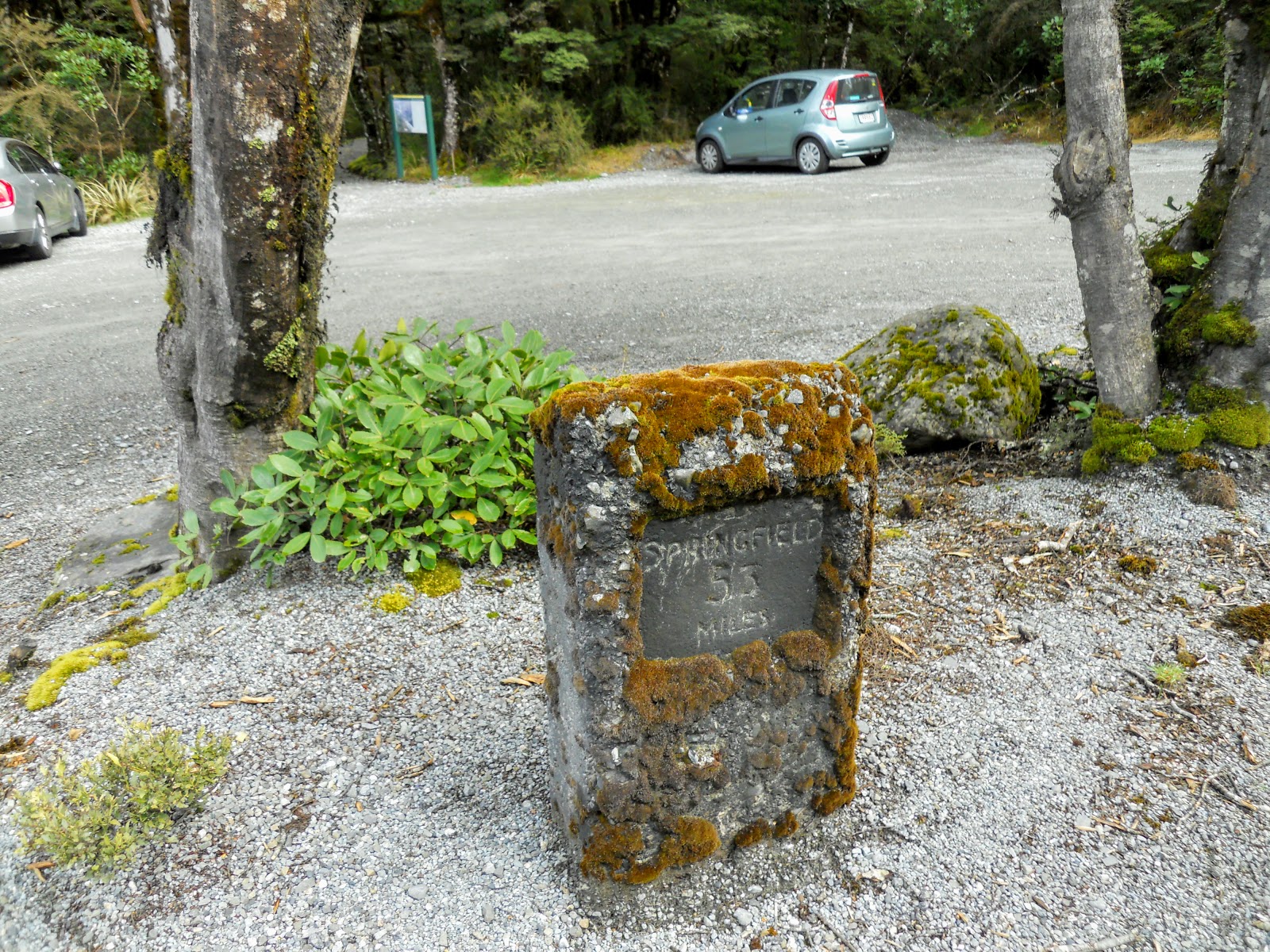
| An old road marker...Springfield is 53 miles away from this point |
 |
| SH73 at the Bealey Valley Track entrance...Arthur's Pass is 3 km's in this direction |
The track starts out right from the car-park, the first 500 odd meters is a part of the Arthur's Pass Walking Track from the village to the top of the pass. After 500 meters there is a junction leading down to the Bealey River and the bridge over the Bealey Chasm.
Sounds spooky doesn't it...the BEALEY CHASM!!!!
 |
| The silver surfer parked at the Bealey Valley car-park, Arthur's Pass National Park | |
 |
| Arthur's Pass National Park: start of the Bealey Valley Track network |
 |
| The Bealey Valley Track: Arthur's Pass National Park |
 |
| Track map for the Arthur's Pass Area |
This first part of the track is to Great Walk standard; i.e. you could easily push a wheelchair over it.It is very picturesque along here with the deep moss on the ground, the alpine plants and moss covered beech forest.
 |
| On the Arthur's Pass Walking Track, near the Bealey Valley |
 |
| Bridge over a small side stream, Arthur's Pass Track |
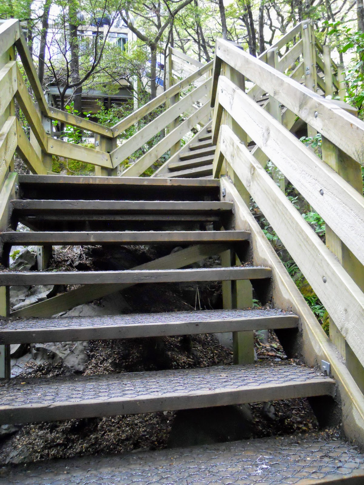
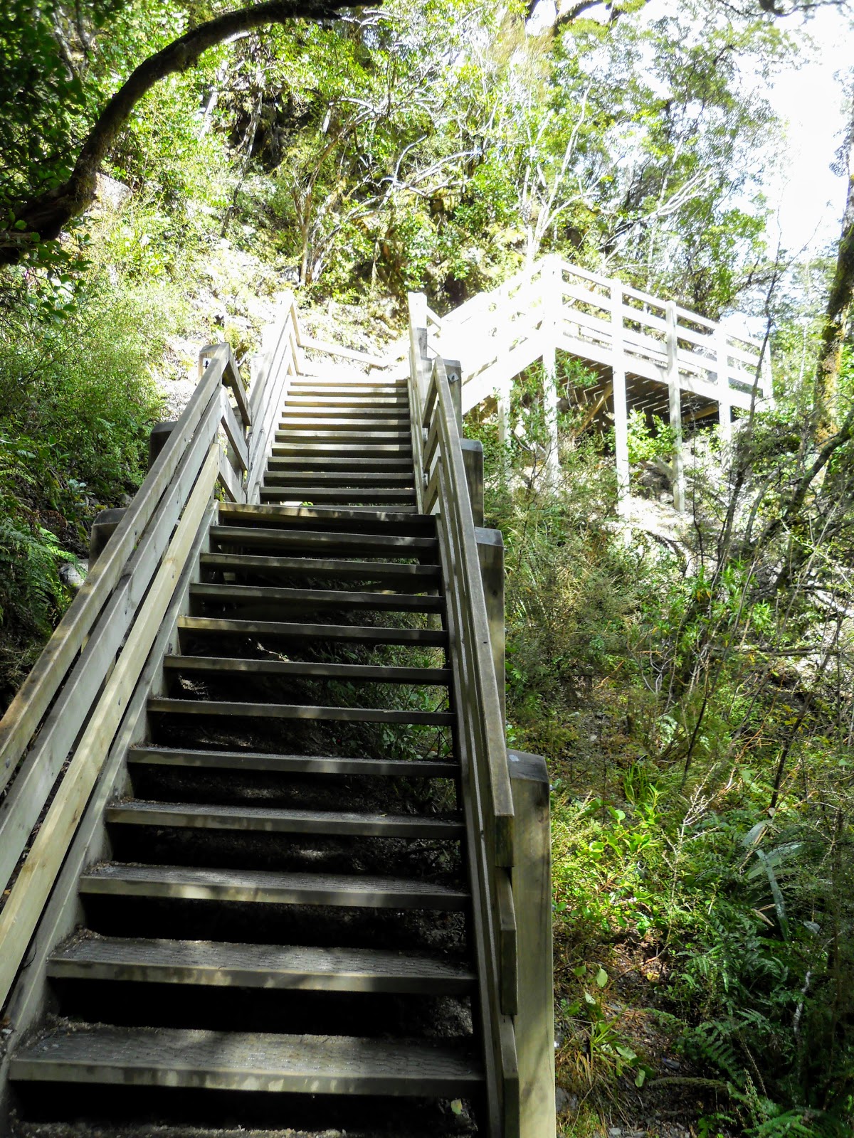
At the junction there are a series of stairs which descend down the side of the valley gradually dropping you down to the Bealey River. The track quality is still superb...it is very easy walking!
 |
| Bealey Valley Track-Arthur's Pass Walking track junction |
 |
| Lots of stairs on the Bealey Valley Track, Arthur's Pass |
 |
| Stairs and board walk on the Bealey Valley Track |
 |
| Jon Moake on the Bealey Valley Track. Arthur's Pass |
Down close to the Bealey River there is another track junction, the rough one on the right will take you down to the edge of the Bealey River while the other leads to the bridge over the Bealey River Chasm
 |
| The junction of the old and new tracks to the Bealey Chasm...go left! |
When I was a teenager there was no bridge here so you could not get further up the track if the river was high as you had to ford it. Now it is a year round, all weather track.
 |
| The bridge over the Bealey Chasm, Arthur's Pass |
 |
| The Bealey River upstream of the Bealey Chasm Bridge |
 |
| The Bealey River downstream of the Bealey Chasm Bridge |
 |
| The end of the easy walking, Bealey Valley Track... |
On the far side of the Bealey Chasm bridge the track reverts to your standard back-country track, it is much rougher with climbs, drops and other hazards.
 |
| Climbing up to the alpine bog on the Bealey Valley Track |
 |
| Bealey Valley Track, heading out into the alpine bog |
 |
| Goldney Ridge from the Bealey Valley Track near Margaret's Tarn |
 |
| At Margaret's Tarn, Pt. 1548 from the Bealey Valley Track |
There used to be a tarn in this alpine bog area but it has dried up over the years, now it is just a wet boggy area of mud, tussock and rock. Still very pretty though...
 |
| The Arthurs-Otira Pass area from the Bealey Valley Track |
 |
| Looking down the Bealey River Valley from the Bealey Valley Track |
It is back into the bush for the remainder of the walk to the Upper Bealey Valley. The track is easy and consists of alternating boardwalk and rock track with bridges over all of the larger side streams.
 |
| Heading into the bush just past the bog on the Bealey Valley Track |
 |
| Looking towards the Temple Basin area from the Bealey Valley Track |
I was using my new day pack, I brought a
Vaude Brenta 40 pack to use on these day walks. It is a more suitable size, and holds all the gear I need for a couple of hours in a more compact form. It has the same great harness system that my Brenta 50 uses.
 |
| My Vaude Brenta 40l pack on the Bealey Valley Track |
 |
| My Vaude Brenta 40l pack on the Bealey Valley Track |
There are a couple of fixed bridges on this track,not really required as the streams they cross are so small. Still, at least it lets you walk the track with dry boots so that is a plus.
 |
| Moss covered trees on the Bealey Valley Track |
 |
| Bridge crossing a side stream, the Bealey Valley Track |
 |
| Bridge crossing a side stream, the Bealey Valley Track |
There are the odd specimen of Dracophyllum along the track..these are often known as Dr Seuss trees as they look a little like the trees you see in his books. In fact they are remnants of ancient tree types that have existed in New Zealand alpine areas for millions of years.
I didn't see any Speargrass which is another endemic alpine plant but I know there are some further up the valley beyond the beech line at 900 meters.
 |
| Dracophyllum or Dr Seuss Tree on the Bealey Valley Track |
You are safe on this track right up to the point where it intersects the Upper Bealey River. Past this point there is a significant risk of avalanche...there are a number of steep sided mountain ranges surrounding the valley and very dangerous avalanche chutes coming down off them..
Do not proceed past the end of the track unless you are avalanche savvy and have checked the avalanche advisory to make sure you are safe in the headwaters of the valley. Do not approach the headwaters if there has been a recent or heavy snow event, or if there is a lot of snow on the mountains and it is raining.
 |
| Avalanche warning sign on the Bealey Valley Track |
From the end of the track you can see right up into the headwaters of the Upper Bealey River...
 |
| Closer view of Goldney Ridge from the Upper Bealey River |
Below are some photos of an avalanche chute which comes down off the high ridges and ends right at the rivers edge. I have been up here in Winter before and there were huge piles of avalanche debris piled up at the end of this chute.
I'm not kidding you can easily get squashed like an pumpkin by an avalanche five meters from the end of the track....
 |
| Avalanche chute coming down off Pt. 1548, Upper Bealey River |
 |
| Another view of the Pt 1548 avalanche chute, Upper Bealey River |
I had checked out the
on-line avalanche advisory so I knew there was a slight risk of avalanches so I felt confident to walk a bit further up the valley. There is a mountaineers track along the true right of the river you can follow or if you are feeling a bit more adventurous you can just walk up the river bed.
 |
| In the Upper Bealey River looking at the Goldney Glacier |
 |
| Upper Bealey River, Jon with the Goldney Ridge in the background |
 |
| The mountaineers track alongside the Bealey River, Upper Bealey River |
I walked up river about 15-20 minutes almost to the edge of the beech forest, I didn't feel very confident walking past this point as there is a avalanche chute coming down off Rome Ridge and there was a bit of snow right on the edge.
I will come back at the end of summer when all of the snow has melted and walk right up to the cirque at the bottom of Goldney Ridge.
 |
| Almost at the edge of the Beech Forest, Upper Bealey River |
I could just make out a trio of climbers up on Goldney Ridge, one climber was on the ridge coming down from Pt. 1832 and I could see two climbers traversing the snow slope directly under the Goldney Glacier.
Very hard to see them as it was a kilometre or so away but I watched them for about 10 minutes and they were all on the move.
Or it could have been Thar aka Himalayan Mountain Goats cavorting...
 |
| Spot the climber on Goldney Ridge, Upper Bealey River |
 |
| Goldney Glacier with two climbers crossing the face... |
I walked back down the river bed for a change, it is easy travel down the river as the water level was low but I would not come this way if it was raining. Watch the side banks as they have been undercut in the past by the river. I stayed mid central and worked my way down...
There are some awesome views across the valley to Mt Cassiday, Mt Blimit, and the ski field around Temple Basin.
 |
| Looking North towards Mt Cassidy and the Twin Creek Falls |
Twin Creek Falls across the valley is the second highest waterfall in the park at 115 meters, but it is not possible to approach the base of the falls to have a look at them...
 |
| Close up of Twin Creek Falls on Mt Cassidy, Arthur's Pass NP |
 |
| Walking down the bed of the Bealey River, Upper Bealey River Valley |
 |
| Still in the bed of Bealey River, Mt Cassidy in the distance |
If you walk out into the centre of the
river close to the where the track is you can see most of Rome Ridge.
Rome Ridge is one of several ways climbers can get up onto the Goldney
Ridge and from there to Mt Rolleston, the most iconic peak in the
national park.
At
2275 meters Mt Rolleston is the second highest mountain Arthur's Pass
National Park, Mt Greenlaw at 2315 is taller but much less accessible as
it right out on the south eastern edge of the park.
 |
| Rome Ridge and Pt. 1825 from the Upper Bealey River Valley |
There was a huge slab of shale laying out in the middle of the river. Shale is the atypical rock of the Southern Alps, it is ancient sedimentary rock thrust up from the ocean bed millions of years ago.
The main characteristic of shale is that it flakes, that is why climbers call it 'weetbix rock', it will fall apart just like a weetbix at the most inopportune moment. It is hellish to climb on; weak, flaky and prone to collapse...and it makes climbing the mountains of the Southern Alps sporty to say the least.
 |
| Typical Southern Alps Weetbix rock....shale slab, Upper Bealey River Valley |
 |
| Weetbix are just like a slab of shale...flaky! |
I got one quick peek at Mt Rolleston as a window appeared in the clouds but it was a very fleeting glimpse as you can only see the extreme top of the mountain from this location. The best spots to see the mountain are either from the upper Otira River Valley, the Crow Valley or from the bed of the Waimakiriri River near Anti Crow Hut.
 |
| Mt Rolleston just visible on top right of photo, Upper Bealey River Valley |
After a bit of a sit in the sun and a snack I set off back to the car, the track is much quicker on the way back as it is very gradually downhill all the way back to the Bealey Chasm Bridge. I passed two people on my way back to the car, they were the only folk I saw the whole time I was walking.
 |
| Heading back down the Bealey Valley Track, Arthur's Pass |
 |
| Bridge on the the Bealey Valley Track, Arthur's Pass |
This photo gives you a god idea of the rise and drop in altitude you experience on the Bealey Valley Track...it doesn't seem that pronounced on the way up but it actually is..
 |
| Steep track with boardwalk and bridges, the Bealey Valley Track, Arthur's Pass |
 |
| Mt Temple and the Mt Cassidy Ridge from the Bealey Valley Track, Arthur's Pass |
 |
| Last view of the Upper Bealey Valley, the Bealey Valley Track, Arthur's Pass |
 |
| On the boardwalk across the alpine bog, the Bealey Valley Track, Arthur's Pass |
The photo of Mt Cassidy below gives a good indication of how the vegetation changes with a gain in height. You can clearly see the different bands of plants as you go further up the slope.
The beech forest will peter out around the 1100 meter line, this is replaced by low alpine scrub and then tussock. Finally the top of the range around 1900-2000 meters is all exposed rock as the conditions are too extreme for plants to survive the heavy winter snows.
 |
| Mt Cassidy...good illustration of vegetation bands in an alpine area |
At the Margaret's Tarn alpine bog there is a side track going off the Bealey Valley Track to god knows where...it is not on the topo map for the area. The best I can guess it is the old track up the Bealey Valley, that one deposited you at a point on the lower slopes of Rome Ridge.
Alternately, it may be a track onto Rome Ridge itself...I am intrigued....!!!!
 |
| The track to nowhere.....the Bealey Valley Track, Arthur's Pass |
 |
| Tussock, beech forest and rock...classic Arthur's Pass scenery |
 |
| The only two other people I saw on the Bealey Valley Track, Arthur's Pass |
You can see the very pronounced bend in the bridge over the Bealey Chasm. I'm going to assume this is a design feature as several of the other bridges in the area look the same. If it is not then this bridge has some serious design faults...
 |
| Approaching the southern side of the Bealey Chasm Bridge |
 |
| Stairway to Heaven, the Bealey Valley Track, Arthur's Pass |
 |
| Last set of stairs on the Bealey Valley Track, Arthur's Pass |
 |
| Nearly at the carpark on the Bealey Valley Track, Arthur's Pass |
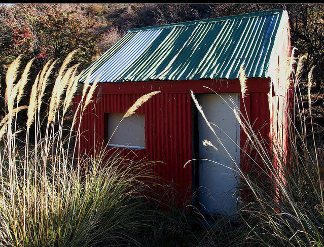
Finally after an hour and a half of walking I popped out of the forest at the car park once again. I took the opportunity to walk over SH 73 to have a quick look at Jacks Hut. The hut is a historic one i.e. you cannot stay in the hut, it is just there as it is one of the few in situ roadmans huts still left in New Zealand.
 |
| Jacks Hut on the far side of SH73, near the Bealey Valley Track, Arthur's Pass |
Up until the 1920's there was a roadman located every 10 kilometres along SH73 over Arthur's Pass. They were paid and responsible for the upkeep of the road for five kilometres either side of their hut.
Even into the 20th century they maintained the road using a pick, shovel and wheel barrow...what a hard life it must have been!
 |
| Jacks Hut, Arthur's Pass...one of the last existing road-mans huts |
The only other roadmans hut still in existence along SH73 is the one at Porters Pass, on the way to Arthurs Pass National Park. It is in a dilapidated state and sits forlornly on the side of the road just before the climb over Porters Pass.
These are the only two remaining from the 20 odd huts built to accommodate the turn of the century road repair crews.
 |
| Porters Roadmans Hut, Porters Pass, SH 73 |
The Bealey Valley Track is a great wee day walk, I recommend it whole heartily to those of you passing this way. Just be careful of those snow and avalanche conditions...
Access: Turn
off SH 73 at the carpark opposite Jacks Hut,.The
track starts next to the carpark. The first 500 meters are on the Arthur's Pass Walking Track, then turn off to the Bealey Valley Track
Track times: 30-40 minutes to the Upper Bealey River, then 30 minutes to the cirque under Goldney Ridge.
Hut Details: Jacks Hut (historic)
Miscellaneous: Avalanche and rock fall danger in the Upper Bealey Valley, do not go past the end of the track unless you have some avalanche awareness. No toilets at any point along this track.