In the shadow of Mt Rolleston...
Just after New Years Karen and I ventured up to Arthur's Pass National Park to stay in a holiday home we had rented for a weekend. The weather was good with sun, warm temperatures and no rain. The previous three times we have come up here it has been raining so it was good to have a nice couple of days for a change.
While in the area we did a number of short and medium day walks one of which was a trip up to the end of the Bealey Valley Track in the catchment of the Upper Bealey Valley.
 |
| Start of the Bealey Valley Track at SH 73 |
This is a relatively short track...it is about 1.5 hours return and is a mixture of nice bush walking, open beech forest, boardwalk and some open tarn fringes. It is a very lovely track and is suitable for all ages and in all conditions. Too wet and windy to walk the Avalanche Peak Track....give this beauty a go...!!!
 |
| The Bealey River from the bridge over the Chasm |
 |
| Mountain Neinei trees along the Bealey Valley Track |
The view of the northern face of Mt Rolleston is beautiful and well worth the effort of walking up the track. The track ends at the Bealey River and though you can venture further upriver this is where we halted.
 |
| Mt Rolleston from the end of the Bealey Valley Track |
This was the last of the walks we undertook on this trip but this is certainly not the last time we will come up to Arthur's Pass as there are many excellent tracks still to walk.
From Jacks Hut to the Upper Bealey River
The Bealey Valley Track starts about 6 km's west of Arthur's Pass Village at a car-park opposite the iconic Jacks Hut. There is plenty of parking space here and as the road is very busy it is a fairly safe place to leave your car while you are walking.
 |
| Historic Jacks Hut on SH73 just west of Arthur's Pass village |
This is also the re-entry point for the top section of the Arthur's Pass Walking Track and in fact you are walking on that track for the first 200 meters to the Bealey Chasm junction. The track is Great Walk style...flat, level and very easy to walk on.
 |
| Karen and I set off from the Bealey Chasm car-park at SH 73, Arthur's Pass |
 |
| On the Arthur's Pass Waking Track at the start |
After 200 meters there is a track junction...if you follow the left branch you go down a set of stairs to the Bealey Chasm and the Bealey River. If you go to the right you will eventually arrive at the top of the Pass as this is the top half of the Arthur's Pass Walking Track.
 |
| Junction of the Bealey Valley Track & Arthur's Pass Walking Track |
 |
| Karen at the Bealey Valley Track junction |
 |
| DOC sign at the Bealey Valley Track junction |
The track & stairs are certainly better than the muddy rutted track that once went down to the river and are the result of a millennial project to build a new track from Arthur's Pass Village to the high point of the pass at the Dobson Memorial.
 |
| Descending down the stairs to the Bealey Chasm |
 |
| Karen is descending down the stairs to the Bealey Chasm |
 |
| Bridge over the Bealey Chasm, Arthur's Pass NP |
 |
| Bridge over the Bealey River near the Bealey Chasm |
Part of the construction was upgrading the track down to the Bealey Chasm and building a new bridge over the Bealey River. If you are short of time even walking down to the bridge is worthwhile as the Bealey River is beautiful along here and worth visiting.
 |
| Bealey River, view upstream from the Bealey Chasm bridge |
 |
| Bealey River, view upstream from the Bealey Chasm bridge |
 |
| Bealey River, view downstream from the Bealey Chasm bridge |
On the far side of the bridge you climb up the the site of Margaret's Tarn which is slowly filling in with silt and is now a large clear area of tussock and turpentine scrub. There are good views down the valley towards the village and this is the best spot to get a wide angled view of Rome Ridge, Mt Rolleston and Goldneys Ridge
 |
| Climbing up to the Bealey Valley Track past the bridge |
 |
| Mt Rolleston from the Bealey Valley Track |
 |
| Goldneys Ridge from the Bealey Valley Track |
 |
| Heading into the beech forest on the Bealey Valley Track |
The track to the Upper Bealey River continues on the western edge of the clearing and heads off through the stunted beech forest on a series of boardwalks, small bridges and bush track.
 |
| There is a lot of boardwalk along the Bealey Valley Track |
 |
| Karen on one of the bridges along the Bealey Valley Track |
 |
| The Bealey Valley Track from the fixed bridge... |
There are a number of Dracophyllum Traversii or Mountain Neinei (also sometimes called the 'Dr Seuss tree') along the side of this track....so named because they look just like the trees you see in Dr Seuss books. These are a really ancient tree species and have been around for several million years now...this partially explains why they look so weird.
 |
| Mountain Neinei or Dracophyllum traversii on the Bealey Valley Track |
 |
| Boardwalk over tree stumps along the Bealey Valley Track |
You arrive at the end of the track after about 20-25 minutes of walking and the end of the track makes for a good rest spot either in the bush fringe or siting on one of the large boulders in the river bed. This is as far as the track goes as there are a number of avalanche chutes from this point onward.
If you are coming up here in winter or early spring do not go further up the valley without first checking the avalanche advisory...the possibility of an avalanche is so high during those seasons that this valley has its own advisory page.
 |
| End of the Bealey Valley Track at the Upper Bealey River |
You have magnificent views of the north face of Mt Rolleston from the river bed at the end of the track and it is well worth taking a rest here and checking out the scenery. If you are lucky you might see someone on one of the ice faces of the mountain.
You can go further up the valley but it is totally at your own risk...there is a overgrown and rough track up the true right side of the river which can take you right up to the head of the cirque under Mt Rolleston.
 |
| Mt Rolleston from the bed of the Upper Bealey River |
 |
| Rome ridge climbing to Mt Rolleston from Bealey river |
 |
| Jon at the end of the Bealey Valley Track |
Karen and I sat on the edge of the river and ate our lunch while enjoying a tasty brew. We were not alone as there were a number of other people taking advantage of the fine weather to explore the valley.
Just opposite the end of the track you can see an obvious avalanche chute on the far side of the river. I have been up here in winter before and as well as being damn cold there was avalanche debris piled up at the base of the chute. Slips off the side of the steep sided Goldneys Ridge are quite common after heavy snow falls or if there is heavy rain in the middle of winter so stay clear at all times
 |
| A mixture of rock types at the Upper Bealey River |
 |
| Active slip chute at the Upper Bealey River |
 |
| Rugged terrain climbing up to the cirque at the end of the Bealey river |
We packed up and headed back down the track after about 20 minutes as it was starting to get a bit cold as the wind had started to blow.
From the Bealey Valley to SH 73...
Your return to the highway is a reverse of your previous walk...you just jump on the track and head for the road. This really is a nice track well marked, well maintained and very easy to follow.
 |
| End of the Bealey Valley Track in the Bealey River |
 |
| Karen heading down the Bealey Valley Track |
 |
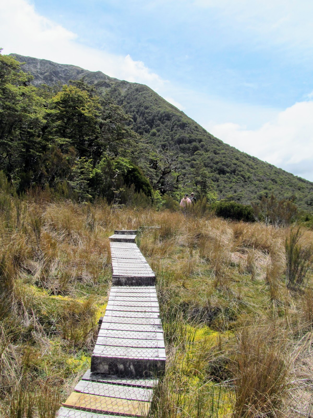
| Bealey Valley Track: lots of boardwalk to ease your passage |
There are good views of the main part of the Bealey Valley from the edge of the large clearing...you can easily see Mt Bealey and Avalanche Peak and you can even see the course of Scott's Track climbing up to Avalanche Peak from a bit further down the valley.
 |
| On the boardwalk on the Bealey Valley Track |
 |
| View down the Bealey Valley towards Arthur's Pass village |
 |
| Random beech growing next to Bealey Valley Track |
Halfway across the clearing is an unmarked track leading off into the bush around the base of Rome Ridge...this is an old track that used to go up to a view point on the side of Rome Ridge. It over looked the Bealey Glacier which has been melting since the mid 1980's...the only remnant is a small patch of ice high on the north face of Mt Rolleston.
 |
| The side track to Rome Ridge, Bealey Valley Track |
 |
| Mt Rolleston Massif from near Margaret's Tarn, Arthur's Pass NP |
 |
| ...last view of Goldney ridge from the Bealey Valley Track... |
We passed half a dozen people on our way back to the car-park...a mixture of tourists and locals out for an afternoon stroll. This is a very popular track probably the second most popular behind the Punchbowl Falls Track but despite this it has a quiet solitude to it more like a remote backcountry trail.
 |
| Back at the Bealey Chasm bridge, Bealey Valley Track |
 |
| Jon approaches the Bealey Chasm bridge, Bealey Valley Track |
The whole trip took us about an hour return including the 20 minutes we spent up at the river eating our lunch. Time wise and level of difficulty make this a tramp you could do as you passed through on the way to the West Coast.
 |
| Bealey Valley Track: climbing the stairs to the Arthur's Pass Walking Track |
 |
| ...more stairs at the end of the Bealey Valley Track... |
Once again the final part of the walk is on the Arthur's Pass Walking Track as you walk along the last 200 odd meters of the track to the car-park. This will probably be the next tramp Karen and I walk in the National Park as it is a really nice three hour return trip from the village to the Arthur Dobson Memorial at the top of the pass.
 |
| On the Arthur's Pass Walking Track heading for Jacks Hut... |
 |
| End of the Bealey Valley Track at SH 73, Arthur's Pass |
It was great to get back up the Bealey Valley and it was awesome that Karen got to see the end of the track this time. This is another excellent short walk for people passing through or staying in Arthur's Pass and I cannot recommend it enough.
If you have a spare hour the next time you are passing through Arthur's Pass take a trip up to see the lovely Upper Bealey River. You will not be disappointed.
Access: Turn off SH 73 at the car-park opposite Jacks Hut, the track starts next to the car-park. The first 200 meters are on the Arthur's Pass Walking Track, then turn off onto the Bealey Valley Track
Track times: 30-40 minutes to the Upper Bealey River, then 30 minutes to the cirque under Goldney Ridge.
Hut Details: Jacks Hut (historic)
Miscellaneous: Avalanche and rock fall danger in the Upper Bealey Valley, do not go past the end of the track in winter unless you have some avalanche awareness. No toilets at any point along this track.