Tramping the St James Walkway.....
I spent 4 days tramping around the
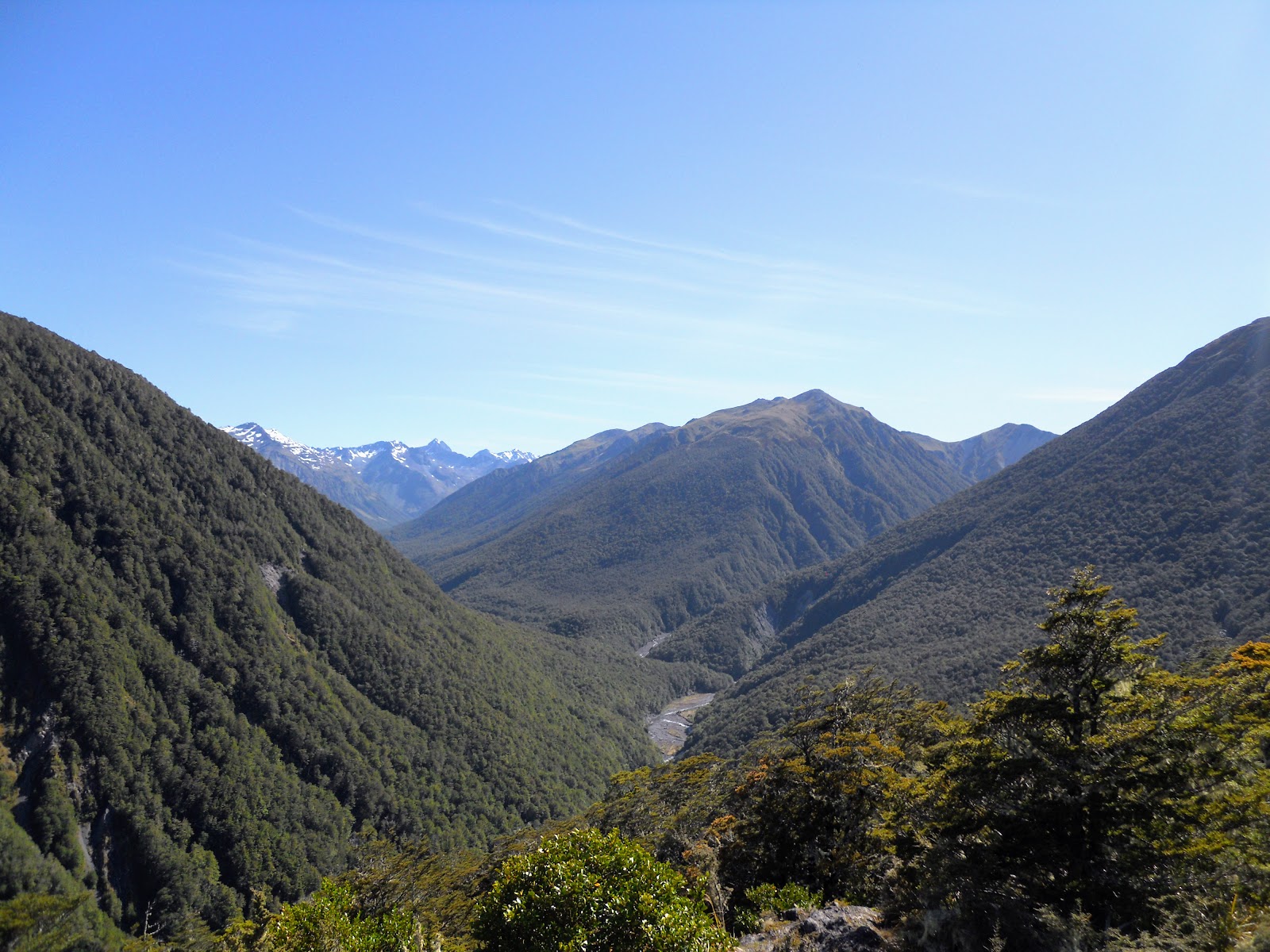
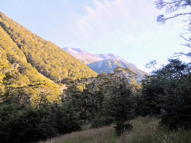
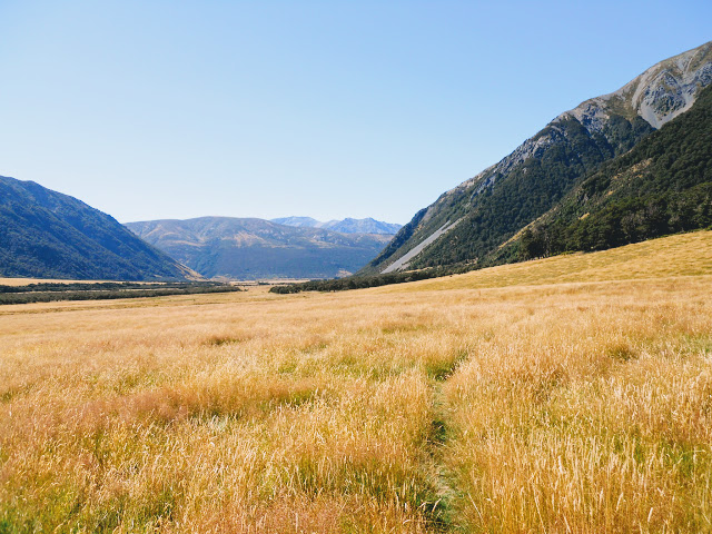
St James Walkway near Lewis Pass last week. The St James Walkway is a near circuit 67 km long taking in the Maruia, Ada, Henry, Anne and Boyle River valley's. There are a number of good huts to stay in on the way, as well as some fine scenery especially the Poplar and Spencer Mountains.
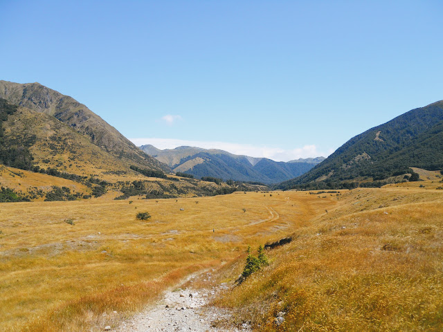
 |
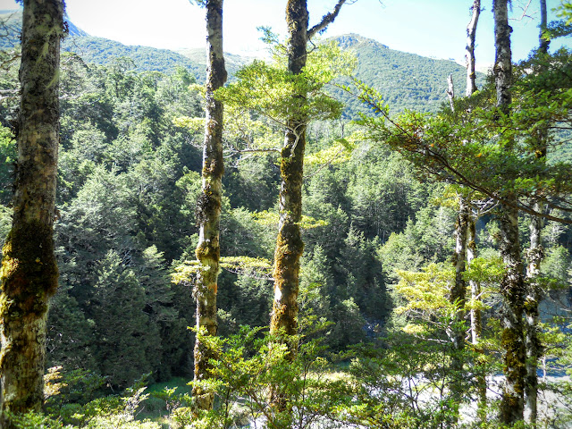
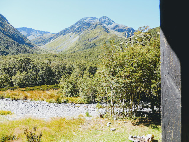
| Christopher River Valley, Spencer Mountains day two of the St James Walkway |
 |
| Profile diagram of the St James Walkway: Source DOC website |
Day One: St James Walkway, Lewis Pass to Ada Pass Hut (12.4 km's)
I started from the Lewis Pass end of the track as a clockwise tramp takes advantage of the downhill tilt to the whole track. I left my car at the
Boyle Outdoor Education Centre and got them to shuttle me to the start of the track at the Lewis Pass Tarns. A valuable service as it is common for cars to be broken into at the St James Walkway car park, they cannot safely be left there. At all!!!
 |
| First view of Lewis Pass Tarn (September 2021) |
The St James Walkway starts with the scenic track around the Lewis Pass Tarn and is clearly sign posted from there. It is 67 kilometer's or 4-5 days tramping from here to the Boyle Outdoor Education Center down the Lewis River Valley.
 |
| View from the eastern end of Lewis Pass Tarn (September 2021) |
Here I am looking fresh as a daisy before starting the long walk, I did not look so fresh by the end!
 |
| Jon at the start of the St James Walkway |
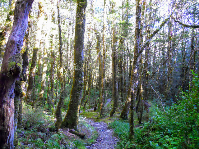
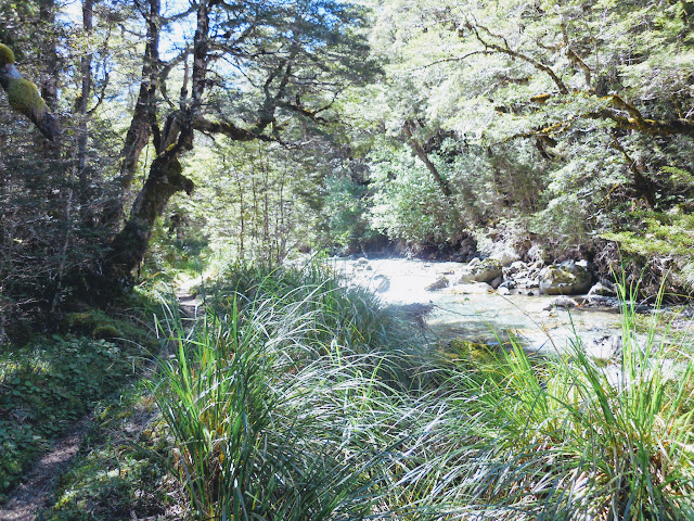
The start of the track is through some beautiful alpine bogs, very picturesque, before descending steeply to the Maruria River and the first swing bridge on the track. The forest is still Beech even though you are actually on the West Coast now...
 |
| Start of the St James Walkway, Lewis Pass National Reserve (September 2021) |
 |
| The forest near the Lewis Pass Tarn is covered with lichen (September 2021) |
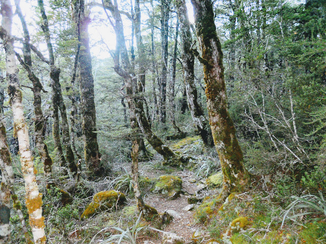
The track condition is generally good with plenty of boardwalk, track markers and a mostly finely benched track to follow. Later on as you pass Cannibal Gorge Hut the track gets a bit rocky and undulating under foot...
 |
| Part of the scenic walk at Lewis Pass Tarn, St James Walkway |
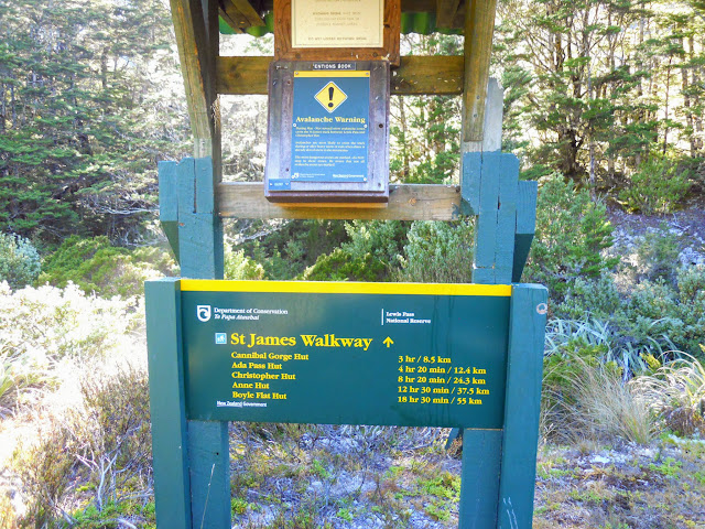
There is a small kiosk with an intentions book about 300 meters down the St James Walkway where you can see how many other people are on the track ahead of you. It is about 8.5 km's or three hours walk from here to the first hut on the track.
 |
| Start of the St James Walkway...intentions book near the tarn |
 |
| St James Walkway: descending towards Maruia River |
You are walking down to and along the Maruia River Right Branch until just past Ada Pass Hut when you change over to the Ada River catchment. You can see the Maruia in a few places but you never get close enough to reach it as you are sidling along the side of the Freyburg Range.
 |
| Cannibal Gorge section of the St James Walkway |
 |
| St James Walkway: log jam in side stream |
This is a mature area of beech so there were some spectacular examples of Red Beech to be seen along the track. The tree below would have been at least 5 meters around the trunk.
 |
| Big Red beech tree on St James Walkway |
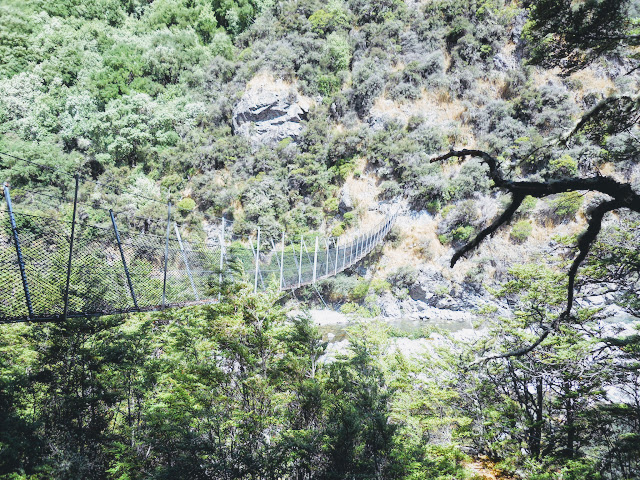
You eventually arrive at the first swing bridge across the Maruia River, this is the first of seven bridges you cross on the track. Generally all the major rivers are bridged. There are several un-bridged side stream's (especially in the Cannibal Gorge section) that could be a problem if it was raining heavily.
 |
| Cannibal Gorge: first swing-bridge (6 more to go) |
Cannibal Gorge is so named as it was the site of an impromptu battle between two Maori iwi before Europeans arrived in New Zealand. As was their custom, the winning side ate the losing side for dinner.
The early history of New Zealand is pepper shot by instances of extreme violence and carnage...both Maori and Settler history. New Zealand was a rough and fearsome pioneer nation until late in the 1880's...
 |
| St James Walkway: information about Cannibal Gorge |
 |
| St James Walkway: typical up and down track |
About one hour along the track you reach the point where a creek on the true left of the river leads up to the Zampa Tops. The Zampa Tops are a continuous series of tussock clearings from here all the way along the Spencer Mountains and make an excellent fine weather tramp. You can stay on the tops and walk all the way south to near Boyle Flat Hut if you want to...
 |
| St James Walkway: creek leading towards Zampa Tops |
I had the usual progression of wrens and robins following me along the track, there is a goodly number of birds in the area. I saw a number of Tui, Bellbirds, Robins, Kakariki and Keruru as I walked along.
 |
Bush Robin on the St James Walkway
|
There are a number of "no stop" avalanche zones along the track, the steep terrain combined with a lot of snow in winter makes avalanches fairly common. You should not be venturing up this end of the St James Walkway over Winter unless there is zero snow on the higher areas, its just too dangerous.
 |
| St James Walkway: avalanche warning sign |
 |
| St James Walkway: Cannibal Gorge Track about 2 hours in |
Here is a brand new addition to the track, the Cannibal Gorge Hut Swingbridge, built in December 2014, you could still smell the pine scent and feel the grease on the cables. The old bridge got carried away by a flood in late 2013...
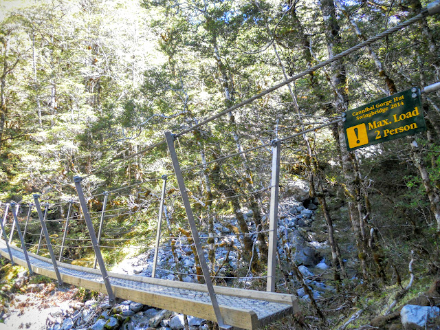 |
| St James Walkway: new swing bridge (2014) across Maruia River |
Eventually you reach
Cannibal Gorge Hut, a 20 bunker about 3 hours in. It is a fine looking hut and would certainly warrant a stay if you started the tramp later in the day. Personally, I was bound for Ada Pass Hut another two hours up the track.
 |
| Cannibal Gorge Hut, St James Walkway |
 |
| Cannibal Gorge Hut, St James Walkway |
 |
| St James Walkway: interior of Cannibal Gorge Hut |
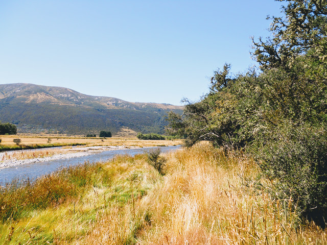
Past Cannibal Gorge Hut the track is generally within view of the ever decreasing Maruia River...it was very cool and pleasant on such a hot & sunny day. All the water up here is fine for drinking...there are no farm animals in the Upper Maruia Valley. This cannot be said of the Ada, Anne, Henry and Boyle Valleys which all have stock in them...
 |
| Mid reaches of the Maruia River on St James Walkway: |
 |
| St James Walkway: mid Maruia Valley |
The views get progressively better as you move towards the head of the Maruia Valley as the mountains get steeper and more alpine in nature. There are some beautiful high alpine cirques and U- valleys that would not look out of place in Fiordland, Mt Cook or Aspiring NP. The whole area is the south east border of Nelson Lakes NP which is noted for its high mountain ranges, passes and alpine features.
 |
| St James Walkway: a high cirque basin on the Spencer Range |
 |
| Freyburg Range: eroded U-Valley on St James Walkway |
About 20 minutes from Ada Pass Hut you cross the Billy Goats Gruff bridge, if you are wanting to have a wash this is the closest stream to the hut. Gentle travel across some river flats and the hut comes into view.....
 |
| St James Walkway: Billy Goats Gruff bridge |
Ada Pass Hut is a 14 bunker, it is really nice- well maintained, and has both coal and wood for the fire. It is on a small river terrace with plenty of open space around the hut for a small village of tents if required.
The tent in the photo belonged to a pair of German tramper's who had gone for a day-trip up to Three Tarn Pass. We had a short chat when they arrived back before they left to walk out to Lewis Pass at around 5 pm. Personally I wouldn't want to be walking out of there in the dark but horses and courses as they say....
 |
| Ada Pass Hut, St James Walkway |
Right across the valley is the route up to Three Tarn Pass, this is one of several routes into Nelson Lakes NP via the East Matakitaki Valley. It is steep, rough and would require ice axe and crampons if snow was present.
 |
| Ada Pass Hut: the Three Tarns Pass is up this valley |
 |
| Interior of Ada Pass Hut, St James Walkway |
Here is a good view of the flat area in front of the hut, the stream was only a trickle but drift wood piles indicate that it carries a good load of water in winter. If stream water was required it would need to be fetched from a larger stream 10 minutes down the valley. Not needed as there was a rain water tank right next to the hut
 |
| Route towards Three Tarn Pass from Ada Pass Hut |
I had a very restful night at the hut, the only other occupant was an Australian tramper who was walking the St James in a counter clockwise direction. I got some good info from him about track conditions further along the walkway. He had coffee and pre-made Peanut Butter sandwiches for his tramping food, three per day...how does that menu grab you!!!!
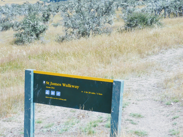
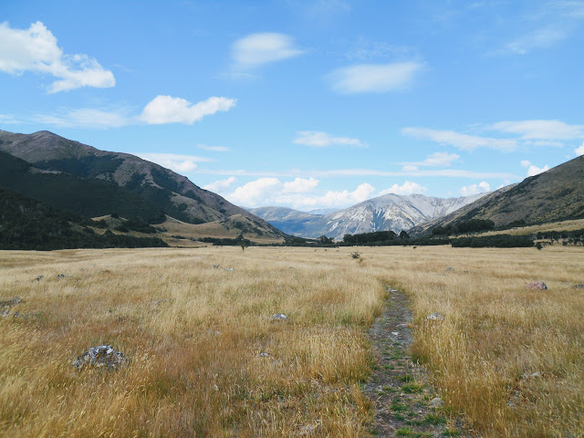
Day Two: St James Walkway, Ada Pass Hut to Anne Hut (25.1km's)
As is my norm I was packed up and on the trail by 7am, my intention being to walk to Christopher Hut and stay for the night. This was giving myself a long rest day as it is only 4 hours between the huts.
More about that plan later.....
 |
| St James Walkway: track between Ada Pass Hut and Christopher River |
The track to Ada Pass starts right outside the door of the hut, it is a very gentle ascent up the last 200 meters to the pass. As you can see from the photos below, Ada Pass hardly deserves the name, it is basically a flat track on top of a flat plateau.
 |
| DOC track sign at Ada Pass on the St James Walkway |
 |
| Ada Pass (1008 meters) |
If the signs weren't there would you recognise it as a pass at all? Nonetheless it is one of the passes which separates the east coast of the South Island from the west coast. So I had just crossed back into Canterbury....
 |
| What Ada Pass actually looks like...St James Walkway |
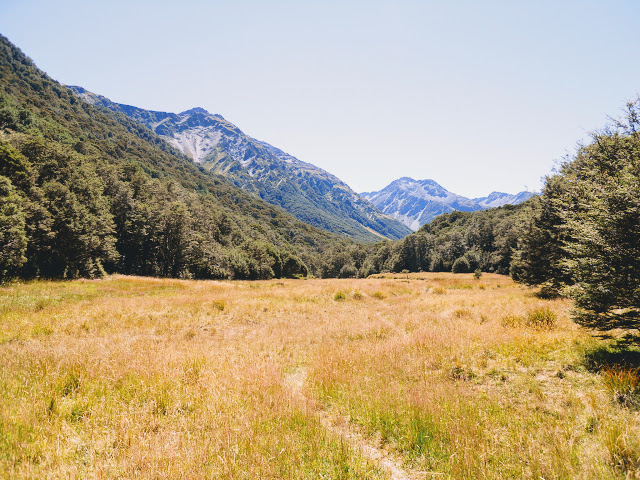
On the eastern side you begin a very gentle descent into the headwaters of the Christopher River and the track alternates between grass flats and bush fingers so it is very pleasant walking. Because of the height of the Spencer Mountains it was quite dark in the valley even though it was nearly 9 am....
 |
| St James Walkway: descending from Ada Pass |
 |
| St James Walkway: grass plains on the way to Christopher Hut |
 |
| View back towards Ada Pass from St James Walkway |
 |
| St James Walkway: Faerie Queene coming into view on left |
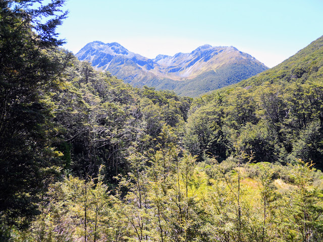
The further down the valley you travel the more spectacular the view of the Faerie Queene (2232 a.s.l) becomes until it dominates the whole left side of the valley. The mountains on the left side of the valley are the demarcation line between Nelson Lakes NP and the St James Conservation Area. It is also the end of the Southern Alps which stretch from Fiordland to near the Faire Queene.
 |
| Faerie Queene from St James Walkway |
 |
| St James Walkway: great forest track section into the Christopher River |
 |
| Camera Gully, Gloriana from near Ada Cullers Hut |
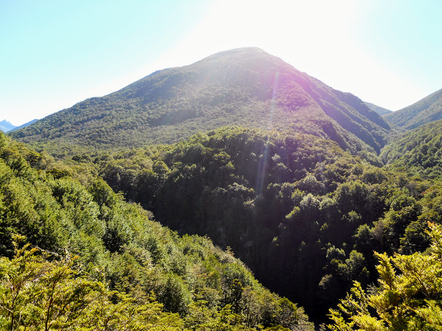
This photo really doesn't do the peak justice, it is enormous and totally dominates the valley, this is most obvious once you reach Christopher Hut and can see it on the horizon. In winter avalanches have fallen off these peaks and reached 100 meters up the far side of the river valley. That is why you should not be up here over the winter months.
 |
| Side view of Faerie Queene from the St James Walkway |
 |
| Bush track between Ada Pass and Christopher Hut |
Eventually you reach the Ada - Christopher River confluence and start walking down valley towards Christopher Hut. The river is very close to the track at this point but moves further way the further down valley you travel. The Valleys in this area are the home of the St James wild horse herd, they live on the wide grass plains and forest fringes.
 |
| View south towards Christopher Hut from the St James Walkway |
 |
| View north up Christopher River Valley from St James Walkway |
As you can see below the immensity of the Faerie Queene (2234 a.s.l) becomes more obvious the further away you get. The whole Spencer Mountain Range averages out at between 1900-2300 meters so they are not insignificant peaks.
 |
| Faerie Queene in all its splendour, Spencer Mountain Range |
You pass
Ada Cullers Hut near the confluence, it is a historic NZFS 2 bunk bivy from the deer culling days. It would once have been home to a couple of cullers clearing deer from this area. I read a book about deer culling last year and the author said this hut was often buried up to the window sill in snow. They often had to dig it out before it could be used...my god it must have been cold inside.
 |
| Ada Cullers Hut |
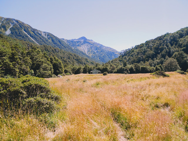
About 20 minutes further down the valley you arrive at
Christopher Hut. The hut would be the first real shelter for some Te Araroa walkers coming over Waiau Pass. There is a small 2 person bivy (Caroline Creek) at the head of this valley but it is in poor condition.
 |
| Caroline Creek Bivy in 2015 |
NB: 2018...there is now a new 6 bunk hut located one hour down valley from Caroline Bivy. Waiau Hut was built in 2017 with funds donated to DOC for the purpose of building a hut in this valley. The donor (Mr Tony Birks) also provided part of the funding for the new (2020) Casey Hut II. That is over $400 000 he has donated to the Nature Heritage Fund...what a champion!!!
 |
| Waiau Hut in 2018 from the DOC website
|
 |
| Casey Hut II in the Poulter Valley, Arthurs Pass NP |
Christopher Hut is not on the direct line between the Waiau Pass Track and Anne Hut but river conditions sometimes force TA walkers to venture this way to find a passable ford.
 |
| Christopher Hut, St James Walkway |
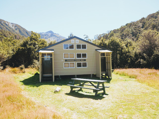
It is quite a nice hut; 20 bunks, with plenty of space, water tanks and lots of wood for the fire. The problem would be the mice: when I opened the door three ran off across the floor, sign of them was everywhere and I could hear them running around in the walls. I think DOC need to do a major poisoning program to eradicate them here.
There is often a hut warden in residence over the summer months they have their own separate quarters on the northern end of the hut.
 |
| St James Walkway: interior of Christopher Hut: dining area |
I was at the hut by 10.15 so the early arrival time combined with the mouse problem made me decide to keep walking. I would set off on the 13 km, 4 hour trek to Anne Hut, skirting the base of Mt Federation. I ate an quick lunch, refilled my water bottles and started the boo-ga-loo!
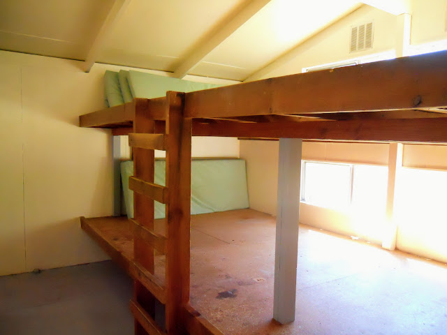 |
| Bunk room at Christopher Hut, St James Walkway |
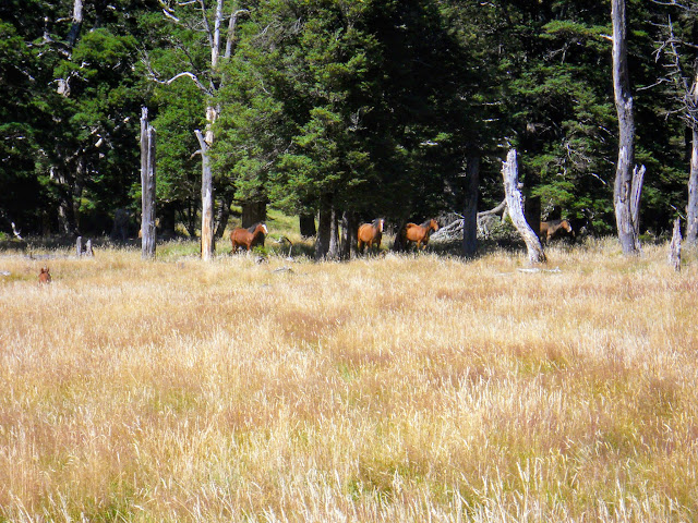 |
| Wild St James Horses next to St James Walkway |
I passed some of the wild St James horses just near the hut,...there were about 10-15 of them herding together in a patch of bush. These are descendants of ex farm animals released in the early 20th century to provide a supply of hardy animals for St James Station. It must be a hard life up here for them in winter as they sometimes get 3 meter snowfalls in this area.
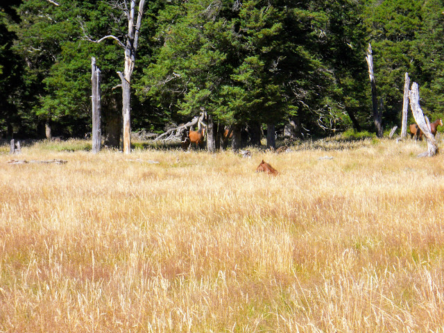 |
| St James Walkway: more wild St James Horses |
The start of the track is easy travel across expansive grasslands this then turns into a miserable rocky, swampy grovel around the lower slopes of Mt Federation. The track is hemmed in between the river and Mt Federation making for a lot of climbing and descending spurs.
 |
| Heading towards Mt Federation on the St James Walkway |
 |
| Faerie Queene from near Ada Homestead, St James Walkway |
This is the end of the easy travel for the next hour or so: from this point the track is irritating. It runs up and down the lower slopes of Mt Federation, you are never more than 100 meters from the river but because it is mostly swampy you cant walk on the river terraces.
As we say in Kiwiland...noice!!!
 |
| Ada Homestead in distance across river |
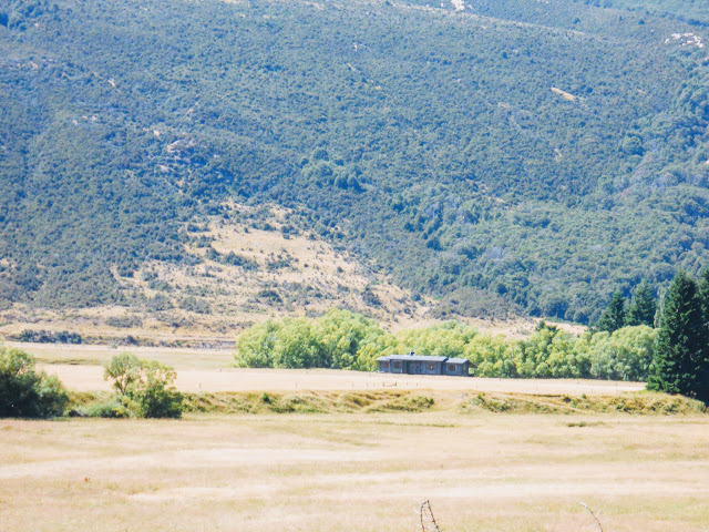
That is Ada Homestead in the distance on the true left of the river. This is a working sheep and cattle station on leased DOC land and provides a link between the Spencer Mountains and
St James Conservation Area.
The track from Waiau Pass joins the St James near Ada Homestead. Often Te Araroa walkers need to walk some distance up the Christopher Valley to cross this river. I could see several easy points to cross the Christopher but then it has been a long dry summer.
 |
| Close up of the Ada Homestead from the St James Walkway |
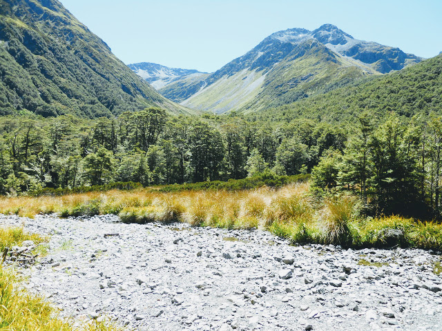
Once around Mt Federation there is a two hour walk up the Henry River Valley to contend with. Take LOT'S of water with you from Christopher/Anne Hut as this section is exposed, hot and bone dry: there is no potable water at all. There are cattle in both the Christopher and Henry Valleys so any river water there is suspect.
This is a massive valley, the far side would be 5-6 km's away at this point.
 |
| On the St James Walkway around base of Mt Federation |
It was frickin' hot in the Henry Valley probably like 31 or 32 degrees so I was cooking like the Sunday roast. I had to sit down under a Matagouri tree for 20 minutes as I was over heating...
 |
| Hot and bothered (not in a good way) on the St James Walkway |
 |
| St James Walkway: entering Henry River valley |
Eventually you connect with an old 4 W/D track half way up the valley- you follow this for the rest the way to the hut and makes for much faster travel. Apparently there is a side track connecting the St James Walkway with this 4 W/D track near the Waiau River but I didn't see it. If you can find it use it as it would probably save you 30-40 min's walking time.
 |
| Henry River Valley...still 1.5 hours to Anne Hut |
Eventually you reach the Henry Swing bridge...it was quite sporty crossing it. The wind had come up and it was swaying back and forth alarmingly as the wires need tightening. You need to cross this bridge as the 4 W/D ford further up the valley looked deep and swift even with the dry. The bridge was built because people have died trying to cross the Henry River.
Far better to play it safe and follow the track instead.
 |
| Swing-bridge over the Henry River |
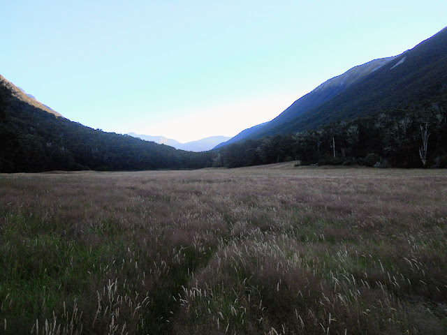
After the swing-bridge you ascent one last hill on the 4 W/D track, it is then a 2 km trip across a plateau to Anne Hut sitting temptingly out on an open plain. Believe me...it takes a looooooooooooonnnggg time to cover those last couple of kilometres!
Anne Hut is a total cracker...it is brand new and repositioned from its old location closer to the Henry River.
 |
| Anne Hut (2012), in the St James Conservation Area |
 |
| St James Walkway: Anne Hut, detail of one of the bunkrooms |
 |
| Anne Hut, the fire and bunkrooms, St James Walkway |
 |
| St James Walkway: Anne Hut, living space, cooking bench |
The hut is new, rebuilt in 2012 after the old Anne Hut burnt down. It is big: 24 bunks, warm
(well insulated), spacious, well appointed with a big wood shed (full) and
multiple rain water tanks. Very, very nice.
 |
| View down Henry River Valley from Anne Hut |
Look at that view, awesome!
I noted with interest that the hut was connected to the ground with massive concrete piles, which leads me to believe that it must be bloody windy up here sometimes. Also, it must get some shockingly deep snow as the hut was probably at 800-900 meters in the middle of an wide open semi alpine plateau.
 |
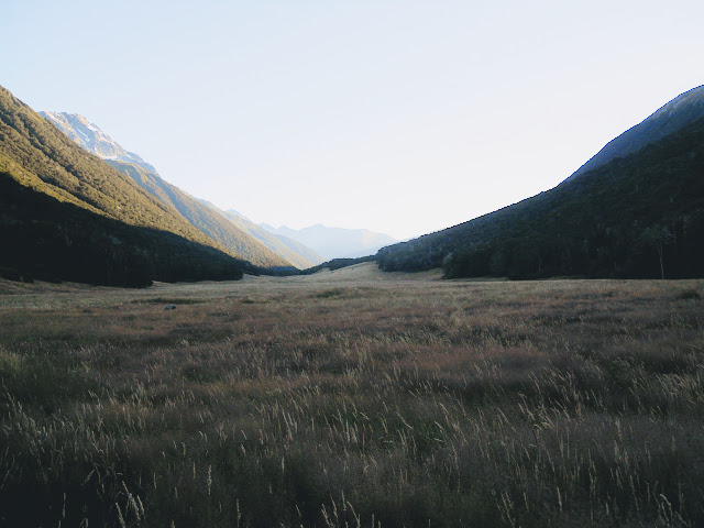
| View up valley from Anne Hut to Opera Range |
As the day wore on various trampers turned up at the hut, all of them Te Araroa walkers from other countries. I was the only Kiwi there so I got pumped for information. Most of them had walked all the way from Caroline Bivy: a distance of 30-40 km's! I was suitably impressed as my 25 km trip had left me totally stuffed, I don't know if I could have walked another 10-15 km's.
Eventually there were 14 of us in the hut and it made for a great atmosphere. We had Swiss, German, French, Australian, Canadian, Czech and New Zealand tramper's there that night. I had several conversations with people about tramping, New Zealand, their home countries & food of course...always a good topic of conversation.
It seems steak dinners, bacon and cheese burgers, wedges and ice cold coke or beer were being lusted after...nobody was talking about a big old plate of cooked Spinach:)
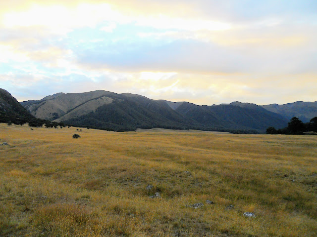
 |
| Dusk at Anne Hut on the St James Walkway looking east towards St James Range |
 |
| Nightfall Anne Hut looking west towards Opera Range |
So two full and interesting days of tramping completed with two more to follow. The next section would take me from Anne Hut to Boyle Flat Hut and then out to Boyle Village. Come back soon to see how that section stacked up....
Access: From SH 7 (Lewis Pass Highway), the track starts at Lewis Pass Tarns, southern terminus is at Boyle Village.
Track Times: Day one: From Lewis Pass- 2.5 hours to Cannibal Gorge Hut, another 1.5-2 hours to Ada Pass Hut: Day two: 3 hours to Ada Cullers Hut, another hour to Christopher Hut. 4 hours to Anne Hut from Christopher Hut
Hut Details: Cannibal Gorge Hut: serviced, 20 bunks, water tank, wood burner, toilets, wood shed: Ada Pass Hut: serviced, 14 bunks, water tank, wood burner, toilets, wood shed: Ada Cullers Hut: basic, 2 bunks, water from stream: Christopher Hut: serviced, 20 bunks, water tanks, wood burner, toilet, wood shed: Anne Hut: serviced, 20 bunks, water tanks, wood burner, toilets, wood shed
Miscellaneous: Severe avalanche risk in Winter/Spring, some un-bridged side streams. The walkway is in a high alpine area and as such is prone to extreme weather.