Wednesday, 21 May 2014

Orton Bradley Park to Mt Herbert Shelter: 17 May 2014

Banks Peninsula tramping...to Mt Herbert from Orton Bradley

I went for a tramp up Mt Herbert over the weekend, originally I was going to start at Kaituna Valley, but decided instead to try the Orton Bradley - Mt Herbert track. 

In the Rewod Forest at Orton Bradley Park


The track starts at the Orton Bradley Estate, which is located on the southern side of Lytelton Harbour.
The estate was one of the original farms on Banks Peninsula, it is now owned by a charitable trust. It is an excellent location for a family picnic as it has a number of tracks, forested areas, playgrounds and a working farm for the public to enjoy.


Topo map of the Mt Herbert track

Starting at the Orton Bradley Park

The tracks begin at the end of the Orton - Bradley Estate access road, there are track junctions from this point leading to Mt Herbert, Gebbies Pass as well as short local walking tracks. There is a map with information about the tracks on a big rock near where I parked my car.

Orton Bradley Park to Mt Herbert track


Here are the toilets and track entrances at the start of this tramp, the tracks are well signposted.


Orton Bradley Park to Mt Herbert track


The track starts out through shelter belts and farm land, eventually it becomes more rugged.

Orton Bradley Park to Mt Herbert track


There is a nice stream running next to the track for most of the way up valley, I was surprised by how much water there was in it, it was at least knee deep for most of its length. Don't drink it: there are cattle in the side valley's.

Orton Bradley Park to Mt Herbert track


As you can see there are a number of tracks to visit, I am keen to try out some of the others as time goes on.
Track direction board at Orton Bradley Estate

You pass this large rock about 30 minutes up valley, at a guess I would say that a much larger river in the past eroded the rock into the shape you see now.  

Orton Bradley Park to Mt Herbert track

Orton Bradley Park to Mt Herbert track


The photos above and below show a gum plantation just past the rock, it was very pleasant walking under the trees as it was a hot sunny day. There is a adventure rope area in this plantation, you need to cross the river to reach it.

Orton Bradley Park to Mt Herbert track


The track alternates between forest and open areas for the first hour up valley, this is a typical example.
Orton Bradley Park to Mt Herbert track


View down valley to Quail Island, Orton Bradley Estate
You eventually start to climb, mostly on old farm tracks, from this point onwards there is very little cover so take a wide brimmed hat to protect you from the sun.

On the Orton Bradley Park to Mt Herbert track

Orton Bradley Park to Mt Herbert track
About an hour up valley you reach the end of the estate, the land from this point onward is either DOC or belongs to the farm in the Kaituna valley.
Orton Bradley Park to Mt Herbert track
The track gradually winds up the valley, for the most part crossing scrubby paddocks, but there are also significant areas of bush along the bottom of gullies etc. There are a lot of natives birds in this area I saw Tui, Bellbird, Wood Pigeon and Fantails.

Orton Bradley Park to Mt Herbert track
As you can see some places on the track are steep, and involve easy rock scrambling, the track was a lot tougher than I expected.
Orton Bradley Park to Mt Herbert track
Here is the view after 2 hours walking, this is 2/3rd of the way to the top but even from here there are great views.
Orton Bradley Park to Mt Herbert track
This waterfall was going over 30-40 metre bluffs, for such a dry open area the amount of water is a real surprise. The terminus of these falls are accessed from the Waterfall track.


Waterfall near Orton Bradley Park to Mt Herbert track
The next four photos are views from the spot where I stopped for 10 minutes, this would be 2.5 hours in and about 3/4 of the way to the ridge top. Look at that view of Lyttleton harbour, magic!

Lytellton from the Orton Bradley Park to Mt Herbert track

Quail Island from the hills overlooking Orton Bradley

Orton Bradley Park to Mt Herbert track

Mt Bradley massif from the track to Orton Bradley Estate
The last section of the track before reaching the ridge top is this series of zigzags, the track from Packhorse Hut and Gebbies pass enters from the right side of the photo. The ridge line shelter is in the centre left of this picture.

Zig-zag on the Orton Bradley Park to Mt Herbert track
Orton Bradley Park to Mt Herbert track


Orton Bradley Park to Mt Herbert track
Below is the Orton Bradley - Packhorse Hut track junctions, only 20 more minutes to the top!
That is the Mt Bradley plateau in the distance, I walked up to the top in November 2013, see my previous post about the trip.

Orton Bradley Park to Mt Herbert track
I reached the day shelter after 3 hours which isn't bad going really, this was as far as I went. The Orton Bradley park closes at 5pm and it was already 2 pm by the time I got here, it would be 1.5 kms and another 30-60 minutes to reach the summit of Mt Herbert.

I was more than happy to have a rest, eat my lunch and enjoy the view. There was no one about! I would have thought there would be a few people out on such a beautiful day, but they obviously went elsewhere. 

Mt Herbert shelter

Here are a couple of views from inside the shelter, at a pinch you could stay here overnight, but it would be cold and windy. Look at that view!

Canterbury and the Port hills from inside Mt Herbert shelter


Lytellton and Quail Island from near the Mt Herbert Shelter


Summit of Mt Herbert from the shelter


I stayed for about half an hour and then set off back down the same track I had followed to the top. It is a lot faster going downhill than going up.

View from Mt Herbert shelter

I stopped an hour back down valley and took this long view of the track.
 It cuts up the centre of the valley and then sidles out to the left hand side through bush and scrub. It then passes through the open grass area just down from the ridge in the centre top and then sidles out to the right. You climb the zigzag and emerge at the shelter, which is near the hillock at one o'clock.

The actual summit of Mt Herbert is the high point on the left.
View of Mt Herbert from the Orton Bradley - Mt Herbert track
A view down valley from the same spot, the track largely follows the bottom of the valley with the river to your right for most of the way.


The Port Hills from the Orton Bradley - Mt Herbert track

Below is Quail Island, its makes a great day trip, you can only get to the island by boat, it is separated from the peninsula by an inlet. 

Quail Island from Orton Bradley - Mt Herbert track


Eventually I arrived back at the car-park, and took some shots to show you how much space there is for camping, picnics etc. The tracks start on the far side of the farm gates next to my car.
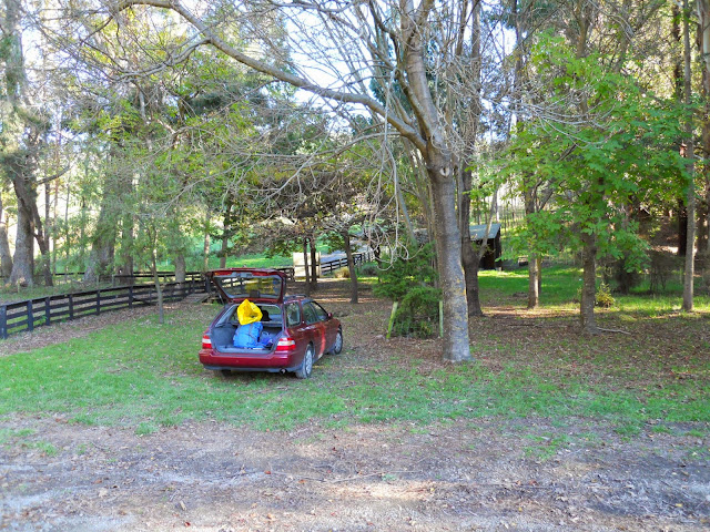
Track end, carpark at Orton BradleyEstate


View of the picnic area at Orton Bradley Estate

The red beast at the carpark at Orton Bradley Estate


Jon Moake, car-park at Orton Bradley park


A couple of shots of the entrance to the park, it is impossible to miss, you head towards Diamond Harbour from Christchurch, travelling via Gebbies pass or over Cashmere and around the bays.
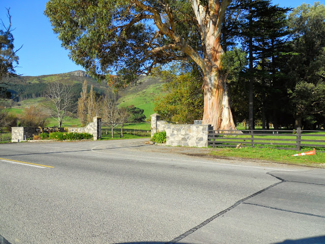
Orton Bradley on the Christchurch-Diamond Harbour road

Orton Bradley Park entrance


Another great trip, I am slowly working through my list of classic tramps on Banks Peninsula. I didn't make it to the summit but I was more than happy to reach the shelter and still have plenty of time to get back to the car.

 I recommend you take a lot of water with you as there are no clean water sources anywhere along the track. Enjoy!


Access: Follow the Christchurch-Diamond Harbour Road from Dyers/Gebbies Pass, turn off at the obvious entrance before reaching Diamond Harbour
Track Times: 6-7 hours return to Mt Herbert, 5 hours one way to Packhorse Hut
Hut Details: Mt Herbert Shelter: shelter only, no bunks, no fire, water tank and toilets; Packhorse Hut: serviced, 12 bunks, wood burner, water tank, wood shed, toilets; Orton Bradley Estate Campsite: open December-January each year only, cooking shelter and ablutions block, water, toilets
Miscellaneous: Seasonal track closures, Packhorse Hut is on the  DOC Hut booking system, must be booked for overnight visit


Thursday, 15 May 2014

Tramping Food: Nissin Top Ramen short cuts

Tramping Food: Nissan Top Ramen Noodles


I am constantly looking for convenient food to take on my tramping trips, weight, taste and ease of preparation are important. I have been making my own version of "freeze dried" meals that just need water added or minimal cooking to prepare.

I recently found these noodles which combined with other ingredients make a fine meal for a hungry outdoors man.


Top ramen noodles

Americans will recognise these Nissin Top Ramen noodles, they are a well known pre seasoned noodle for use in Chow Mien type meals. I have found a supplier of Nissin products in Christchurch; The Mad Butcher store on Ferry/Aldwin's road sell packets of these noodles for $5.00.

Various flavours available

They currently have the beef, chicken and roast chicken flavour. Here is a advertising blurb about them!


View inside the packet
As you can see the noodles are about 2cm long, and have a flavour powder on them. You follow the instructions on the pack, add to a pot of hot water and simmer for three minutes. They are then ready for eating. With the addition of meat and or vegetables they make a calorie packed meal.

Here is a recipe I have worked out using the noodles and dehydrated mince:

Jon's Top Ramen Beef Chow Mein

1 Cup Top Ramen noodles (or use any 2 minute or Rice noodles)
1 Cup dehydrated beef mince (or your own choice: salami/biltong/jerky/canned meat)
1/2 Cup dehydrated beans/mixed vegetables (I prefer Surprise dried beans if you can find them)
3 Cups water
clove of garlic, cut fine
1/4 t five spice
1/2 t dried shallots/onions + salt-pepper/soy sauce to taste


Bring water to the boil, add the Top Ramen noodles, vegetables, garlic and five spice simmer for 2 minutes. Add beef mince, simmer for 1-2 minute till tender. The meal is then cooked, sprinkle over the onions/shallots and add salt/ pepper/soy to taste. Enjoy.

I usually have the noodles, spices and beans in one zip lock bag. The mince is in a second smaller zip lock bag. I always carry a small bag of dried shallots with me to "pep" up my meals. Total cost per serving: about $5.00!

This is one of my favourites, it is tasty, slightly soupy and really easy to clean up afterwords.

Here are some other recipes using these noodles:

Update 2019: I have not seen these in New Zealand for about 3-4 years now. If you come across them where you leave then I highly recomend them to you. 


Friday, 9 May 2014

Inspiring tramping/hiking material from You Tube

More inspiring tramping videos...


I enjoy watching tramping and hiking videos on You Tube, there is a massive amount of funny, informative & interesting material covering every aspect of the outdoor experience. I am going to place a few links to some of my personal favourites,  I hope you enjoy them:

Pamela Zoolalian: John Muir Trail- Solo Hike 2013


I happened across this video series (as you do) while searching for something else. For those of you who don't know,  the John Muir Trail or JMT is one of the great long distance trails in the USA. It is named for John Muir a pioneer environmentalist and outdoor enthusiast. 


Pamela Zoolalian's Page on YouTube


I love this video, it really captures the essence of the outdoor experience: at various times funny, painful, exciting, terrifying. It really affirms to me the reasons we go out into the outdoors and endure hardships when we don't need to in our modern society.

It also really makes me want to go and walk the John Muir Trail. Check it out:


Wintertrekker: Canadian Adventures


Wintertrekker is the online name of a Canadian hiker, ski trekker and canoe enthusiast. He goes on long multi-day trips into the Canadian far north for periods up to 5-6 weeks. 


He has a series of videos on all aspects of his outdoor adventures, while they mainly deal with Canadian conditions and locations a lot of it is still applicable to any other country including New Zealand. 
I find his posts both informative and interesting, have a look at Wintertrekkers YouTube channel


John Spraggo: Kiwi fisherman and tramper


This is another series of videos I came across, these ones deal with New Zealand and in particular Canterbury.  John Spraggo is a tramper/ fisher who seems to spend a lot of time in the Arthur's & Lewis Pass areas.

John Spraggo's YouTube page


I do a bit of fishing so I find his trips to such well known spots as the Poulter River, Hope Valley and up the Boyle very interesting.

He has a series of Hero Cam clips which give excellent visual information about track conditions you might strike if venturing to any of these areas.I have referred to his videos before going out on a trip a number of times.


Thursday, 8 May 2014

Outdoor literature: Mountaineering books

Some books on mountaineering I found interesting


An important note: I am not a mountaineer, I have no pretensions to be one, I occasionally walk up mountains but I have no aspirations to climb Everest or any other really big mountain.
Any comments I make are therefore as a layman.
I have been slowly reading my way through some of the "classic" books about mountaineering and Mt Everest. There seems to be a veritable mountain of books on the subject: some of them are very informative, some mediocre others appear as apologia for one point of view or another. 

 I became interested in the subject after reading an anthology of articles on Mt Everest. It was excellent as a first introduction to the subject and lead to further reading. I intend to review a few of these books and may make comment on points raised within them.

View from the Summit: Sir Edmund Hillary

This is a book written by Ed Hillary in 1999, towards the end of his life. It is an autobiography of his climbing career and subsequent adventures in Antarctica and around the world. Sir Edmund Hillary is a kiwi icon, but I knew very little about his climbing apart from the famous Everest ascent. He had quite a respectable climbing career both in New Zealand and the Himalaya.

 He also covers his expeditions to Antarctica and the Ganges river as well as dealing with his charitable work in Nepal.
His writing style is spare: he was no journalist or professional writer, yet engaging none the less.

You do strike the odd cringe worthy passage, he writes several times about booting/kicking Sherpas/porters and refers to a intellectually handicapped person as a "cretin". I found this jarring but it is probably indicative of Hillary being a man of the 40-50's rather than anything else.
I enjoyed this book and would recommend it as a good introduction to his history and writing style.

High Adventure: Sir Edmund Hillary


Another book by Ed Hillary this is his story of the lead up and climbing of Mt Everest in 1953. He covers aspects of his early years, the 1951 New Zealand expedition to the Himalaya, and the 1952 & 1953 British expeditions. The book is full of anecdotes about his time in the mountains, people he worked with, met and mountains climbed.

I was struck by how primitive and at the same time how advanced they were. Their organisation and siege style were the same as the 1930's British expeditions, yet their basic climbing techniques and gear are still in use today.

As Ive said earlier, Hillary's writing style is straightforward, but for all of that I really enjoyed this book, more so than his later writing efforts. I love the small details such as what he and Tensing ate the night before their summit of Everest (sardines/biscuits/dates/lemon drink and a frozen can of apricots in juice). It is the kind of climbing book I enjoy, what they did rather than how they felt.

This is an excellent volume about post war climbing in the Himalaya, go find a copy.

Annapurna: The First Conquest of an 8,000-Meter Peak, Maurice Herzog


Annapurna was the first 8'000 metre mountain to be climbed, it was conquered by a French team in 1950 lead by Maurice Herzog. It included a stellar list of the best French climbers and success was seen at the time as a matter of national pride.

The expedition to Annapurna was quite controversial, although they managed to reach the summit, several of the climbers ended up with frostbite injuries. There was a certain degree of disorganisation to the climbing plans, and several of the other climbers later spoke disparagingly of Herzog's leadership.


This book is considered by many people as the first (and possibly best) book ever written about climbing.  Although I enjoyed this book, the style did not really suit my taste. There is no doubt that it is very well written but because it was made in the 1950's it has a particular "boys own adventure" feel to it. It is full of lofty prose but light on actual detail of what they did on the mountain.

A must read if you are interested in the history of post war climbing

Lost on Everest : the search for Mallory & Irvine, P. L. Firstbrook


Who were the first two men to summit Mt Everest?

On June 8, 1924, George Mallory and Andrew Irvine left their tent high up on the NE slopes of Mount Everest and climbed into history. They were seen at 12:50 pm just 800 feet from the summit and “going strong for the top”. Within minutes, Mallory and Irvine had disappeared in a snowstorm and were never seen alive again.

What happened to these two pioneering climbers is perhaps the most famous mystery in the history of mountaineering. For over 75 years there has been fierce debate over whether they were the first to reach the summit, doing so 29 years before Sir Edmund Hillary and Sherpa Tenzing Norgay. In March 1999 an expedition primarily sponsored by the BBC climbed to the North Face of Everest. The discoveries of this expedition became front page news around the world.

This is a gripping book, it fully explores the events leading up to Mallory and Irvine’s historic attempt to reach the summit, and gives a dramatic first-hand account of the search expedition. I could not put it down.