Adventures on the Christchurch 360 Trail...
I've mentioned on this blog before that I do a bit of walking for general fitness. One of the places I like to go is along the
Southern Pegasus Track, from Waimairi Beach to Spencer Park. A circuit along this track with a return via the beach is approx.13 kilometers in total or 3-4 hours walking time.
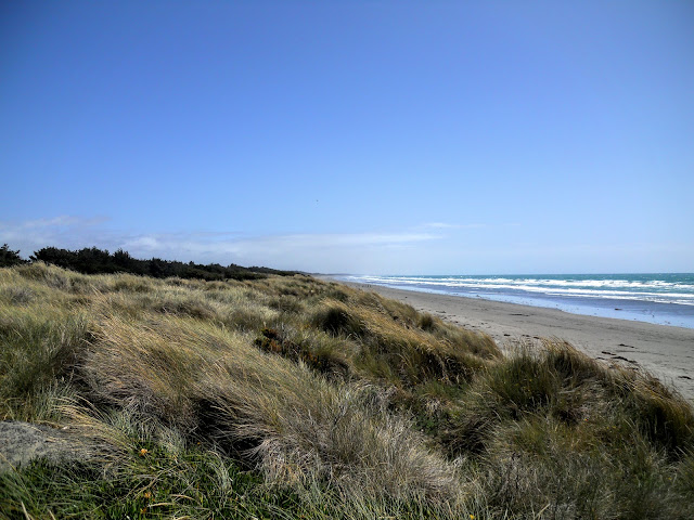 |
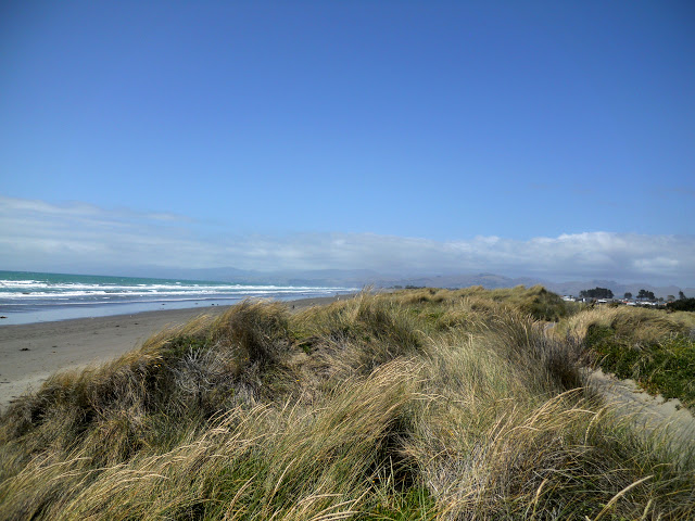
| View north along the coast at Waimairi Beach |
 |
| Map: Route from Waimairi to Spencer Park |
As well as being one of my favorite fitness walks it is also a part of the wider Christchurch 360 Trail network...
On the Southern Pegasus Track/Christchurch 360 Trail:
The South Pegasus Track is a dual use MTB/walking track from North Beach all the way to Spencer Park. A lot of it is along the sand hills backing the local beaches but slightly less than half the journey is through Bottle Lake Plantation on the North Eastern outskirts of Christchurch.
 |
| Christchurch 360 trail map: The complete route encircling Christchurch |
Over the summer I tend to alternate a walk day and a tramping trip every other weekend. If I'm not up in the mountains I will be walking along the beach or traipsing along the Port Hills.
Parts of this route are also sections of the
Christchurch 360 Trail which circles the city from Brighton to MacLean's Island then all the way to Sumner via the Summit Walkway.
 |
| Christchurch 360 Trail: spot where I park the car, Waimairi Beach |
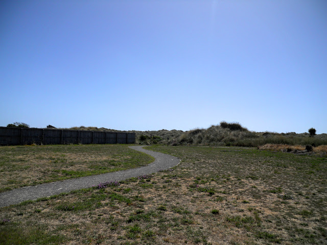 |
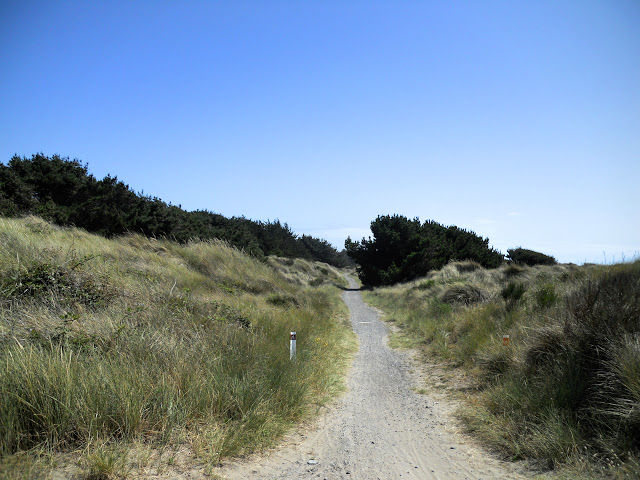
| Waimairi Beach entrance to the South Pegasus Walkway/Christchurch 360 Trail |
You can see from the photos below that the track is exposed to the sun, make sure you have a hat, sunscreen and water as you will get burnt to a crisp if you do not. Later parts of the track are in forest but by then it will be too late.....!
 |
| South Pegasus walkway- view north near Waimairi |
 |
| South Pegasus walkway- view south towards Port Hills |
The track is hard packed gravel or sand, the biggest hill (mound really) you will need to climb is about 10 meters high so it makes for fast and straight forward travel. Walking or running shoes are best, boots are total over kill for a track of this kind.
 |
| Sandy patch - South Pegasus walkway |
 |
| Pegasus Bay, view North from the Christchurch 360 Trail |
 |
| Pegasus Bay, view south from the Christchurch 360 Trail |
You can walk all the way on the gravel track but I prefer to head 100 meters inland and use the old forestry road which parallels the track. It is a lot quieter (no dodging speeding MTB riders) as well as being better protected from the wind & sun.
 |
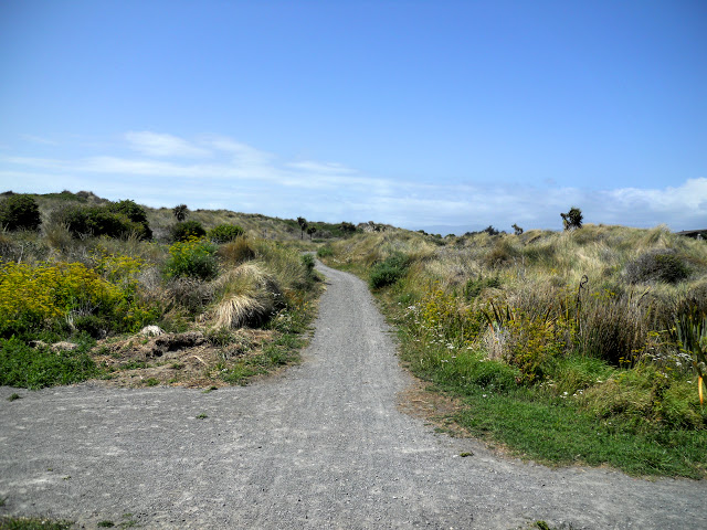
| Turn left to access secondary track on the Christchurch 360 Trail |
 |
| South Pegasus Walkway heading north.... |
 |
| Christchurch 360 Trail: Head right at this track junction |
There are plenty of signs and maps to help you navigate, but keep your wits about you. It is a bit of a rabbit warren so people can and have got lost here before. If you get lost, head East and eventually you will strike the Pegasus Track and beach.
 |
| Map: Bottle Lake Forest Park |
The old forestry road is very nice to walk along it is a lot softer hence easier on the feet and allows you to walk a circuit if the tide is too high to return along the beach. The old forestry road was built for 4 W/D and is dry most of the time...soggy after any big rain event.
 |
| Secondary track heading North on the Christchurch 360 Trail |
Below are some photos of the Burwood landfill, destination for a lot of the rubble left over from the Christchurch earthquakes. For the first 2 years after the quakes almost all of the spoil and ruins from the Central City were trucked out here and dumped.
Later the rubble was used to extend the wharves over at Lyttleton or crushed for use as road fill. This pile of debris is about 1.5 kilometers (1 mile) long, a half a kilometer wide and about 100 meters (300 feet) high. It really shows you how much destruction the earthquakes caused. It is a modern day barrow!
Eventually it is planned to plant pine forest on the hills and incorporate them into some new MTB tracks.
 |
| Burwood Landfill from the walking track |
 |
| Burwood Landfill and flax's- big, long hill |
The swirl design on the post below is the marker for the Christchurch 360 trail, which over its 135 kilometers encircles the city. One of my side projects is to walk/bike the whole Christchurch 360 trail, I am about 60% complete at this time.
I will be doing a post about this sometime in the near future.
 |
| Christchurch 360 Trail marker at Bottle Lake Forest |
 |
| Looking South West towards Burwood Forest HQ track |
I normally just keep walking straight North towards Spencer Park but as I was following the course of the 360 Trail I turned right at the end of the landfill and followed the trail markers to the main South Pegasus Walkway track. This section is mostly forested and reaches for 3 kilometers to the start of the reserve at Spencer Park.
 |
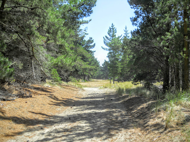
| Heading into the forest portion of the track, South Pegasus Walkway |
 |
| Typical conditions along the forest section, South Pegasus Walkway |
 |
| Beach access point, South Pegasus Walkway |
 |
| Track junction to secondary road- go right for the Christchurch 360 Trail |
After a kilometer I jinxed back onto the secondary road and followed this all of the way to Spencer Park. This is a nice option of a sunny Winters day as it is more open and therefore a bit warmer. in the Summer it is often better to stay on the main track for the shade the pine trees provide.
 |
| Christchurch 360 Trail: secondary forest track 100m inland |
 |
| Flowers growing alongside Christchurch 360 Trail |
 |
| Closeup of the flowers, Bottle Lake Plantation |
This area of the forest is often busy with runners, walkers, bike riders and horse folk from the local suburbs. That said you will often walk for long periods and not see another sole so it can be quite tranquil at times...
 |
| Jon Moake half way to Spencer Park |
 |
| Jon Moake half way to Spencer Park on the Christchurch 360 Trail |
 |
| Old Forestry Road- Bottle Lake Plantation |
 |
| Track Junction en route to Spencer Park |
Bottle Lake Forest was once a test forest for the NZFS or New Zealand Forestry Service and they trained perspective NZFS Rangers here in the 1960's and 1970's. The role of the NZFS was folded into DOC when it was set up in 1987 and the Forestry School closed down. The forest is now managed by Matariki which is the forestry subsidiary of Ngai Tahu Holdings the local Iwi.
 |
| A mixture of adolescent pine forest...north of Waimairi Beach |
 |
| ...and scrub areas on way to Spencer Park |
 |
| Start of Spencer Park Reserve along distant tree line |
You eventually arrive at the access road which runs along the back of the beach at Spencer Park. There are a number of parking areas here so if you wanted to start this section from Spencer Park there are many good spots for you to stop at.
 |
| Christchurch 360 Trail: car parking lay by- Spencer Park |
I usually stop for a 5 minute break somewhere along this point as it is about an hour from the start of the track. On the day I actually had some lunch so stopped for a bite out of the sun under the forest canopy.
 |
| My lunch spot near Spencer Park |
The quality of service station food is sometimes surprising, the BP Connects in particular have a great selection of bakery goods. This sandwich was panko crusted chicken schnitzel with herb mayo slaw and it was delicious. Much better than the week old manky mince pies we remember from our youth.
 |
| Lunch of champions; crisps, sandwich and water on the Christchurch 360 Trail |
After 25 minutes I headed off to walk the last 1.5 km's to the main Spencer Park beach access point.
 |
| Back on the Christchurch 360 Trail: a marker en route to the car park |
The trail takes you right through the middle of the Spencer Park surf lifesaving complex and then continues down to a carpark about 40 meters north of the surf club.
 |
| Christchurch 360 Trail: Spencer Park Surf lifesaving buildings |
 |
| Link track to main Spencer Park beach access, Christchurch 360 Trail |
 |
| Track end: Main Spencer Beach car park |
This is the main access point for the beach at Spencer Park which sits at the end of Heyders Road. If continuing on to the next 360 Trail section you start by heading down this road in the direction of Spencer Park.
 |
| Spencer Park- beach access car park view towards the park |
 |
| Christchurch 360 Trail: Spencer Park sign |
 |
| Me at the main Spencer Park beach car park |
The main beach access point at Spencer Park is not the end of this section as it continues down towards the Spencer Park Campground before joining the next section of the track along the back of the Brooklands Lagoon.
 |
| View down Heyders Road from the carpark at Spencer Park Beach |
 |
| Christchurch 360 information kiosk on Heyders Road (2022) |
 |
| View out over the southern end of Brooklands Lagoon (2022) |
Once opposite the entrance to Spencer Holiday Park you turn right into the road leading to the Christchurch Adrenaline Park. the next section of the Christchurch 360 trail starts here and goes out to the old suburb of Brooklands.
 |
| Entrance to the Adrenaline Forest at Spencer Park (2022) |
From here I usually turn around and head back the way i have just walked. Once I make it to the beach access point at Spencer Park I usually go onto the beach and walk back to Waimairi along the shoreline.
 |
| Main Spencer Park beach access on Heyders Road |
Obviously, this is reliant on tides and weather conditions, when you have a high tide the surf will come right up to the sand hills as the land has tilted down as a result of the earthquakes. Alternately, return the way you have come or follow the Pegasus Track back towards the City.
 |
| Christchurch 360 Trail: Surf conditions near Spencer Park |
 |
| View of distant Port Hills from near Spencer Park |
This is an interesting circuit with its blend of track, sand hills and beach walking, it is seldom boring as there are always a lot to see as you meander along. Take lots of water (no sources anywhere along the track) and watch for MTB riders. Also, in a slightly less savory fashion, stay away from all the nude sunbathers around Spencer Beach, it is one of the un-official nude beaches around Christchurch.
Yes, you will see them, it is inevitable if you walk this way often enough!
In a later post I will discuss my other common walk on the Port Hills: from the Sign of the Takehe up Dyers Pass running track to the car park at Sugarloaf and return.
Access: This section starts from Parklands on the northern suburbs of Christchurch. Various access points along Waimairi Beach, clearly signposted by Christchurch City Council as either 'Beach Access", or Bottle Lake Plantation
Track Times: It is 13 kilometers or 3-4 hours return to Spencer Park
Miscellaneous: Beach section is tidal, exposed to sun and wind so be prepared
Christchurch 360 Trail: Travis Wetland Section-Waimairi Beach Section-Spencer Park - Spencer Park to Brooklands Section