Day walks in Mt Peel Forest, South Canterbury
The family and I went for a holiday to Mt Peel recently and while there walked a couple of the shorter bush tracks in the surrounding area. The
Peel Forest Park Scenic Reserve is a small remnant of the extensive podocarp forest that existed on the Canterbury plains before humans arrived in New Zealand.
 |
| Little Mt Peel from Blandswood Road, Mt Peel Forest |
The area around Peel Forest was the scene of intensive logging in the late 19th century. Lucky for us a visiting Englishman brought most of the existing forest and eventually gifted it to the people of New Zealand.
 |
| Map of Mt Peel Forest area...extensive tracks to explore! |
There are a series of short walks and longer tramping tracks in the Mt Peel area, the main short walks are the
Fern, Big Tree and Dennistoun Walks.
The pre-eminent tramping route is up to the summit of Little Mount Peel via Deer Spur, not a trip I did on this visit.
The Dennistoun Walk
The
Dennistoun Walk is through an area of regenerating bush with some
fine specimens of the native trees endemic to the area. These include
Matai, Fuchsia, Kahikatea and Totora. It takes about 1 hour to walk the
full circular track with the first 35 minutes being through old growth
podocarp forest.
I have absolutely no idea who/what Dennistoun was!
(See the comment at the bottom of the page for info about George Dennistoun...)
 |
| Start of the Dennistoun Walk, Mt Peel Forest |
The entrance to the walk is on Blandswood Road, go past the Peel Forest township, then turn right into Blandswood Road. The walk is about 2.5 kilometres down this road on the left and is clearly marked with a roadside DOC sign.
 |
| Many Moake's walking into Mt Peel Forest |
It was a sweltering 29 degree Celsius day so it was really nice to be walking under the cool forest cover. Contrast the type and degree of bush cover of this previously logged area with the Fern Walk which was never logged.
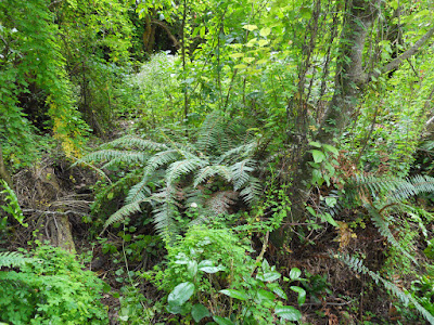 |
| Mixed podocarp forest: ferns, bush and trees, Dennistoun Walk |
There are some large examples of Fuchsia trees along the track, they are some of the largest ones I have ever seen in the NZ bush. Incidentally, the paper like bark of the Fuchsia tree is perhaps the finest natural fire starter you will find in New Zealand. I always carry a handful in my pack for emergency use.
 |
| Mature Fuchsia tree next to Dennistoun Walk track. |
 |
| Track side fern, Dennistoun Walk |
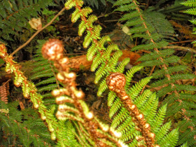 |
| Close up of the above fern |
 |
| One of the resident Totara trees, Dennistoun Walk, Mt Peel Forest |
 |
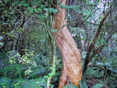
| Massive Southern Rata, Dennistoun Walk |
 |
| Close-up of Rata trunk, Dennistoun Walk |
 |
| New Zealand Fantail |
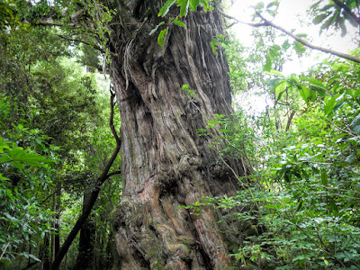
The most common tree in Mt Peel is the Kahikatea but there are also some fine specimens of Totora, Southern Rata, Matai and Fuchsia trees in evidence. Some of the larger trees could easily be 900 years old, most would be between 400-500 years.
 |
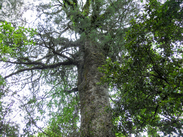
| Trunk of Kahikatea Tree, Dennistoun Walk |
I was disturbed to read somewhere that the only practical use for some of these 600 year old Kahikatea trees were as packing crates! So trees that pre-dated the Maori arrival to New Zealand were cut down to ship fruit, cheese etc. to Australia in the 1890's.
Stupid!
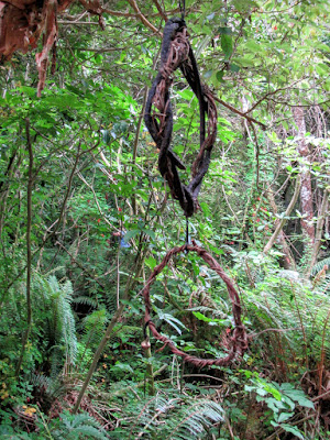 |
| Interesting object d'arte along the Dennistoun Walk |
 |
| Mature Kahikatea Tree, Dennistoun Walk |
 |
| Mature Kahikatea Tree, Dennistoun Walk |
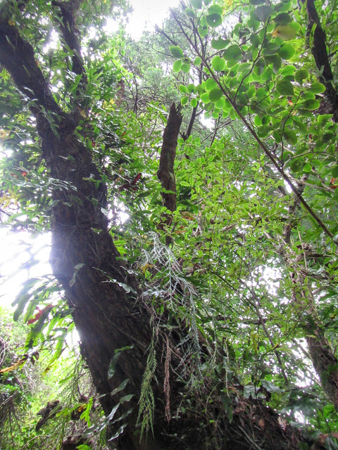 |
| Plant community inhabiting a track side Matai tree in Mt Peel Forest |
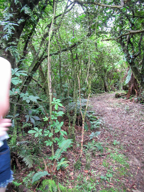
The walk itself is very nice, there are a lot of native birds in the area, we saw Wood Pigeon, Bellbirds, Tui, Fantails, Silver eyes and Tomtits as we walked along. The track is in excellent condition, firm and dry underfoot.
 |
| Dennistoun Walk track conditions- excellent! |
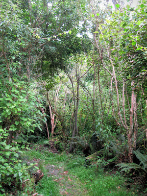 |
| More of the Dennistoun Walk track |
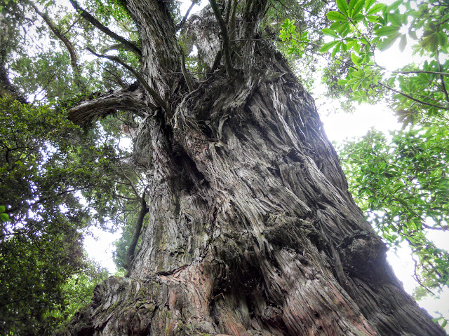
There is a massive and ancient Southern Rata tree about halfway around the track, it is very likely that this tree could be as much as 800-900 years old. It probably only survived being felled as Rata is a notoriously difficult wood to turn into usable timber products.
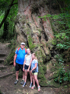 |
| Jon, Georgia and Juliet next to massive tree, Dennistoun Walk |
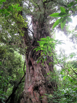 |
| Detail of Rata tree, Dennistoun Walk |
The image below is a perfect example of why wind fall trees should be left to rot into the forest floor. As you can see this old log sustains a lively community of ferns, shrubs and saplings which will eventually replace the lost tree.
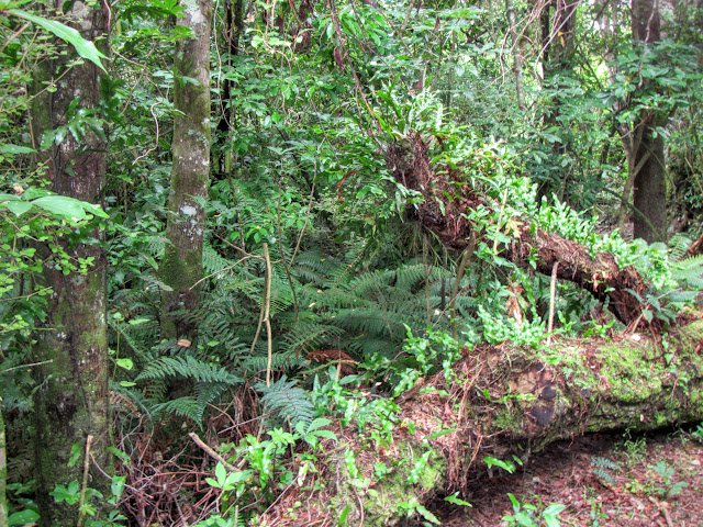 |
| Mt Peel Forest, ferns and young Matai trees growing on rotten log |
Fern Walk: The historic saw pit and "Big Stump"
About half way around the track there is an old saw pit from the area's
forestry days. To turn the trees into timber a deep pit was dug to allow massive 2 or 4 man hand saws to be used.
 |
| Turn off to the historic saw pit and "big stump" on the Dennistoun Walk |
There is a massive hollow stump which is about 2 meters deep and 3-4 across, it is easily big enough to hold a family of four within it. This tree was probably 900+ years old...
 |
| Massive hollow stump, Dennistoun Walk, Mt Peel Forest |
As you can see, the cut tree is rolled over the pit, one man stands at the top and another at the bottom to work one of the massive two handed saws they used at the time. Pity the poor sod who had to stand in the pit, he would have been covered in sap and sawdust at the end of the workday.
I'm thinking it was a job for the new chums.....
 |
| Detail of saw pit, Dennistoun Walk, Mt Peel Forest |
We happened to spy these two fat wood pigeons or Keruru in a nearby tree, they are really prevalent in the area as this type of forest is their traditional home.
 |
| Tree bound Keruru, DennistounWalk |
You can see why the early explorers lived off Keruru...they are really fat and would make for a good eating. Roasted wood pigeon, a bit of baked fern root, some piko piko...sounds like a excellent meal to me!
 |
| Close up of the Keruru, Mt Peel Forest |
Some assorted photos of the girls exploring the stump, Georgia is 5'8" tall for comparison....
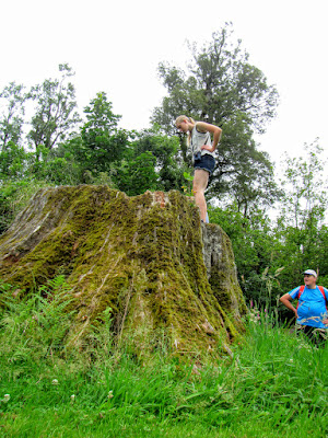 |
| Georgia on "the stump", Dennistoun Walk |
 |
| Georgia and Juliet on "the stump", Dennistoun Walk |
 |
| The girls pointing to the Keruru, Mt Peel Forest |
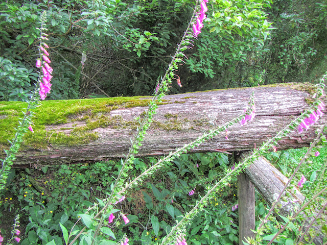
Because this area was clear felled there are a lot of areas where exotic plants and weeds have taken over the land. You can see many small saplings of Totora and Matai growing but it will be several hundred years before they achieve any size.
The photos below is of one area with invasive weeds and larger remnant forest in the background.
 |
| Fox glove growing in clear over area, Dennistoun Walk |
 |
| Mt Peel Forest, some animals dinner, Dennistoun Walk |
It is a very nice walk and even though the area was once logged there are still a lot of truly massive native trees to be seen.
Thoroughly recommended if you happen to be in the area.
Access: Dennistoun Walk
is accessed on Blandswood Road travel to Peel forest township, turn left one kilometre past the town onto Blandswood Road. The track starts on the left approximately 2.5 km's west of the Peel Forest Road - Blandswood Road intersection.
Track Times: 1 hour for the full Dennistoun Walk circuit, follow the signs
Miscellaneous:Toilets at start of the track


