Return to an old favourite... Magdalen Hut, St James Conservation Area
This is my first trip for a number of months as poor weather and a family trip to Australia meant that I didn't get out over the winter months. My original plan was to visit
Mid Robinson Hut near Lake Christabel, but less than ideal weather meant I needed to find a new tramp.
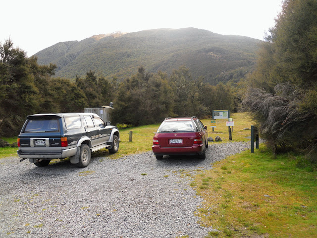 |
| The St James Walkway: southern exit - car park, Boyle Village |
Day One: On the way to Magdalen Hut
I took the opportunity to go for an overnight tramp up the St James Walkway to
Magdalen Hut.
It is about 11 km's upriver, 10 km's to the second swing bridge turn right and another 1 km downriver. I love this hut it is clean, tidy and in a great spot, this is the 2nd time I have been here.
 |
| Boyle Village to Magdalen Hut |
Here is the car park at the beginning/end of the walkway, it is not a large area but it is relatively secure as the Boyle River outdoor education centre is right next to it.
 |
| Sign at southern end of St James Walkway |
As you can see, this is either the start or finish of the walkway depending on which way you walk the track.
 |
| St James Walkway: 4 W/D track up valley |
You can follow a gravel access road to the beginning of the track about 1.5 km's up the valley, this is an easier option than the sidle track at the beginning of the walkway.
 |
| Lower swing bridge, Boyle River |
The real track begins at the first wire bridge over the Boyle River, as you can see in the photo below the river was running high due to recent rain.
 |
| Rain filled Boyle River from the first swing bridge |
It did occur to me that you wouldn't even have time to think "I'm going to die" if you fell into the river. Luckily the St James has walk wire or swing bridges over all of the significant rivers.
 |
| Boyle River from the St James Walkway |
Another view of the very swollen river, normal flow would be about a quarter or less of this amount. I heard a low rumbling sound as I was walking this part of the track. I assumed it was a bulldozer etc. working up valley until I got closer to the the river and realised the Boyle was making the sound. In high flow New Zealand rivers will pick up boulders and drag them along the river bottom making a low rumbling sound.
You should not enter a river making this sound or you will die, its that simple!
 |
| St James Walkway:on the way to Magdalen Hut |
Here is the track condition about 2 kms up the valley. The weather wasn't too bad, I had rain for about 30 minutes of the 3.5 hours it took to get to the hut. The rest of the time it was cool with occasional low cloud as seen below.
 |
| St James Walkway: Approaching St Andrews Flat |
My lunch stop on a river terrace overlooking the river, it was a bit misty, so I deployed the new cheap 6'x4' groundsheet/tarp I brought recently for $6.00. It worked really well, and weighs only 200gms so doesn't weigh me down.
 |
| St James Walkway: View down valley from mid point of day |
The track sidles over river terraces and small spurs for the first 3 kms, the river is below and about 500 distant from the track. I passed a trio of female hunters, probably early 20's, carrying a deer "Indian" style tied to a pole out to the road head. I assume they were by themselves as I didn't see anyone else about. I often see male hunters when I'm tramping, this was the first all women group.
There is an suggestion about that all tramping parties in New Zealand should carry a firearm. The idea is that we could all be blasting deer, rabbits, stouts, possums, Thar etc. and help the native flora and fauna. I think it has merit, provided people didn't start blasting each other as well.
 |
| Crossing St Andrews Flat, St James Walkway, St James Conservation Area |
About 2 hours in you cross some cattle flats, before ascending over a last spur before reaching the second Boyle River swing bridge. As you can see the weather had improved by this point.
 |
| Magdalen Hut (2007) |
Here is Magdalen Hut it is a very tidy hut in a large clearing on the beech forested river flats. The whole area is fenced to keep out the cattle which live in the area. This is an fantastic place for an overnight trip or easy family tramping trip. Apart from some mud and Maritana stream there are few hazards.
 |
| Magdalen Hut: me standing outside the hut |
Here I am both inside/outside the hut, as you can see it is very nice inside, with bunk spaces for 6. You could chuck another 2-3 people on the floor if needed, there is a lot of space. It has an excellent firebox, selection of 80/90's magazines and plenty of wood in the immediate area.
 |
| Magdalen Hut interior showing the table and wod burner |
There were only two of us in the hut overnight, myself and another tramper from Christchurch, Phil. We had a good chat about tramps we have done or want to do, he was attempting a 3 day traverse of the whole St James. Phil was an old tramping buddy of one of my neighbours, which just goes to show you how small the world really is.
 |
| View towards Maritana and the Opera Range, rain coming in |
Slightly threatening cloud blew by all afternoon with some brief showers none of them sustained.
 |
| Maritana Stream next to Magdalen Hut |
Here is a view of Maritana stream, located right next to the hut, I was slightly concerned about this stream as you need to cross it to reconnect with the track. No bridges! In the event there wasn't enough rain overnight to cause any problems. There is a nice swimming hole in the Maritana, its a couple of hundred metres upstream, great for a swim or clean up.
Day two: Return to Boyle Village via the St James Walkway
 |
| Magdalen Hut at sunrise on day two |
There was a mild frost the next morning, the area around the hut was a bit cold, the frost quickly disappeared as the sun rose and warmed the valley.
 |
| View of Magdalen Hut from across Muritana Stream |
Here is a view of the hut from the far side of Maritana stream early the next morning. I enjoy travelling in the early morning hours, the light is interesting from 6am-9am in the morning and I like the quietude of the morning, it is also more comfortable as the air is cooler.
 |
| St James Walkway: The track back to the second Boyle River bridge |
The track back to the Boyle swing bridge meanders along next to the river, easy travel through the mostly open forest. The track sidles up the hill in a few spots as the river is eating away the true left bank. I think a new track will eventually need to be cut as the erosion is fast moving, more of the bank is gone each time I visit.
 |
| Mid Boyle River swing bridge, from the true left bank |
Here is the approach to the second Boyle swing bridge, it was a bit icy on the morning in question.
 |
| DOC St James Walkway sign at the Mid Boyle swingbridge |
If you continue past the Boyle swing bridge eventually you will eventually arrive at Boyle Flat Hut, about another 1-1.5 hours up river.
 |
| St James Walkway: swing bridge |
Classic Kiwi swing bridge; absolutely necessary for crossing this river when there is any kind of heightened flow. In the middle of summer it is possible to ford the Boyle River down by the hut and connecting with the walkway, thus saving about an hour. Personally I would always use the bridge and save myself from coming to possible grief in this unpredictable river.
 |
| St James Walkway: Climbing over the ridge |
The track climbs to this high point on the far side of the bridge, then sidles for about 2 kms through mixed red and lowland beech forest.
 |
| St James Walkway:Muddy conditions |
The track was quite muddy after overnight rain, in some places it was necessary to go off the formed track or chuck down material to allow you to advance. I built several bridges on the way to help the next people who come along.
 |
| St James Walkway: More of the mud... |
Lovely Somme like mud, the track needs some attention. A raised board walk in this area would be ideal, it would make the walking easier and save the delicate forest plants because people have started to "blaze" their own trails around the mud.
 |
| St James Walkway: Lots of windfall trees |
There were significant areas of windfall, both on and off the track. This windfall ran up the hill for about 100 meters, a domino effect had led to a lot of trees knocking over their neighbours. The logs could be used to "corrugate" the track, as you find in other countries. With recent DOC job losses, it will probably just rot on the ground, what a waste of timber!
 |
| St James Walkway: Heading down to St Andrews Flat |
More views of the windfall, these trees came down in the wind storms in July and August 2013 as there was no damage in this area the last time I came through in early 2013. There was widespread damage through out Canterbury, some wind gusts went up to 160-180kph.
Obviously, beech forest does not like those kinds of wind speeds.
 |
| St James Walkway: Looking east towards the Poplar Range |
 |
| St James Walkway: View east across St Andrews Flat |
Eventually you emerge to views of the river flats, and a view down stream towards the gorge of the Boyle River. A possible alternate egress route is along the farm track on the far side of the valley, as it goes all the way down to the outdoor education centre. Please note that this is private land so permission must be sought first.
 |
| St James Walkway: Crossing one of the bush fingers en route |
The final part of the track is along an old river terrace which is about 30 metres higher than the level of the river, it is picturesque with the forest, bird life and sound of the Boyle River in the background.
 |
| Back at the lower Boyle River swing bridge |
Eventually you get back to the first Boyle swing bridge, then climb to the 4W/D track and out to the road end. It was an excellent trip, as I said earlier I hope to make a visit an annual event.
 |
| On the gravel road heading back to Boyle Village |
I highly recommend a trip to the hut as a easy family tramp, or for a short overnighter. Hopefully, in February I will be walking the whole St James Walkway (67 kms) of which this trip is but a small part.
Access: The track starts off SH 7 at Boyle Village, follow the southern entrance of the St James Walkway. Once over the second Boyle swingbridge turn right and head downstream on the true left of the Boyle River
Track Times: 4 hours to Magdalen Hut on the St James Walkway
Hut Details: Magdalen Hut: standard, 6 bunks, wood burner, water tank, wood shed, toilets
Miscellaneous: Maritana Stream and many of the smaller side streams may flood in heavy rain


