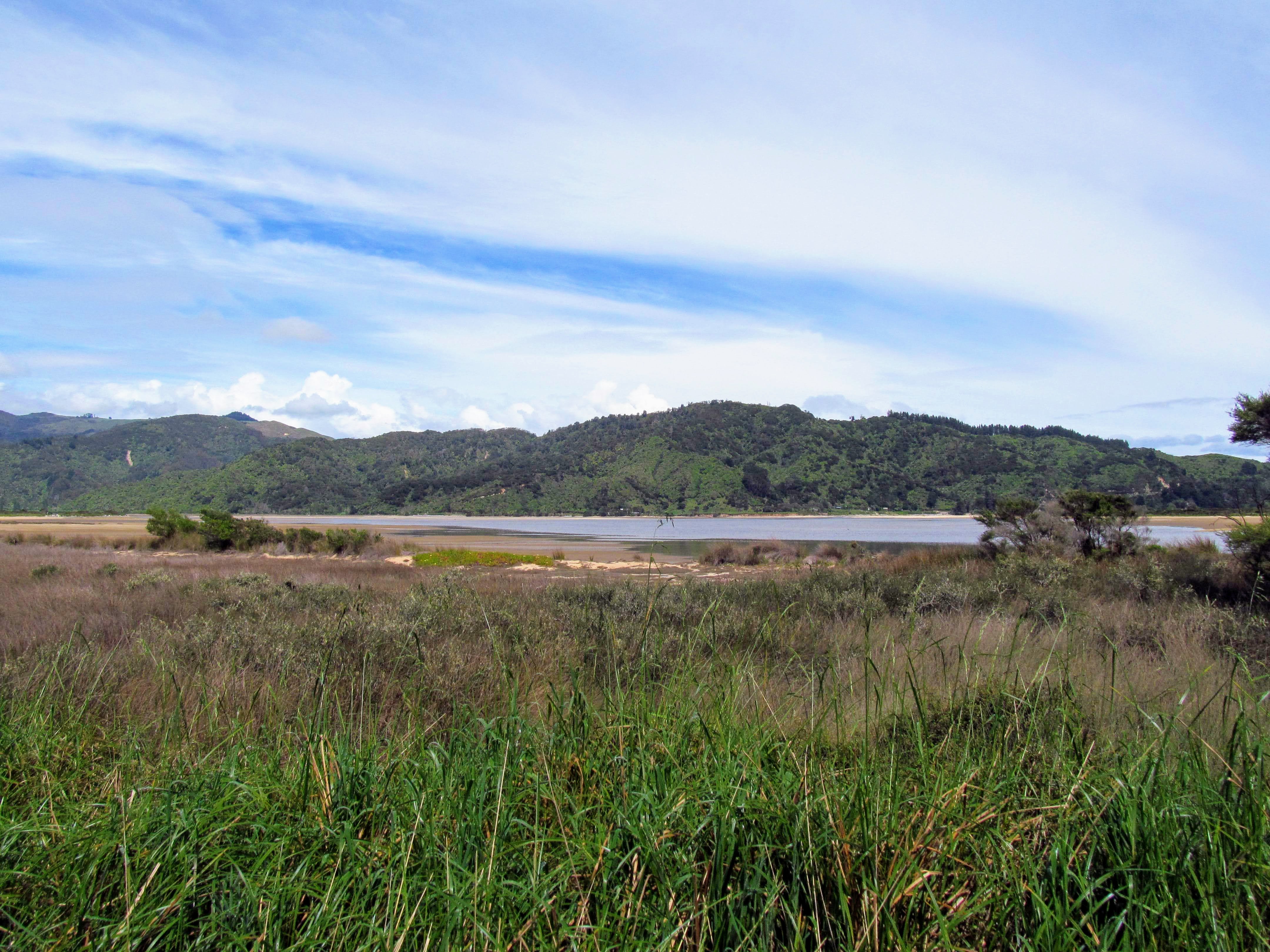
We awoke on Friday 6th November to a stunning day with sunshine, no wind and clear skies. It was a massive change from the torrential downpours we had experienced for most of the previous five days. We had several places we were going to visit including the beach at Wainui Inlet and The Abel Tasman Memorial but our main focus was on visiting Wainui Falls.
Wainui Falls is on the edge of Abel Tasman National Park and at the head of Wainui Inlet. The water for the falls comes from the Wainui River which has its origins high in the mountains that fill the center of the Abel Tasman NP. The headwaters start near Mt Evans the highest point in Abel Tasman National Park.
To start with the Wainui Falls Track crosses over farmland just off Abel Tasman Drive about a kilometer short of Anatimo. After that it is a combination of bush track, boardwalk, bridges and easy rock scrambling.
 |
Start of the Wainui Falls Track, Wainui Inlet
|
 |
| Close view of Wainui Falls Track sign |
There is a set of toilets at the start of the Wainui Falls Tack...there are none anywhere else along the track so make sure to use them before setting out on your walk. From the carpark it is 2 km's or roughly 30-40 minutes walking to reach the waterfall. We were the first people to arrive on the day and we set off briskly along the track to get away from the heinous sandflies which live near the trailhead.
 |
| There are toilets at the start of the Wainui Falls Track |
The first part of the track is along a farm track before it joins a dedicated walking track along the banks of the Wainui River. There are a couple of streams to cross along the track...I would imagine they are usually dry but with all the rain they were flowing well.
 |
| Wainui Falls Track: on the farm track... |
 |
| There are several stream crossings on the Wainui Falls Track |
Once on the official DOC track all side stream's, creeks and rivers are bridged so this is in reality an all weather track. The track is lined on both sides with native trees and there were several places where you could see fresh planting so this must be an ongoing task. The track quality is fair...it is wide, flat and mostly clear of debris so is very easy to walk along.
 |
| Turn off to the DOC track...Wainui Falls Track |
 |
| Ongoing native planting along the Wainui Falls Track |
 |
| Forest canopy along the Wainui Falls Track |
 |
| First view of the Wainui River from Wainui Falls Track |
About 700 meters up the track you reach the edge of Abel Tasman National Park and will be walking on park land for the rest of the way to the falls. There is a warning sign here about the drop offs along the track...take heed as there are a number of places where you will need to keep tight control over children.
There is one bluff about a kilometer in where you are at least 60 meters above the river and DOC have installed a safety barrier to stop people falling off the track. It is a long way down and while it might not kill you it would certainly put you in hospital for a spell.
 |
| Wainui Falls Track...there are bluffs along the track |
 |
| Wainui Falls Track...the border of Abel Tasman NP |
There are a number of bridges along the length of the Wainui Falls Track, I didn't think to count them but there are at least 10 of them over the two kilometers. Most of them were over side streams which crossed the track and the largest is a swing bridge over the Wainui River about 500 meters before you reach the falls.
 |
| One of 15? bridges along the Wainui Falls Track |
 |
| Approaching one of the bluffs along Wainui Falls Track |
 |
| Wainui Falls Track...guard rails to prevent falls |
 |
Its a long way down to the Wainui River
|
There are some lovely benched track sections on the way to Wainui Falls with the classic flat track with a sharply cut upper bank.
 |
| Lovely benched track along the Wainui Falls Track |
 |
| Wainui Falls Track: a mixture of Podocarp forest species |
I love all the epiphytes growing on this Totora Tree we passed along the Wainui Falls Track. The totally blanket the lower branches of the tree in an attempt to gather more of the limited sunlight in this narrow valley. It is like a waterfall of greenery cascading down the side of the parent tree...
 |
| A variety of epiphytes on a Totora Tree...Wainui Falls Track |
There are occasional breaks in the forest canopy which allows you to look further up river...The river was one series of cascades after another with plenty of white water. If the river was always this full it would be a great spot for some advanced level fast water kayaking.
 |
Looking up the Wainui river from the track
|
 |
| Wainui Falls Track: the track borders the river at points |
We arrived at the swing bridge over the Wainui River after about 30 minutes...this is a substantial bridge...it would be 20 meters across and 15-20 meters above the river. It is one of the new design with a solid wooden walkway across the top of the foot wires so it is solid and rigid in the wind.
The river was full of water and really rumbling over the cascades just upstream from the swing bridge...mist was drifting down the valley from all of the waterfalls and cascades running here after all that rain.
 |
| First view of the Wainui River swing bridge |
 |
| Wainui Falls Track: the bridge over the Wainui River |
 |
Wainui River from the Wainui swing bridge
|
It is only 500 meters from the swing bridge to the water fall and you could hear the distant roar of rushing water from this far away. The valley steadily constricts the closer you get to Wainui Falls..it basically becomes a gorge with the track sidling along the true left side of the river.
 |
| Wainui Falls Track: good study of the canopy of a podocarp tree |
 |
| On the true left of the Wainui River, Wainui Falls Track |
We passed this interesting side valley near Wainui Falls...it almost looks like an avalanche chute as the vegetation lining the side and bottom of it was stunted. I imagine that when you get heavy rain in the area this gorge fills with water which would scour the sides of the gorge clean.
It would take a lot of water but the whole Golden Bay-Tasman region often gets slapped by the dregs of dying sub tropical cyclones which hold massive amounts of rain. Ex Cyclone Gita dropped over 250mm of rain on Abel Tasman NP back in 2017 which is the equivalent of two months rain over a 24 hour period.
That is a lot of water.....
 |
| Side valley off the Wainui Falls Track |
Just past the gorge you come to a bridge crossing a stream and from here you can see the spray coming off Wainui Falls just upstream. The trees were dripping with moisture from the spray and the undergrowth in the forest was luxuriant and green...
 |
Wainui Falls are just around the corner...
|
 |
| Wainui Falls Track: another of the numerous bridges |
I stopped and took a photo of this fallen Punga tree below as I love the pattern of the bark these plants have. The marks are from where the fronds have fallen off the tree over the years...I think it is quite beautiful.
Isn't nature inventive...
 |
| Interesting pattern on a Punga Tree, Wainui Falls Track |
 |
| The end of the Wainui Falls Track |
There was a healthy waterfall coming down one of the gorges around the Wainui Falls Pool...an excellent entrée for the main event...
 |
Waterfall just downstream from Wainui Falls
|
 |
First view of Wainui Falls, Karen looks startled...
|
Wainui Falls were absolutely pumping when we got there...there was a thunderous roar as the water shot over the lip of the falls and crashed down into the pool at their base. The cold tonnage of water coming over the waterfall would most assuredly 'squot you like a pumpkin' as I am fond of saying....
 |
Wainui Falls, Abel Tasman NP
|
 |
| The pool at the base of Wainui Falls, Abel Tasman NP |
 |
| Cascades in the Wainui River, Wainui Falls, Abel Tasman NP |
Here is a video of the Wainui Falls in action....
I could see a number of places where people had climbed down to the pool at the end of the track...I think this is absolute madness. If you fell in that freezing cold, furious water you wouldn't last more than a couple of minutes. People can be really idiotic at times.
 |
| Viewing platform at Wainui Falls, Abel Tasman NP |
 |
| The sun reaches the Wainui Falls, Abel Tasman NP |
 |
| Jon at the Wainui Falls, Abel Tasman NP |
 |
| Wainui Falls, Abel Tasman NP are over two levels |
 |
| Mist from the Wainui Falls fills the valley |
We spent around 10 minutes at the viewing platform at the end of Wainui Falls Track before heading back down the track to the car park. We passed a couple of groups of people heading up to have a look at the waterfall on our way back down to the swing bridge but I would have expected a lot more people out and about given how nice the weather was.
I'm sure that over the rest of the day numerous folk headed along the track.
 |
| The waterfall downstream from Wainui Falls, Abel Tasman NP |
It is much easier walking back towards the car park as there is a slight incline to the track when you are going up river. Apart from the climb up and over the area of bluffs we were more or less walking downhill the whole way back to the car.
 |
Heading back down the Wainui Falls Track
|
The forest in the Wainui River Valley is super thick because of the ready supply of moisture. The bush came right down to the side of the river including some large Beech and Podocarp trees but most of the vegetation was grass, flax and ferns.
 |
The forest comes right down to the Wainui River
|
 |
One of many pools along the Wainui River
|
The photo below gives a much better view of how high above the river the swing bridge is and you can also see the wooden foot walk. This is the semi standard for DOC constructed swing bridges now as they are more stable and tend to last for longer than a wire only bridge.
 |
| Wainui River swing bridge, Wainui Falls Track |
 |
Wainui River swing bridge is about 15 meters above the water
|
I like the play of light and shadow in the photo below...the Nikau Palm is cool as well....
 |
| Sun dappled clearing along the Wainui Falls Track |
 |
| Early morning sun on the Wainui Falls Track |
You have a much better view of the Wainui River near the bluffs when walking down river...you can see how high above the river you are and also get a view down the Wainui River Valley. It is quite rugged country given it is less than one kilometer from a formed road...
 |
View of the Wainui River from the bluffs...
|
 |
| There is a good drop off at the bluffs, Wainui Falls Track |
 |
| Wainui Falls Track: one of several benches along the track |
We soon found ourselves back on the farm track and covering the last kilometer to the carpark. There are some excellent views of the edge of Abel Tasman National Park off to your right. The park boundary starts right from the fence along the edge of the farmland and it is straight into dense forest.
 |
| Wainui Falls Track: back on the farm track... |
The ridge in the photo below is the one I tramped along in 2018 on my way to Awapoto Hut on the Inland Track. The dip on the left of the photo is Pigeon Saddle where the Inland Track meets the road to Totaranui Campgrounds. Awapoto Hut is out of frame to the right and about another kilometer along the ridgeline. It is rough, steep terrain up there but there are occasional views down to Wainui Inlet, Golden Bay and Totaranui
 |
| Pigeon Saddle from the Wainui Falls Track |
 |
| Wainui Falls Track...almost back at the carpark... |
 |
| The carpark for the Wainui Falls Track |
Wainui Falls is an excellent day walk if you are up in Golden Bay and you should make an effort to visit if in the region. The track is lovely and very easy walking and the waterfall especially after a bit of rain is spectacular. We saw very few people along the track but then we were there early in the morning. I will definitely be returning here if I ever find myself in Golden Bay or heading for Totaranui Campgrounds.
Access: The Wainui Falls Track can be accessed off Abel Tasman Drive approximately 700 meters before the turn off to Totaranui & Awaroa at Anatimo. Look for the DOC sign at the head of Wainui Inlet and follow the short gravel road to the carpark at the start of the track.
Track Times: The Wainui Falls Track is 2 km's or 35-40 minutes walk one way, it will take 1.5 hours (4 km's) return.
Miscellaneous: The track is to a good standard, a mixture of flat farm track, bush track and easy rock scrambling. There are numerous bridges including the main swing bridge over the Wainui River. There are steep drop offs and multiple water courses on this track so closely monitor children. Toilets are available at the Wainui Falls Track carpark