Backcountry huts: A guide for new trampers...
One
of the unique things you will encounter tramping in New Zealand are the
DOC huts which are such a feature of outdoor life here. We have 900+
back country huts scattered around the country which can be used for a
very minimal charge.
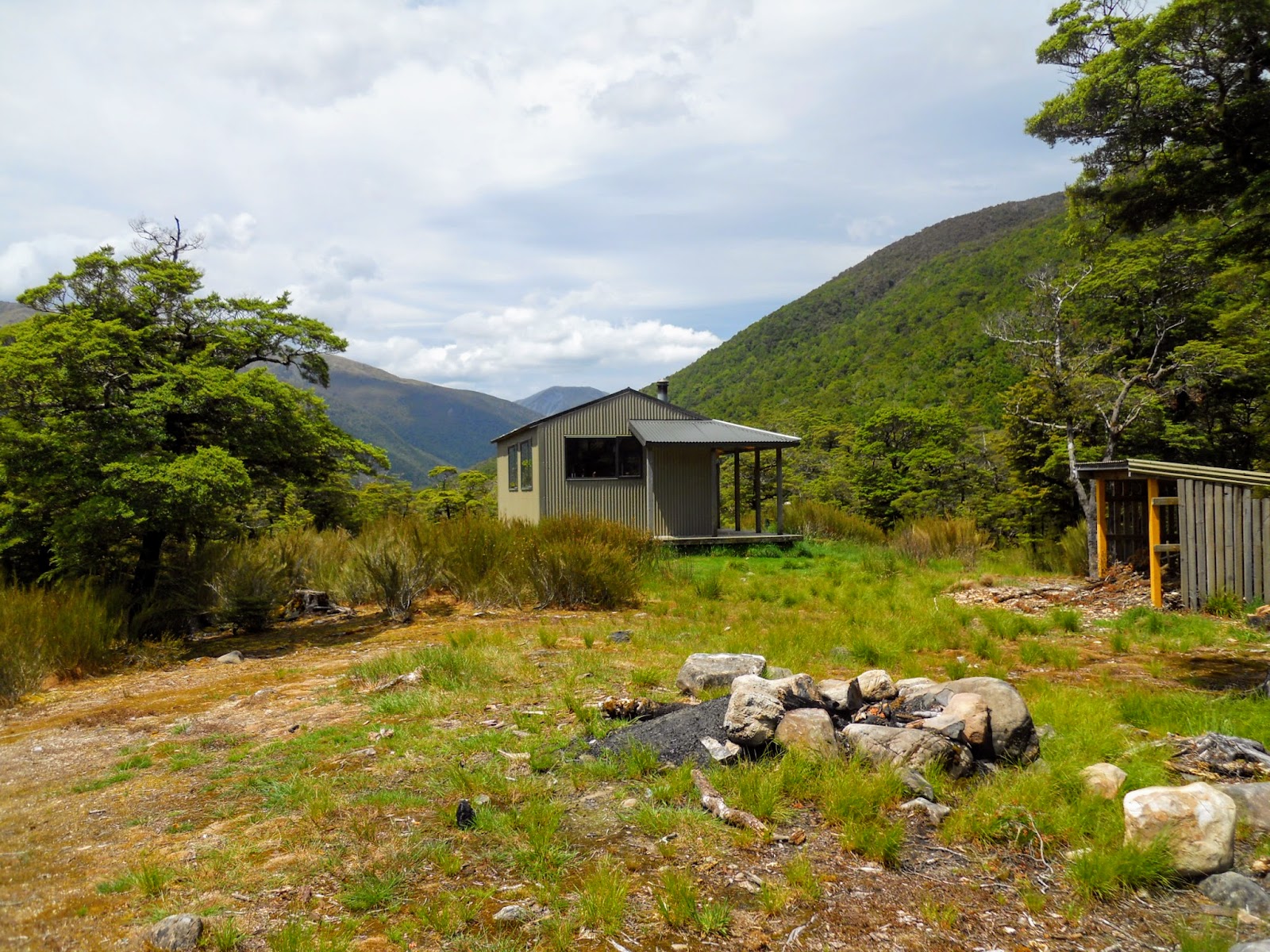
 |
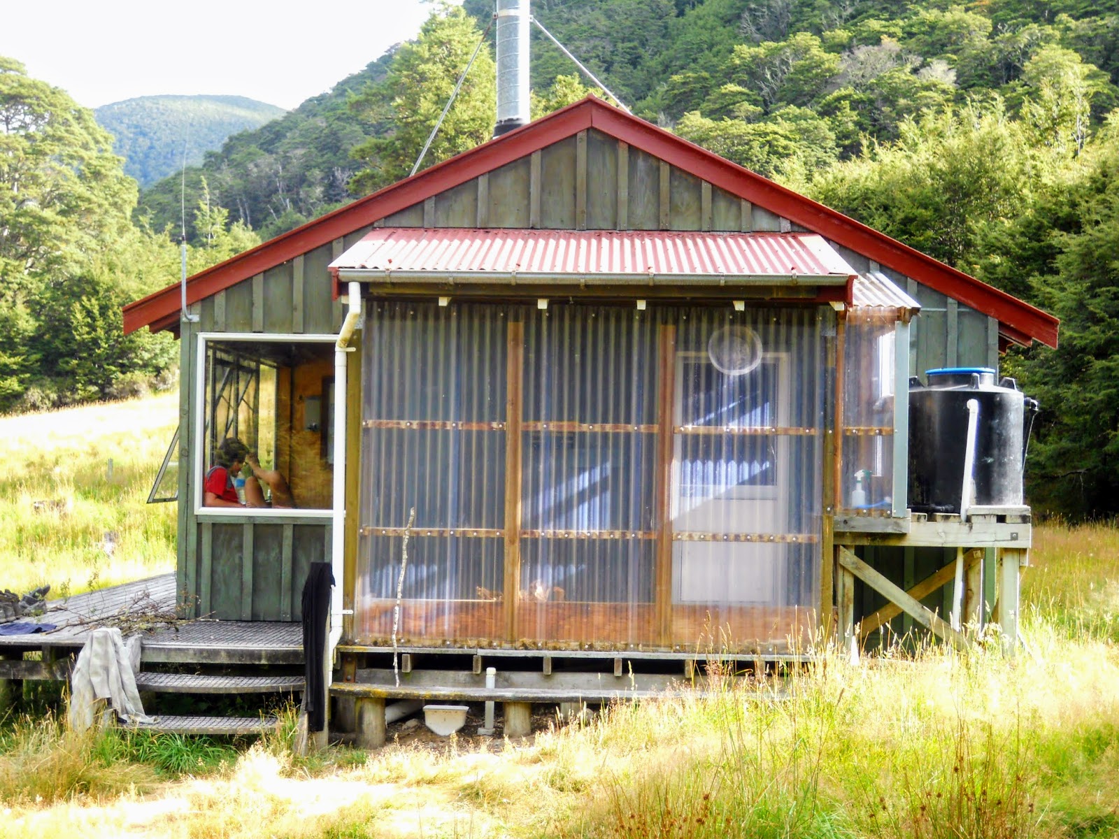
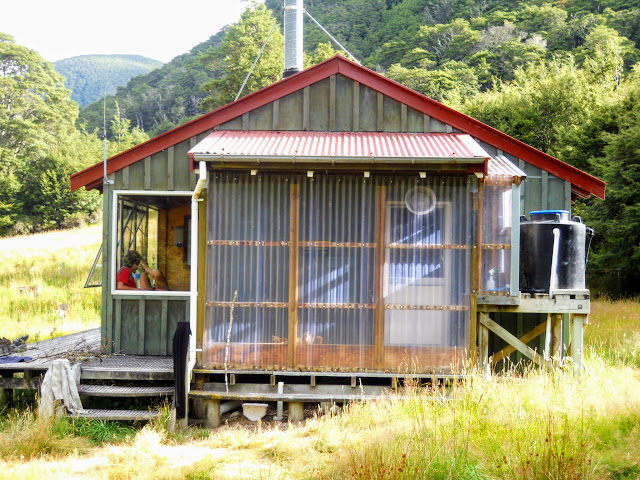
| That first tantalising glimpse of your home for the night...Magdalen Hut |
Your average Kiwi tramper will probably stay in huts for 90% of the time when tramping, the other 10% will be camping.
 |
| A good hut has an awesome location...Nina Hut, Lewis Pass Scenic Reserve |
That
is a lot of hut life!
I don't know about you but huts are one of the things I most enjoy about tramping.
A breakdown of DOC hut amenities
I
thought it might be interesting to look at some of the amenities DOC
huts contain as well as discussing some of the rules of good hut
etiquette before you start your tramping adventures.
Living Space
Most of the larger huts will have some sort of living area, what this
entails varies from hut to hut. Generally this will consist of a table
of some description with wooden benches, a cooking bench (see below),
heating source (see below) and possibly some shelving space.
 |
| Living/Cooking space, Te Matawai Hut, Tararua FP |
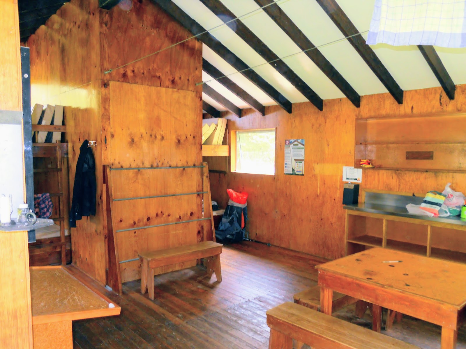
If
we look at a specific hut, Boyle Flat Hut on the St James Walkway we can see what the hut contains in the way of living space. This is one of my favourite
huts, I have been here several times now and I have always enjoyed my stay.
As
you can see below there are several tables with bench seating, there is
also a very nice bench seat under the window. There are a series of
drying wires across the living space for trampers to dry their gear on.
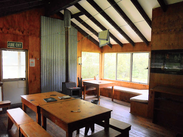 |
| Living area in Boyle Flat Hut |
In
this photo we can see the integrated gun rack that has been built for
this hut, there is a book shelf with some reading material and some
information panels on the walls.
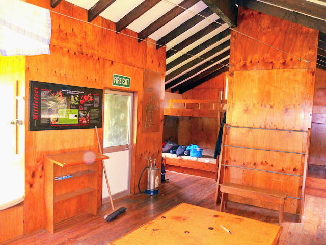 |
| Looking towards the bunk room in Boyle Flat Hut |
The other side of the room has a cooking bench along the wall, with
shelf units above and below it. The sleeping area at Boyle Flat consists
of two separate 10 bunk rooms. This hut was built by the Walkways
Commission back in the early 1980's so it has a much higher level of
amenity than your more typical 4 or 6 bunk hut.
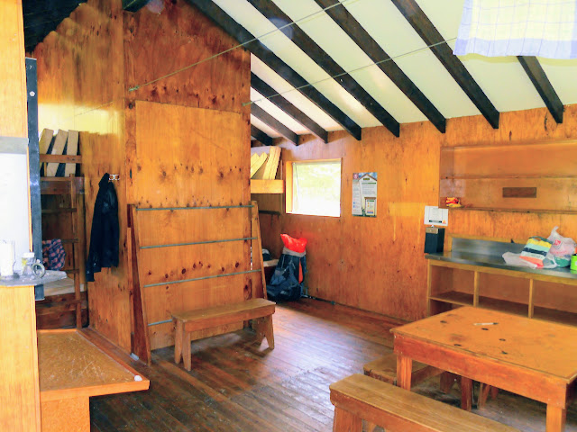 |
| Other side of Boyle Flat Hut living area |
Compare Boyle Flat to the classic NZFS 6
bunk Hackett Hut in Mt Richmond FP. The New Zealand Forestry Service (NZFS) was the precursor to DOC, they had generic 2, 4, 6 and 8 bunk hut designs which they scattered wildly about the country. A NZFS hut has the same amenities as a larger hut but in a much more compact form.
Generally these smaller huts are an open room design, they will not have
a table but will still have a cooking bench, heating and shelving in the living area.
Sleeping areas
Many
of the DOC huts were built as overnight shelter for NZFS forestry
workers, deer cullers and musterers so of course they needed sleeping
facilities.
Some
of the older huts still have the original canvas/burlap sacking bunks
which was the standard format up till the late 1960's. This consists of a
piece of canvas stretched over poles to make a hammock like bunk.
If you never have the doubtful pleasure of sleeping in one just let me say...they are damn uncomfortable!
 |
| Canvas sacking bunks, West Harper Hut |
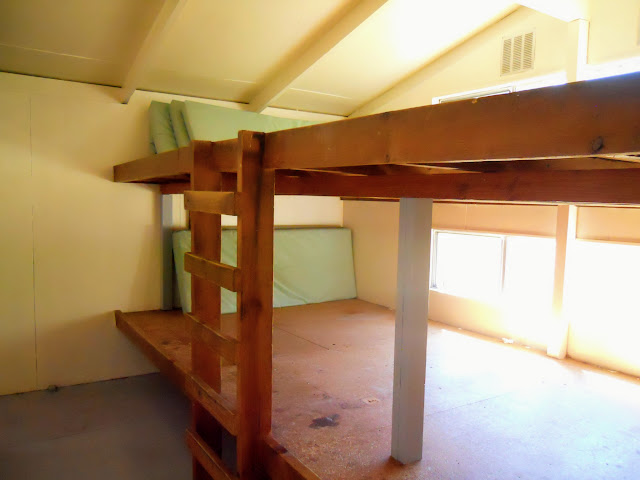
Far
more common are huts with mattresses and bunks/sleeping platforms. A
sleeping platform is one large expanse of wood or concrete which you top
with the supplied mattresses. This is the most economical use of space
as 10 people can fit on a sleeping platform that will only hold 6
individual bunks.
Let us look once again at the facilities at Boyle Flat Hut. Boyle Flat is a
20 bunker, i.e. it has space for 20 people to sleep inside. In this
case the sleeping areas consist of two bunk rooms separated by a wall. The bunks in
this particular hut are of the "sleeping platform" type and can
accommodate 10 people per room in two layers.
 |
| Sleeping platforms at Boyle Flat Hut |
Bunks
are individual spaces, just big enough for the standard DOC foam
mattresses to fit on and are more common with huts built after the mid
1970's. All DOC huts can be partially characterised by the number of
bunks supplied: for example Anne Hut is a 24 bunk hut, whereas tiny
Harpers Pass Bivouac is a 2 bunk.
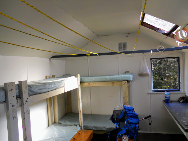 |
| Individual bunks in Anti Crow Hut, Arthur's Pass NP |
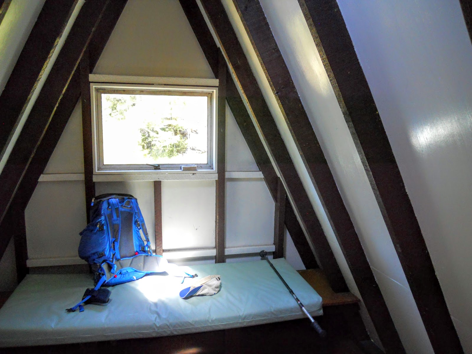
Some huts will also have you sleeping on the floor, an example being Lagoon Saddle Hut in Craigieburn FP. There is a combined table/sleeping platform for one person in the hut, the other two residents sleep on the floor on the mattresses provided.
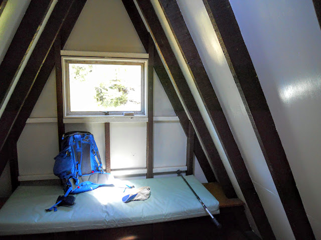 |
| Lagoon Saddle Shelter, 1 person sleeping space (2 more on floor) |
When you leave in the morning you need to stack the mattresses on their sides in an orderly fashion, this
protects them from dust, vermin and mildew.
 |
| Nicely stacked mattresses in Christopher Hut |
A note concerning bunk reservations...
If you are hiking with a group and arrive
piecemeal, good hut etiquette dictates that you cannot reserve a bunk
for your mate....they need to be there in person to claim a bunk.
Hut
floors, decks and verandas make great back ups if the bunks are all
taken and this perfectly allowable (I have slept on a hut table a couple
of times...). You can sleep in your tent and only use the hut
for cooking, socialising etc if that proves necessary.
 |
| Packhorse Hut, Banks Peninsula, 10 bunks...awesome views! |
Share the hut: if there are 6 of you in a 6 bunk hut and a
group of 4 arrive move over, make room for them and welcome them in.
This is how a real kiwi tramper acts...be a real kiwi tramper!!
Verandas/Decks
There is a trend in the newer huts to include both verandas and decks to maximise the usable living space.
Decks
are a welcome addition to huts, as they provide space to sit in the
sun, dry out gear and generally stop mud from entering the hut itself.
There is nothing finer of an afternoon than sitting on a sunny sand fly
free deck supping a hot brew.
 |
| Anne Hut, the wrap around deck look... |
Verandas
are often built onto existing huts to provide a place for hanging wet
gear out of the rain as well as providing storage areas for firewood.
They range in size from small alcoves right through to fully enclosed
secondary rooms.
 |
| Boyle Flat Hut, open deck and enclosed veranda |
 |
| Inside the Lakehead Hut veranda, Nelson Lakes NP |
Water sources
With some exceptions every DOC hut will have one of two types of water source: a water tank or a nearby stream or river.
 |
| Your source of water, the Robinson Rive, Victoria Forest Park |
The
vast majority of huts will still get their water from a nearby stream
or river but this is changing. With climate change, drier weather and
more people visiting back country areas these water sources either
disappear or become vectors for sickness. The solution is rain water
tanks.
 |
| Boyle Flat Hut, stream fed water tank |
Increasingly
DOC huts are provided with a rainwater tank, these take rainwater from
the hut gutters and store it in large capacity tanks. This is especially
prevalent in low precipitation areas like the Richmond Range and at
those huts atop ridge lines or on drier east facing hills.
 |
| Magdalen Hut, brand new rain water tank next to hut |
All
new huts are built to this standard and more and more older ones are
having them added as maintenance is done on the huts. Eventually all of
the huts maintained by DOC will get the majority of their water from rain.
NB: Not all of the huts are owned & maintained by DOC, a lot are owned by 4 W/D/hunting/skiing/mountaineering clubs and increasing numbers are maintained by volunteers.
Water is a precious resource please conserve it: take only what you need.
Cooking spaces
Cooking mishaps are the number two reason huts burn down so DOC have
provided us with metal cooking benches for our stoves. Please use these,
as cooking on one of the wooden tables or the floor of a hut can easily
cause a fire.
 |
| Small Hut: Magdalen Hut,Lake Sumner FP: the cooking bench |
In
the newer huts these benches will be stainless steel, generally with a
metal back splash on the nearby walls. There will be a window for
ventilation and candle holders or solar lighting panels to illuminate
the area.
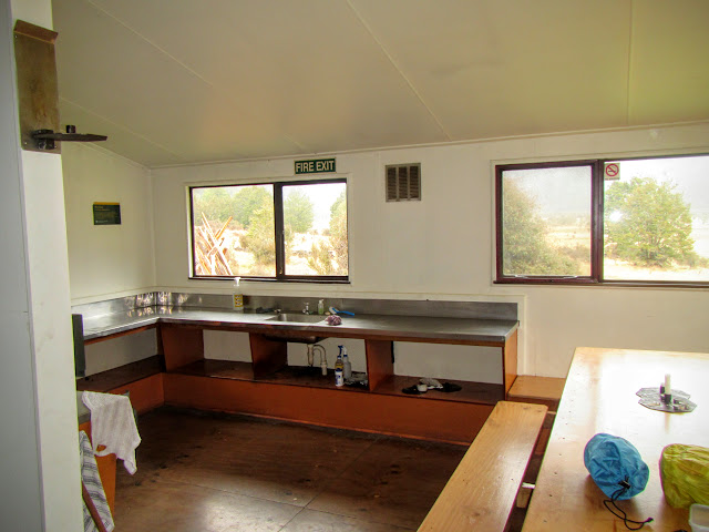 |
| Inside a larger hut: Lakehead Hut cooking area, table and bench |
In the older huts the bench will be made of zinc covered wood but they provide the same fire protection for the hut.
Some popular huts may have pots, pans, utensils etc. but don't count on this, bring your own.
Hut etiquette note:
Please make sure you have adequate ventilation while using a stove. Solid fuel, white spirit, meths and gas canisters all give off carbon monoxide in use, open a window so it can escape. Be extremely careful when refilling gas bottles or changing canisters as fire is a real risk at that time.
 |
| Classic NZFS zinc covered cooking bench, Mid Robinson Hut |
Many
of the established DOC camp grounds will have a covered shelter where
you can cook and hang out. Generally these are set up like a hut:
steel/zinc covered bench, picnic table with seating or benches and water
supply from tank or stream. If the bugs aren't too bad these are
excellent places to mingle with other trampers.
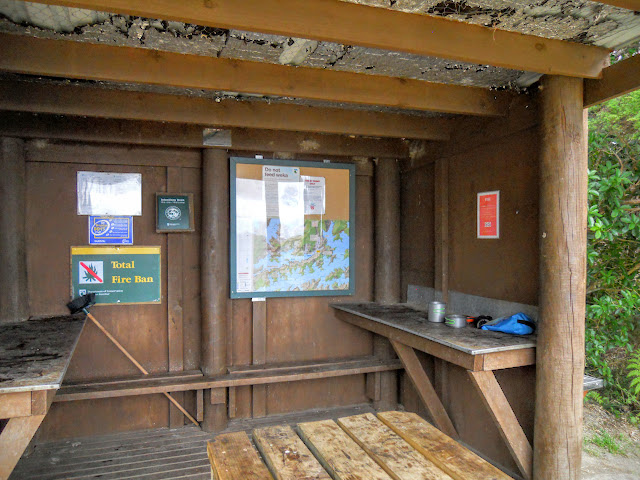 |
| Cooking shelter, Bay of Many Coves, Queen Charlotte Track |
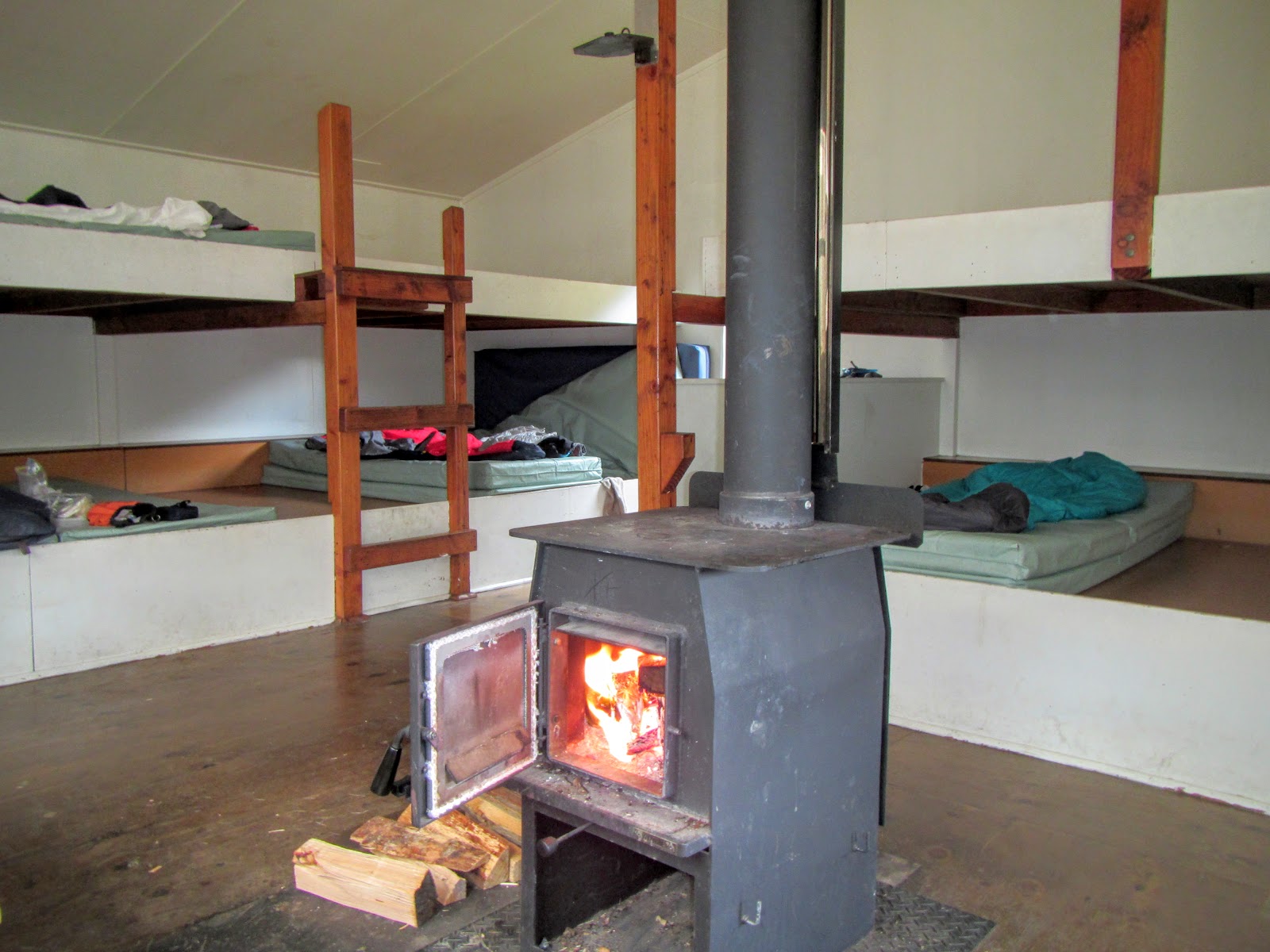
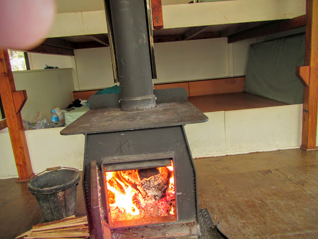
Fire places/stoves
Most
DOC huts in will have a fireplace, gas heater or wood burner in them.
These are there to provide heating as well as a place to cook. What you wont
always get is wood- only the Great Walk and Serviced huts will have a
fuel supply- otherwise it is up to you to provide. Fuel can be wood, coal or gas depending on the location.
 |
| Example of an open fireplace at West Harper Hut, Craigieburn Rnge |
 |
| Firewood waiting to go into the wood shed at Lakehead Hut |
 |
| A sight to gladden any budding pyromaniacs heart...a full wood shed! |
All
huts with wood heating will have either an axe (usually chained to the
wood shed) or a bow saw for cutting firewood. Please return them to
their spot so other trampers can use them in the future.
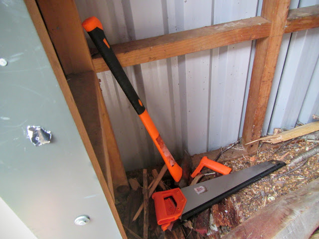 |
| With axe and saw we get firewood... |
 |
| ...and fire!!!! |
Please don't steal the tools: some day a cold, wet and hypothermic tramper might turn up at that hut and find no means to cut wood for a life saving fire...
Consider your actions!
 |
| Extra fuel for the wood burner at Magdalen Hut |
Hut etiquette note:
Please
do not cut up the furniture, decks, doors etc. and burn it (yes people
have done this), not only is it ridiculous it also the number one way to
get off side with fellow trampers. If I turn up at a hut and I see you
shoving the last piece of the table into the fire rest assured I will
tear you a new one....
Please
do not cut down the 200 year old tree next to the hut....go find some
standing dry in the forest and cut it up with the axe or saw provided. Look for standing trees that are dead but not rotting, these will often burn extremely well. Rotten wood WILL NOT burn so please don't gather it up.
Don't use all the wood, replace the dry wood you use so the next visitors have some.
 |
| Nothing like a blazing fire... |
Make sure the fireplace is
cleared or at least fully out before you leave. More huts burn down
because of careless ash handling than any other cause. Dowse them or put
them in the ash barrel if there is one. As a last resort leave the
cooling ashes in the fireplace with the door firmly shut, at least they
wont burn down the hut if they are contained.
 |
| Ash barrel at Lakehead Hut, Nelson Lakes NP |
Finally,
if it is a sweltering 30 degree summer day don't light the fire, it is
not necessary. You are just wasting firewood and irritating your hut
mates.
Cheers!
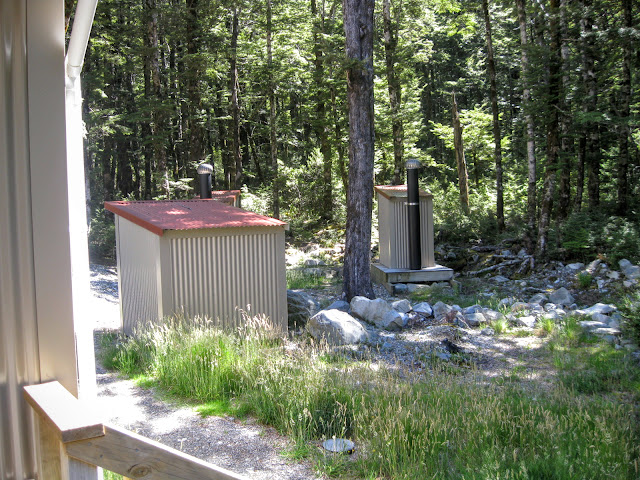
Toilet facilities
Ah... a subject dear to the heart of all trampers....toilets!
Almost
all of the 900+ DOC huts will have toilet facilities of one sort or
another, the quality will depend on popularity of the hut, its age,
location and users.
 |
| Were there be people there be long drop.... |
The
toilets will range from very basic long drops right through to palatial
toilet mansions with flushing toilets, sinks, fresh water, a disco ball and even a
supply of paper in some cases.
 |
| Most basic toilet...a handy patch of bush... |
 |
| A "Bog" standard DOC long drop toilet |
 |
| Better: Slightly more up market facilities, Hawdon Hut |
 |
| Oh yeah!!!: High quality DOC campground toilet block |
Two things to consider:
1. Bring your own paper as 98% of the DOC facilities will not have any.
2.
USE THE TOILETS! There was a lot of hate for Te Araroa thru hikers in the
media earlier this year as tales of sordid toilet habits were made
public. It seems that some people were "doing their business" outside hut
doors and on tracks rather than using the toilets provided.
It was probably not TA walkers but that is who got blamed.
Don't be that guy or gal... if there is a toilet available then bloody well use it!
If you must "s - - t in the woods" do it right and bury your waste at least 100 meters away from water/tracks/huts.
 |
| Martins Hut, Longwood Forest...the first/last hut on the Te Araroa Trail |
Miscellaneous Hut Gear
Stuff you will commonly find in a DOC Hut:
- Broom (Hint: You use it to sweep the floor...)
- Ash bucket for the fire
- Axe and/or saw for cutting firewood
- Half brush and shovel
- A green DOC hut visitors book
Stuff you might find in a hut but don't rely on it:
- Buckets/bowls/pots/pans
- Cleaning materials/soap/dishwash
- Reading matter
- Paper/matches/lighter for starting a fire
- Pack of Cards
- Spare tramping food left by other visitors
 |
| Cleaning materials at Hawdon Hut |
Weird stuff I have found in a hut:
- an unopened 750ml bottle of good red wine (seriously...why didn't you just drink it...it was delicious by the way).
- A pair of lavender frilly french knickers?
- a 12 pack of condoms...found near the knickers...???
- One sized 10 boot??????
- a kiddie paddling pool???????
Use them....don't abuse them!
Outdoor loving kiwis are justifiably proud of our hut network and we are also very
protective of it. We are privileged to be able to use these
huts, just imagine how different the New Zealand outdoor experience would be without them.
 |
| East Hawdon Biv, Arthurs Pass NP |
Please remember they are a finite resource: DOC is strapped for cash so if
you damage a hut or burn it down it will probably not be
repaired or replaced (Casey Hut in Arthur's Pass is a case in point...).
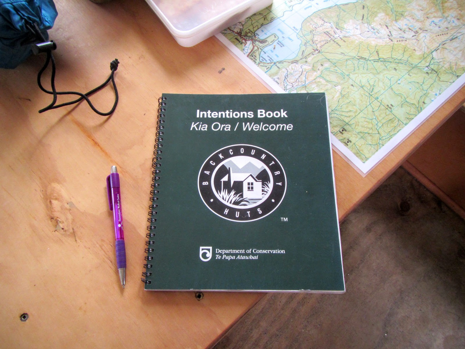
Please fill in the hut book, DOC maintain
these huts based on the number of visitors to them and hut book
statistics are their main source of data. No data....no maintenance!
 |
| Standard DOC hut visitors book |
Pay
your hut fees........I do, so should you. This includes all kiwi
trampers...no you haven't already paid for them with your taxes, Joe Taxpayer paid for
them back in 1971 when the hut was built! A DOC hut pass costs about $100 per year - how many coffees is that: 25!
Don't be so goddamn cheap!
If in doubt, treat the hut like you would your own home, thanks very much...