Another visit to Lakehead Hut
Over Show weekend I went for a three day tramp in Nelson Lakes National Park, the park is my favourite place to tramp. I love the lakes, the flat valley travel, the mountains and the huts in the area. It was also a training trip of a sort as I am preparing to walk the Milford Track in the first week of December and I'm working on my fitness for the climb to MacKinnon Pass.
 |
| View up Travers River Valley from the Lakehead Hut dock, Nelson Lakes National Park |
The park was relatively busy, I encountered folk doing everything from an in/out mountain run right through to the first Te Araroa trekkers for the 2018/19 season.
A plan to visit Hopeless Hut...
My original plan was a four day trip up to Hopeless Hut, but the storm approaching the country, the many river crossings required and the avalanche danger meant I could not visit the hut this time. Instead, I walked into Lakehead Hut on the Lakehead Track, spent two nights in the hut and walked out on the third day.
 |
| Silver Surfer parked at the Ward Street car-park |
Quite a nice day for a tramp, it was in the low teens temperature wise, cloudy and little wind....so good tramping weather. I notice that there is some work being done to the flats near the Lake Rotoiti lakeside, no idea why but it looked like the land has been flattened out a bit.
 |
| Earthworks under way along the shoreline of Lake Rotoiti |
 |
| Lake Rotoiti jetty, with Mt Robert to right, Travers Valley dead ahead and St Arnaud Range to left |
I decided to walk along Lakehead Track to save that 1.5 hour walk up to the Lakeside Track entrance on Mt Robert Road. Also I wasn't too sure of the river levels up valley for fording the Travers River. In the event over five parties passed the hut who had used the Travers River ford including a couple of people on their own.
 |
| Start of the Lakehead Track at Kerr Bay, St Arnaud |
 |
| Interpretive panels at Kerr Bay St Arnaud |
The beginning of the Lakehead Track is wheelchair accessible so it is very flat, wide and well constructed. I really like walking this track as you keep getting flashes of the lake through the trees.
 |
| On the start of the Lakehead Track, Nelson Lakes NP |
 |
| Board-walk along the Lakehead Track, Nelson Lakes NP |
 |
| Small stream crossing Lakehead Track, Nelson Lakes NP |
 |
| Solid bridge over one of the streams along the Lakehead Track, Nelson Lakes NP |
The lake had that nice aquamarine colour to it, it was carved by a glacier in times past and has gradually in-filled with rock and soil. I don't think it is that deep (82 meters at deepest point or so Uncle Google says...), certainly nowhere as deep as Lake Rotoroa at 145 meters.
 |
| Mt Robert from the Lakehead Track, Nelson Lakes NP |
The track is benched in places and was good and dry as they have not had an significant rain up here for a couple of weeks. Certainly not the mud pit it can be if walked during or after a big downpour.
 |
| Nice benched track in places....the Lakehead Track, Nelson Lakes NP |
 |
| Looking back to Kerr Bay from further along Lake Rotoiti |
 |
| Aquamarine colour of Lake Rotoiti, note jetty on opposite side of lake |
At several places along the track there are streams and rock fall zones, the ones below show how the gravel and smaller rocks get dispersed in the forest when the streams break their banks. The streams flood and then roll the mostly round stones down the incline of the slopes of the St Arnaud Range.
 |
| Example of braided stream crossing the Lakehead Track, Nelson Lakes NP |
 |
| Lakehead Track, Nelson Lakes NP, the stones are spoil from floods in the nearby stream |
 |
| One of three larger side streams crossing the Lakehead Track, Nelson Lakes NP |
Lake Rotoiti is the source of water for the mighty Buller River, the outflow is at West Bay on the low point between Mt Robert and the St Arnaud Peninsula. If there is a lot of rain in the area the Buller will flow more strongly as there is more water leaving the outflow.
 |
| View towards start of the Buller River at Lake Rotoiti |
 |
| Outflow of Lake Rotoiti...start of the Buller River in 2016 |
 |
| Verdant bush alongside the Lakehead Track, Nelson Lakes NP |
 |
| On the descent to the Lakehead Hut Jetty, the Lakehead Track, Nelson Lakes NP |
Eventually I made it to the Lakehead Hut jetty, this is the point the water-taxi visits to collect and drop off passengers. Hey TA trekkers, starting from here will save you a 2-3 hour walk along the side of the lake.
Great views of the lake, mountains and Travers Valley from the jetty
 |
| Christie Ridge from the Lakehead Hut jetty |
 |
| View of Travers Valley from the Lakehead Hut Jetty |
 |
| A native Heron at the head of Lake Rotoiti |
 |
| Looking across at the mouth of Travers River |
From the jetty it is a short 15 minutes walk to the hut along a generally easy part of the track.
 |
| About 200 metres from Lakehead Hut on the Lakehead Track, Nelson Lakes NP |
As well as Lakehead Hut there is also a small camp site tucked into a patch of beech forest near the hut, there is water, toilets and a fire ring in the area. It looks like a nice wee spot to pitch your tent, covered and protected from the wind.
 |
| Camp-site at Lakehead Hut, Travers Valley |
First view of the hut is the chimney sticking up over the bush, it is a nice wee hut and was built sometime in the early 1980's when the national park started to become more popular as a tramping destination.
Up until the late 1990's very few tourists visited Nelson Lakes, now they are the main visitors. The Te Araroa Trail, Blue Lake and the Lake Angelus route are the main draw cards for tourists, all of which feature in Lonely Planet guides and their ilk.
 |
| First view of the chimney at Lakehead Hut |
 |
| Lakehead Hut, Nelson Lakes National Park |
I had the hut to myself that first night so I cut up some wood, got my sleeping spot fixed up (five mattresses in two layers...!!!) had a clean up and relaxed. Over the course of the afternoon about 15 people passed through, a couple of families, some hunters, a mountain runner and a solo tramper heading for St Arnaud.
At Lakehead Hut..
So as I mentioned earlier, my original plan was to continue up to Hopeless Hut for a night and then walk out to St Arnaud. When I checked at the DOC visitor centre I found out Hopeless Hut was closed due to avalanche risk so I just hunkered down in Lakehead Hut for two nights rather than one.
 |
| Lakehead Hut: showing detail of the veranda, wet room, and nearby woodshed |
 |
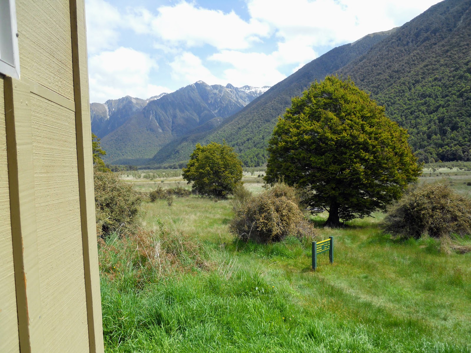
| The track to the Travers River ford goes straight across these river-flats |
If you ever get the opportunity to stay in a DOC hut for more than one day do so, it is interesting to see the different moods a hut has through the day. I spent most of the time taking to the various groups or individuals passing by...all with places to go, things to see.
I had the hut to myself on the Friday but the next night there were 15 of us staying for the night. The dynamic was completely different as there were folks to interact with, we chatted about food, the weather, tramping, Donald Trump etc...
 |
| Interior of Lakehead Hut on the first night...I had it to myself... |
 |
| Jon Moake sitting at the Lakehead Hut dining table |
The main groups staying on Saturday were a group of church ladies from Nelson, a couple from Wellington who had just finished university and three dudes from Otago University. It was the first time in over two years where ALL of the people staying in a DOC hut with me were Kiwis....
I certainly prefer to have company in the huts at night, its nice to have some solitude but 1-2 days is more than enough for me. I've discovered that I actually like people and like to be around them....
 |
| View up Travers Valley from Lakehead Hut veranda |
 |
| Lakehead Hut: interior showing dinning table, wood burner and cooking benches |
 |
| Lakehead Hut: interior showing sleeping platforms, hut book holder |
A group of us played 'Last Card' which was a blast from the past as it was the card game we used to play out in the field back in my Army days. Many an extended hour was spent sitting under a hootchie playing cards and drinking coffee...your tax dollars at work folks!!!
 |
| Jon Moake inside Lakehead Hut, Nelson Lakes National Park |
Over the course of Saturday another 10 people passed on by including a couple of Te Araroa trail trekkers I had a good chat to. Looking in the hut book I saw that they were numbers 4 and 5 for this season, I passed number 6 (a guy from Hamilton) the next day as I was walking out.
 |
| Weather conditions on the Sunday at Lakehead Hut |
I could have stayed on Sunday as well but there was a big rain coming in later on Sunday afternoon and I didn't fancy a long wet walk out to the car on the Monday morning.
Lakehead Hut to St Arnaud, 18th November
I really wanted to get over Lewis Pass before the weather packed a sad so I was ready to hit the trail by 8 am on the Sunday morning. They had predicted torrential rain, hail and snow down to 500 meters but it didn't happen in the event. I did strike rain for about 10 minutes as I drove through the Shenandoah Valley but that was it, so I could have stayed the extra day.
Everyone in the hut was heading out to St Arnaud via the Lakehead track so I caught glimpses of them right through the morning.
 |
| Last view of Lakehead Hut as I set out for St Arnaud |
There was a group of anglers tenting in the camp-site, it looked like a guide and two American tourists. The Travers River is a noted trout fishery although I talked to a Aussie angler early this year who said he thought the river was being over fished.
The trout are supposedly less numerous and less tempted by the anglers lure...
 |
| Anglers Fly camp set up in the Lakehead Hut camp site |
 |
| On the Lakehead Track to St Arnaud near the jetty |
I went out onto the jetty to take some photos before I set off down the track, there was a strong breeze blowing down the lake, it got stronger the closer I got to Kerr Bay. The weather had started to change with a south westerly wind making its presence felt.
 |
| Lake head Hut jetty looking out on Lake Rotoiti |
 |
| Last view up Travers Valley from the Lakehead Hut jetty |
The track flows better heading back to St Arnaud, it doesn't seem as long, the hills as steep or the track as rough when heading east to west. You will often find tracks have a more favorable direction, one way is easier to walk than the other, just the flow of the land really.
 |
| On the Lakehead Track headed for St Arnaud |
 |
| Beautiful under-story alongside the Lakehead Track to St Arnaud |
Sections of the track look like they might have been made for a cart, they are a bit wider, flatter and often benched. The area shown below is typical of this...perhaps there was a bullock track heading up the valley in days past.
 |
| The Lakehead Track to St Arnaud, might have once been a cart track.. |
An interesting sight, a tree which has made its home on a handy rock outcrop...
 |
| A young beech tree clings to a rocky outcrop, the Lakehead Track to St Arnaud |
 |
| Wet conditions along the Lakehead Track to St Arnaud |
There are some nice views of the lake and Mt Robert from the track, on the Sunday you could also hear the water lapping against the shore as the wind was causing quite a lot of chop on the surface.
 |
| Looking out on Mt Robert from the Lakehead Track to St Arnaud |
 |
| Nice early morning lighting effect, the Lakehead Track to St Arnaud |
 |
| Choppy conditions on Lake Rotoiti, on the Lakehead Track to St Arnaud |
 |
| The wind blows up the lake creating choppy conditions, Lake Rotoiti, Nelson Lakes NP |
I stopped a couple of times for breaks as I made my way along the track, it was peaceful sitting quietly and listening to the birds sing in the forest canopy. There is a lot more bird song around Lake Rotoiti as the area is a pest trapping area. Removing the pests has an immediate impact on the number of native birds you see/hear.
I spotted Bellbirds, Keruru, Ruru, Kea and Fantails over the course of this tramp.
 |
| My pack at one of the rest spots I used on the Lakehead Track to St Arnaud |
Eventually I made it to the edge of the 'inland conservation island' DOC is working on in the region. An inland island is an area where DOC uses intensive trapping and pest removal to provide a safe haven for native flora and fauna. Even though there are no fences, belts of pest traps have significantly lowered the number of introduced pests like rats, mice, stoats and the such.
 |
| Beautiful flat track towards the end of the Lakehead Track to St Arnaud |
 |
| Start of the inland "island" about three kilometres from Kerr Bay, the Lakehead Track |
 |
| Mt Robert from the Lakehead Track to St Arnaud |
Here I am rolling along the track in my traditional blue and black, this is about 40 odd minutes from Kerr Bay. It was a good day for tramping: cool, overcast with only the occasional spit of rain.
 |
| Jon Moake on the Lakehead Track to St Arnaud |
 |
| Heading over a bridge on Lakehead Track |
The turn off for this end of the Loop Walk Track is also 30 minutes from the end of the track at Kerr Bay.
 |
| Only thirty minutes to Kerr Bay....the Lakehead Track to St Arnaud |
 |
| Parting the trail...a marker on the Lakehead Track to St Arnaud |
The Loop Track is a very nice one hour short track which climbs up from the lake and then sidles along the hillside then descends on the St Arnaud Range Track closer to St Arnaud. The track from this point to its end at Kerr Bay is of a better quality as it is easier to get staff and materials to these less remote locations.
 |
| Eastern end of the Loop Walk, Lake Rotoiti, Nelson Lakes NP |
I climbed up and along the nice set of board-walk about 20 minutes from the end of the track, it is there to protect an area of delicate bog plants.
 |
| Board-walk about 15 minutes from the track end, the Lakehead Track to St Arnaud |
 |
| More board-walk about 15 minutes from the track end, the Lakehead Track to St Arnaud |
The last/first kilometer of the track is supposed to be wheel chair friendly so it is very flat, smooth and easy to walk along. There is a very nice walk near her called the Honeydew Walk, it takes about 20 minutes through some thick bush close to the Kerr Bay Camp grounds.
 |
| Back on the wheel chair accessible section of the Lakehead Track |
 |
| Closer view of one of the information panels, Kerr Bay, the Lakehead Track |
 |
| End of the Lakehead Track at Kerr Bay....hello civilisation! |
I walked off the end of the track around 11 am so it was roughly 3 hours including rest and photo stops along the way. There were a few people around Kerr Bay but I only passed one person (a TA trekker) heading in to the Travers Valley so I basically had the track to myself for all of the morning.
 |
| The boat ramp and jetty at Kerr Bay, Lake Rotoiti, Nelson Lakes NP |
So another excellent trip to Nelson Lakes National Park, I hope to next visit the area in early January for a trip to Lake Angelus or maybe a couple of day tramps I have on my to do list...
Access: Lakehead Track is in the Travers Valley, Nelson Lakes NP. Access is from the Kerr Bay boat ramp around the edge of the lake. There is a water taxi service, cost is $100 per boat and can be found at the Kerr Bay jetty.
Track Times: It is 2-3 hours to Lakehead Hut from St Arnaud. It is another 20 minutes to the ford near the mouth of the Travers River, then 10 minutes to Coldwater Hut.
Hut Details: Lakehead Hut (Serviced, 28 bunks, water tank, wood shed, toilets),
Miscellaneous: Some un-bridged side streams, only a problem in major rain events but care is required at all times.
The Ward Street car park
Whenever I visit Nelson Lakes National Park I park my car outside the St Arnaud DOC workshops on Ward Street. Ward Street is directly opposite the visitor centre in St Arnaud.
 |
| Map: St Arnaud street map, B is the DOC visitor centre |
There are DOC people coming and going from this workshop at all hours of the day and night, also the local head ranger lives right across the road from the car park.
 |
| Entrance to Ward Street from the St Arnaud DOC visitor centre car-park |
There is space for about 10 cars and it is a much safer spot to park than down near Lake Rotoiti.
 |
| The Silver surfer parked at the Ward Street car park, St Arnaud |
If the car park is full the next best place to park is at the Kerr Bay entrance to Lakehead Track, there is a busy camp ground near here and a lot of traffic so your vehicle should be relatively safe there.
 |
| View down Ward Street to the St Arnaud DOC Headquarters |
 |
| The olde 'Red Beast" parked at the Kerr Bay carpark in October 2016 |