A rainy day in the Abel Tasman NP
Day three had me walking from Bark Bay to Awaroa via Tonga Campsite, Onetahuti and Tonga Saddle. It was complicated by the heavy rain falling and strong winds. What is normally a long but relatively benign walk turned into something approaching a survival march.
It was less than optimal to say the least...
 |
| Dawn breaks over Bark Bay |
I was up at dawn as I had considered heading down to the beach to see the sun rise but it was bucketing down with rain. I went and took some photos and had a look at the receding tide in the estuary before heading back into the hut to warm up.
 |
| It was raining as we started our day at Bark Bay |
 |
| Bark Bay Hut in the early morning light |
I just stoked up the fire to get some warmth into the hut and set about having breakfast, packing up and getting on my way. We all headed out early as we just wanted to get the walking done. I had a Real Meal creamed rice for breakfast on the day and boy are they good...great for breakfast of dessert.
 |
| My breakfast on day three at Bark Bay Hut |
We did a quick tidy of the hut, wiped down the benches, stacked the mattresses closed down the woodburner and swept the floors.
 |
| Packing my gear away in Bark Bay Hut |
Mahalee was the first out of the hut and Bruce, Ali and I didn't see her again until we arrived at Awaroa Hut. She told me later that she saw us a couple of times walking along the beaches and on the track. She was followed by myself and then Bruce and Ali.
Heading to Onetahuti Beach:
From the hut it is a 700 meter walk around the estuary to the Waterfall Creek swingbridge...this is all easy track as it is flat and well constructed. It was wet and muddy from all the rain but still easy to follow.
 |
| Start of the track at the rear of Bark Bay Hut |
 |
| The Coastal Track heads around the Bark Bay Estuary |
Waterfall Creek bridge is the first bridge of the day and you cross about another ten or so as you make your way to Awaroa. They are all smaller foot bridges except for the bridge over Richardson Stream near the end of Onetahuti Beach. That is quite an imposing structure...
 |
| Crossing Waterfall Creek on the foot bridge |
 |
| Map: Bark Bay to Tonga Quarry |
It is a bit steep climbing up out of Bark Bay and the open nature of the forest meant I got a good soaking from the persistent rain. Once you get up to the top of the climb you settle into a long slow sidle across a flat plateau. It takes about 40 minutes to cover this plateau before the track starts to drop down to Tonga Bay.
 |
| Climbing to the plateau between Bark Bay and Tonga Bay |
 |
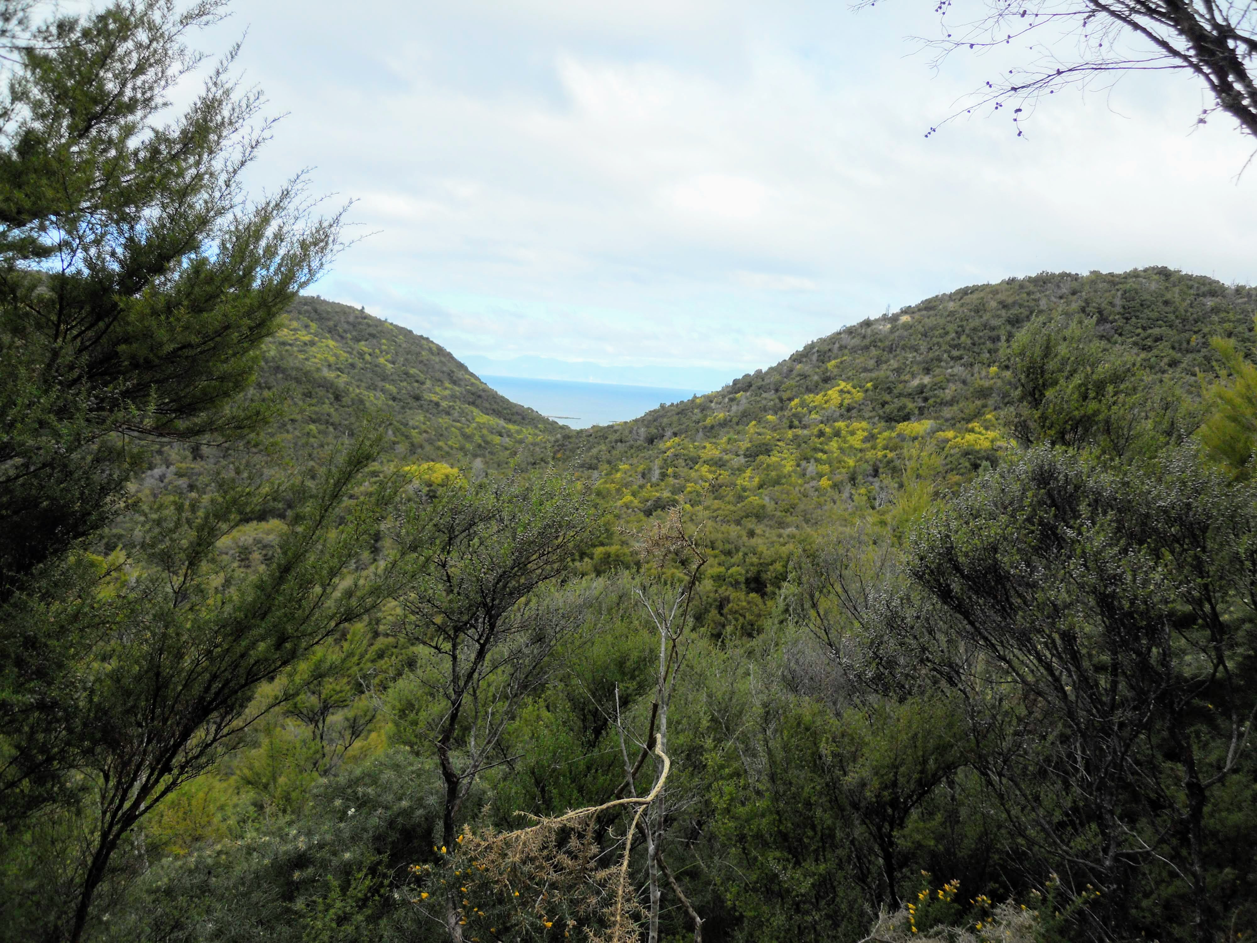
| View across the plateau towards Tonga Roadstead in 2018 |
It is a bit of a steep descent down to the Tonga Quarry site and care was required as the track was slick clay and very slippery. It was quite a slow trip coming down off the plateau but at least it is in thick forest so I was protected from the worst of the weather.
 |
| Tonga Bay comes into view from the track |
The Tonga Bay camp site has been decommissioned since the big storm back in 2018 as it ate away at the shoreline along here. Rising sea levels will eventually take all of these camp-sites as they are all only a few meters above sea level and get flooded in every big storm.
 |
| At Tonga Bay, Abel Tasman NP |
Tonga Quarry still has a toilet but the water supply that used to be here is now gone. You can check out the foundations of an old jetty building used back in the early 1900's when limestone was quarried from the area for buildings in Nelson and Wellington.
 |
| Looking out to the Tonga Roadstead, Tonga Island |
 |
| Information panel at Tonga Campsite |
From Tonga Quarry you climb up and around a headland and sidle along the side of the coastal hills on your way to Onetahuti Beach. There are some decent views of the ocean from up here and boy did it look rough!!! There were no boats dropping off passengers that day as it was just too dangerous for the watertaxi's to go out.
 |
| First view of Onetahuti Beach |
It took me about 30 minutes to walk around to Onetahuti Campsite and I was joined by Bruce and Ali just as I made it to the beach. The Onetahuti Campsite is starting to recover and I noticed that there was grass growing over most of the old sandy area I saw here the last time I visited.
 |
| Bruce and Ali at the Onetahuti Campsite |
 |
| Onetahuti Beach, Abel Tasman NP |
We were all pleased to get to the campsite shelter at Onetahuti as it meant we could get out of the rain and have a rest if only for a short time. This shelter would be a real lifesaver in really bad weather and it allows campers to cook their meals in a protected place.
 |
| Onetahuti campsite Shelter |
I spent about 10 minutes at the Onetahuti Shelter before chucking my gear back on and setting out with Bruce and Ali on the two hour trip to Awaroa Hut.
Onetahuti to Awaroa:
There is a tidal crossing on Onetahuti Beach about 200 meters shy of the camp-site cooking shelter. Richardson Stream has cut a new channel through the sand bar so you can only cross for four hours either side of low tide. When the tide is full the water coursing through the channel is waist deep and very dangerous.
Do not try to cross at high tide!!!
 |
| Heading to Richardson Stream along Onetahuti Beach |
 |
| Map: Onetahuti to Awaroa Inlet |
The weather was really awful from Onetahuti to the Awaroa Campsite with horizontal rain, strong wind and occasional hail showers. It was particularly bad on Onetahuti Beach as the wind was roaring over Tonga Saddle and down to the coast. You have zero protection on this beach so we had to contend with the full force of the weather.
 |
| View back towards the Onetahuti Campsite |
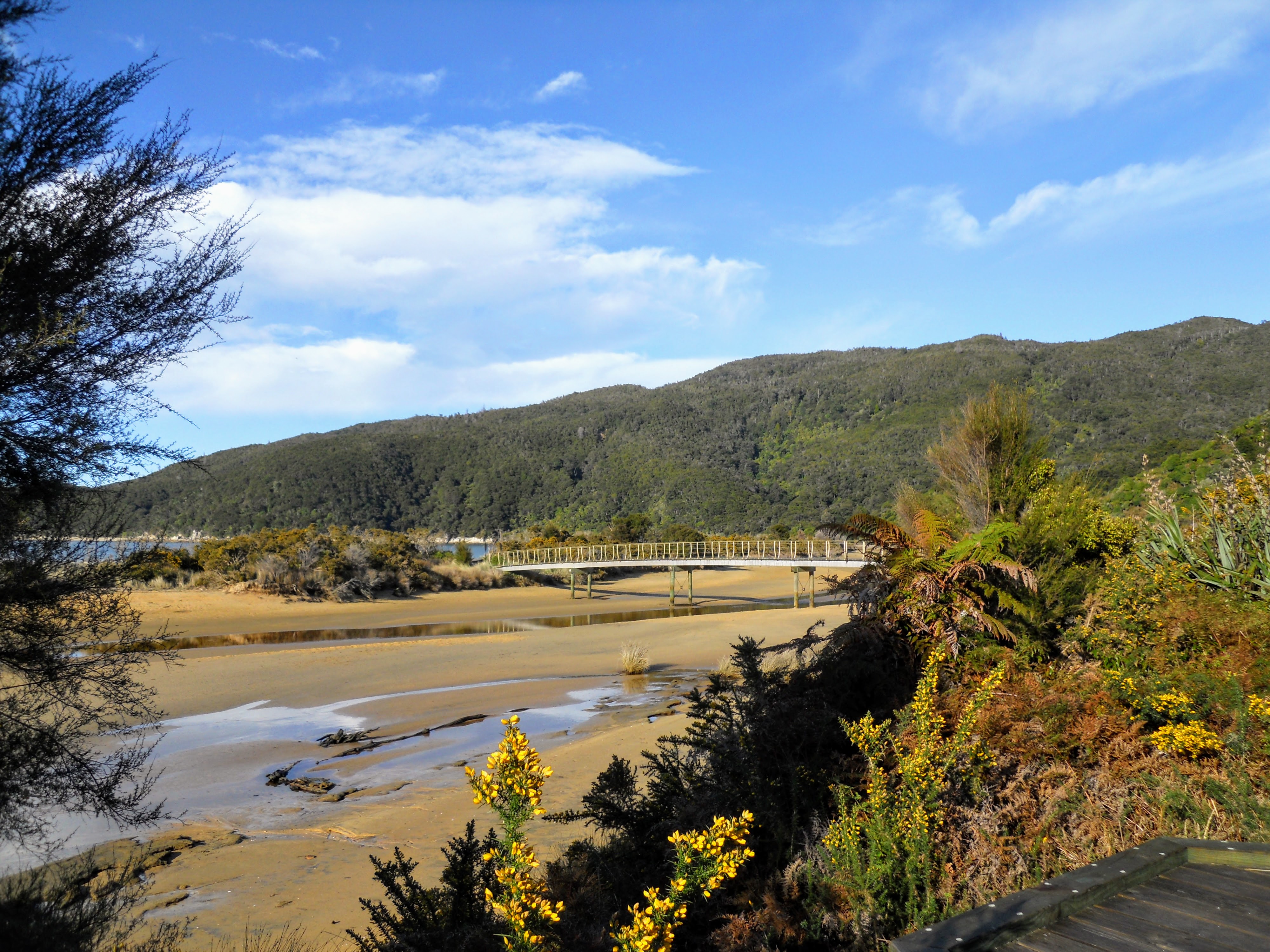
The bridge over Richardson Stream is nicely placed and designed to access the beach. Its a pity it is now in the wrong location as the stream has blown out closer to the cooking shelter at the other end of Onetahuti Beach.
 |
| Richardson Stream Bridge, Abel Tasman NP |
 |
| Boardwalk at the back of Richardson Stream |
If the tide is out you can cross Richardson Stream at the bottom of the hill and walk along the beach. Personally, I prefer the board-walk track to Richardson Stream bridge as it is much easier walking than on the acutely sloped beach sand.
 |
| Low tide crossing at Richardson Stream in 2017 |
Once past Richardson Stream you spend the next 45 minutes walking up to Tonga Saddle. To start with it is steep but it evens out some as you get closer to the top. The forest is thick along the track so you have some protection form the elements but it was still cold, wet and windy.
 |
| Start of the climb up to Tonga Saddle |
 |
| The track to Tonga Saddle is slippery clay |
The swamp behind Onetahuti Beach is a
Project Janzoon site and is a replanted Kahikatea Forest. In 100 or so years there will be a forest of 30+ meter high Kahikatea trees in this area...pity I wont be here to see it!
 |
| Onetahuti & Richardson Swamp from the track |
Once you reach Tonga Saddle you have finished the last of the two climbs for the day...there isn't much at the saddle itself but 100 meters down the Onetahuti side are a couple of seats with views of Onetahuti Beach. It is worth stopping there in bad weather as Tonga Saddle itself was horrendously exposed.
 |
| I arrive at Tonga Saddle, Abel Tasman NP |
If you are heading for Awaroa Lodge or the watertaxi pick up point make sure you take the side track just past Tonga Saddle. There is no way to get from Awaroa Settlement to the Lodge unless it is low tide and you don't want to have to walk all the way back up here.
There were 100+ kph wind gusts howling over the saddle and branches flying around so it is not a good place to rest. I didn't stop for long but headed down the Awaroa side of the hill and out of the worst of the wind.
 |
| Side track to Awaroa Lodge and watertaxi |
The walk down the Awaroa side of Tonga Saddle was nasty...it was very, very windy and wet and I just put my head down and covered it as fast as possible. You start glimpsing Awaroa Lodge as you descend...it looks like a big complex from way up on the track.
 |
| Awaroa Lodge, Abel Tasman NP |
I found out from a local tramper that this track is informally called the 'Skyline Route' because it seems like you are walking along the skyline. It was constructed in 2017 as there are high tide access problems across the private land at Awaroa Settlement.
 |
| First view of Awaroa Inlet from the track |
 |
| The old track down to Awaroa Settlement |
It is a long way from Tonga Saddle to Awaroa covering 6.5 km's of the total 8.5kms from Awaroa and Onetahuti Beach. It becomes increasingly tiresome as it just seems to drag on forever and keeps going steeply up and down the side of the hills. I was pleased when I finally rounded one last corner and saw the start of the descent down to Awaroa.
 |
| ...on the descent to Awaroa Inlet... |
 |
| Mouth of Awaroa Inlet, Abel Tasman NP |
 |
| Awaroa Settlement comes into view |
I eventually made it back down to flat ground a couple of hundred meters away from Awaroa Hut. From here there is a low tide track which follows the side of Awaroa Inlet or the high tide track along the hillside and down to Awaroa Campsite.
 |
| Flat ground at Awaroa...Abel Tasman NP |
It is about 10 minutes walk to the campsite and along the way you have several good views of the hut coming closer and out across Awaroa Inlet.
 |
| Awaroa Hut is about 100 meters away |
There is a decent looking camp-site at Awaroa, about 100 meters from the hut. It doesn't have a cook shelter but there is a set of toilets, some picnic tables and filtered water on offer. The land looked dry and well sloped so they would be nice dry camp sites.
 |
| Awaroa Campsite in Abel Tasman NP |
 |
| ...nice looking campsite at Awaroa... |
I finally arrived at Awaroa after 4.5 hours it had been a long, hot and wet walk and I was really pleased to finally get out of the weather. Everyone else was already in residence and once at the hut I had a clean-up and made a brew. This is the fifth time I have been to this hut now, it is in a very attractive spot.
 |
| Awaroa Hut, Abel Tasman NP |
From the hut and veranda you have marvelous views out into the Awaroa Inlet. It was sometimes hard to see across the Inlet due to the heavy rain but this is an awesome vista to enjoy once you finish your days walking.
 |
| Looking across Awaroa Inlet from the hut |
 |
| View to the mouth of Awaroa Inlet |
On the last day of my trip I would start by making the 30 minute crossing of Awaroa Inlet before heading along the coast for about 1.5 hours to Totaranui.
 |
| ...30 minutes to cross Awaroa Inlet... |
Awaroa Hut is a classic Lockwood design and is mostly wooden with that beautiful caramel color to the wood from all the varnish used on it. These are my favorite type of DOC huts! It has a large central living space and two 10 bunk interior bunkrooms. There is also the standard 6 bunk exterior bunkroom which is where Bruce and Ali were sleeping.
 |
| One of the bunkrooms at Awaroa Hut |
 |
| The other internal bunkroom at Awaroa Hut |
 |
| The exterior bunkroom at Awaroa Hut |
Bruce and I went and started chopping up some firewood and got some helpful assistance from the others who humped the wood around to the hut. We needed it as it was quite cold once the sun went down in the afternoon, this is normal at this time of year: warm sunny days, cold nights.
 |
| Awaroa Hut: the living space |
Later in the afternoon we were joined by a trio of older trampers from Hastings and Palmerston North so there were seven of us in the hut that night. They were great hut mates and we all enjoyed a convivial evening in the hut as the wind howled and the rain hammered down outside.
 |
| Awaroa Hut: the kitchen and woodburner |
Despite the rain and poor conditions it was quite a pleasant tramp from Bark Bay to Awaroa. Certainly it is nicer in fine weather as you have some nice views but I don't actually mind walking in the rain. The only bit that really irritated me was the track from Tonga Saddle to Awaroa. That section just seems to go on forever and I really hate the up and downs just before you start to descend to Awaroa Inlet.
Why didn't they just sidle around the hillsides on one contour line...stupid!!!
Access: Water taxi from Kaiteriteri or Marahau to Totaranui or walk from Bark Bay. The trip takes one hour from Marahau to Totaranui.
Track Times: 7.2 km's or 2.5 hours Totaranui to Awaroa Hut, 12.5 km's or 4.5 hours Awaroa to Bark Bay.
Hut Details: Awaroa Hut: serviced, 26 bunks, wood burner, filtered water tank, wood shed, flush toilets; Bark Bay Hut: 34 bunks, wood burner, filtered water tank, wood shed, flush toilets
Miscellaneous: On DOC Great Walk booking system, must be booked for overnight visit. Hut warden in residence from 1st October to 30th April each year. There is a tidal crossing at Awaroa Inlet and Onetahuti Bay with no high water track so check tide charts before booking huts.


No comments:
Post a Comment