The Andrews Valley to Binser Saddle Circuit
In mid November I tramped around the calssic Andrews-Casey-Binser saddle route in Arthurs Pass NP. The trac is rated as easy-moderate which I think relates more to the length of the track (36 kms over two days) rather than the technical nature of the track. Unfortunately the weather was absolutely atrocious....80+ kph winds, driving rain, sleet, hail and snow so it was less than ideal.
 |
| View up Poulter Valley from the rise near Petes Stream |
Note: I have supplemented the photos I took of this trip in 2012 with photos from another trip in 2020 to illustrate points. It was raining so much on the 2012 trip that my camera stayed in my pack for most of the trip. The recent trip was a lot better weather wise...
 |
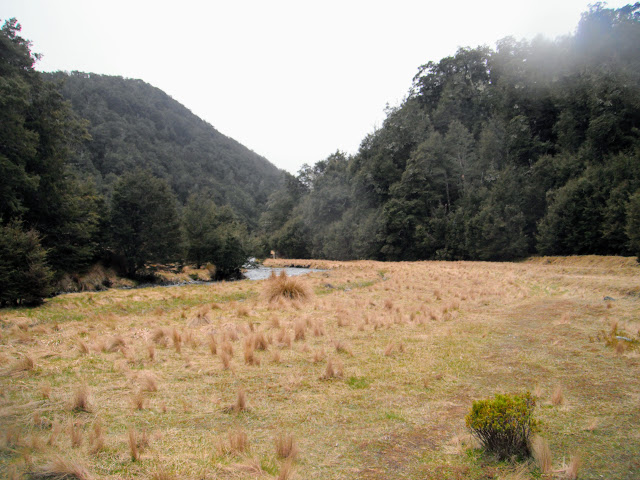
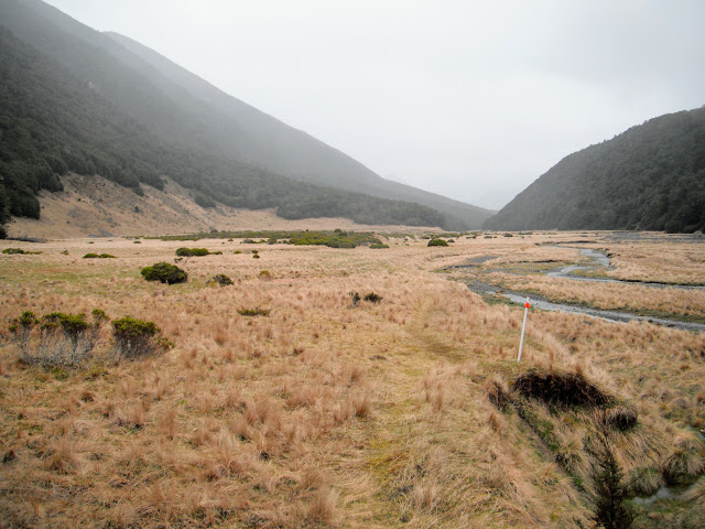
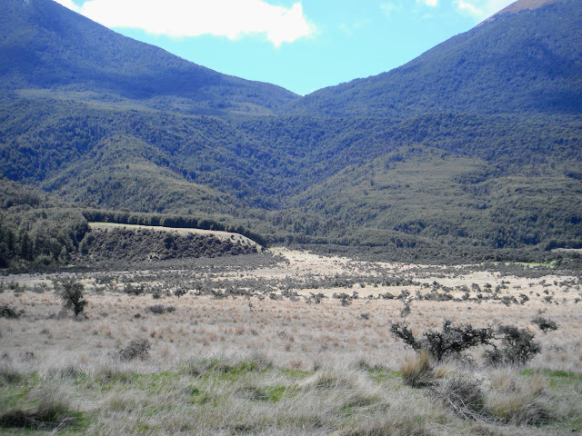
First view of Hallelujah Flats (October 2020)
|
The Andrews Valley-Poulter-Poulter Valley-Binser Saddle-Mt White Road Route is one of the few circuit tracks in Arthur's Pass NP. It is also one which crosses no major rivers so is safe in moderate rainfall conditions. There is an excellent route guide for this track;
Casey-Binser Saddle Tracks.
 |
Andrews River from the Andrews Valley Track (October 2020)
|
I had three days of lovely late Spring weather so inother words the theme for this trip was wet, WET, WET
Day one: Andrews Shelter to Casey Hut, 6-7 hours
The track from Andrews Shelter to Casey Hut is mostly in the bush so the threes protected me from the worst of the rain that was falling. The weather improved day by day as a front moved off the South Island and it was clear and sunny on the last day of the tramp.
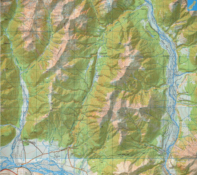 |
| Map: Andrews Valley-Poulter Valley area, Arthur's Pass National Park |
 |
| Car parking area near Andrews Shelter, Arthur's Pass National Park |
The posted DOC times for the track are a bit out for the Andrews Valley Track to Casey Hut. The time posted on the board at the track end is 6 hours but it took me 7 hours to get to the hut as the weather packed in and made travel more difficult.
I also massively over estimated my fitness levels...this was way too long of a track for a first tramp. I should have started off with some longer day tramps first. I was also carrying far too much shite in my pack as I have not been tramping for a number of years but we live and learn...
 |
| Interior of Andrews Shelter, Arthur's Pass National Park |
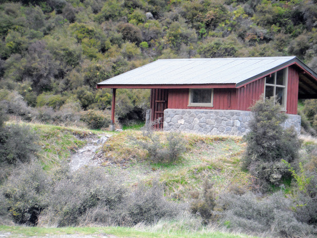 |
| Andrews Shelter, at the start of the Andrews Valley Track |
I left my car (the Red Beast...) parked at Andrews Sheleter...it is a very basic camp shelter with some bench seats, tables and a toilet. If staying here you need to get water from the nearby Andrews Stream (treat, filter or boil the water from this far down stream...). You could sleep on the concrete floor in the shelter but be aware that there is a slip prone bluff right behind the shelter that could 'squot you like a pumpkin' if there was a rock slip.
Please note: DOC has made this a day shelter only so do not sleep here or they will either remove it or lock it and on a cold wet rainy day it is a useful place for trampers to wait for transportation.
 |
| Start of the Andrews Valley track, next to the Mt White Road |
 |
| Pole Beech at the start of Andrews Valley Track |
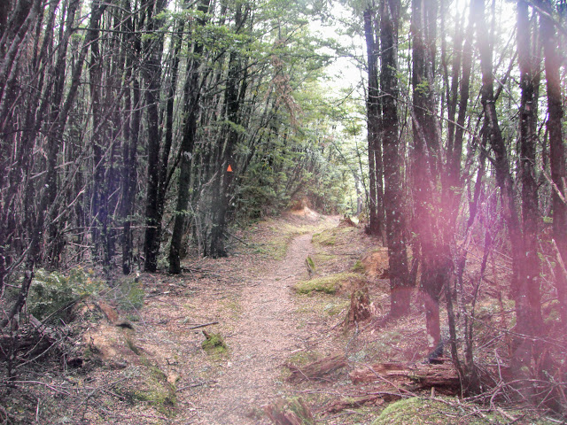
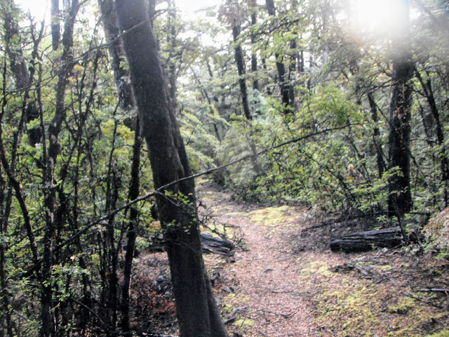
The Andrews Valley Track starts with an initial steep uphillclimb to gain altitude before turning into a long gentle sidle along the side of the hils to Hallelujah Flat 2 hours away. The track is easy to follow as it is wide, well marked and used by a great many people so it is difficult to loose.
 |
| Manuka scrub lining sides of Andrews Valley Track, Arthur's Pass |
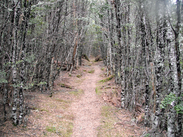 |
| Andrews Valley Track, this is about 1.5 hours in from the Mt White Road |
It would be difficult to get lost following this track, but incredibly, people have come to grief in this valley before. Personally, I found the going fine, the track sidles in a band about a hundred metres up and down for most of the way, not too strenuous.
 |
| Andrews Valley Track: A Wren that came to check me out |
If you did a right turn and walked off the track I can see how you could get lost, as it is quite thick but other wise....?
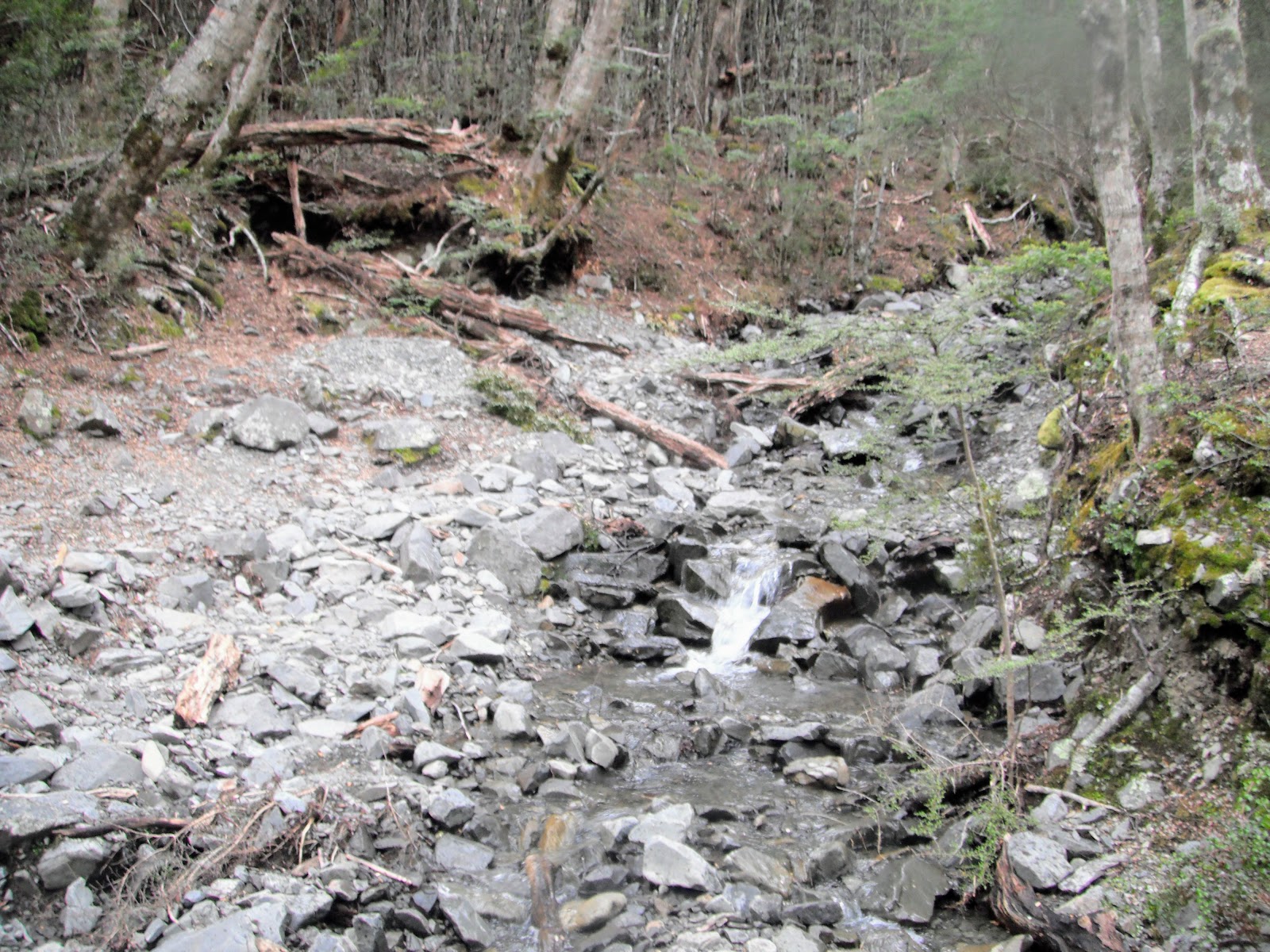
There are several side streams coming down off the unnamed range of mountains along the track so there are multiple places where you can resupply with water. There are no stock in this valley so you are able to use the water from all of the streams and rivers. I would probably still treat the water as there are wild deer and pigs in this locale.
 |
| One of the side streams crossing the Andrews Valley Track....good to drink! |
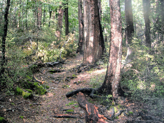
There are some areas of large, mature Red Beech but most of the forest is Mountain Beech or Silver Beech trees. All of these will be 200-30 years old at least while some might be 500 years old....as with all beech forest the understory is usually sparse.
 |
| Mature red beech trees, Andrews Valley Track, Arthur's Pass National Park |
After 2-3 hours you drop down to the side of the Andrews River, during a dry summer it is possible to wade up the Andrews River Gorge and save about an hour off the trip. Only possible if the flow is very low as there are a couple of compulsory crossings of the river required going this way.
 |
The start of the river flats on Hallelujah Flats (October 2020)
|
 |
| A wet Andrews River, Andrews Valley, Arthurs Pass NP |
There are some scratch campsites at the western end of Hallelujah Flats just before you start the climb back to Andrews Shelter. There is space here for at least a dozen tents both in the tree line and along the banks of the river. No toilets so dispose of your waste responsibly and water is from the Andrews Stream.
 |
Scratch campsites at the western end of Hallelujah Flats (October 2020)
|
I eventually made it to Hallelujah Flat, aptly named I thought ( I certainly said "Hallelujah" when I saw them!!!!). These flats extend for about 2-3 km's with the track following close to Andrews Stream for most of the way. The track is easy to follow, it obviously sees a lot of use.
 |
| At the beginning of Hallelujah Flats, Andrews River Valley: Castle Hill in the distance |
 |
| Map: Hallelujah Flats and Casey Saddle, Arthur's Pass NP |
Hallelujah Flat is an excellent place to camp, there is a lot of flat land, the water is clean (no domestic animal access in the valley) and there is a bit of firewood available. The best spots are at either end of the flat so try to camp in one of the patches of bush with a slight incline so you don't get inundated if it rains during the night.
 |
On the western edge of Hallelujah Flat (October 2020)
|
 |
View out over Andrews Valley (October 2020)
|
 |
| View back down Andrews Valley, Casey-Binser Route, Arthur's Pass NP |
The flats took nearly an hour to traverse after which I stopped for a soggy lunch
huddled under some beech trees at the eastern end! Nothing says New Zealand tramping more than a cold, wet lunch huddled under a tree with the smell of wet beech up your nose.
I got the cooker out and boiled a brew as I was a bit cold. There is little to stop the sometimes savage winds blowing across this valley so take your comfort where you can find it.
After about 20 minutes I set off once again...
 |
My Hallelujah Flat lunch spot from 2012 (October 2020)
|
It had been drizzling for most of the day but this was the point that the rain started really coming down so I packed my camera
away. Several of the photos from this point onwards are from a trip I took along this route in
October 2020.....
 |
| Heading over Casey Saddle on the way to Casey Hut, Arthur's Pass NP |
 |
| Casey Saddle, the Casey Saddle Track sidles along the spur to the right (Oct 2020) |
 |
Boardwalk crosses Casey Saddle, Arthurs Pass NP (October 2020)
|
Past Casey Saddle you need to ford Surprise and Trinity Streams which will be impassible in heavy rain. As it was they were right on the edge of safety for me a solo crossing. If I had come through an hour or so later I probably would not have been able to cross as the water levels were rising quickly with all the rain.
 |
| Dropping down into Surprise and Trinity Streams |
 |
Crossing Trinity Stream enroute to Casey Hut (Oct 2020)
|
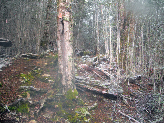
The last 2 hours are a climb up and over a ridge, the track is a bit hard to locate as you come out of Surprise Stream look for the over sized orange triangle in the forest. The climb was slow and painful...the track was becoming a minor stream and there were plenty of roots and mud to slip on.
 |
Andrews Valley Track heads up the side of Mt Brown (October 2020)
|
 |
Andrews Valley Track: muddy in places heading for Casey Hut (Oct 2020)
|
 |
| Andrews Valley Track: Ancient rock fall near Pt. 890 (October 2020) |
 |
| Andrews Valley Track: Rest spot at an unnamed stream near Pt. 869 |
 |
| Andrews Valley Track: open forest near Pt. 869 (October 2020) |
Once over the ridge it was a long slow descent in the rain down to the river flat Casey Hut is located on. Take your time as the track is that slick South Island glacial clay...easy to take a tumble when you loose traction and slip over.
 |
Andrews Valley Track: descent down to Casey Stream (Oct 2020)
|
 |
On the river flats at Casey Stream (October 2020)
|
I finally made it to Casey Hut about 7 pm, just as it was starting to get dark...it was cutting it far to fine athough i did have a tent so could have stopped in the forest if required. There were only two other hut occupants so there was plenty of room in this 18 bunk hut. It was a real pleasure to arrive and find an enormous fire blazing in the wood burner...tea and a meal was the order of the day!!!
Note: Casey Hut burnt to the ground in late 2015. The site of the old hut is now a backcountry campsite. Currently you will find a toilet and the old woodshed, water is from the nearby stream.
 |
| Burnt out Casey Hut, 2016 from the TVNZ website |
There is a new Casey Hut located another 30 minutes along the Poulter River Track. Look for the large orange triangle on the eastern edge of the old Casey Hut clearing and follow it around to the new hut.
 |
Start of the marked track to Casey Hut II (October 2020)
|
 |
Map: Casey Hut locations (red is old hut site, blue is new hut site)
|
 |
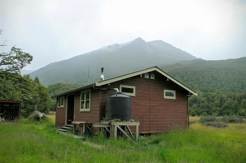
The new Casey Hut II (2020)
|
Casey Hut is magnificent, it is one of the "Lockwood/Fraemohs" style huts popular with the NZFS in the early 1980's, others included Hamilton Hut, Hope Kiwi, Hawdon Mark I, Edwards and Goat Pass. I love these huts with all that buttery golden varnished wood.
The interior shots of the old Casey Hut shown below are from the Tramping New Zealand website.
 |
| Interior of Casey Hut showing bench area | | | | | |
|
 |
| Bunk room in old Casey Hut, Arthur's Pass NP |
 |
| The awesome firebox in Casey Hut, Arthur's Pass NP |
I shared the hut that night with two Kiwi women who had come in from Andrews Shelter a couple of hours before me. They were on their way up valley to
Lake Minchin but unfortunately the heavy rain scuttled their plans as Casey Stream was a swirling vortex of death in the morning. It hosed with rain overnight from 7 pm right through to noon the next day.
 |
The track to the Upper Poulter Valley starts at the old Casey Hut site
|
 |
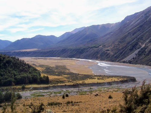
View of Upper Poulter Valley from the old Casey Hut site (October 2020)
|
I had a meal of instant mash and corned beef fried into patties...oh man it was good after a long hard day of tramping. After that it was reading and copious brews before a well deserved sleep.
I had a whole bunk room to myself that night....luxury!!!
Day Two: Casey Hut to Pete's Stream; 10 kms. 3-4 hours
I woke at around 8 am then stayed in the hut all morning eating, reading and drinking tea as the weather was terrible. It was forecast to clear in the late afternoon...this partially happened..it was still drizzling but the worst weather had passed.
 |
| Casey Hut, Poulter valley, Arthur s Pass National Park... morning of day two |
The ladies went up the valley to check Casey Stream but came back as it was flowing so strong it was leaping out of the river bed. No trip to Poulter Hut was happening for a day or two...Casey Hut is fantastic...it is well placed at a crossroads between the Andrews and Poulter Valleys and is well used by trampers, anglers, hunters and MTB riders.
The weather cleared in the afternoon so I packed up and started down the valley...I started walking at 2 pm. There were light showers on and off as progress was made down the Poulter Valley over the rest of the afternoon. It was quite a hike, about 12km's and took about 3-4 hours to reach the scratch camp sites near Pete's Stream.
Some of the side streams en route were running high but none of them were at danger levels.
 |
| Poulter Valley: walking through the Red Beech trees near Casey Hut |
Because of the rain I took few photos, my camera is not waterproof so I was concerned about water damaging it. I usually hauled it out temporarily when I stopped for a drink or a snack break.
 |
| Poulter Valley: setting off down the river flats near Casey Hut |
The following photos are from my
2020 tramp of the Andrews-Binser Circuit after the new Casey Hut was opened. I had a waterproof camera and much better weather in October 2020 so I was able to fully document the track...
 |
Poulter River Track: on the track near Pt. 657 heading for Rabbit Flat
|
 |
| Poulter River Track: one of several fords along the track (October 2020) |
 |
| Poulter River Track:the border of Arthurs Pass NP and Mt White Station (October 2020) |
 |
| Poulter River Track: View of Mt Binser from near Turnbull Stream (October 2020) |
 |
Pete's Stream, Mt Binser and distant Binser Saddle
|
 |
| Map: Poulter Valley...the long slog from Casey Hut, Arthur's Pass NP |
 |
| View of Binser Saddle from down on the Poulter River Track Scott Condron |
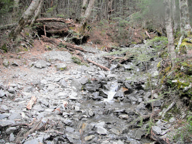
There are two significant streams to cross: Mt Brown and Pete Stream's. I had no problems crossing them but they could be a problem if it was raining hard, bear this in mind when planning a trip up the Poulter Valley.
 |
Mt Brown Creek, Pt. 1596, Poulter Valley (October 2020)
|
 |
Pete's Stream and the river terraces (October 2020)
|
Note that there are some nice camping spots on the true left of Pete's Stream just before the ford over the river. They are on a river terrace about 3 meters higher than the river and are tucked into the side of another river terrace with some small Beech Trees to shelter them. These are the best of the many possible camping sites in this locale...
 |
| Campsites on the true left of Petes Stream... (October 2020) |
My plan was to camp before Binser Saddle so a camp was selected on the river terraces on the true right of Pete Stream, around 6.30 pm. Pete Stream is the last reliable water point between here and Andrews Shelter, so fill up before you start the climb.
 |
| Poulter Valley: misting rain over the Poulter River from the terraces above Pete's Stream |
There are a couple of scratch spots on the second terrace down at the northern end under some small Beech Trees. There are also sites in the Matagouri on the third terrace where you can pitch your tent, well protected from the wind. It was a good place to camp as I had an excellent view up the valley from the vestibule of my tent.
I stopped here as it was at least another 3-4 hours to get back to the car and I didn't fancy walking on an unfamiliar track in the dark. Also...I was bloody tired after the previous days exertions so yeah....
 |
I set up my tent on the second terrace above Pete's Stream
|
I was frankly knackered by the time I had my tent up and ready to go in the semi darkness. After a couple of brews and some ramen and tuna I was feeling much better. It was too wet to stand outside cooking so I just lit up in the tent vestibule.
 |
| Me inside my tent on the terraces above Pete's Stream, Poulter Valley |
I heard some distant thunder and I had light rain and snow falling during the night but nothing to major...after all that walking I had an excellent nights sleep.
Day three: Pete Stream to Andrews Shelter; 10 kms, 4 hours
I was surprised to wake on the last day and see quite a lot of snow on the trees
towards Binser Saddle, but apart from the snow coating the trees it was a
nice day; clear, warm and the sun eventually came out.
 |
| Pete Stream, Poulter Valley from near my camp site, morning day three |
When you look at a map of Binser Saddle it doesn't look that bad but it is actually quite steep on both sides of the saddle. You are either ascending or descending for the next 3-4 hours.
 |
| Map: Pete's Stream to Binser Saddle the red cross is my camp-site on day two. |
After a quick breakfast and after packing up I set out to cross Binser Saddle around 7.30 am, it was 2 hours to the top and 1.5 hour down the other side. I was surprised by how far it was, the track sidles up and down through the forest for quite a way but only has 600m of height gain over 6-7 km.
 |
The start of Binser Saddle Track is moderate...(October 2020)
|
 |
You are in Beech forest for much of the Binser Saddle Track (Oct 2020)
|
 |
| Binser Saddle Track, heading to the saddle...Arthur's Pass NP |
The track to the top is steep in places and a bit long, the track condition on the Poulter Valley side of the saddle is good. There are no reliable water sources along this section of the track so make sure you resupply before starting the climb.
 |
| Jon resting half way to Binser Saddle, Arthur's Pass National Park |
 |
| Binser Saddle Track, looking back downhill towards the Poulter Valley |
Lower down you are travelling through areas of regenerating beech, kanuka and manuka...there is also a bit of Pole Beech so I'm thinking it is regenerating forest. There are also a few stands of large red beech trees as you get closer to the saddle itself.
 |
| Nearing the top of Binser Saddle, Arthur's Pass National Park |
Near the summit there were patches of old growth forest with some sizable trees and also a small amount of snow on the ground. There is a small seasonal stream about 200 meters from the saddle, this is the only water supply on the whole track.
 |
| Snow on trees, Binser Saddle Track |
 |
| Snow on the tree tops near Binser Saddle, Arthur's Pass National Park |
 |
| Binser Saddle Track just before the saddle, the stream is near here |
There is a beautiful clearing at the top of the saddle which would be an ideal place to camp. It had about 5 cm's of snow on it as I passed, but you could see the potential there. I would like to come back and stay up here but the lack of a trusted water supply puts me off.
 |
| Binser Saddle Track: the seasonal stream near Binser Saddle |
 |
| This is actually Binser Saddle on the Binser Saddle Track (October 2020) |
 |
| Binser Saddle Track: the clearings near the saddle (October 2020) |
I stopped at the clearing on top of Binser Saddle for a 10 minute snack break before continuing on my way. There are great spots tucked under the tree branches where you can get out of the elements and have a rest.
 |
| Map: Binser Saddle to Andrews Shelter, last 30 minutes is on Mt White Road |
 |
| Binser Saddle Track: heading down to the Waimakiriri River flats |
 |
| Binser Saddle Track: a stream near Pt. 830 (October 2020) |
 |
| In Pole Beech on the Waimakiriri side of the Binser Saddle Track (October 2020) |
Half way down the other side of the saddle was an excellent view of the Mt White bridge area and the Waimakiriri River Valley. As you can see the weather was great on the last day with sun and light winds...I actually got a bit too hot as the day wore on.
 |
| View from the high point on Binser Saddle, down towards Mt White road, Waimakiriri River |
The condition of the track from this point down to the Waimakiriri River flats is very poor. It is steep & rutted with a lot of wind fall, it really needs some TLC from DOC. It took me nearly an hour and a half to cover about 2 kms of ground.
 |
| Steep, rough track on the Binser Saddle Track (October 2020) |
 |
| Binser Saddle Track: views of the Waimakiriri River Flats (October 2020) |
 |
| Binser Saddle Track: On the last 500 meters to Mt White Station (October 2020) |
 |
| The Waimakiriri end of the Binser Saddle Track (October 2020) |
 |
| Binser Saddle from Mt White road, Arthur's Pass National Park |
Eventually I made it to flat ground. There was the matter of a 4 km walk back to the car on the Mt White Station road. I found this to be the most difficult part of the trip because I was really tired by this point.
Next time, I would be tempted to park my car at the base of Binser Saddle and then walk back to the Andrew Shelter start point, to save this walk at the end. You just need to be able to ford Lower Farm Creek which is not always easy to do...
 |
| Binser Saddle, doesn't look so bad....nek minit! |
Binser Saddle is the V notch in the centre of the photo above, you sidle through the forest and then work your way down the long ridge running left to right.
Overall a good trip, enjoyable even with the rain. I made a rookie mistake and started out with a three day tramp, really I should have worked my way up to a three day trip because I was seriously unfit. I had too much gear and gear that was too heavy....change is required...
I think next time I would start at the Binser Saddle end of the track and walk out through Andrews Valley. This trip rates a 4 out of 5 on the Jon Moake Tramp-o-meter....
Access: From off SH 73 drive along Mt White Road to Andrews Valley entrance near Andrews Shelter, other exit is at base of Binser Saddle 4 kms along Mt White Station Road
Track Times: 6-7 hours to Casey Campsite, 5 hours to Pete's Stream, 4-5 hours to Andrews Shelter via Binser Saddle
Hut Details: Andrews Shelter, no bunks, no heating, toilet: DOC campsite on old Casey Hut location, toilet and wood shed, water from nearby stream: Scratch campsite on the river terrace overlooking Pete's Stream
Miscellaneous: All streams on this circuit are un-bridged and may be impossible to cross in a storm, long periods traversing flats which are prone to windy conditions.
The fate of Casey Hut:
The Original Casey Hut burnt to the ground in 2015 and there was no hut along this route up until 2020. DOC Canterbury simply did not have the funds required to build a replacement so the original hut site was left as a backcountry camp site up to 2020.
 |
| Casey Hut No. 1, Arthur's Pass NP circa 2014.... |
Casey Hut No. 1 was a Lockwood kit set design from the 1970's so lots of varnished wood inside...one of my favorite types of back-country hut. Unfortunately all that varnish means these go up like a fire starter if sparks or embers get loose inside.
 |
| Another photo of the old Casey Hut No. 1, Poulter Valley |
The consensus at the time was someone forgot to shut the firebox fully or they left hot ashes in a bucket which tipped over and caught fire.
 |
| The Casey Hut site after the fire which destroyed the hut |
Finally in 2019 it was announced that a new hut was going to be built in the area . The money for the new hut ($250 000) was a donation from some local trampers with a long association with the area.
I have discovered that the two donors are Mr Robert Birks and Dr Sharon English...in conjunction with the Nature Heritage Fund, DOC and the FMC. From myself and others who love Arthur's Pass NP and the Poulter River in particular I would like to thank you whole heartedly. I appreciate what you have done...all I can say is you are bloody legends!!!
The beers/wines are on Jon if I ever run into you somewhere......
The new hut is a 12 person structure with a large veranda and deck around the outside of the hut and large capacity water storage. The new hut is about 800 meters east of the old location on a slight rise with excellent views of the Poulter River valley and closer to the Poulter River.
 |
Map: Casey Hut II, (red is old hut site, blue is new hut site)
|
I will be visiting the hut when it is finished as I have long wanted to have another go at the Casey-Binser Circuit Track and I would love to bag the six huts further up the Poulter Valley. These are Poulter Biv, Worsley Hut, Poulter Hut, Minchin Biv, Trust/Poulter Hut and Ranger Biv. There is an additional hut down valley on the true left of the Poulter River called Turnbull Biv but I have previously visited this hut.
 |
| Concept drawing of the new Casey Hut in Arthur's Pass NP... |
I look forward to the new hut appearing on the next iteration of the New Zealand topomap series...
Here are some photos of the hut under construction...
 |
| State of the new Casey Hut in May 2020... |
 |
| State of the new Casey Hut in May 2020... |
Nice veranda on that hut...it just needs a couple of benches to make it complete!
The end of the rebuilding saga....
Woohoo...the new Casey Hut was officially opened on the 22nd August 2020. It will be great to once again have a hut halfway around the Casey-Binser Route. I have been anticipating this for some time and will absolutely be planning a trip to the area.
It looks like a really nice hut and with its new position looking up and down the Poulter River is in a prime location.


